Most of the time (read: 99%) when I’m on Hive, it’s all about Splinterlands. Battles, land, cards, strategies. But every now and then, it’s nice to step away from the battlefield, especially when you’re on holiday. So, for once, let’s do something different. Let me take you to a little place that feels far away from ranked queues and archons: Terschelling.
I'm not much of a globetrotter. Actually, quite the opposite—a "huismus" as we say in Dutch. Someone who enjoys staying close to home and doesn’t crave far-off adventures. And now that I’m 44, the traveling part of a vacation is more hassle than excitement. But once I arrive and settle in? That’s when I can really enjoy it.
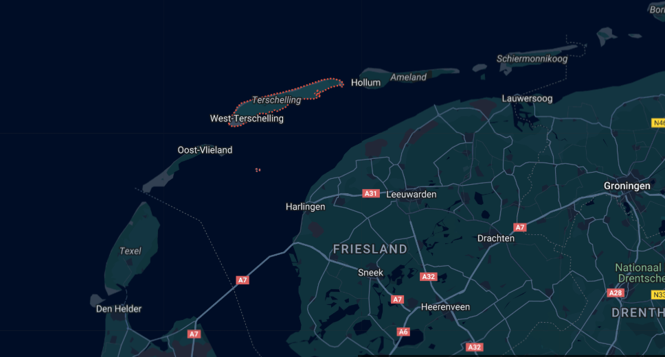
Terschelling Quick Facts:
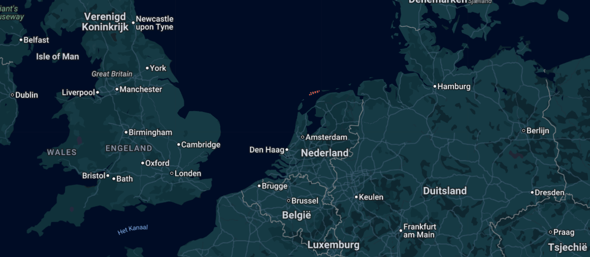
- Location: One of the Dutch Wadden Islands in the north of the Netherlands
- Population: Around 4,800 residents
- Tourism: Over 400,000 overnight guests each year
- Known For: Nature, beaches, cycling, and its relaxed atmosphere
- Average Summer Temperature: 17-20°C, often windy but with plenty of sun too
- Transport: Reachable by ferry from Harlingen
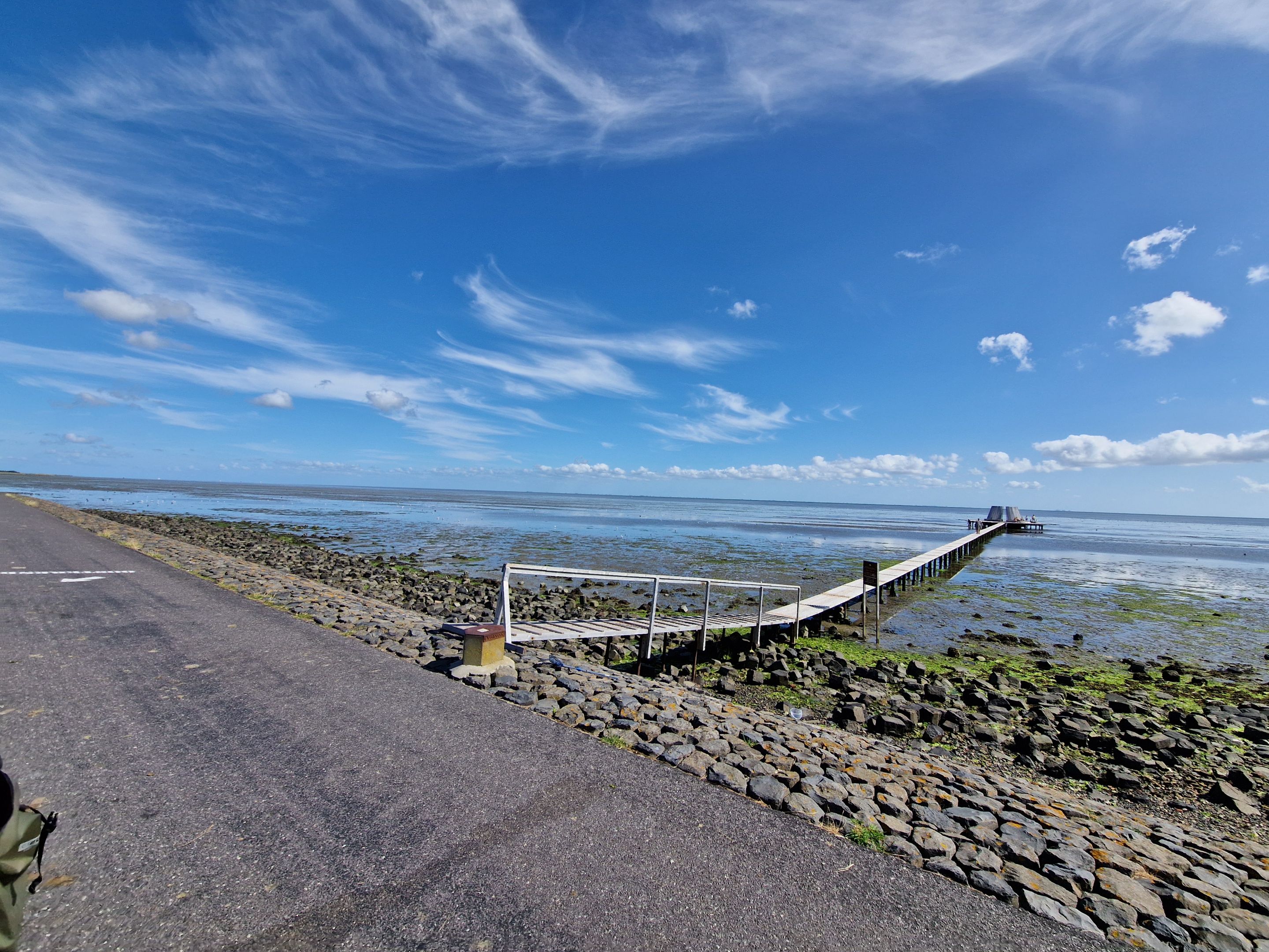
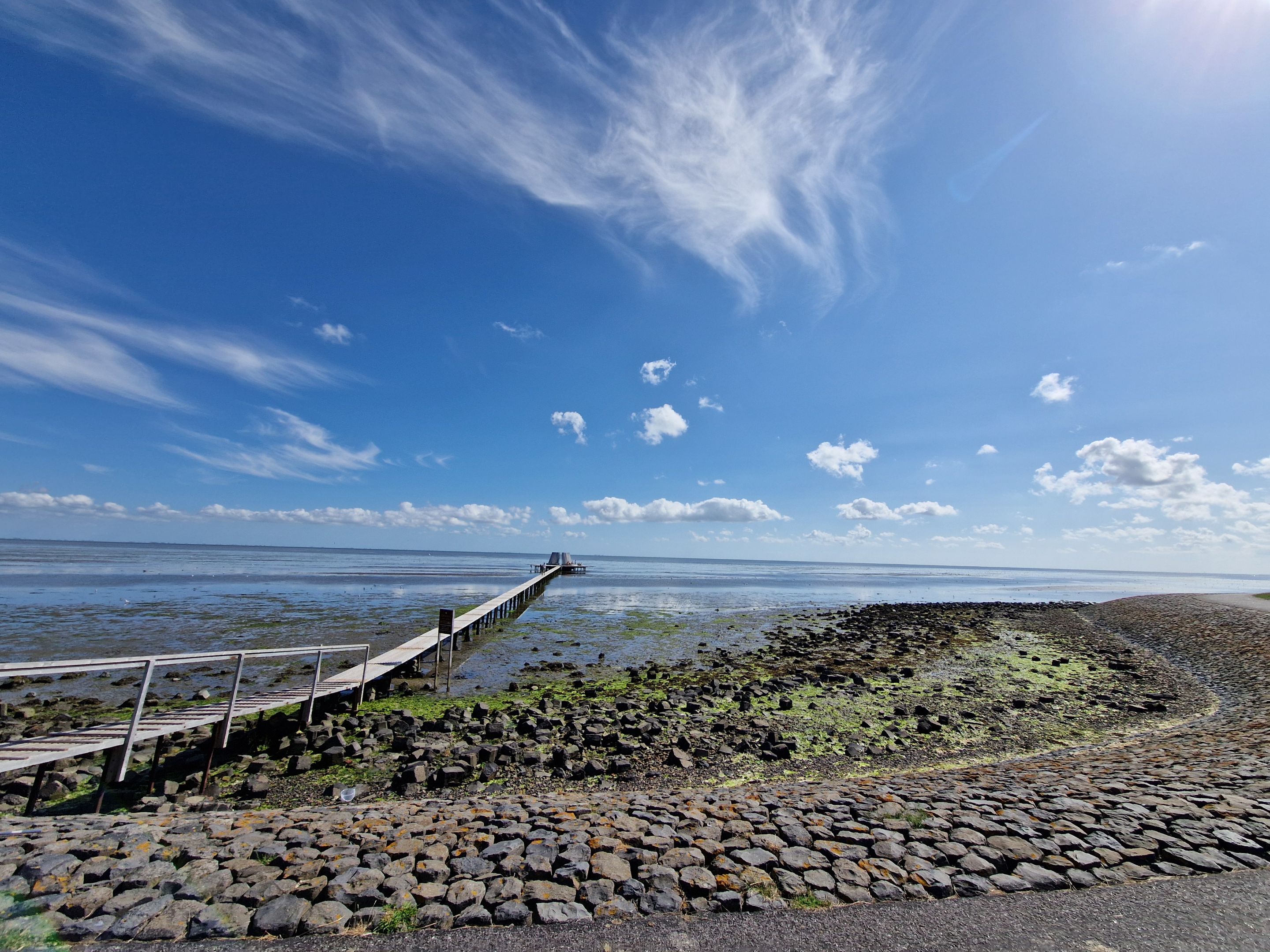
UNESCO Wadden Sea Region
Terschelling is part of the Waddengebied, or Wadden Sea region—a UNESCO World Heritage site. This unique coastal area is famous for its tidal flats, salt marshes, and the ability to walk on the sea floor during low tide, an activity called wadlopen. It’s an ecological treasure and a peaceful contrast to the usual hustle of daily life.
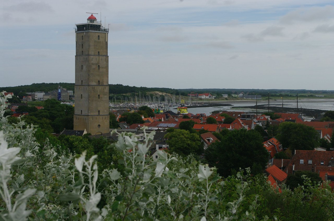
Brandaris (The Lighthouse)
Let’s start with the most iconic landmark: the Brandaris.
You can recognize Terschelling from afar by its lighthouse, the Brandaris. For centuries, the face of the island has been defined by this iconic tower. Locals call it "ús toer", "our tower."
Standing 55 meters tall with its square shape and 206 steps, the Brandaris dates all the way back to 1594, making it the oldest lighthouse in the Netherlands. It has been watching over the island and the sea for more than four hundred years.
Today, the Brandaris serves as a marine traffic control center, staffed 24/7 and guiding vessels across a large part of the northern Dutch coastal waters.
Because of all the equipment and its role in maritime safety, the tower isn’t open to the public.
A Coin From the Past
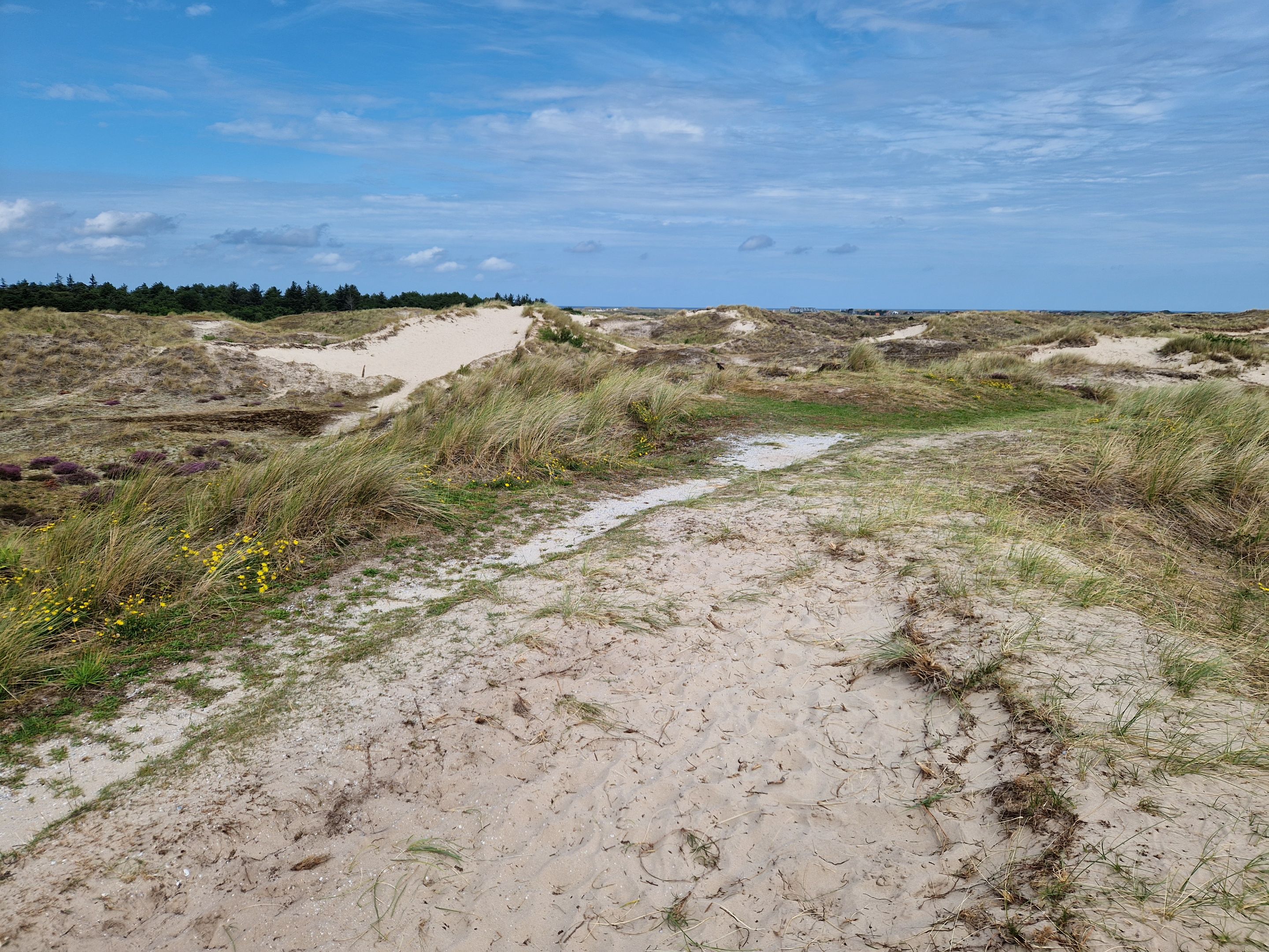
One day, while walking in the dunes with the family, my youngest son found a coin. At first, I assumed it was just a banged-up 10 cent euro coin. But once we got home and cleaned it, it turned out to be a 10 cent gulden coin from 1942!
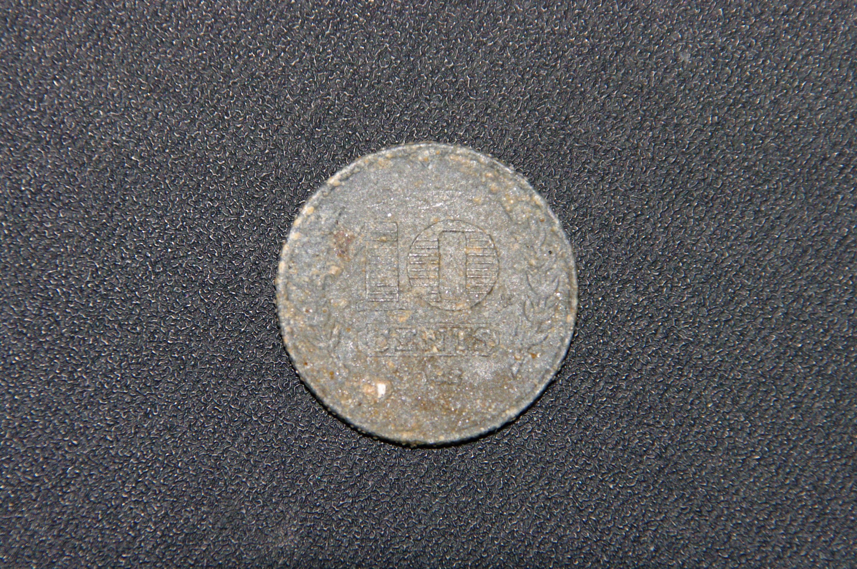
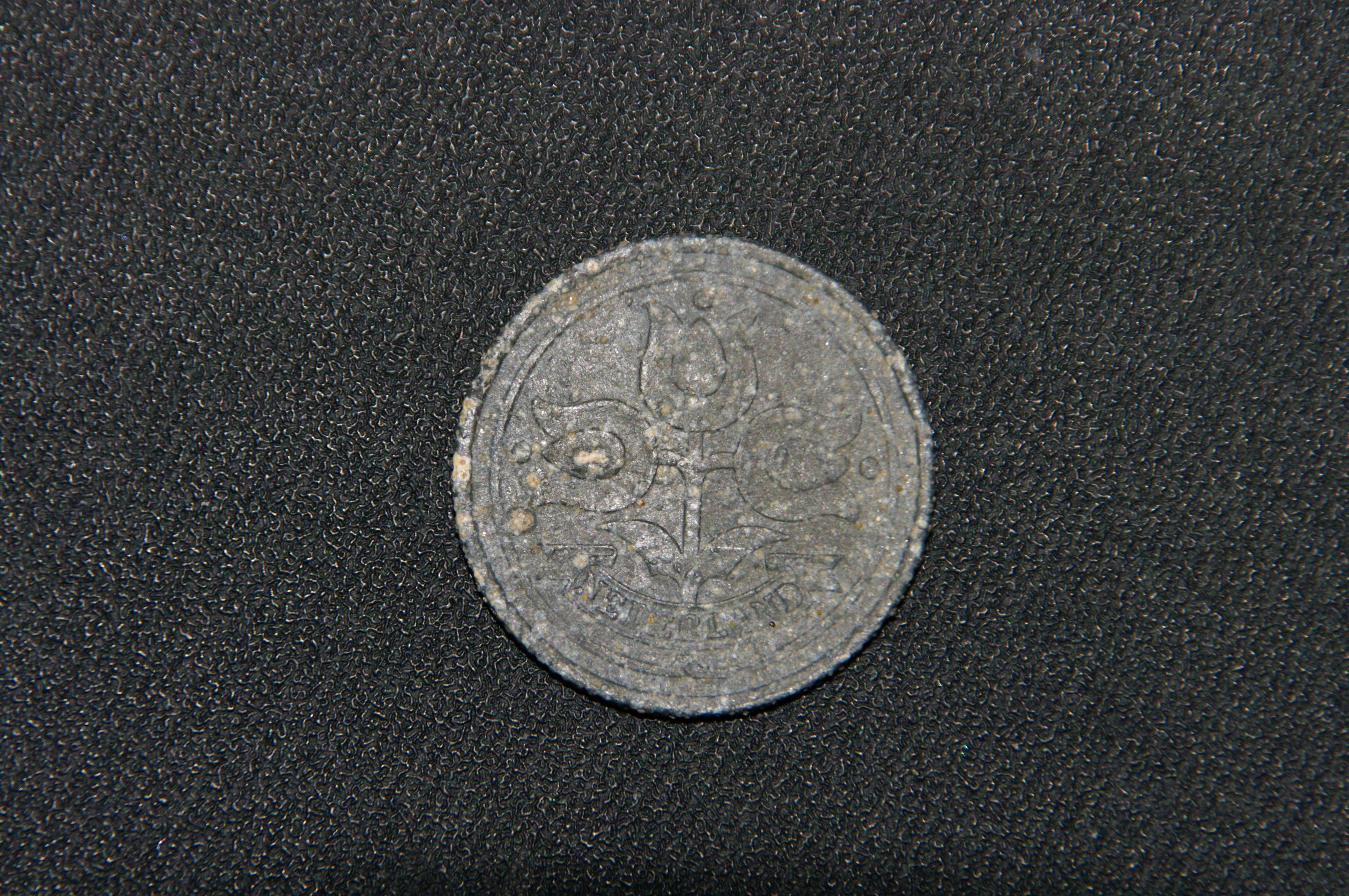
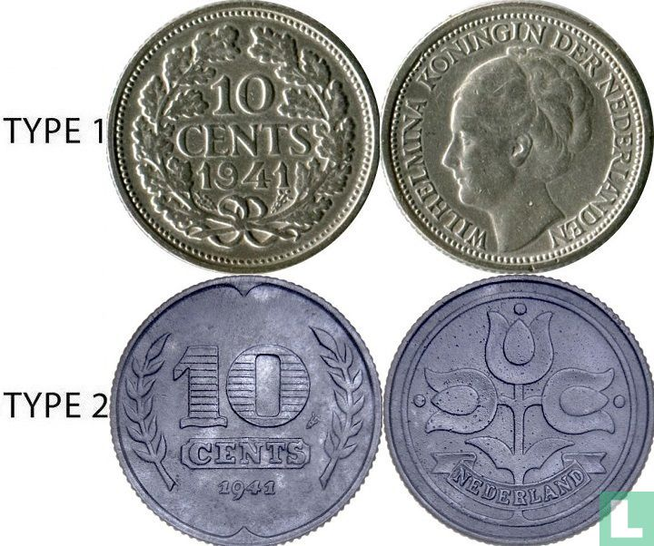
That discovery took me right back to my childhood coin collection days. And of course, the date 1942 sparks a flood of thoughts—it was right in the middle of World War II, during the German occupation of the Netherlands. Including this island.
It’s a wild thought: this coin might’ve been lying there since the war. And there are still many visible reminders of that era here.
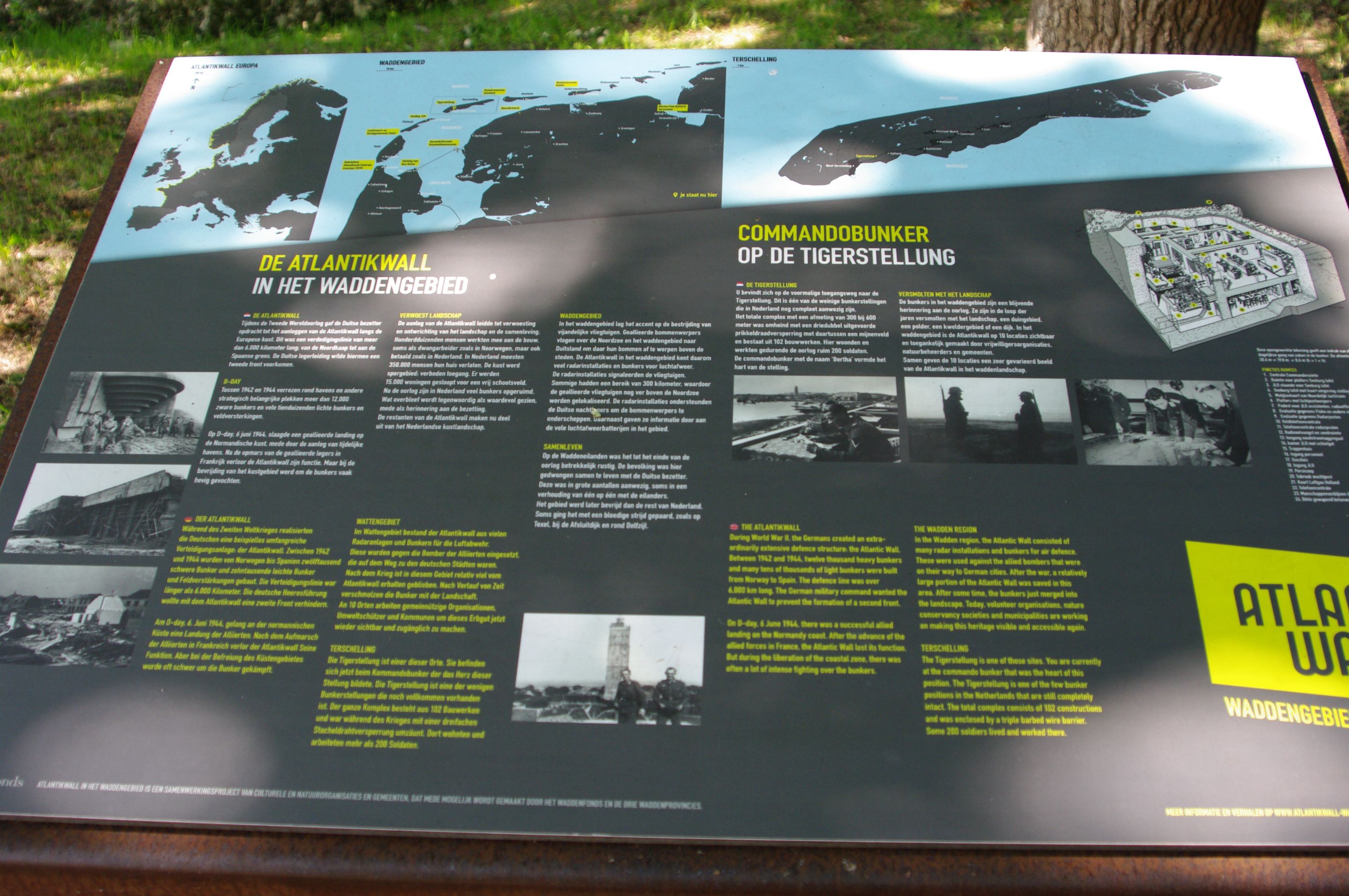
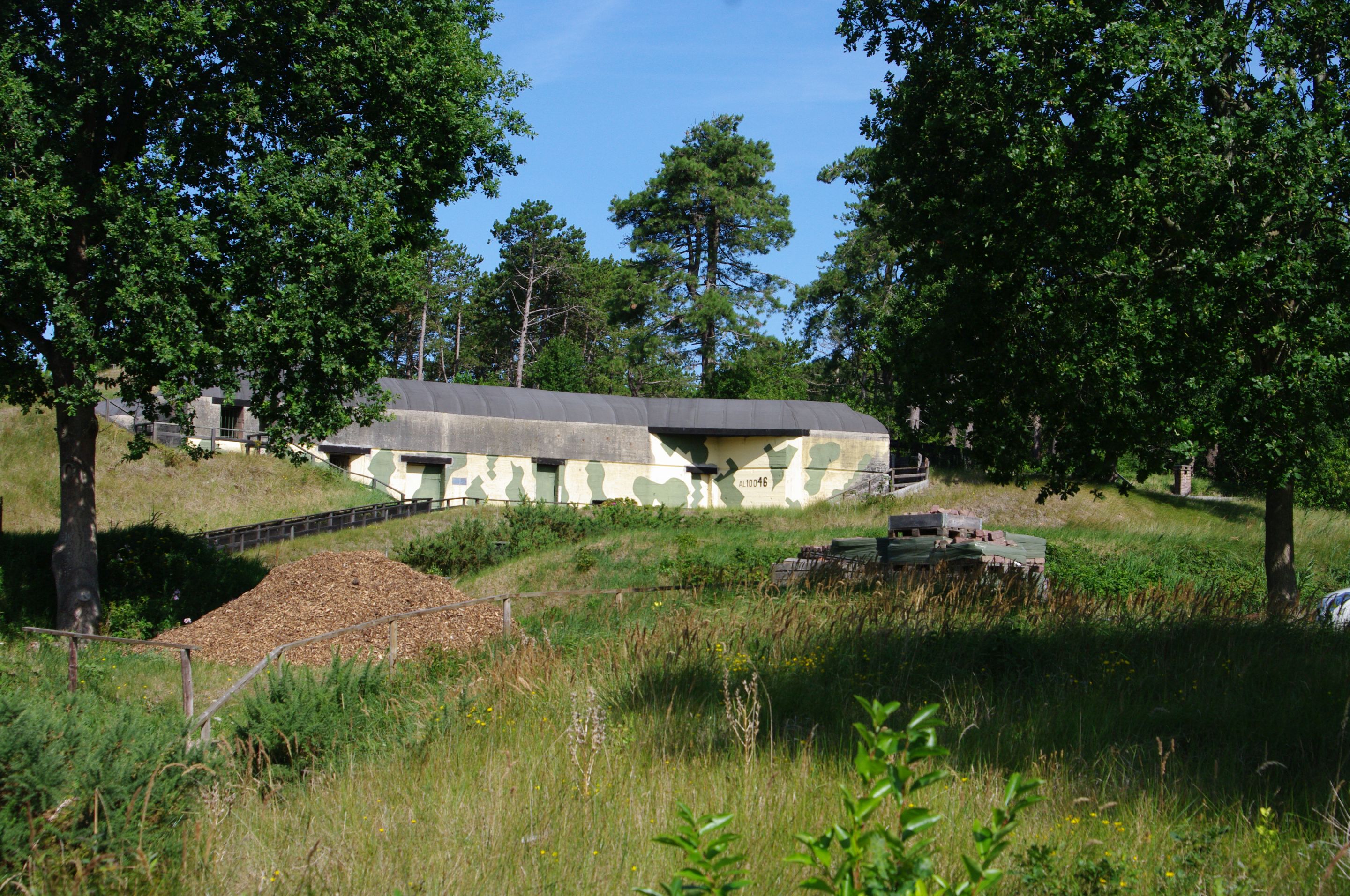
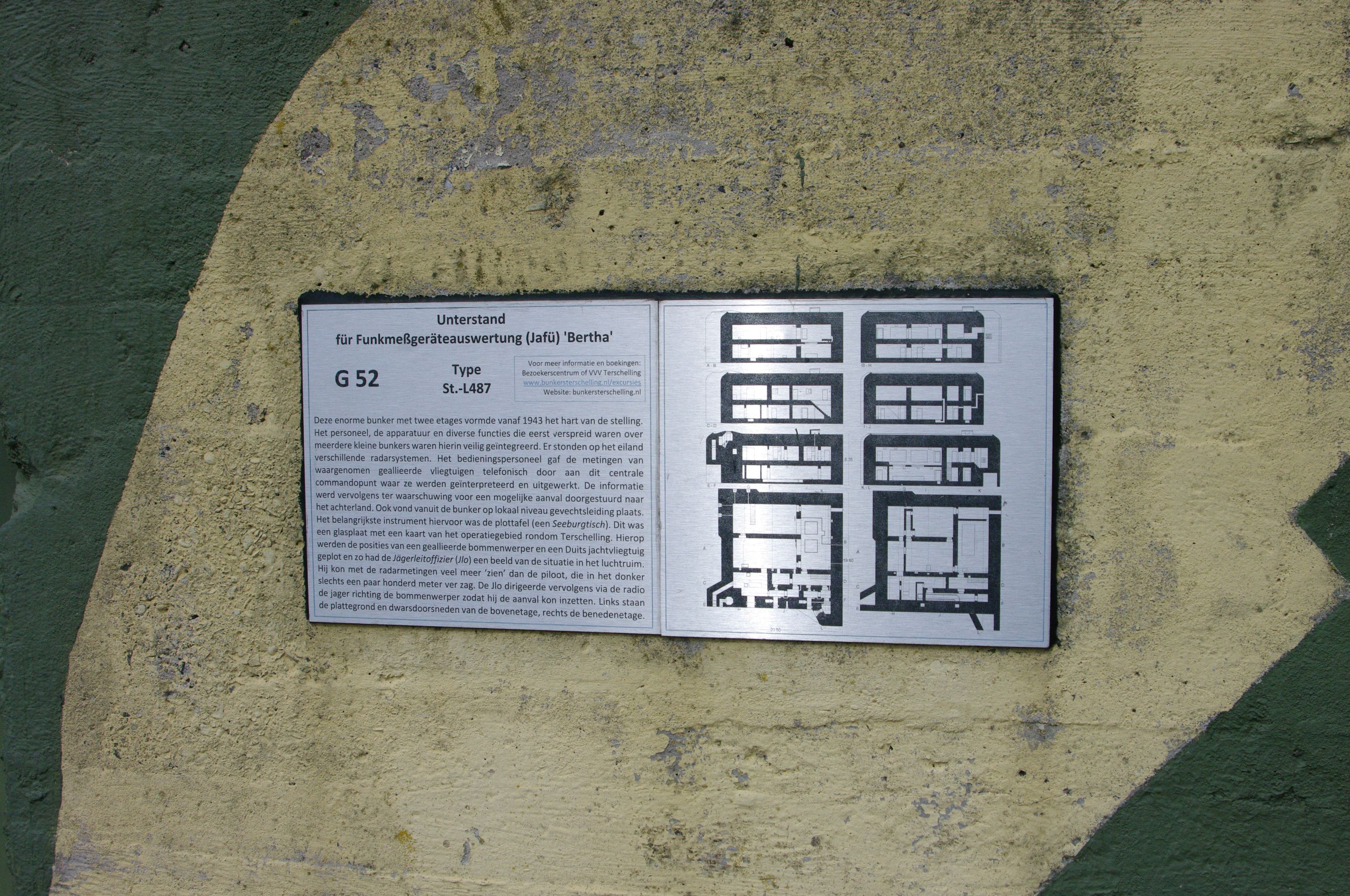
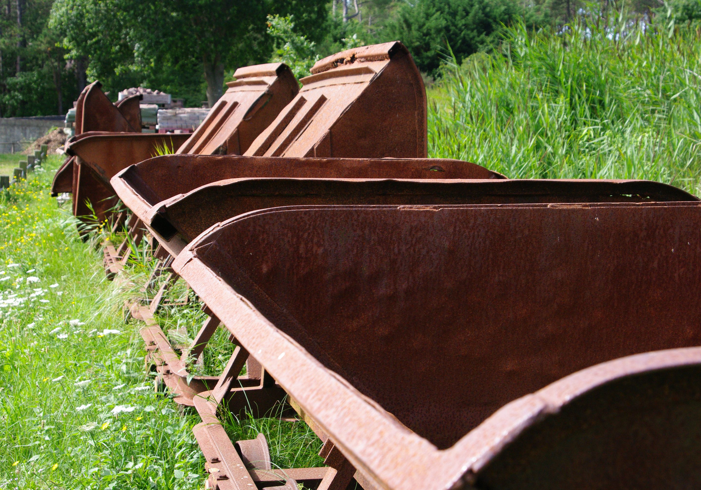
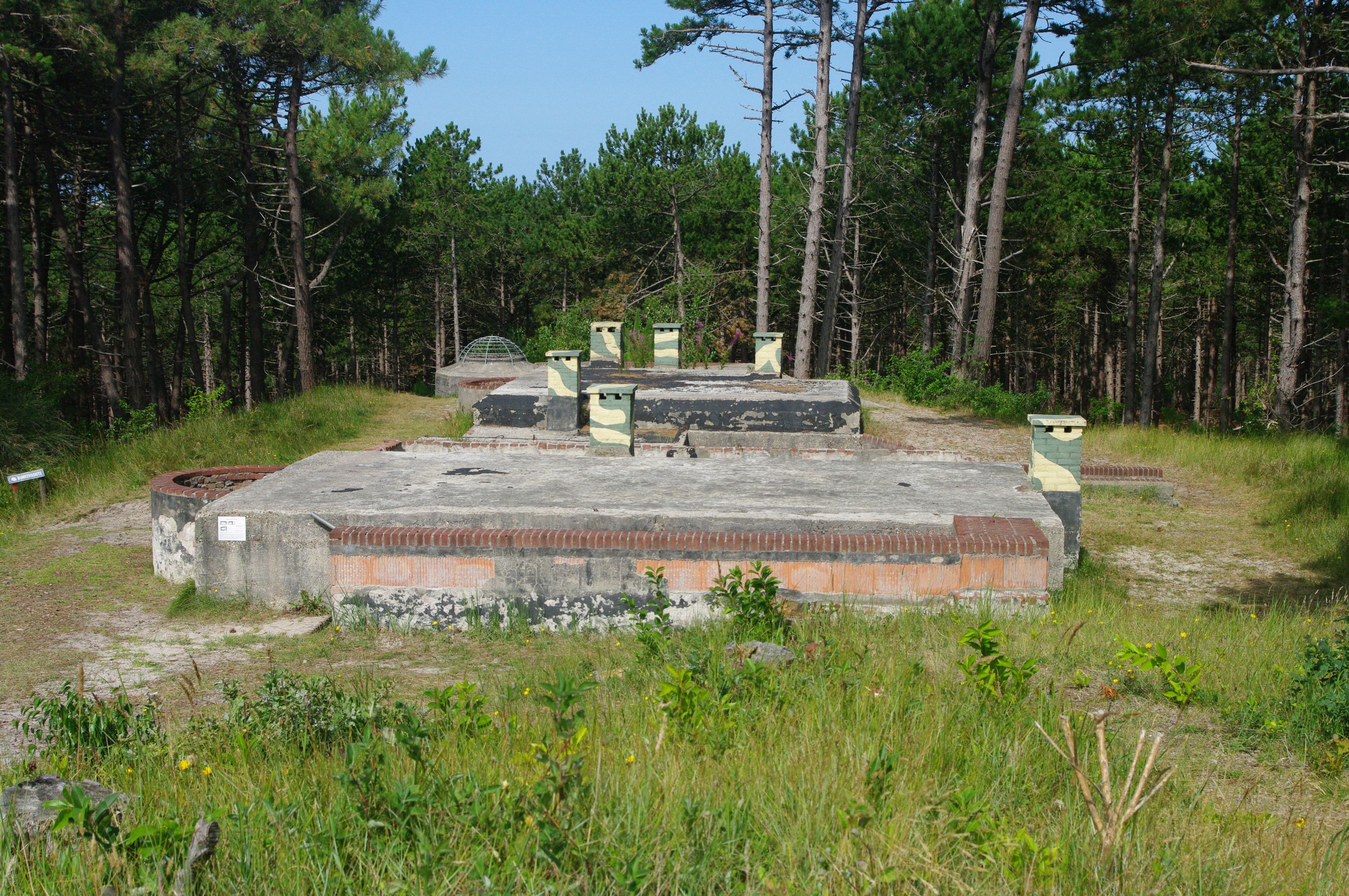
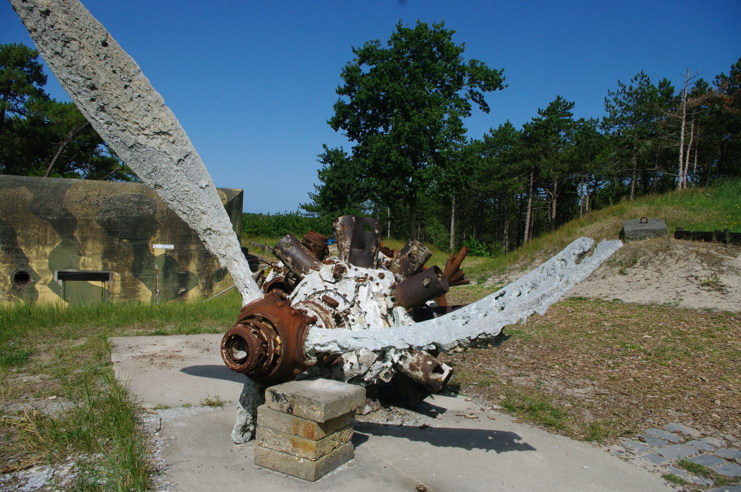
The Atlantikwall (A Piece of WWII History)
During WWII, the Germans built the Atlantikwall, a massive line of coastal defense stretching from Norway to France. It included bunkers, walls, and artillery positions—many of which can still be found on Terschelling today. They were meant to defend against an Allied invasion from the sea.
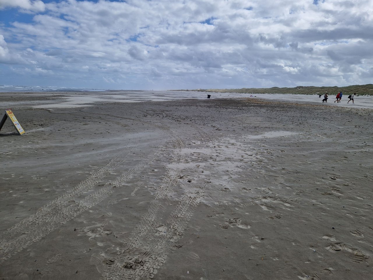
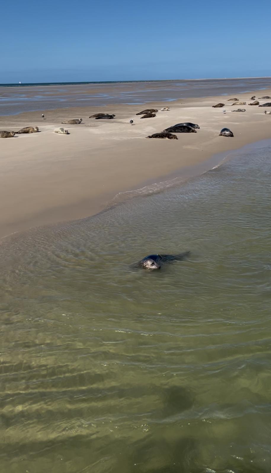
Beach Days (Windy to Wonderful)
The rest of the vacation? Just good old-fashioned beach time.
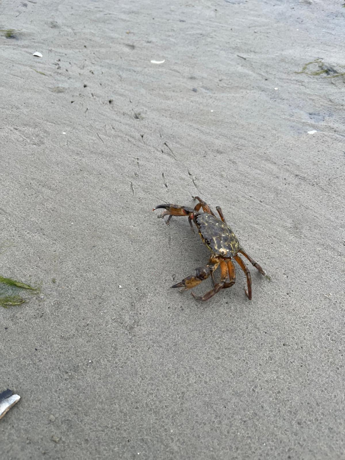
The first week was classic Dutch summer—16°C, wind force 5-6. Not exactly tropical, but still a great time. The kids ran around with their nets, catching tiny fish, crabs, and shrimp.
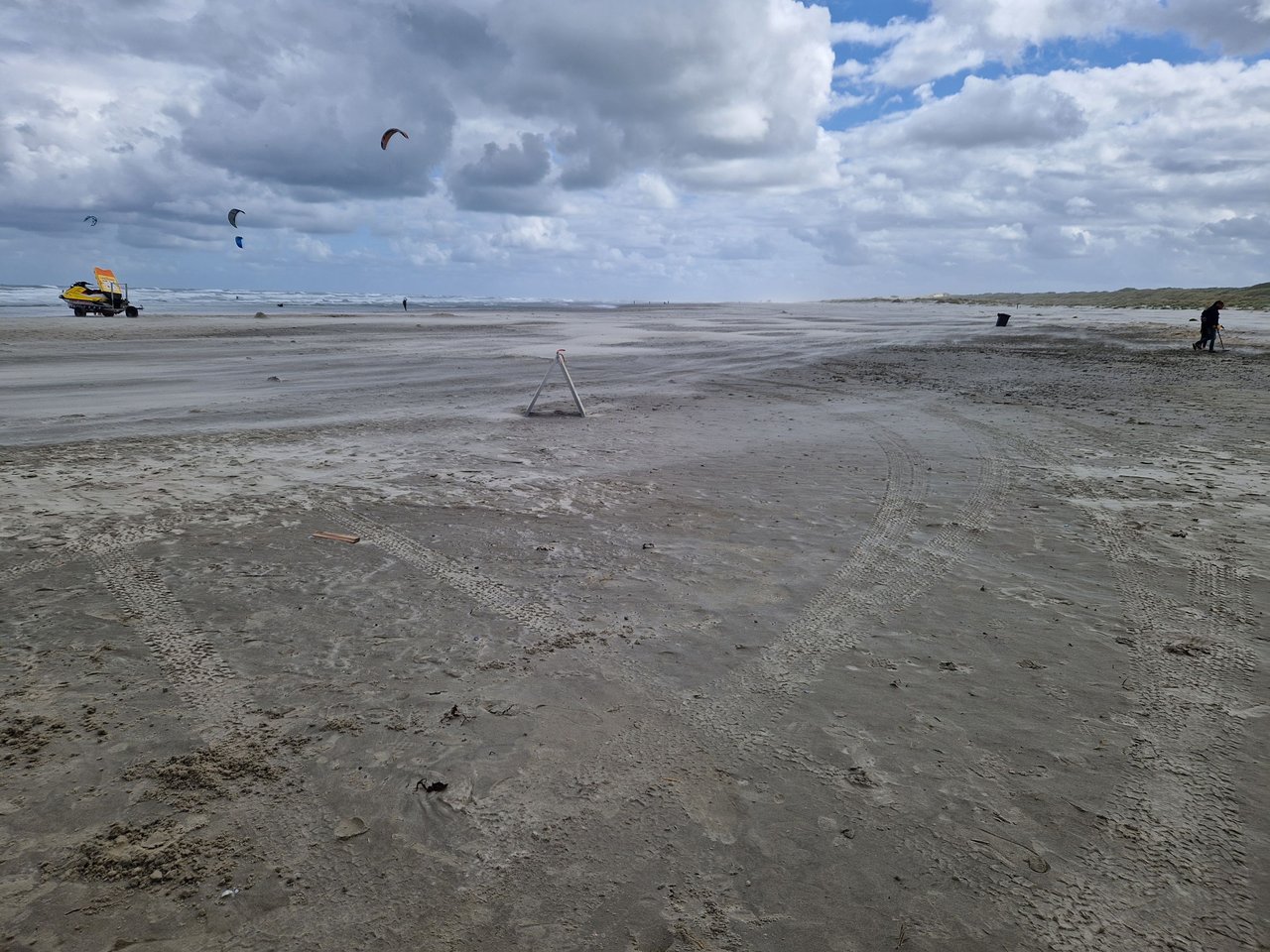
The second week, though, brought much better weather. Warmer, sunnier, and we even got to walk on the wad—which means we literally walked across the sea floor during low tide.
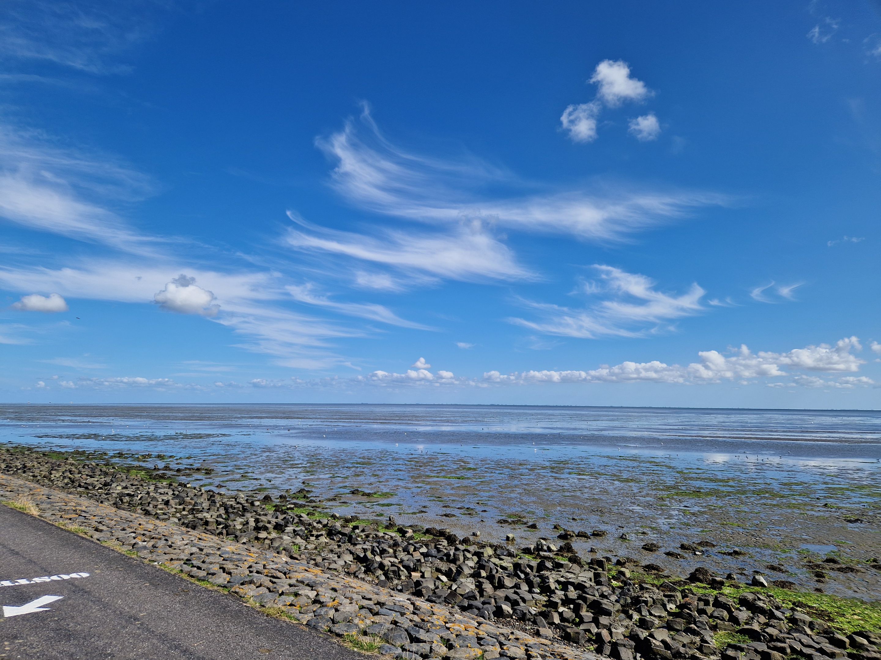
Fun fact: when the tide is low, it’s possible to walk (or wade) from one Wadden island to another with a guide.
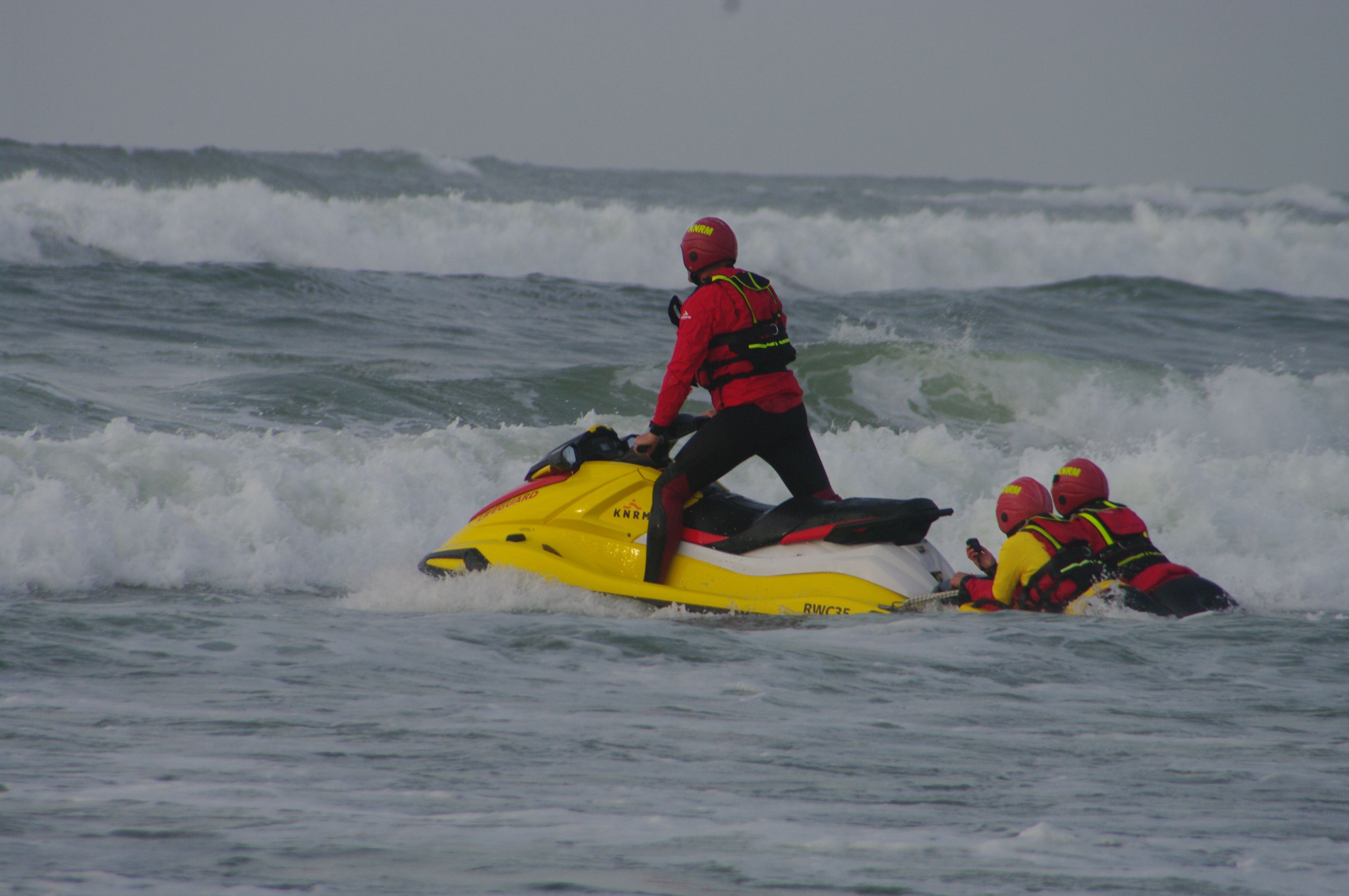
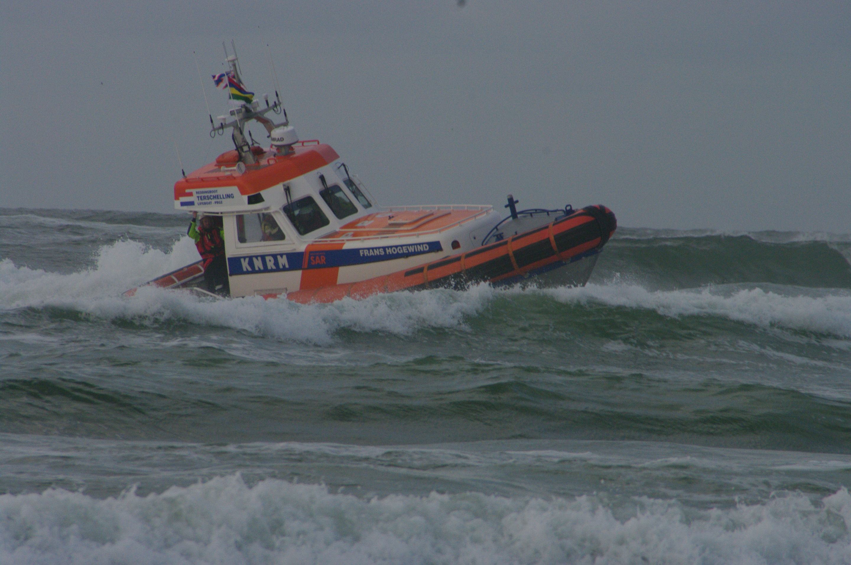
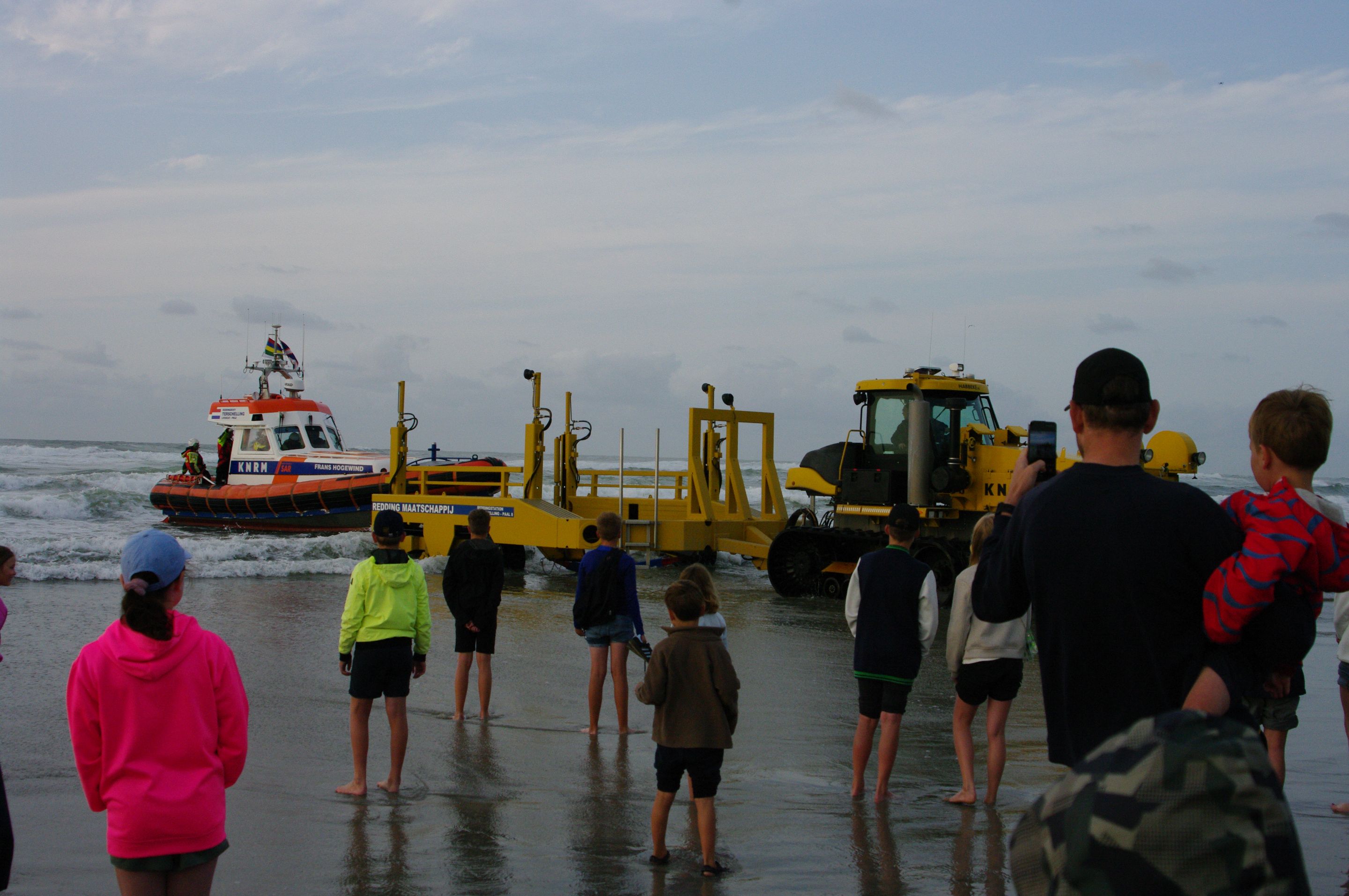
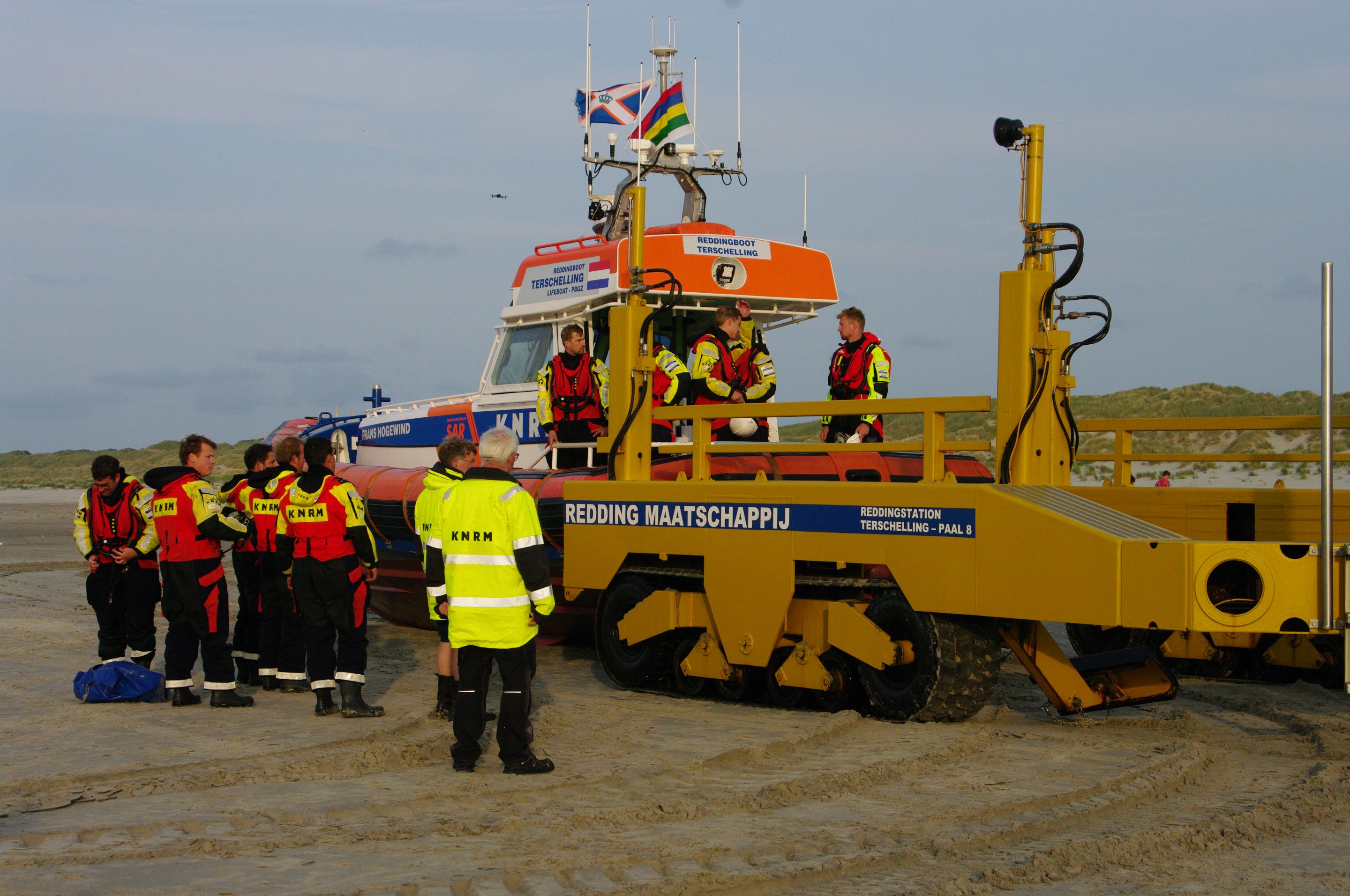
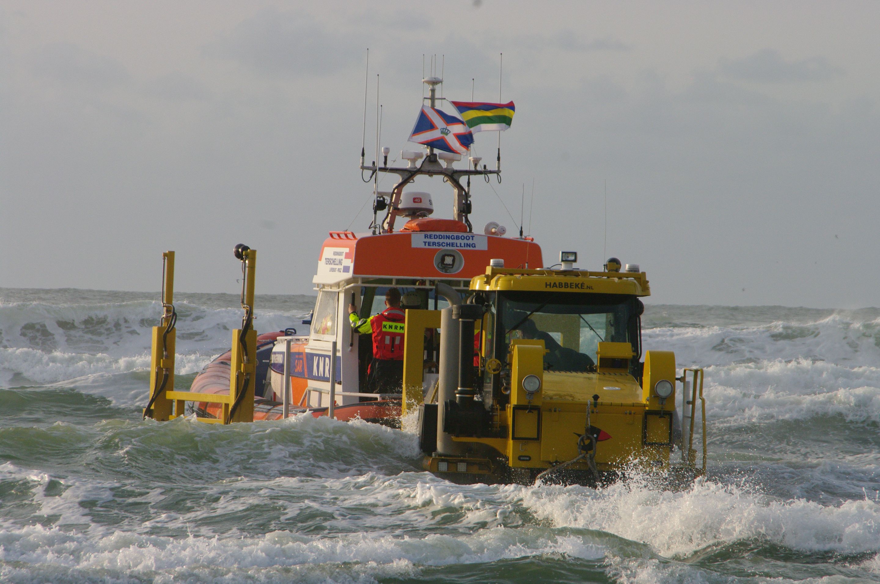
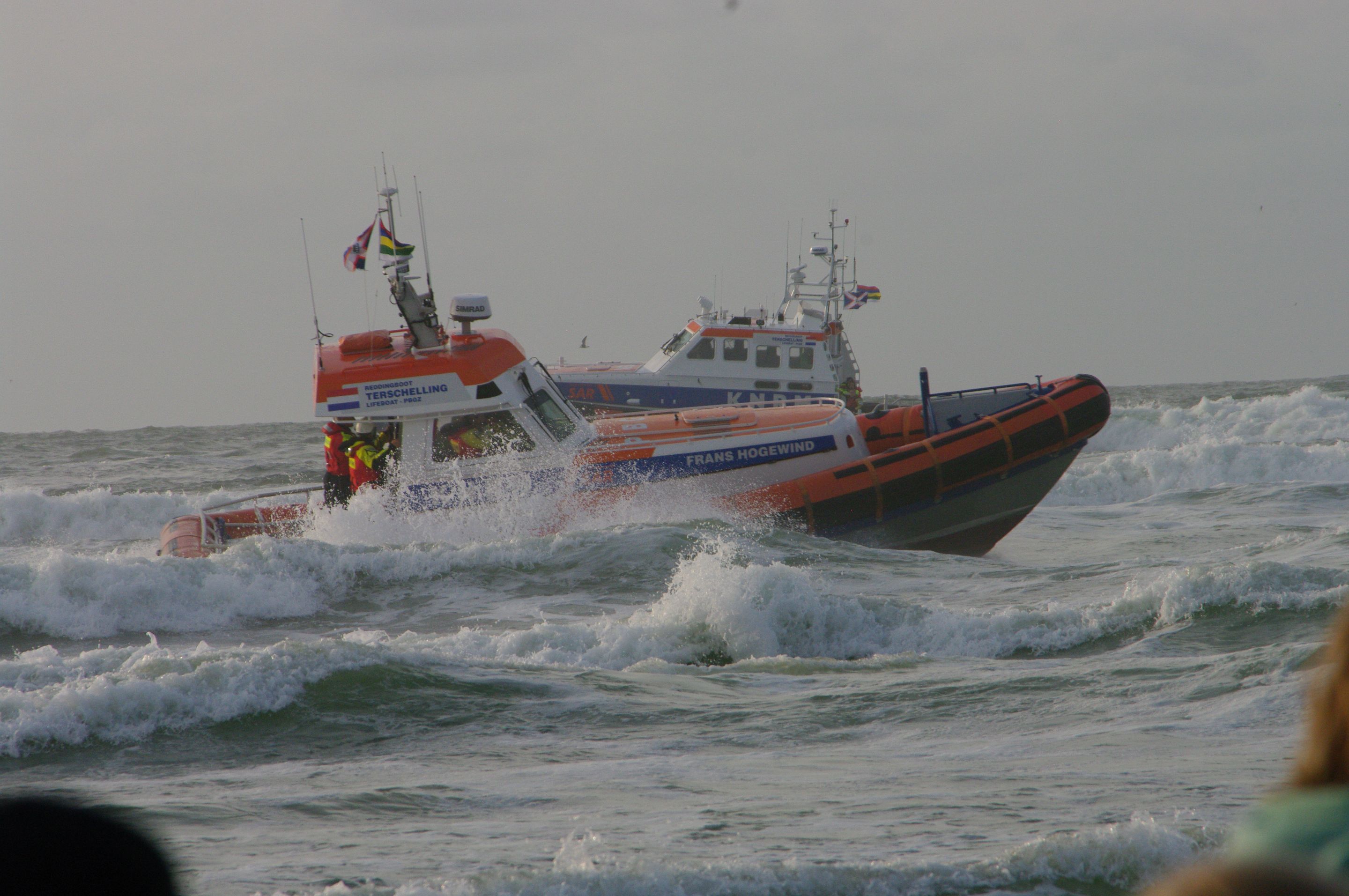
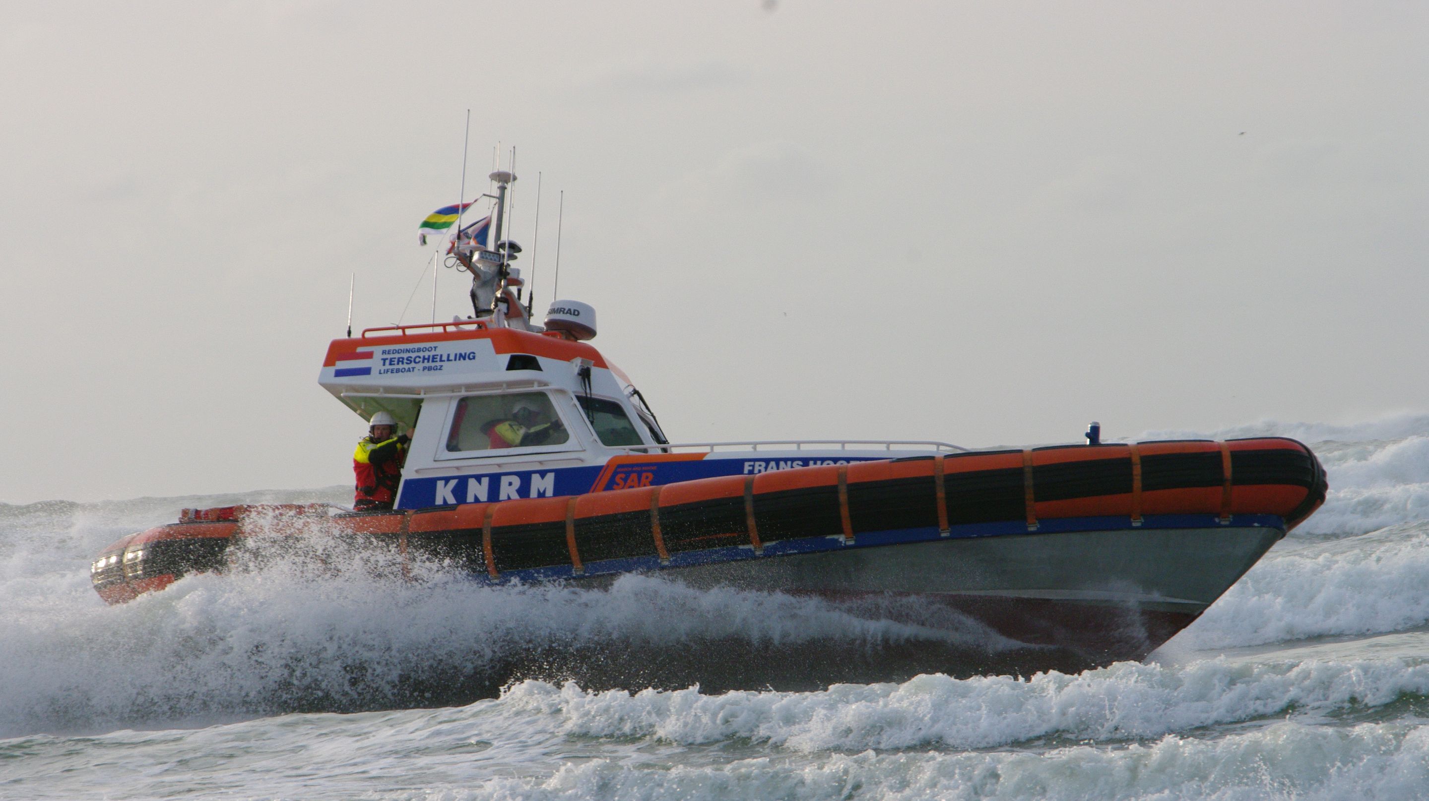
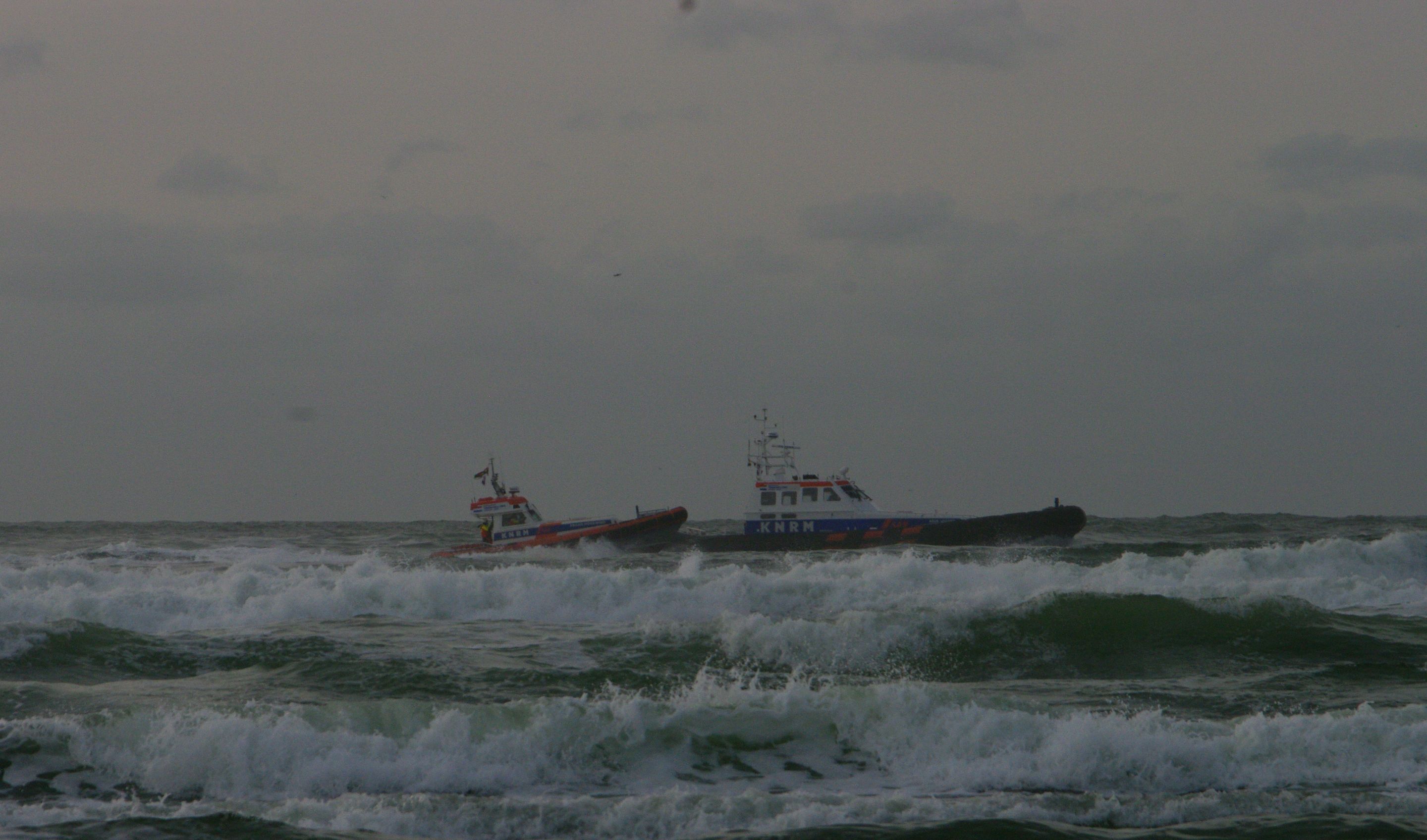
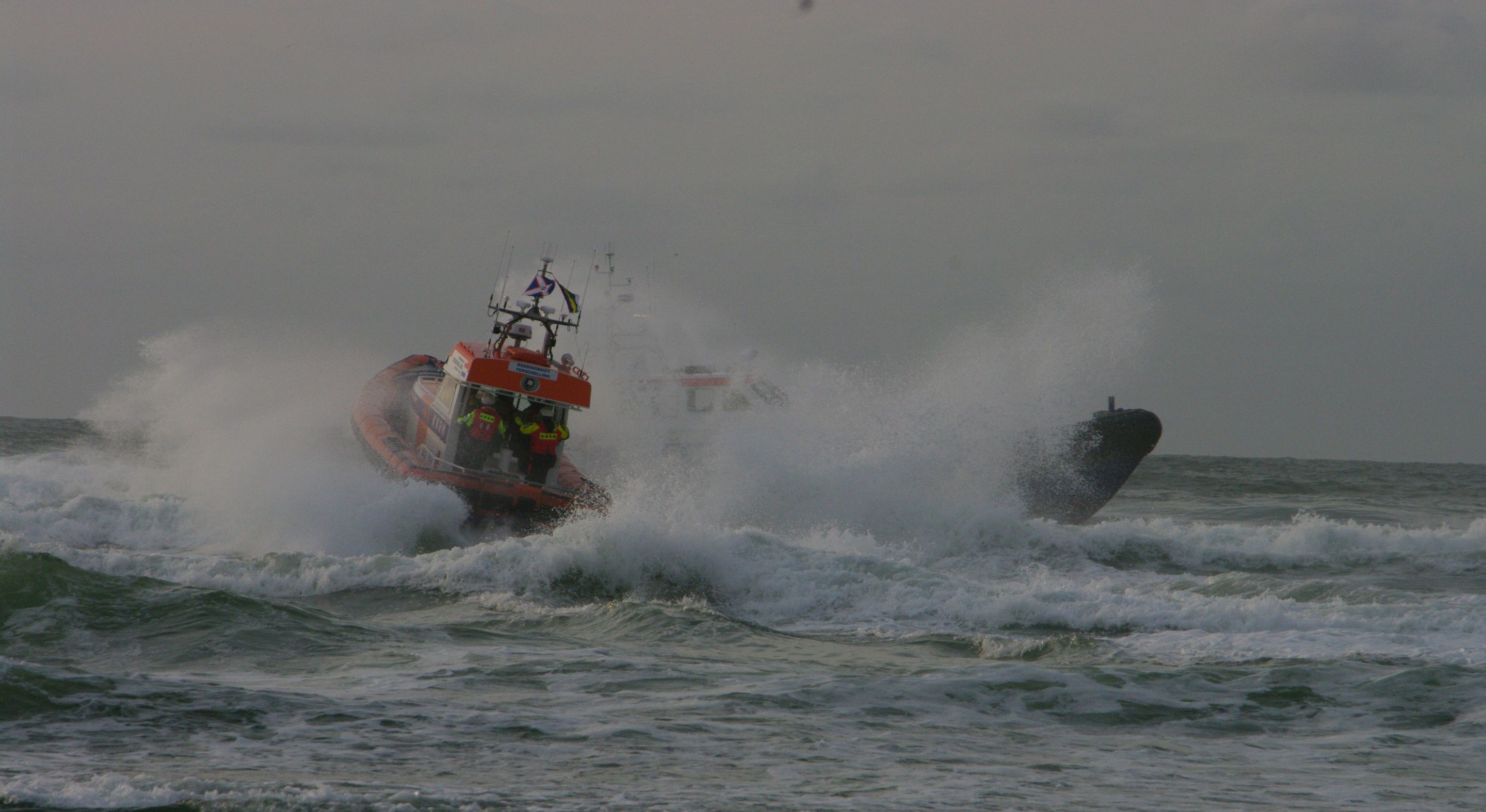
KNRM Rescue Demonstration
Midweek we were treated to an impressive demonstration by the KNRM (Royal Netherlands Sea Rescue Institution). It’s honestly amazing to see how fast and maneuverable their rescue boats are in action. The crew was a bit delayed, though—because they were dealing with an actual emergency: a fire on a small vessel out on the North Sea. Real life in action.
Here’s a bit of background on what the KNRM does:
About the KNRM: The KNRM saves people and animals in distress at sea. Fast, professional, and completely free of charge for those in need. Volunteers are on call 24/7, 365 days a year, and have been for over 200 years. Every year, the KNRM carries out around 2,500 rescue missions, helping about 4,000 people and animals. It’s a charitable organization, fully funded by voluntary donations—with no government subsidies.
Here are a few impressions from that evening:
A Simple, Good Time
All in all, this holiday was just what I needed (still have few days left). No rankings, no brawls. Just sand, sea, history, and family. In all honesty is still did play some battles here and there 🤣.
It's nice to share something a little different once in a while. As this is my first post in the worldmappin community please let me know what you think of the post or you have any suggestions for improvements, let me know in the comments.
Signing off, beaker007