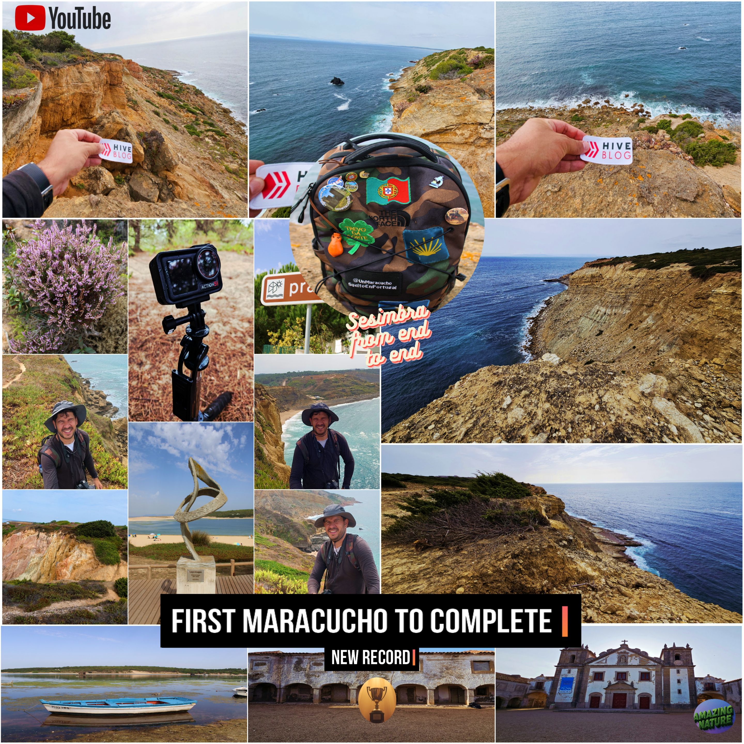
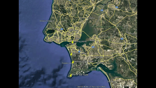
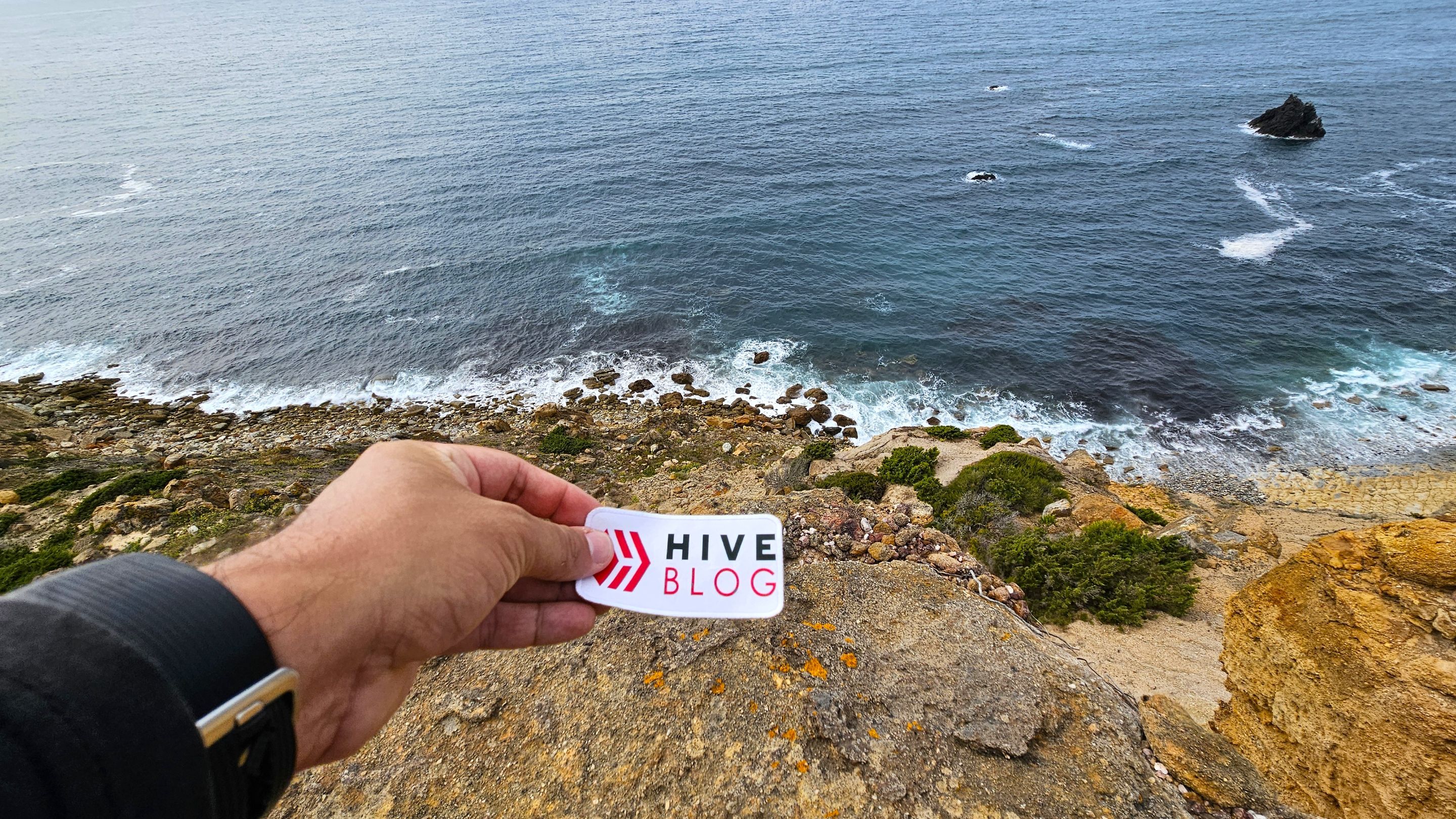
A new extreme adventure is coming! I'm quite excited because while I was doing some "research" about the Sesimbra area I couldn't find any Maracaibo native who recorded that they had hiked the "margem sul" from end to end. We've already hiked from "Fonte Telha to Almada" and another from "Fonte Telha to the Albufeira lagoon" and now we're taking things to the extreme and with almost 20km and a tough 9 hours of hiking we've reached the tip of "Cabo Espichel". This would make me the first Maracaibo native, possibly the first Zulian and also possibly the first Venezuelan to hike the "entire margem sul" from end to end in different posts!🌍🧭
#
Se viene una nueva aventura extrema! estoy bastante entusiasmado porque mientras hacia algunas "investigaciones" sobre la zona de Sesimbra no consegui ningun Maracucho que registrase que recorrio el "margem sul" de punta a punta, ya hicimos una caminata desde "Fonte telha hasta Almada" otra desde "fonte telha hasta la laguna de albufeira" y ahora llevamos todo al extremo y con casi 20km y unas duras 9 horas de caminata llegamos hasta la punta de "Cabo Espichel" esto me convertiria en el primer Maracucho, posiblemente el primer Zuliano y tambien posiblemente el Primer Venezolano en recorrer "todo el margen sul" de punta a punta en diferentes post!🗺️⛰️
#
Detailed walk🌍🏞️/ Caminata detallada📍🧭
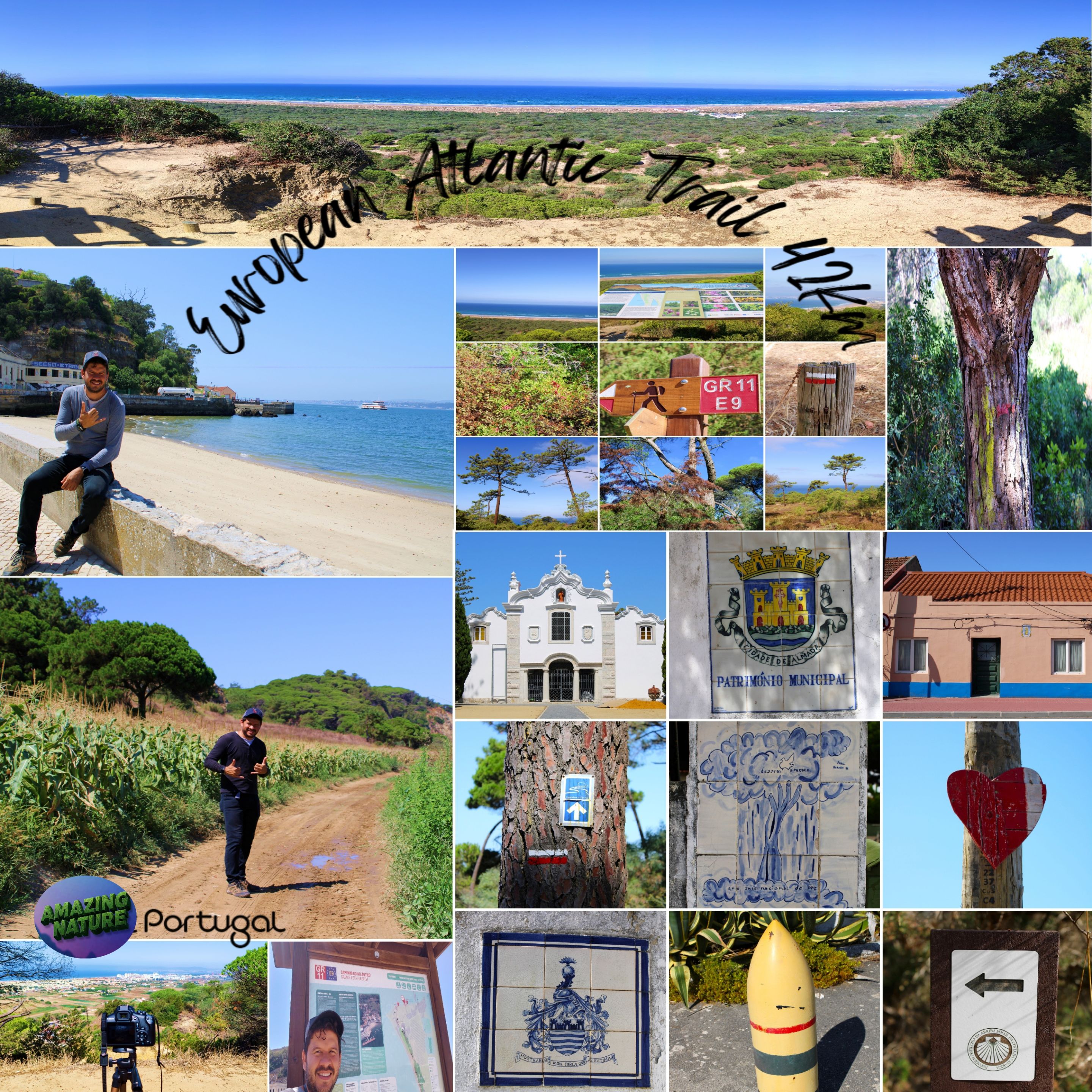
This is everything we walked together, it is not possible to do the route in one day, so I divided it into sections, in total it is 40km and when I say impossible it is not because of the energy of walking it because I already covered 32km in one day in summer, but in autumn it gets dark very early making these adventures difficult, I would like to leave you the evidence of the walk along with two videos that I will be releasing in two parts.🧭🌍
Esto es todo lo que caminamos en conjunto, en un día no es posible realizar el recorrido por ello lo dividí en sectores, en total son 40km y cuando digo imposible no es por la energía de caminarlo porque ya recorrí en un día 32km en verano, pero en otoño se oscurece muy temprano dificultando estas aventuras, me gustaría dejarles las pruebas de la caminata junto a dos videos que estaré sacando en dos partes.🌄🚩
 https://peakd.com/hive-163772/@biologistbrito/completed-european-atlantic-trail-42km
 https://peakd.com/hive-163772/@biologistbrito/gr11-e9-european-atlantic-trail-north-south-en-es
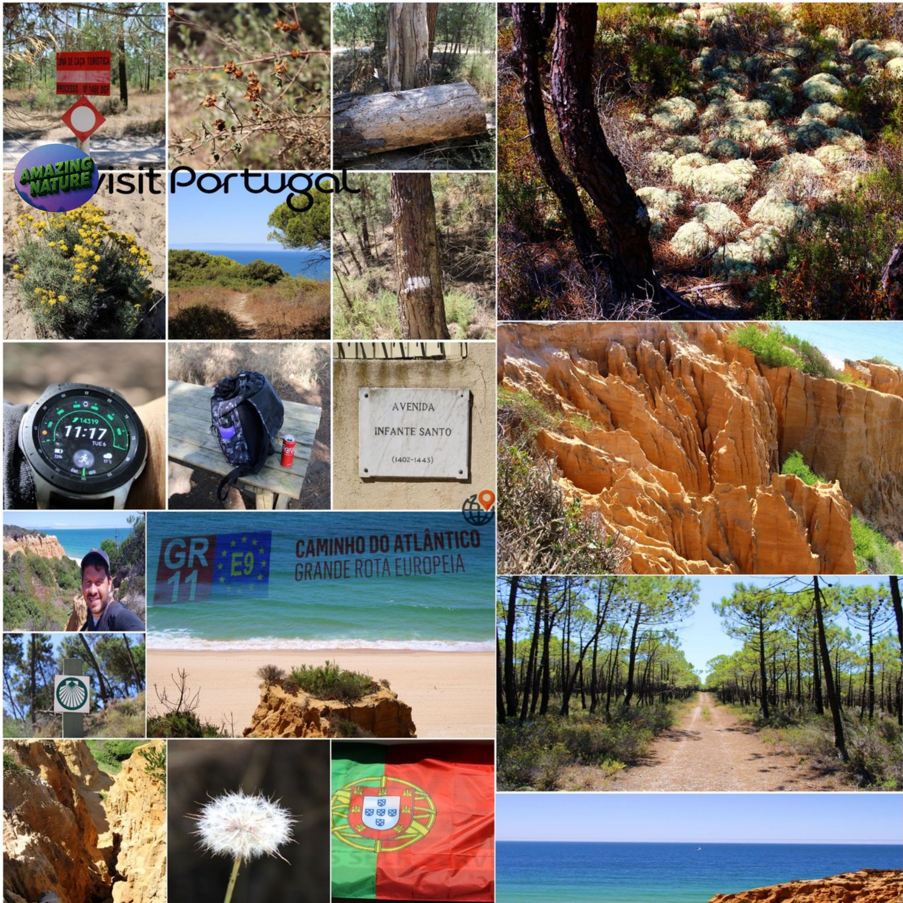
A large extension of this route that we completed is thanks to completing the GR11-E9 or also known as: "trilho atlantico" that crosses Portugal completely from end to end. Perhaps one day when I live only on social media we will complete it, but for now we have already left a record on this odyssey.🌍🧭
Una gran extensión de esta ruta que completamos es gracias al realizar el GR11-E9 o también llamado: "trilho atlantico" que atraviesa Portugal completo de Punta a punta, quizás un día cuando viva solo de redes sociales lo completemos, pero de momento ya dejamos un récord en esta odisea.⛰️🗺️

It is not for everyone🌍🏞️/ No es para todo público📍🧭
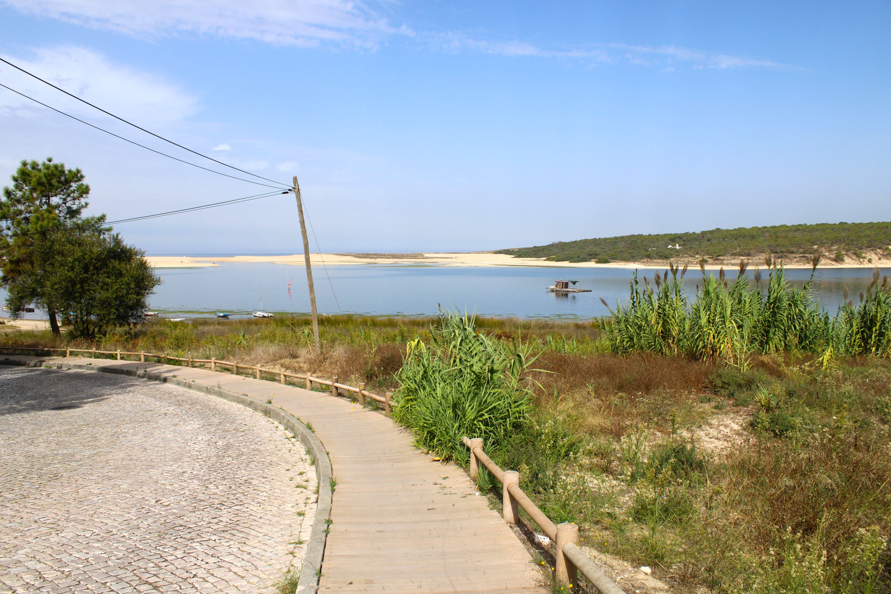
Coordinates: 38.508447, -9.176789📍🌍/ Coordenadas:38.508447, -9.176789📸
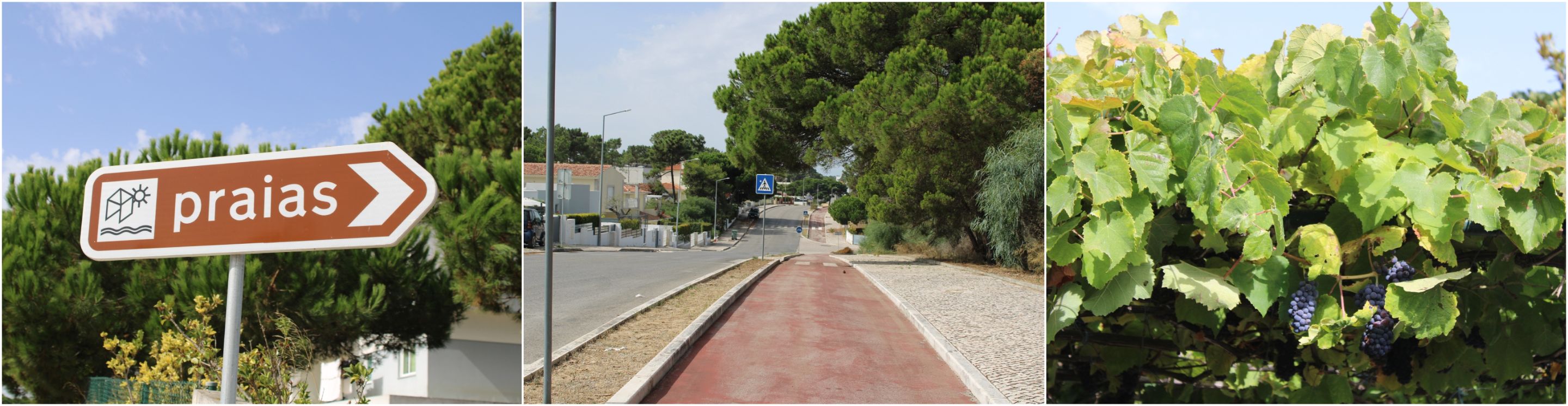
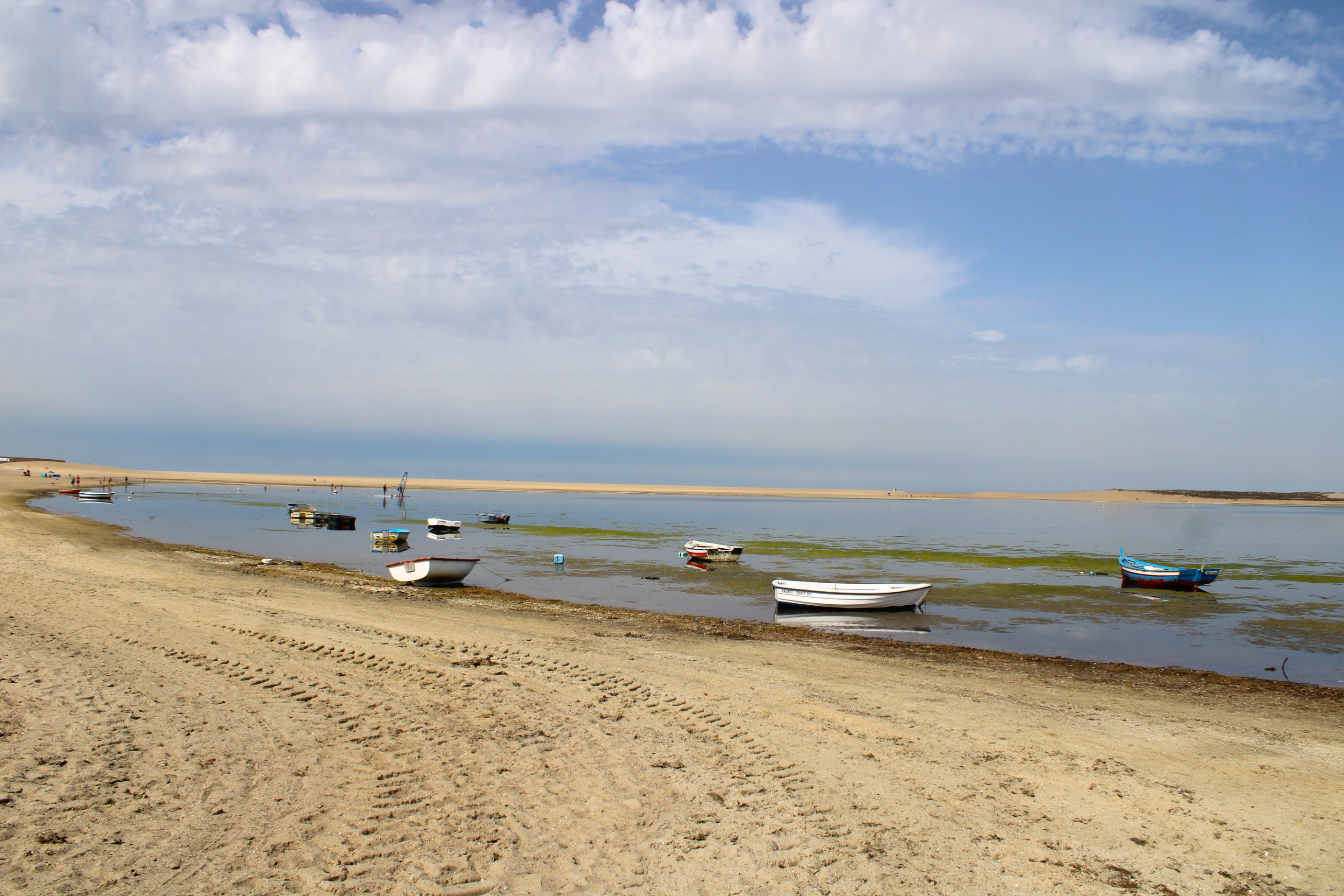
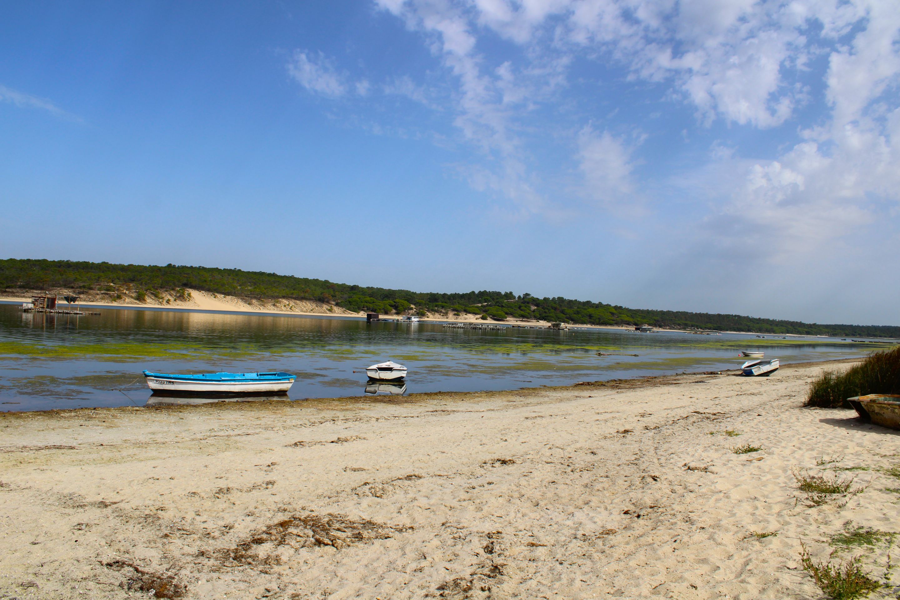
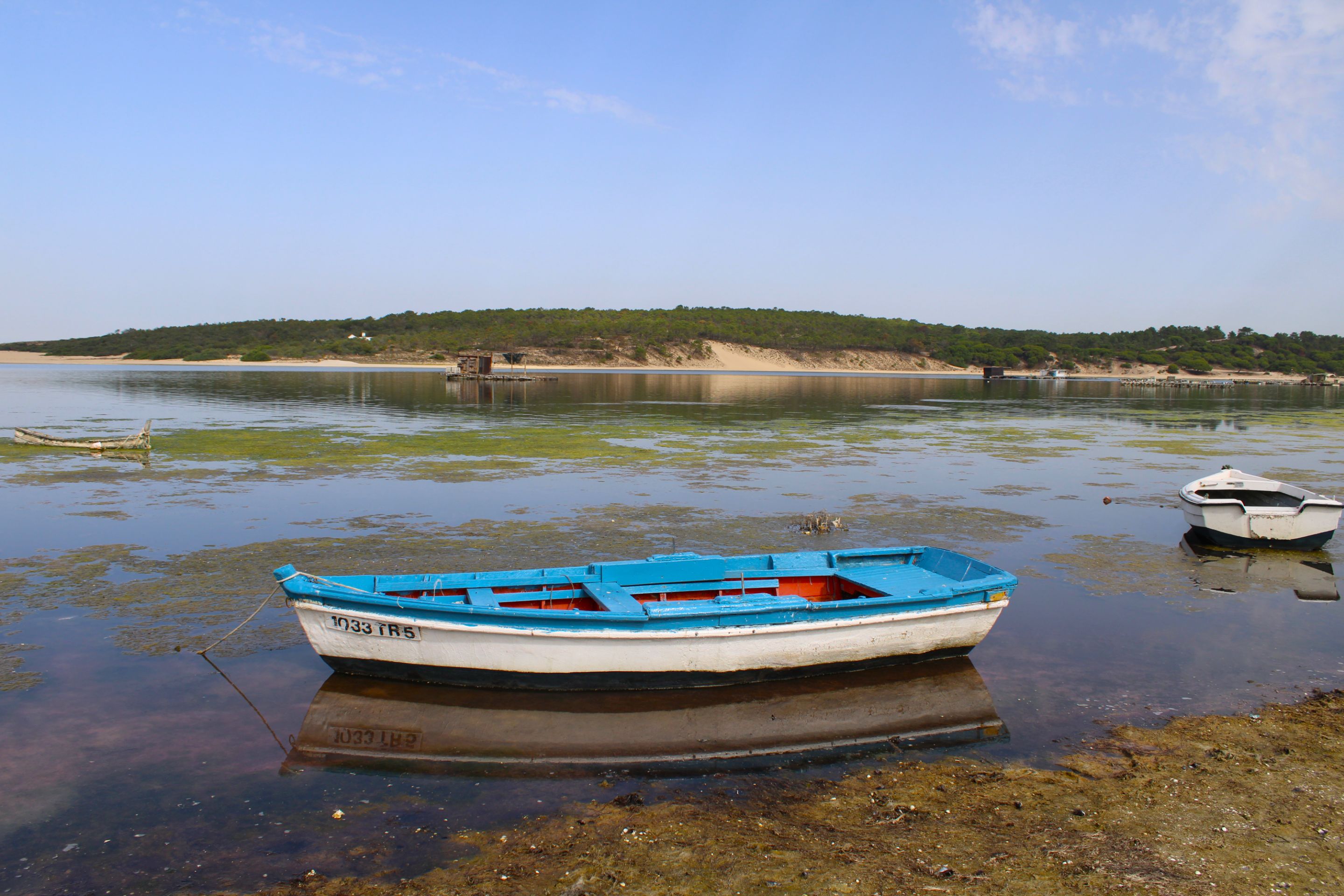
Our adventure begins in Portugal's deepest lagoon: Lagoa Albufeira. From here, we head toward the beach, or rather, the coast, and then continue south for many kilometers until we reach our goal. Things to keep in mind about the hike:🌍🧭
Nuestra aventura comienza en la laguna más profunda de Portugal: "Lagoa albufeira" desde aquí tenemos que ir en sentido a la playa o sea al litoral para luego continuar allí siempre al sur muchos kilómetros hasta conseguir nuestro objetivo; aspectos a tener en cuenta sobre la caminata:👨🏻🏫🧔🏻
En:
-
Not suitable for children, people with motor disabilities, or little experience in long walks
-
Bring as much water and snacks as possible, there are no stores to buy supplies
-
Take the hike very early, preferably between 5:30 and 6:00 a.m. In summer, be careful; this area can be very hot. Wear sunscreen and a hat and take breaks to cool off
-
Follow my video to take the fastest and coolest routes, going through the forest is a way to lower the temperature.
-
You will probably walk 20 km in about 9-11 hours depending on your pace,
=================================================================================
Es:
-
No apta para ninos, personas con discapacidad motora, o poca experiencia en caminatas largas
-
Llevar contigo toda el agua posible y snacks no hay tiendas para comprar insumos
-
Realizar la caminata muy temprano, preferiblemente a las 5.30 - 6:00, en verano ten precauciones, esta zona puede ser muy caliente, usa protector solar y sombrero, haz pausas para refrescarte
-
Acompaña mi video para tomar las rutas más rápidas y las más frescas, ir entre el bosque es una forma de bajar la temperatura
-
Posiblemente, caminaras 20 km con unas 9-11h dependiendo tu ritmo
#
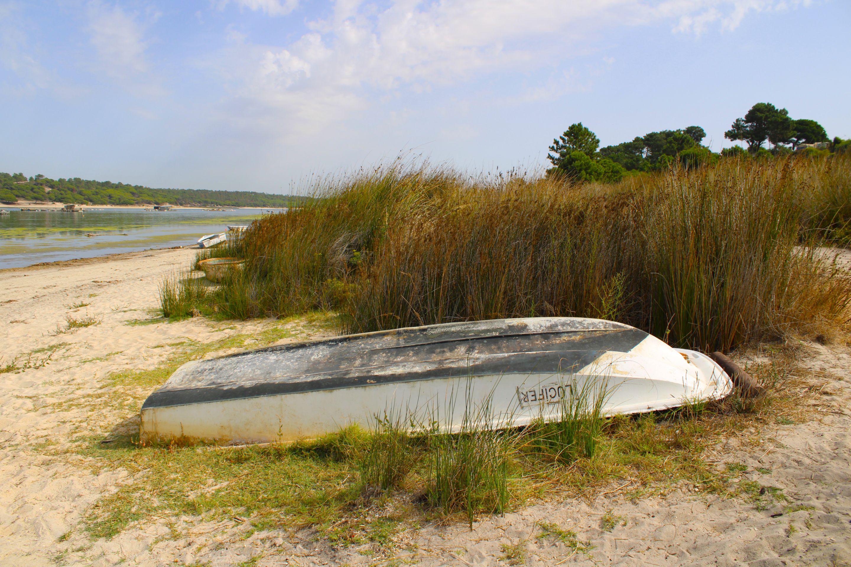
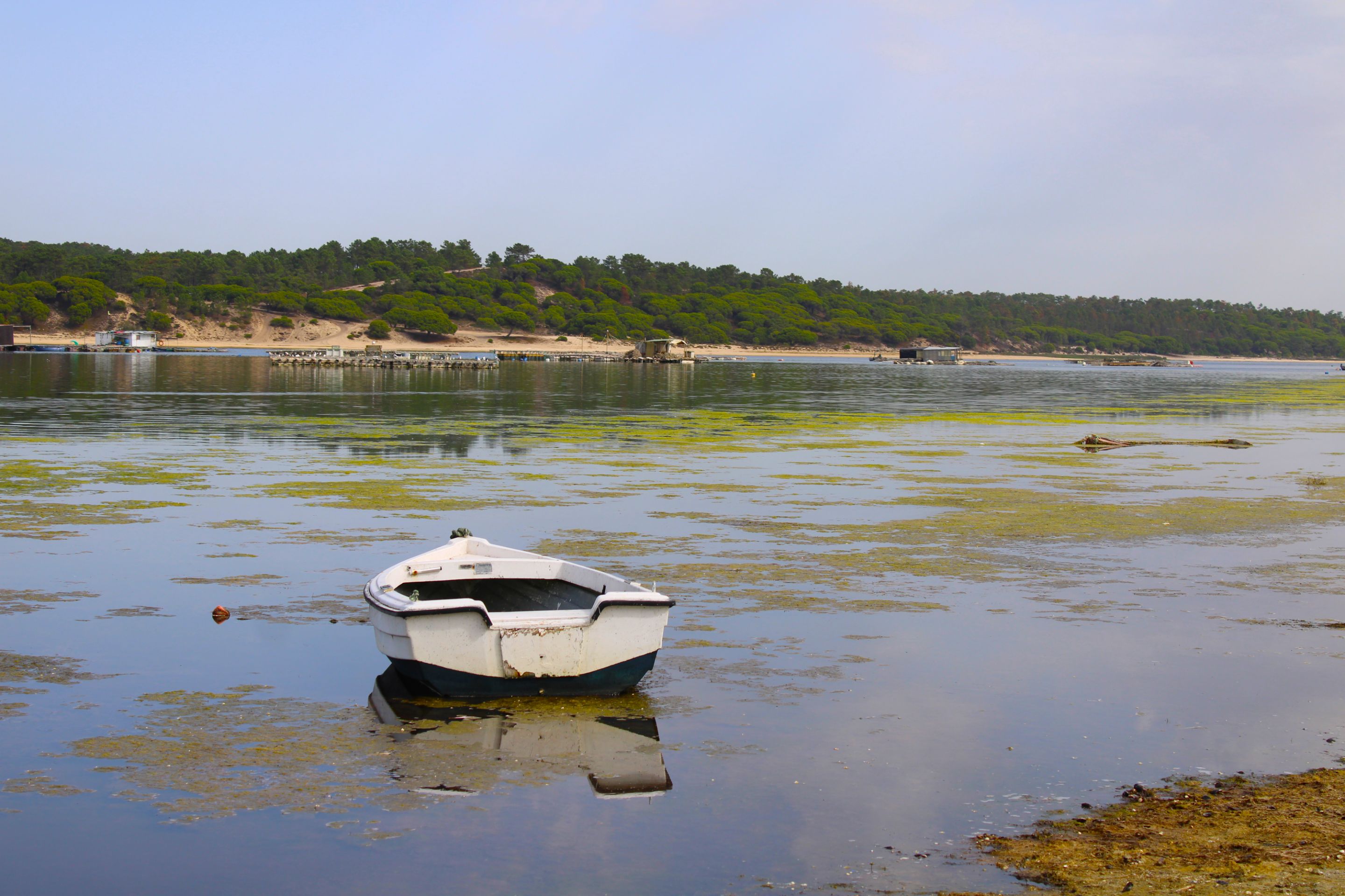
The Deepest Lagoon in Portugal🌍🏞️/ La Laguna más Profunda de Portugal📍🧭
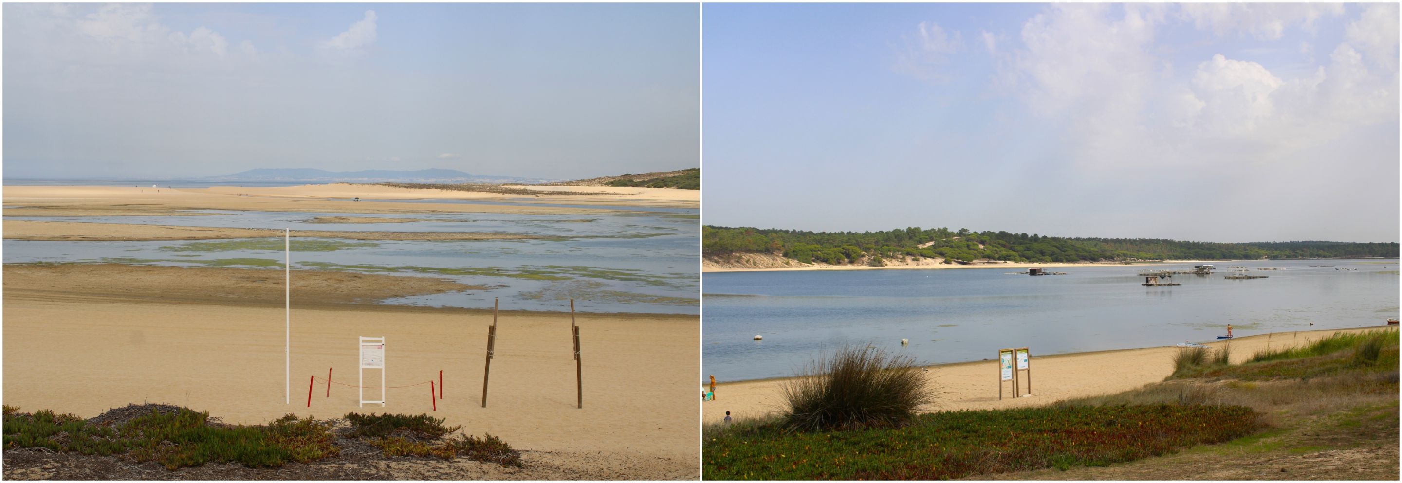
There are many lagoons in Portugal. No attempt has ever been made to count them all, but this one in Albufeira holds the record for being the deepest in the country. It's incredibly interesting because it's not just a hike... It's history...🧭🌍
Hay muchas lagunas en Portugal nunca se intentaron contabilizar todas, pero está de "Albufeira" se lleva el record por ser la más profunda del país, y es super interesante porque no se trata solo de una caminata... Es historia...🚙
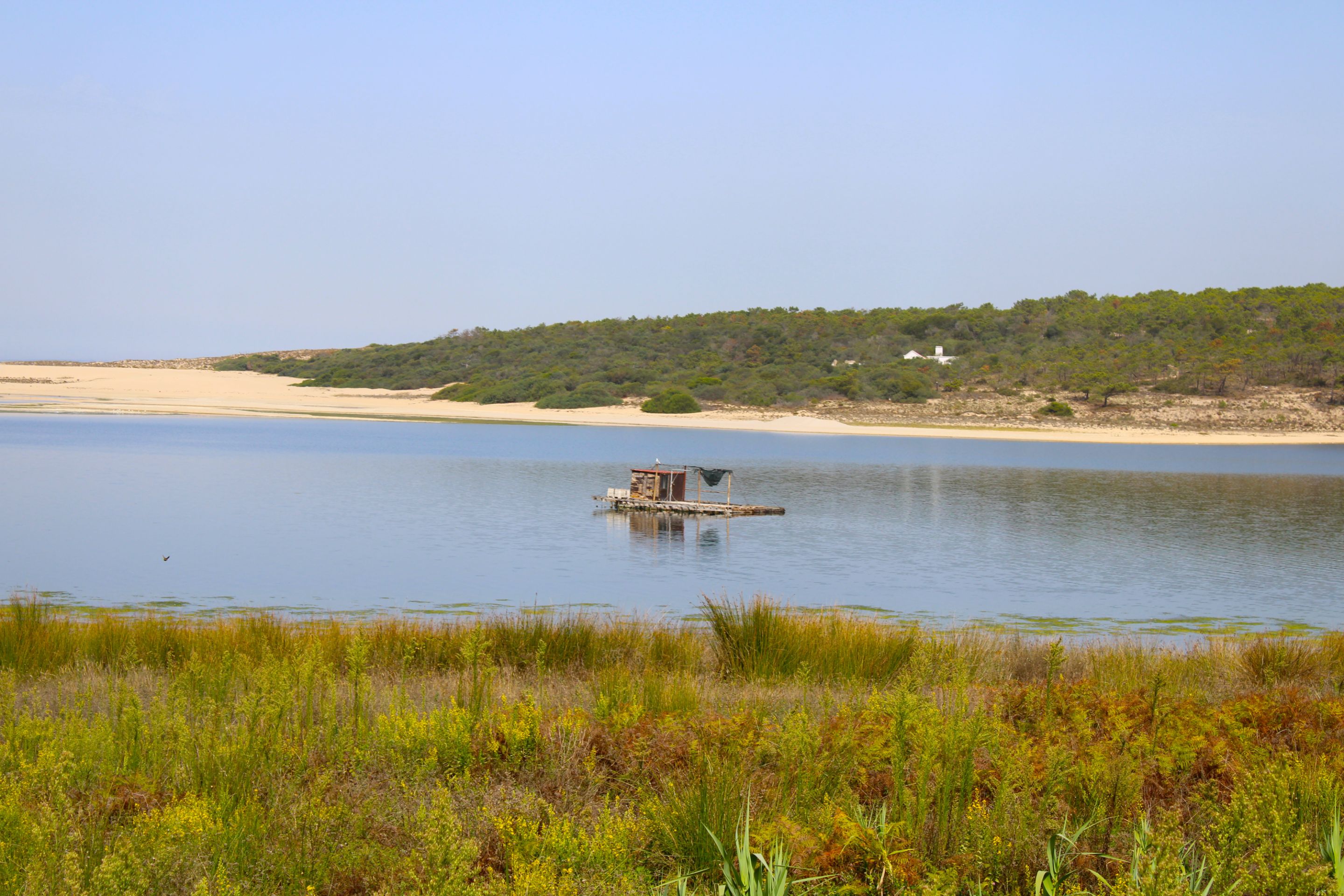
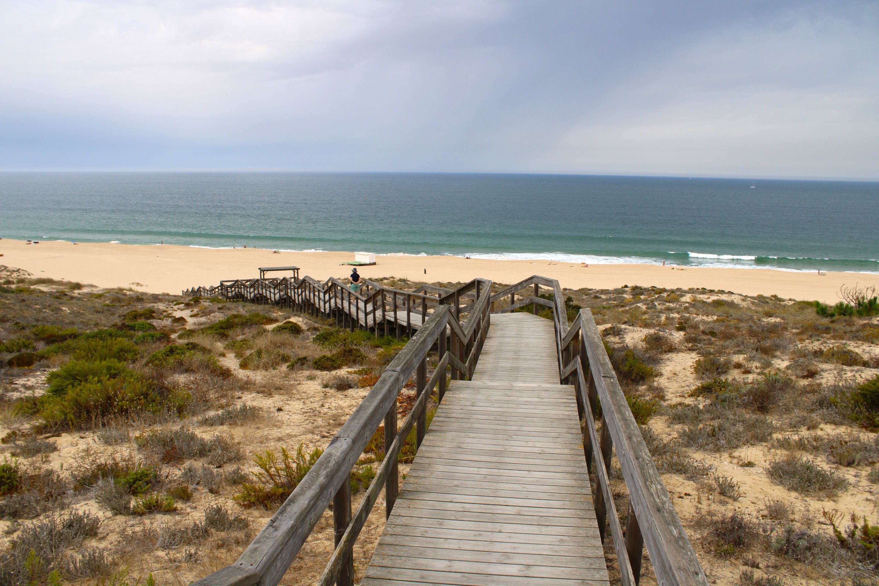
Arrival at the coast🌍🏞️/ Llegada al litoral📍🧭
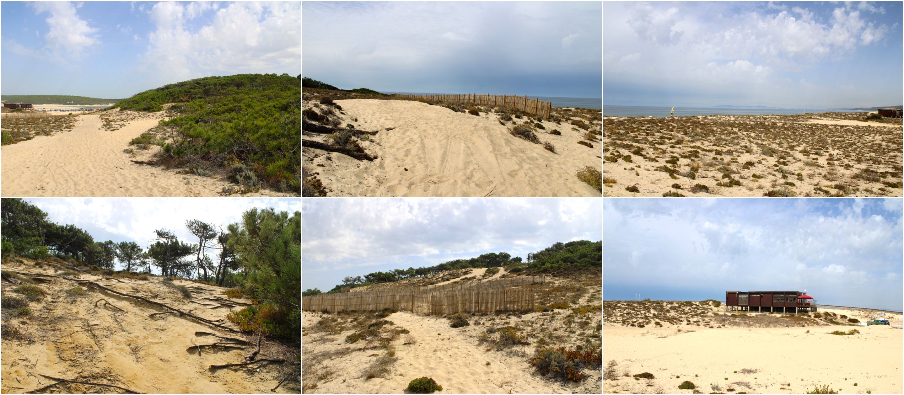
**Detour in the forest🌍🌄**
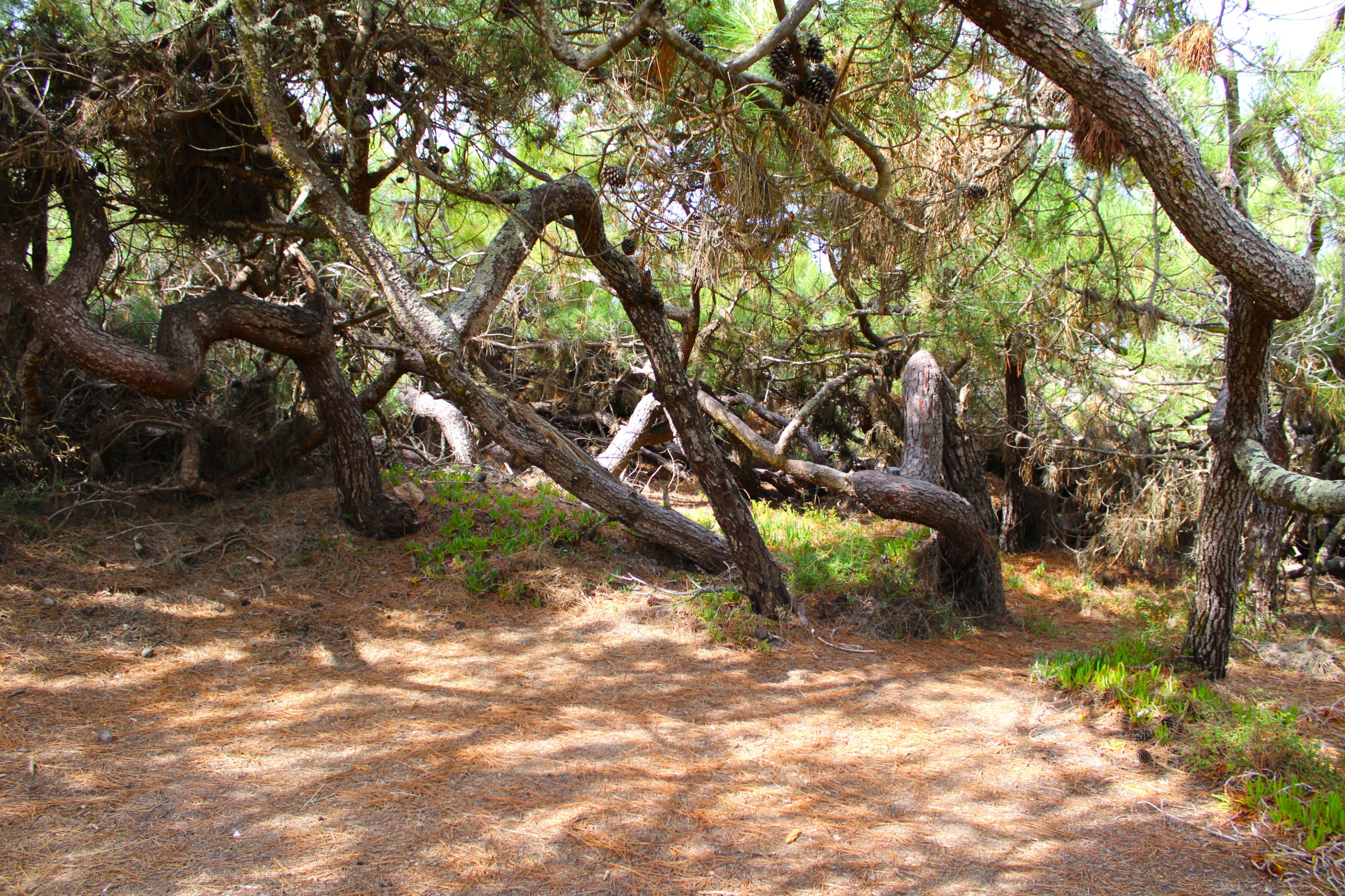
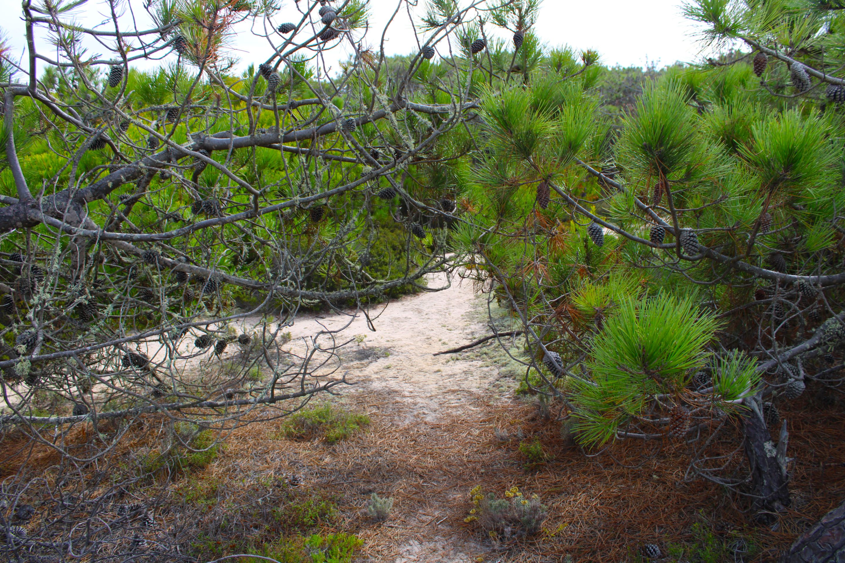
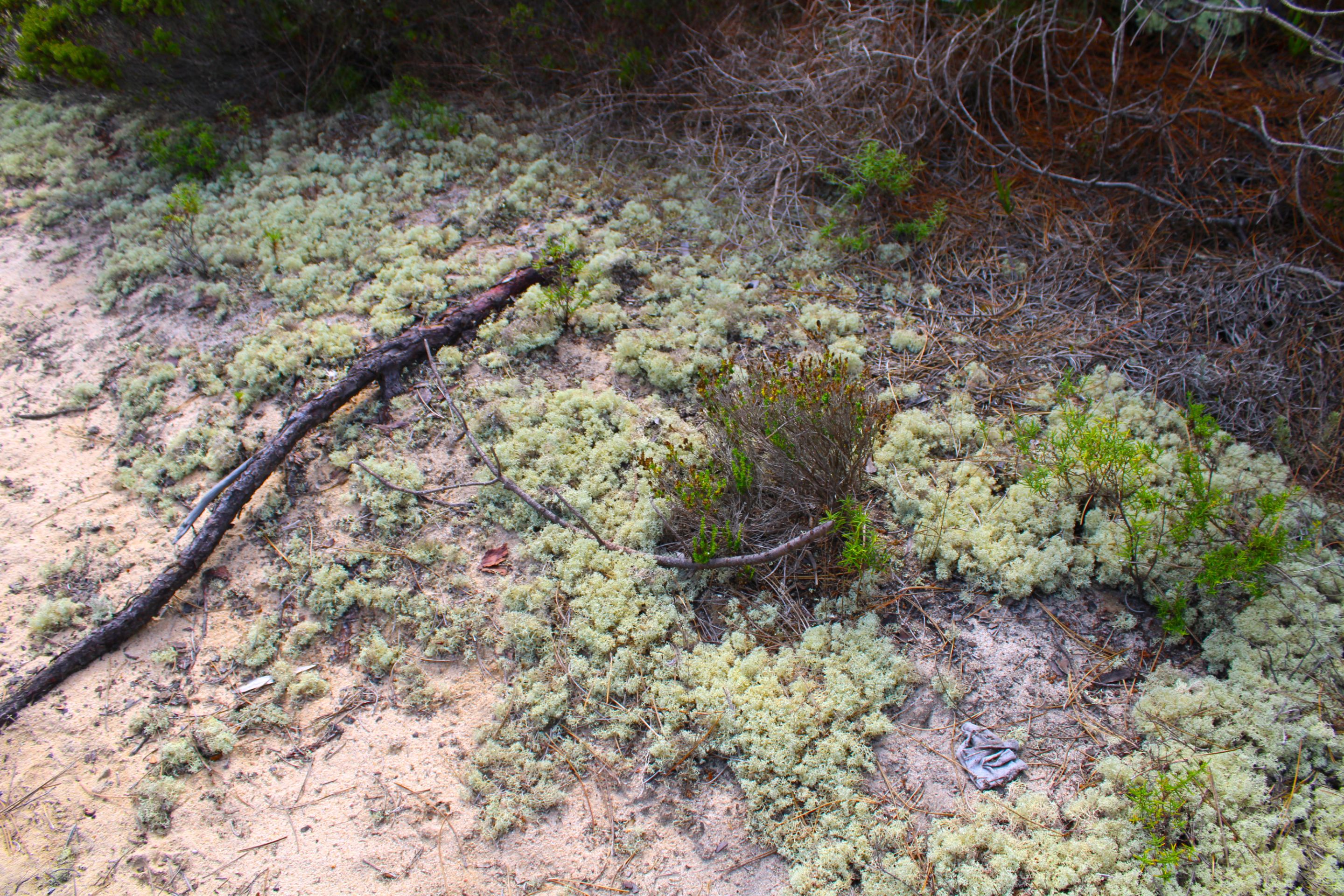
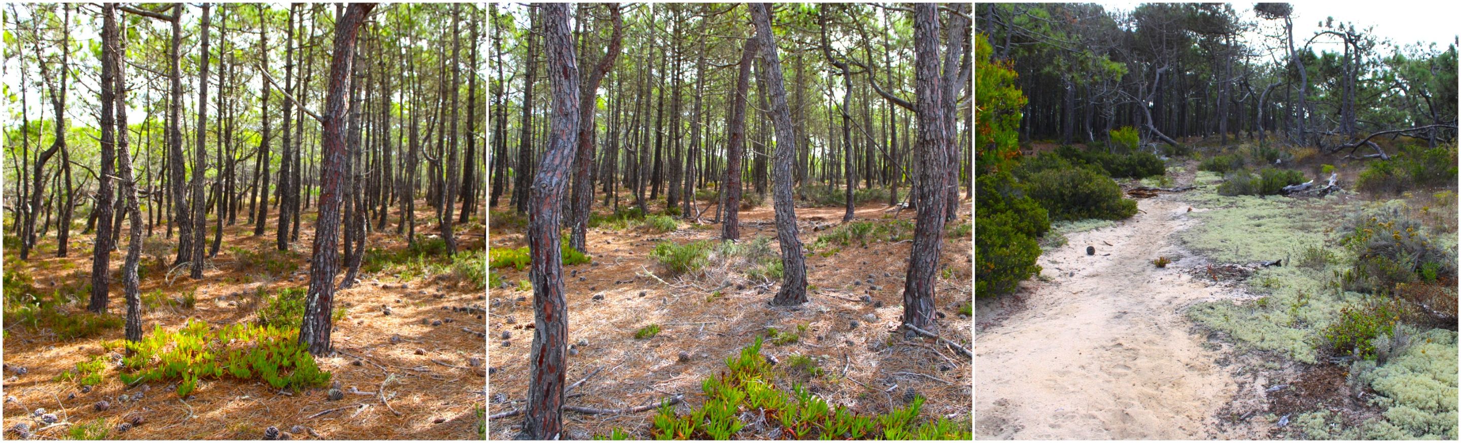
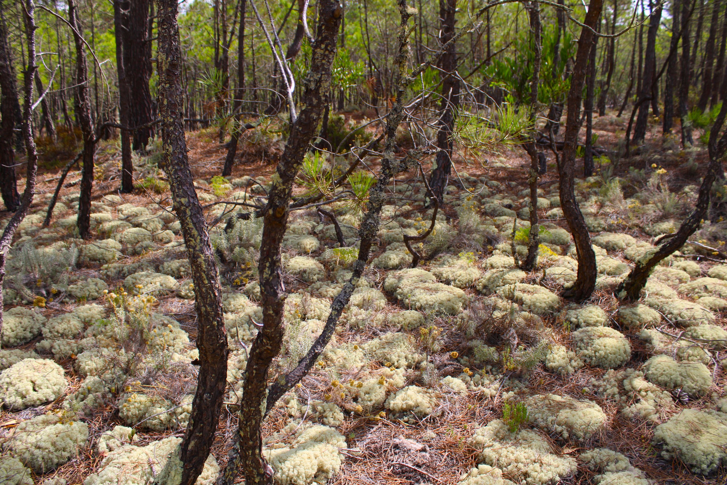
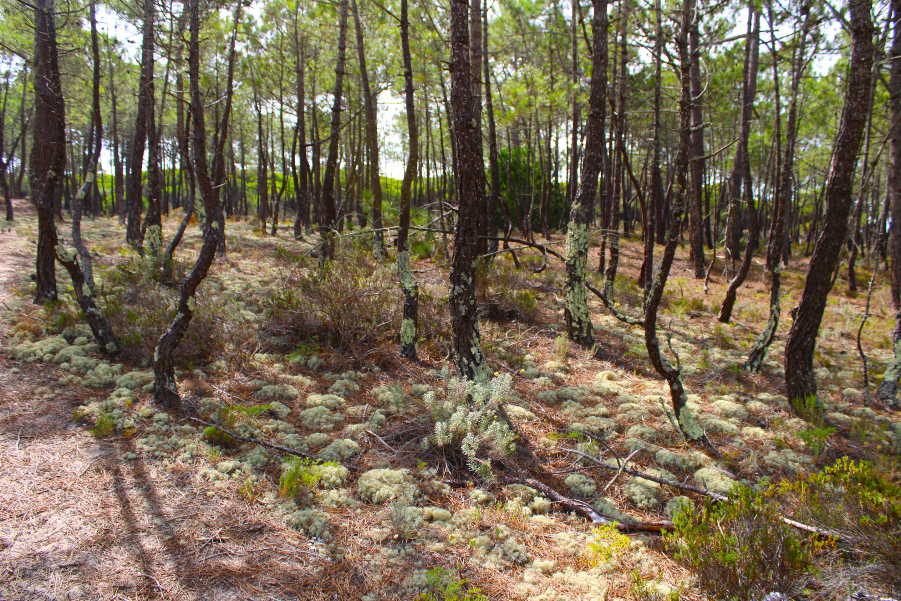
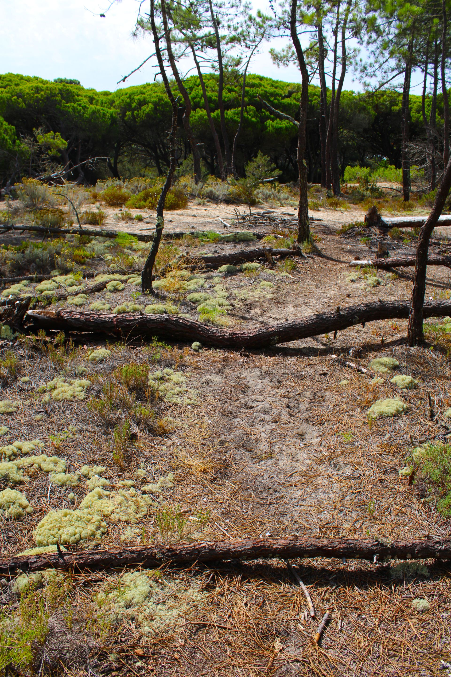
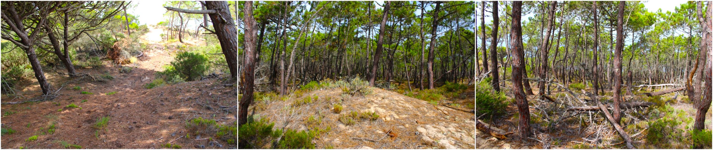
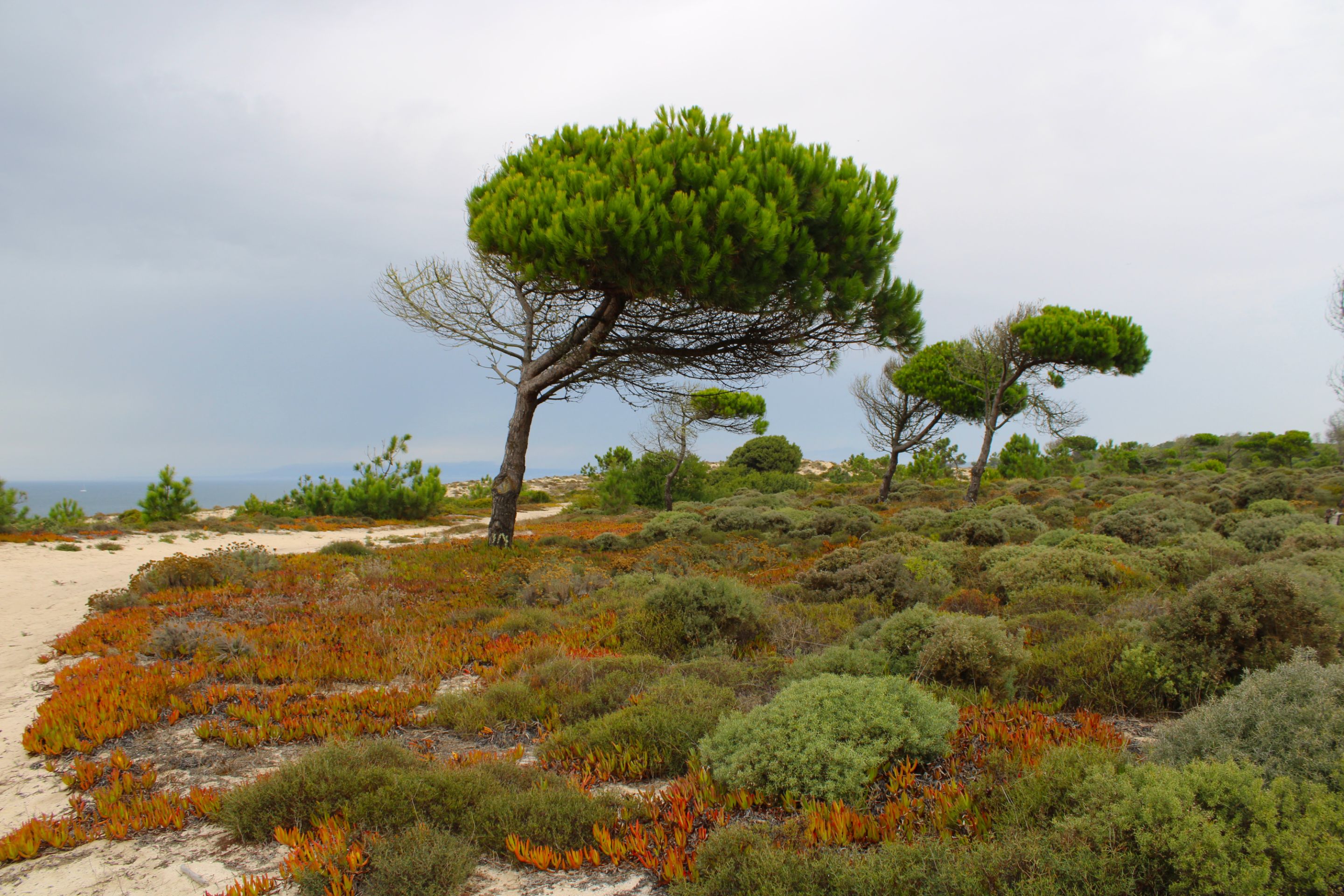
One of the key points of the walk is being able to make small detours in the pine forest and high dunes. First, escaping from the sand of the beach is a positive point to save energy and avoid sinking in the sand, and the other positive aspect is that inside the forest it is a bit cool and we avoid direct sun.🌍📍
#
Uno de los puntos claves de la caminata es poder hacer pequeños desvíos en el bosque de pinos y las dunas altas, primero escapar de la arena de la playa es un punto positivo para ahorrar energía y evitar hundirnos en la arena, y el otro aspecto positivo es que dentro del bosque hay un poco de fresco y evitamos el sol directo 🗺️🚩

#
Don't miss the videos (leaving a mark in Portugal)🌍🏞️/ No te pierdas los videos (dejando una marca en Portugal)📍🧭
https://youtu.be/puY1OPvPZ3I?si=y6dtlrz9HlKgblUH

#
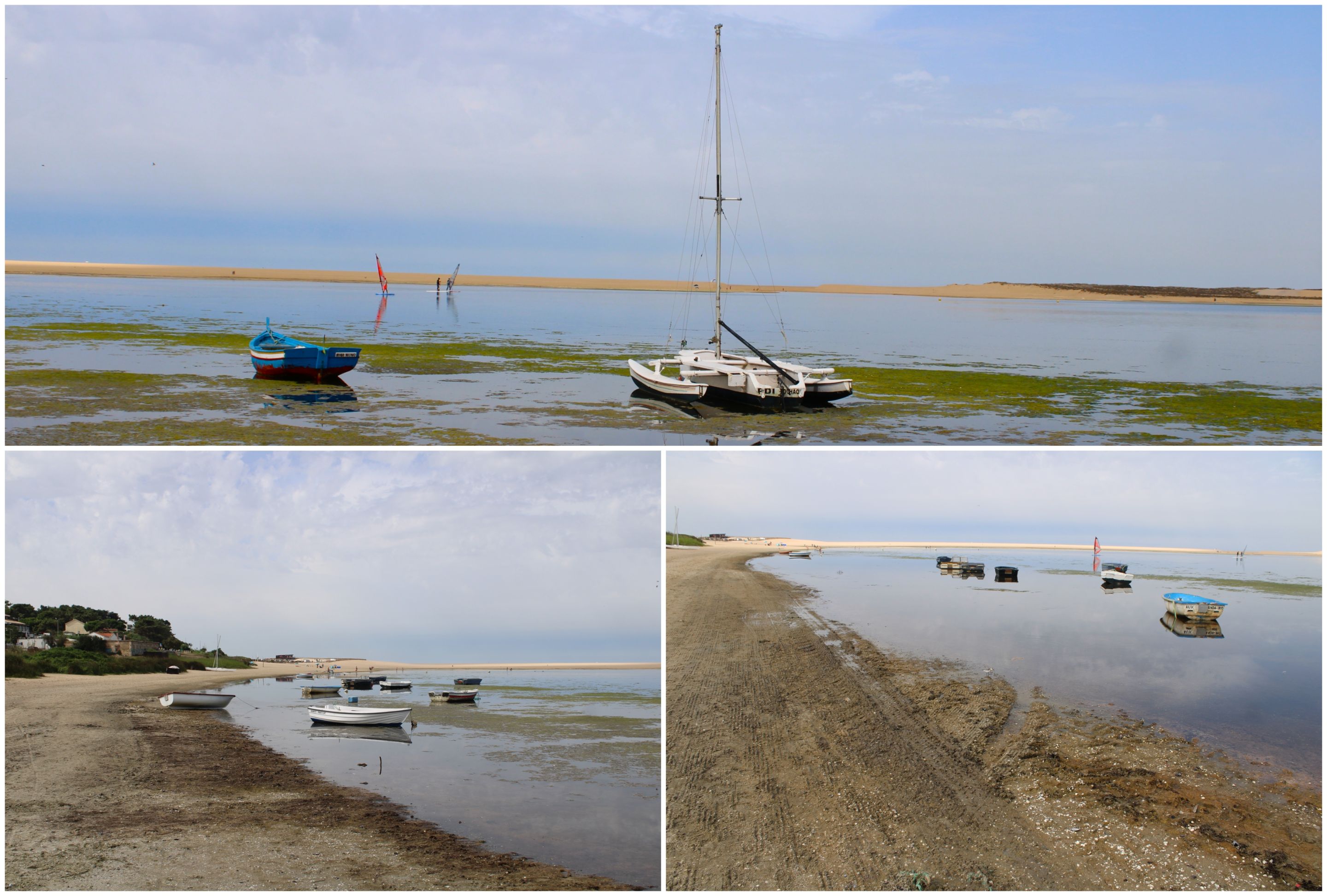
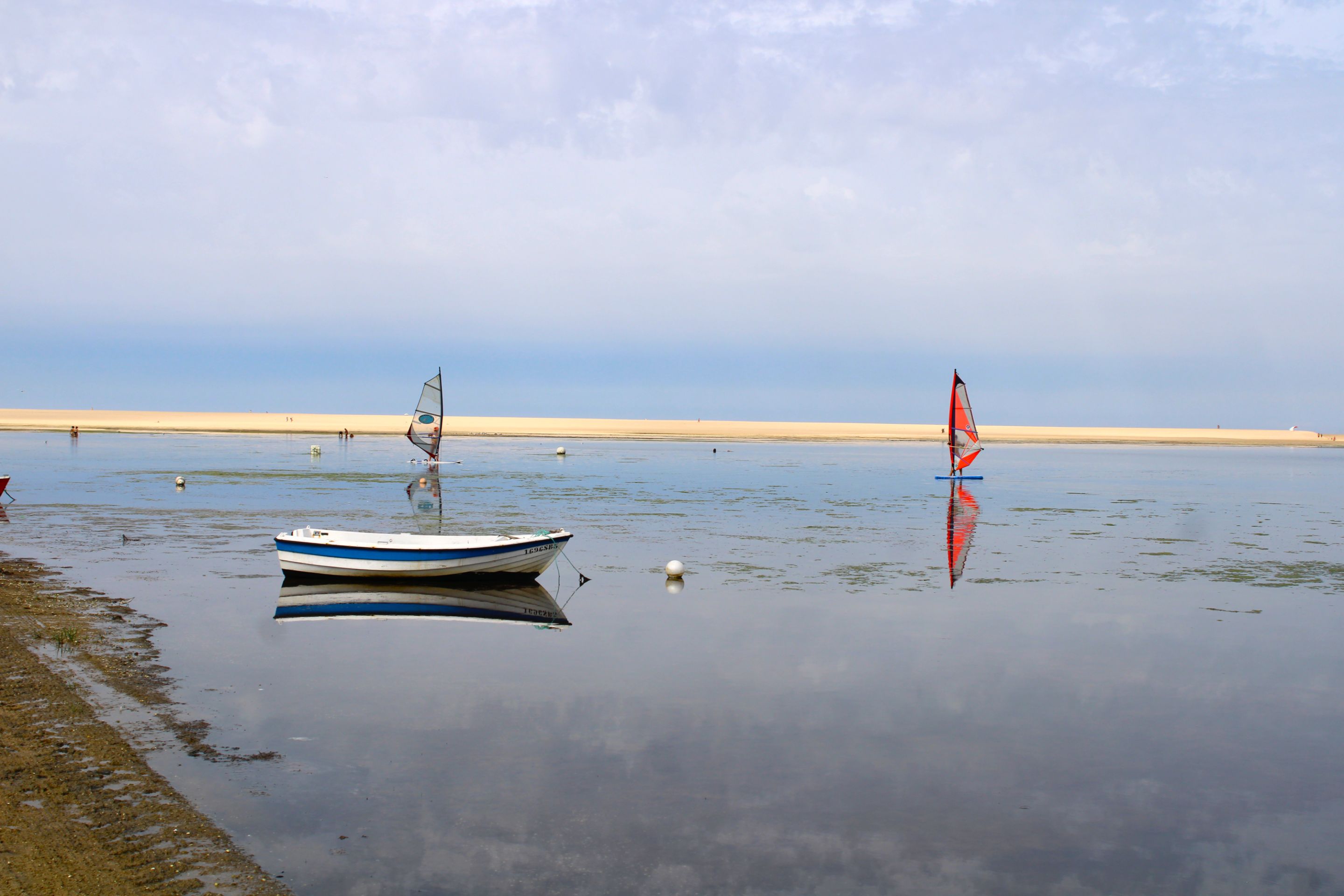
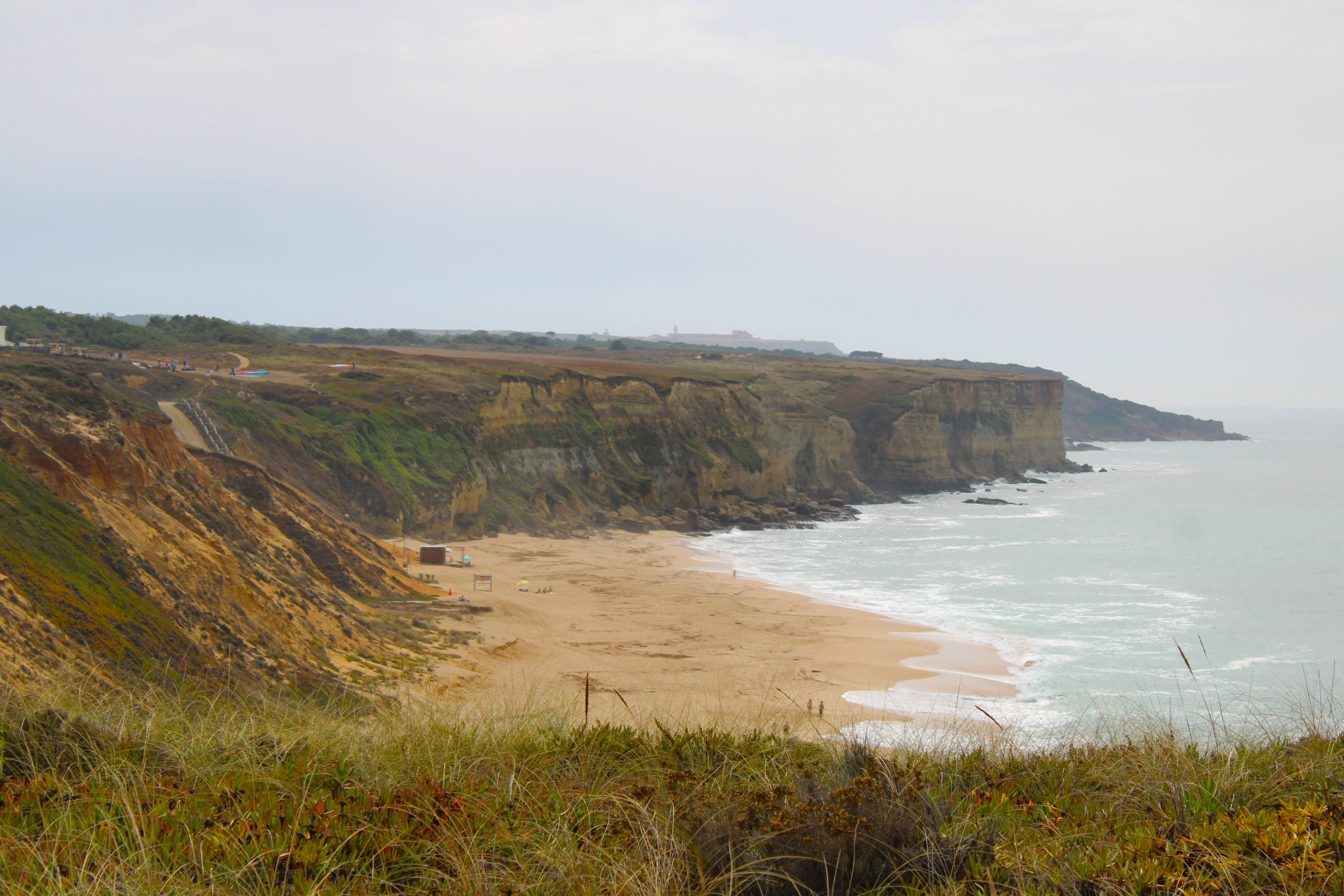
The most popular beaches🌍🏞️/ Las playas más populares📍🧭
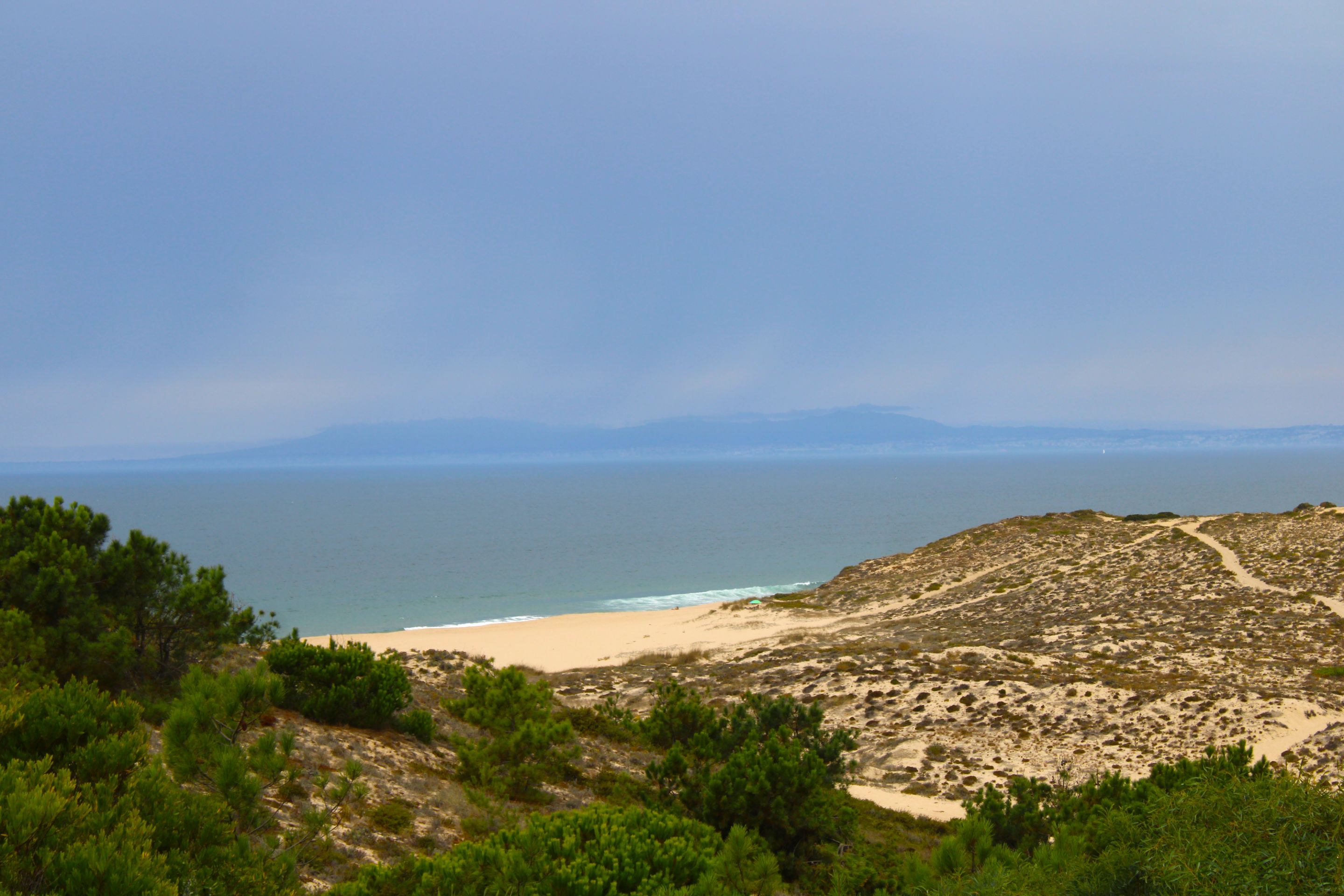
*Coordinates: 38.489911, -9.183989📍🌍/ Coordenadas:38.489911, -9.183989*📸
I had the privilege of visiting beaches I had never read or heard about since I've been in Portugal, such as "Alfarim." I also photographed others that allow pets, which is important to many because many tourists travel with their pets.🚩🌄
Tuve el privilegio de conocer playas de las cuales nunca había leído o escuchado desde que estoy en Portugal, tal como: "Alfarim" a su vez fotografié otras que permiten el ingreso de animales de estimación, cosa que para muchos es importante porque muchos turistas viajan con sus mascotas de estimación.🧭

#
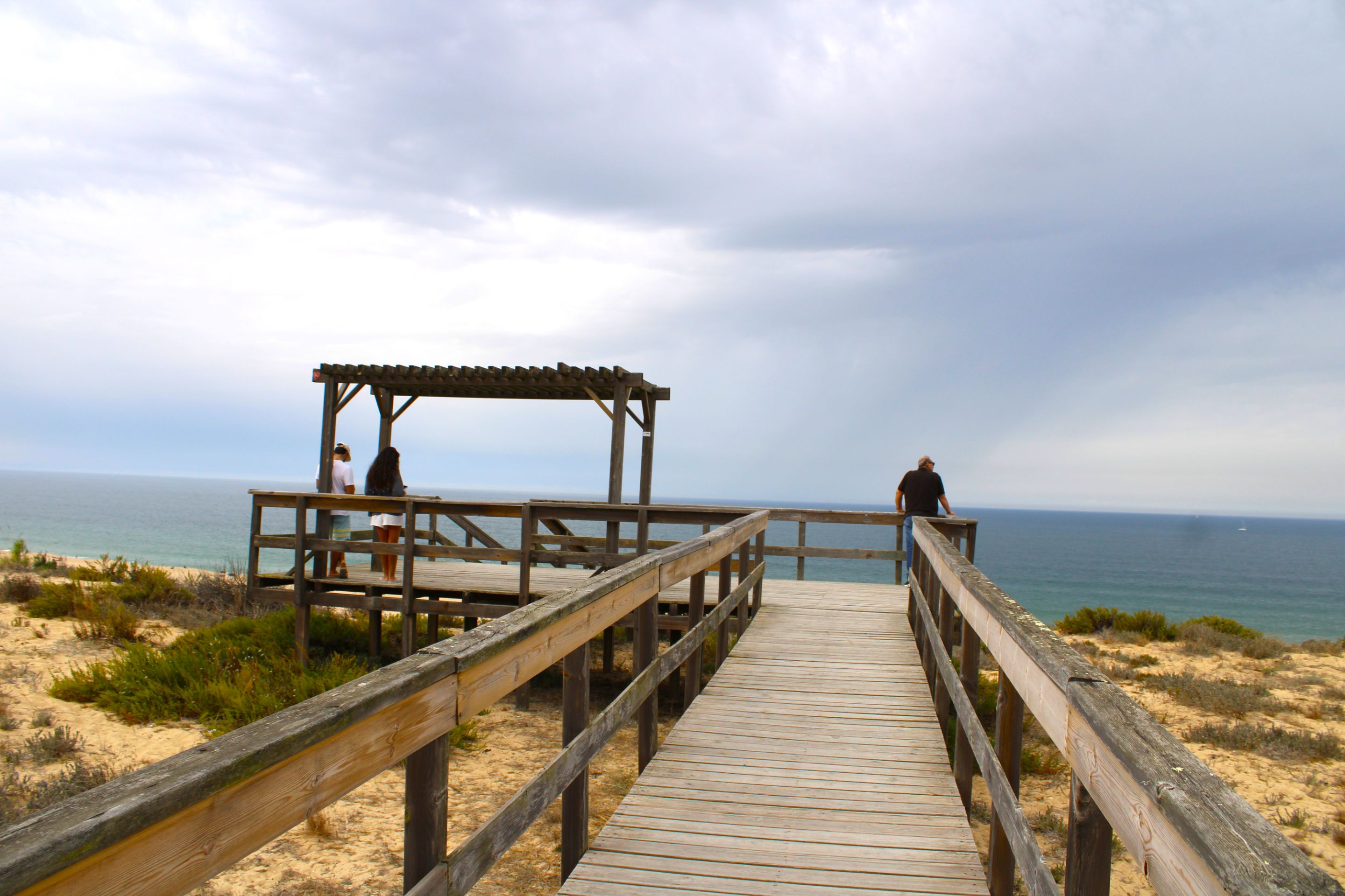
Fighting the weather🌍🏞️/ Luchar con el clima📍🧭
Before hiking, I make a habit of doing a little research into the trails I'll be hiking, the weather conditions, and well, I was confident it wasn't going to rain, but suddenly a cloud passed over me and it started to rain. It was very windy. I had to take shelter in the woods and wait for it to stop. This moment can be seen better in the video.🌄🚩
Antes de hacer un sendero tengo el hábito de investigar un poco que caminos realizaré, como es la condición climática y bueno estaba confiado que no iba a llover y de repente una nube paso encima de mí y llovió, con mucho viento, tuve que resguardarme en el bosque y esperar que dejará de llover, en el video se aprecia mejor este momento.🗺️🏞️

#
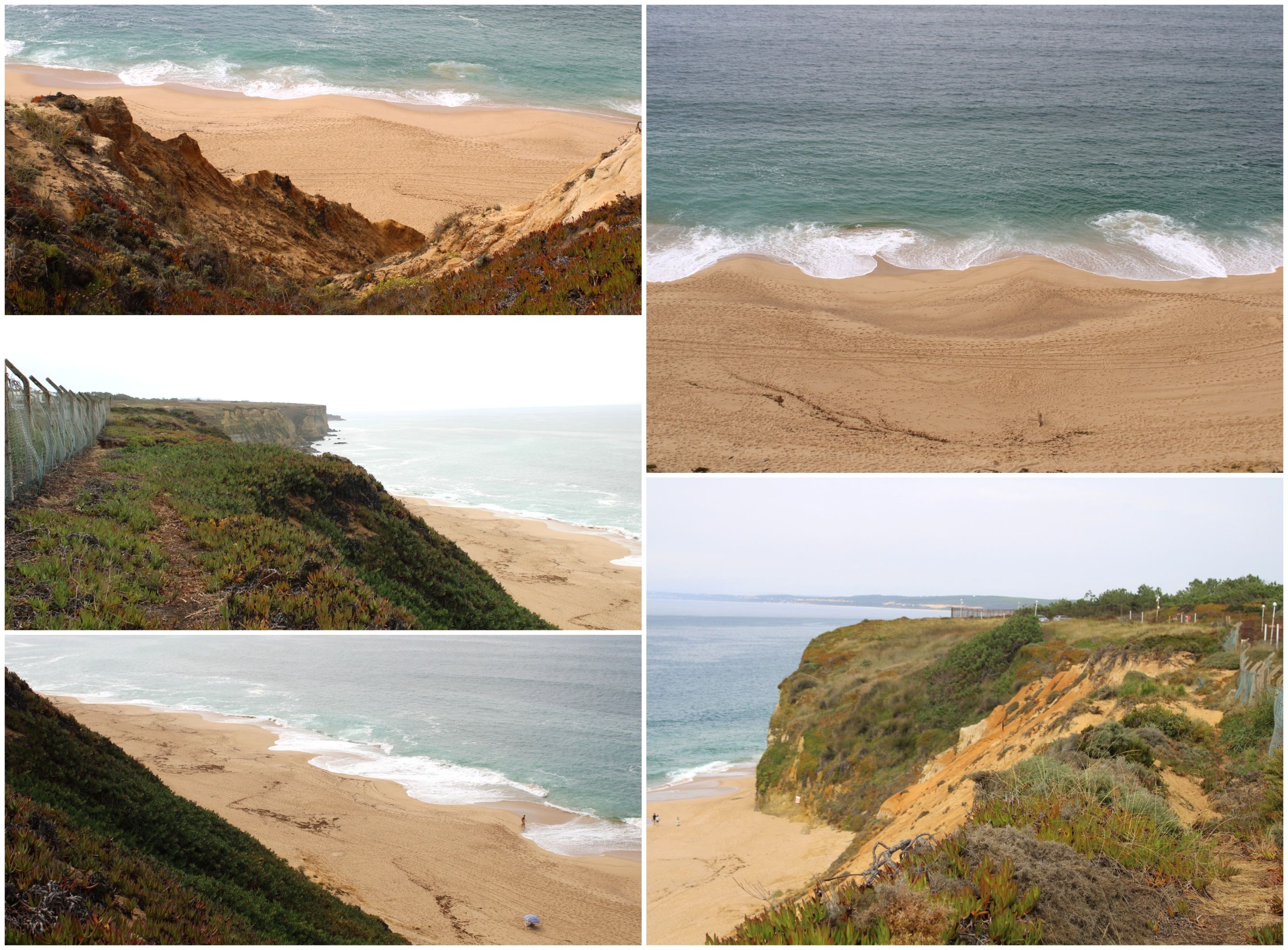
The most dangerous🌍🏞️/ Lo más peligroso📍🧭
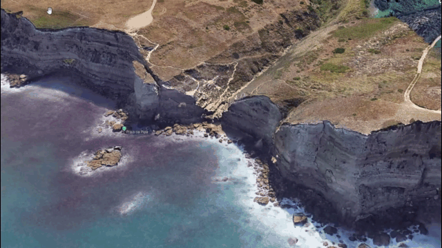
*Coordinates: 38.459985, -9.195032📍🌍/ Coordenadas:38.459985, -9.195032*📸
IMG_9739.JPG (https://files.peakd.com/file/peakd-hive/biologistbrito/23ynQVrXfhuZbMBjGp1C7DNJVFVmBhyaZsytjsBbwywz3yRCien8wa4Pi1YYoMvW853a8.JPG)
IMG_9740.JPG (https://files.peakd.com/file/peakd-hive/biologistbrito/23zki2z7n9z6zuMw2uPYo5Hv9KPXEg3HDz8jjwXL1aqfqFJvk5WKLxtEvUjTaJH9wMcda.JPG)
BeFunky-collage - 2025-10-13T165754.795.jpg (https://files.peakd.com/file/peakd-hive/biologistbrito/23x16sBiRWEmdnP7ThgS5t3BKr8KcvjAai6LLpVUaNEz3qZxHcZdh5apeFuBU6gc33kHf.jpg)
20250920_155105.jpg (https://files.peakd.com/file/peakd-hive/biologistbrito/244eGTVdpzY27NPHRA2ZsWK198m1gjpcBcMJE8DnUoHCaTbCntaXiyzGutcPMJgMhcmrq.jpg)
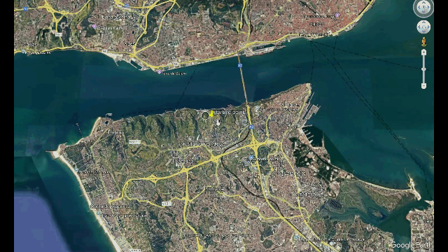
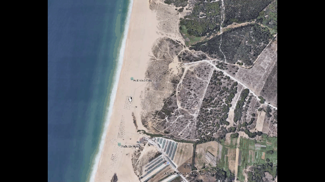
When I say this is the most dangerous part of the hike, just look at the layout on Gmaps to see that we had to go down the crag and climb back up at almost a 40% incline, this is where hiking boots and walking sticks are a plus!👨🏻🏫⛰️
¡Cuando digo que esta es la parte más peligrosa de la caminata basta con ver el diseño en Gmaps para notar que tuvimos que bajar el peñasco y subirlo de nuevo con casi una inclinación de 40%, aquí es donde estar con botas de excursión y los bastones son un plus!🚩
(https://images.ecency.com/DQmbCHnDKMbWHZGL9pemNAuKECHmCrfadtMGuoNeBv2iSwg/image.png)
BeFunky-collage - 2025-10-13T171356.378.jpg (https://files.peakd.com/file/peakd-hive/biologistbrito/23vsSXoBKi6nQAYXqsk4czbCiqVGzauMLxzq3jMFwrcQJ75ar7Qv7Ap1MJ2hEkgzG1YrW.jpg)
IMG_9761.JPG (https://files.peakd.com/file/peakd-hive/biologistbrito/23zbMpD33MhmzEzCpdBd97zr6BahYuDcYiqNkm5SmUEJdvPuQm3ACSYupU7ygDD441fSd.JPG)
BeFunky-collage - 2025-10-13T172754.725.jpg (https://files.peakd.com/file/peakd-hive/biologistbrito/AKRC5XZm6ZfaxHvsz4akp5pwvXY9idnnFY1EDSEf6MMGtgTtBh6QaEZbLyhiEWj.jpg)
IMG_9811.JPG (https://files.peakd.com/file/peakd-hive/biologistbrito/23ynUXCpUDypa2MPKPhFb2D4swB4ndXfaLgRGviLTTouC889SPfJfHBUT9Rh9mcAuHSHZ.JPG)
BeFunky-collage - 2025-10-13T175057.362.jpg (https://files.peakd.com/file/peakd-hive/biologistbrito/AKCGPmWZ5Q25AF7Y5EU1d2oqw1oPiHCx2WFciLokSL7APSqGgw1WeuvLVErNDfb.jpg)
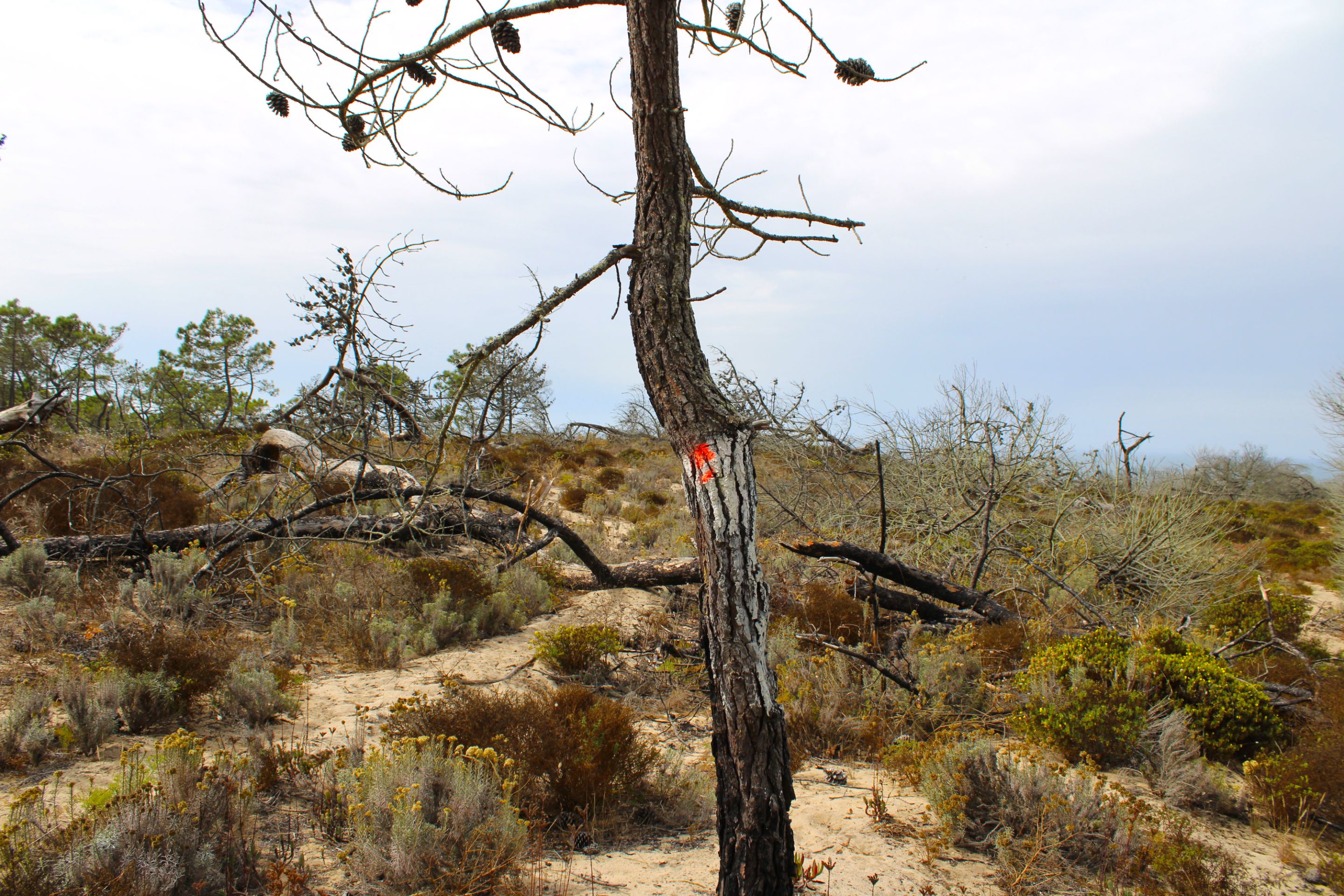
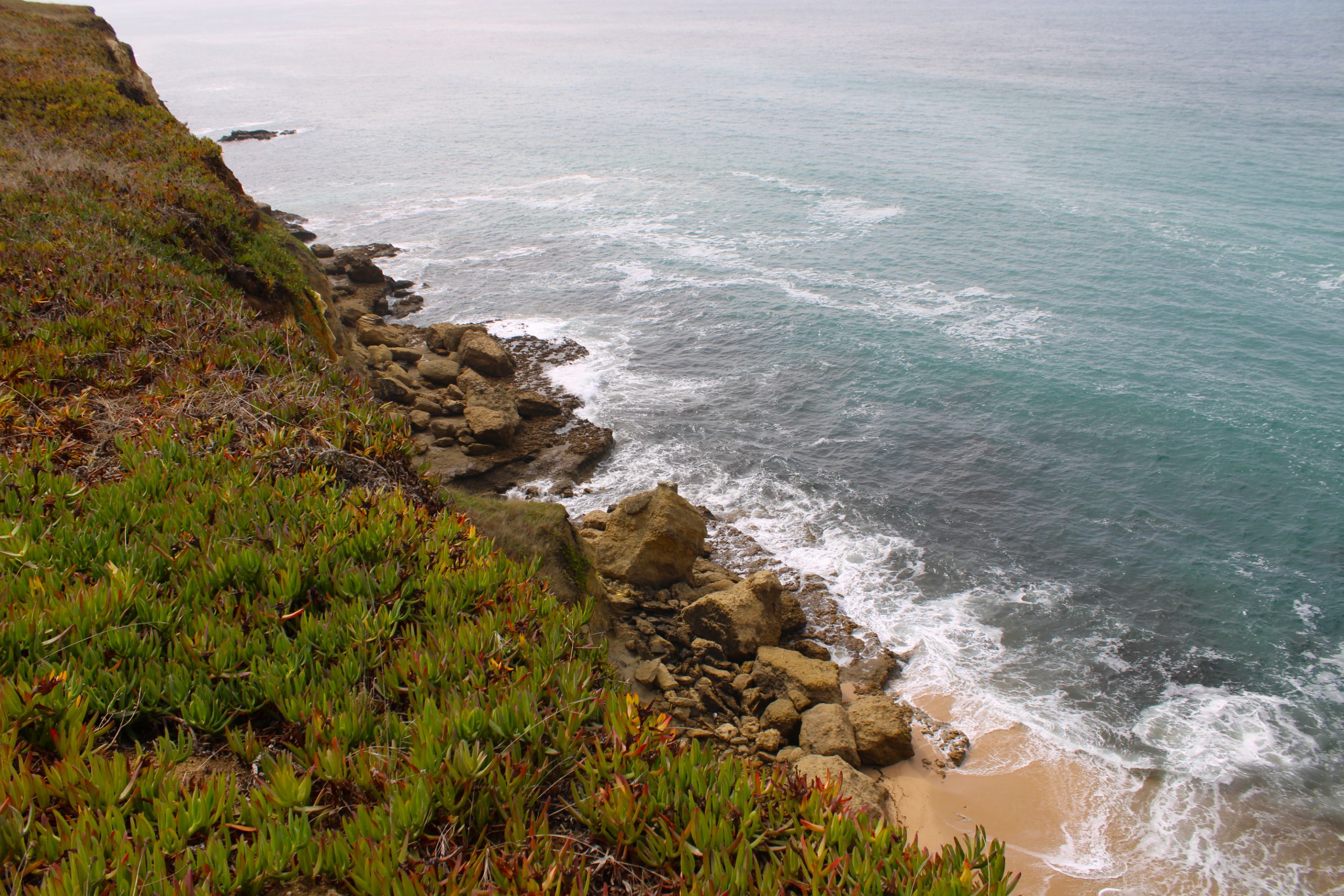
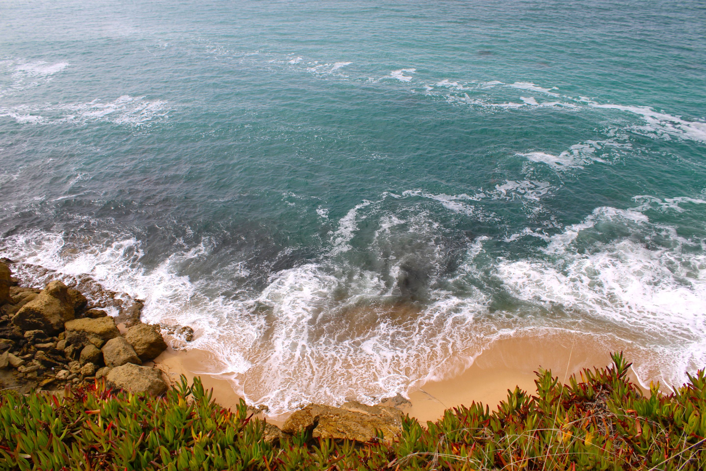
*This part of the hike is very different in terms of landscape as well as flora. I am interpreting that it is very arid because the ocean water covered these areas. Further south I see some flowering plants that were not common further back due to the characteristics of the beach sand.⛰️🚩*
*Esta parte de la caminata es muy diferente paisajísticamente así como la flora, estoy interpretando que es muy árida porque el agua del océano tapaba estas zonas, más al sur veo algunas plantas con flores que no eran común más atrás por la característica de la arena de playa.🌻🌼*
(https://images.ecency.com/DQmbCHnDKMbWHZGL9pemNAuKECHmCrfadtMGuoNeBv2iSwg/image.png)
#
Last kilometers (5km)🌍🏞️/ Ultimos kilometros (5km)📍🧭
IMG_9847.JPG (https://files.peakd.com/file/peakd-hive/biologistbrito/23tvnuE4Nb3hedzpd6iN8V29f35YTpCgxVkqVBaaqf79hNLi4hH55WBHV1XeYDDUA3c7h.JPG)
IMG_9849.JPG (https://files.peakd.com/file/peakd-hive/biologistbrito/23sdfk15EQQDoksUVbXmj86XP9CZa8WnreeKnD7AM5JwqYzUc45NC95ceE8iHkTfdaxUo.JPG)
IMG_9850.JPG (https://files.peakd.com/file/peakd-hive/biologistbrito/23uaPdEVvCBE1aG6jzfgnGsyBA7nFXDnmR8L35SwV7ZjSwW18Umqqx66jBQkpDdjUeGV9.JPG)
BeFunky-collage - 2025-10-14T092929.550.jpg (https://files.peakd.com/file/peakd-hive/biologistbrito/243BiRAU5SKc9nkTr4pM66PMJeY3pZHBT6inwhiAYKUAJb91YMQKyxmg4Sa6TUjfn6wwE.jpg)
BeFunky-collage - 2025-10-14T100235.871.jpg (https://files.peakd.com/file/peakd-hive/biologistbrito/AKF8q7ovyCWVLV91kR4RKq3vNjvo8ee2ugXaAXrZesXFPdxGJAdeJyvR3UdUR1k.jpg)
We're almost 5 km from the end of the route, it's still a demanding hike because there are still about 2 hours left. I've already started to pick up the pace and take fewer photos. Now I'm going to reach an archaeological area to show you something super interesting.🧭👨🏻🏫
Estamos cerca de l
#appreciator
#gems
#chessbrothers
#ocd
#spanish
#travel
#curangel
#curie
#qurator
#amazingnature
Payout: 0.000 HBD
Votes: 926
More interactions (upvote, reblog, reply) coming soon.