After setting a new record in my previous post and being the first Zulian to cross the "southern margin of Portugal from end to end" that's right... No one had registered this challenge of more than 40 km on any blog or social network, since I have the YOUTUBE channel I am investing much more time in social networks, we always read there that it is advisable to always generate and look for several income... Well why not also invest in my YouTube channel as I already do in HIVE, I am managing to connect both things in order to complete my experience, I even added Reddit at the moment everything is going well! LET'S GET TO WHAT INTERESTS US THE TRAIL...🏞️🏆⛰️
#
Luego de dejar un nuevo record en mi post anterior y ser el primer Zuliano en atravesar el "margel sul de Portugal de punta a punta" así es... Nadie había registrado este reto de más de 40 km en ningún blog o red social, desde que tengo el canal de YOUTUBE estoy invirtiendo mucho más tiempo en redes sociales, siempre leemos por allí que lo recomendable es siempre generar y buscar varios ingresos... Bueno porque no invertir también en mi canal de youtube como ya lo hago en HIVE, estoy consiguiendo conectar ambas cosas con el fin de completar mis experiencia inclusive agregue a Reddit de momento está corriendo todo bien! VAMOS A LO QUE NOS INTERESA EL SENDERO...🚩🧭
#
¿How was the walk?🌍🏞️/ ¿Cómo fue la caminata?📍🧭
Coordinates: 39° 1'4.58"N-9°13'30.40"O📍🌍/ Coordenadas: 39° 1'4.58"N-9°13'30.40"O📸
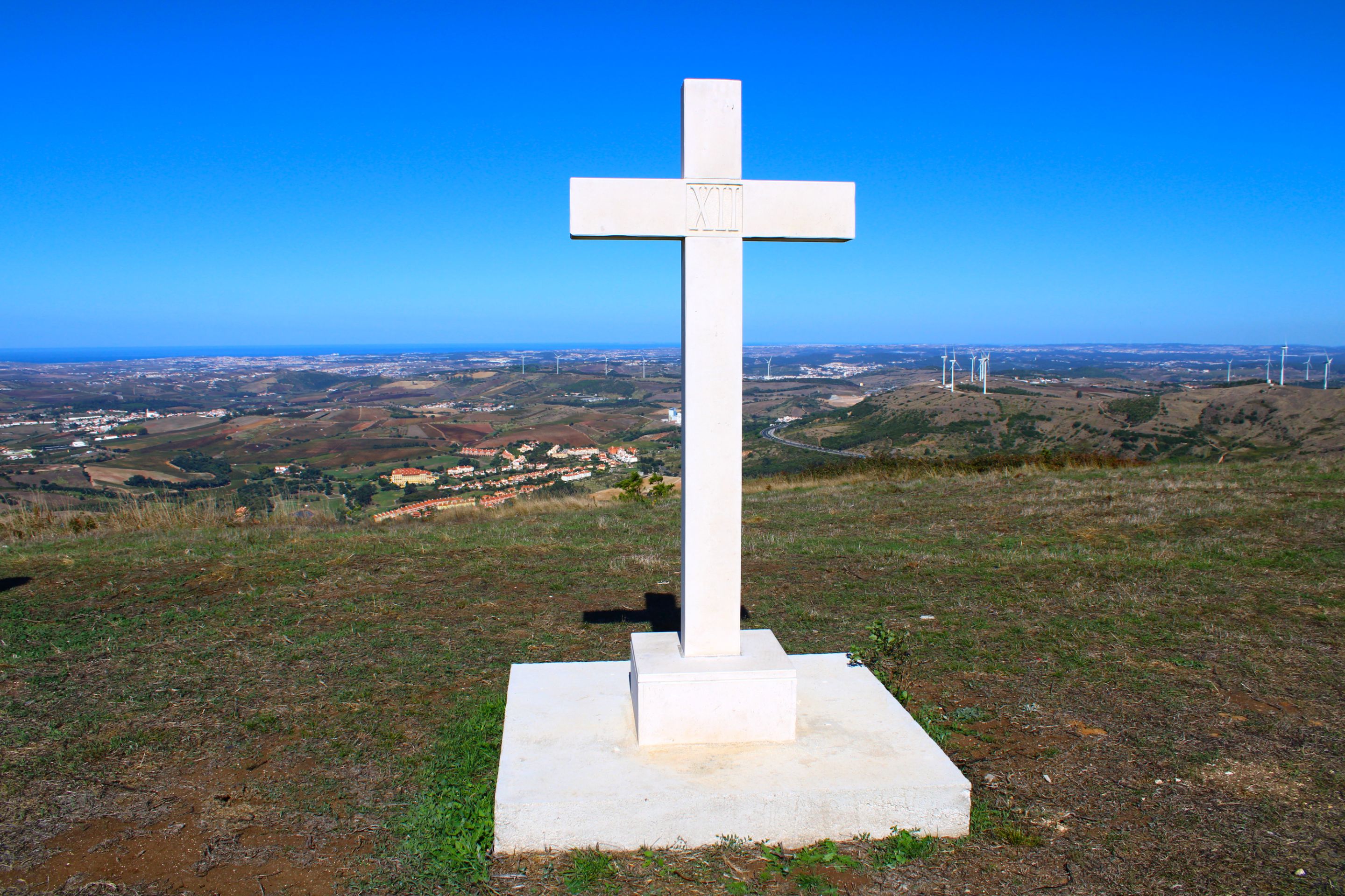
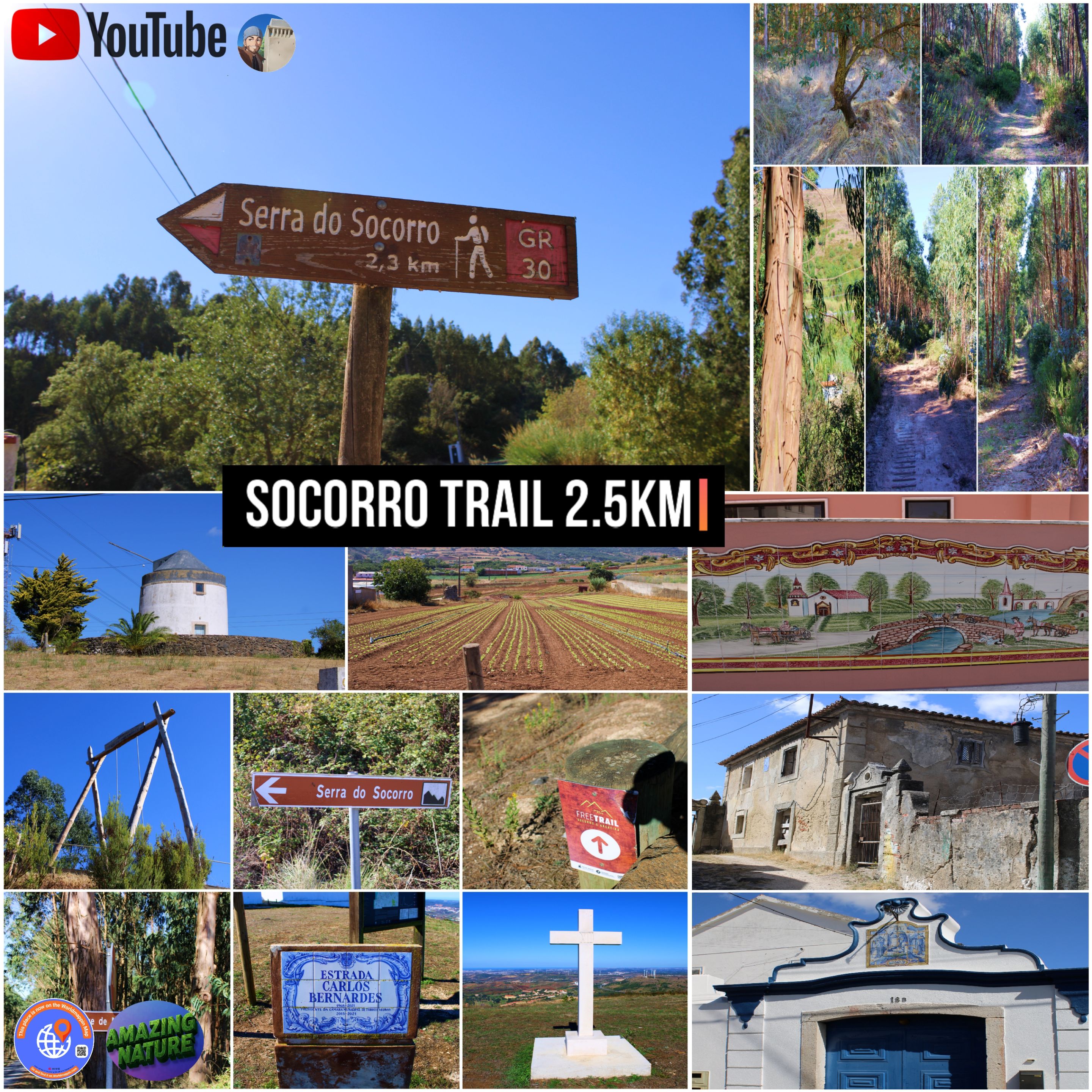
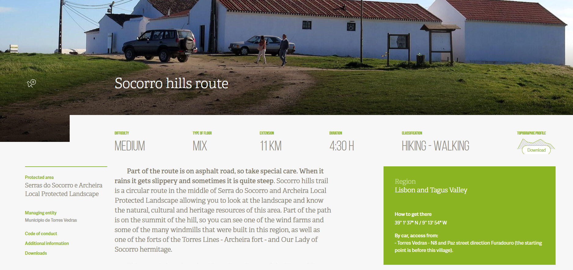
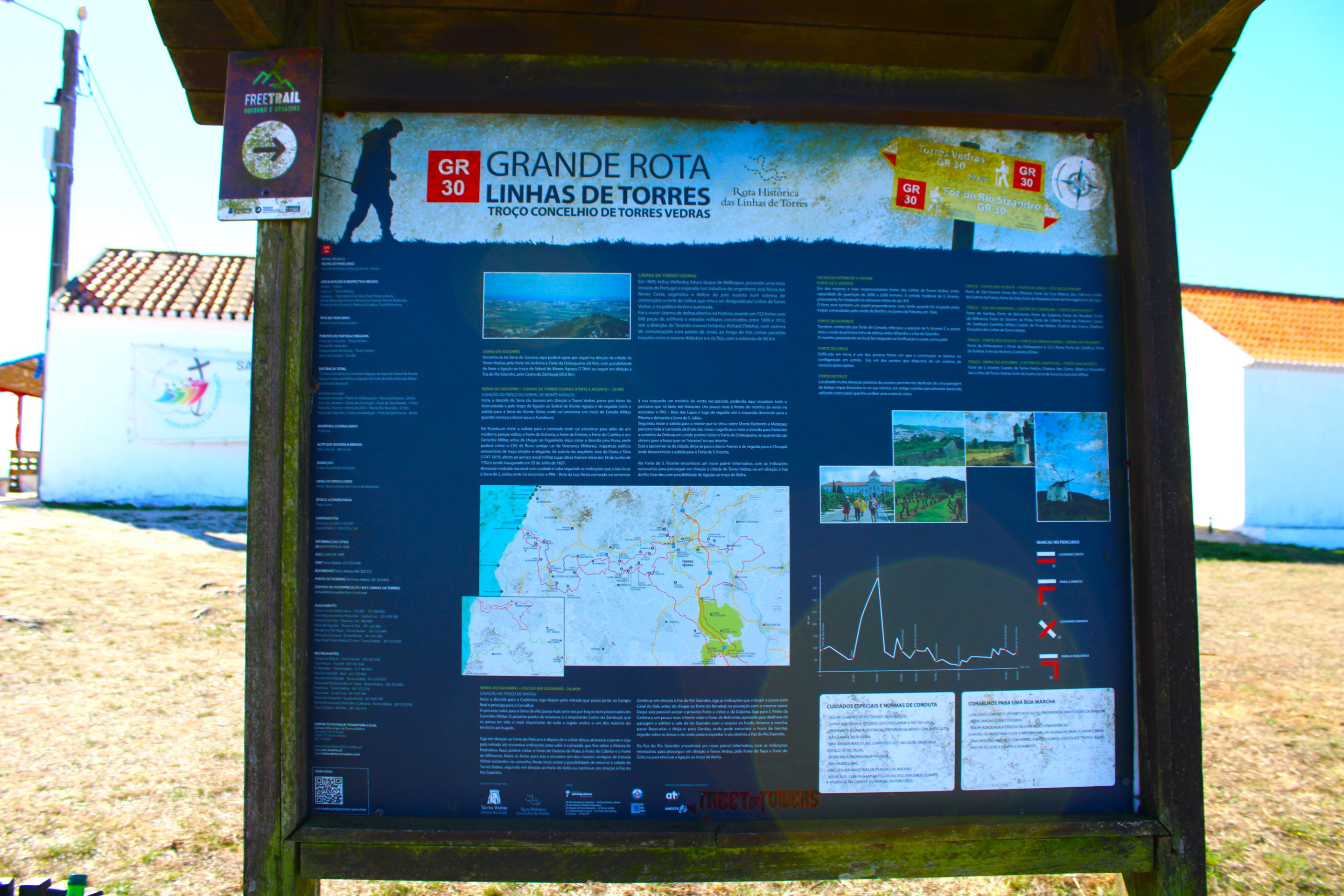
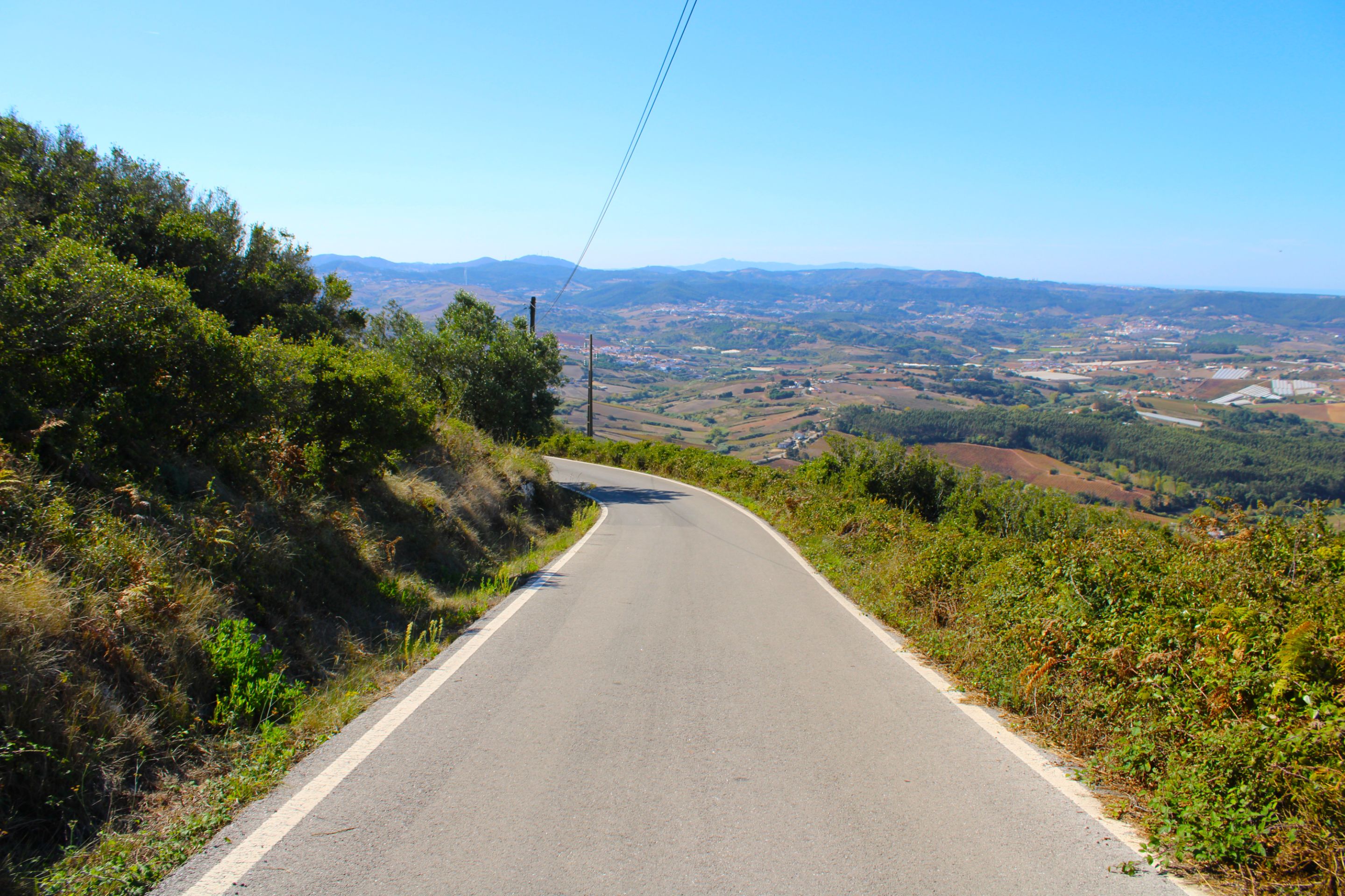
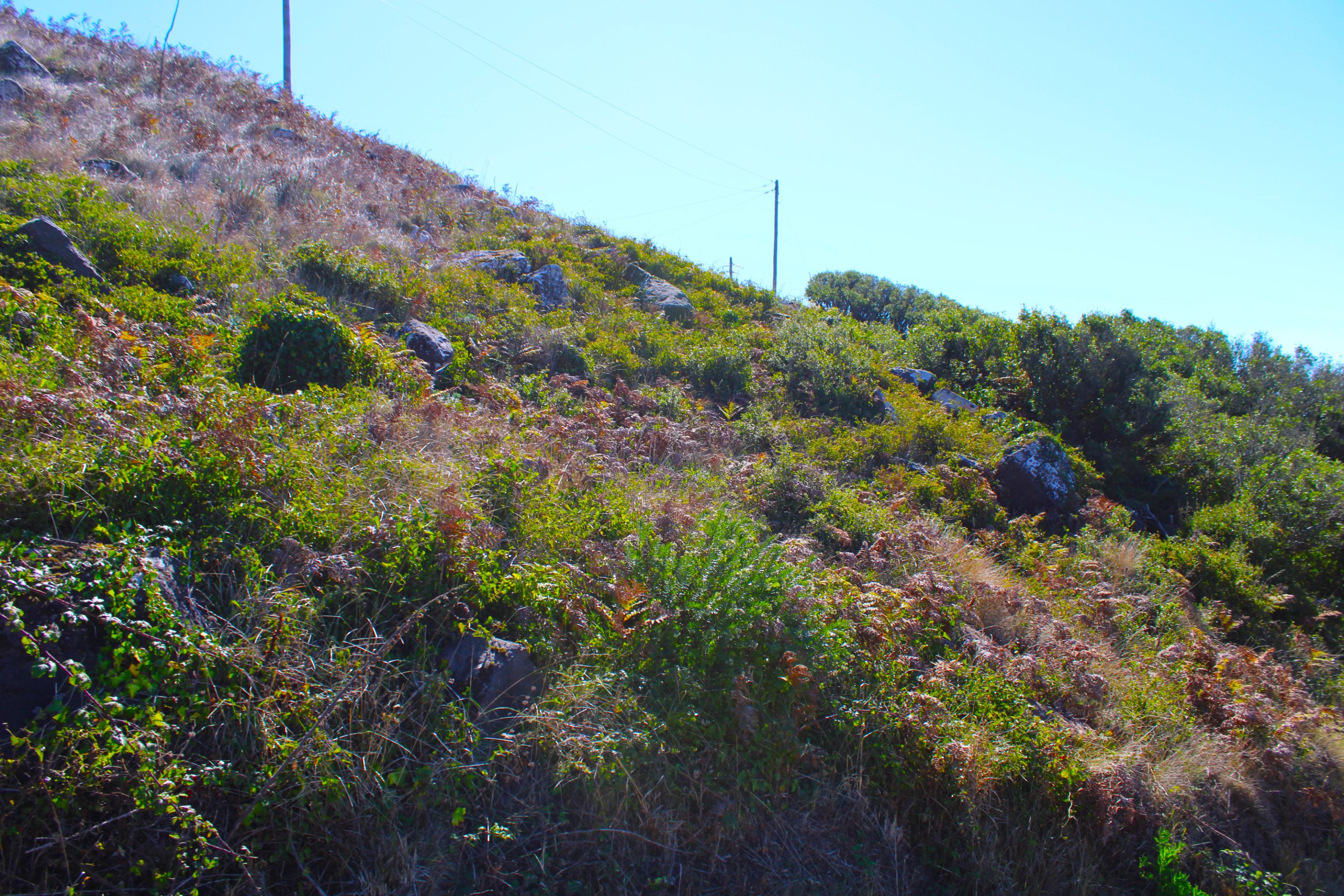
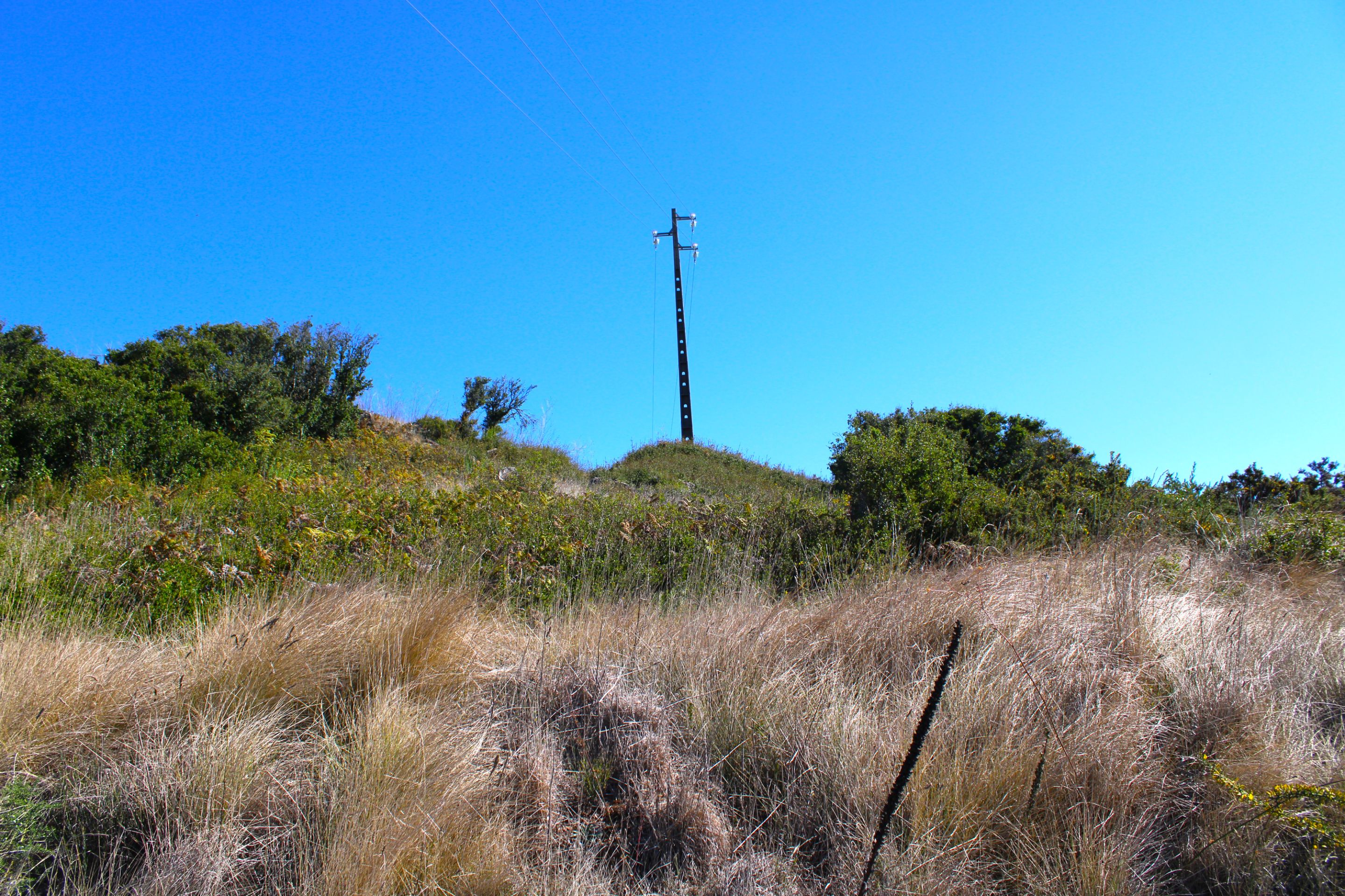
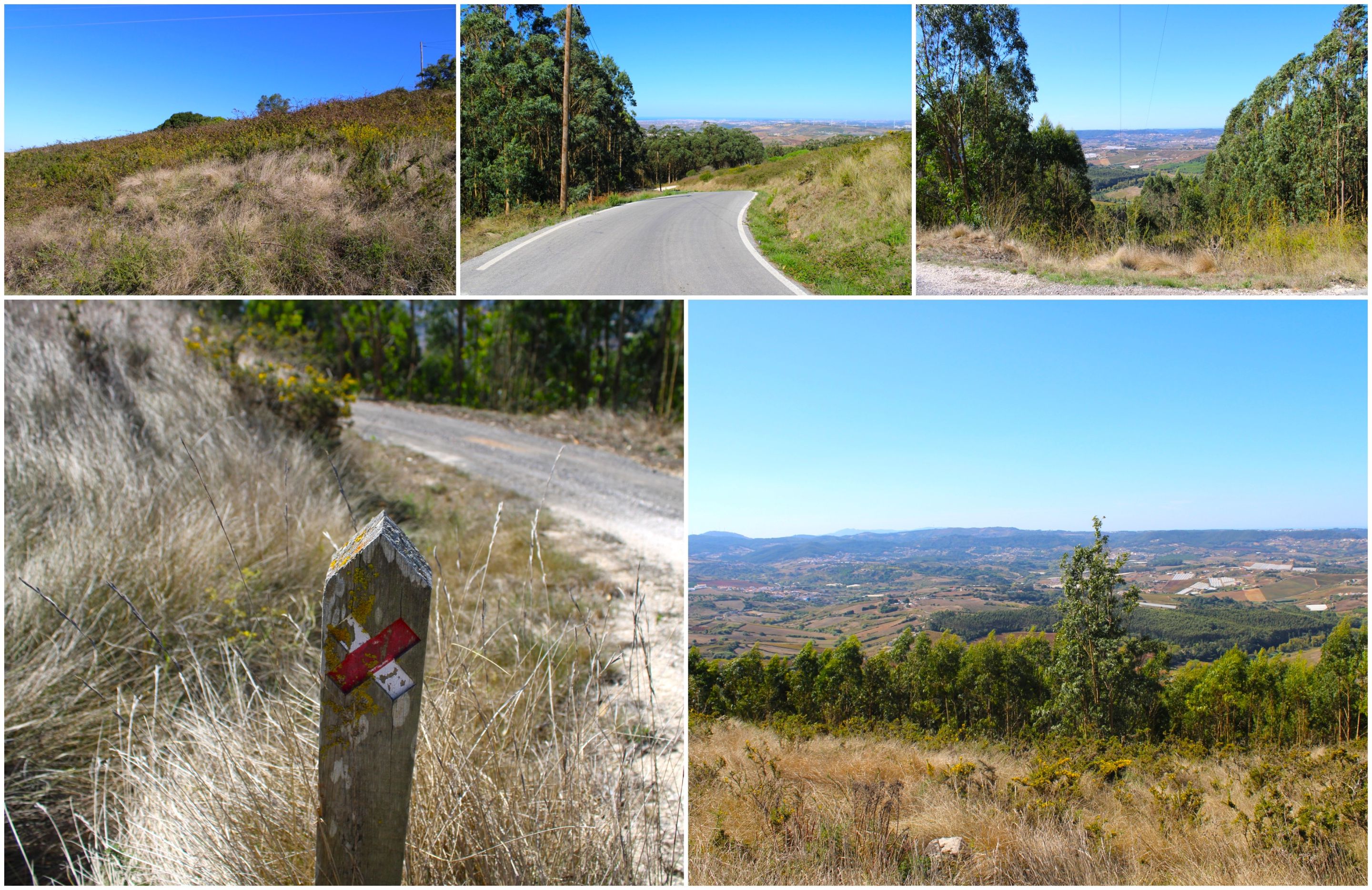
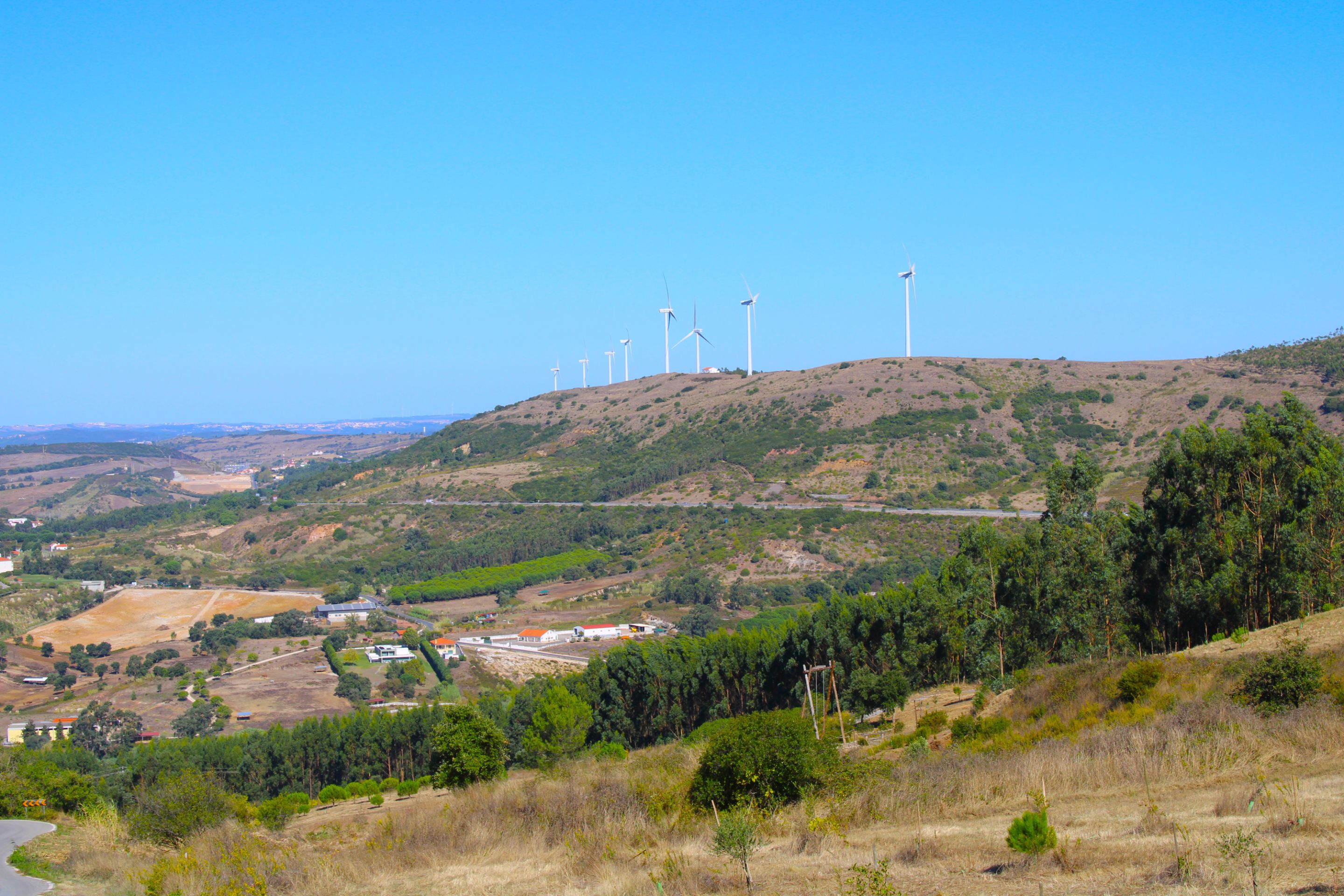
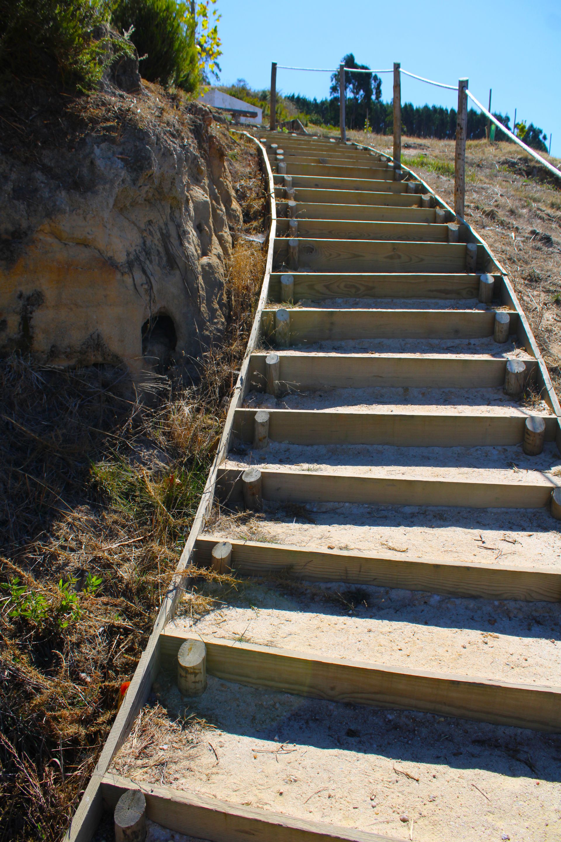
And here begins our walk, in front of the XII cross, later I will explain what it means, for now I emphasize that you prepare yourself because you are going to do one of the most physically demanding trails in the "Torres Vedras" area... Are we going to go up and down almost 400 meters on paths with an 18% gradient? For hiking experts, we know that 18% is a bad sign, because they are paths that give the impression of being steep. Do you like challenges? Then the "trilho socorro GR30" is for you.🚩⛰️🏞️
Y aquí comienza nuestra caminata, frente a la cruz XII, más adelante te explicaré que significa de momento te resalto prepárate porque vas a realizar uno de los senderos más exigentes a nivel físico de la zona de "Torres Vedras"... ¿Vamos a bajar y subir casi 400 metros en caminos con una inclinación de 18% para los conocedores del senderismo sabemos que 18% es mala señal, porque son caminos que dan la impresión de ser empinados, te gustan los retos? Entonces el "trilho socorro GR30 es lo tuyo".🌍🚙

Description of the GR30 trail🌍🏞️/ Descripcion del sendero GR30📍🧭
optimal weather for the trail📍🌍/Clima óptimo para el sendero📸
https://natural.pt/protected-areas/paisagem-protegida-local-serras-socorro-archeira/pathways/rota-serra-socorro?locale=en

We complete the red📍🌍/Completamos el rojo📸
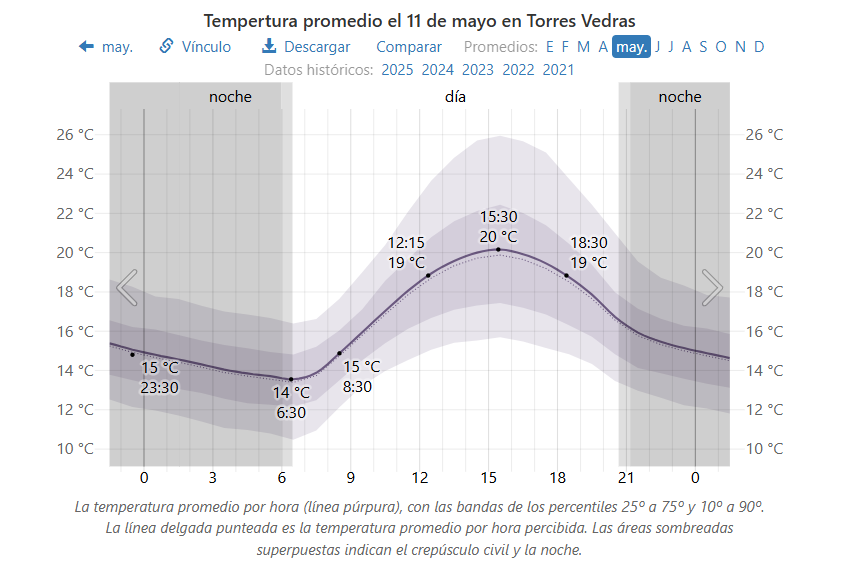
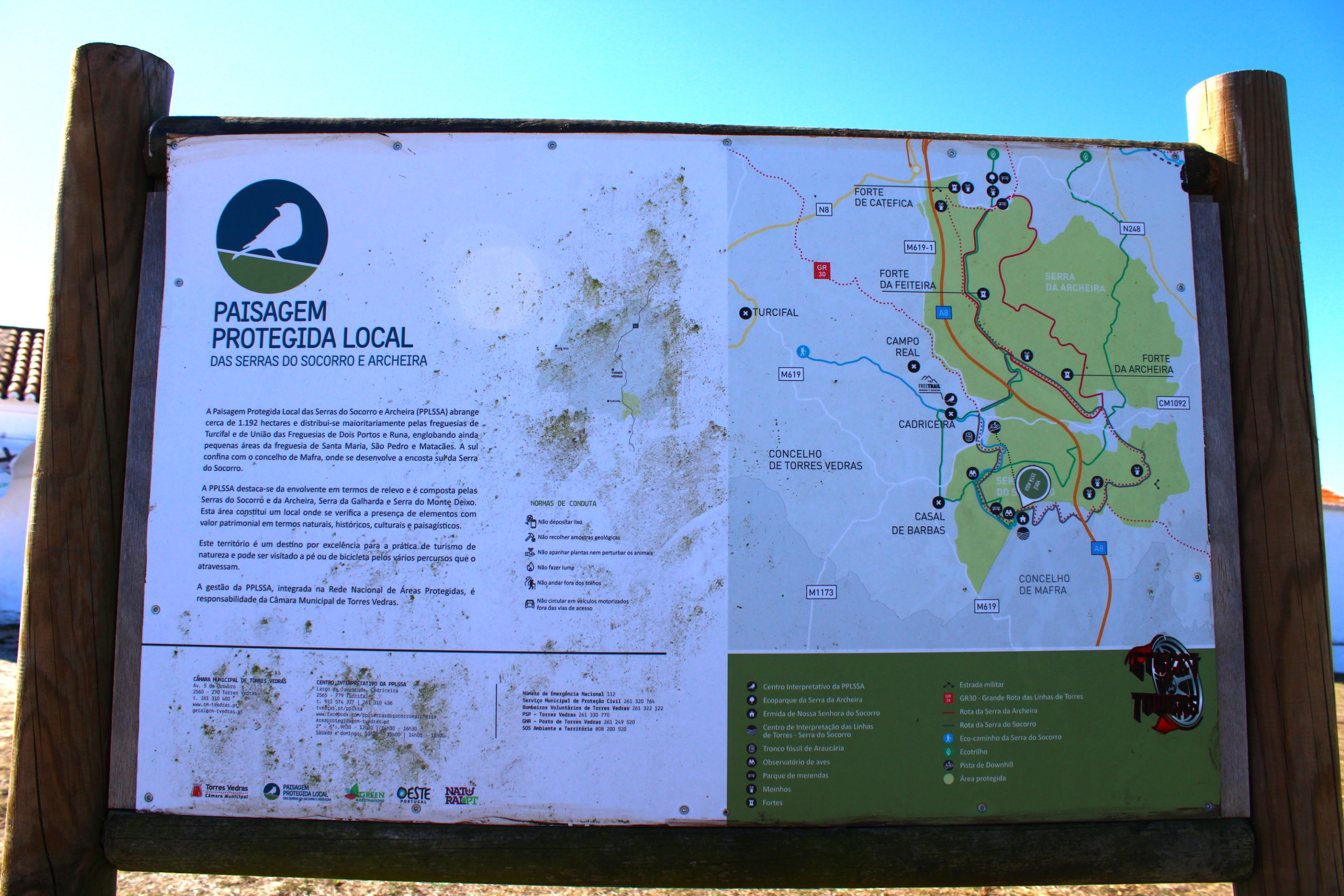
Well the trail (trilho) is quite famous you can find a lot of material on the internet about the routes, there are two possible routes the red one and the green one that I show you on the map which you can access at: https://natural.pt/ up there you are adrift and there are no signs so this map would be useful, I did the walk on Saturday 11-10 the weather was very nice not exceeding 28 degrees, well... a bit hot for me, but anything is better than rain, now I give you some advice before you go on the trail:🏞️👨🏻🏫
Bueno el sendero (trilho) es bastante famoso consigues mucho material en internet sobre las rutas, existen dos posibles rutas la roja y la verde que te muestro en el mapa el cual tienes acceso en: https://natural.pt/ allá arriba estas a la deriva y no hay señalización por ello este mapa te vendría bien, hice la caminata el sábado 11-10 estando el clima muy agradable no superando los 28 grados, buehhhh... un poco de calor para mí, pero todo es mejor que lluvia, ahora te doy algunos consejos antes de realizar al sendero:🛑
📍 You have to be in good physical shape. Climbing 400 meters requires endurance
📍 Bring plenty of water and snacks if you forgot you can buy them in a store in the village: (São Sebastião) in a cafe: (Café Pecharreta) is a store that has a variety of things
📍 Hiking poles help a lot as do hiking boots.
📍A maximum length of between 5-11km depending on which route you take, mine was short, I did a maximum of 3km, 3-4 hours
📍Natural area, protected by the government, respect the rules of conduct in nature, avoid leaving dirt, or extracting plants or animals.
=================================================================================
📍 Tienes que estar en buena forma física subir 400 metros requiere resistencia
📍 trae mucha agua y snacks si se te olvidaron puedes comprar en una tienda en la aldea: (São Sebastião) en un cafe: (Café Pecharreta) es una tienda que tiene variedad de cosas
📍Bastones de excursión ayudan mucho al igual que las botes de excursión
📍Una extensión máxima de entre 5-11km dependiendo de cuál ruta hagas, la mía era corta máximo hice 3 km, 3-4 horas
📍Area natural, protegida por el gobierno respeta las normas de conducta en la naturaleza evita dejar sucio, extraer plantas o animales
Let's walk🌍🏞️/ Vamos a caminar📍🧭
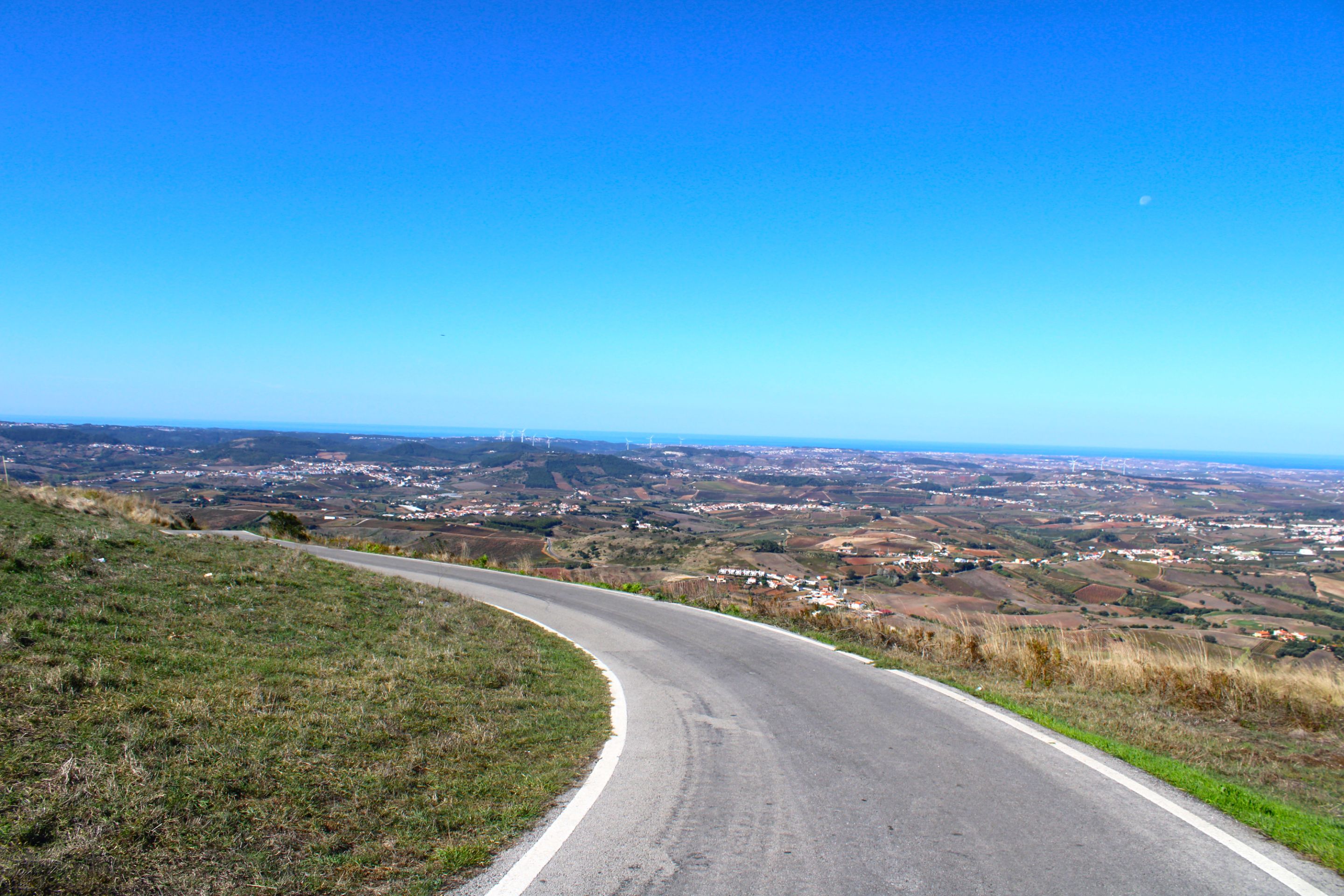
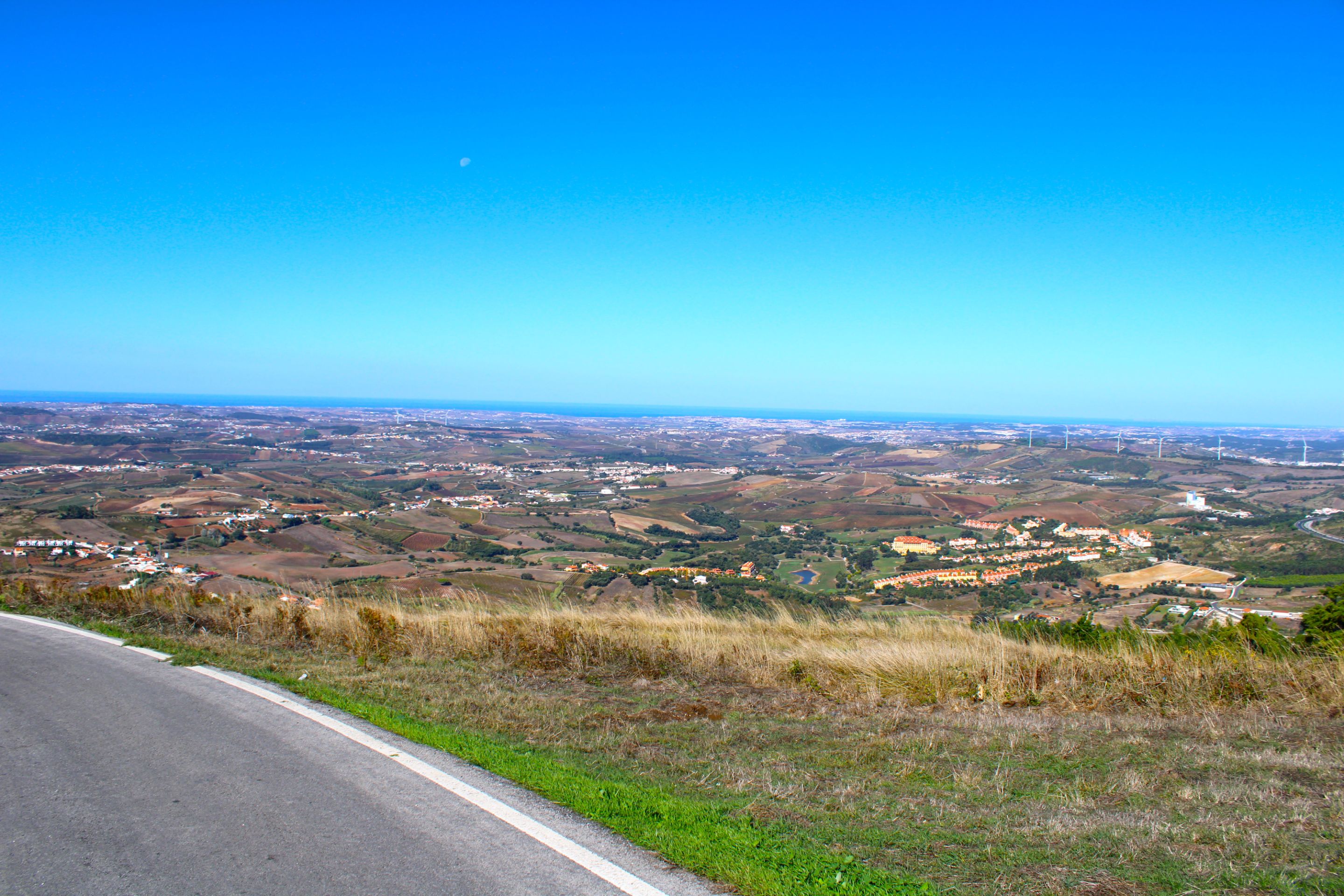
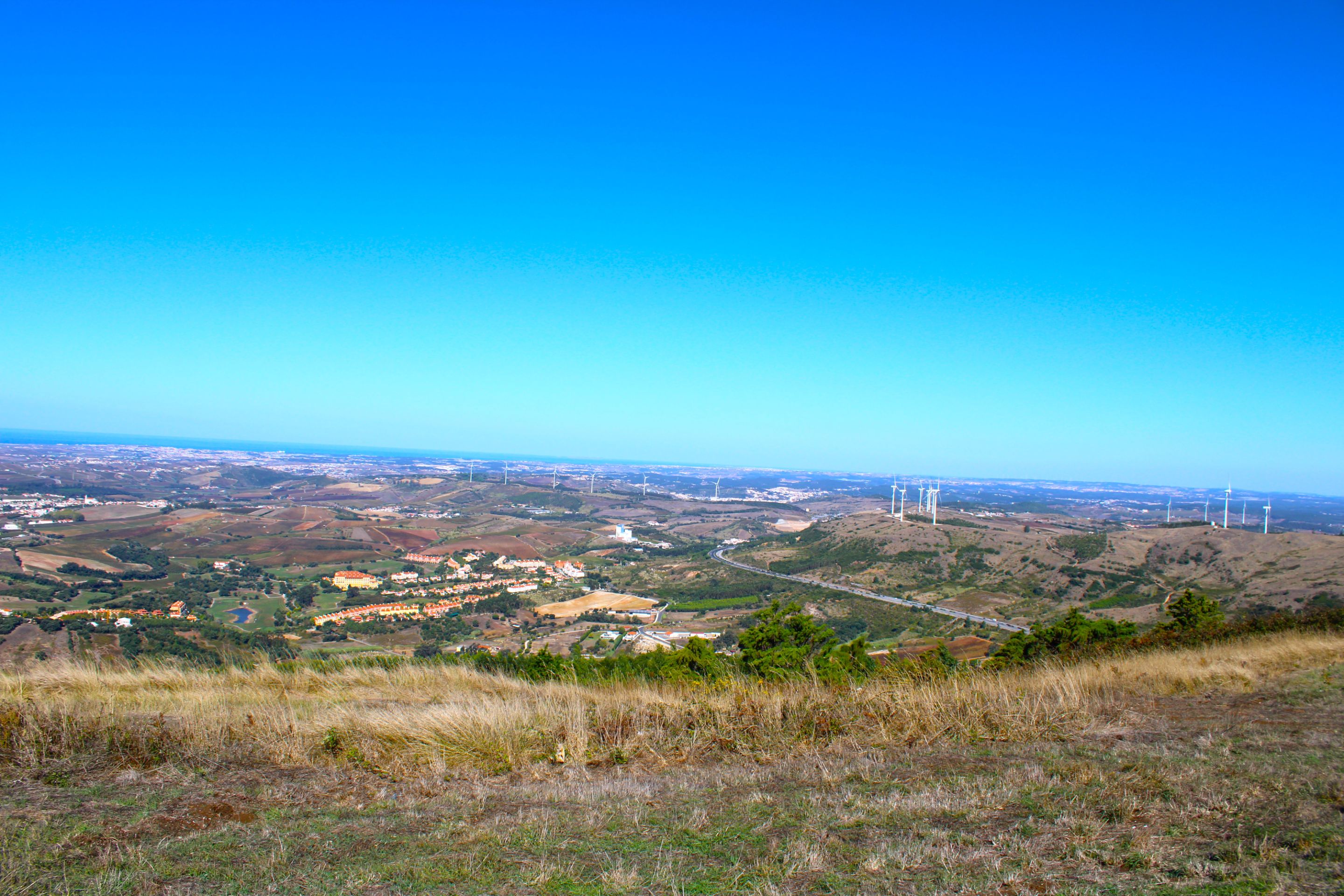
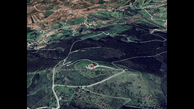
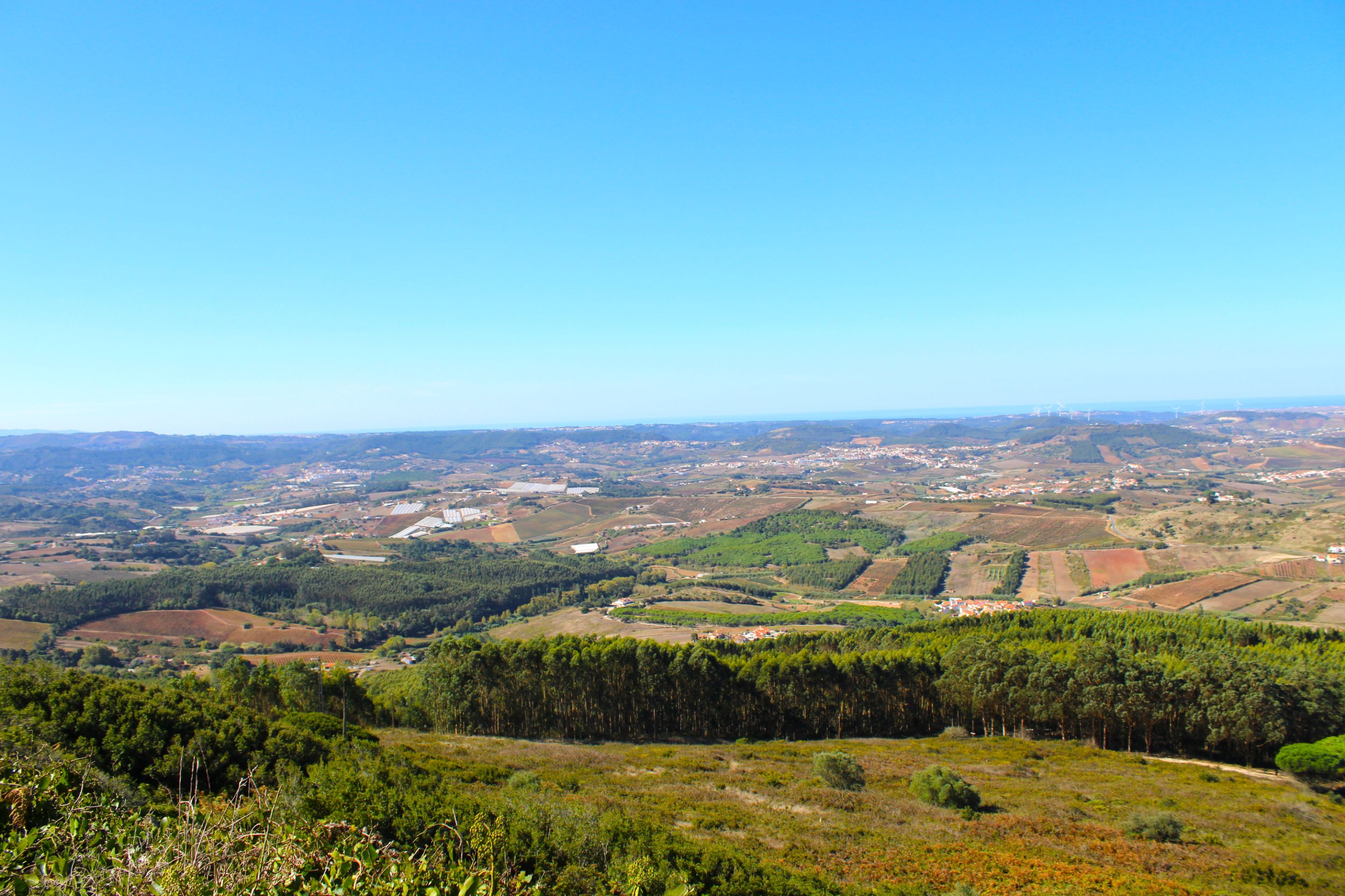
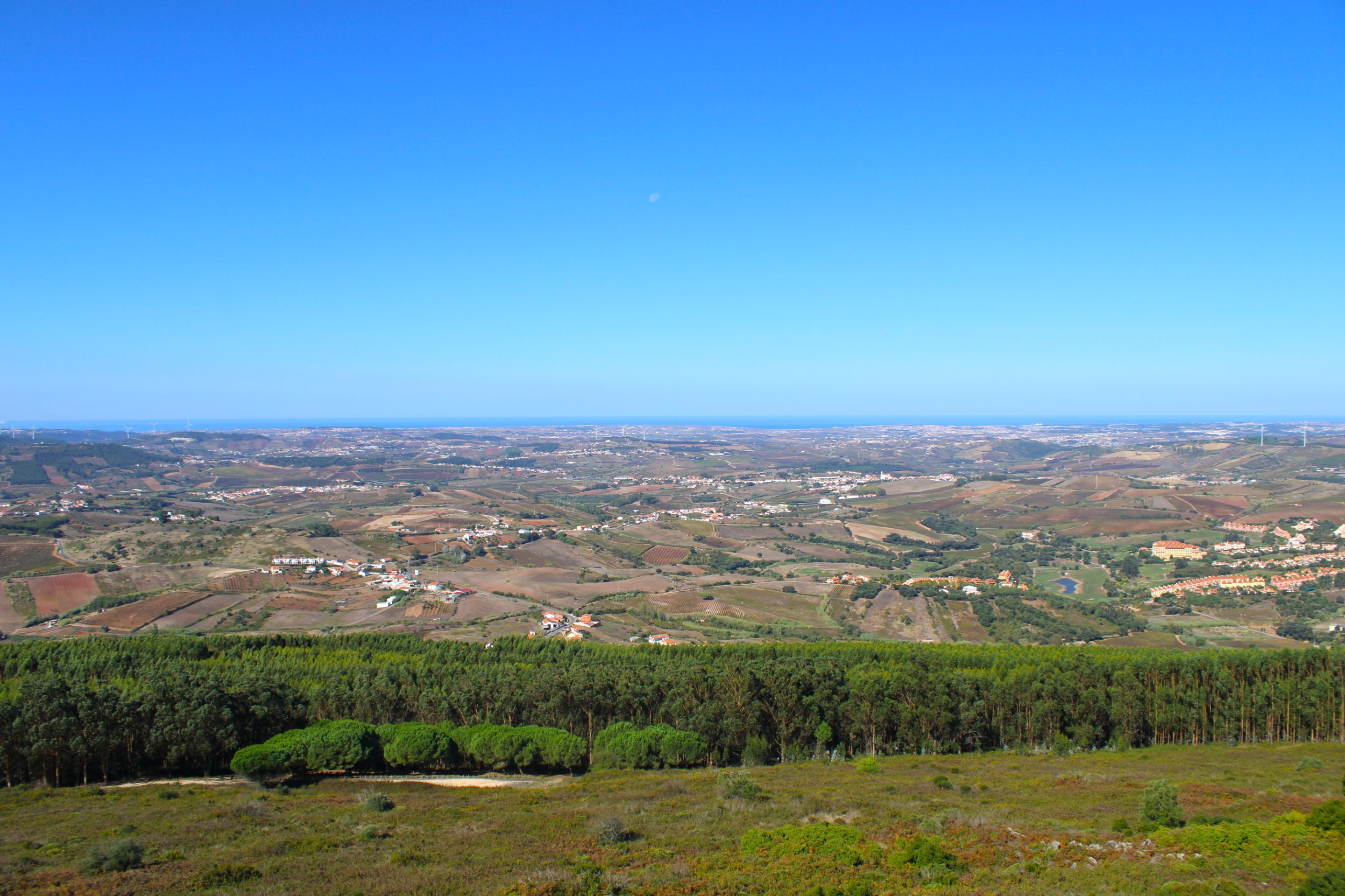
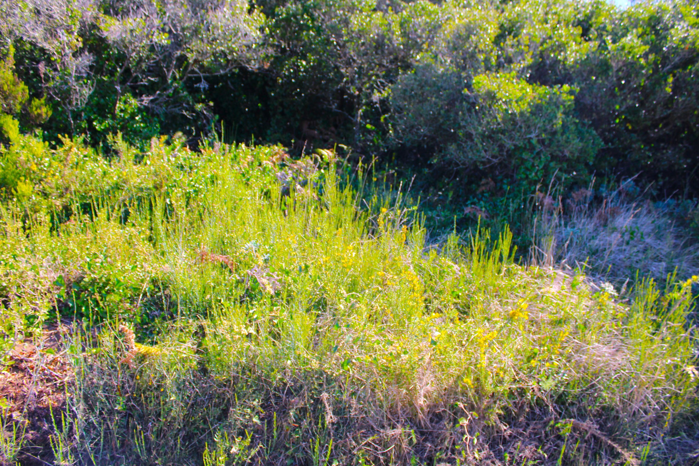
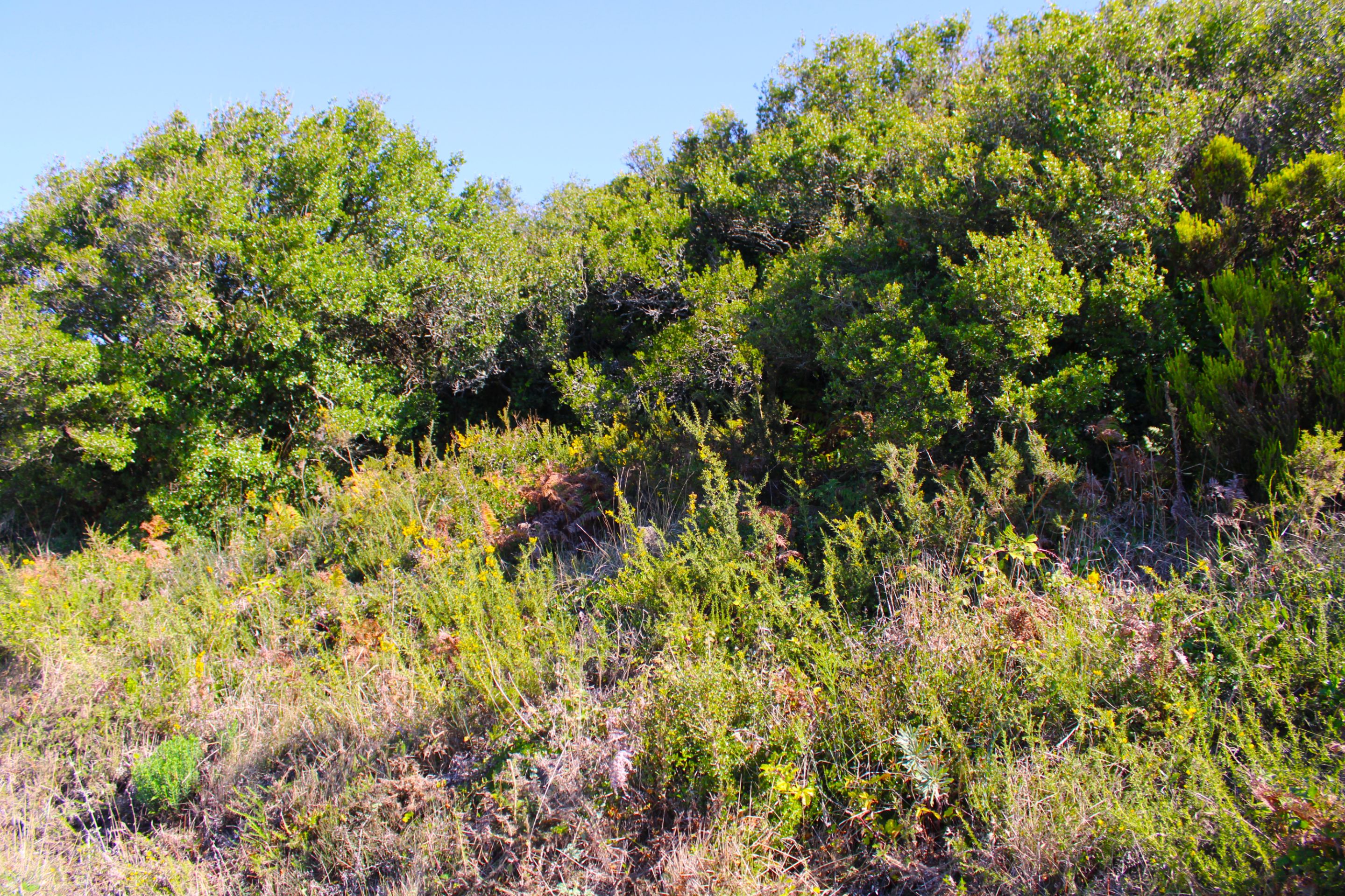
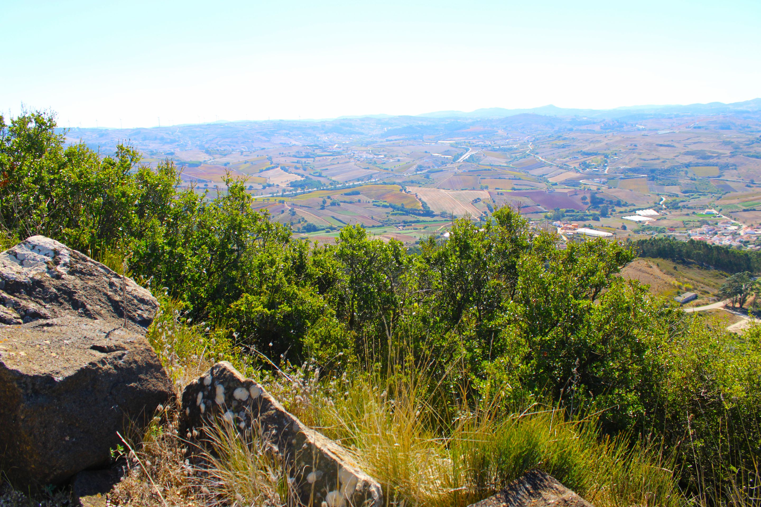
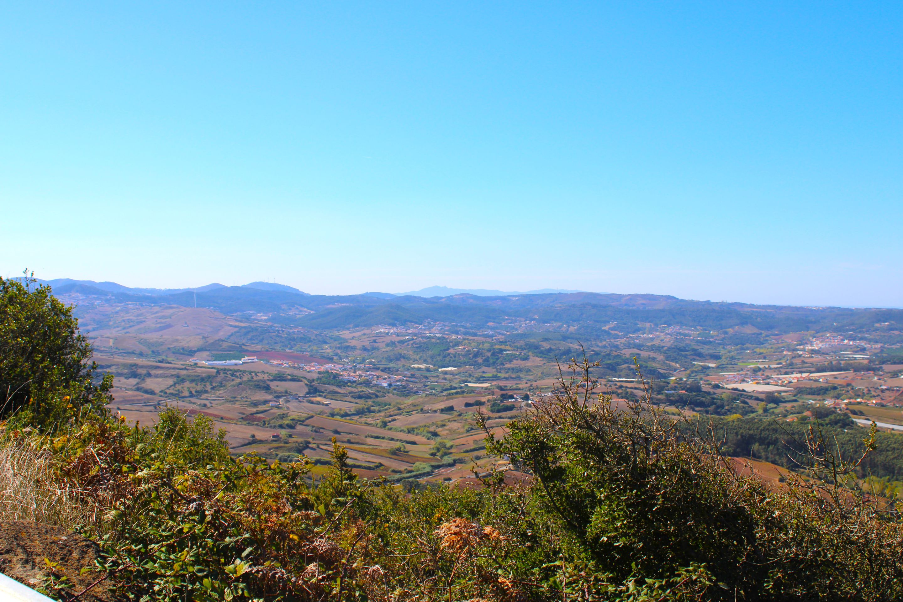
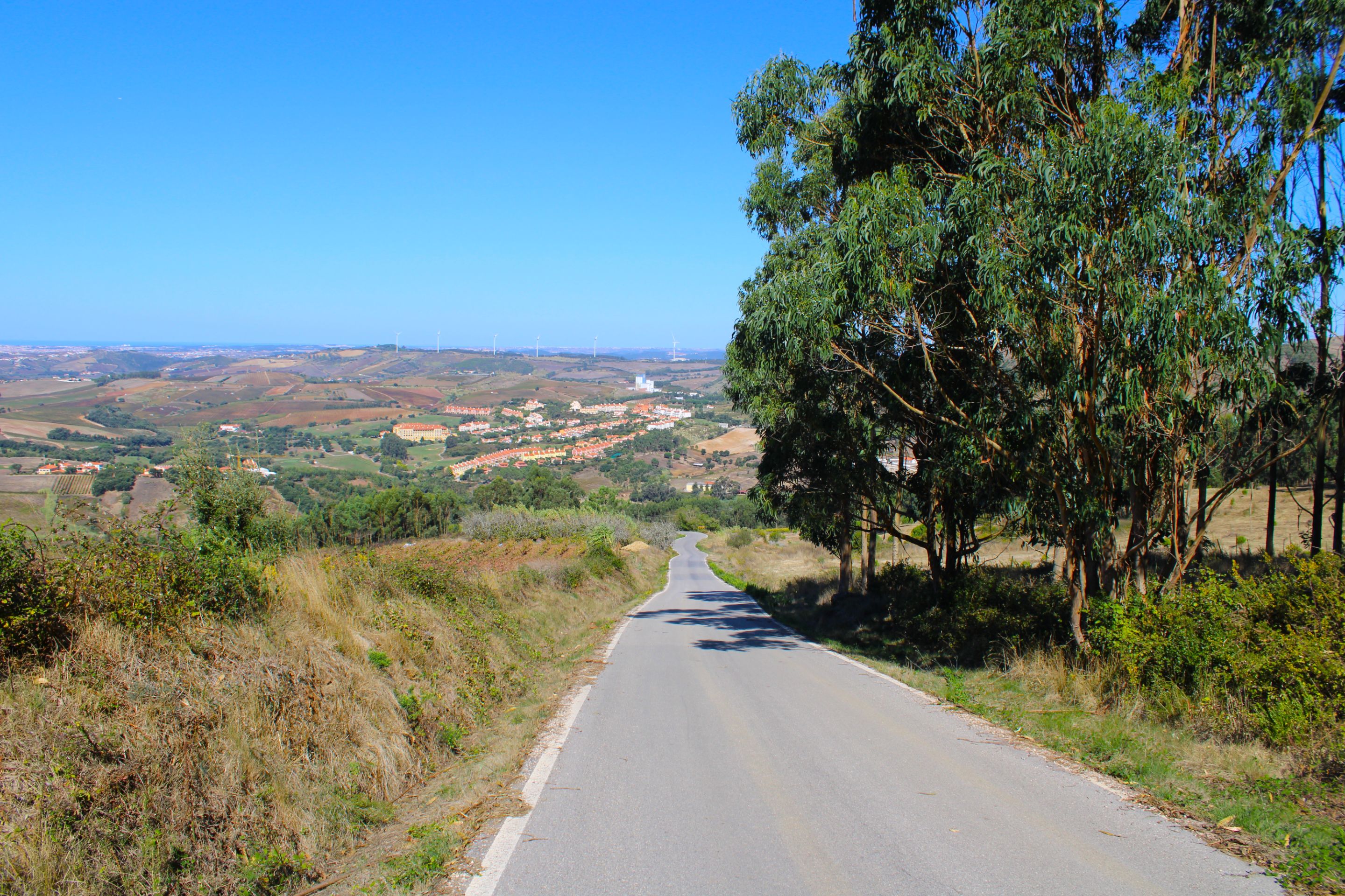
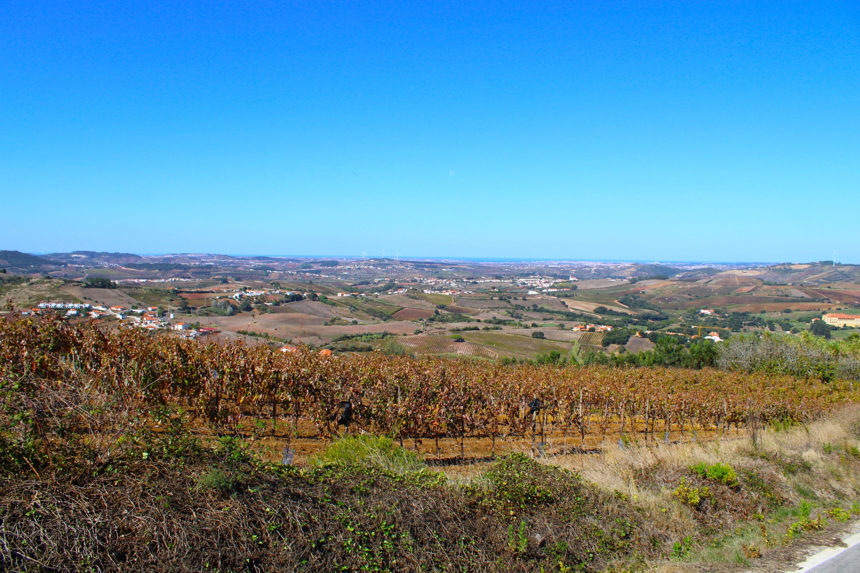
We started at about 350 meters high, the Sierra de Socorro is one of the highest points of "Torres Vedras" and together with the Sierra "Archeira" (394m) technically we would be in the highest part of the municipality, and this means that on our walk we see exceptional landscapes and we can even see the Atlantic in the distance, my first stop is the viewpoint, in order not to get lost I was guided by the places of interest and each time I passed by one I marked it on the map to know if I was going on the right path or not.🧭🗺️
Arrancamos sobre los 350 metros de altura, la Sierra de Socorro es uno de los puntos más altos de "Torres Vedras" y junto con la sierra "Archeira" (394m) técnicamente estaríamos en la parte más alta del municipio, y esto representa que en nuestra caminata veamos paisajes excepcionales e inclusive podemos ver el atlántico a lo lejos, mi primera parada es el mirador, para no perderme fui guiándome con los sitios de interés y cada vez que pasaba por uno lo marcaba en el mapa para saber si iba o no por el camino cierto.🚙🏞️
#
"Serra do Socorro" Viewpoint🌍🏞️/ Mirador "Serra do Socorro"📍🧭
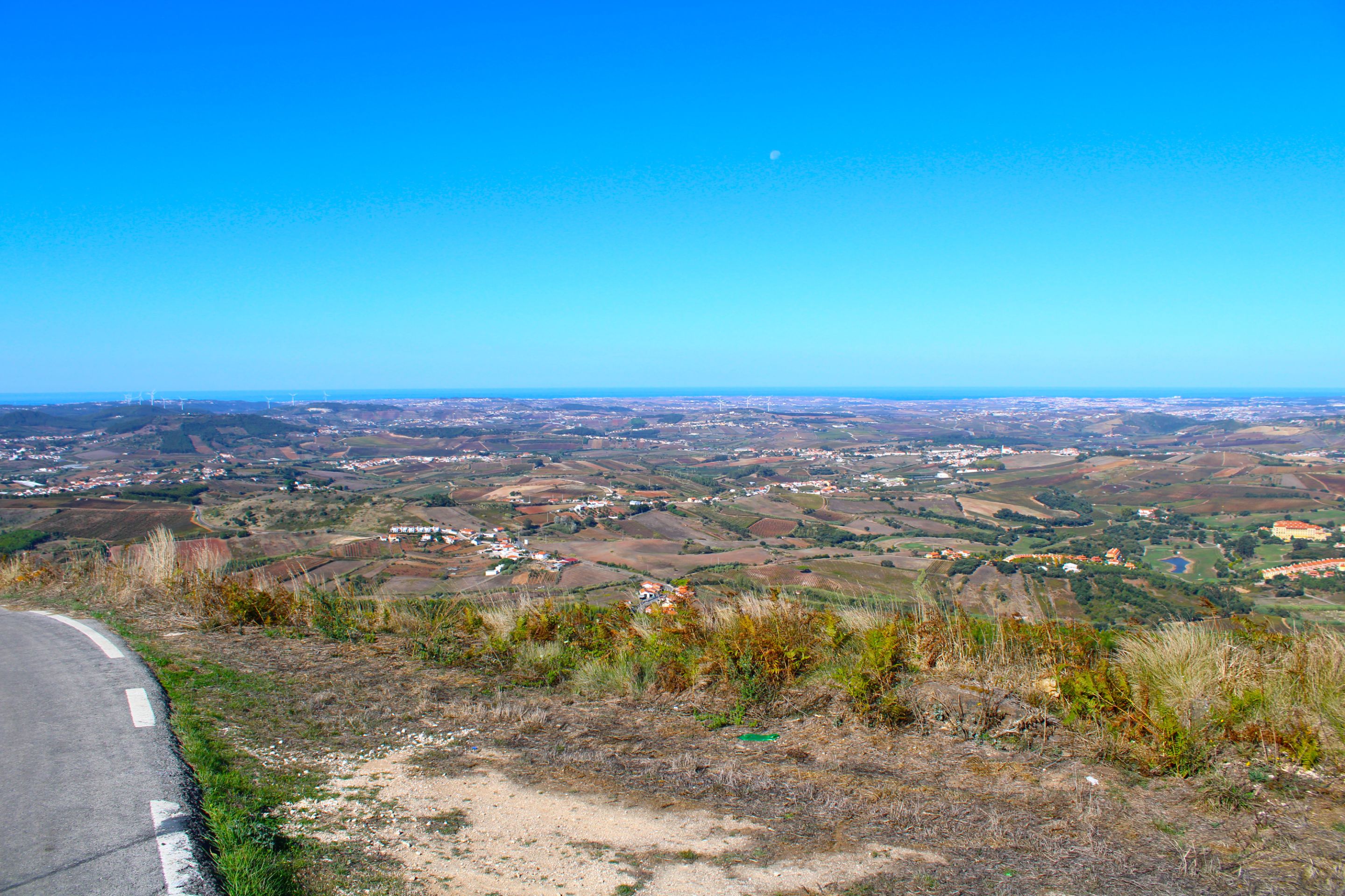
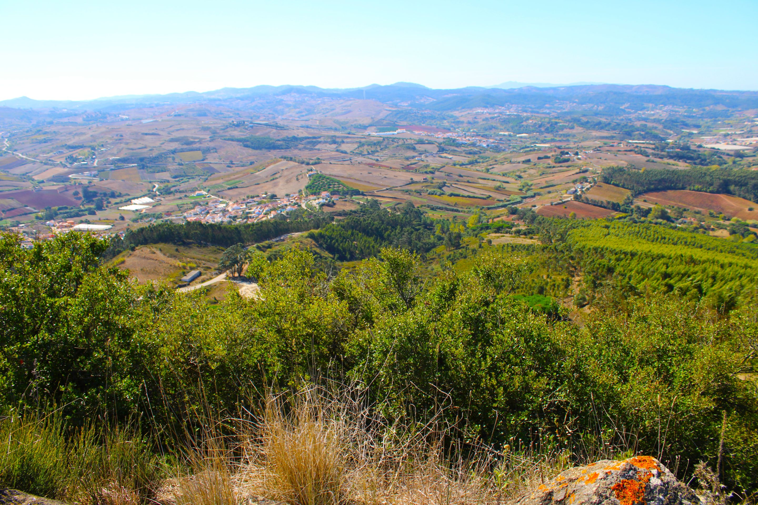
**¿Is this trail one of my favorites?🌍🌄**
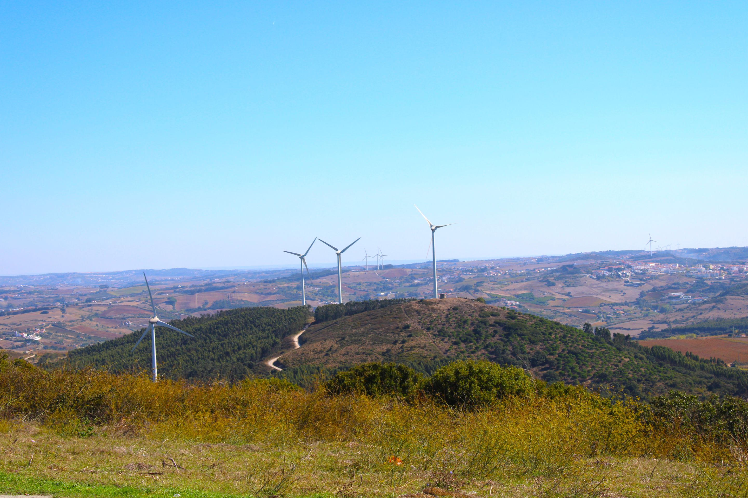
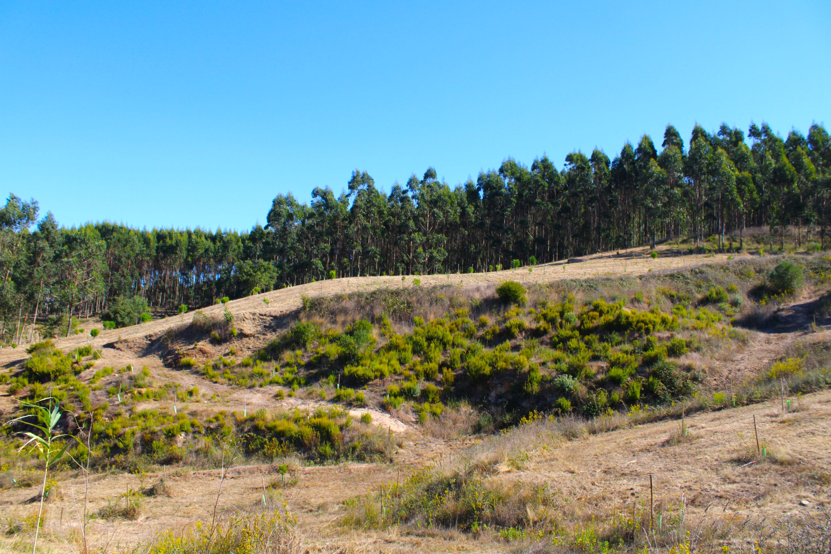
Would I like to tell you that the experience was very good, it's my favorite trail? No... I would put it in the top 20, there are many better quality ones than this one, the landscape is beautiful, only at the viewpoint below it is repetitive because all we see are hundreds and hundreds of eucalyptus trees, Portugal's illicit business... How intentional to then plant eucalyptus trees for the paper business... IT HAD TO BE SAID... While we destroy the original landscapes🌍📍
#
¿Me gustaría decirles que la experiencia fue muy buena, es mi sendero favorito? No... Lo colocaría en el top 20, hay muchísimos de mejor calidad que este, el paisaje es bonito, solo en el mirador abajo es repetitivo porque solo vemos cientos y cientos de árboles de eucalipto, el negocio ilícito de Portugal... Qué intencional para luego sembrar eucaliptos para el negocio del papel... SE TENÍA QUE DECIR... Mientras destruimos los paisajes originarios🗺️🚩

*Now that we're going downhill, it's easy, but phew!!! I have to slow down because my feet keep going... and this already tells us how difficult the terrain is. The next stop is the swing. When we pass by it, it's a sign that we're on the right track.🚙🗺️*
*¡Ahora que vamos de bajada es fácil, pero ufff!!! Tengo que ir frenando porque mis pies se van solo... y esto ya nos dice la dificultad del terreno, la próxima parada es el columpio, cuando pasamos por alli es un indicativo que vamos siguiendo bien la ruta.🚩⛰️*

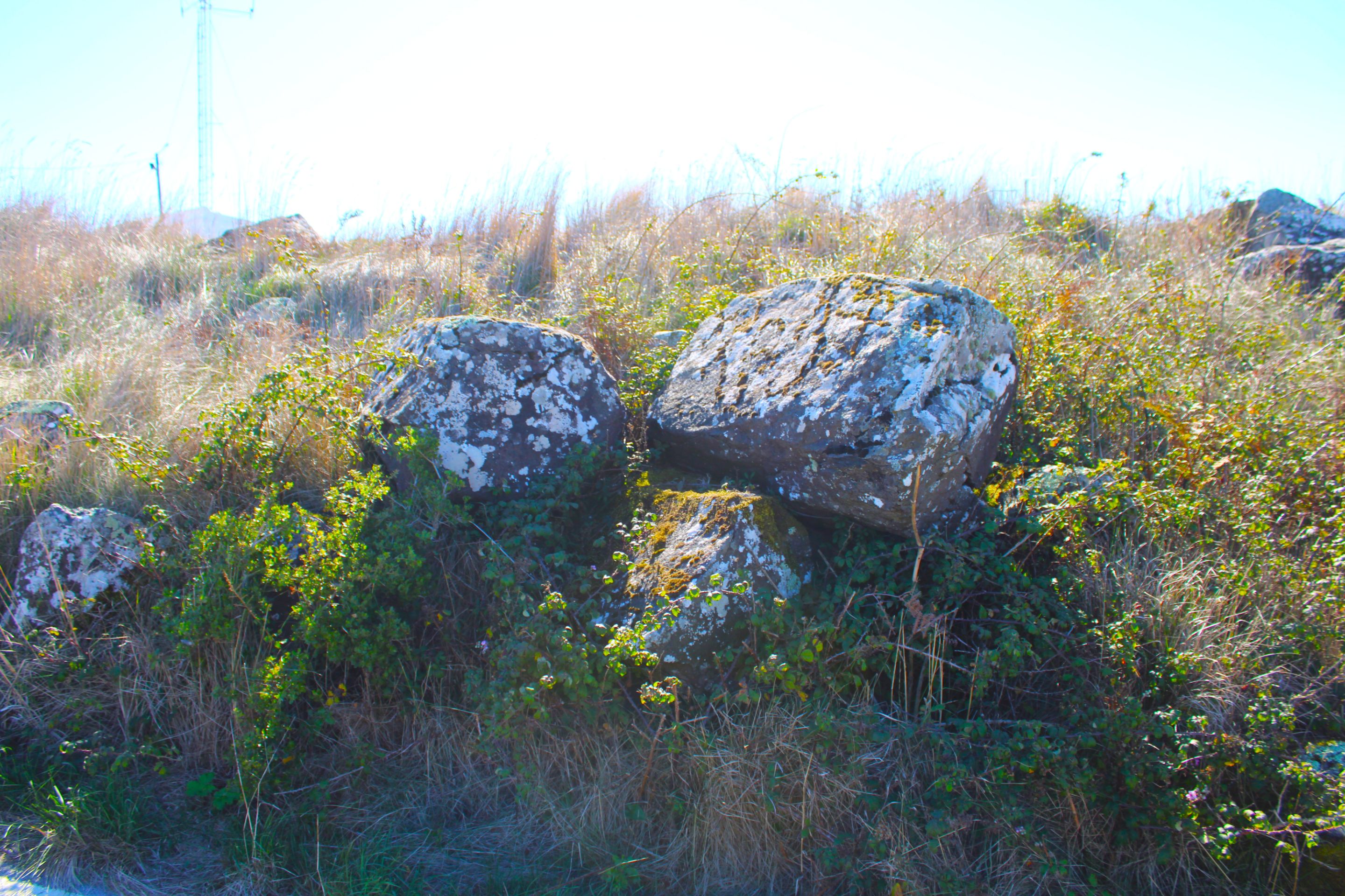
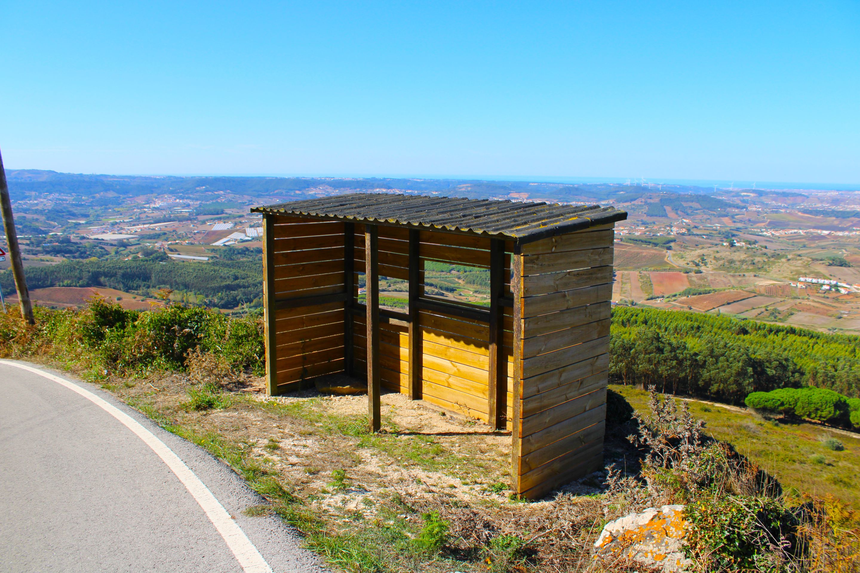
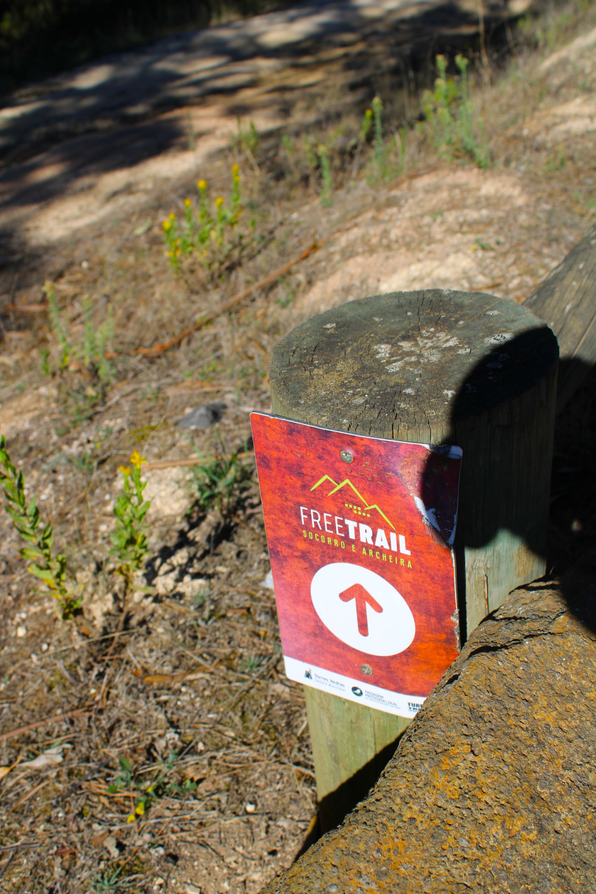
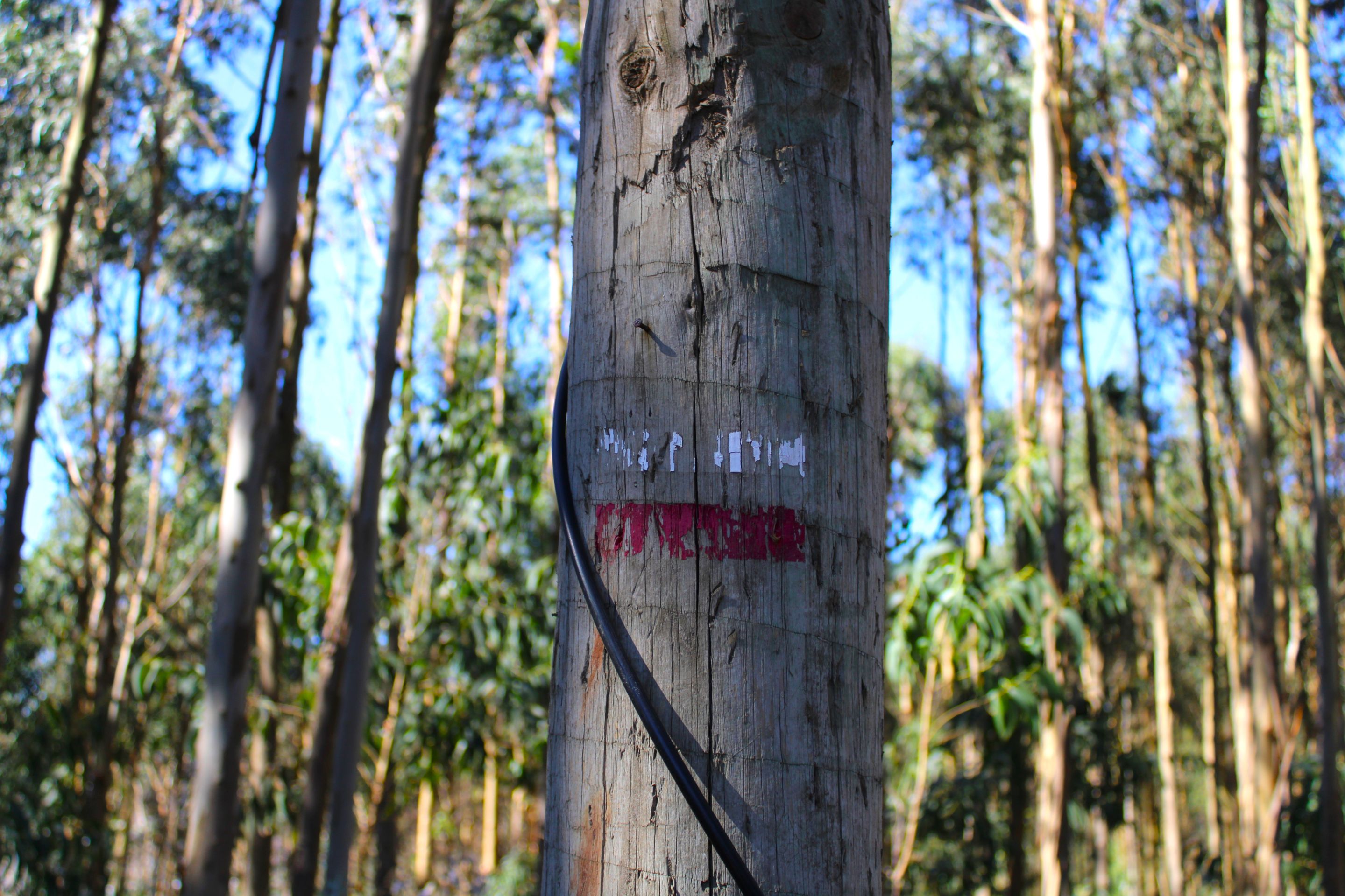
It gives me joy to be able to locate this wooden post with a cross because it is also an indication that we are within an official trail, clearly where the cross is the place where WE SHOULD NOT CROSS.🚙🏞️
Me da una alegría poder localizar este posta de madera con una cruz porque es también un indicativo que estamos dentro de un sendero oficial, claramente donde está la cruz es el sitio donde NO DEBEMOS CRUZAR.🧭🧭

*current location📍🌍/ubicacion actual*📸

#
Swing + viewing platform🌍🏞️/ Columpio+Mirador📍🧭
IMG_0717.JPG (https://files.peakd.com/file/peakd-hive/biologistbrito/23uFVqxMqohnXyF4W5qX9N3L4MJJBytRA6nzuVSzS6NJNxvnVbmCv9qLxkMYTY8U45ifN.JPG)
IMG_0719.JPG (https://files.peakd.com/file/peakd-hive/biologistbrito/242DGDrfCrMsenBfukzXuSvYL8ZYwADzMHtK2yHqjpyxnqWn9nNnLVUkR6PYP6y2uGhJs.JPG)
IMG_0724.JPG (https://files.peakd.com/file/peakd-hive/biologistbrito/2457njBb18kqpi4xT5VU9VnrXHrSSv3ECJd9QGHLcFWKvTuvkzBM6r6atiNMNGwdJihX2.JPG)
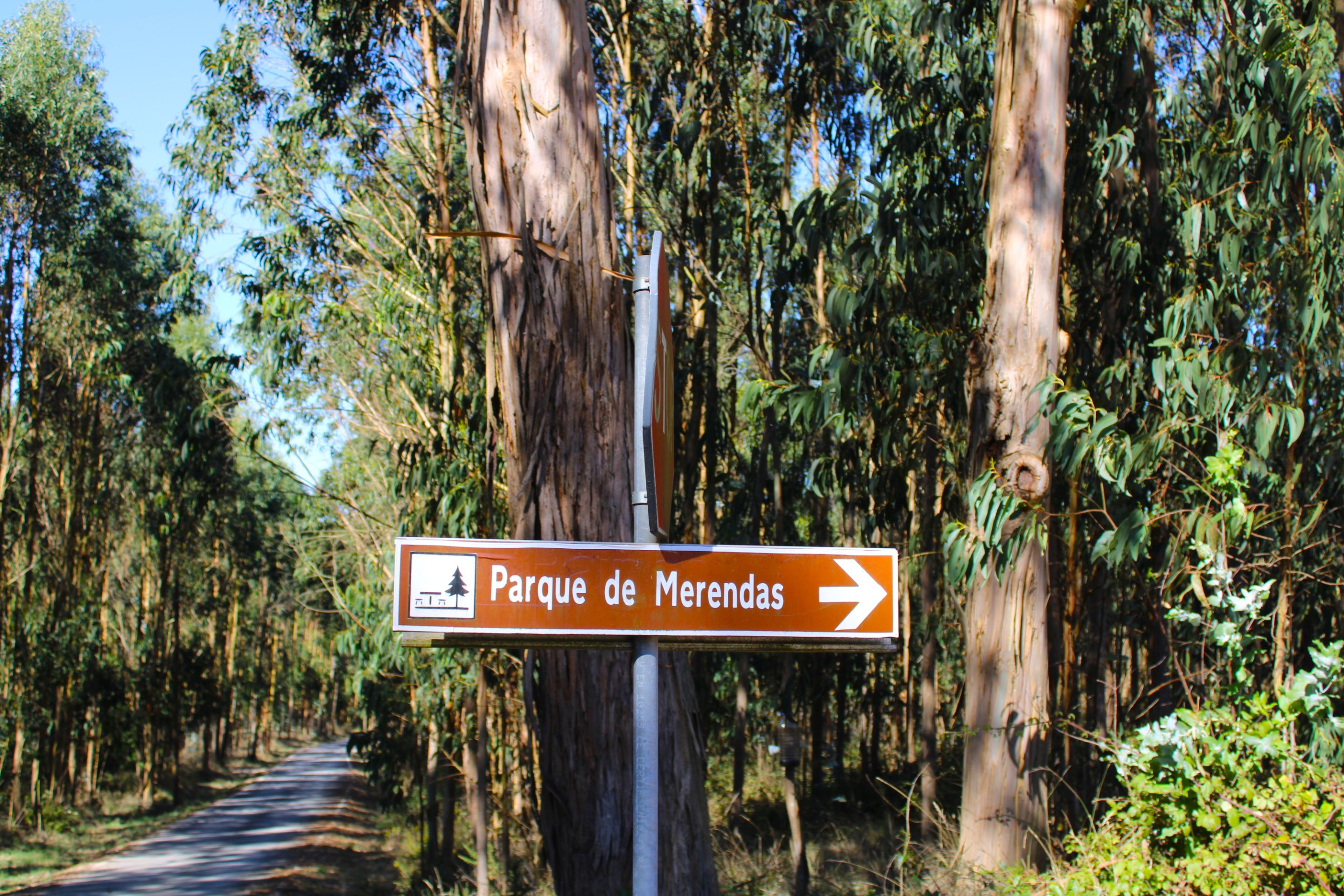
Another must-see stop on the trail, we can take advantage of the tables and chairs in this camping area to eat something, hydrate, and continue, which is exactly what I did. We also climb the hill and see the swing.🚩⛰️
Otra de las paradas obligatorias en el sendero, podemos aprovechar las mesas y sillas en esta zona camping para comer algo, hidratarnos y seguir que fue exactamente lo que hice, también subir la colina y ver el columpio.🌍🌍
(https://images.ecency.com/DQmbCHnDKMbWHZGL9pemNAuKECHmCrfadtMGuoNeBv2iSwg/image.png)
#
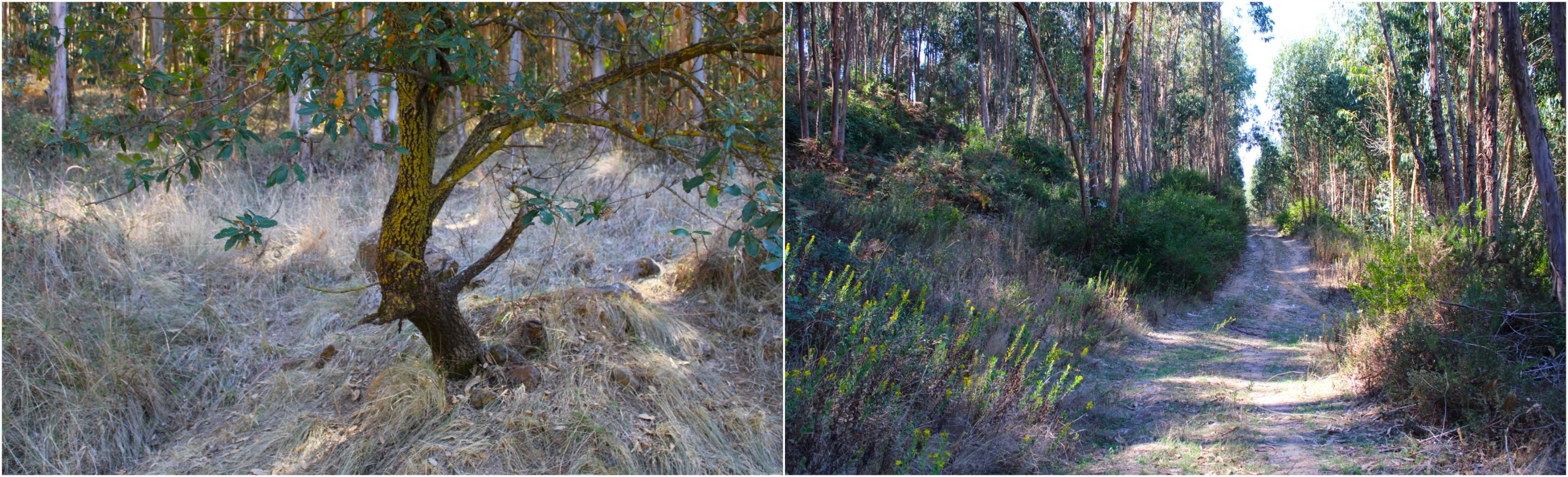
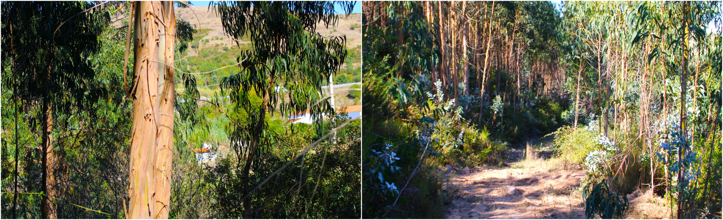
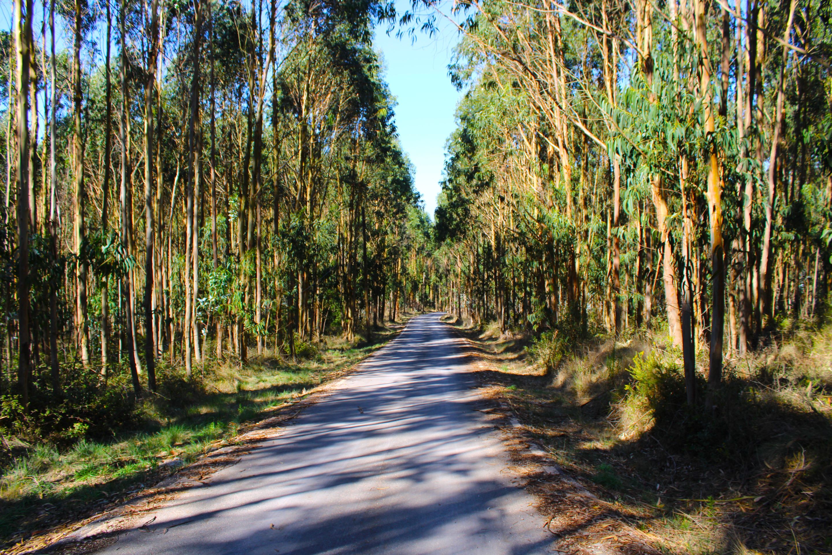
Eucalyptus forest🌍🏞️/ Bosque de eucaliptos📍🧭
BeFunky-collage - 2025-10-17T143739.289.jpg (https://files.peakd.com/file/peakd-hive/biologistbrito/AK6Woo7AkTxjYC3MhcrvPytNFHPrqKgqixFtVsXXDAhtEwfdM5Zd6g2GNAN8snv.jpg)
IMG_0764.JPG (https://files.peakd.com/file/peakd-hive/biologistbrito/23wMQ4GHAoDYYgXf2kkYaFvR55umVzpap1UARk3mBe8XXkvuZuBm33HQ2xQBJPnMGXL1m.JPG)
IMG_0767.JPG (https://files.peakd.com/file/peakd-hive/biologistbrito/23vsFsJqAavPDxj8kwAkkevgNZhCuM5NUMNcnRFTX8ahZJU4BdDZesbgvuYQoBM5bNnYc.JPG)
IMG_0770.JPG (https://files.peakd.com/file/peakd-hive/biologistbrito/23wMRdqj76hz5ruhnYyGyVKXM6F6t7ycbtLGDYpJZbf8MMZZugCoHcX1oL52Uy3DoDUp7.JPG)
*This part drained a huge amount of my energy, the sand was like beach sand, and my boots sank, plus there were a lot of bushes with thorns, get ready because here comes the hard part hehe🛑🗺️*
*Esta parte agoto una cantidad enorme de mi energía, la arena era como de playa, y se hundían mis botas, además había muchos arbustos con espinas, prepárense que aquí viene lo difícil jeje🚩*
(https://images.ecency.com/DQmbCHnDKMbWHZGL9pemNAuKECHmCrfadtMGuoNeBv2iSwg/image.png)
#
Village of Cadriceira🌍🏞️/ Aldea de Cadriceira📍🧭
Mi video00.gif (https://files.peakd.com/file/peakd-hive/biologistbrito/23tGbr2CvJoMtZFrCUXq3exypMTCD4SYTfZS9tiNaVTu4xFd23iroio5kazgPTZTeHeXa.gif)
*current location📍🌍/ubicacion actual*📸
BeFunky-collage - 2025-10-17T145103.895.jpg (https://files.peakd.com/file/peakd-hive/biologistbrito/AKGZjqNiUfTx6SkjRQURHWCTNS6wKcwN893A4Lhr3CdahSfAYgZojPWu16MjWdx.jpg)
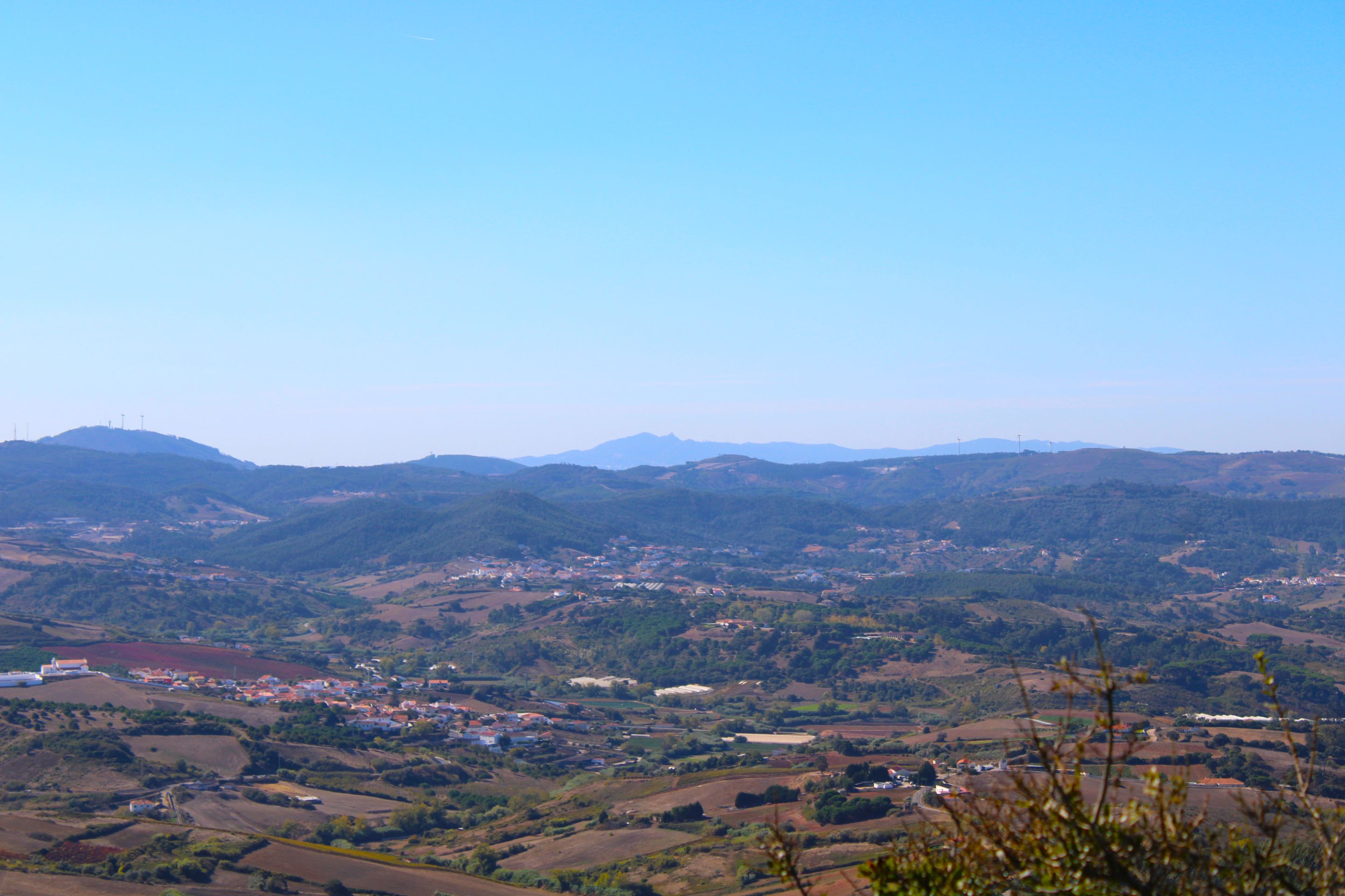
**a small, unremarkable village with less than 20 houses in the middle of nature.**
**una aldea pequeña nada de especial con menos de 20 casas en medio de la naturaleza.**
(https://images.ecency.com/DQmbCHnDKMbWHZGL9pemNAuKECHmCrfadtMGuoNeBv2iSwg/image.png)
IMG_0738.JPG (https://files.peakd.com/file/peakd-hive/biologistbrito/246ajiQyDWmBZbkvM3HaKC2LcGkwQgxGXcvRpHPQvqoz5AjCeK4HPZBA2ukwKhDdgzRE7.JPG)
IMG_0645.JPG (https://files.peakd.com/file/peakd-hive/biologistbrito/246atXKcMW3QCz5tfdeAKcYpHFaKAbiD1KSt3JcKgNjSYYx5XRcfmxSFDPuUhhAG22sL6.JPG)
IMG_0654.JPG (https://files.peakd.com/file/peakd-hive/biologistbrito/23sdUs4x7icGRSFt4wSuYK8Ud42Xq9MAGQMVQWHrUW7GzkoG24Ef7uFLc8R6UZo9t9cwY.JPG)
And we return to the return point. From here, we will see some crosses that represent a Stations of the Cross from the festivities of the Local Virgin. People have to follow the path I made, following the crosses to the top, and enter the chapel, which was closed today.👨🏻🏫🚙🏞️
Y volvemos al punto de retorno, a partir de aquí veremo