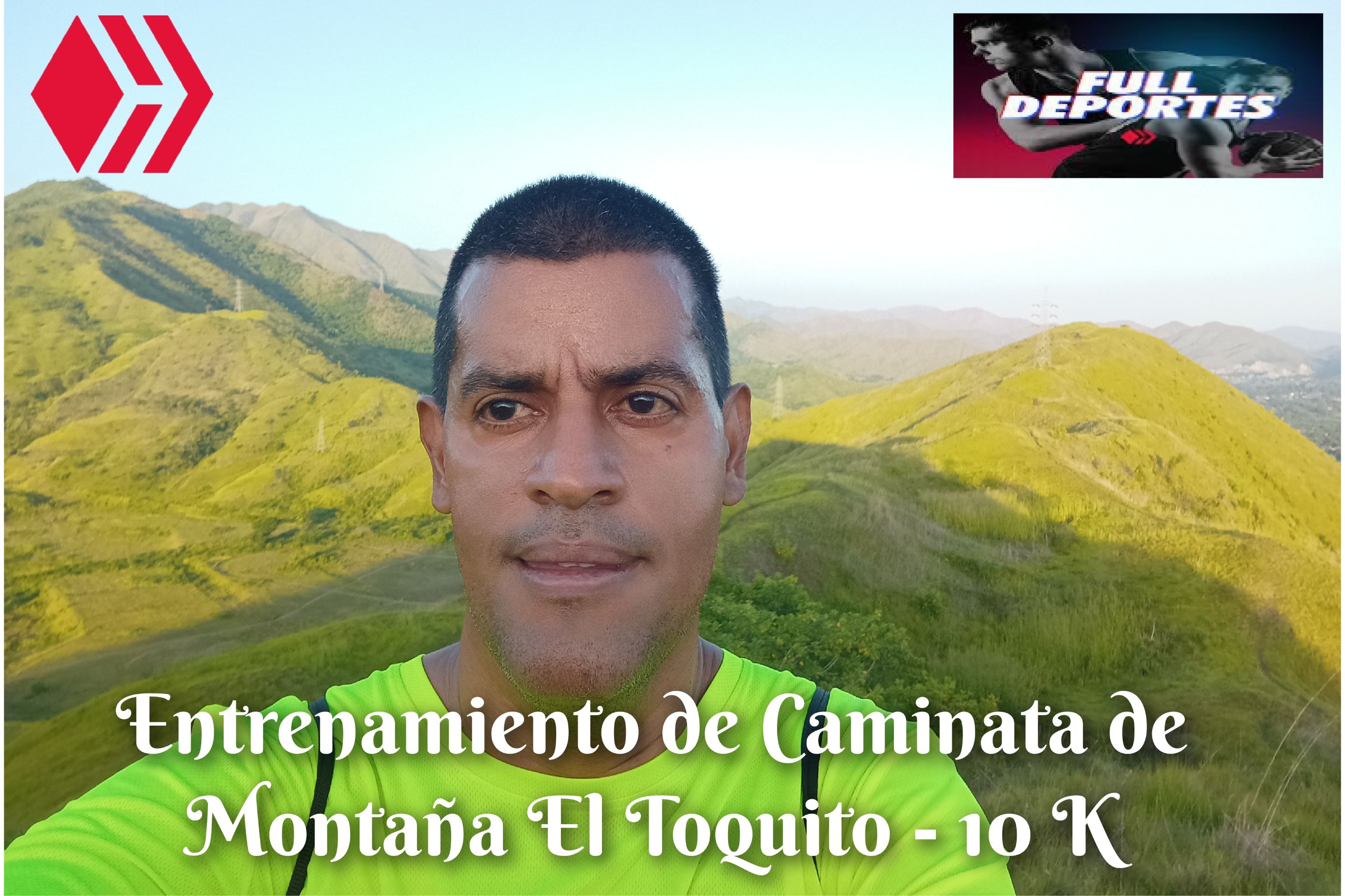
 Cabe destacar que este entrenamiento los realicé el día de hoy domingo 24 de agosto, me levanté bien temprano para hacer mis ejercicios de calentamiento y activar la aplicación Strava a las 5:50 am, subiendo por la calle doctor Morales, para luego pasar por el centro de la comunidad, a esta hora el clima estuvo agradable, caminando a un ritmo de un 70%, al llegar a la comunidad de El Toquito alcance a una persona que también estaba caminando y después termine de recorrer todo este sector, en un tiempo de 20 minutos.
It is worth noting that I did this training today, Sunday, August 24th. I got up very early to do my warm-up exercises and activate the Strava application at 5:50 am, going up Doctor Morales Street, and then passing through the center of the community. At this time, the weather was pleasant. I was walking at a pace of 70%. When I reached the community of El Toquito, I caught up with someone who was also walking, and then I finished walking this entire area in about 20 minutes.
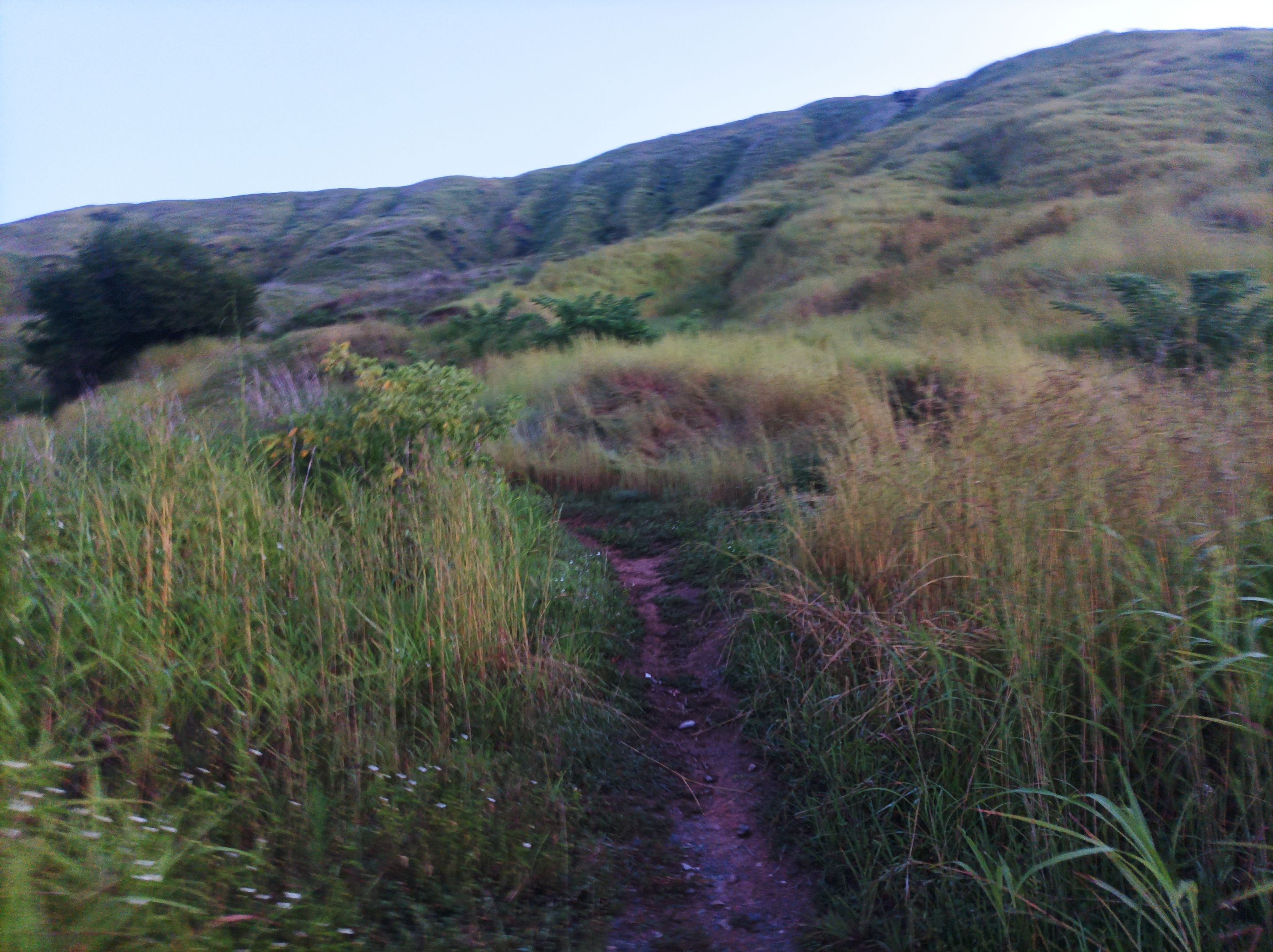
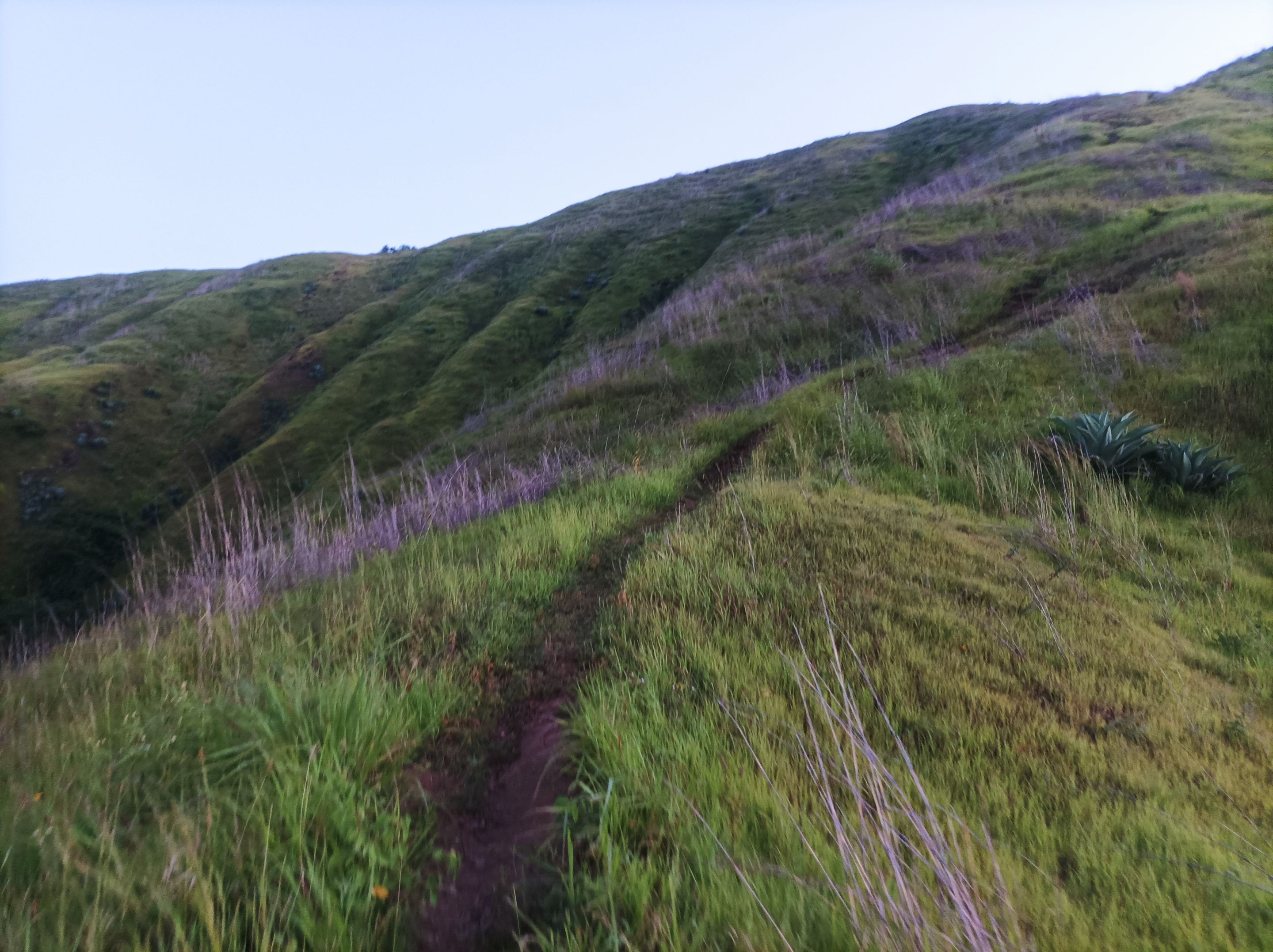
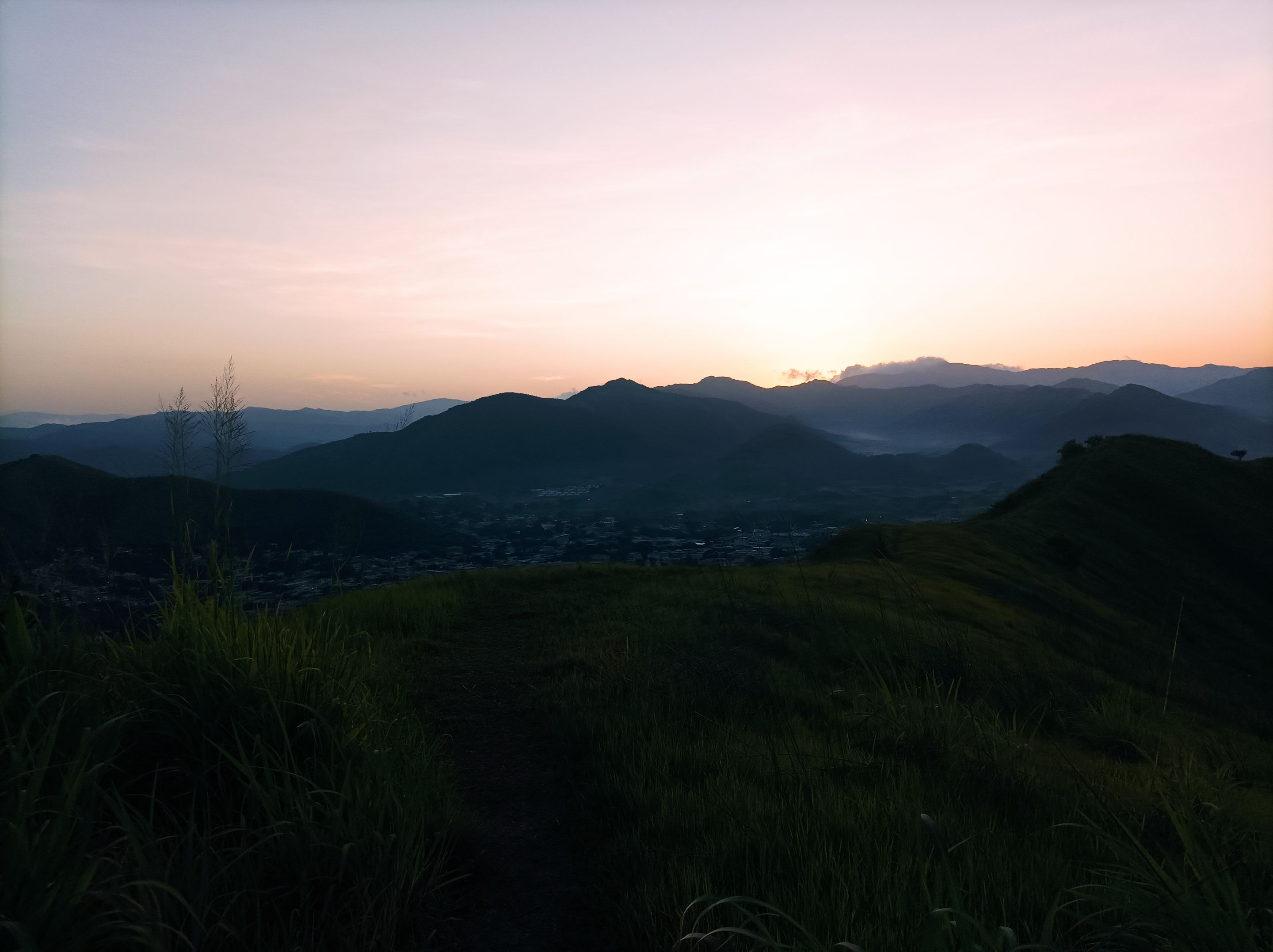
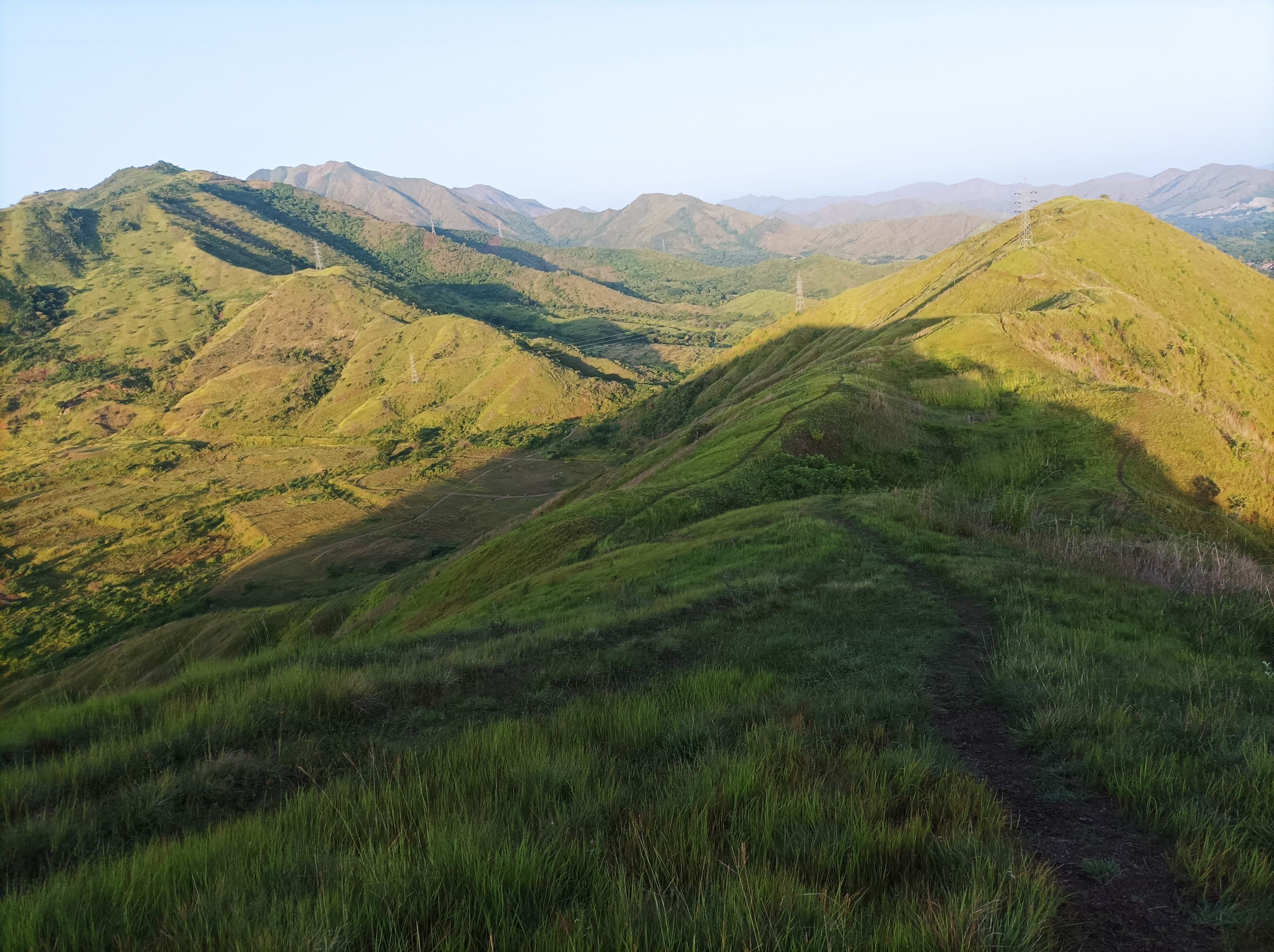
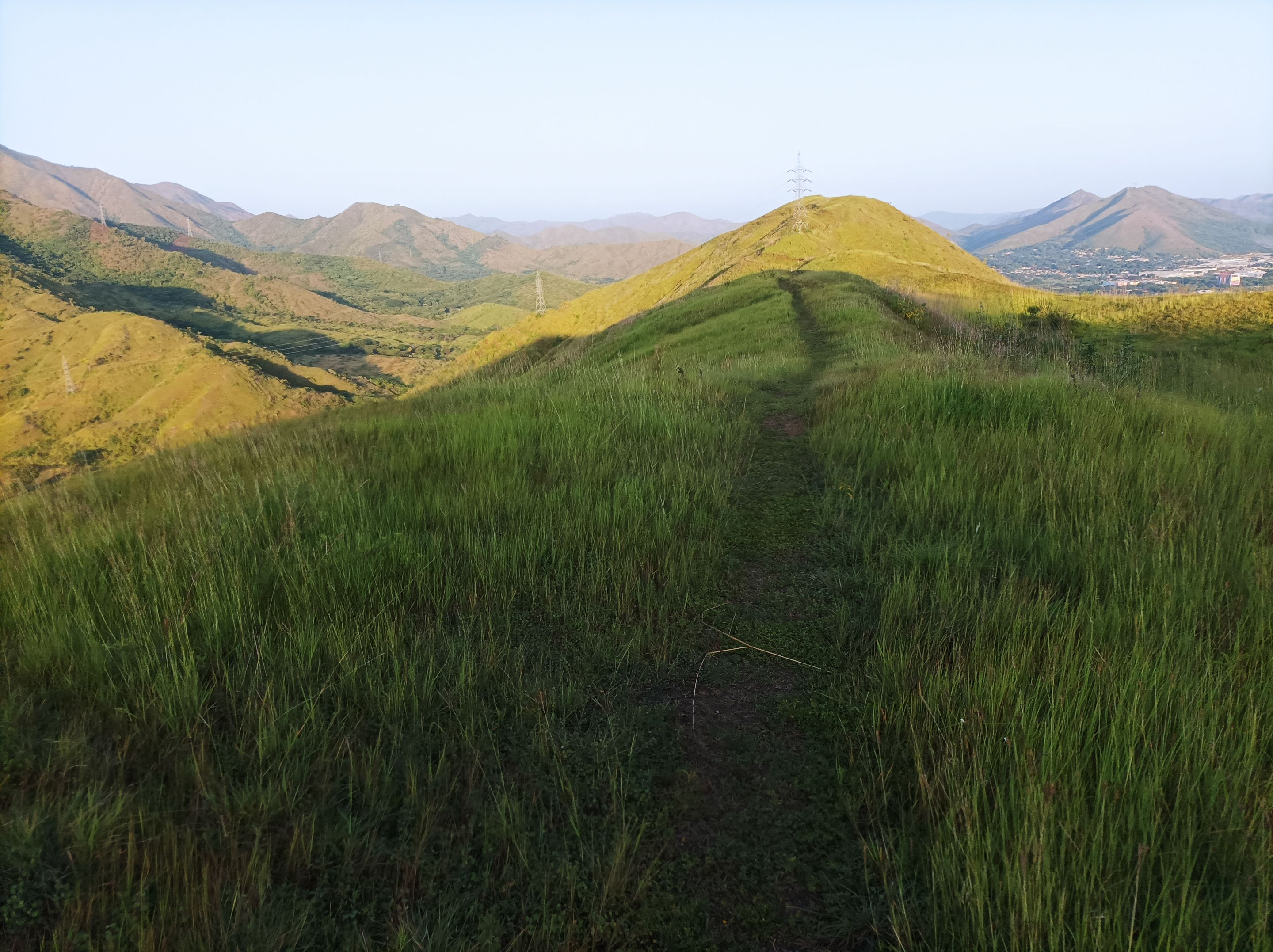
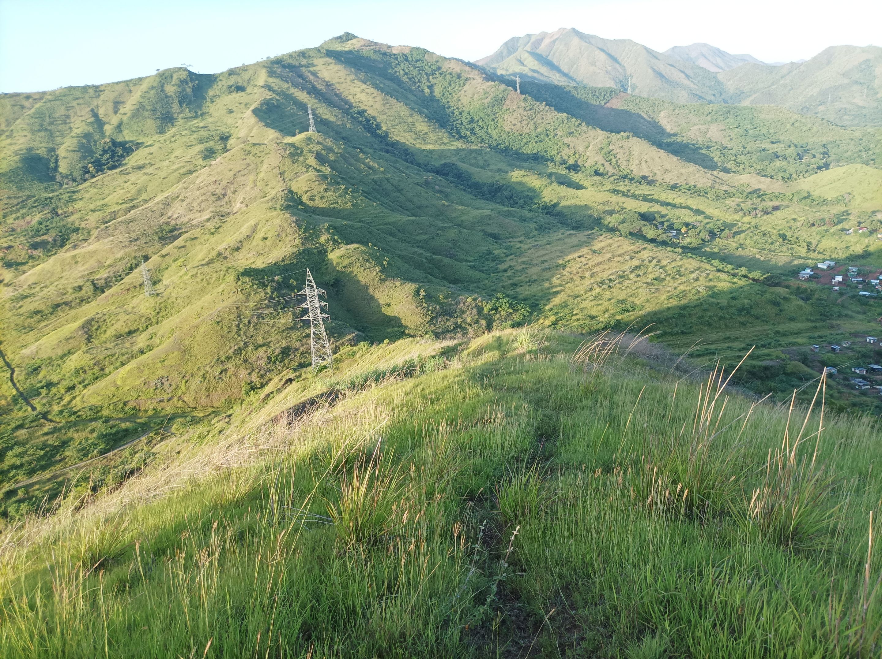
Luego comenzó el ascenso a la montaña, el camino se está cubriendo alrededor de arbustos bien altos, que han crecido debido a las lluvias, partes del camino estaban húmedos, me imagino que llovió en la madrugada, a medida que subía las pendientes eran más exigente, pasando por la primera, segunda y tercera subida, hasta llegar a la cima, con un registro de tiempo de 32 minutos con 35 segundos. Después continúe caminando a la parte derecha de la montaña, para llegar a la punta y bajar unos 250 metros, y después me regresé para subir nuevamente a la montaña.
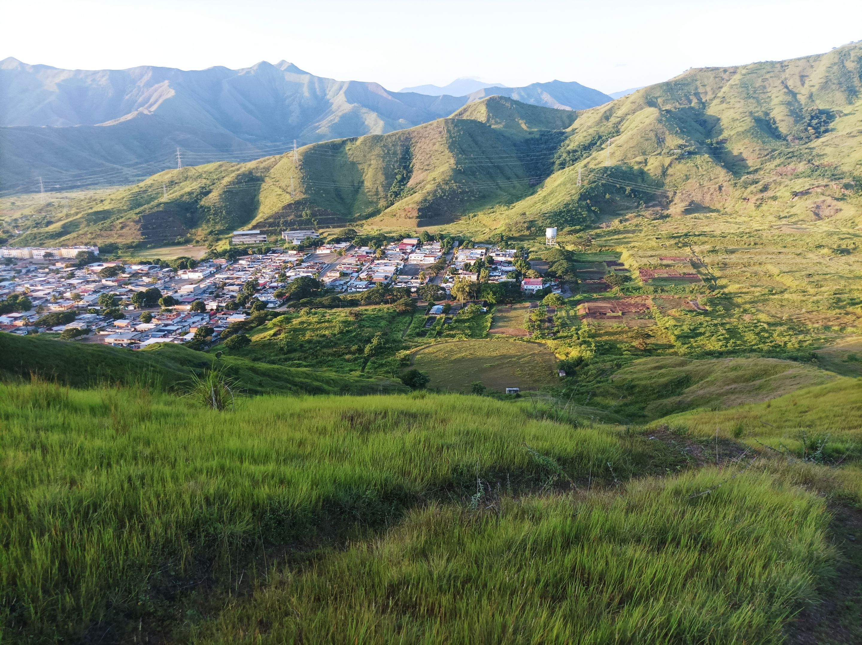
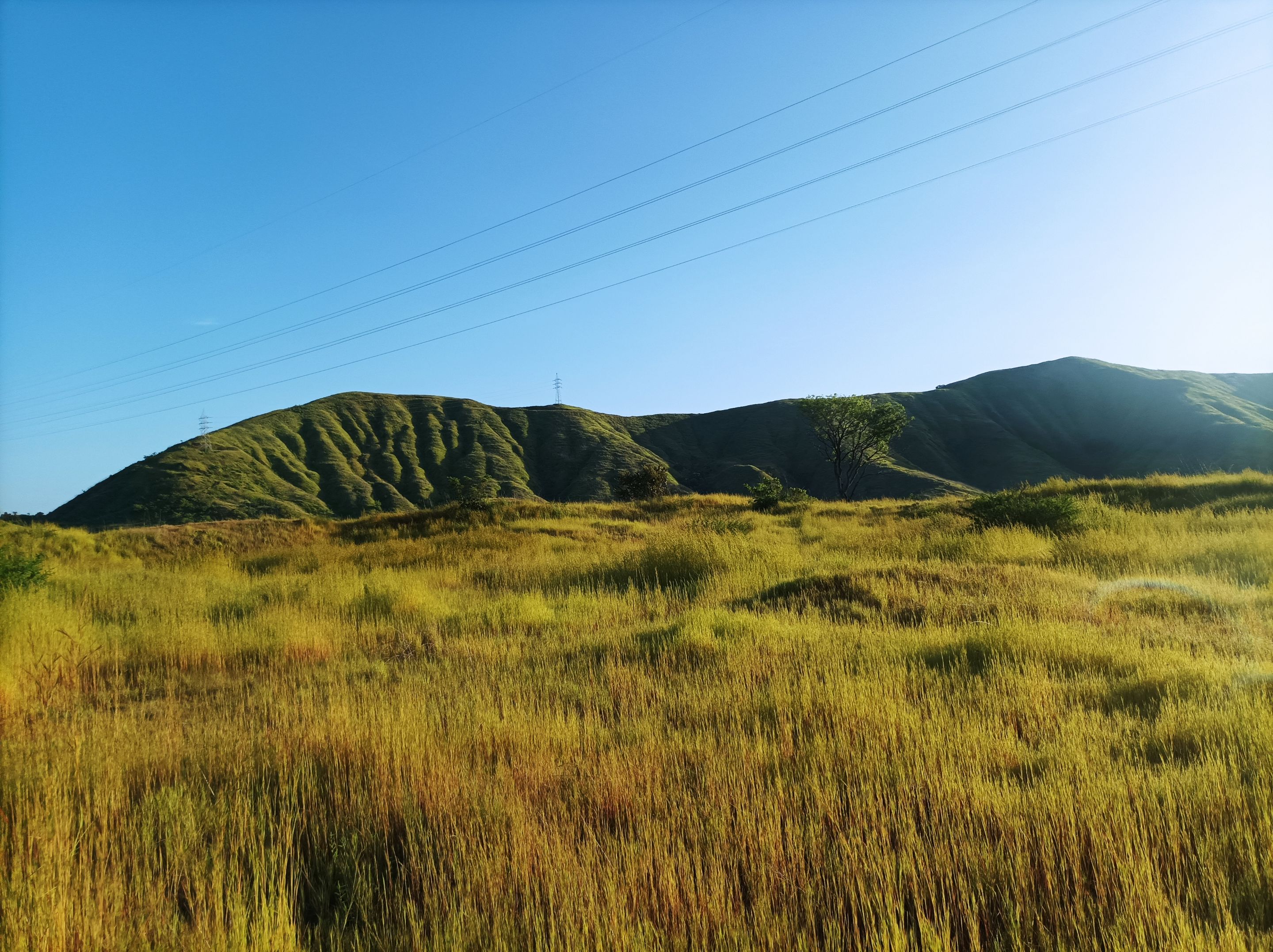
From the top of this mountain, we can see the entire center of the community of Villa de Cura and, in the background, the community of El Toquito. I stopped for a few seconds to hydrate and take some photographs of this beautiful landscape. Every time I wake up early, I have the privilege of exploring these trails to enjoy nature. Then, I continued my journey to the left of the mountain to descend, from where we could see the running track, and then descend behind it to climb another mountain.
Then the ascent to the mountain began. The path was covered around very tall bushes, which had grown due to the rains. Parts of the path were wet. I imagine it rained during the early morning. As I climbed, the slopes became more demanding. I went through the first, second, and third climbs until I reached the summit, with a recorded time of 32 minutes and 35 seconds. I then continued walking to the right side of the mountain, reaching the top and descending about 250 meters, and then I turned around to climb the mountain again.
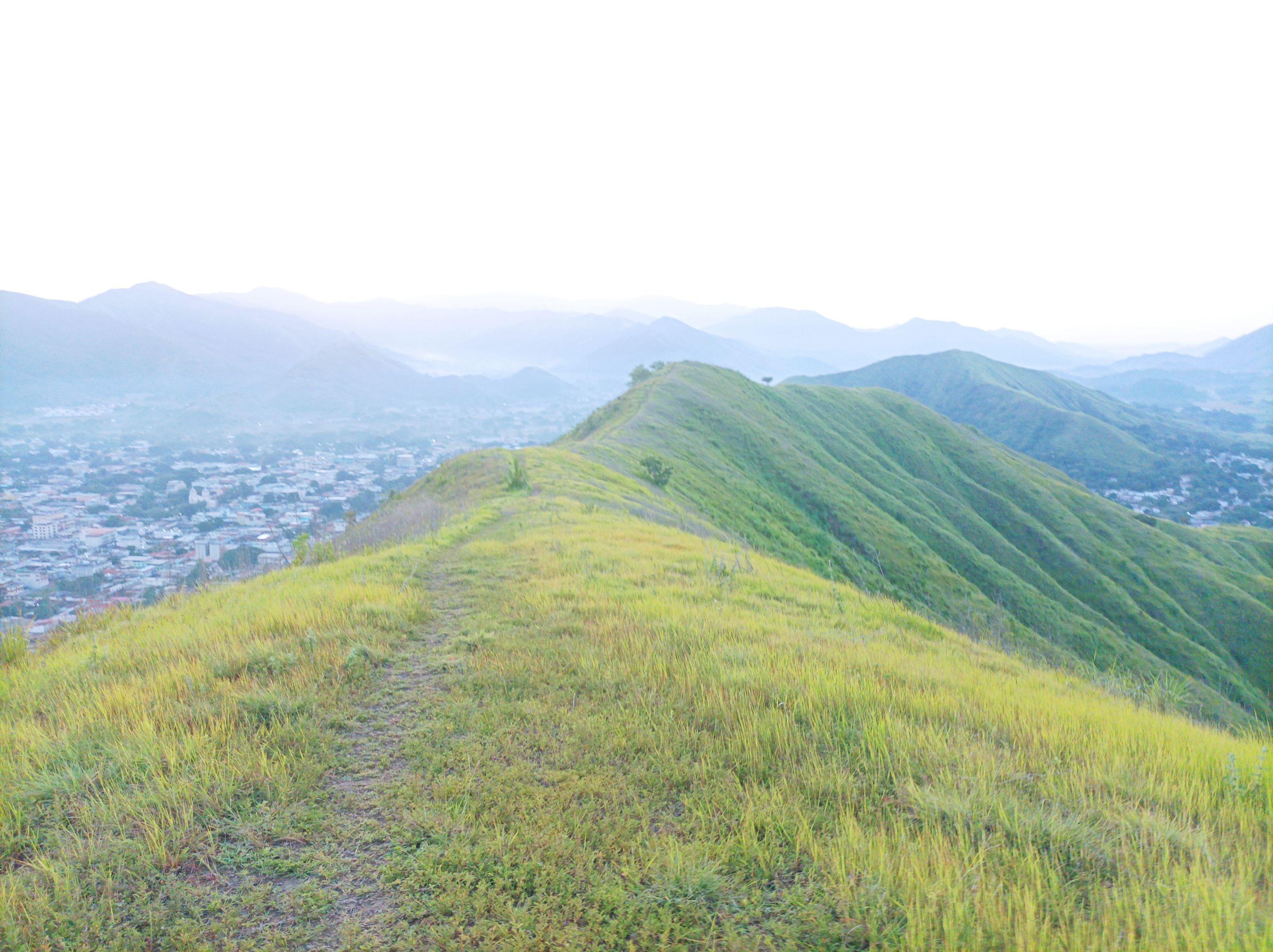
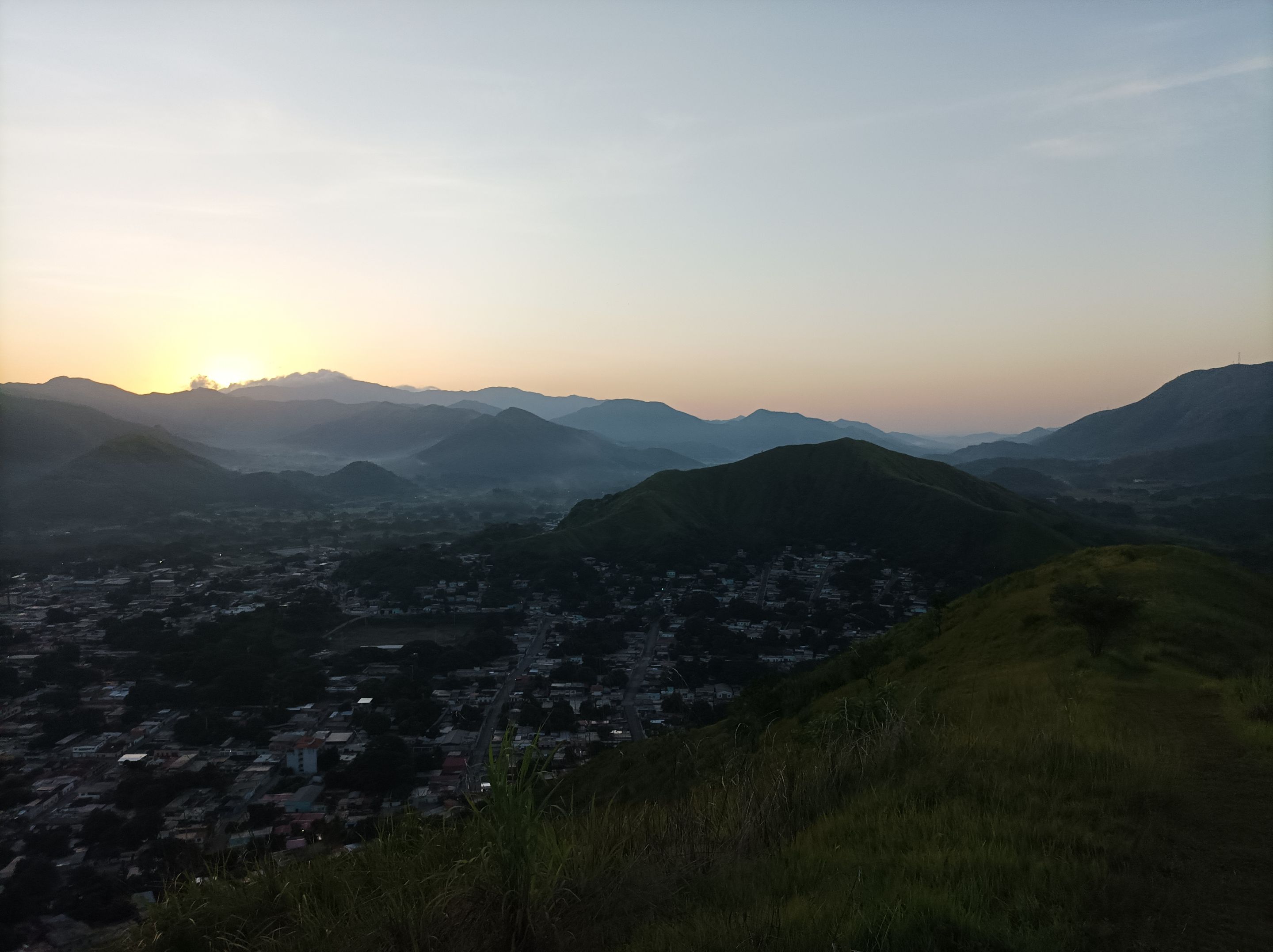
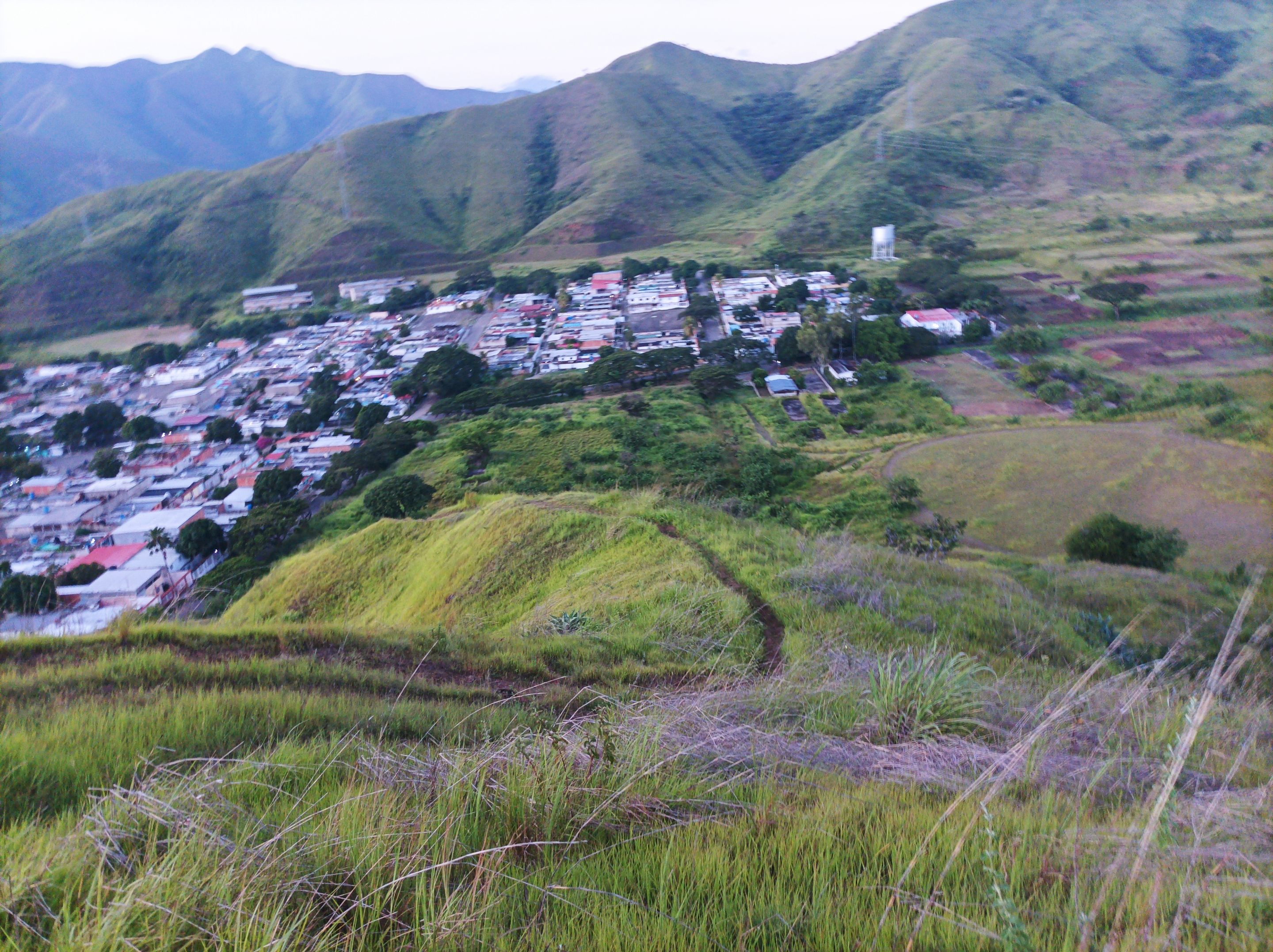
Desde la cima de esta montaña, podemos apreciar todo el centro de la comunidad de Villa de Cura y por la parte posterior la comunidad de El Toquito, me detuve unos segundos para hidratarme y tomar unas fotografías de este bello paisaje. Cada vez que me levanto temprano tengo el privilegio de explorar estos senderos para disfrutar de la naturaleza. Después continúe mi recorrido a la izquierda de la montaña para descender, desde donde apreciamos la pista de atletismo y bajar por detrás para subir por otra montaña.
From the top of this mountain, we can see the entire center of the community of Villa de Cura and, in the background, the community of El Toquito. I stopped for a few seconds to hydrate and take some photographs of this beautiful landscape. Every time I wake up early, I have the privilege of exploring these trails to enjoy nature. Then, I continued my journey to the left of the mountain to descend, from where we could see the running track, and then descend behind it to climb another mountain.
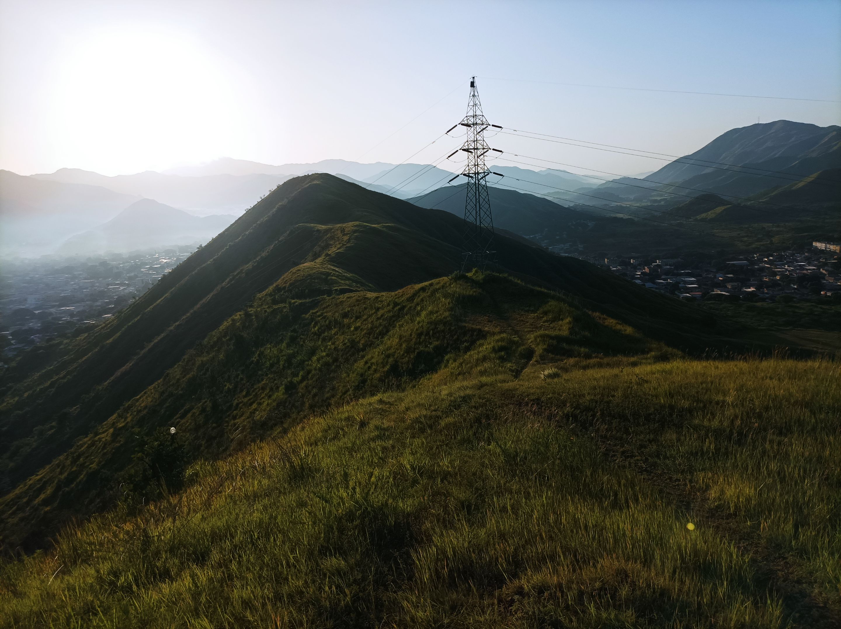
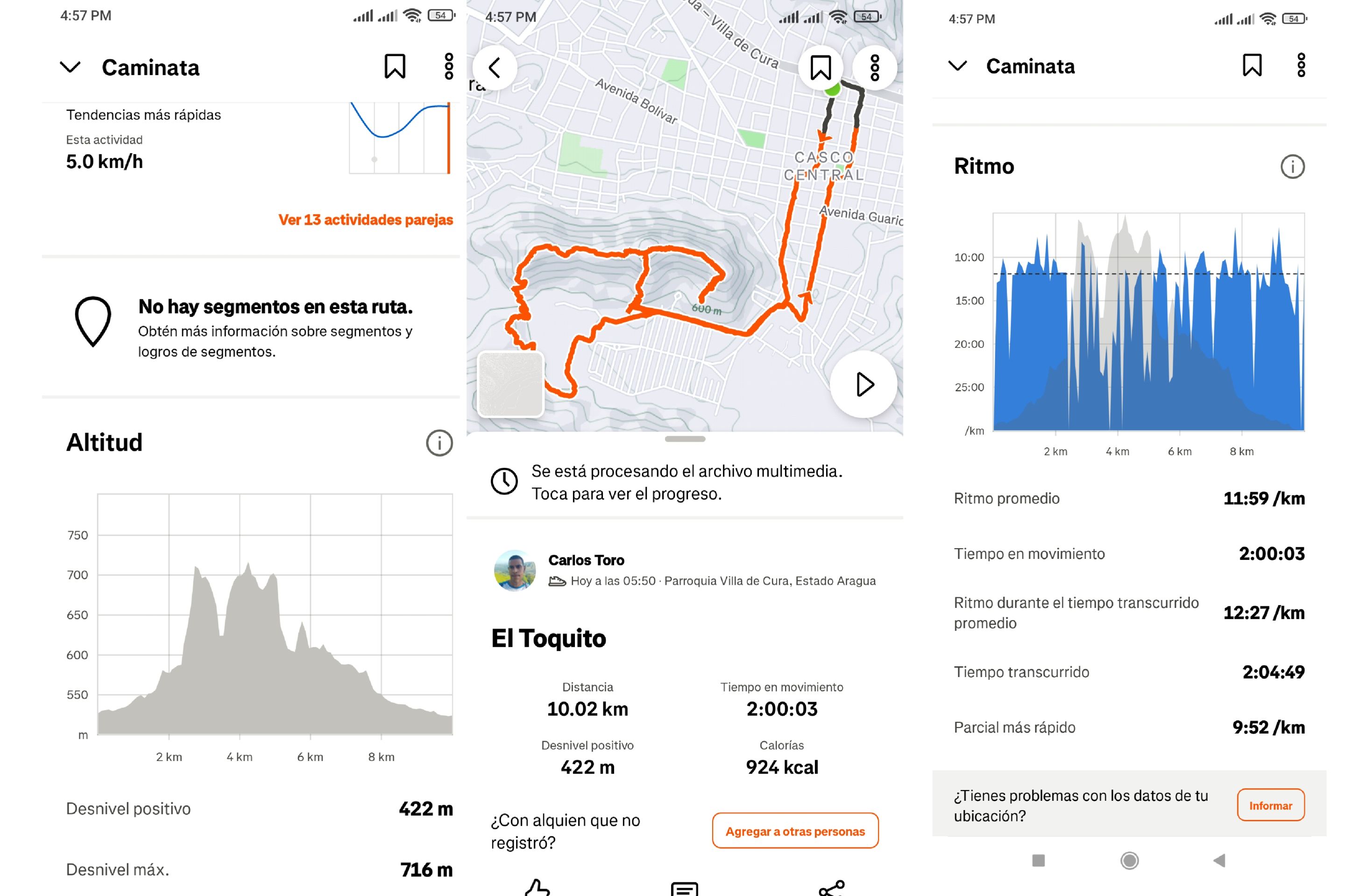
Asimismo, subí está montaña, para después bajar y recorrer la ruta El Country y después bajé por la comunidad de El Toquito, para nuevamente llegar al centro de Villa de Cura y recorrer algunas calles, para finalmente llegar a la avenida Lisandro Hernández, con un tiempo de 2 horas 4 minutos, 49 segundos, con una distancia de 10K, con un desnivel positivo de 422 m y un desnivel máximo de 716 m, registrado en la aplicación Strava.
Likewise, I climbed this mountain, then went down and traveled the El Country route and then went down through the community of El Toquito, to again arrive at the center of Villa de Cura and travel through some streets, to finally arrive at Lisandro Hernández Avenue, with a time of 2 hours 4 minutes, 49 seconds, with a distance of 10K, with a positive slope of 422 m and a maximum slope of 716 m, recorded in the Strava application.
Echa un vistazo a mi caminata en Strava: https://strava.app.link/EmMUr88s6Vb
Espero que les haya gustado, nos vemos en una próxima publicación.
I hope you liked it, see you in a next post.
Fotografías: Teléfono Redmi Note 10 Portada realizada en APP GridArt Logos utilizados de Hive y de @fulldeportes Traductor utilizado: Traductor de Google
Photos: Redmi Note 10 Phone Cover made in The APP GridArte Used logos of Hive and @fulldeportes Translator used: Translator used: Google Translate
 Vote la-colmena for witness By @ylich