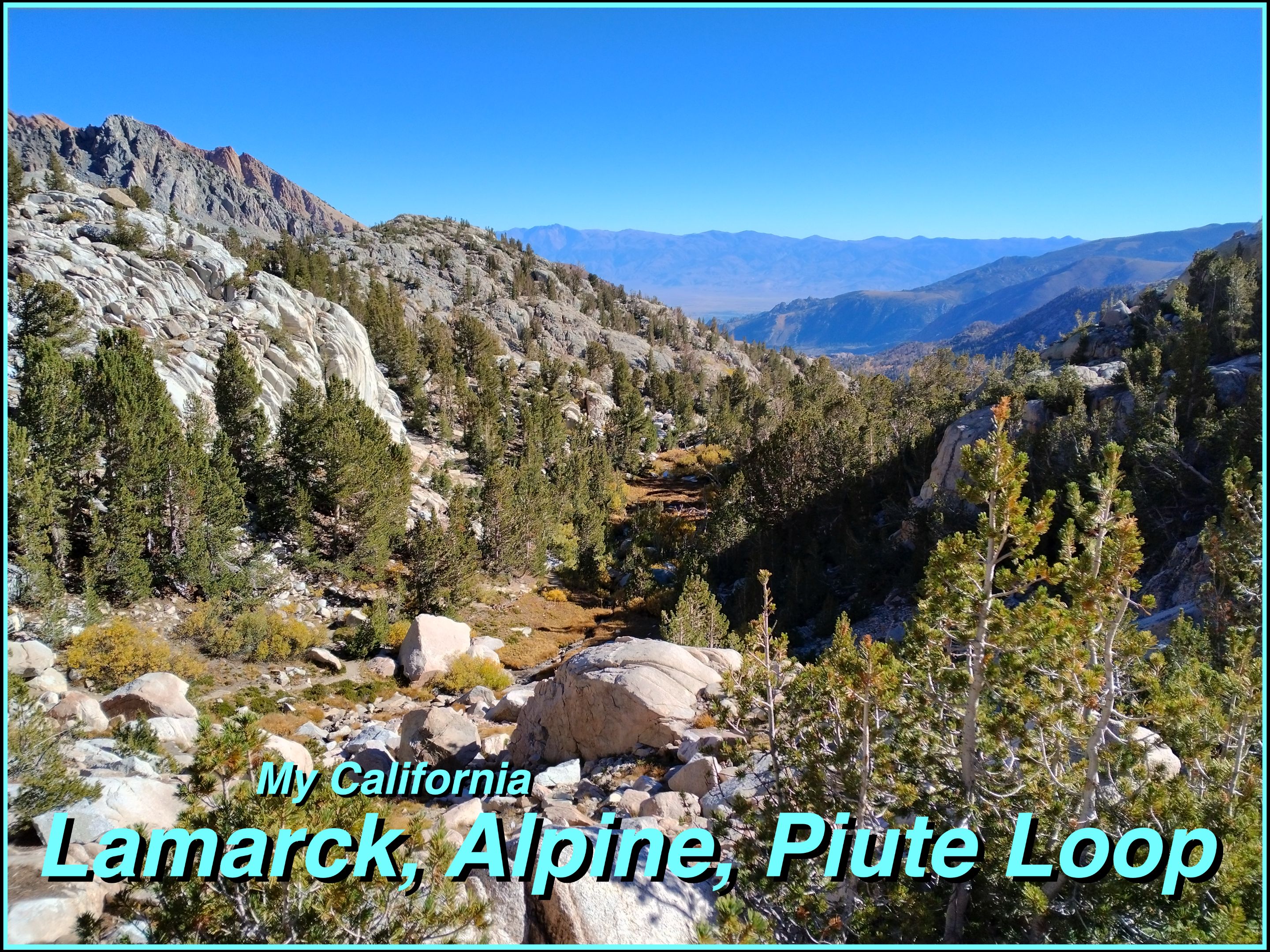
For this weeks [Show Us Your California](https://peakd.com/mycalifornia/@thesocalhive/show-us-your-california-contest-week-228) contest by @thesocalhive I headed up into the Sierra Nevada mountains to spend 5 days hiking the...
Lamarck, Alpine, Piute Loop!!

Late September and early October is my favorite time in the high Sierra. Not only can you get to see the amazing fall colors, but also most the bugs are gone and the thunder storms are much rarer. The nights are getting longer and colder, but a headlight and a good sleeping bag solves that so I find the trade highly worth it. For awhile now I'd been wanting to check out the Lamarck lakes and climb Mt. Lamarck, but when I planned this trip I got a bit more ambitious and decided to turn it into a gnarly 5 day loop. The trip began and ended at the North Lake trailhead in the North Fork Bishop creek drainage up above the town of Bishop, CA. I drove up to the trailhead the night before and just slept in my truck at the trailhead. The next morning I got my stuff all packed and ready to go and then drove up the road into the North Lake campground where the trail actually starts and dropped off my pack there. Unfortunately you can't park at the campground so I had to drive back down to the parking area and walk a half mile up the road before starting the hike. Which really isn't a big deal, but being forgetful I ended up making it a bit worse. As I got to the trailhead and threw my pack on and started up the trail I realized that I had forgot my battery pack that I use for charging things out on the trail, back in my truck. Luckily I realized this quickly and didn't get too far up the trail. But with an extra half mile down the road and a half mile back up I had walked 1.5 miles before even getting started on the actual trail! I didn't let it frustrate me though, the scenery around the trailhead is beautiful and so I saw it as just a pleasant warm up for the actual hike.
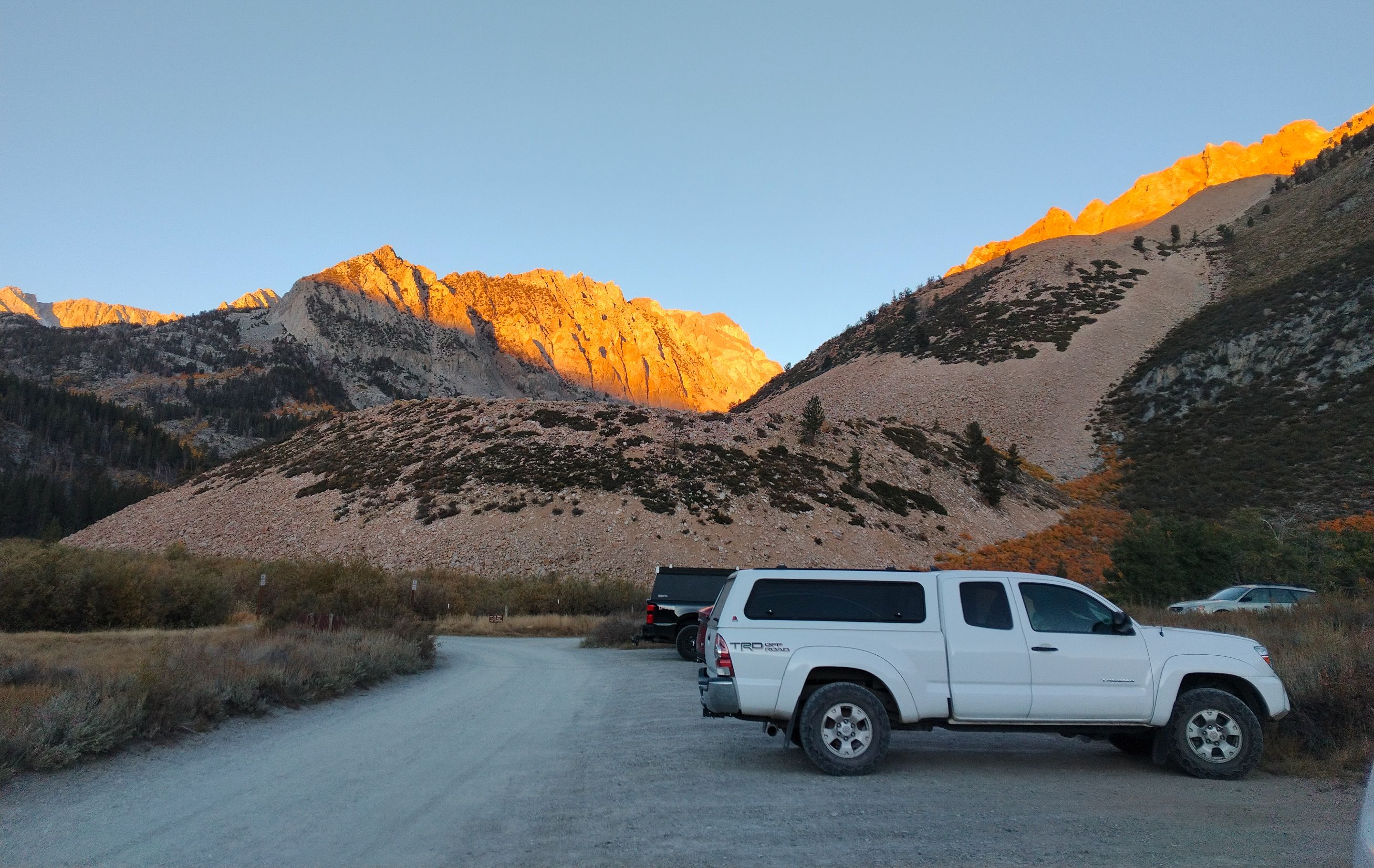 Sunrise at the parking area
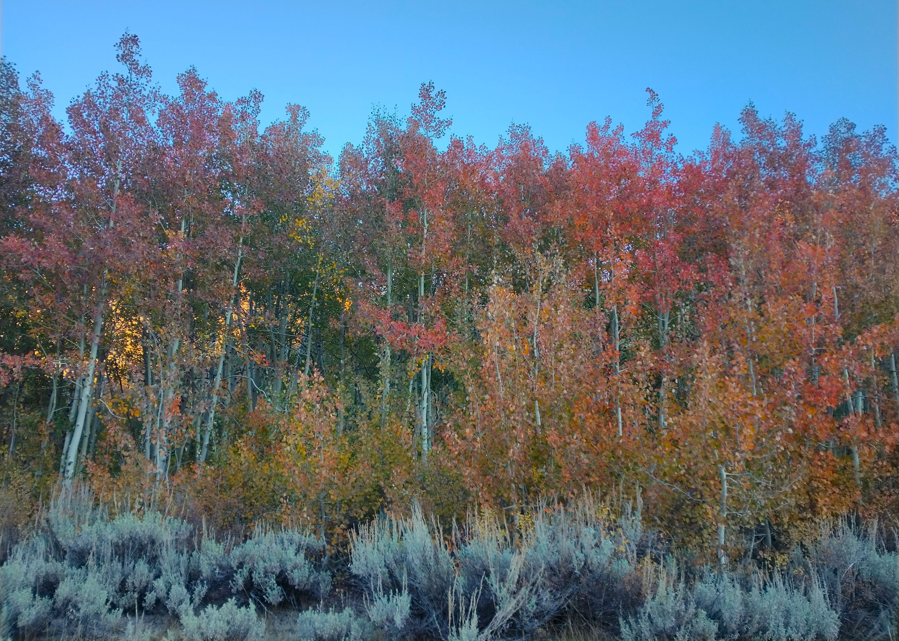 Fall color at the parking area
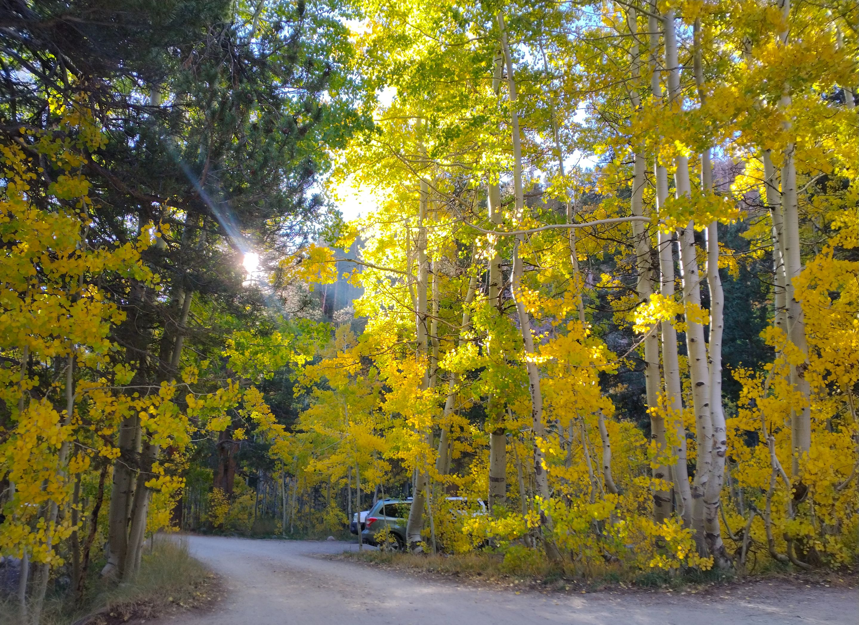 Fall color in the North Lake campground
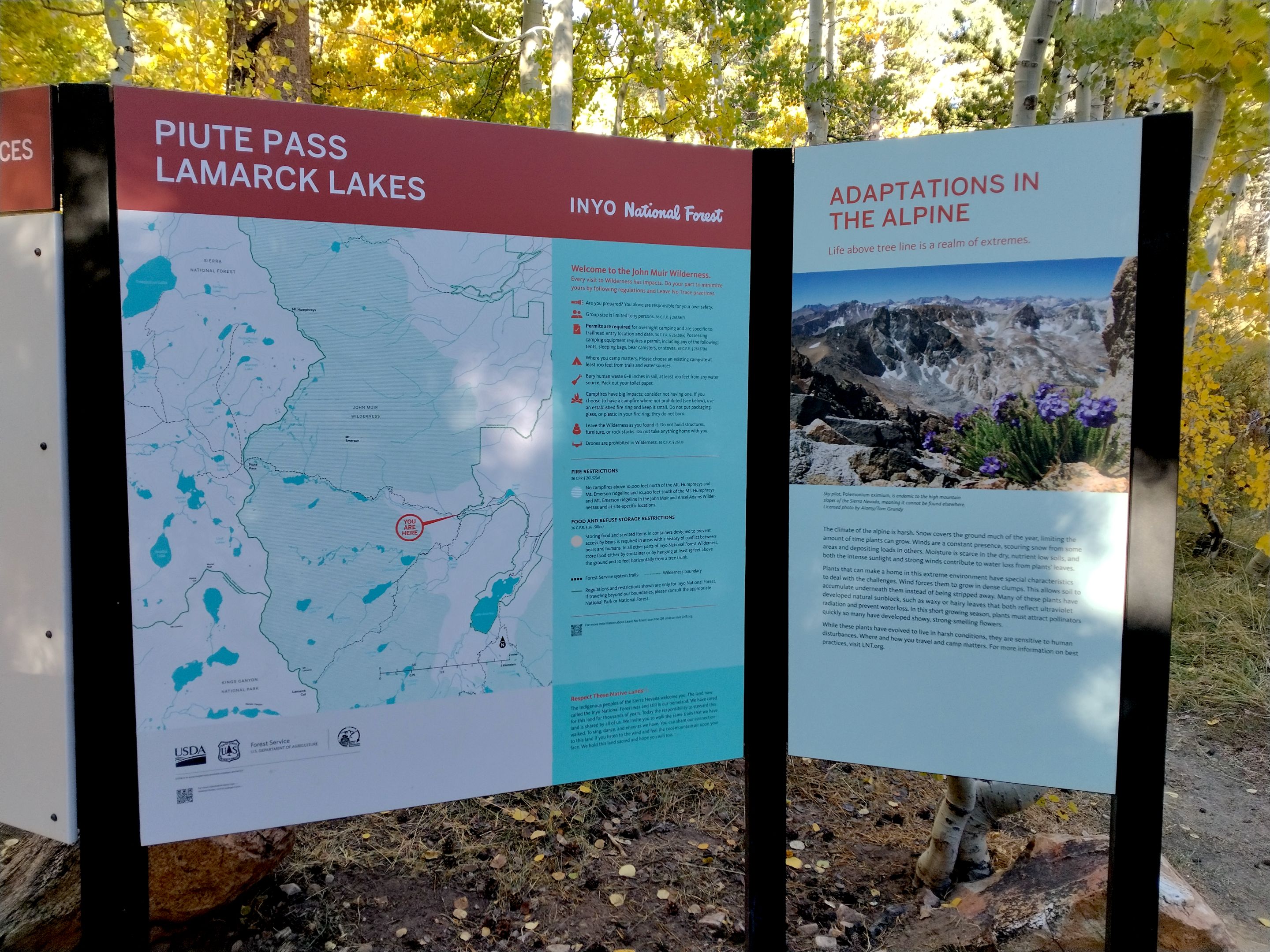 Informational sign at the trailhead
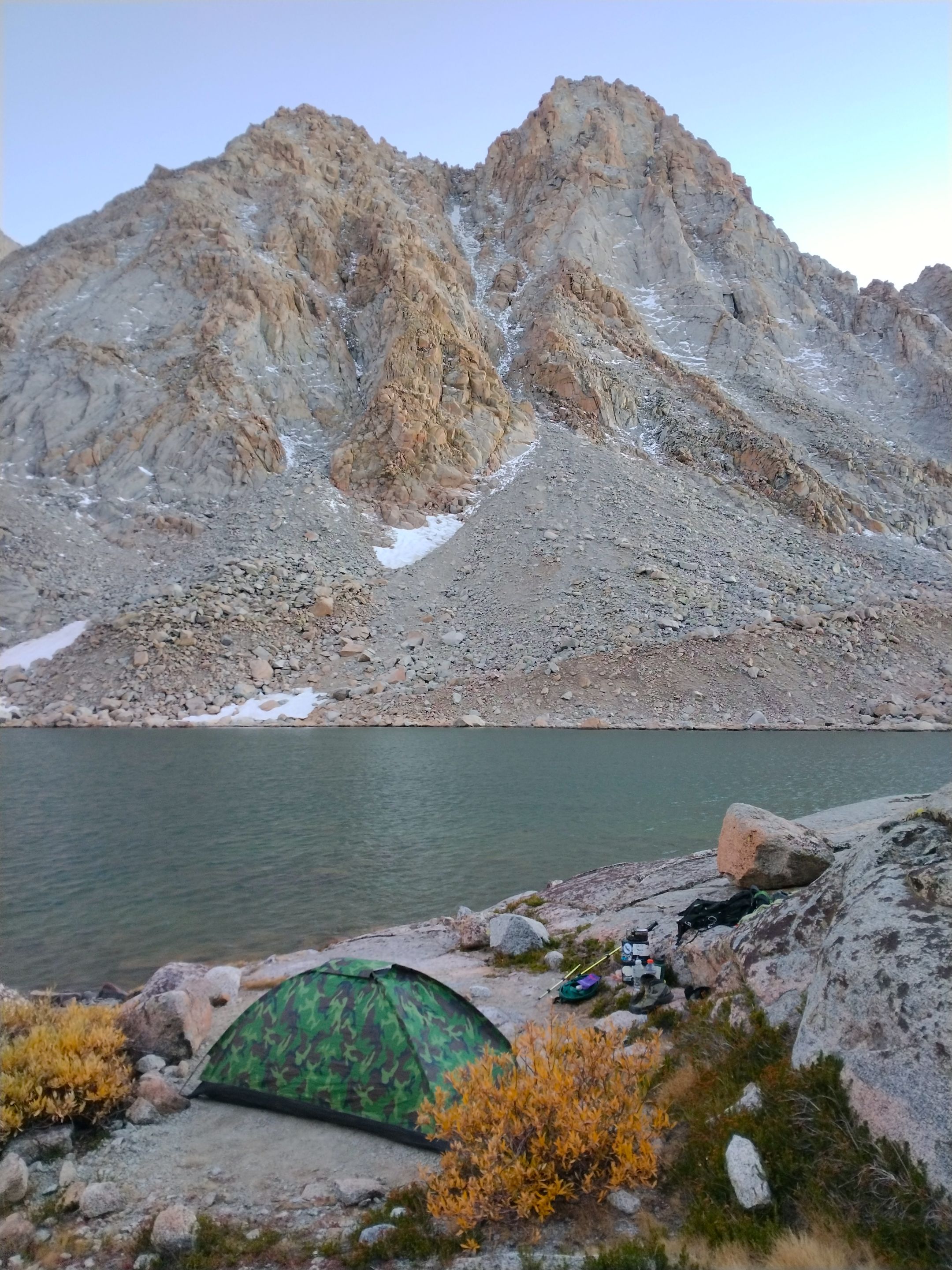
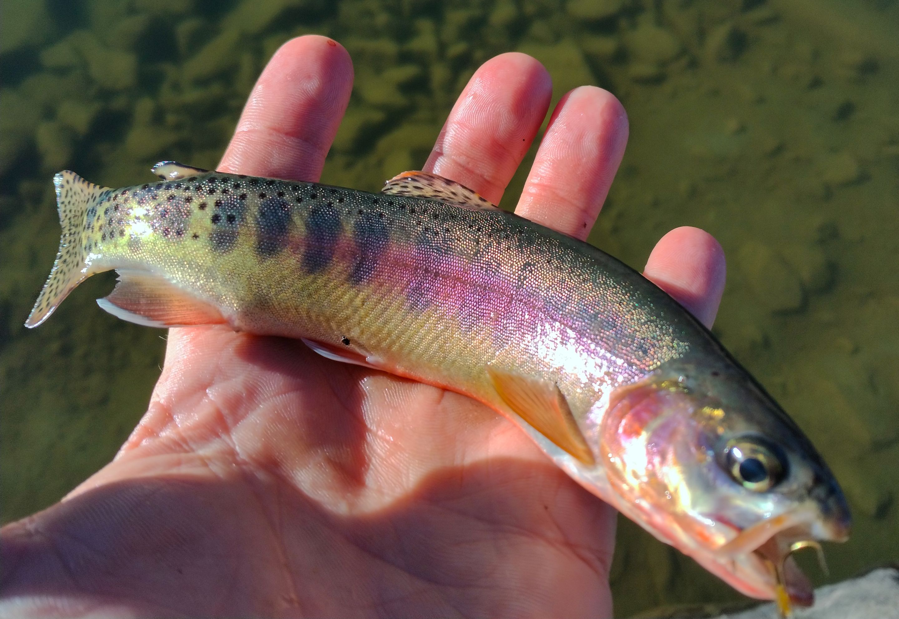
Once back on the trail with everything I needed I hiked up through the campground to the junction for the Lamarck lakes trail. The trail cut left and crossed the creek on a small footbridge and then started switchbacking up the mountain through a mix of pines and golden aspens. Eventually, after a bunch of steep switchbacks the trail leveled out for a little bit and I passed the junction for Grass lake. Passed the junction the trail continued with more steep switchbacks climbing up through the upper reaches of the aspens and eventually opening up for some nice views. At the top of the second set of switchbacks I reached Lower Lamarck lake which was absolutely beautiful. I found a spot along the eastern shoreline and stopped for a bit and took a nice little lunch break. After lunch I got back on the trail, crossed the outlet below the lake, and then started to climb the last half mile or so to the upper lake. The last stretch mostly just followed directly up the drainage and wasn't as steep as the previous sections of trail. Arriving at the upper lake I was a bit confused. To the north of the outlet there was a small granite dome that was blocking my view of the north shore and there was a use trail going out along the south shore. So I decided to follow the use trail to look for camp spots. But before long I realized that the south shore was far too steep and eventually turned into cliffs. In warmer months some of the cliffs would've been great for cliff jumping into the lake and just off the cliffs I could see lots of big trout swimming around. But as I was able to see more of the north shore it became obvious to me that any camping opportunities would be over there. So I headed back to the outlet and found a route up and over the granite dome to the north shore where I was able to find a really nice spot to camp. It was still pretty early in the day so after getting everything setup I just relaxed by the lake for awhile and then later I pulled out the fishing pole and was able to catch a bunch of nice trout! And as the sun faded into the evening I made my dinner and settled in for the night.
 Hiking up through the golden aspens with the Piute Crags in the background
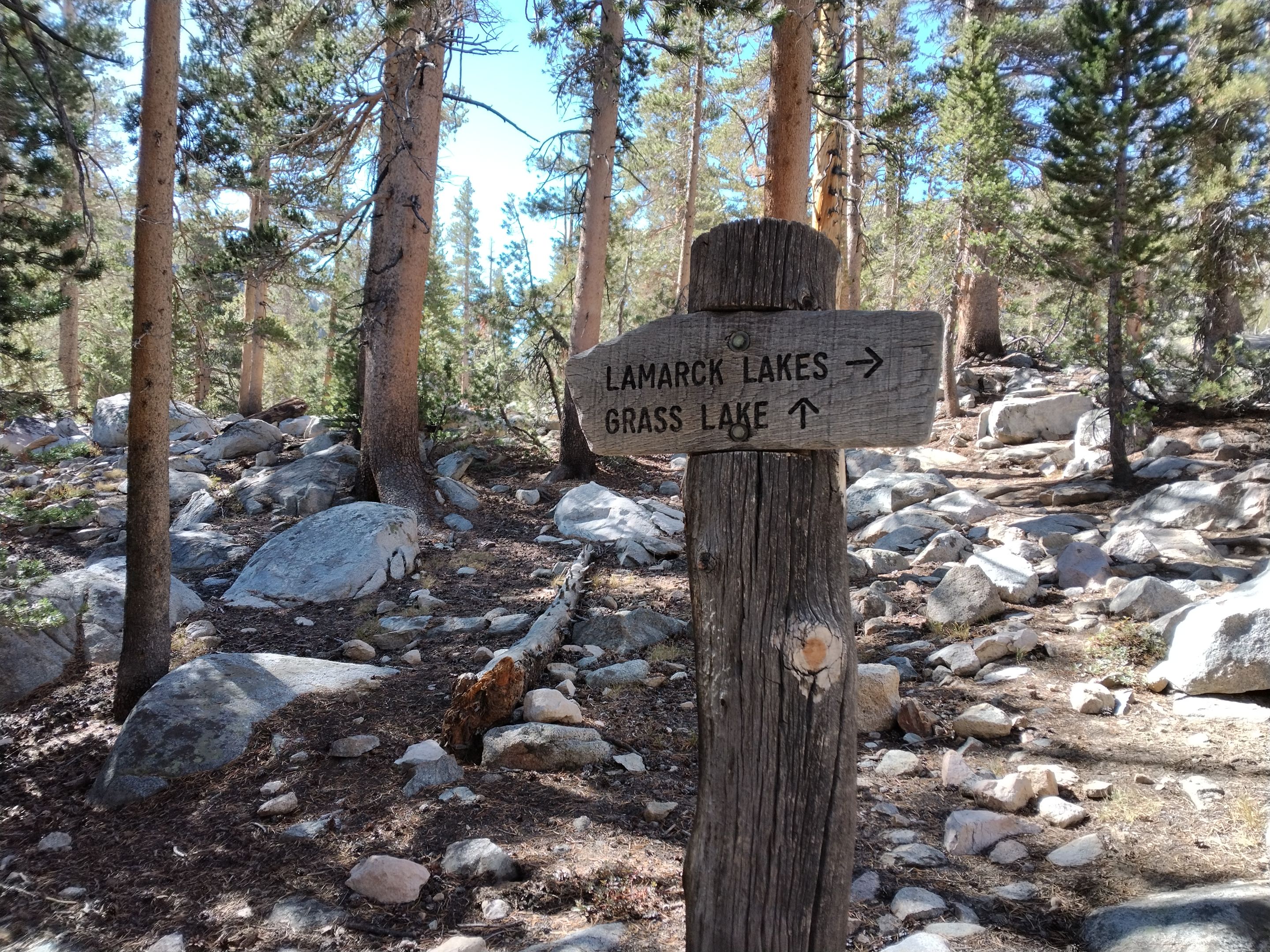 Grass lake trail junction
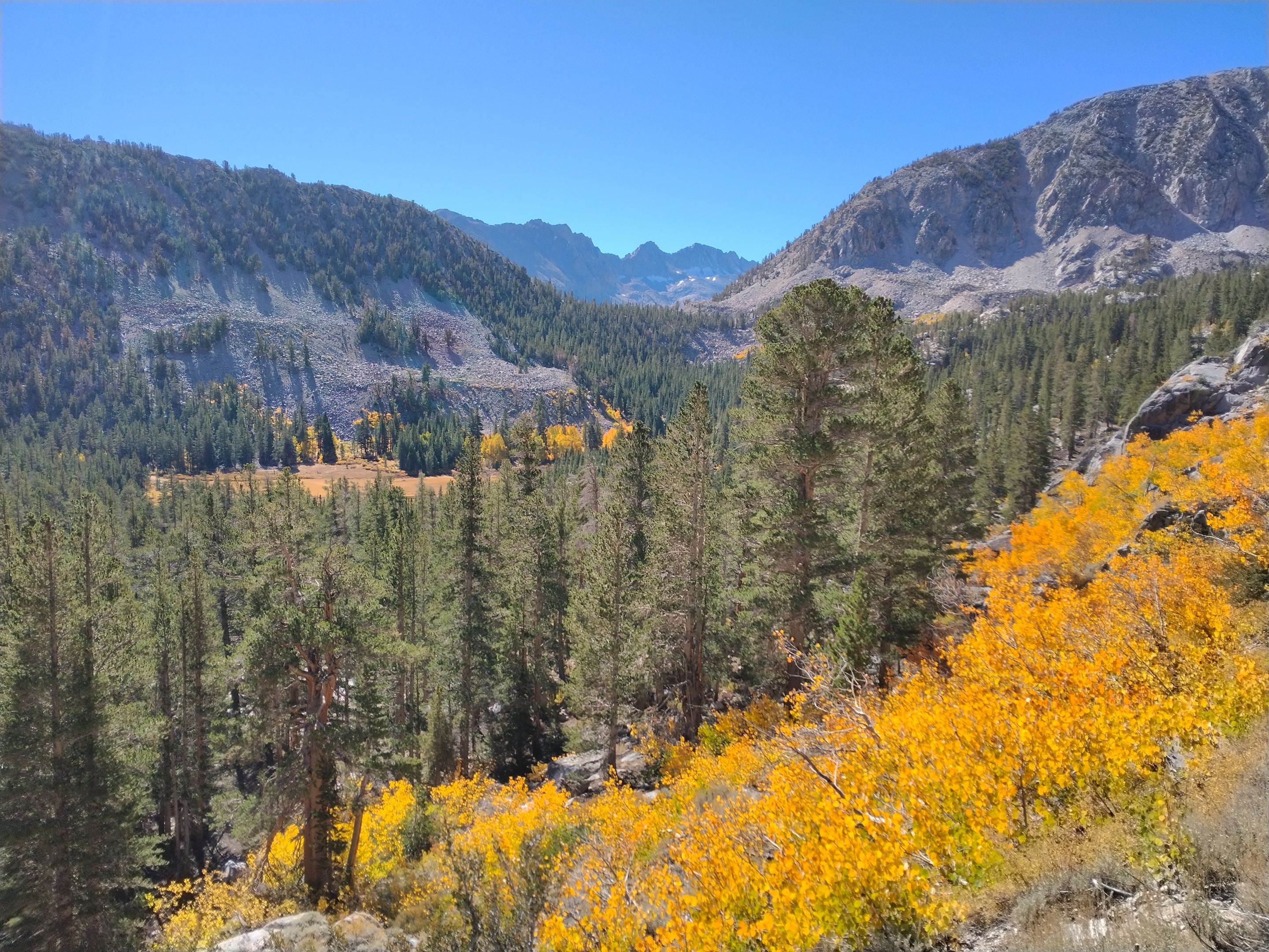 Views from the second set of switchbacks
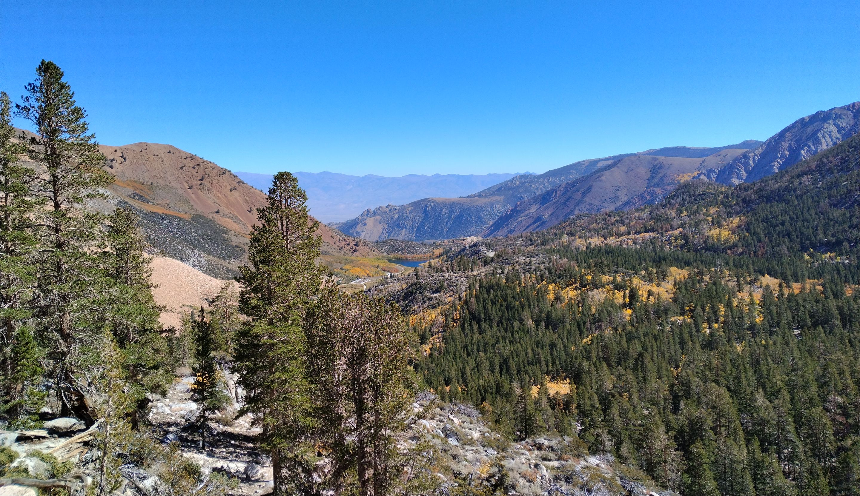 Views looking down at North Lake
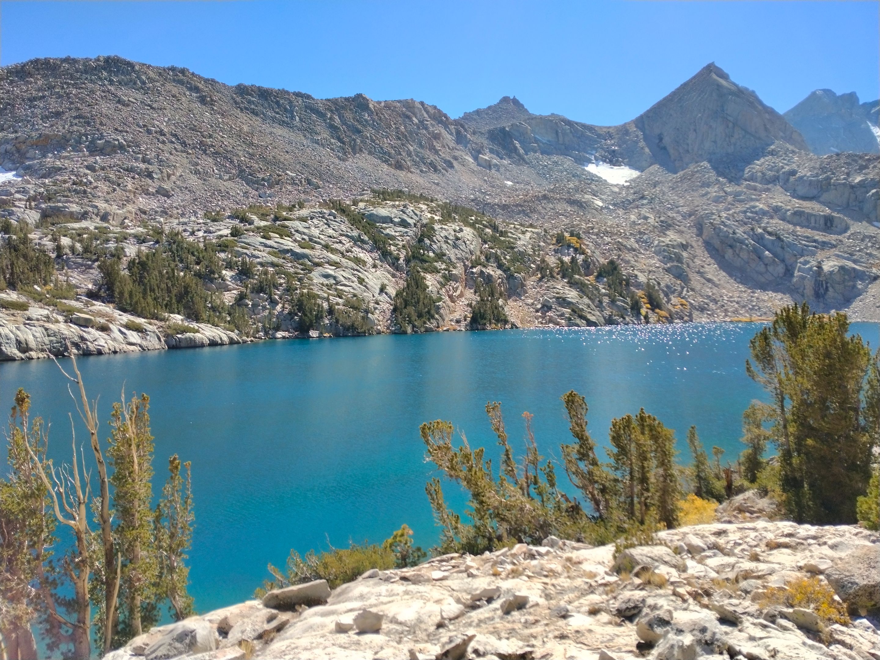
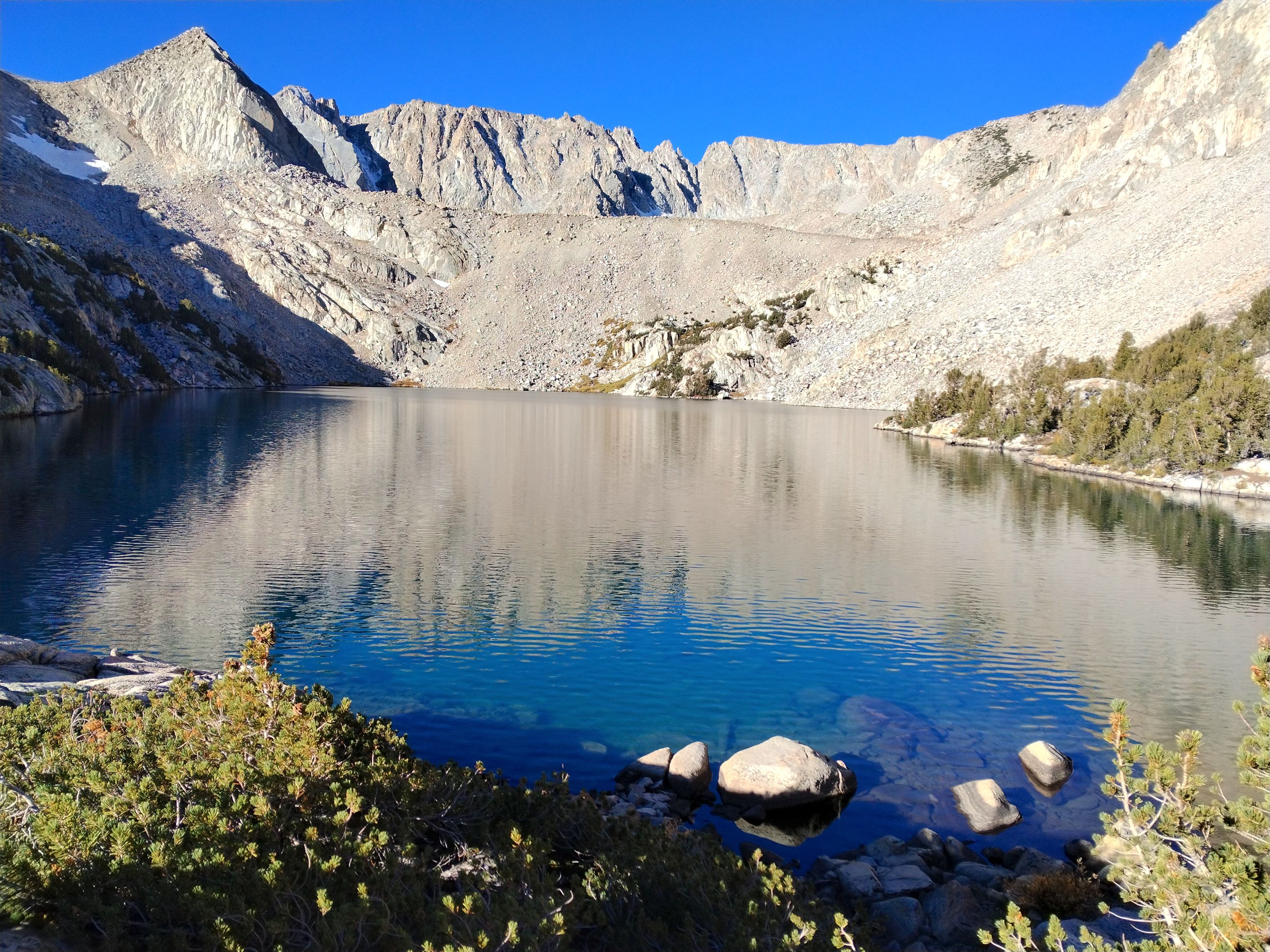
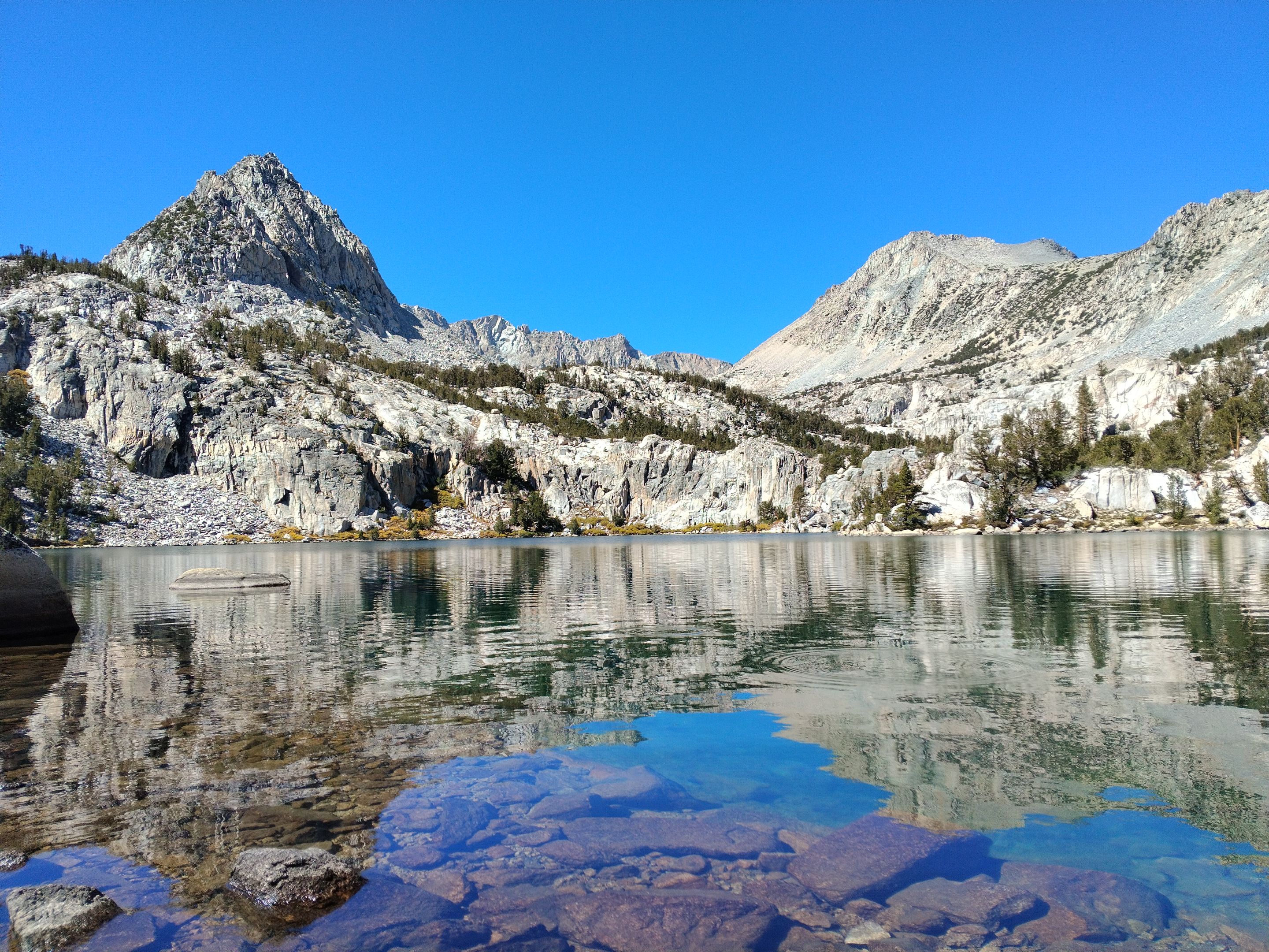 Lower Lamarck lake
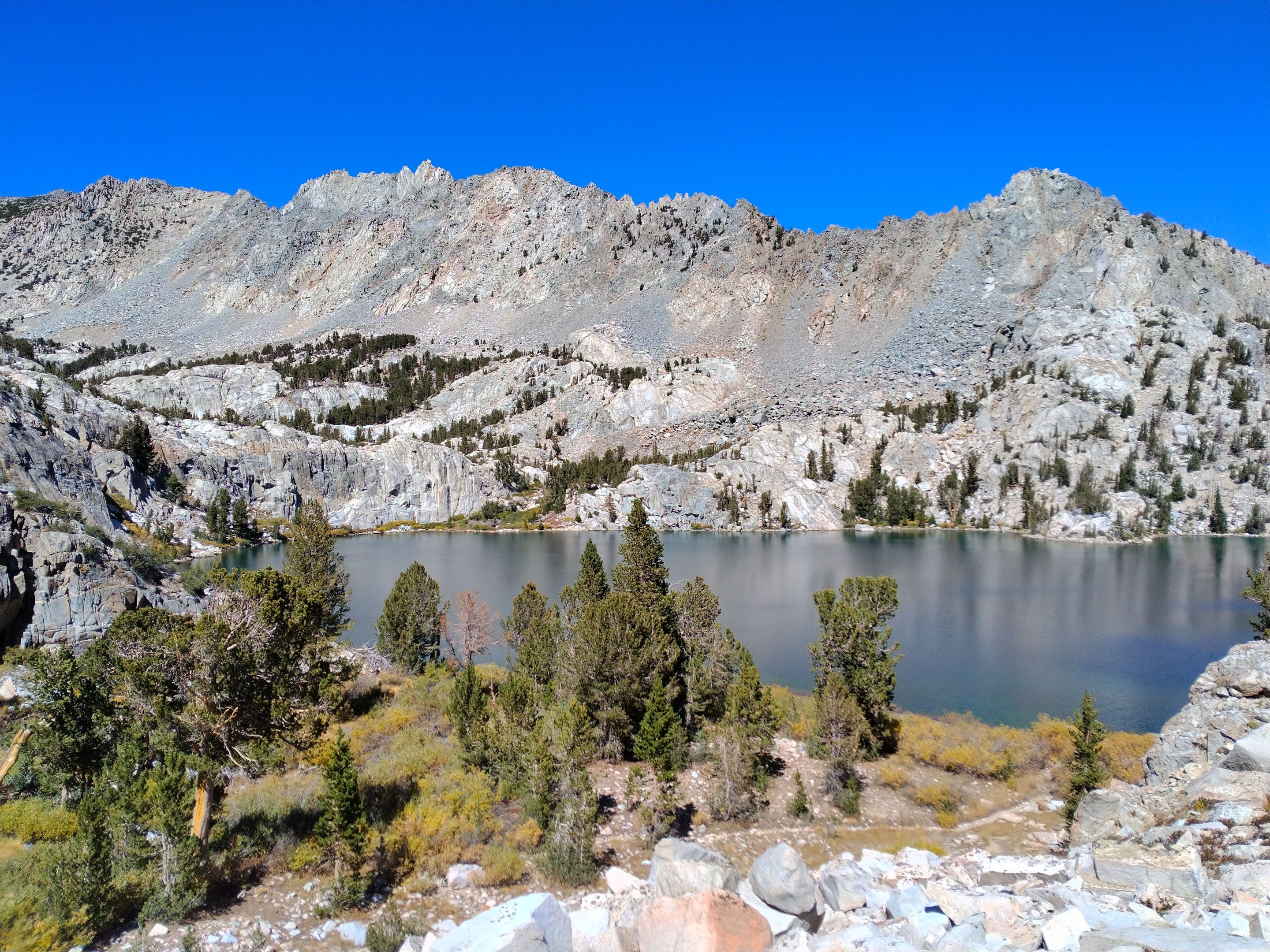 Overlooking the lower lake
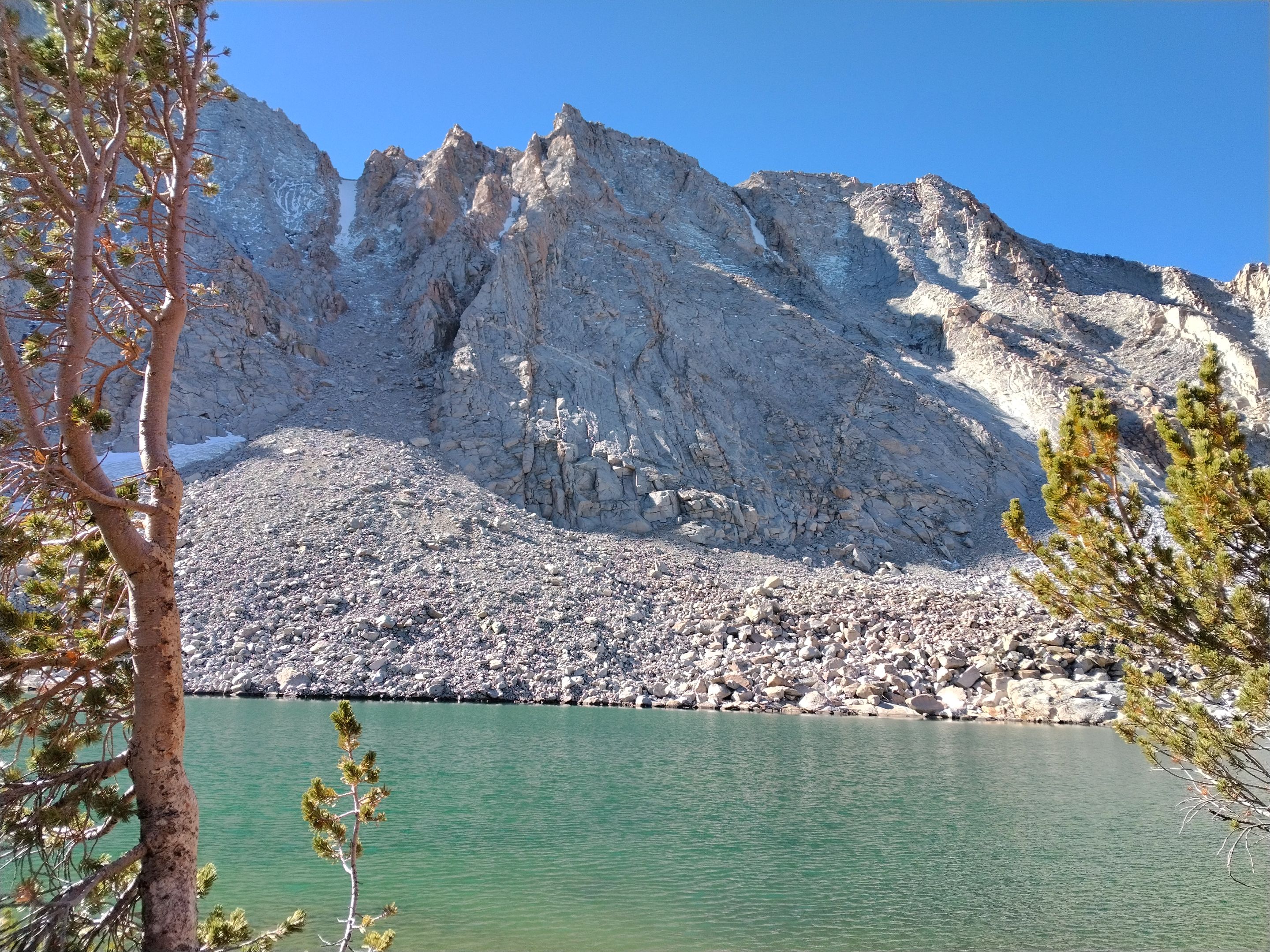
 Cliffs on the south shore of upper Lamarck lake
 Upper Lamarck from the little granite dome
 Exploring the north shore of upper Lamarck
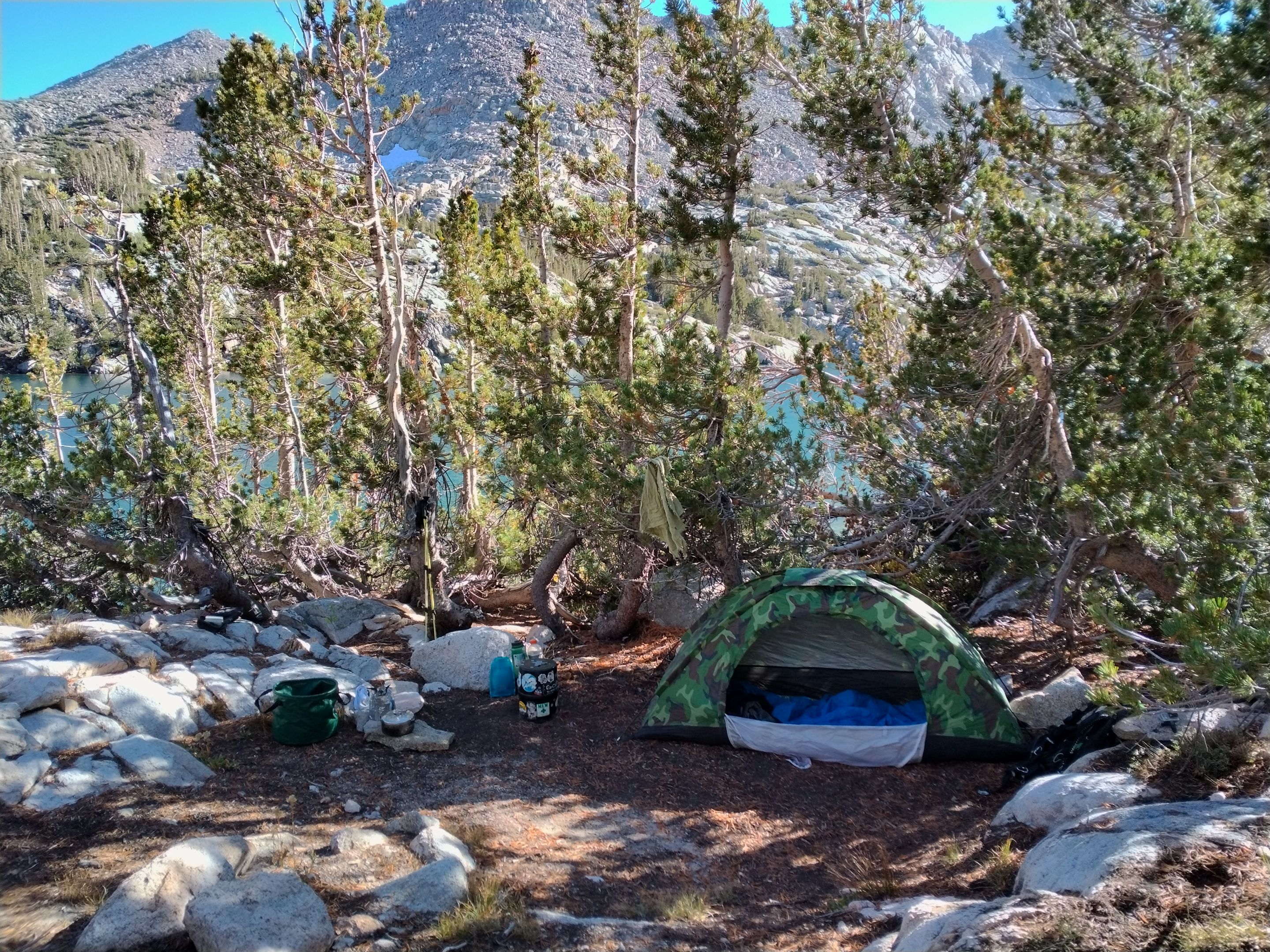 My camp
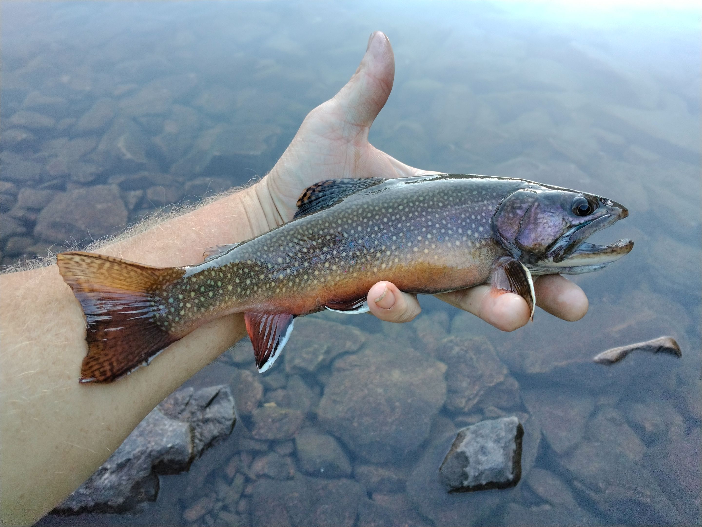 Catching trout
 Evening glow
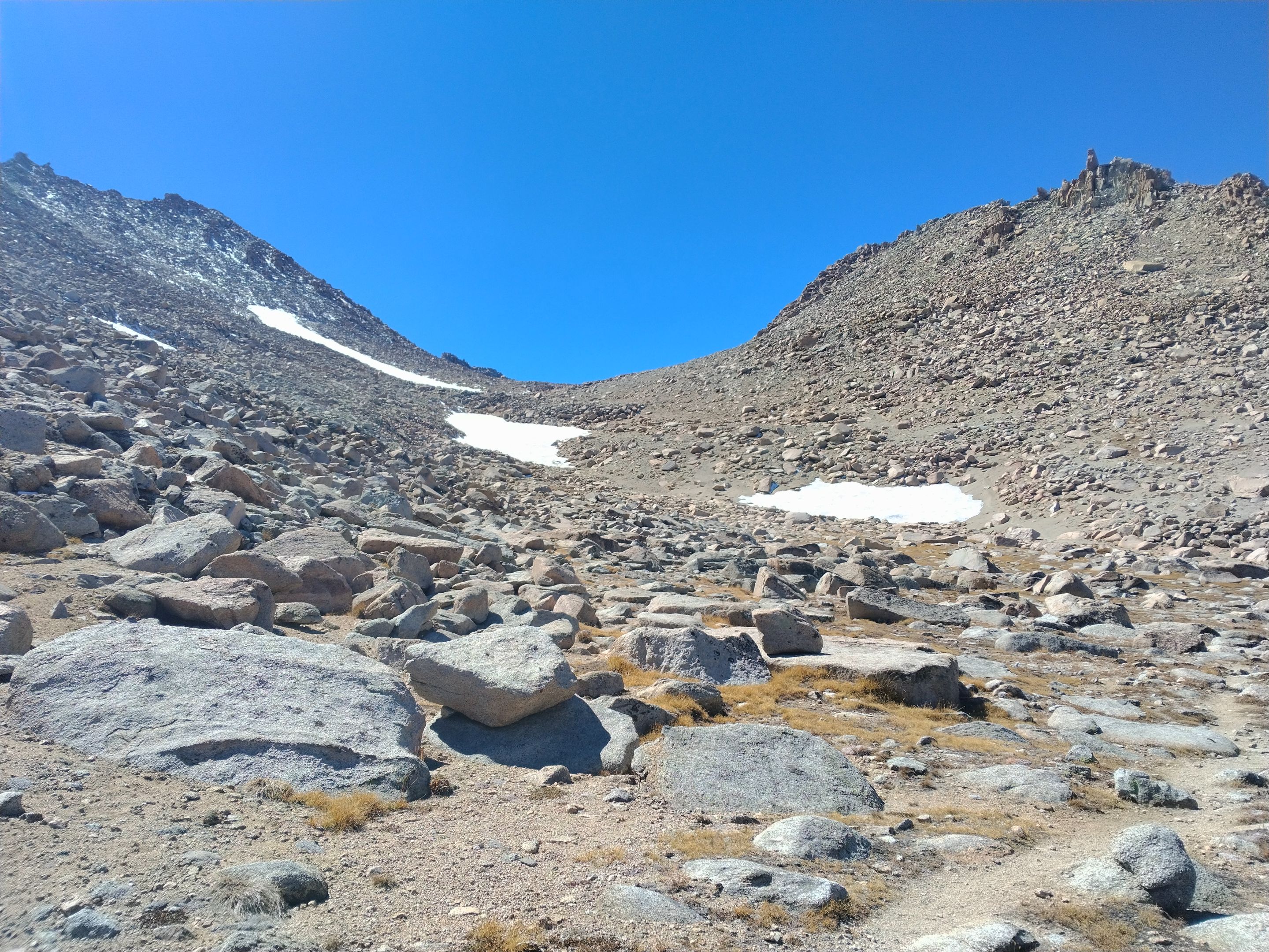
The next morning I woke up, made some oatmeal for breakfast and then got my camp packed up and ready to go. I headed back around the lake to the outlet and then down the outlet stream a short distance to where there was a sign for the use trail (un-maintained trail) up to Lamarck Col. I crossed the outlet and followed the trail up and down as it weaved it's way through some granite cliffs eventually getting to a ridge where the trail started switchbacking steeply upwards. After the switchbacks the trail cut around the ridge and did one more down and up to navigate through another set of cliffs and then cut into a big barren sandy chute. The sun was out and there was no shade in the chute so I stopped and put on lots of sunscreen. Then I started climbing up the chute. It didn't seem excessively steep, but it was still really tiring. I climbed up passed a few small glaciers to the small lake that sits at the base of the Col... or at least the lake that was supposed to be there as it was bone dry! Which was unfortunate because I had planned to fill my water bottle there before climbing Mt. Lamarck. But as to not let that ruin my plans I dropped my pack there and still made the climb up to Mt. Lamarck anyways. From the lake it looked to be a short and easy climb, but it turned out to be a bit longer and more challenging than I thought. Nothing too difficult though and before long I was standing on top(13,417') enjoying the expansive views in all directions. Looking down at where I had started that morning at Upper Lamarck lake it looked so far down there! And looking at the huge cliffy peaks of Mt. Darwin and Mt. Mendel towering over Darwin canyon where I was headed next got me excited for what was to come. So after a quick snack break I headed back down to the dry lake, this time picking a slightly better route. Now back at the dry lake I was faced with the glacier that blocks Lamarck Col. And it was getting late in the day so I was getting a little concerned about it being icy... and it was. But not because of the afternoon shadows which would usually make an icy crust on top. The icy situation here I think was more because of it being so late in the season. From all the trip reports I had read I was expecting to find footsteps kicked into the snow that I could follow, so I didn't bring any crampons or any other snow equipment, but this late in the year there wasn't much snow left and under the few inches that were left was solid ice. So I picked the shortest route across and went for it. Some spots had a little more snow and I was able to get good footholds, but some spots were just solid ice. Luckily I was able to make it up safely, but not without a few sketchy moments where I thought I might take a rather unpleasant slip and slide. As I got to the top of the glacier I ran into two German guys coming down from the Col. I talked to them for a few minutes and they decided to take the same route down the glacier that I had used to come up. Just above the glacier I finally reached the Col. Moments after that a group of three ladies came up from the backside. Being so late in the day (4pm or so) I found it odd to come across 5 people (6 including me) coming across a high cross country pass like Lamarck Col. I didn't talk to the ladies more than a minute or so because they all seemed preoccupied with the fact that they had some cell service from the Col and I personally couldn't care less about that. So I promptly started the decent down into Darwin canyon which was very steep with a mix of sand and rock which luckily for me is great terrain for downhill (not so good for uphill). But even though I was moving fairly quickly it was a really long way down and as I got down to the upper lakes in Darwin canyon I knew I was running out of time to find a camp before dark. Luckily as I was making my way around the third lake I found a nice spot to setup camp just as the sun was setting.
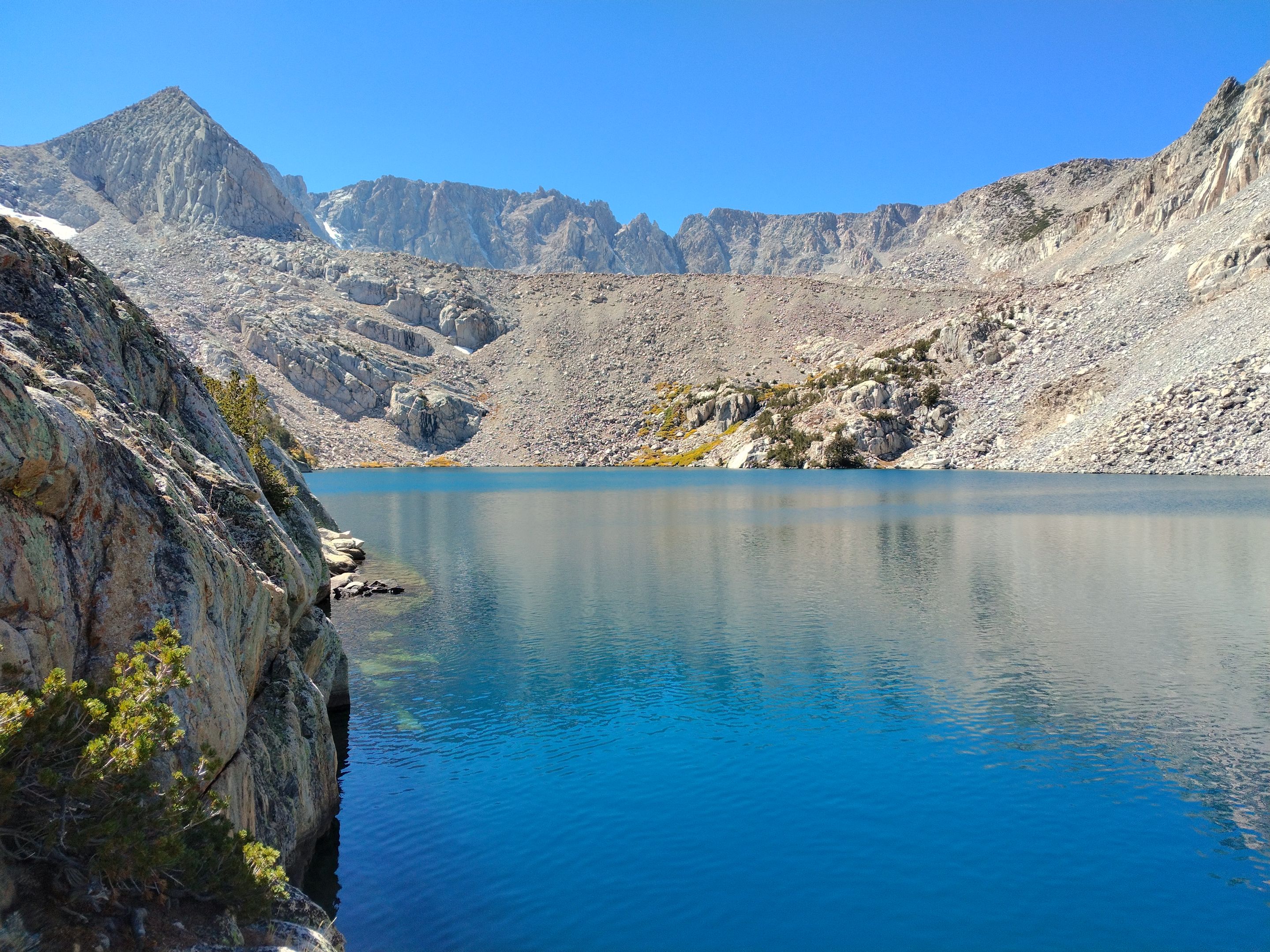
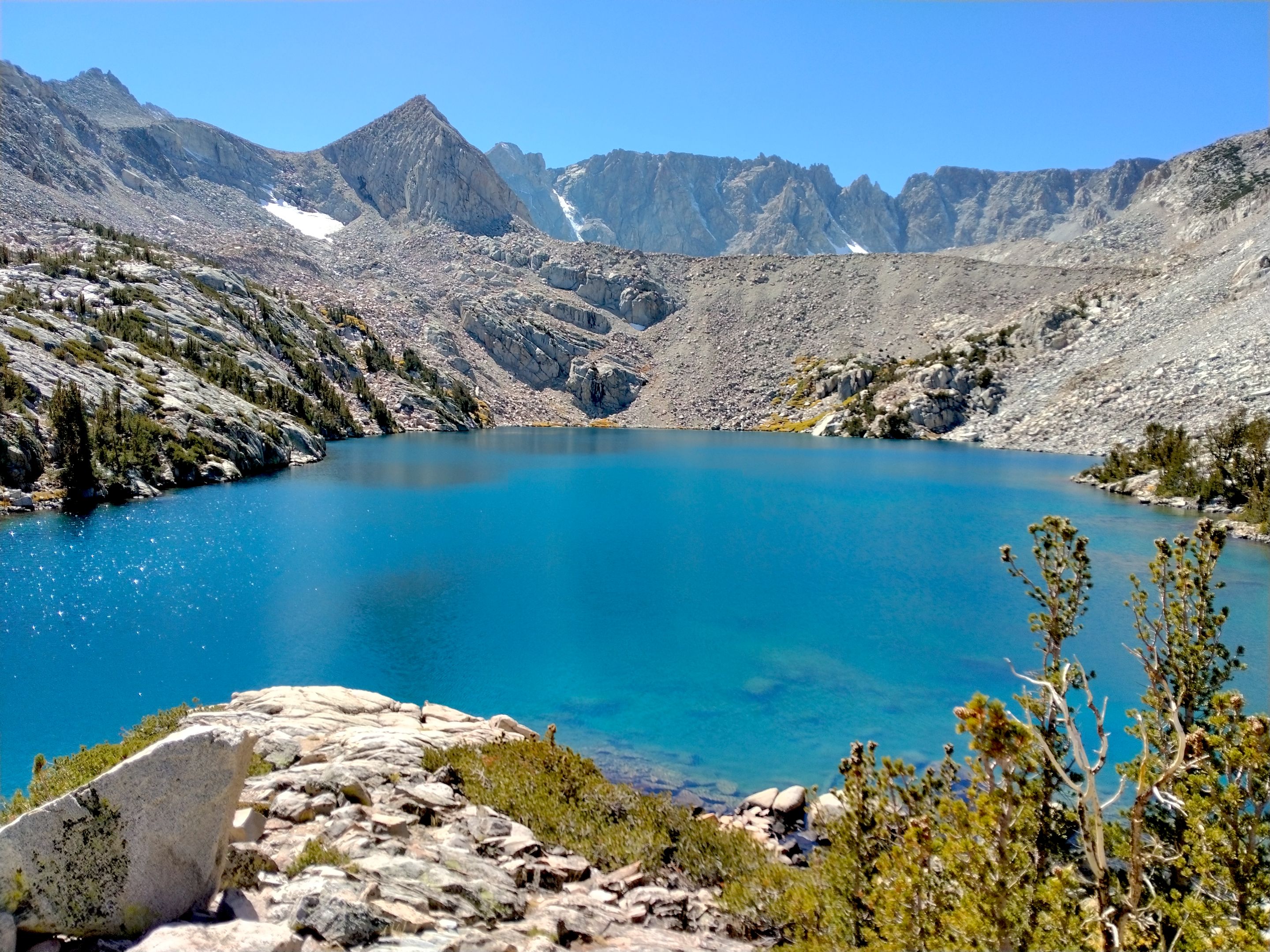
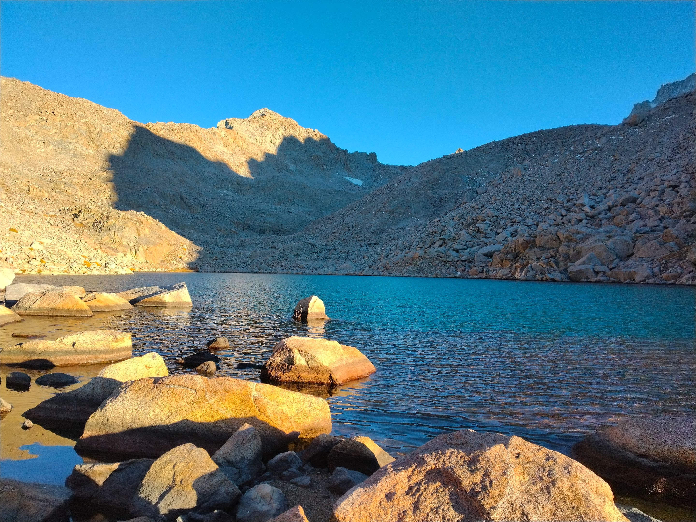
 Upper Lamarck lake in the morning
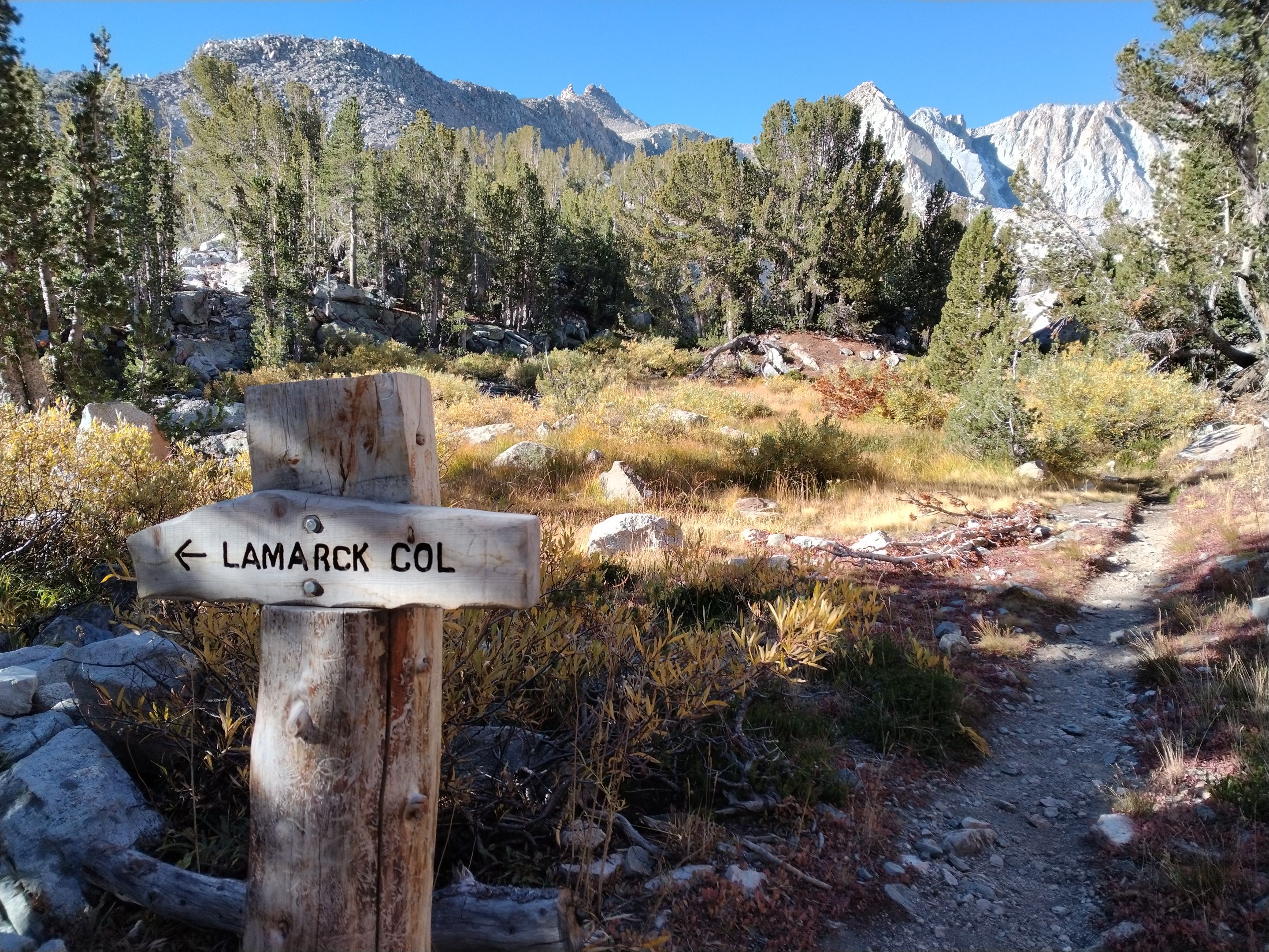 Trail junction for Lamarck Col
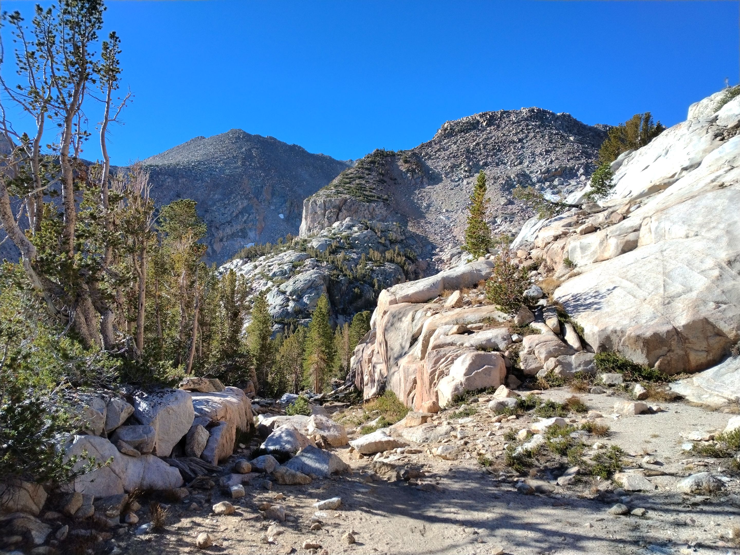 Going up and down through the granite
 Looking back at Upper Lamarck lake
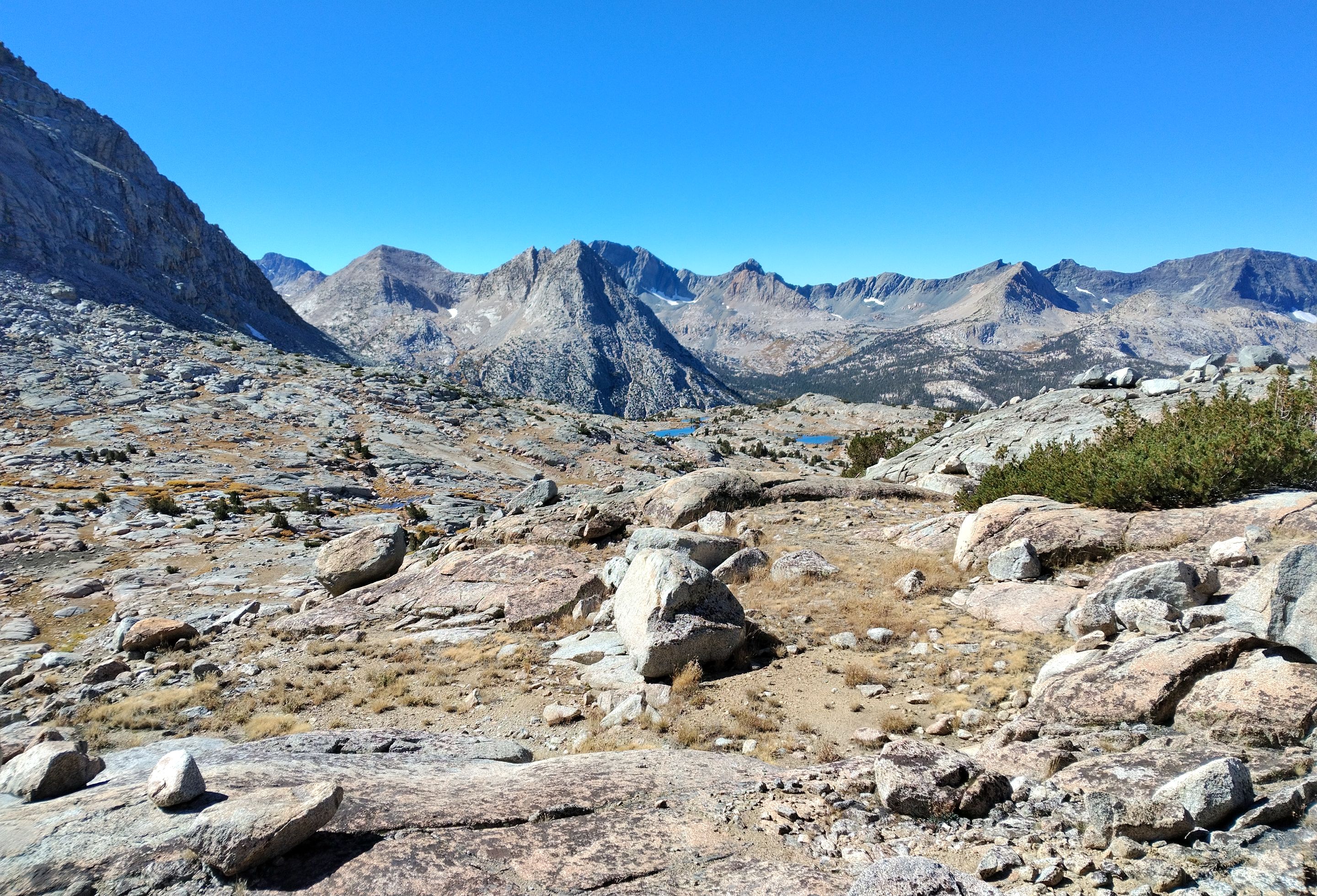
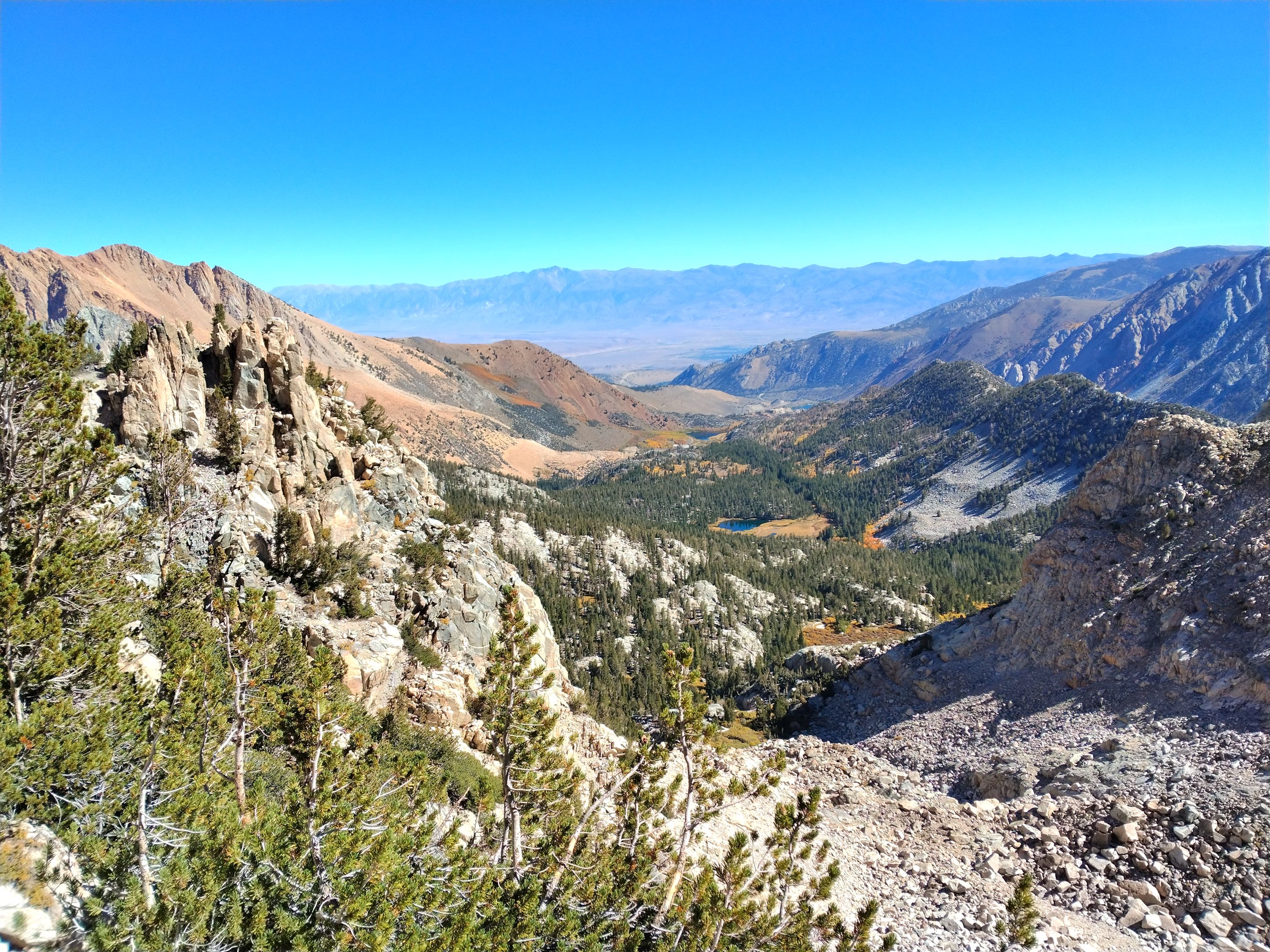 Views overlooking Grass lake and North lake
 Hiking up the barren chute passed the small glaciers
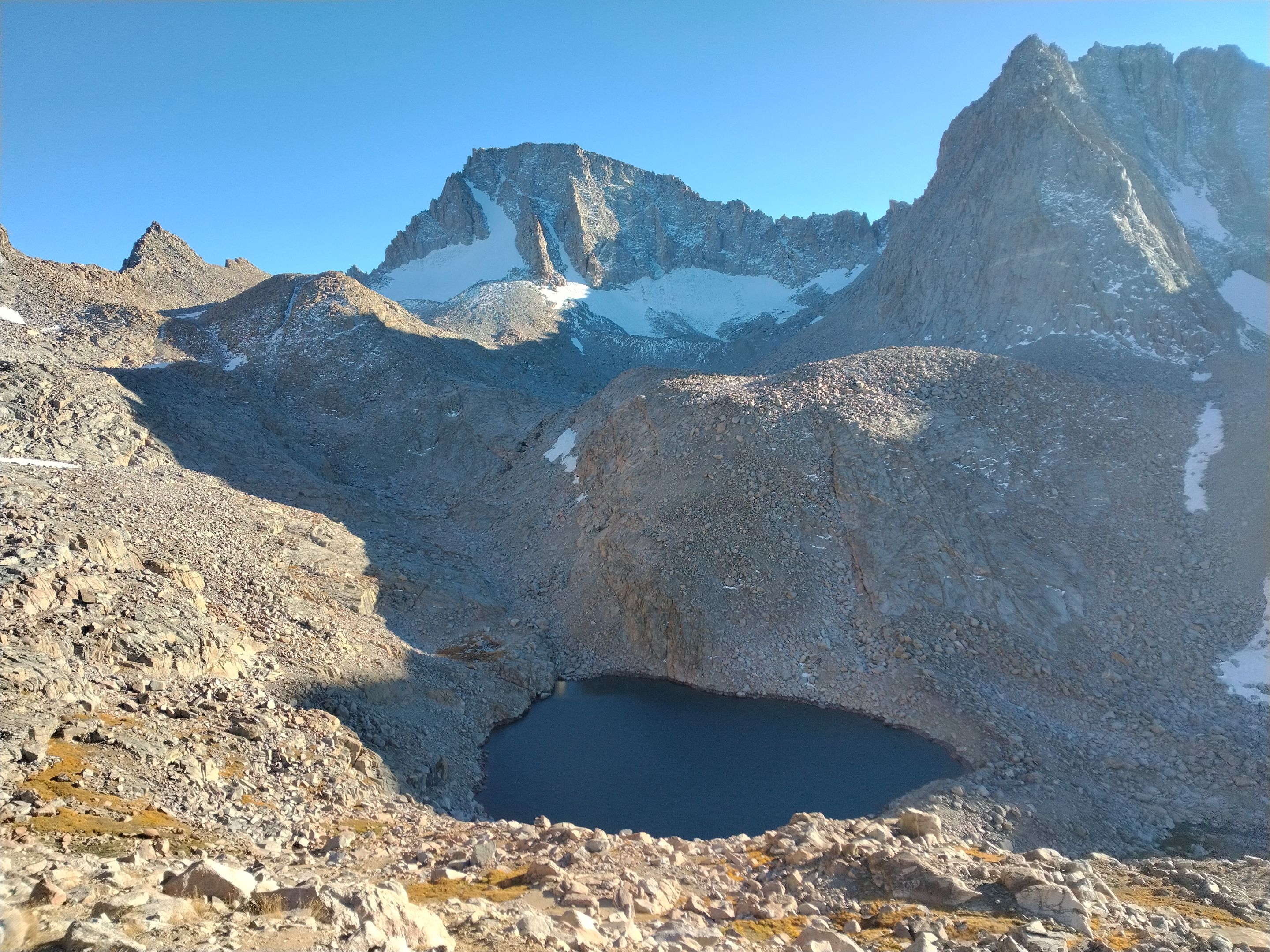
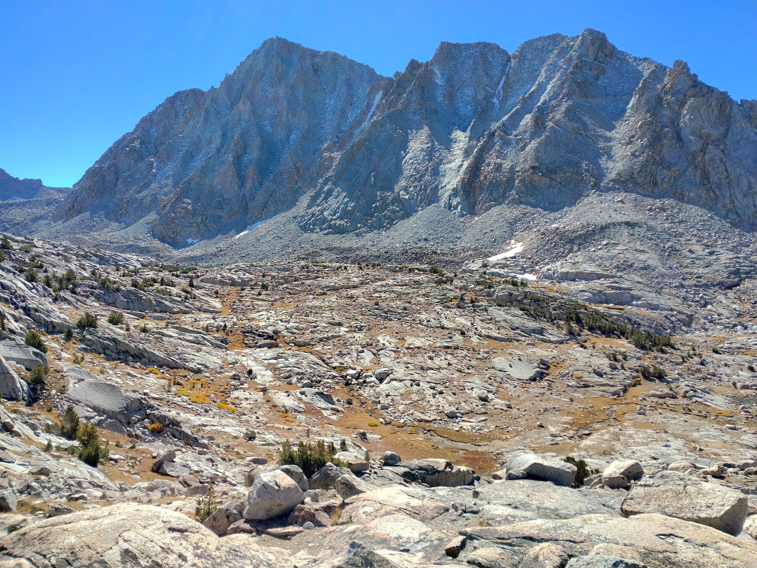
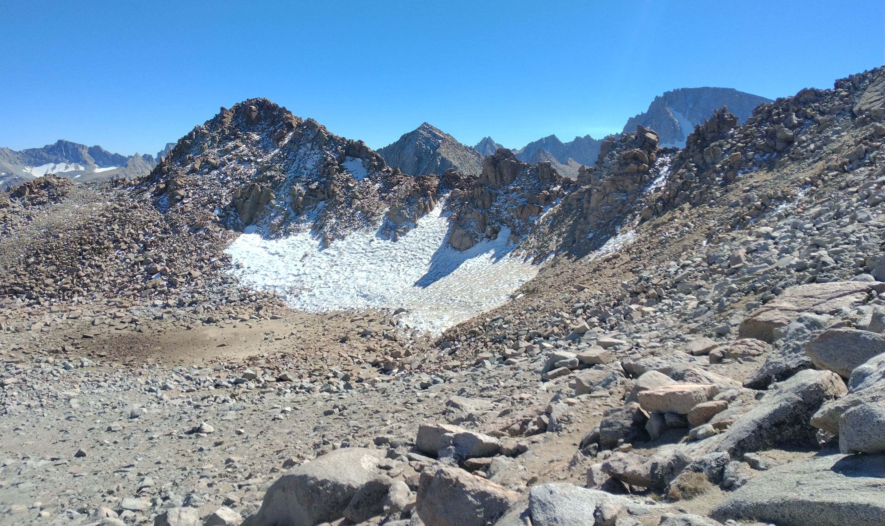 The dry lakebed, the glacier, and Lamarck Col from the south slopes of Mt. Lamarck
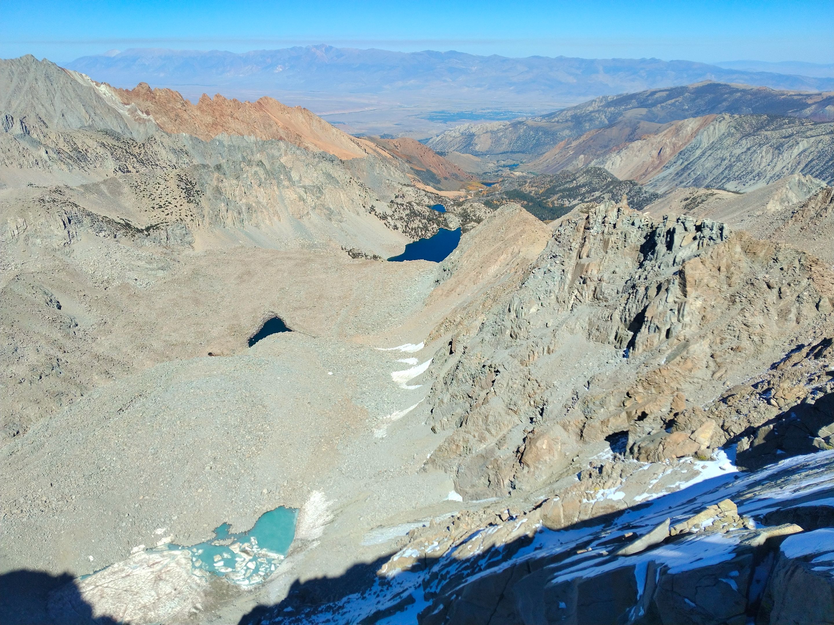 Views from the summit of Mt. Lamarck
https://youtu.be/pYvHF68B9WI
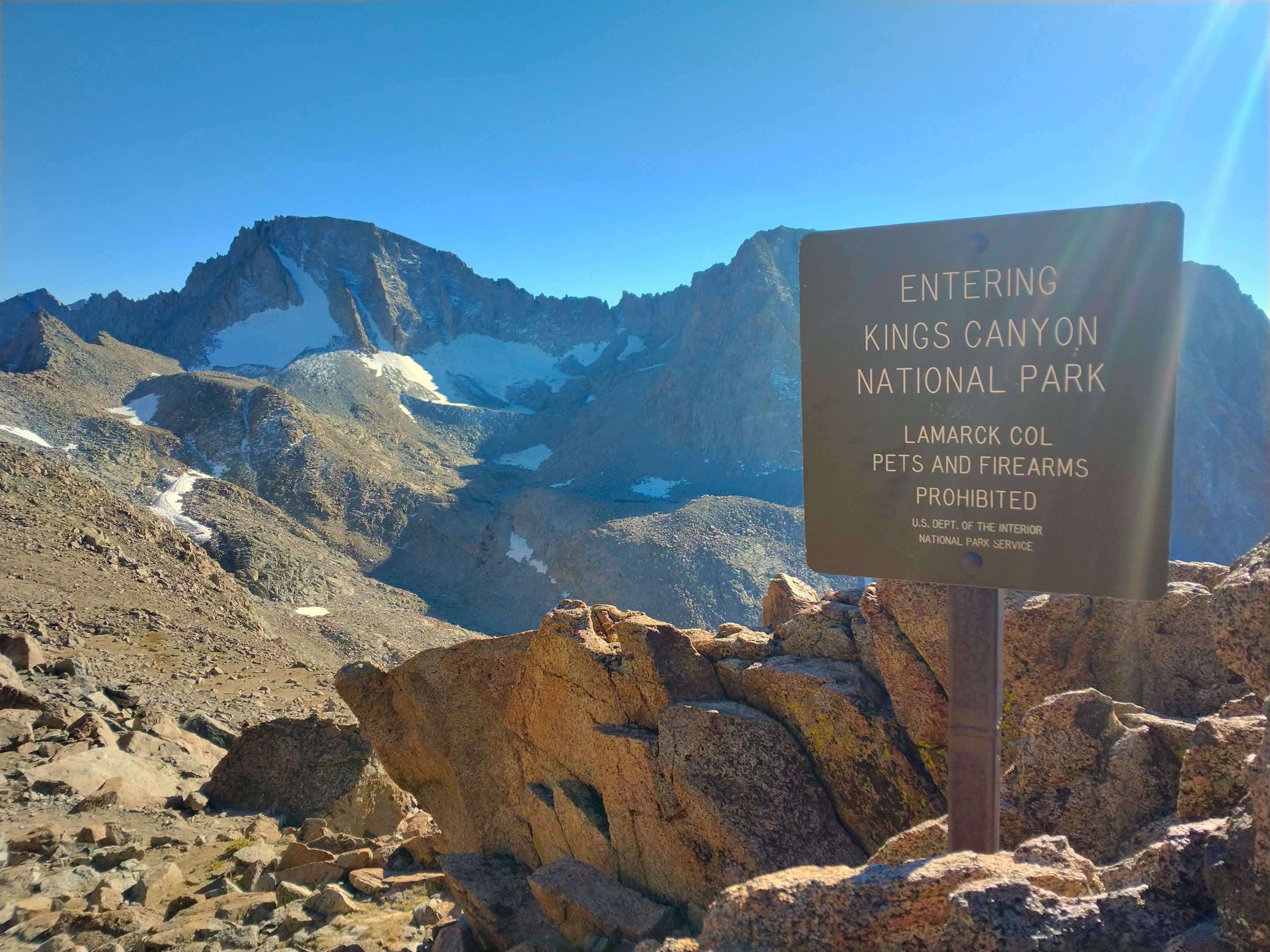 The sign at Lamarck Col
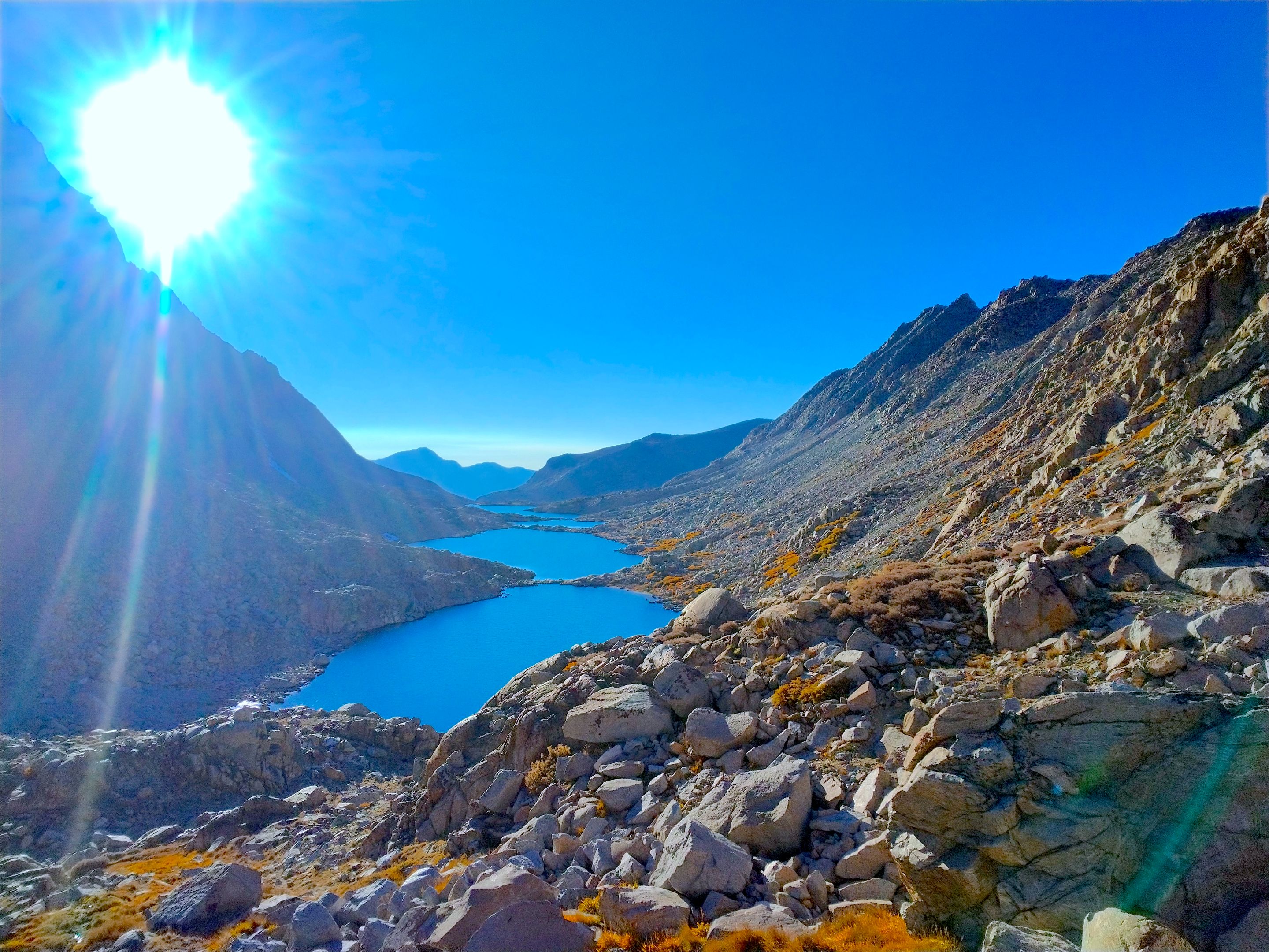
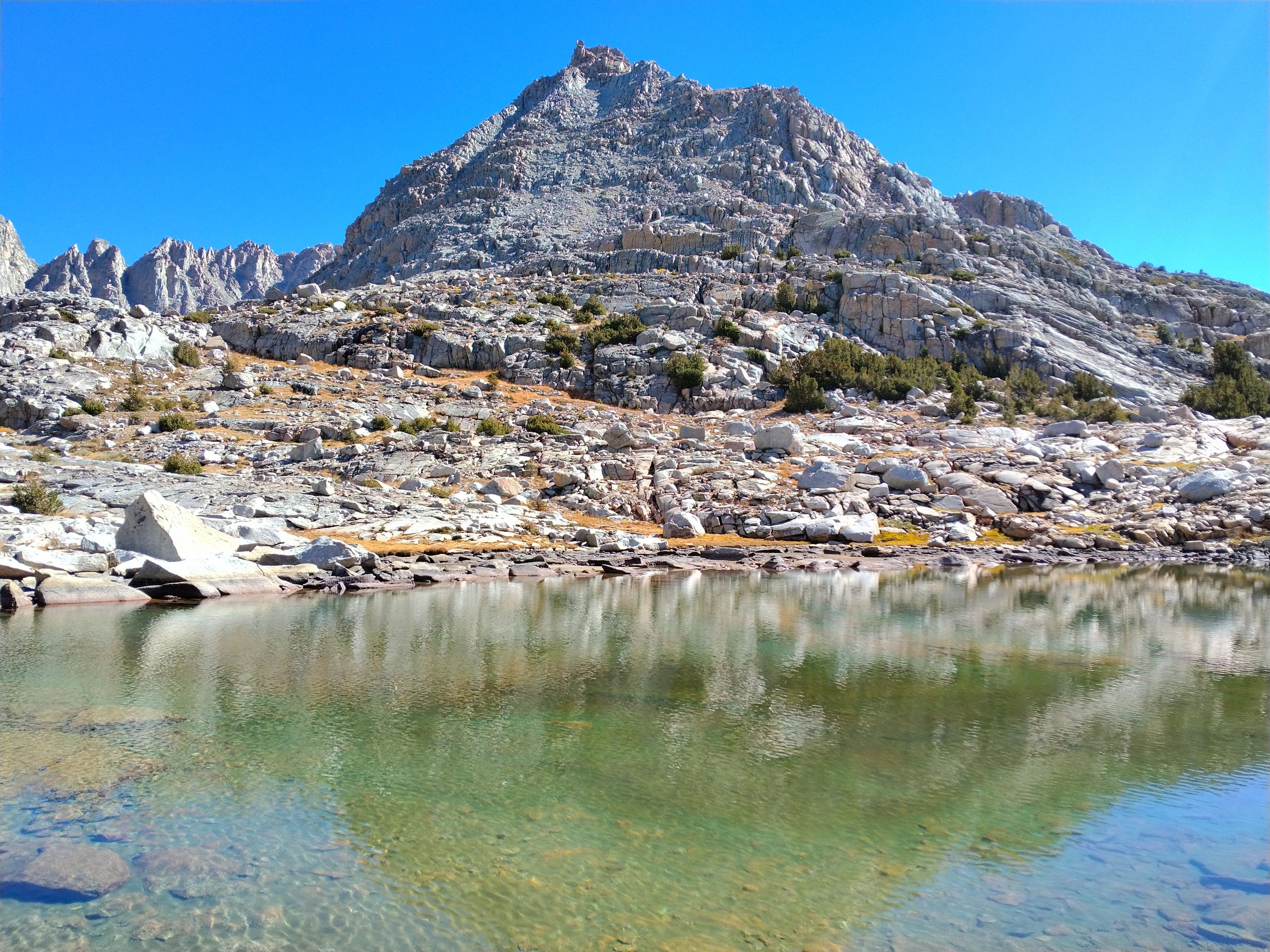
 Dropping into Darwin canyon. Mt. Darwin(left), Mt. Mendel(right), and the uppermost lake in the canyon
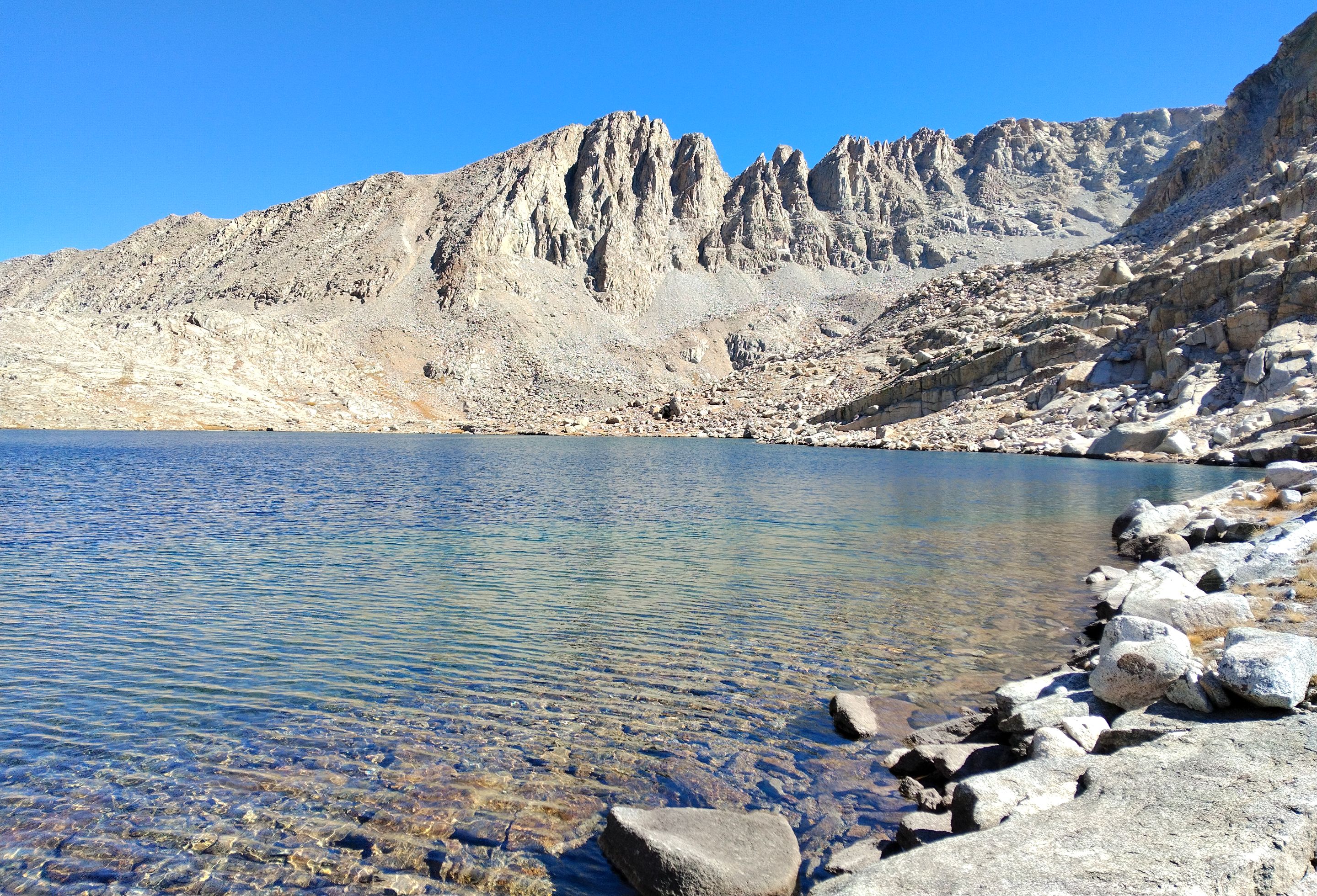
 Looking down Darwin canyon
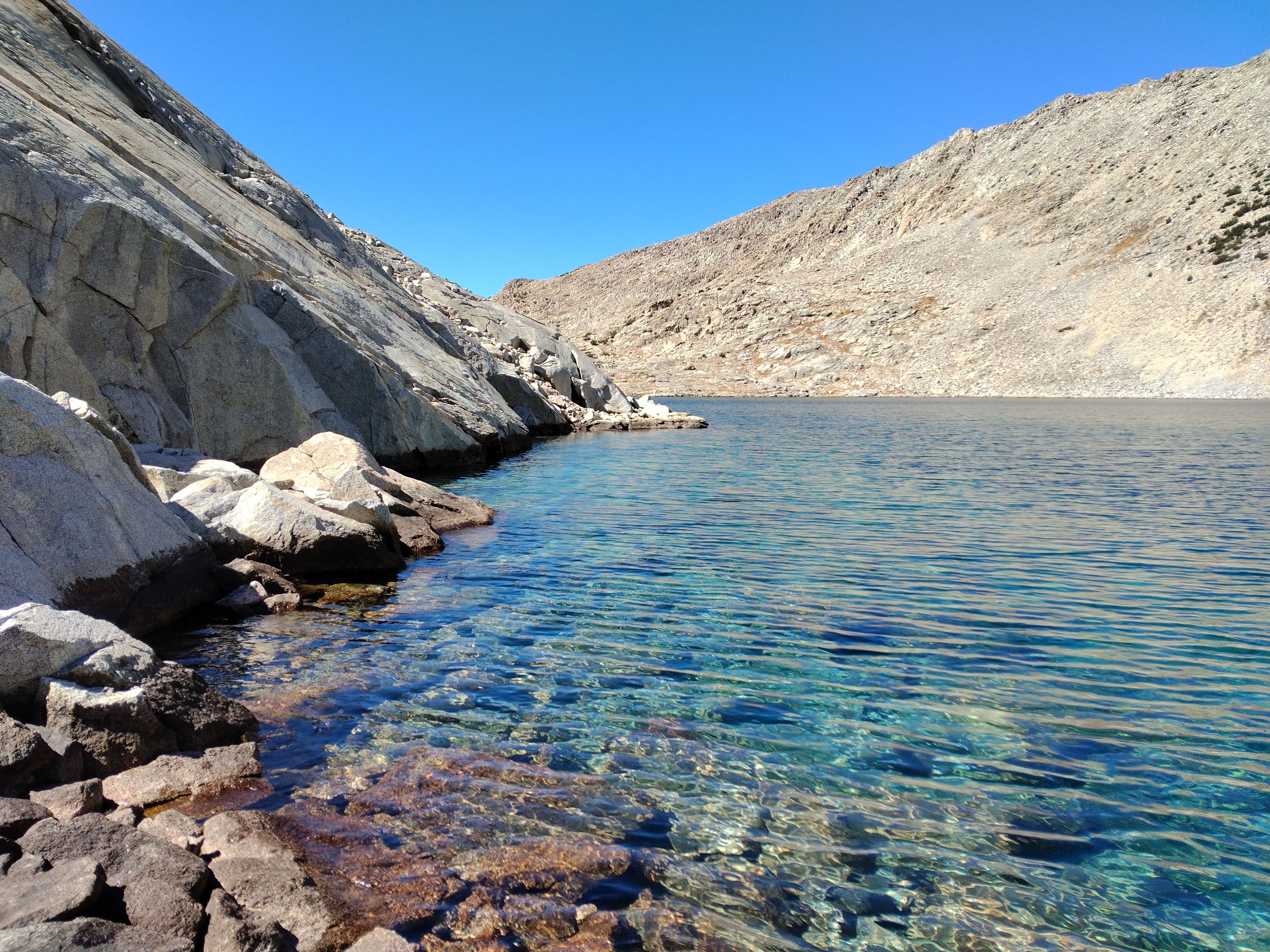
 The second lake in Darwin canyon
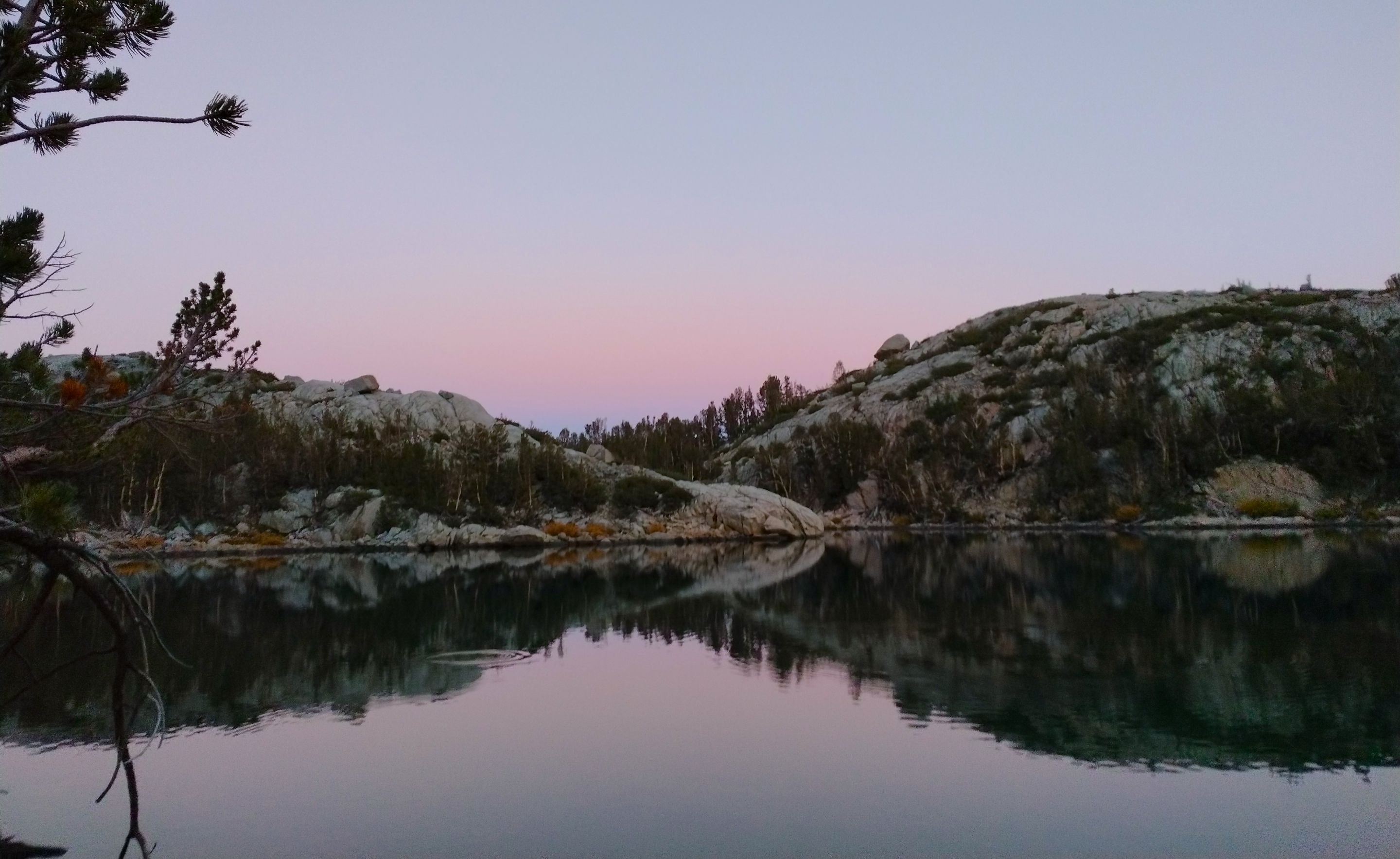
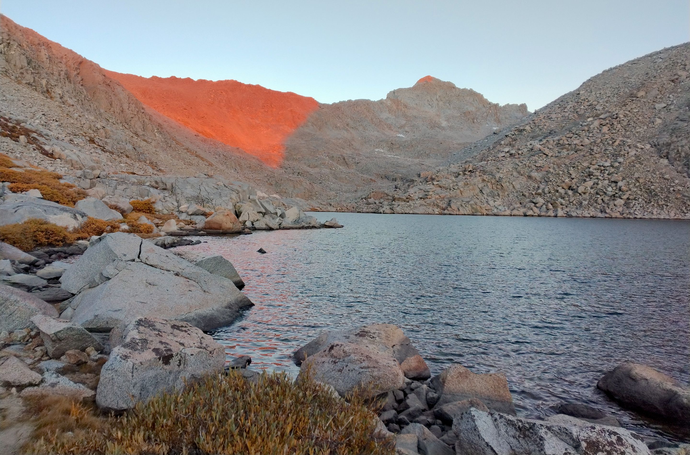 Sunset glow from my camp at the third lake
 My camp
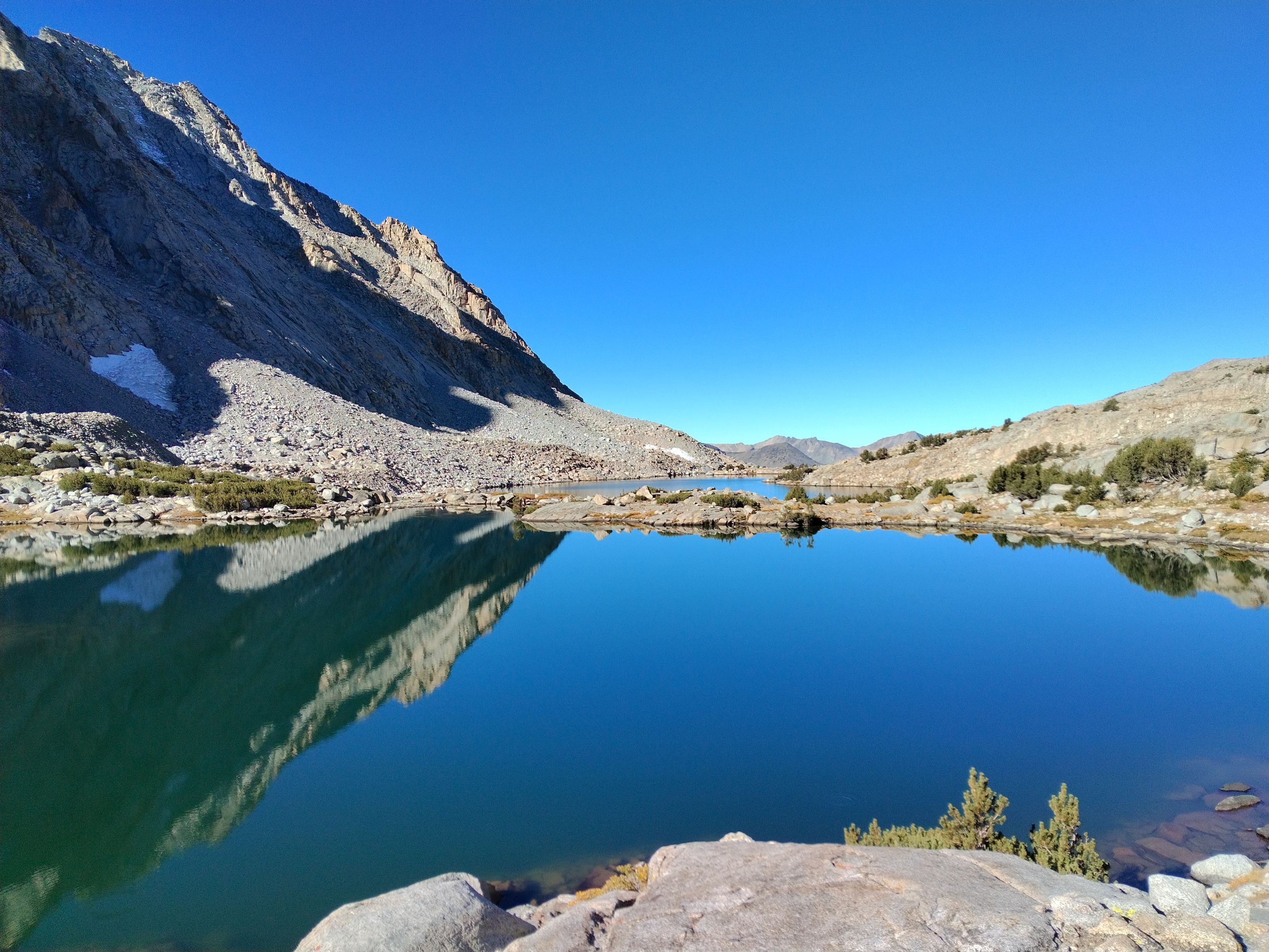
In the morning I woke up and decided to try some fishing and caught a few small trout. After that I had breakfast, packed up camp, and then continued making my way down Darwin canyon. I made my way around the third lake which was smaller, but still nice, and then around the fifth and final lake which was probably the most scenic lake in the canyon. While going around the fifth lake I stopped to get some water and while I was sitting there drinking it I had an interesting little encounter with a coyote. I saw him cruising around the lake, but he didn't see me until he was only probably 20-25 feet away. He stopped once he saw me and we just looked at each other for a minute before he decided to avoid me by cutting up and over a granite outcrop. Getting around the last little bit of the fifth lake I had to navigate through some small granite cliffs, but luckily nothing that was too difficult. From there I cut across the upper part of the Darwin Bench trying to descend only as much as the terrain forced me to before cutting up through a chute to a small lake just above the first of the three huge lakes below Mt. Goethe (which I learned is pronounced more like Goo-tah and is named after some old famous German writer). As I got to the far end of the first big lake I ran into another challenge. There were some cliffs that came all the way down into the water. Navigating through the cliffs looked like it would be challenging and potentially dangerous and below the cliffs it looked like I could potentially wade through the water and only get a few feet deep. So I opted for the wade. I took off my boots and socks and took everything out of my pockets and headed into the lake. The water was absolutely freezing, but for the most part the wade was pretty straightforward... except one spot. About halfway across I got to a point where it required a few technical moves along the cliff and any mistake would send me swimming in the lake and everything would be wet. Luckily I handled it fine and got to the other side and got my legs and feet dry and got my boots back on. From there I made it over to the second of the three big lakes. There were some nice camping spots there inbetween the two lakes, but I still wanted to go farther so I made the climb up to the third and last of the big lakes. All three of the lakes were very impressive, but the upper one was especially nice. I found a nice spot to setup my camp just above the southern shore. It was a bit breezy, but luckily the location of my camp spot provided some pretty good wind blockage. After camp was all setup I had some lunch and while I ate I eyed Mt. Goethe. It was already afternoon, and I was already pretty tired, but I really wanted to climb Goethe. So I decided to give it a try. I made my way up the southeastern slopes. But being tired already I was going pretty slow. And the wind was now blowing smoke right at me from some distant wildfire out to the southwest. After climbing for awhile I was realizing that I probably wouldn't be able to make it to the top and back before dark. So with that, the wind, the smoke, and my tired legs, I made the decision to give up and abandon the climb and head back down to camp. Hopefully someday I'll be able to get back out there and plan on dedicating a full day just to climb Goethe. Once back at camp I went down to the lake to try some fishing, but didn't have any luck. So I headed back up to camp, made some dinner, watched the sunset, and then settled in for the night.
 My camp in the morning
 Morning fishing
 The fourth lake
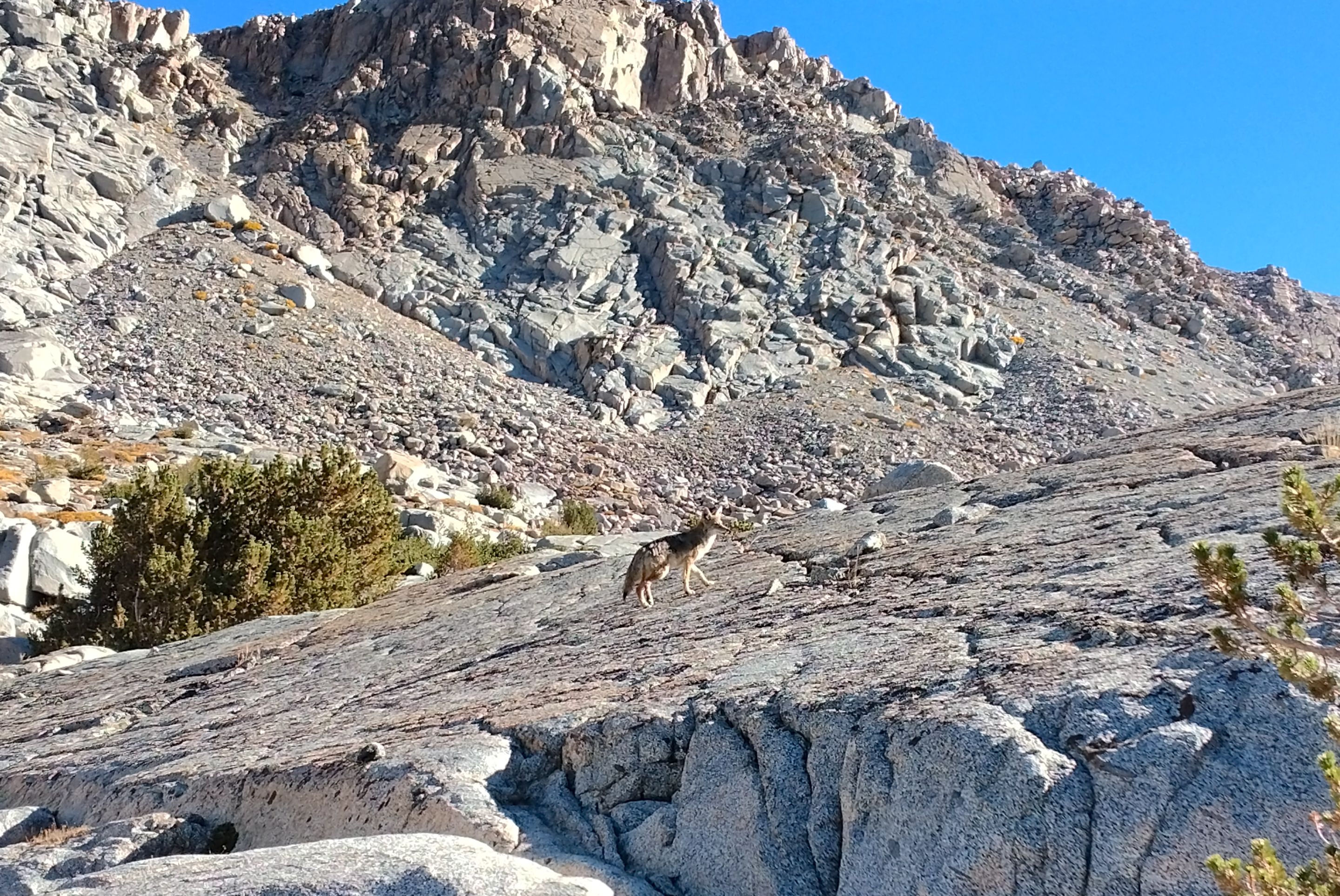 The coyote
 The fifth lake
 The fifth lake
 Crossing the Darwin bench
 Looking back towards Mt. Mendel
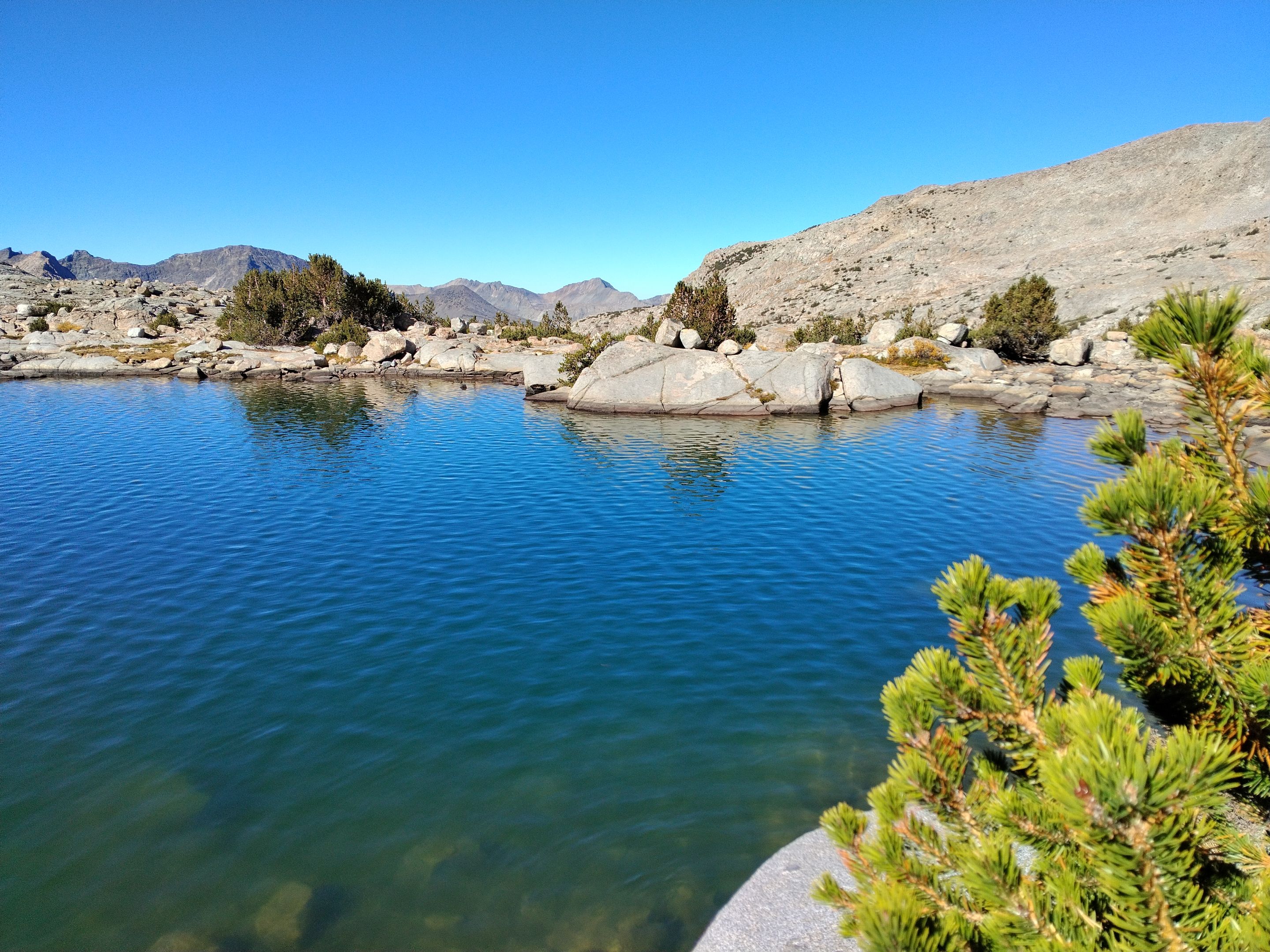
 The small lake
 The first of the three big lakes
 The section I had to wade through
![image.png](https://files.peakd.com/