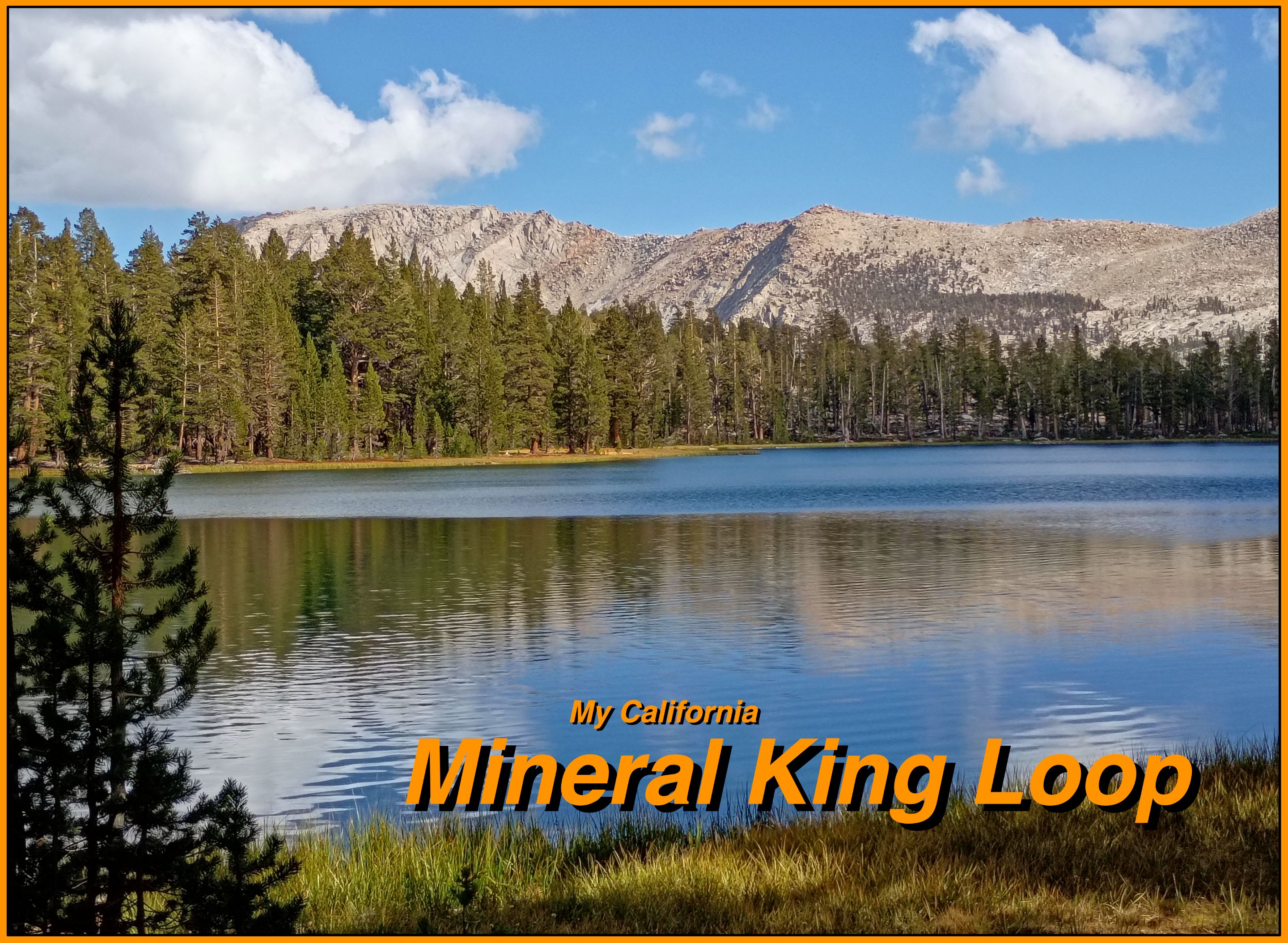
For this weeks [Show Us Your California](https://peakd.com/mycalifornia/@thesocalhive/show-us-your-california-contest-week-276) contest by @thesocalhive I headed up into the Sierra Nevada mountains to spend 5 days backpacking the...
Mineral King Loop!

Every year my mom and I try to get in at least one backpacking trip together and this year we planned a great 5 day loop in the Mineral King area in the southwestern corner of Sequoia national park. It's a really long and tedious drive out to Mineral King so we decided to drive up the day before we started and spend the night at the Cold Springs campground. Along the drive we passed through several giant sequoia groves which was really cool and at the campground we had an awesome site right next to the east fork of the Kaweah river!
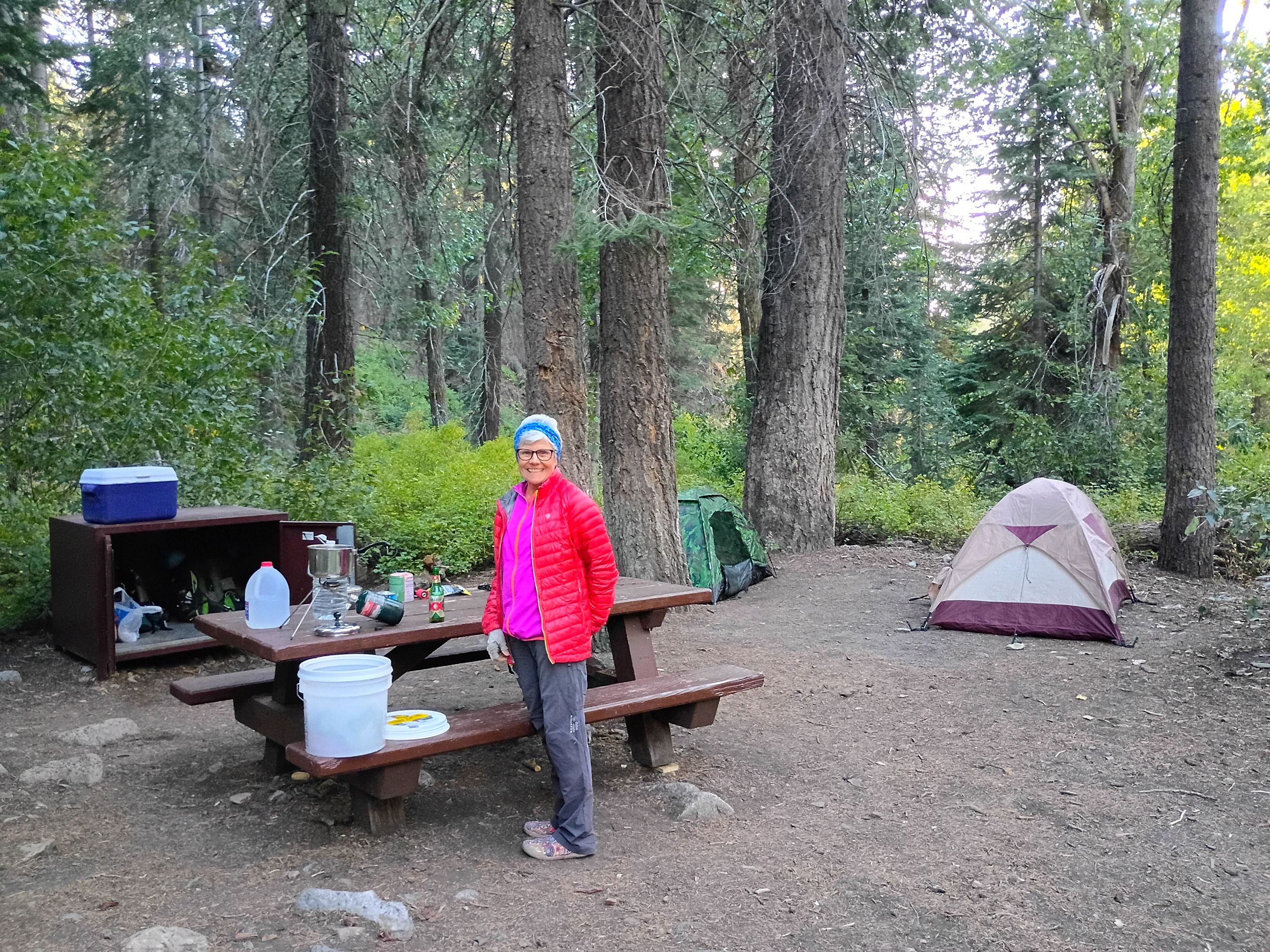 Mom at our site at Cold Springs
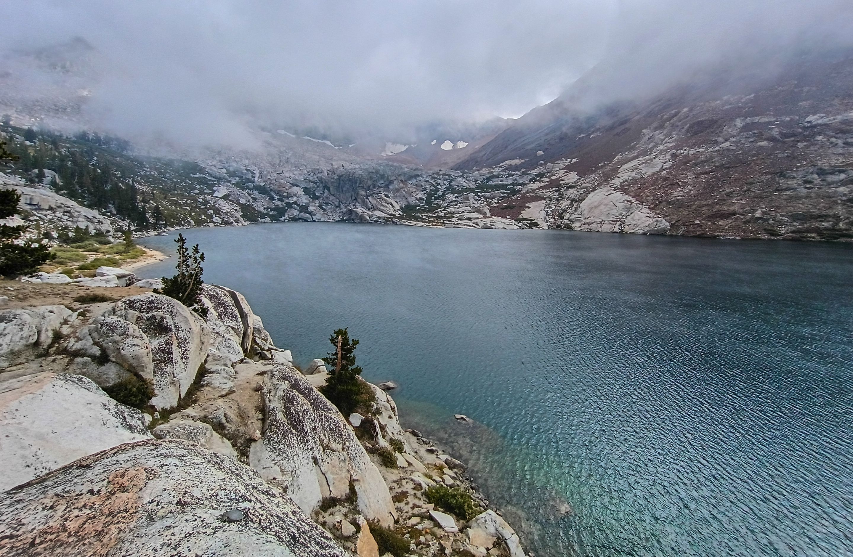
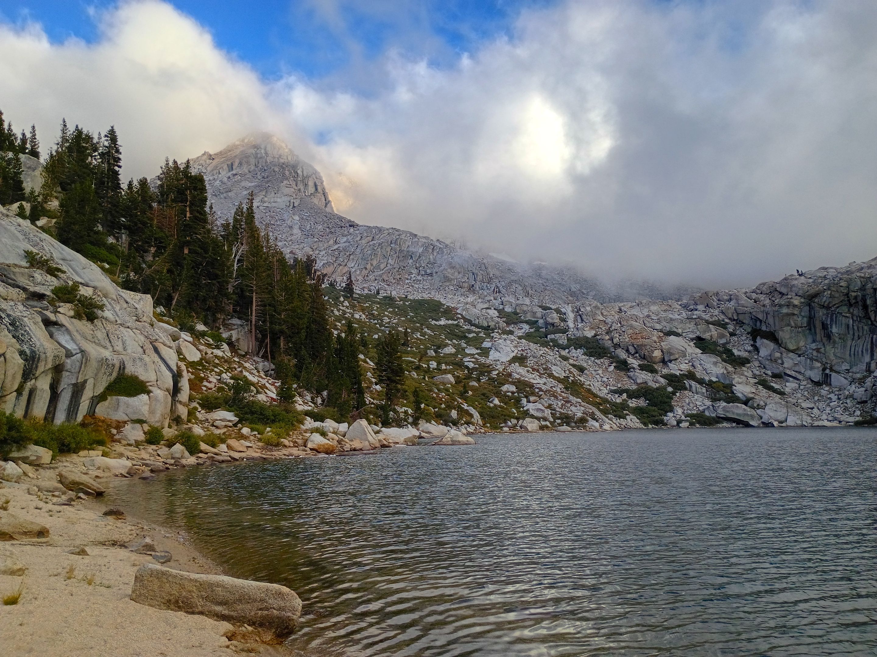
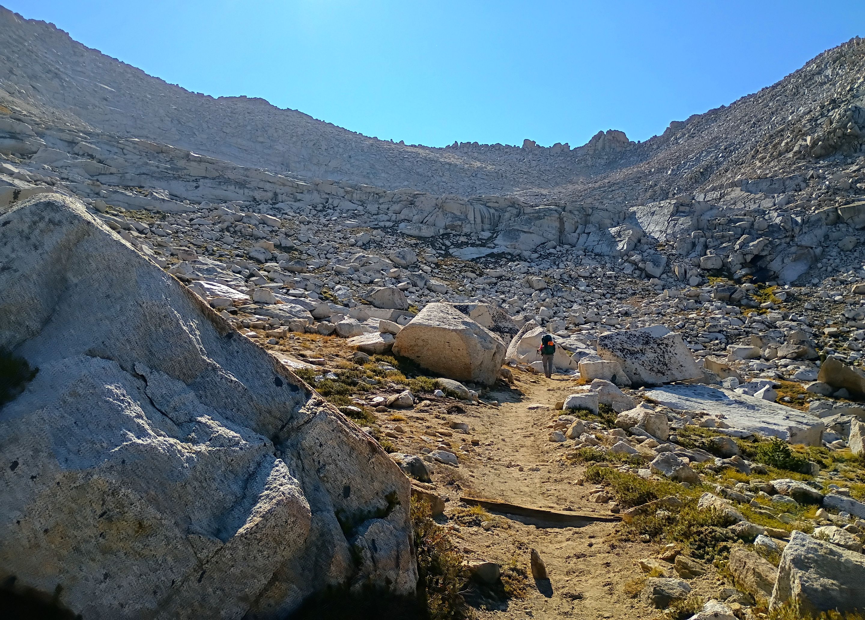
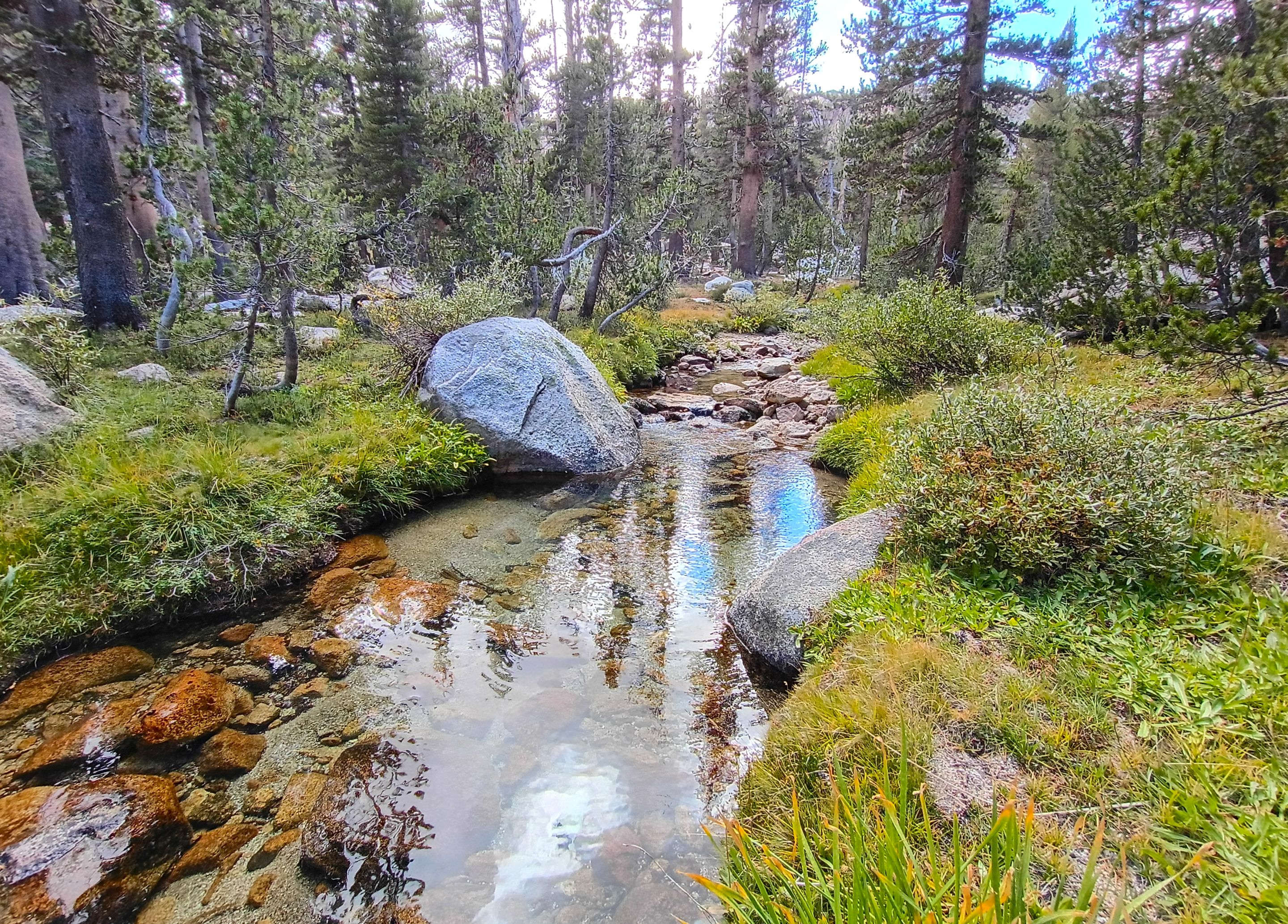
The next morning we headed up to the trailhead and started our hike. The hike started out fairly level for the first two miles as we hiked along the bottom of Mineral King valley. The scenery in the valley is really beautiful. The river runs right down the middle surrounded by open meadow with aspens and pines dotting the edges, deer meandering about, and waterfalls coming down from the many creeks that flow into the valley from the huge mountains that surround it. After the first two miles we arrived at Franklin creek where we were greeted by another awesome set of waterfalls. We stopped for a quick water break there and then continued on up the trail. From here the trail was much steeper climbing up high above the valley floor. Which was a bit tiring but the awesome views made up for it. The trail cut up into Farewell canyon and eventually we reached the trail junction. And this is where our loop began with one fork leading to Franklin lakes, our destination for the day, and the other fork coming down from Farewell Gap which we would be crossing over at the end of our trip. At the junction there was a nice little natural spring so we stopped for another water break there and then started making our way up towards the lakes. Along the way we passed by a spot where at some point in the distant past there had been some mining. We didn't have the time or energy to really explore the area extensively, but it was cool to see some of the old artifacts lying around just off the trail. Passed that we crossed Franklin creek again in a nice little meadow full of wild onions and then started the final climb up to the lake. As we climbed the clouds were building and we were starting to worry that it might rain on us before we got there, but it didn't. The trail actually ended up being much higher than the lake itself so when we finally arrived we were overlooking the lake from above, but we quickly found a good spot to cut down and ended up finding a really nice spot to setup camp right by the water. After camp was setup we found a natural spring pouring right out of a granite cliff which provided us with some nice clean water. Once we were all settled in I headed out along the shoreline for a little bit of fishing and ended up catching 7 nice Brook trout! And while it never rained on us, the previously mentioned clouds were quite the spectacle. They'd build up and move up the drainage, shrouding us in fog and socking in the surrounding peaks, but then clearing up and receding back down into the valley. And they did this over and over several times. I honestly don't think I've ever seen anything like it. Even after it got dark the clouds continued on with this rhythm. Clearing up and allowing me some wonderful views of the stars, and then coming back with a cold fog and cool breeze that eventually forced me to retreat into my tent for the night.
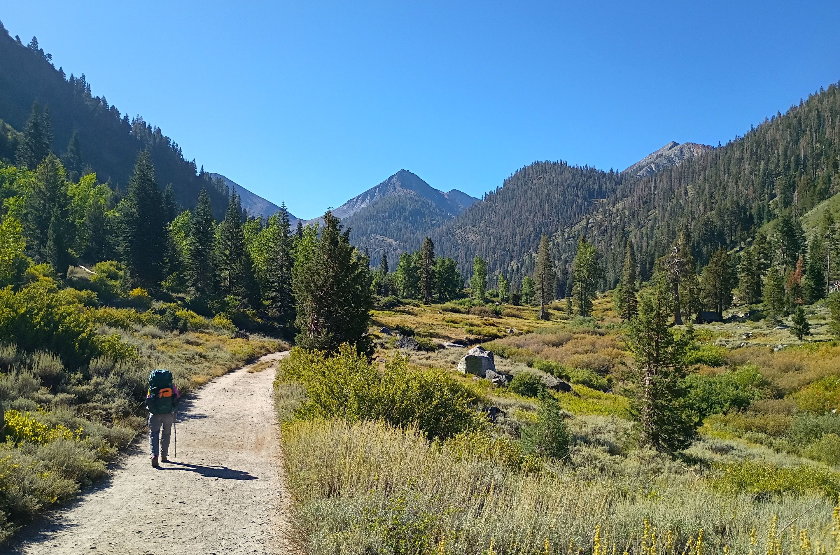 Starting our hike
 Deer sighting
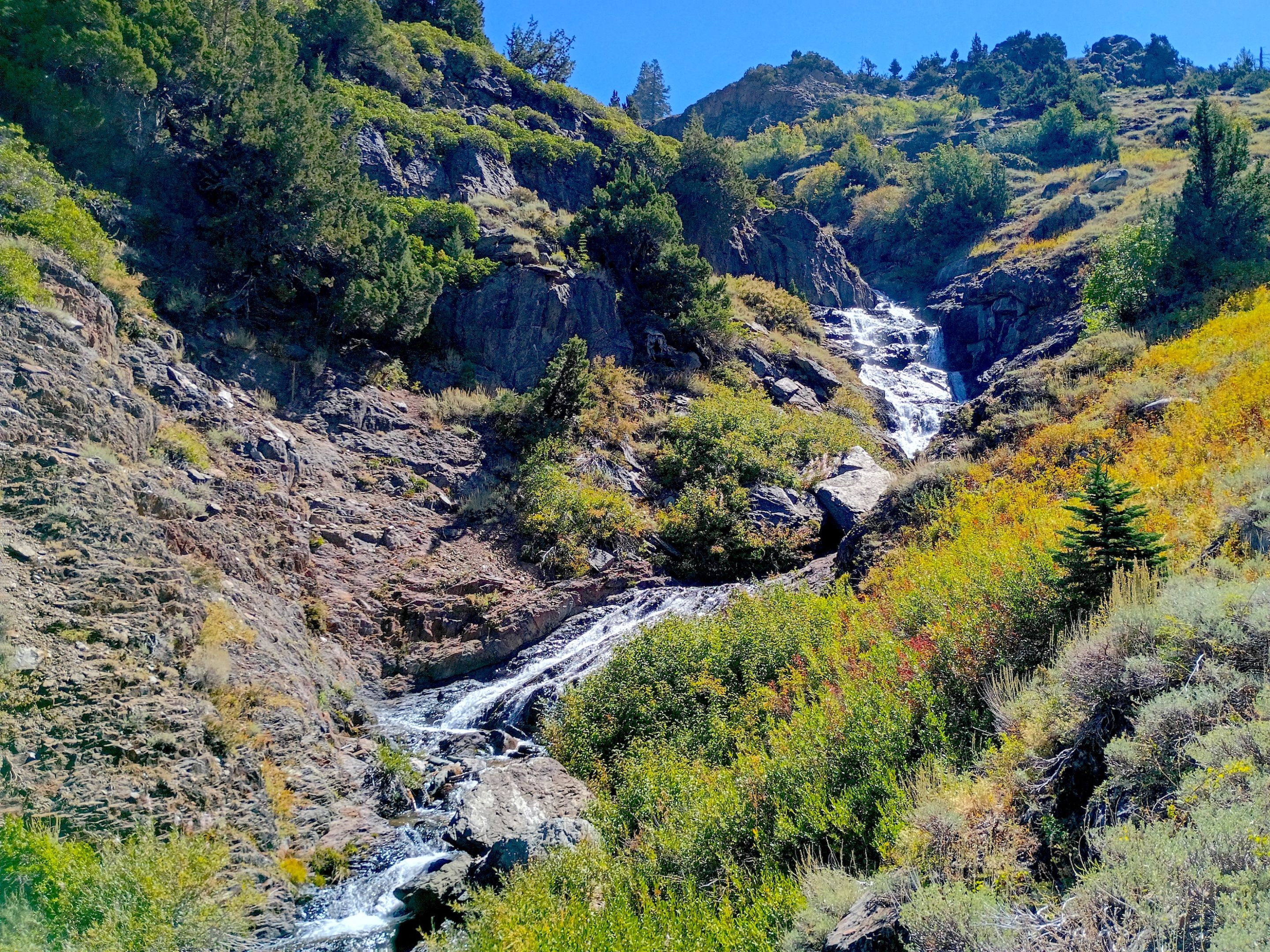
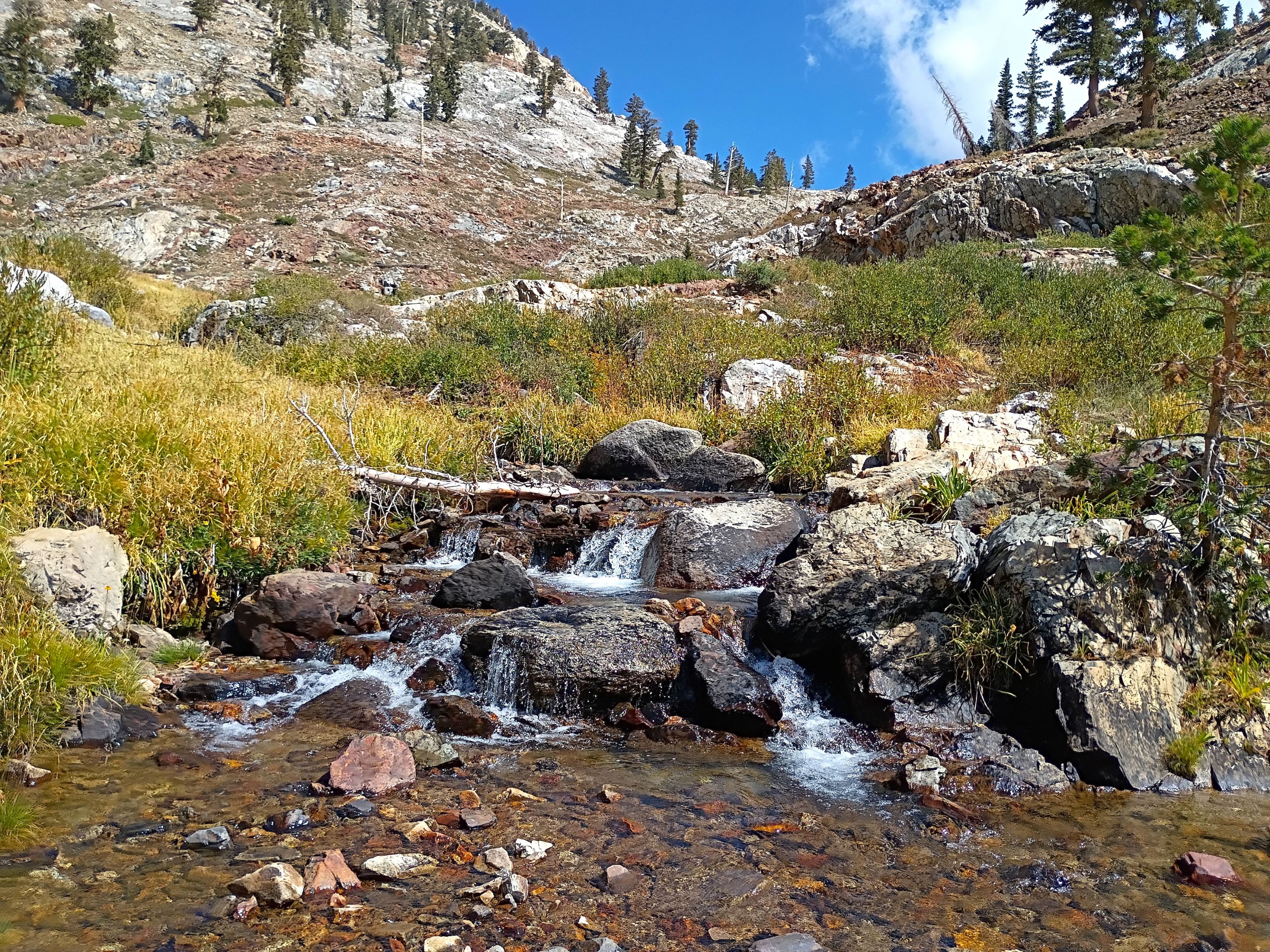
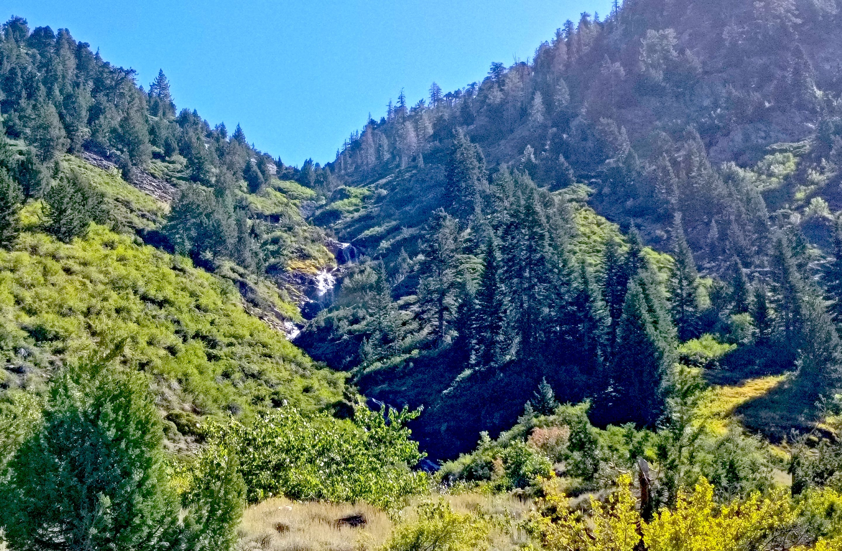 Waterfalls coming down Crystal creek
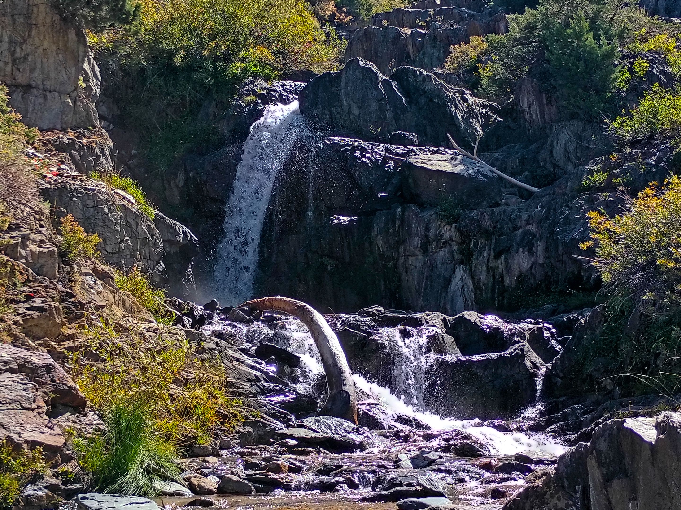 Waterfall at Franklin creek
 More waterfalls at Franklin creek
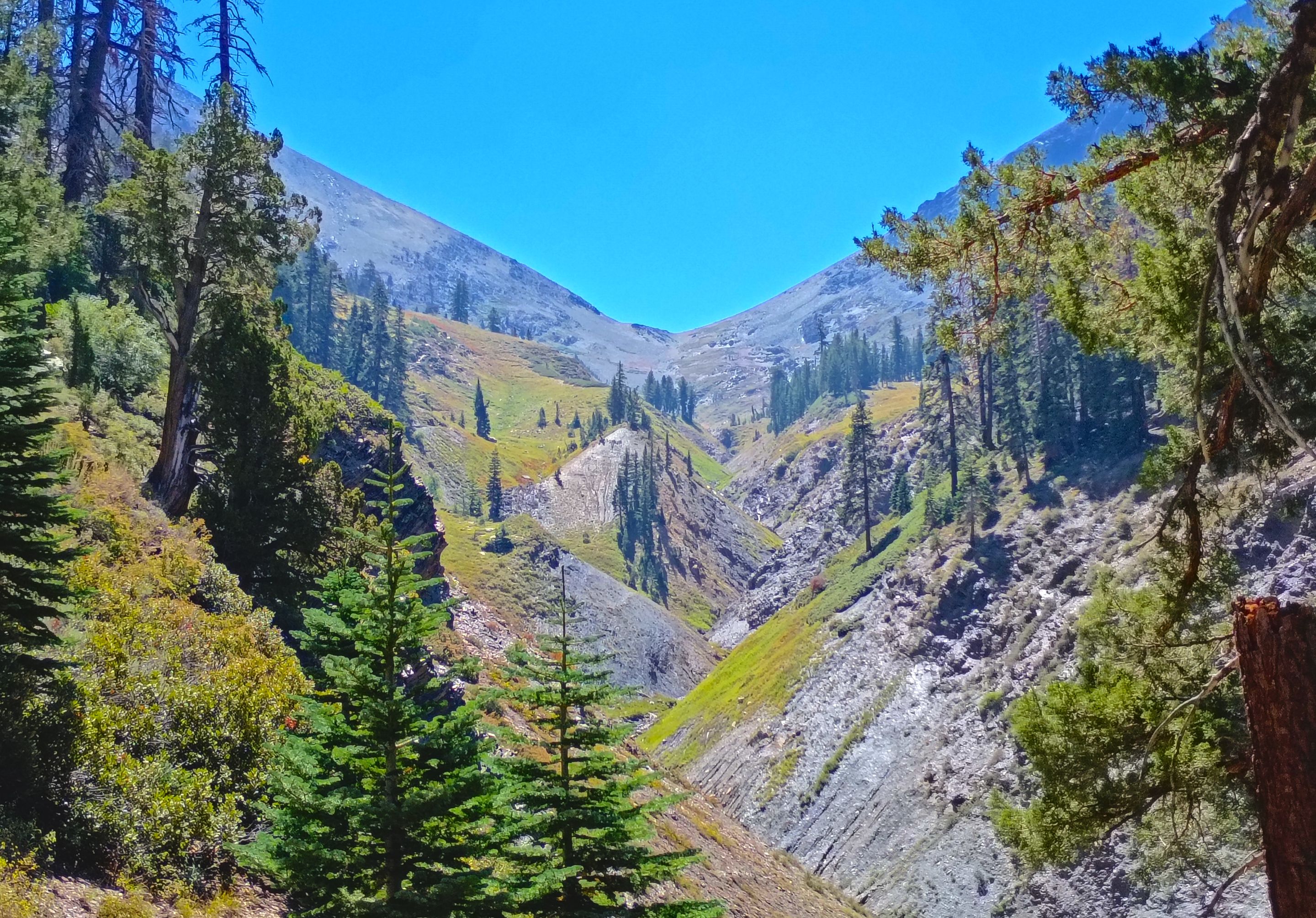 Looking up Farewell canyon to Farewell Gap(our return route)
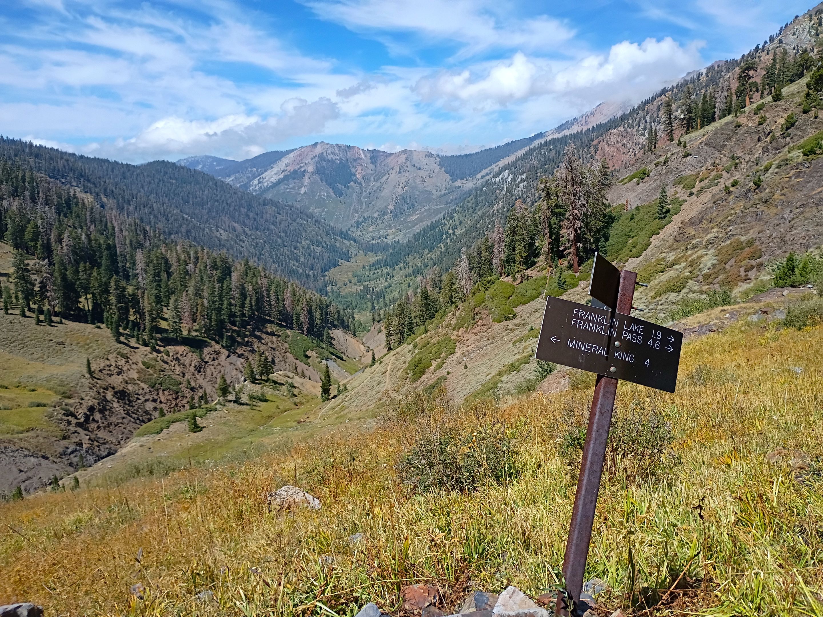 Looking back down into Mineral King valley from the trail junction
 Overlooking Franklin creek from near the old mining site
 Crossing Franklin creek
 Overlooking the small meadow full of wild onions
 Cutting down to the lake
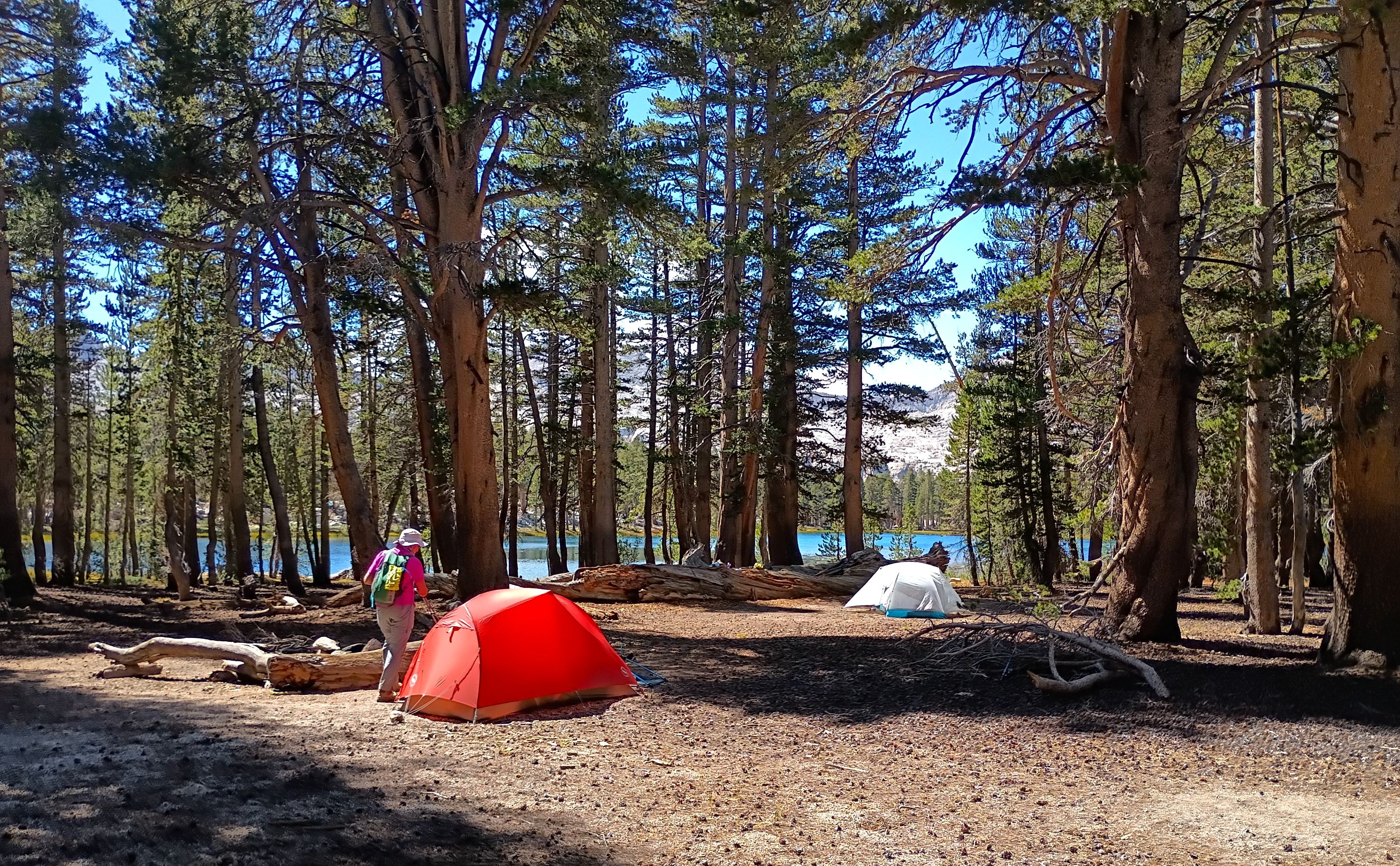
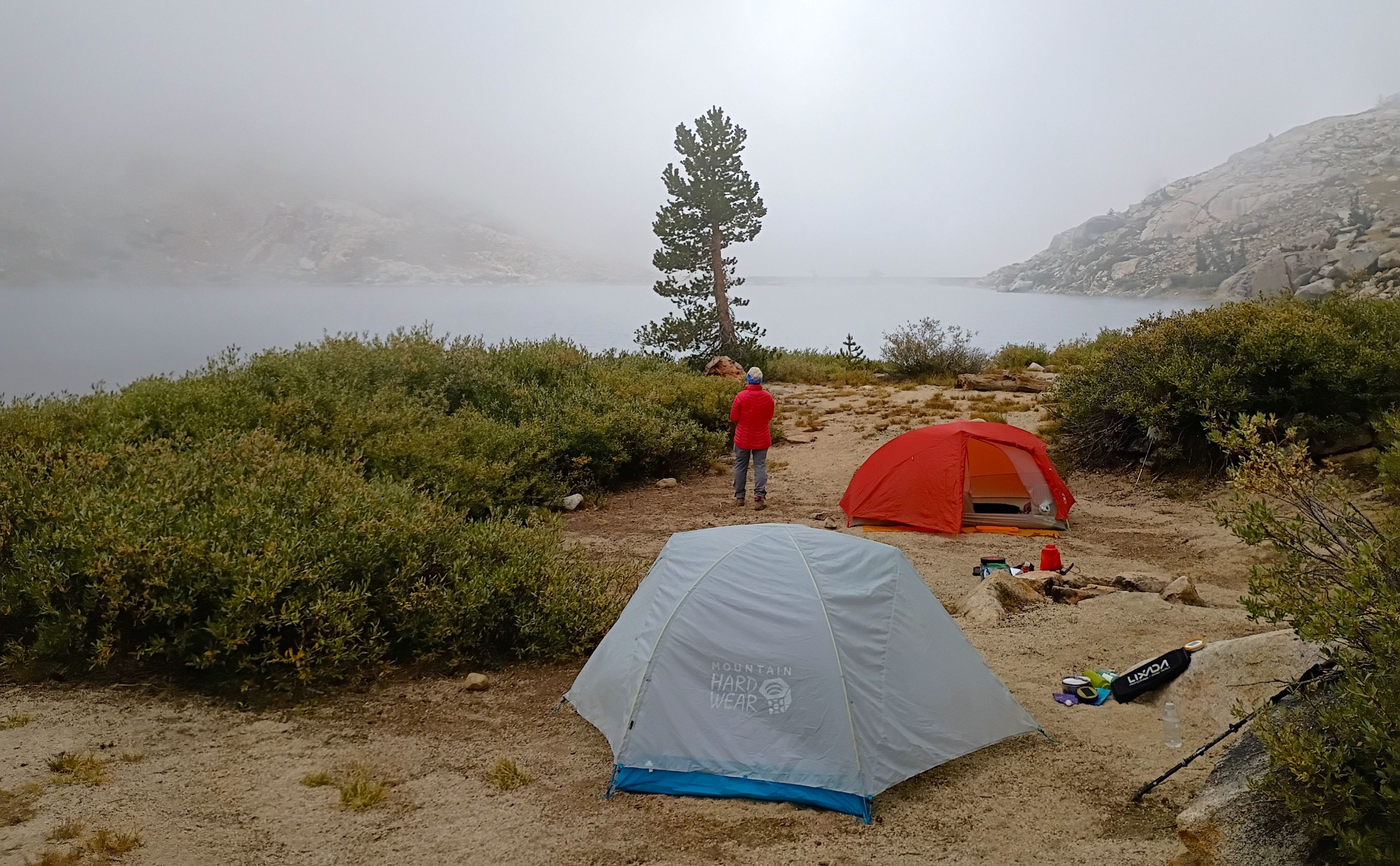 Our camp
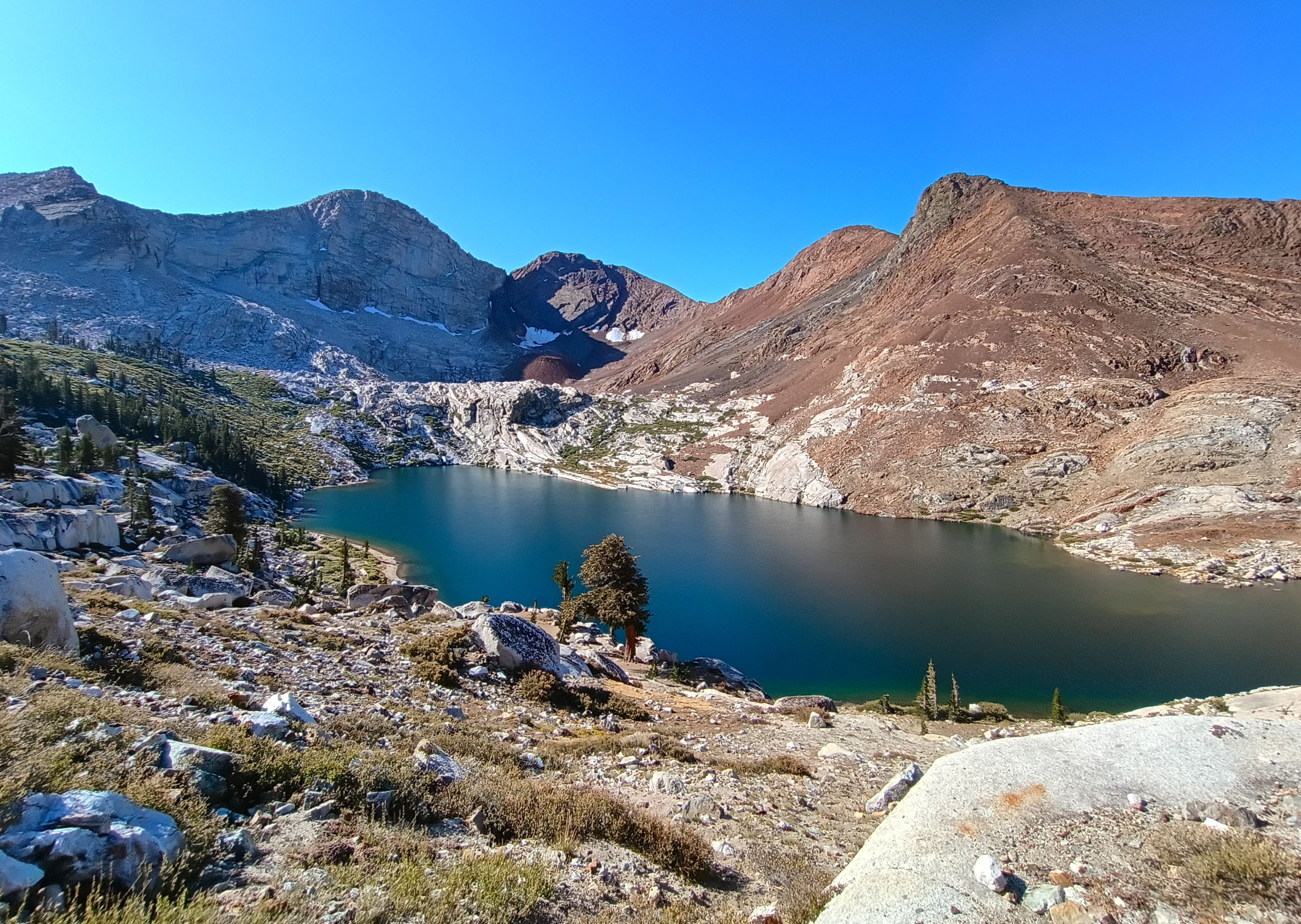
 The lake
 The lake and the granite cliff with the spring(on the left)
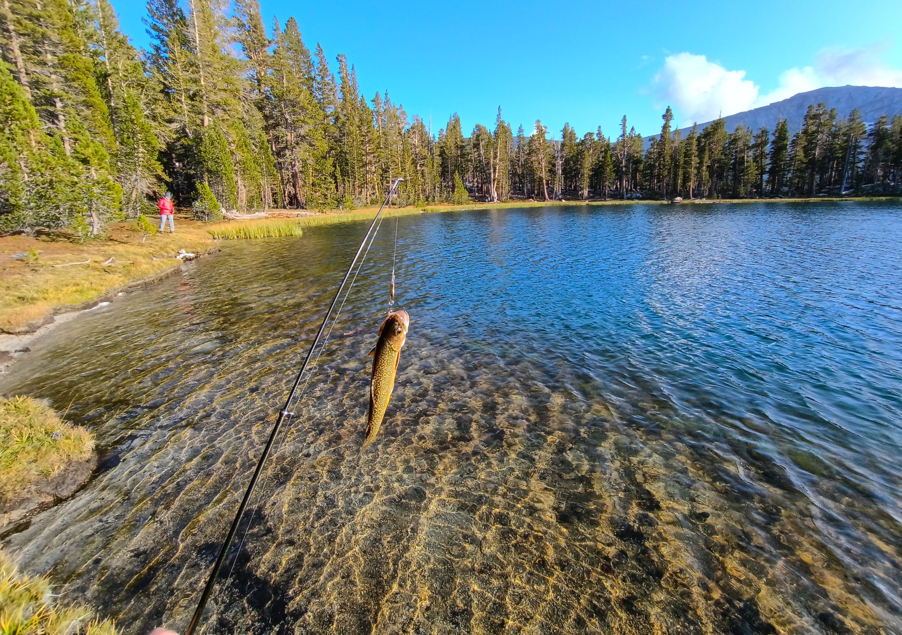
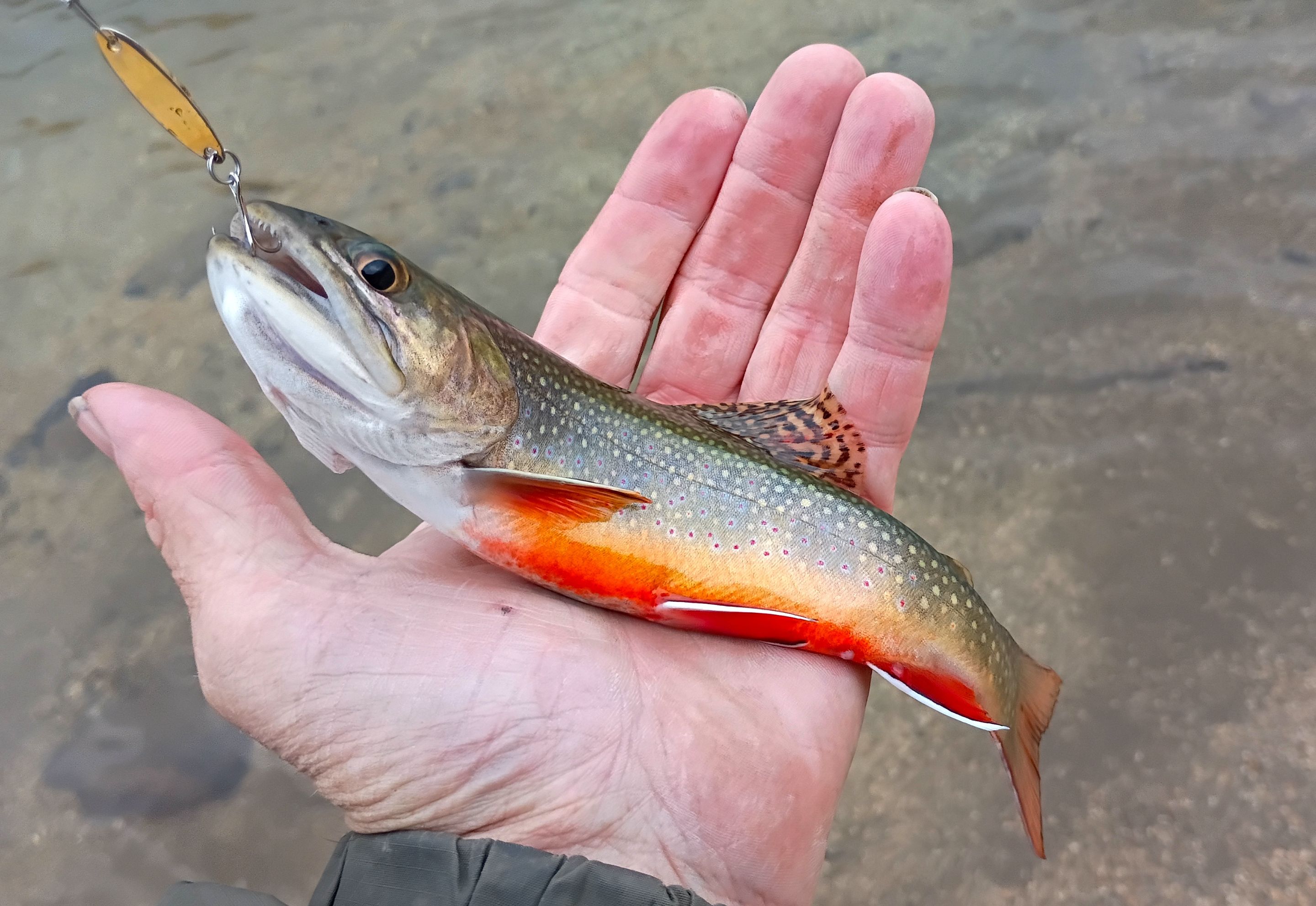 Brook trout
 Fishing
 Fishing
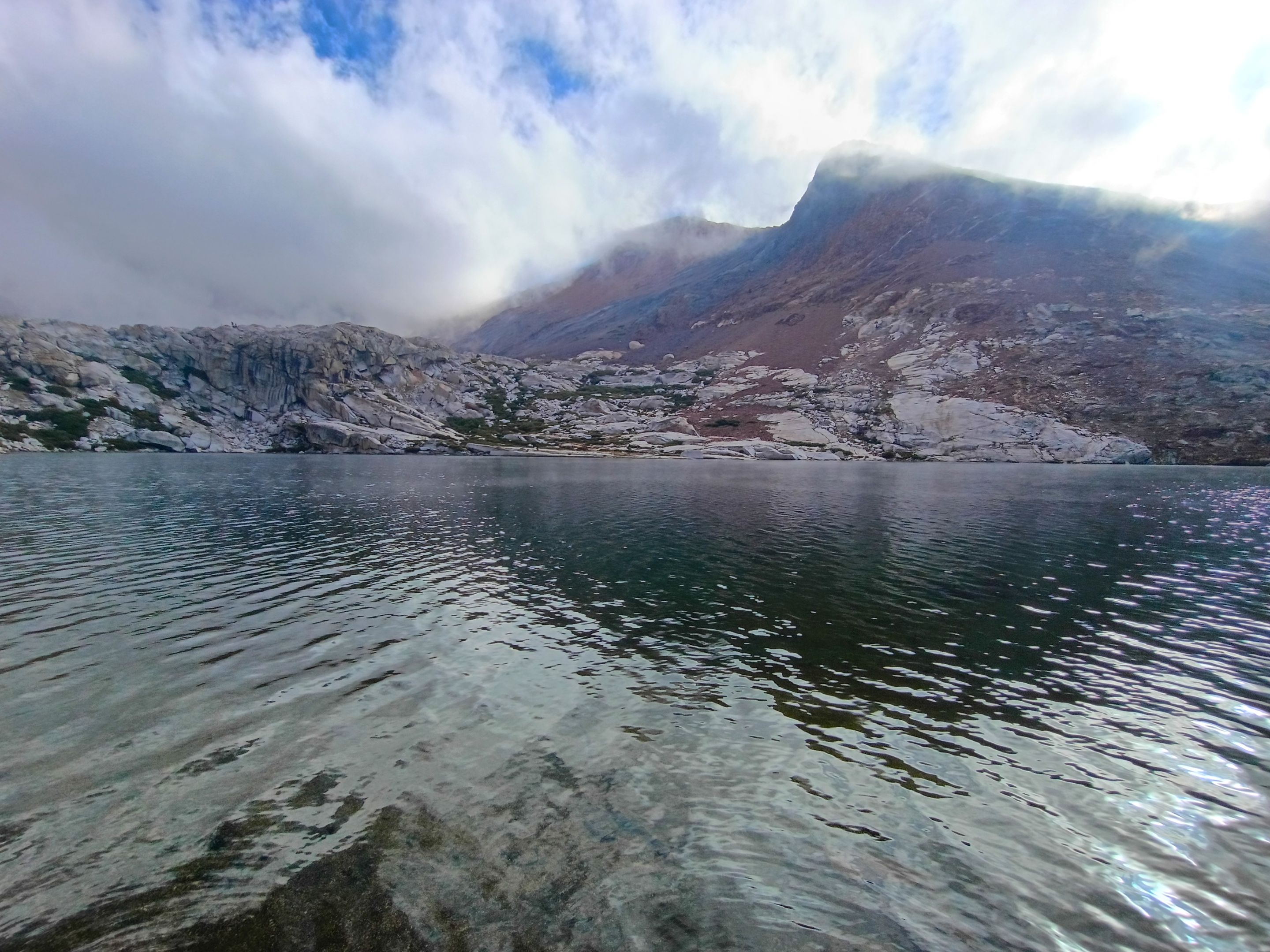
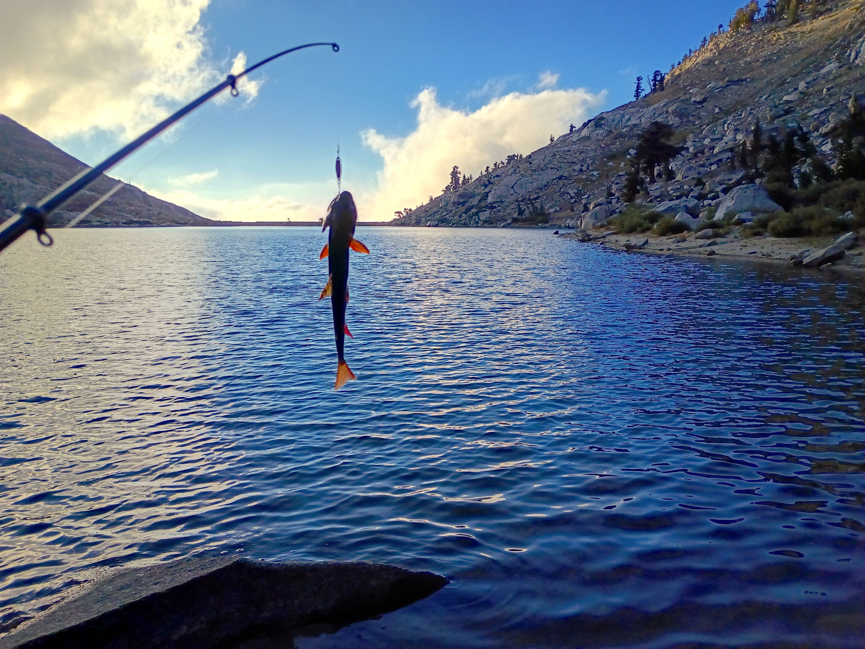
The next morning we woke up to clear skies. We packed up our camp and made the short but steep climb back up to the trail. From there we started the big climb up and over Franklin pass(11,710'). And although we had a lot of elevation to climb, for the most part the trail was actually fairly gradual with several switchbacks. Upon arriving at the pass we were rewarded with some amazing views out to the east overlooking Rattlesnake creek and Forester lake, our destination for the day. The descent down the east side of the pass was much steeper and we passed a bunch of CCC trail crew workers on our way down who were working hard on the trail. Eventually we got down to Rattlesnake creek and the trail leveled out a bit as we got back down below the tree line. We hiked down through a forest of lodgepole and foxtail pines passing the trail junction for Shotgun pass, which we would be taking in two days, and then getting to the junction for Forester lake. And after another mile of gradual uphill we arrived at the lake. The lake was absolutely beautiful and when we had passed the CCC workers one of them had told us that the fishing was really good so I was excited about that. We set down our packs and started looking around for a good camp spot and mom ended up finding us a really nice spot on the far side of the lake. So we headed over there and got our stuff all setup. After that I just relaxed for a bit because I was still pretty tired from the big climb over the pass. But after some rest mom and I headed out to the shore for some fishing and I ended up catching like 20 fish! After the sun set we started a small campfire and hung out around it for a bit and made some dinner and then eventually headed into our tents for night #2.
 Climbing back up to the trail from Franklin lake
 Starting our climb towards the pass
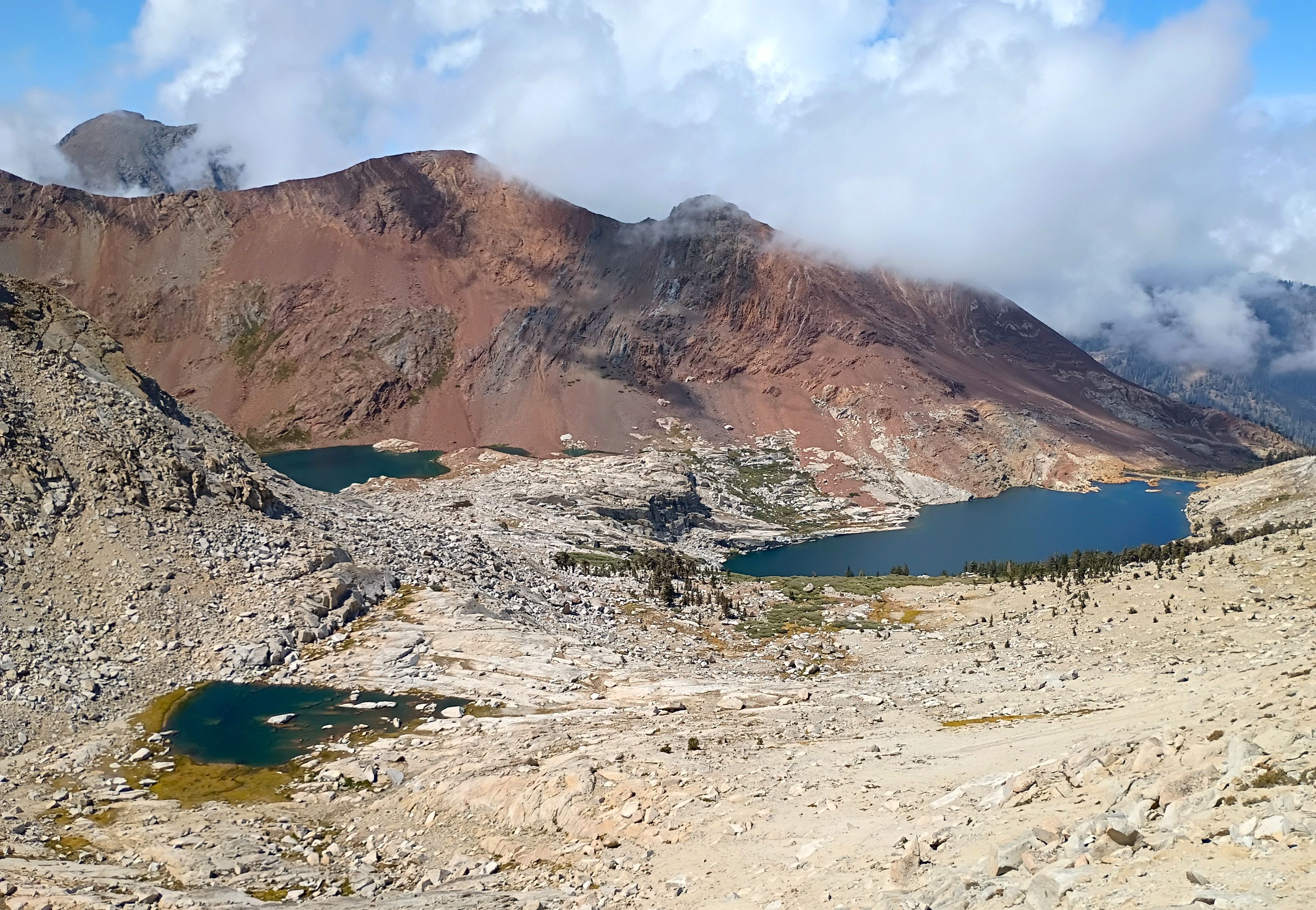 Overlooking all of the Franklin lakes
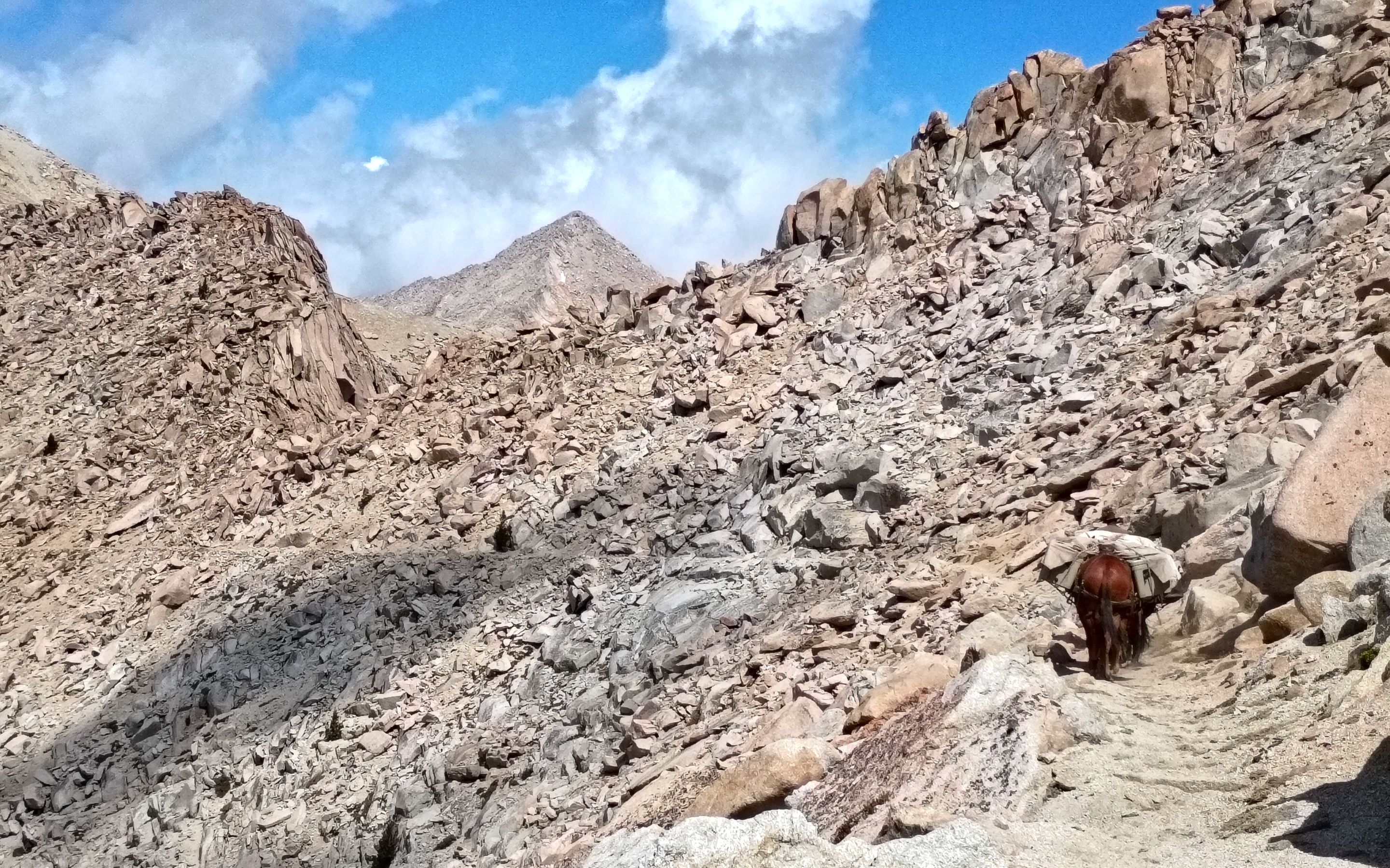 A pack train heading down the trail
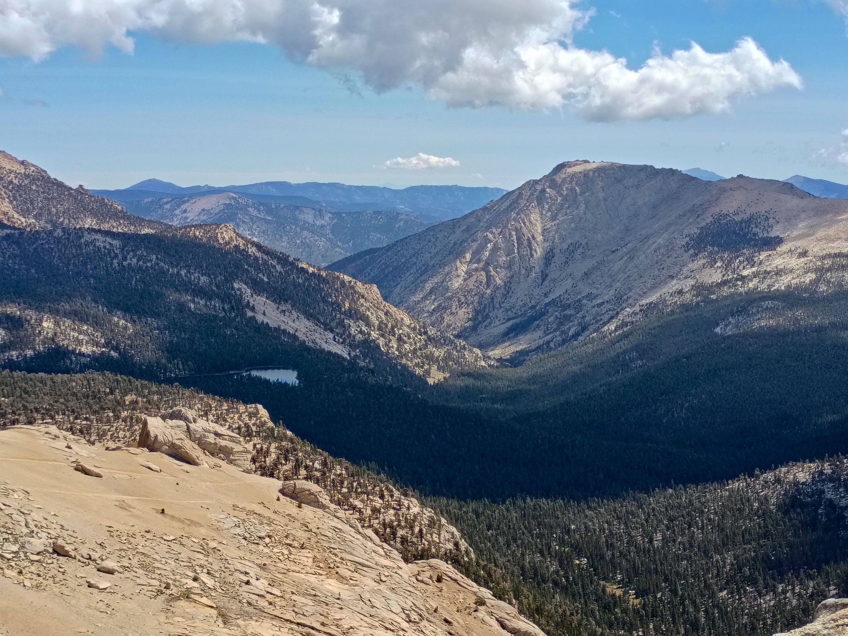 Views looking east from Franklin pass
 Views of RAD peak
(our planned adventure for the following day)
Views of RAD peak
(our planned adventure for the following day)
 Views overlooking Soda creek
 Descending the east side of the pass
(Suzanne Mtn. left, Shotgun pass center, and Bullfrog peak right)
Descending the east side of the pass
(Suzanne Mtn. left, Shotgun pass center, and Bullfrog peak right)
 Rattlesnake creek
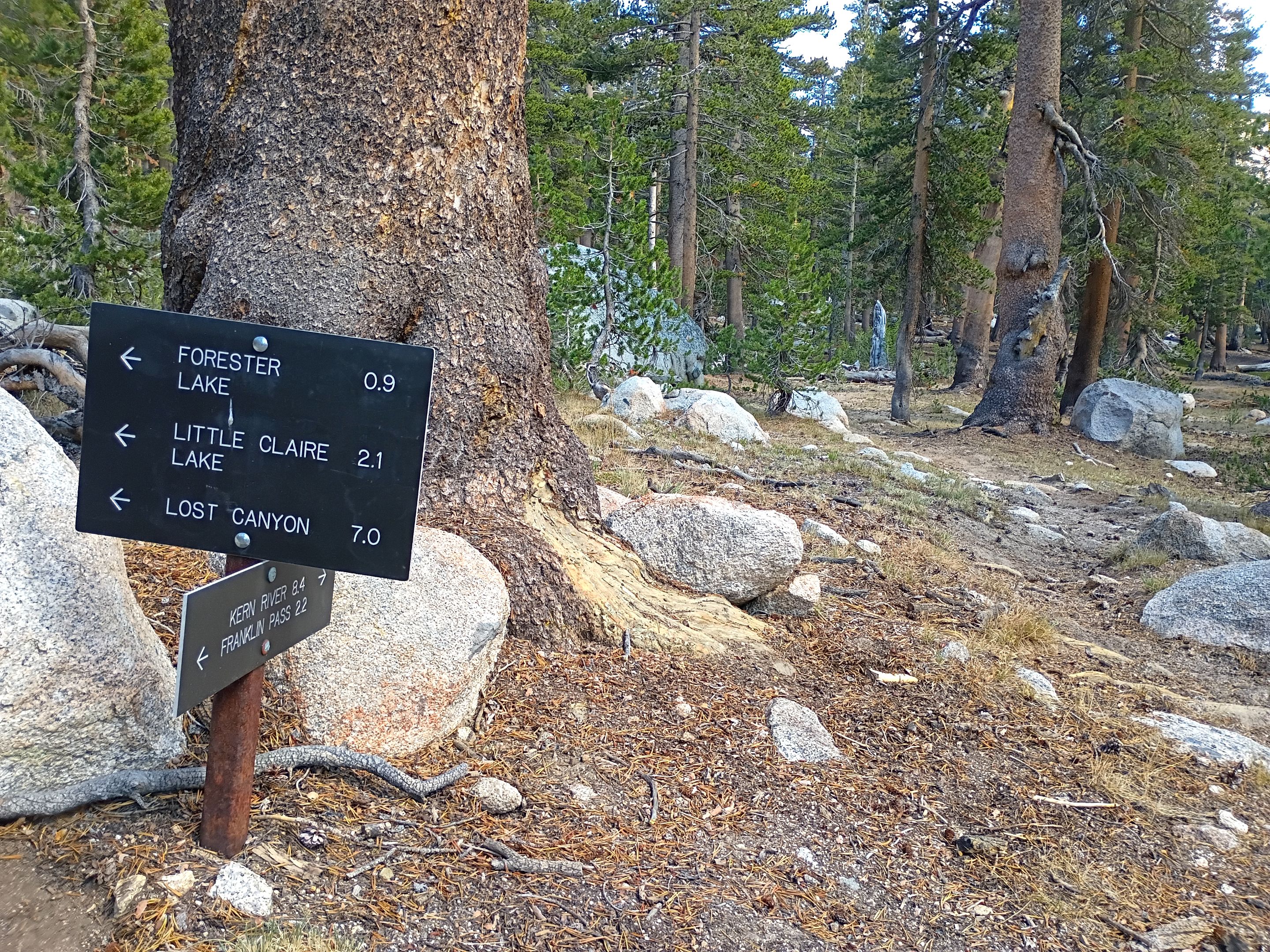 Trail junction for Forester lake
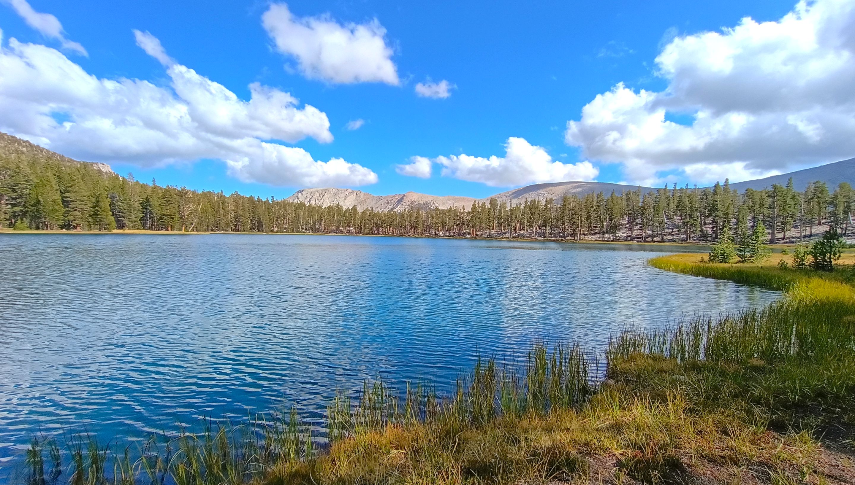 Arriving at Forester lake
 Our camp
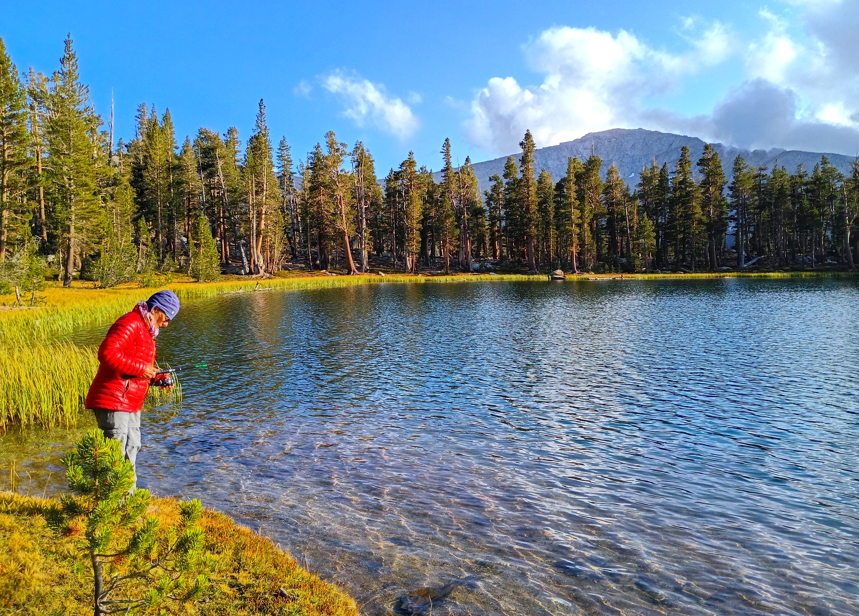 Mom fishing
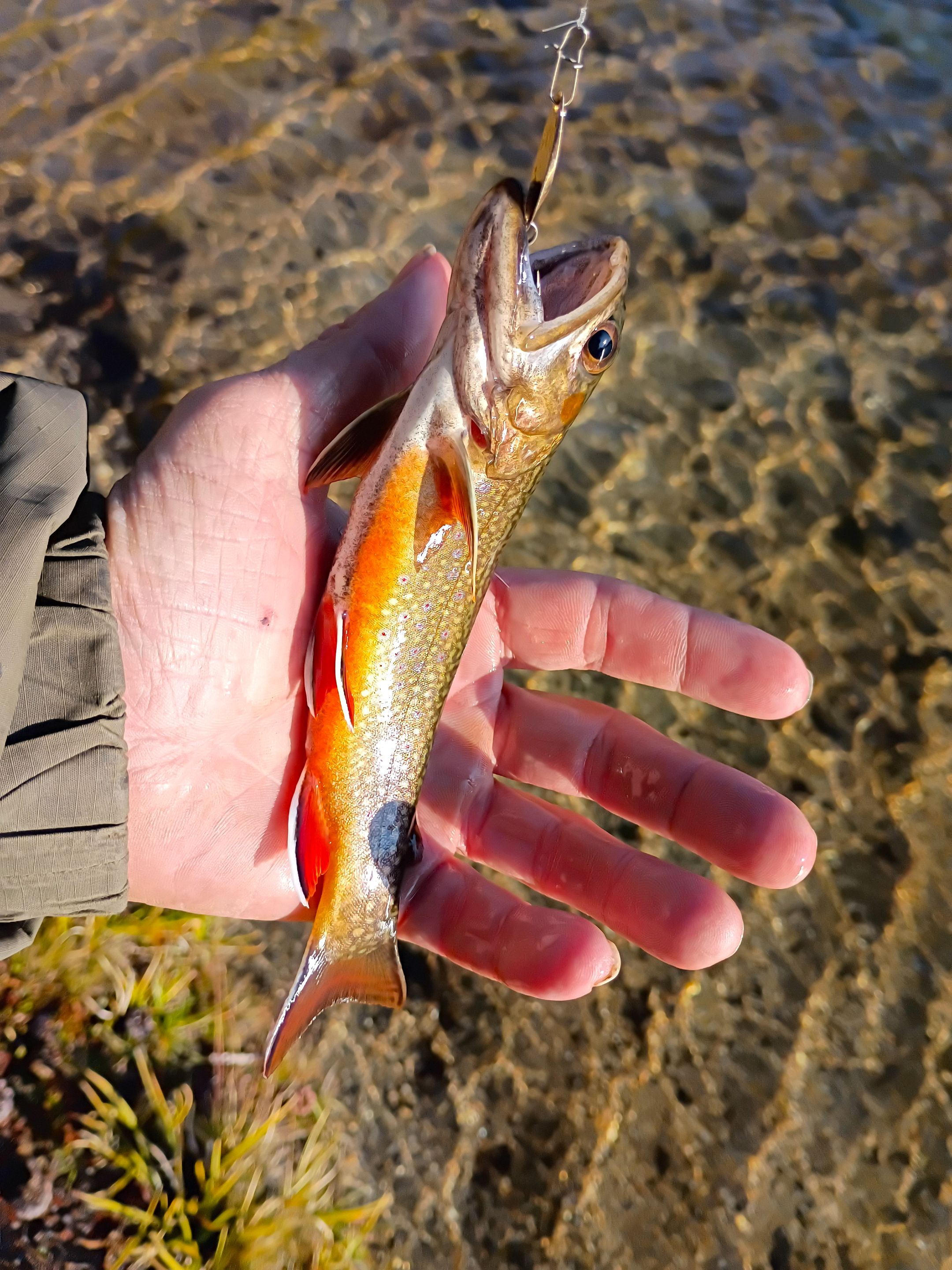 Brook trout
 Fishing
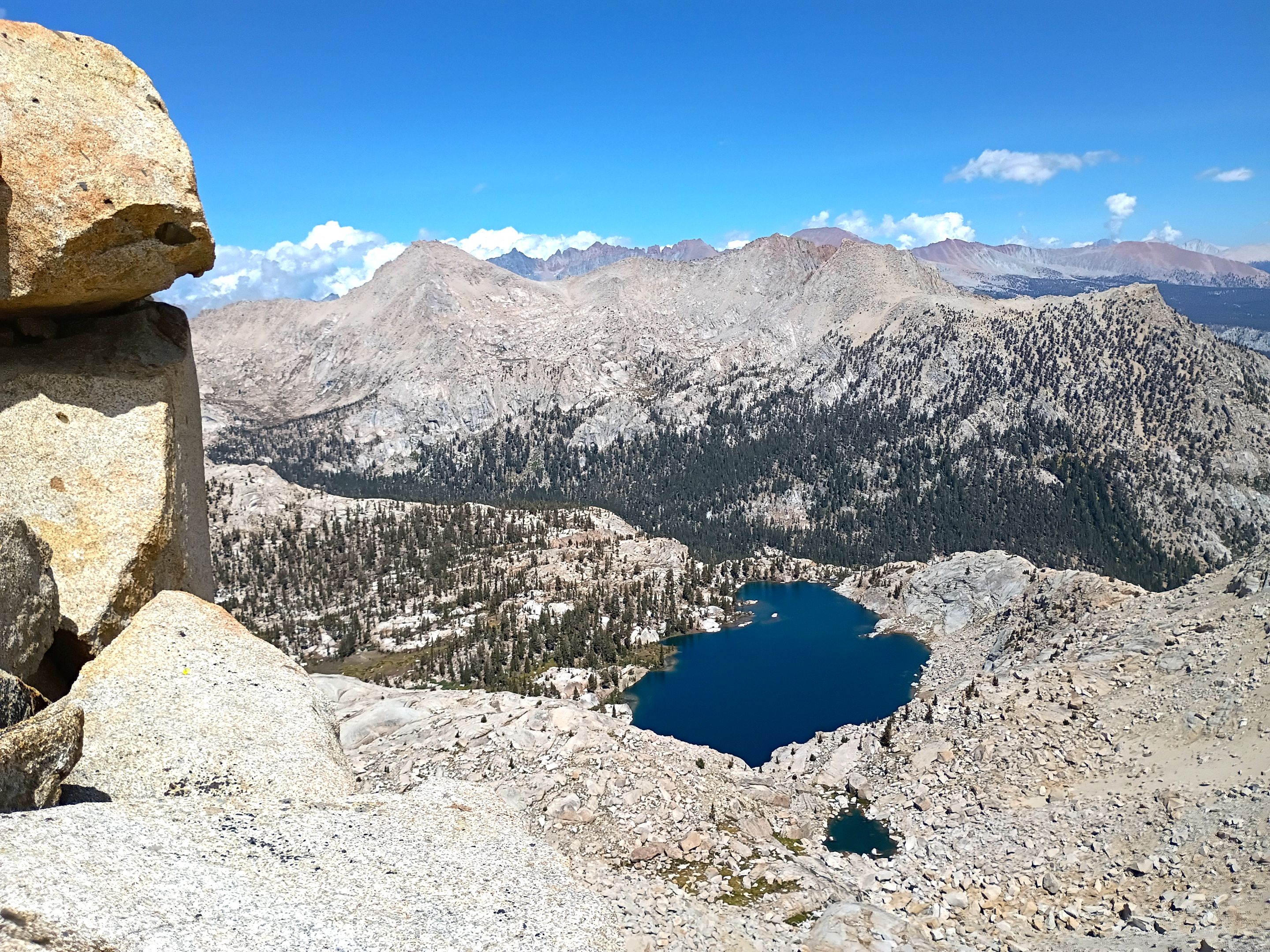
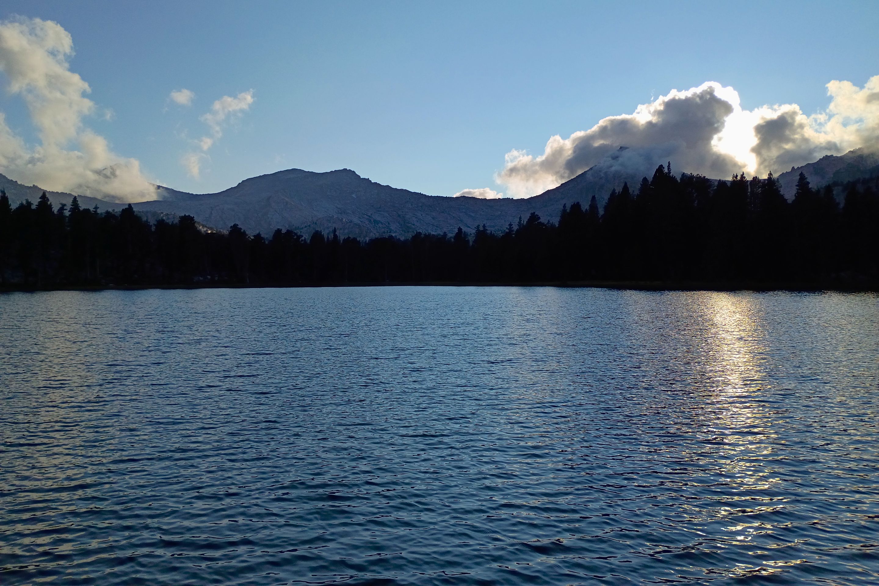 Views from Forester lake
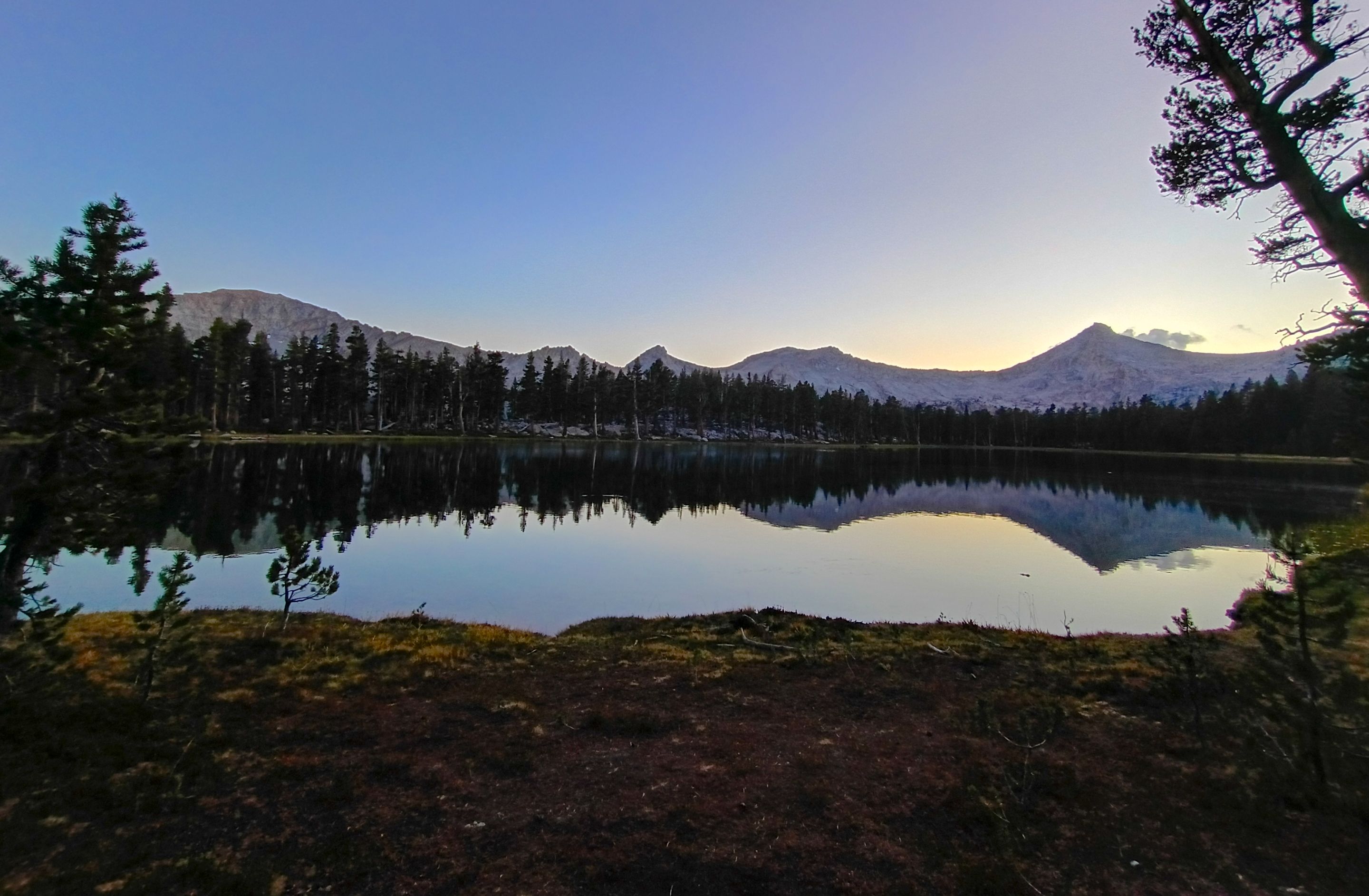 Views from Forester lake
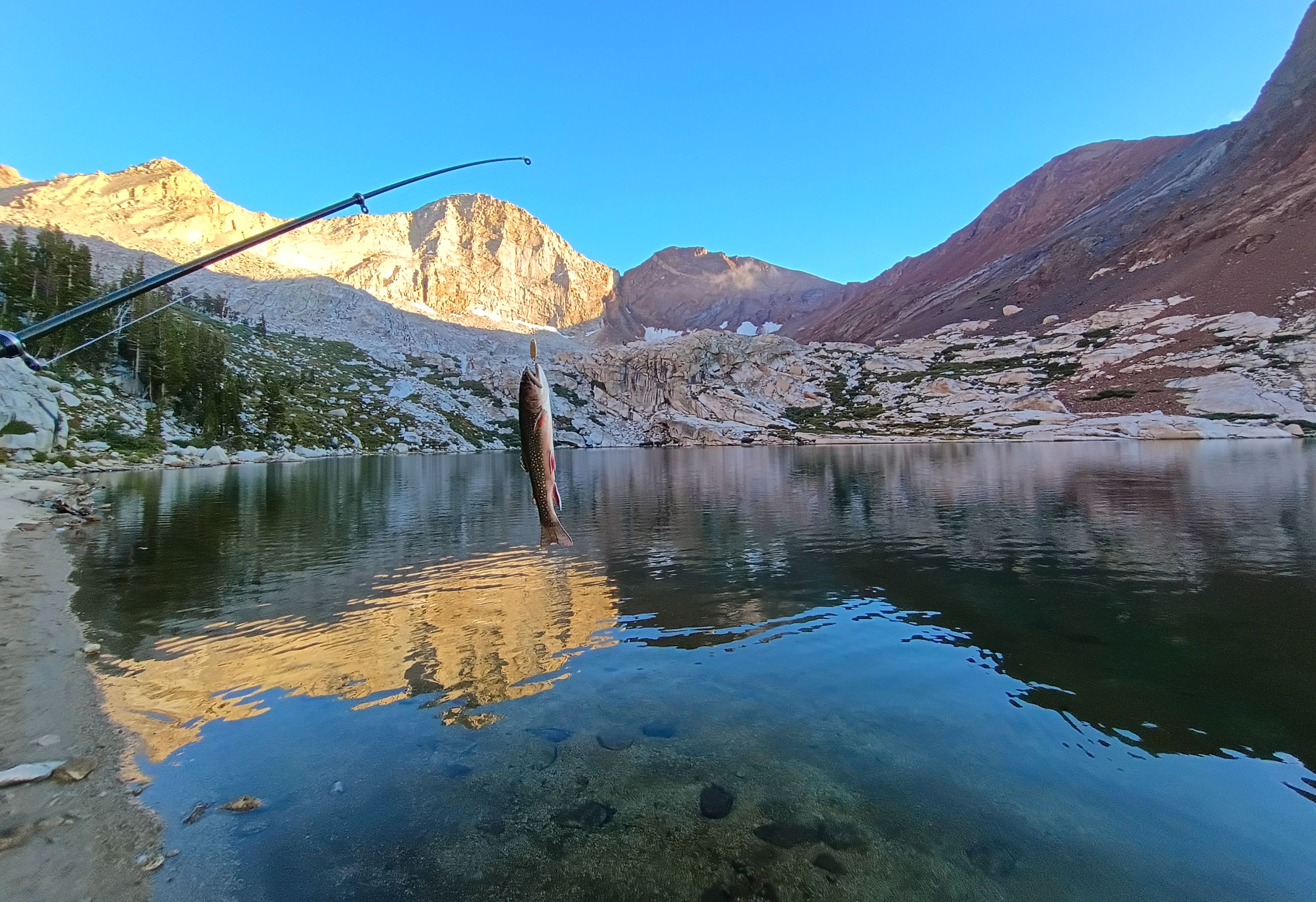
The next morning we woke up to another beautiful clear day. We didn't have to pack up camp this time because our plan was to day hike nearby RAD peak(12,108') and then come back and camp at Forester lake for a second night. So after a casual breakfast we got our daypacks together and started our climb. As we climbed up we passed a few small meadowy creeks and lots of really cool looking old pine trees. Getting through the trees took a bit of navigation and much of it was quite steep, but as we got close to tree line it got even steeper and we got into soft sandy terrain which made climbing extremely tough. But slowly and surely we made our way up and go onto the ridge just below the summit. From there we had to navigate through some huge boulders and do a little bit of technical climbing, but we did it without any problem and finally arrived at the summit! The views from the top were absolutely spectacular making it well worth the climb. The Great Western Divide to the west, the Big Arroyo the Chagoopa Plateau and the Kaweah range to the northeast, Kern canyon and the massive peaks of the Sierra Crest out to the east, and Soda creek thousands of feet directly below us to the north. We took a bunch of pictures and then sat down and enjoyed a snack and signed the peak register(which I was not expecting to be there, and in fact I didn't even know for sure this peak had a name until seeing the register). The register dated back over a decade and yet only had about a dozen or so signatures. Making us part of a very small group of people to ever have made the climb to RAD peak. Which is pretty cool in itself. And while we were sitting there enjoying the views of the many other peaks all around us I decided to count all the peaks that I could see that I'd previously climbed and I think I counted like 13 or 14 of them (some of which I've climbed multiple times) which was pretty cool and a bit nostalgic to get to see a new perspective of so many peaks that I've visited on so many past adventures. Eventually it came time for us to start heading back down. We made our way back through the boulders and then started to descend the steep sandy slope. Which was MUCH easier going down and actually kinda fun. It was kinda like skiing but in sand and with just our feet. We made it back down to the tree line in a small fraction of the time it took us to go up and from there we navigated our way back down through all the cool looking trees and right back to our camp at Forester lake. It was still pretty early in the afternoon when we got back so I decided to take a short nap just to get some extra rest because I hadn't been sleeping great and I knew we were planning to wake up early the next day. After my nap I got up, collected a little bit of firewood and then decided to take a walk out around the southeastern shore of the lake which was fun and I was even able to get some nice views looking down into lower Rattlesnake creek. After my walk it was time for fishing so I got my pole and headed out to the shore. And once again Forester lake did not disappoint and I caught over 40 fish!! It was too much fun! I fished until after the sun set and then headed back to camp and hung out around the campfire for awhile before making dinner and then heading off to bed.
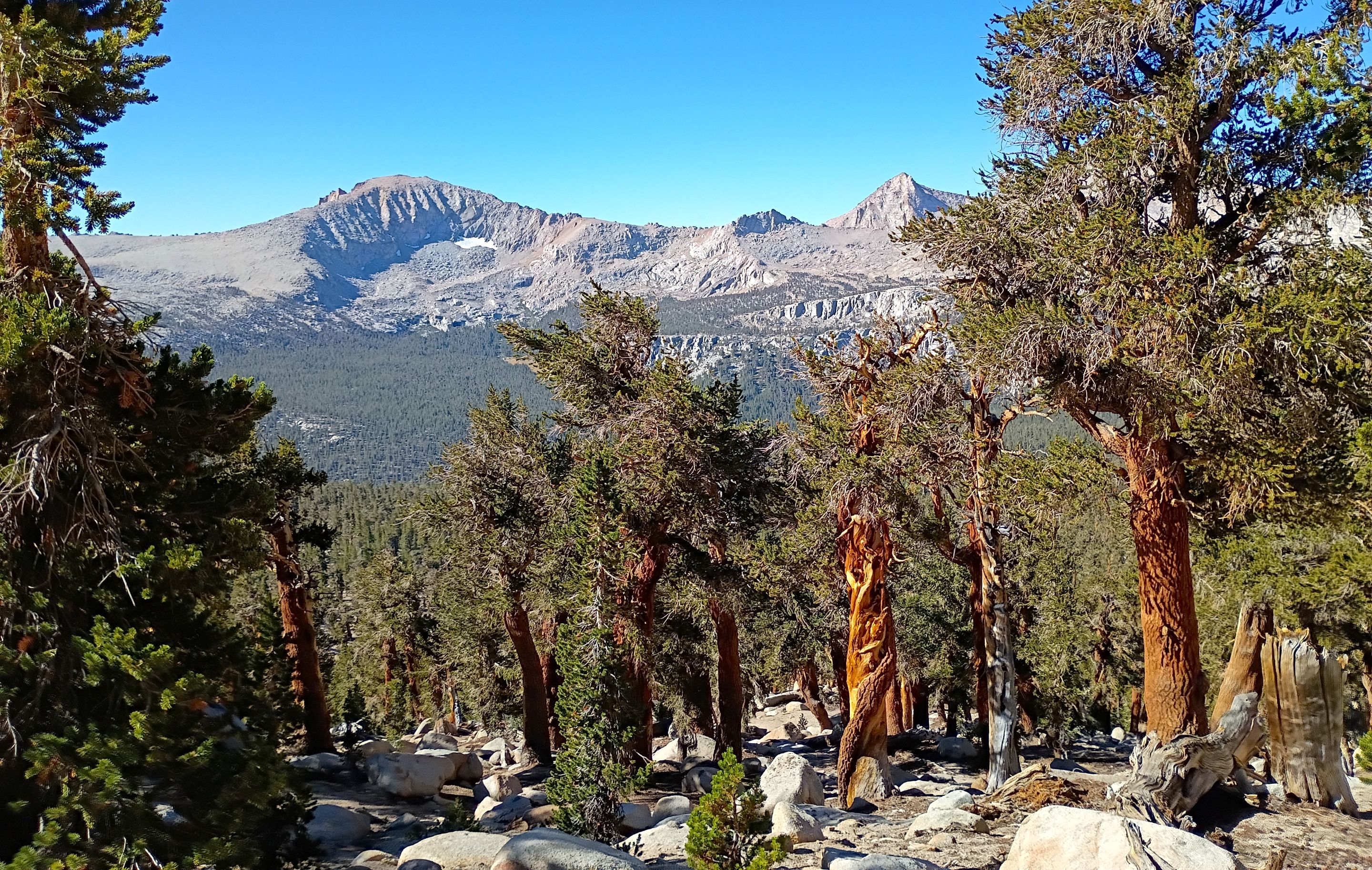
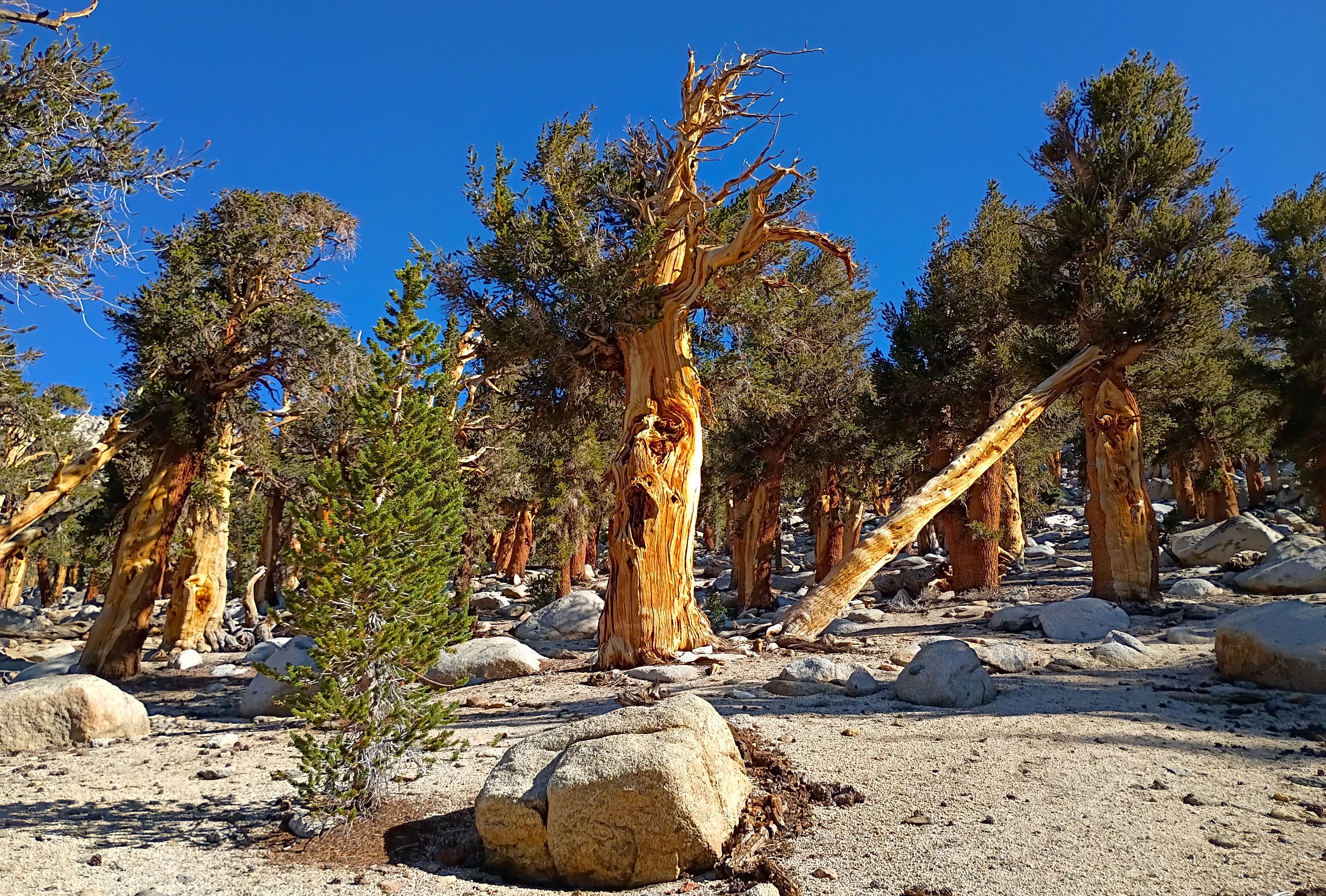 Some of the cool looking pine trees on the way up RAD peak
 Climbing up through the trees
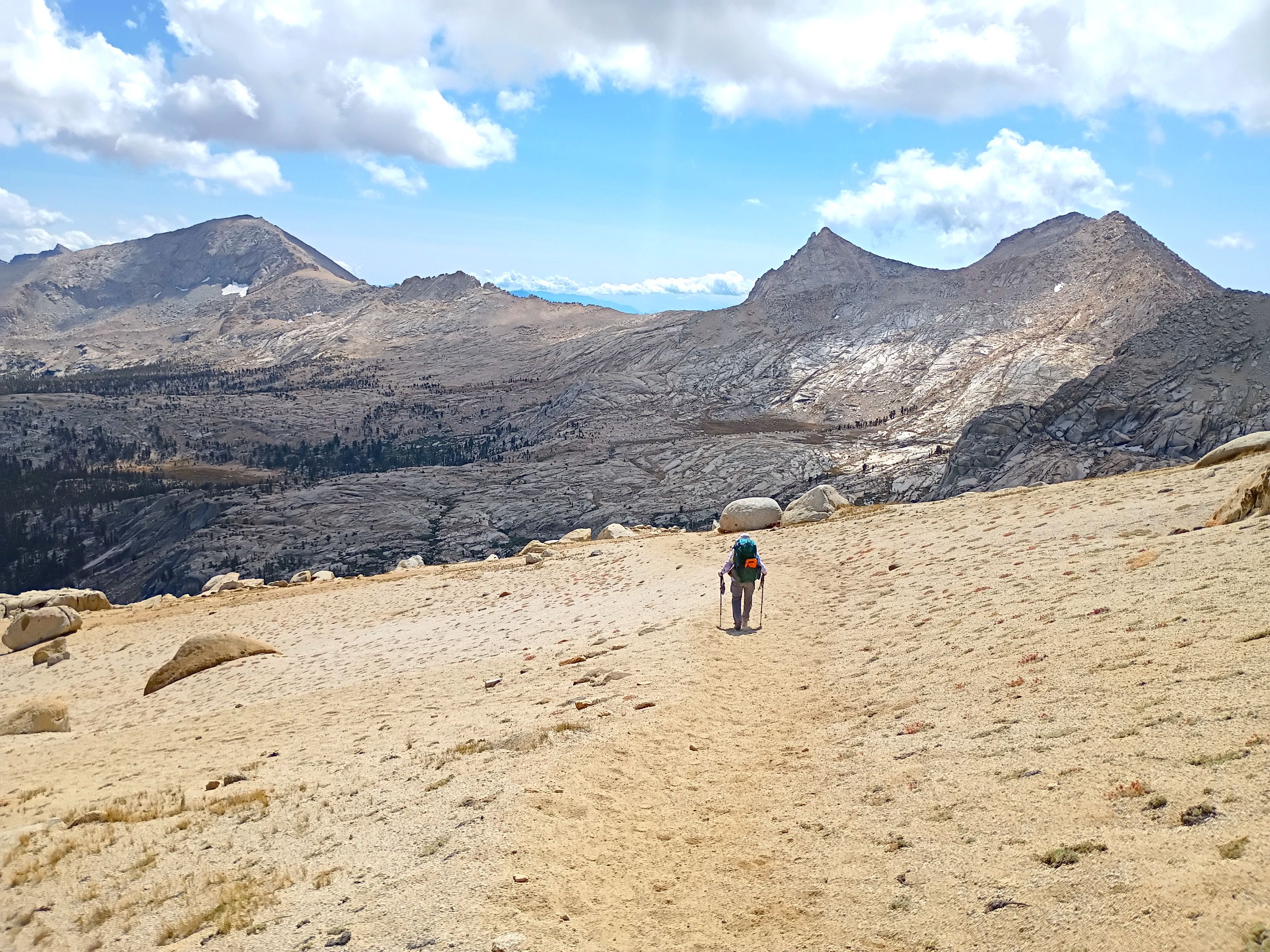
 On the sandy slopes above tree line
 Approaching the summit
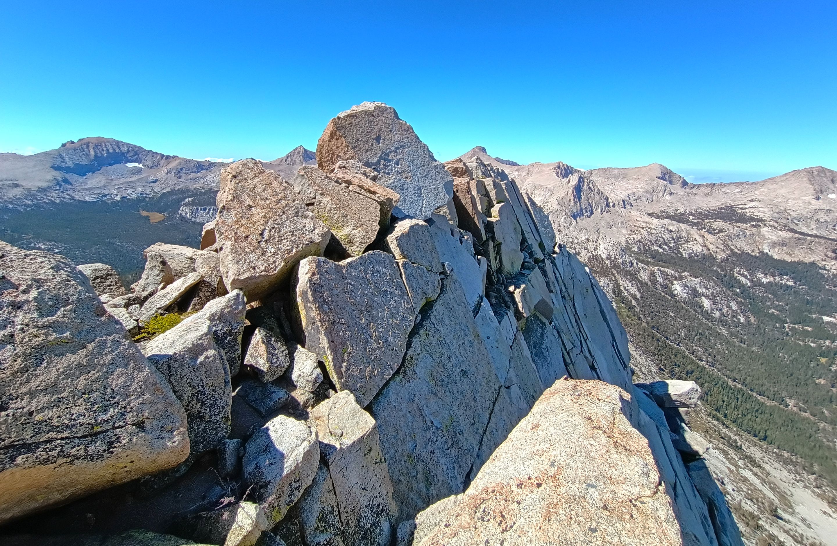
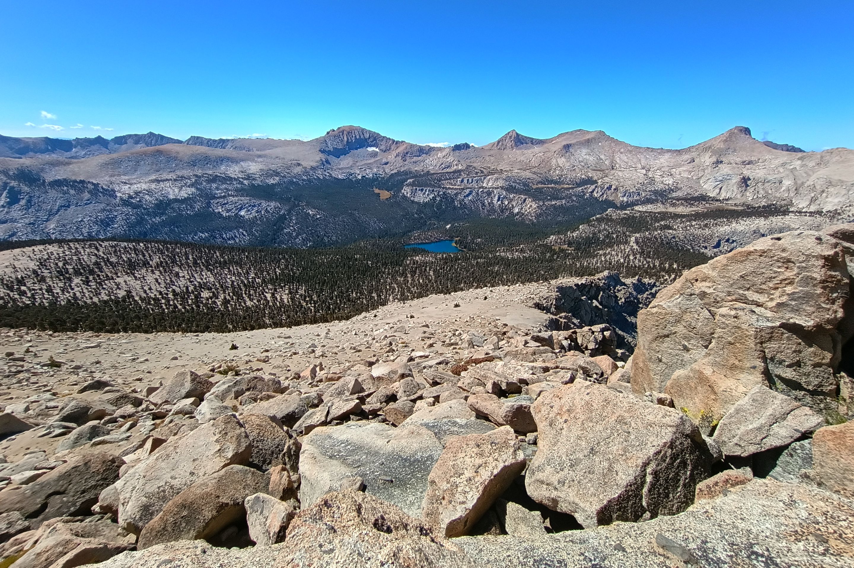
 Summit views looking north
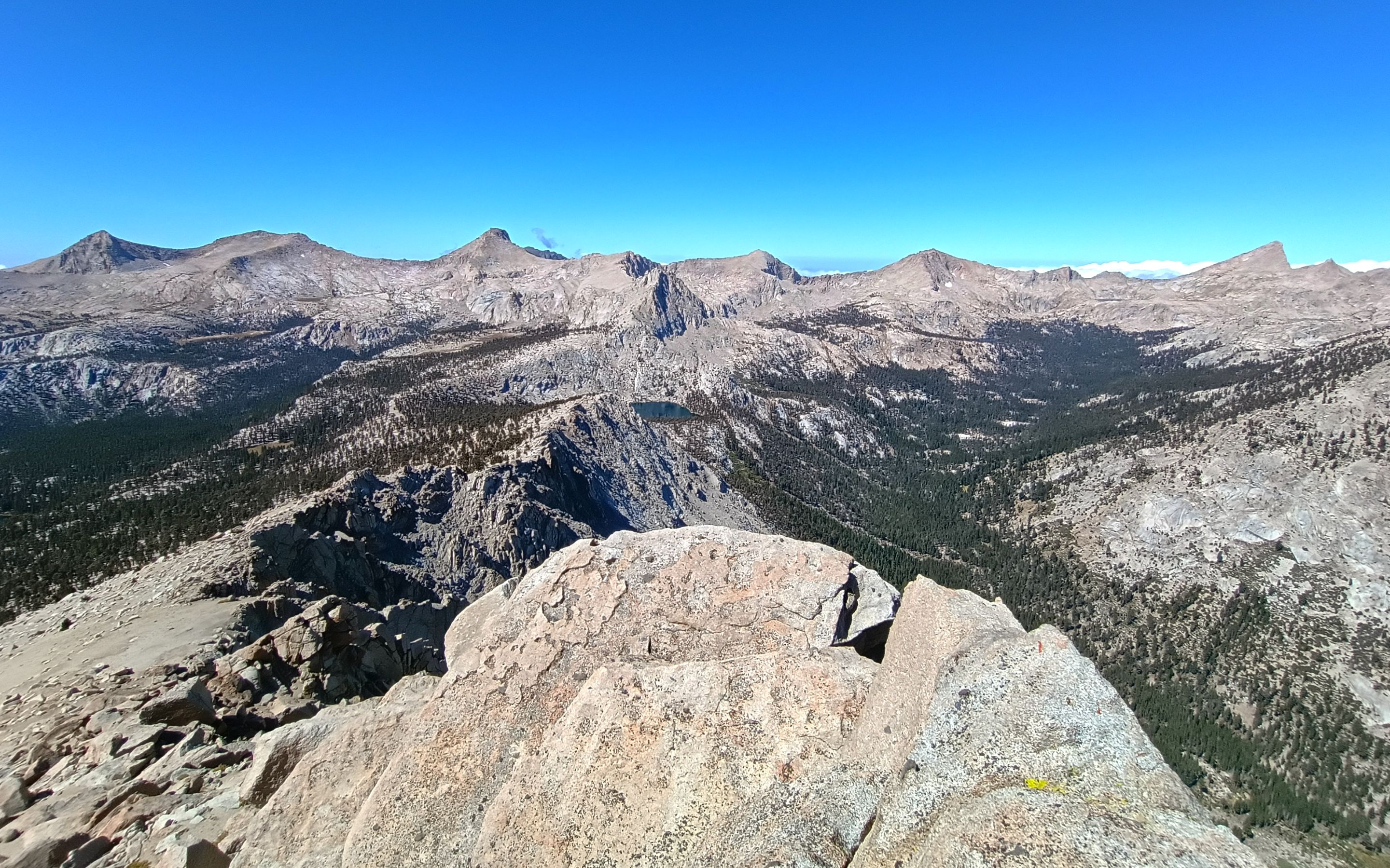
 Summit views looking northeast
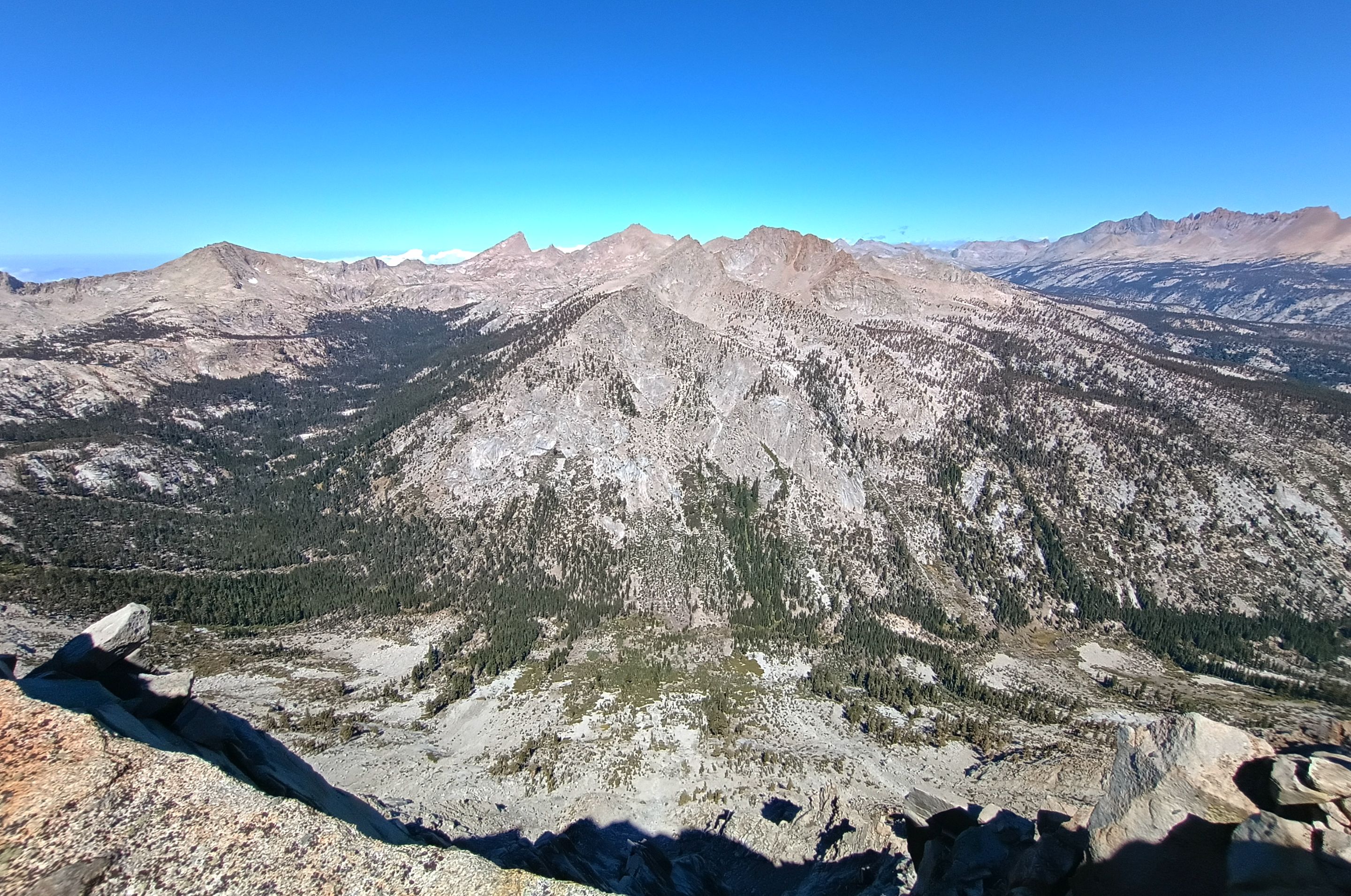
 Summit views looking southwest
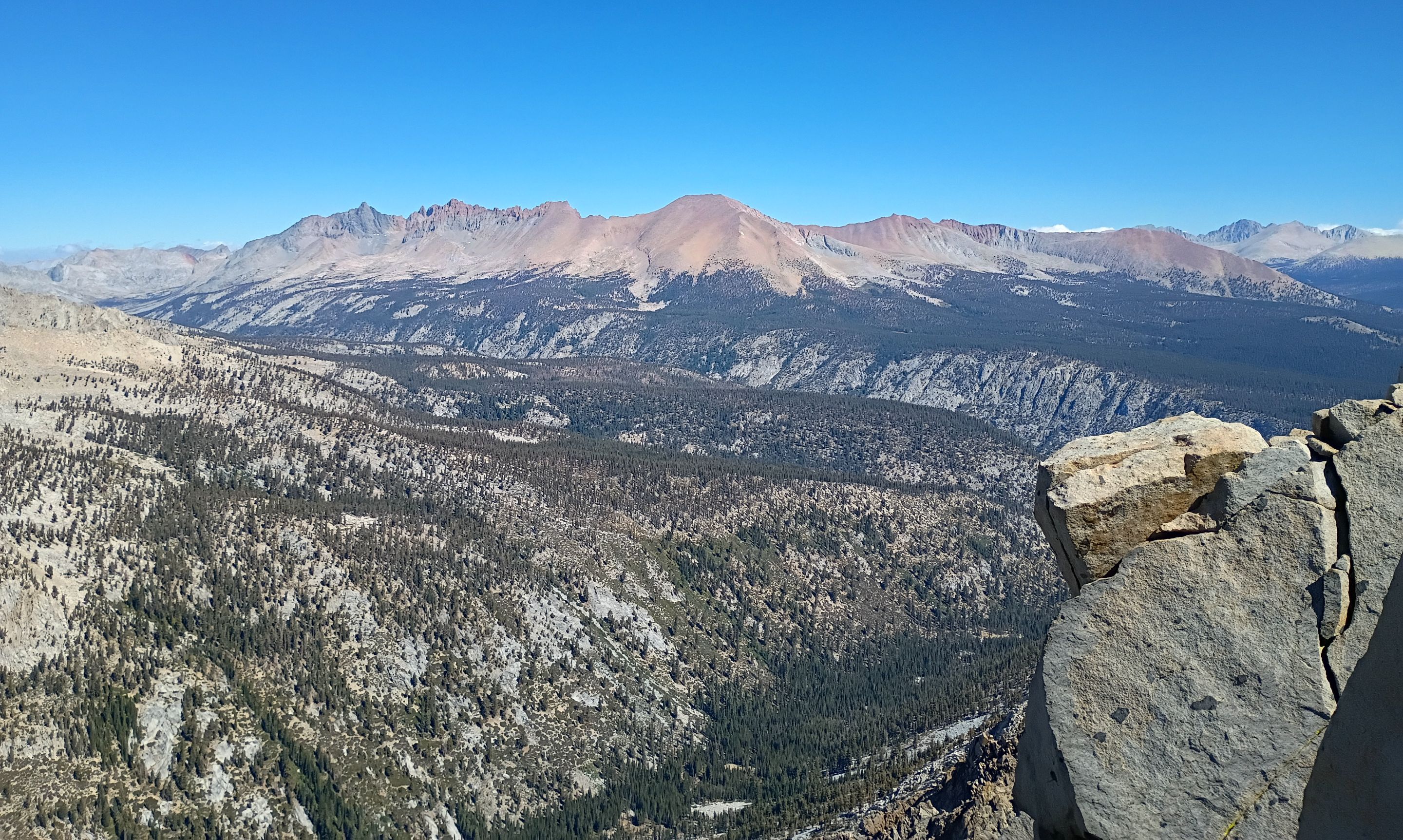
 Summit views looking west
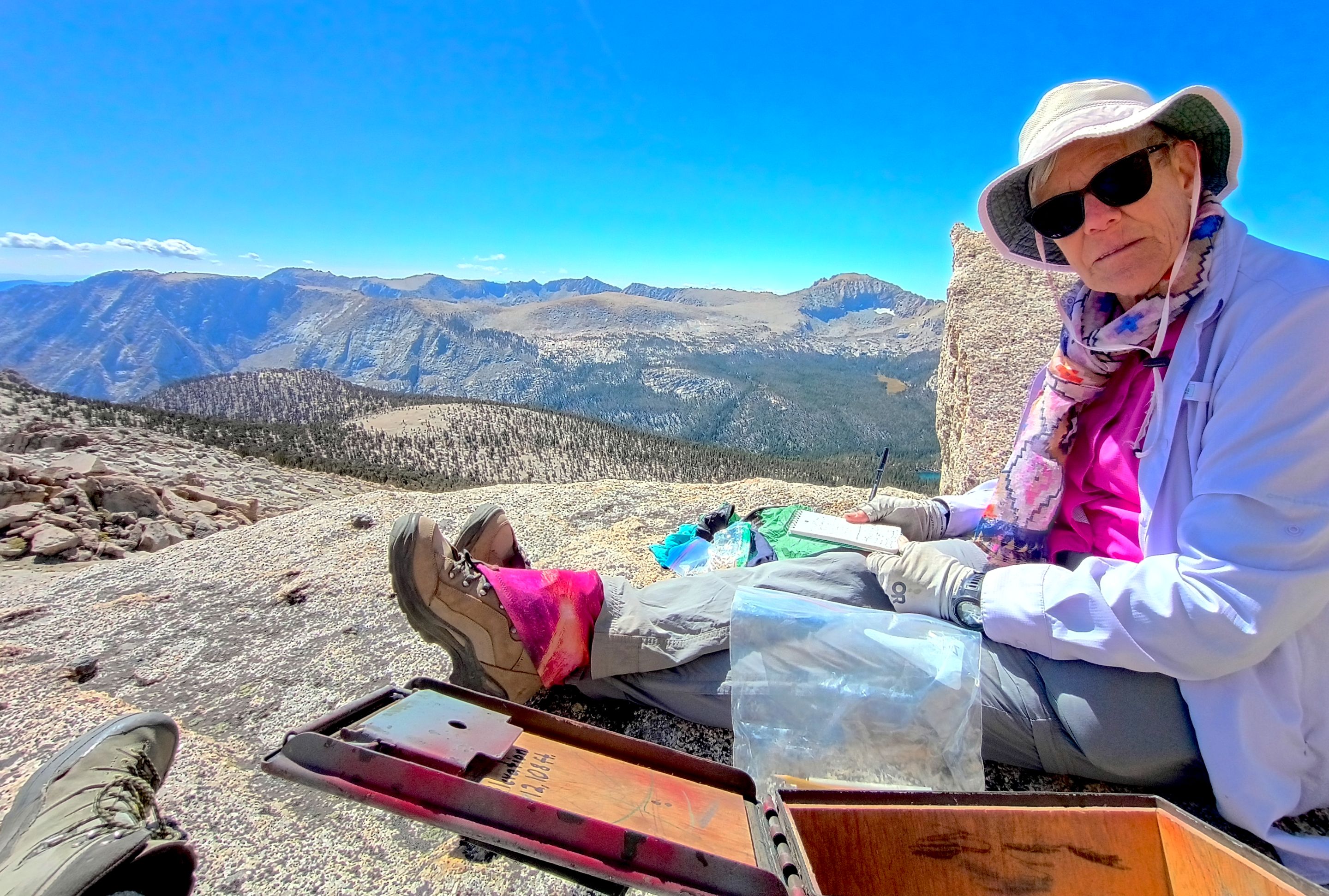 Mom signing the peak register
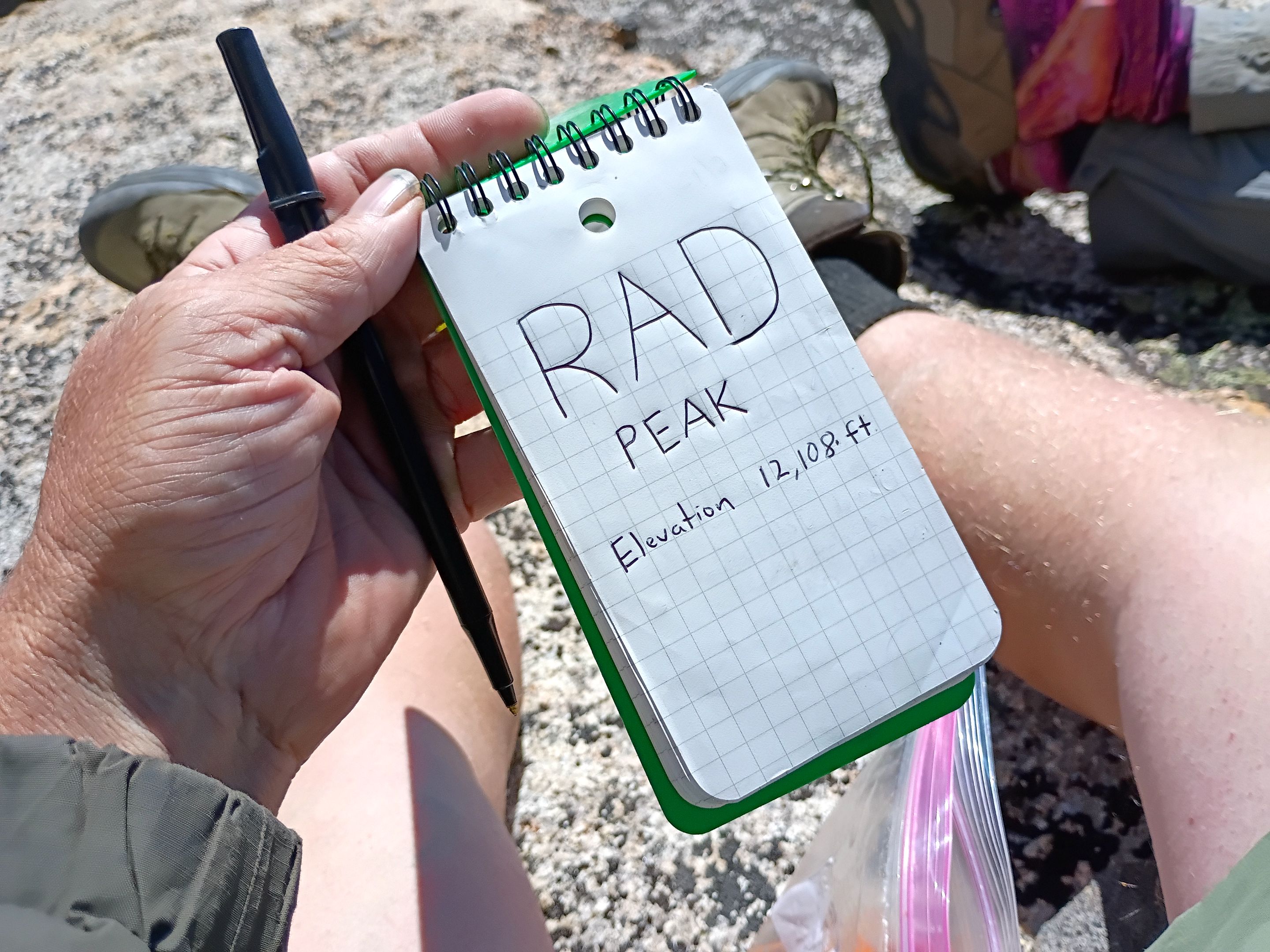 The peak register
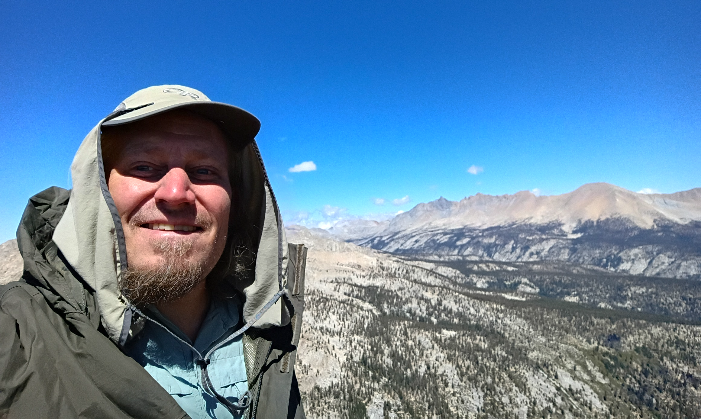 Summit selfie
 Time for sand skiing
 Arriving back at camp
image.png (https://files.peakd.com/file/peakd-hive/derekrichardson/Eqd682LLUmZKEwkgtgBkpRNjToeimvJ2x3c8PQwA4XPsAjrjUMitDqydANdW6DqFV93.jpg) Views from the southeast shoreline
image.png (https://files.peakd.com/file/peakd-hive/derekrichardson/EqSUxYsN6URF4imui2sjVvTLuqhKCnKcBYPDR8sa6xtZ1X9cfBV4StL7LKMG5cmb9Rt.jpg) Watching mom fish from across the lake
image.png (https://files.peakd.com/file/peakd-hive/derekrichardson/Eq9TuBg6hkgtcgHnaXU438FuoCxkzoPnPGgRg43MKzQvAHsoP1sjdECY87DRmPP4Zqy.jpg) Looking down Rattlesnake creek
image.png (https://files.peakd.com/file/peakd-hive/derekrichardson/Ep7tDUU3hS1dRLjrHKityUDkJMsWC1xjh7hMRzTExVTsQ3Z7KXnGih6feQnSqwnvN9U.jpg) Mom catching fish
image.png (https://files.peakd.com/file/peakd-hive/derekrichardson/23zS3KJsX8oF3FkxK44zzRERokMQva77PuLLHytK6CXPvWu8JRaZ9Eu5xDr2Rch7kTydq.jpg) Brook trout