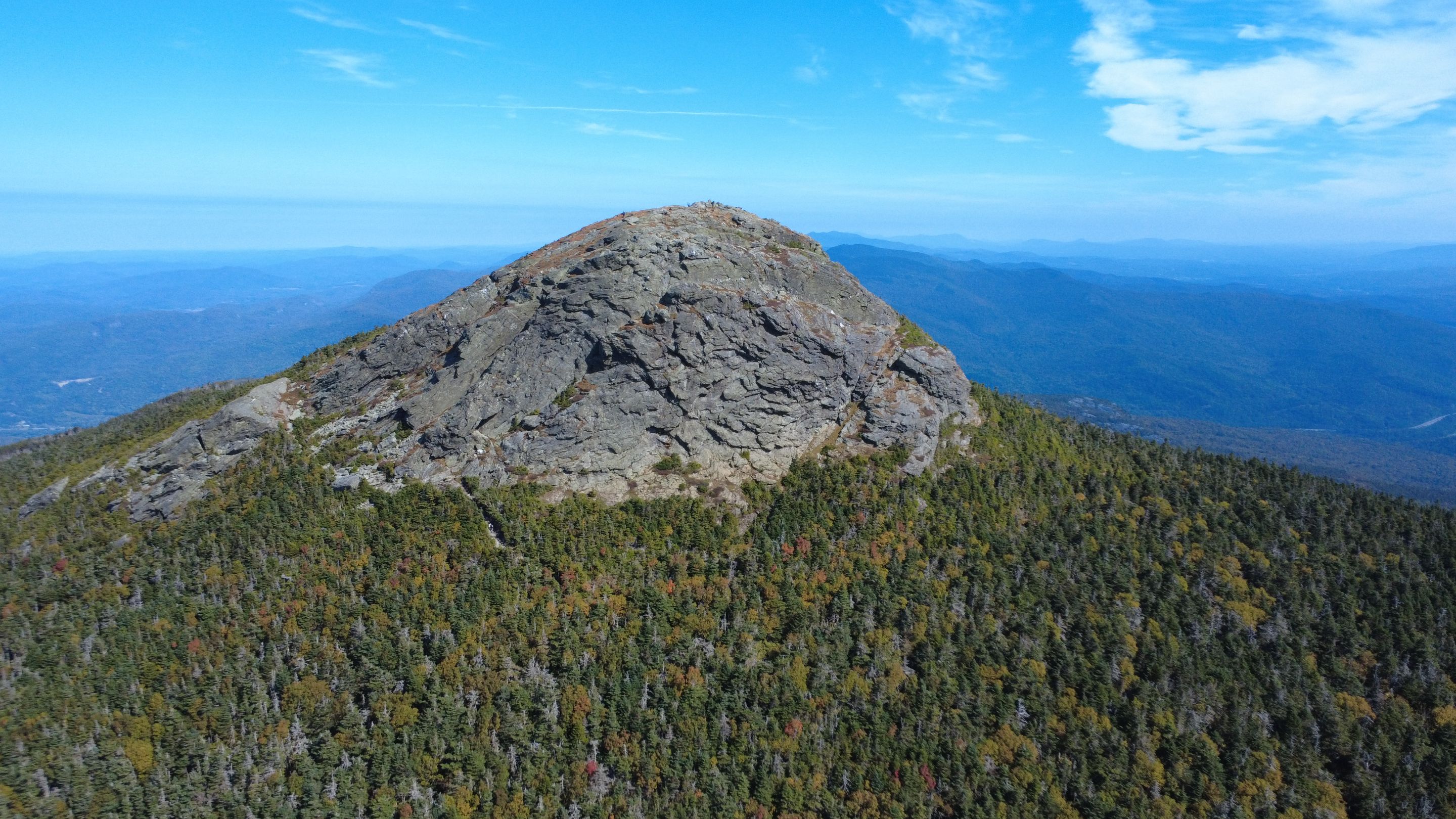
 I really appreciate hiking with a small drone that can capture these stunning aerial scenes that give me a totally different perspective on where I am hiking. This is the summit of Camel's Hump.
It was a stunningly beautiful late summer's day in Vermont, so I grabbed my hiking boots and my drone and drove towards a mountain that I've been wanting to summit for a long time. The summit is 4,083ft high, making it the third tallest mountain in Vermont. I have driven past this mountain many times on the way to Burlington and Lake Champlain, and have always wanted to hike it and see what it was like. Today was the day!
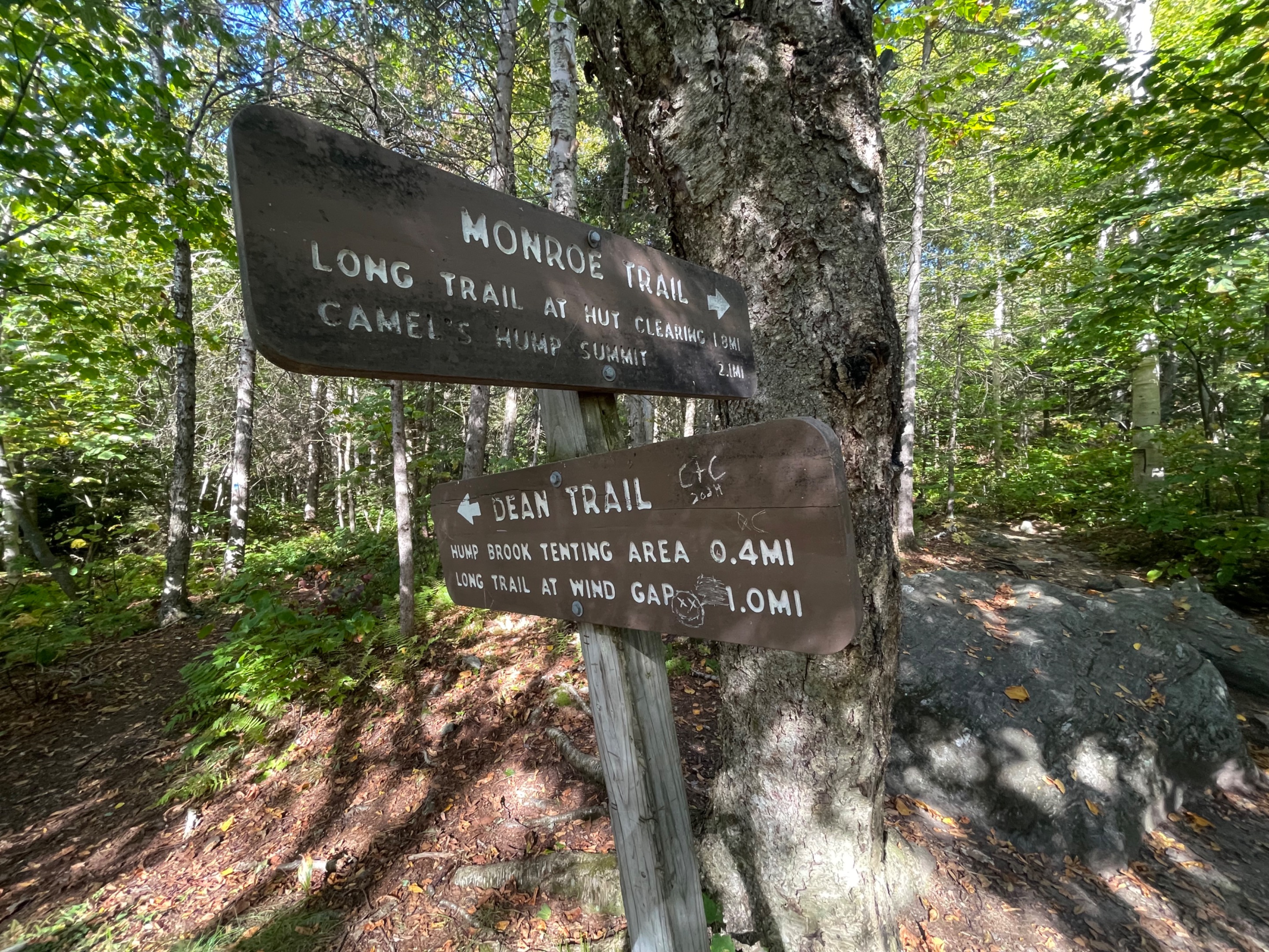
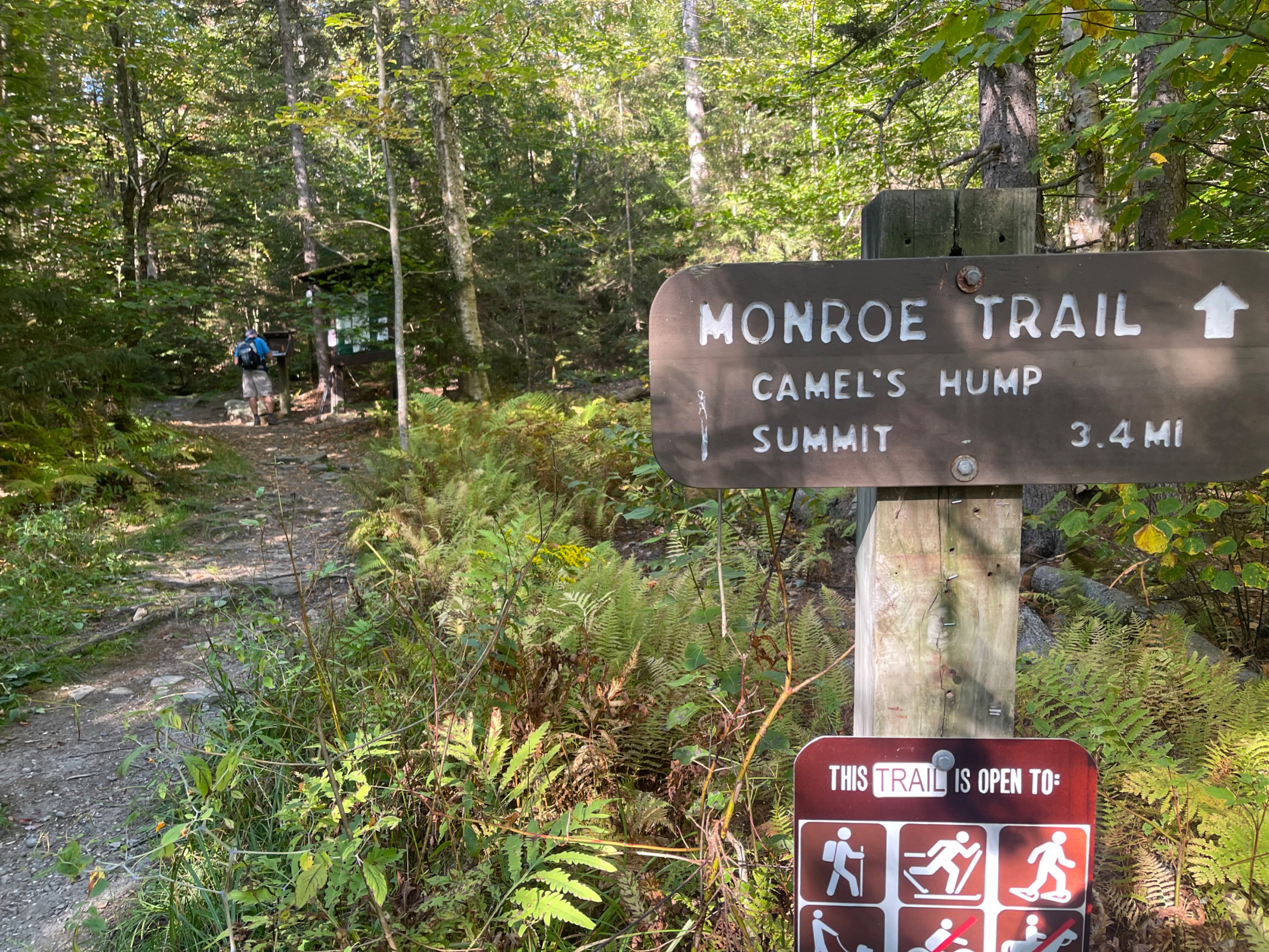
There are several trails leading up to the summit from different sides of the mountain. The closest trailhead to me was the Monroe Trail, so I decided to start there. It was a 7.2 mile, there and back trail, with nearly 3,000ft of vertical gain. I packed pretty light, just a long sleeve fleece for the summit, a couple of granola bars, and my drone. The trail itself was very nice and well maintained, with little bridges and easy signs. I sped up the mountain, enjoying some solitude out in nature, and some time to think.
Once I made it to the summit, I was treated with incredible views in every direction. I could see Mount Mansfield to the North, where I was just hiking with the kids a few days ago. I could even see Stave Island out in Lake Champlain. I sent my drone out for a different perspective, and scored some beautiful looks back at the summit of Camel's Hump. At least, until a ranger came over and told me, 'no drones allowed up here.' Oh well, at least I got some good shots while I could. I'm not sure why there would be a no drones rule. That just makes these photos even more special.
It always feels good to stand on top of a mountain, especially in this kind of weather. I wonder what will be next!
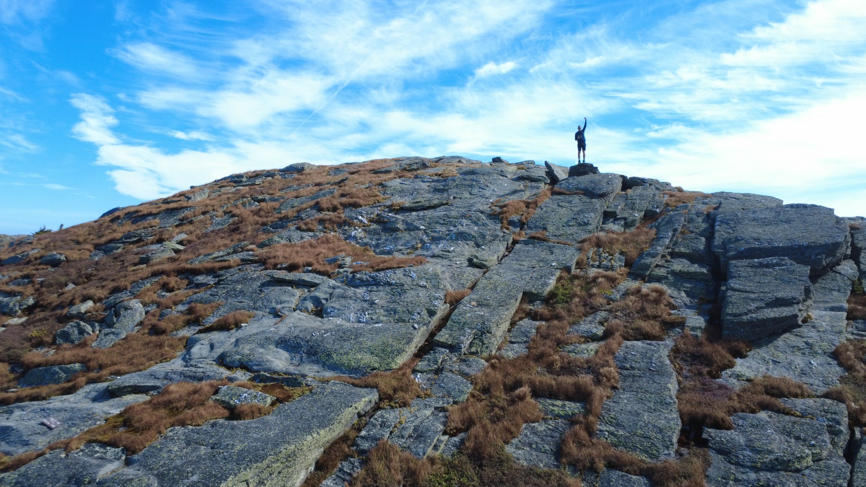 Tackling the summit of Camel's Hump mountain in Northern Vermont. I shot this with my DJI Mini 4K drone.
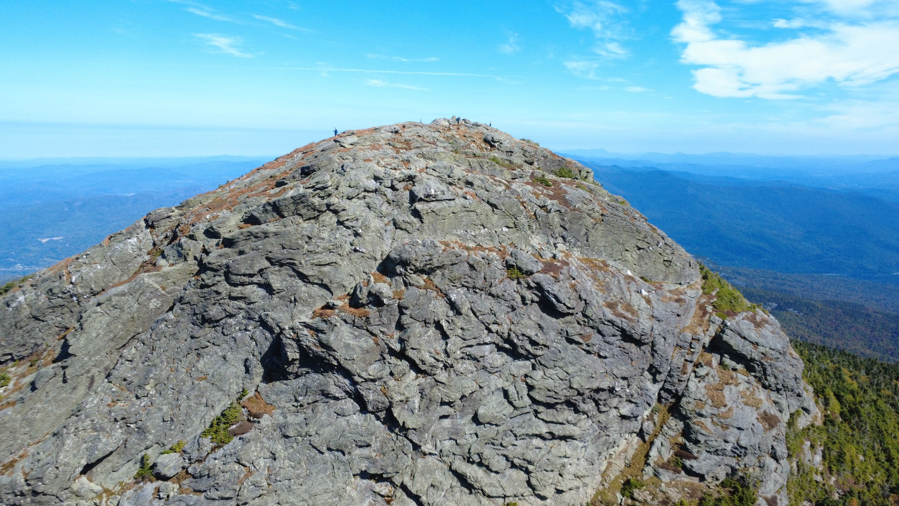 Here is a nice wide shot of the giant rocky summit of Camel's Hump. You need a drone to get a shot like this.
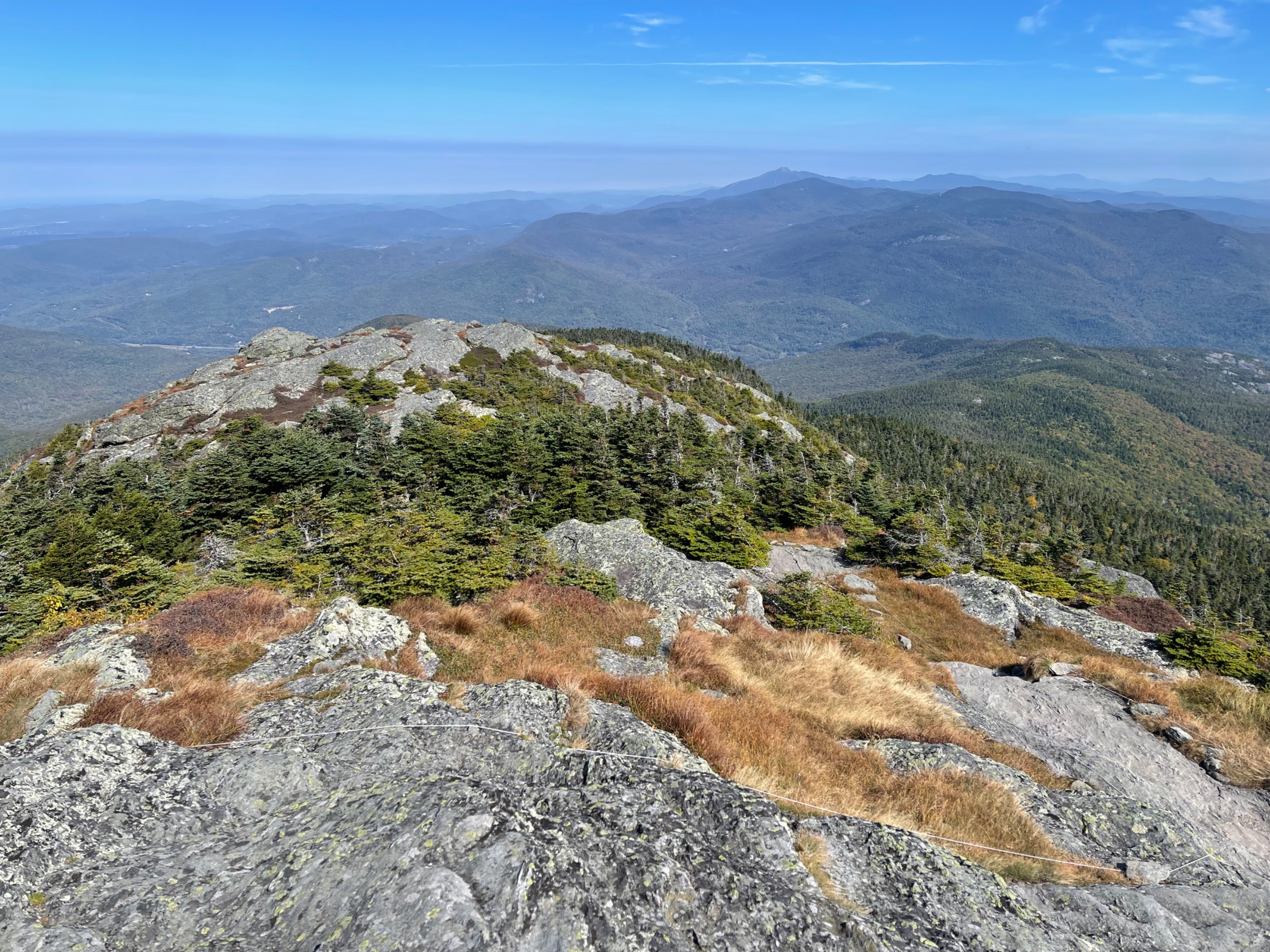
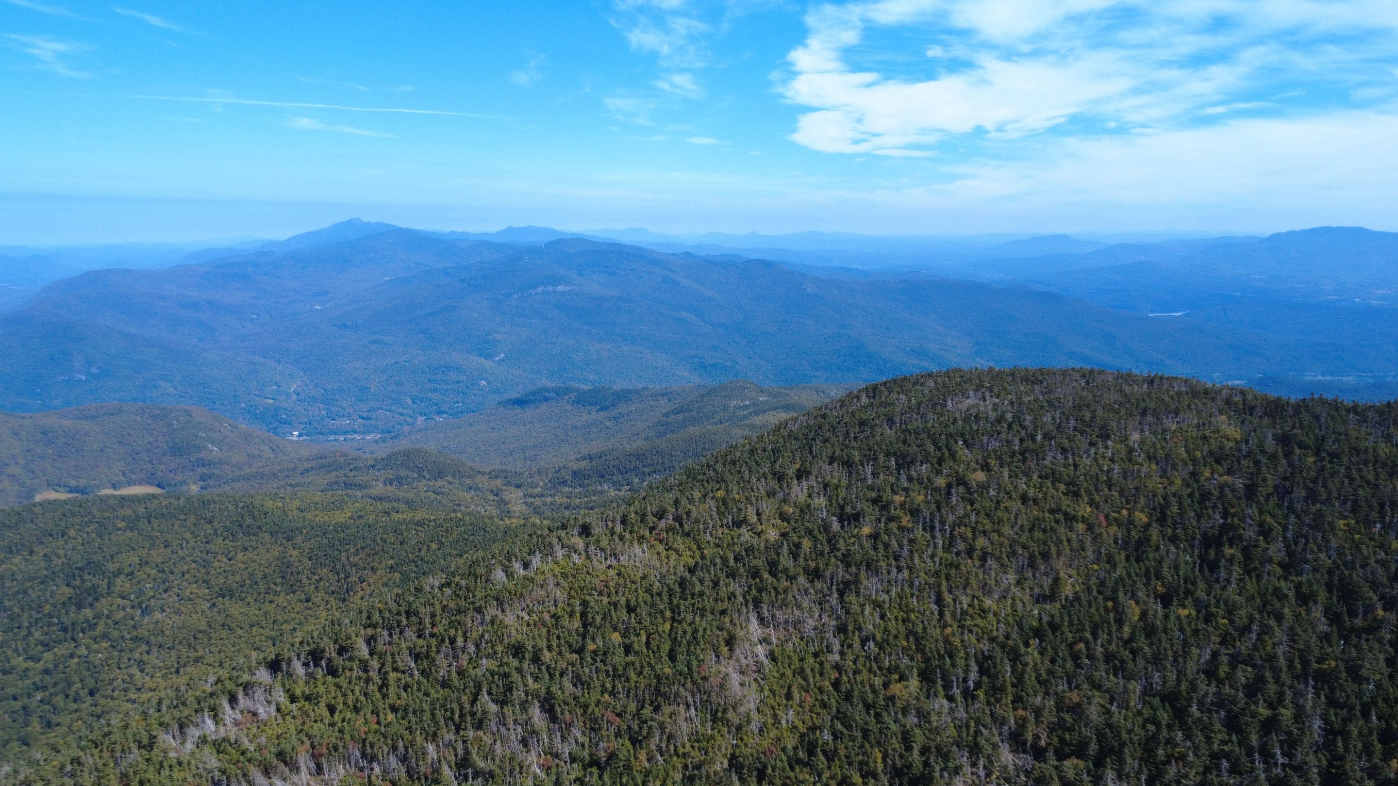 Another drone shot looking out to the North towards Mount Mansfield, where I hiked with the kids a few days ago.
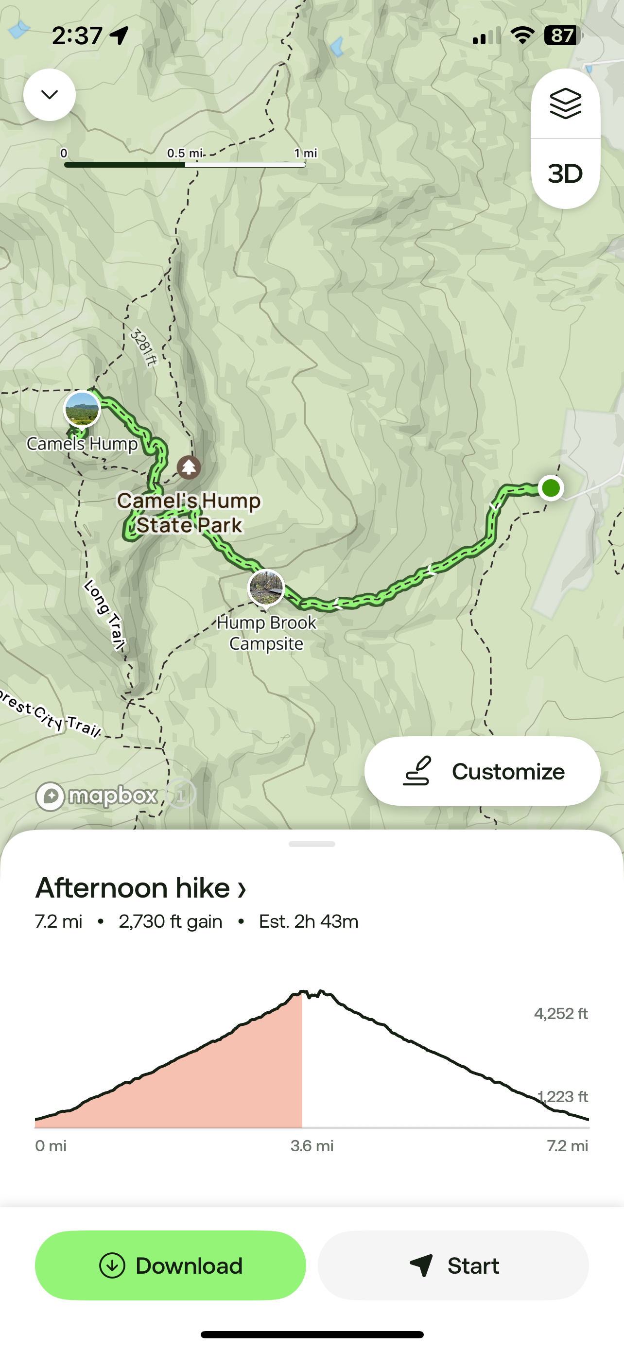 I thought a shot of my All Trails app after finishing the hike would be a good addition. 7.2 miles and 2,730ft of elevation!
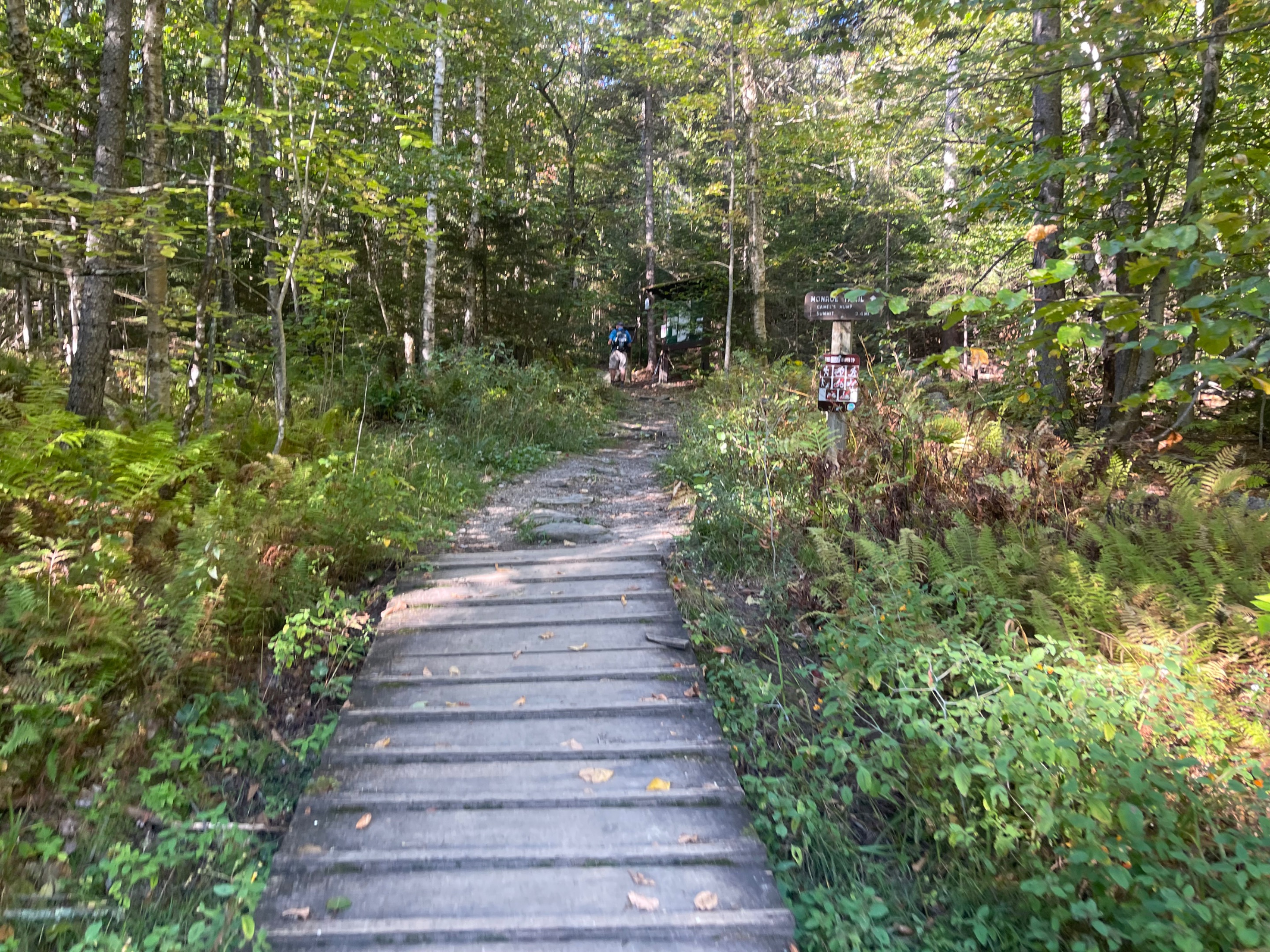
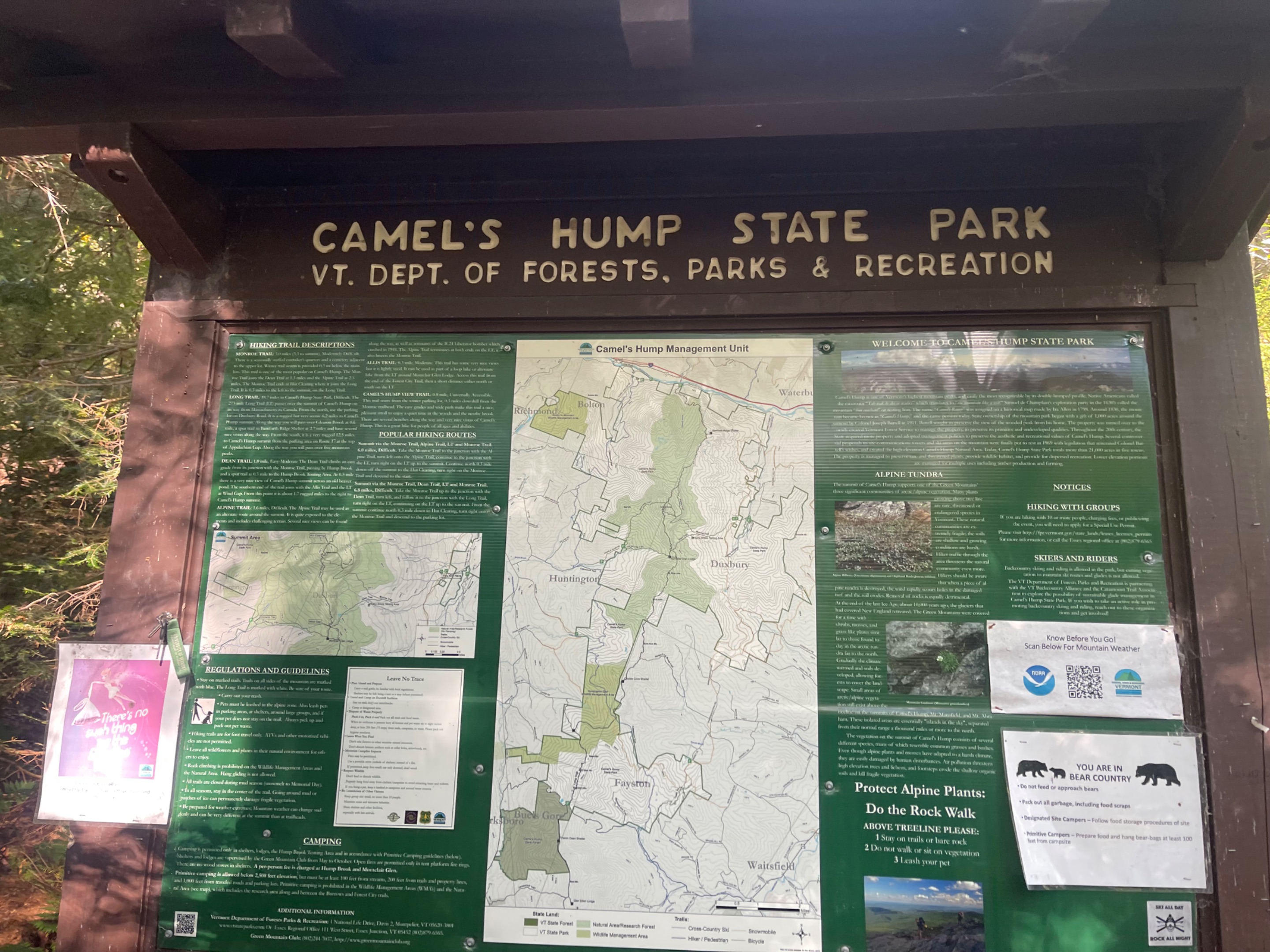 This sign was at the very beginning of the hike. I chose the Monroe Trail today, since it was the closest side of the mountain to where I was coming from in Stowe.
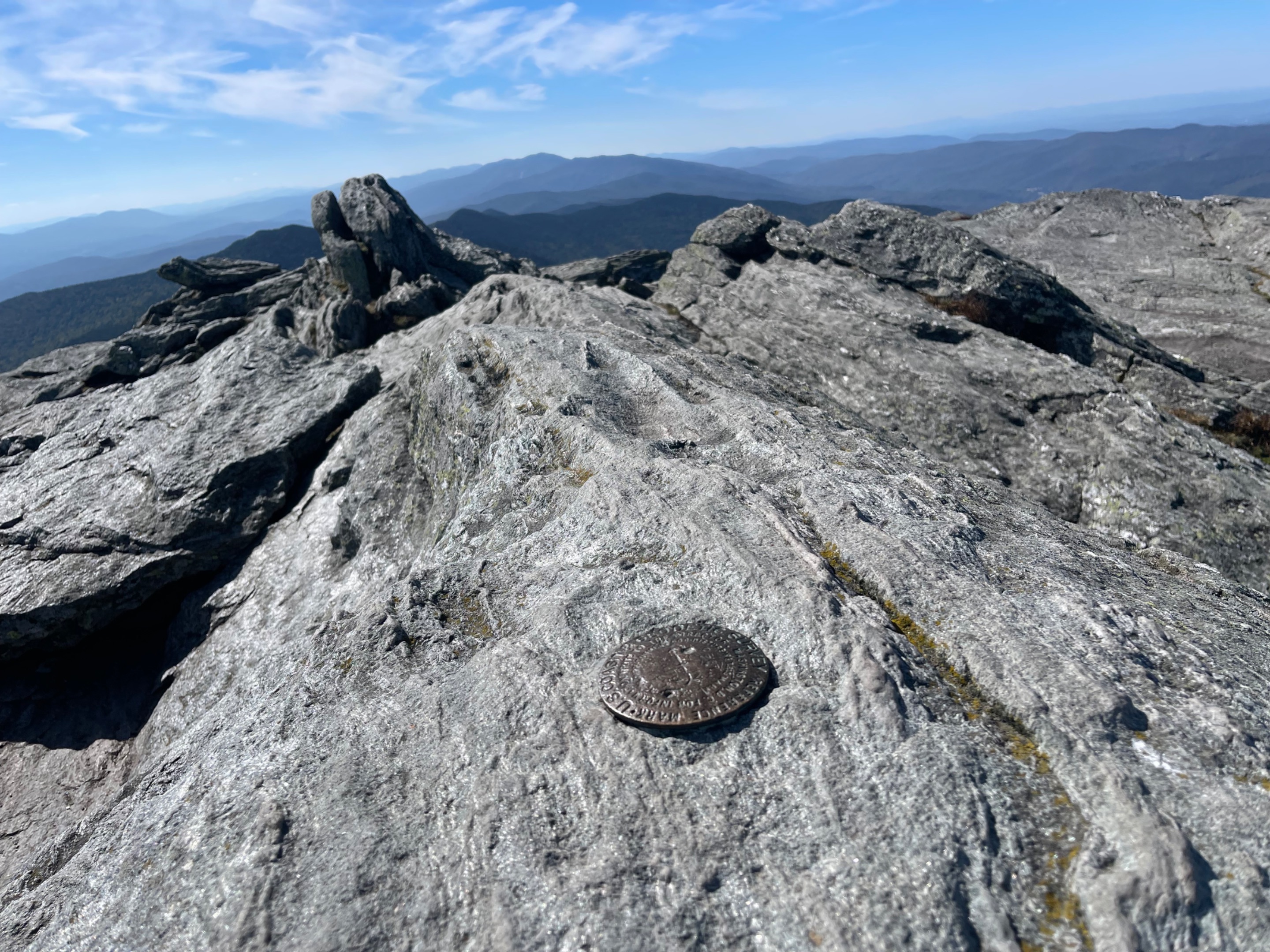
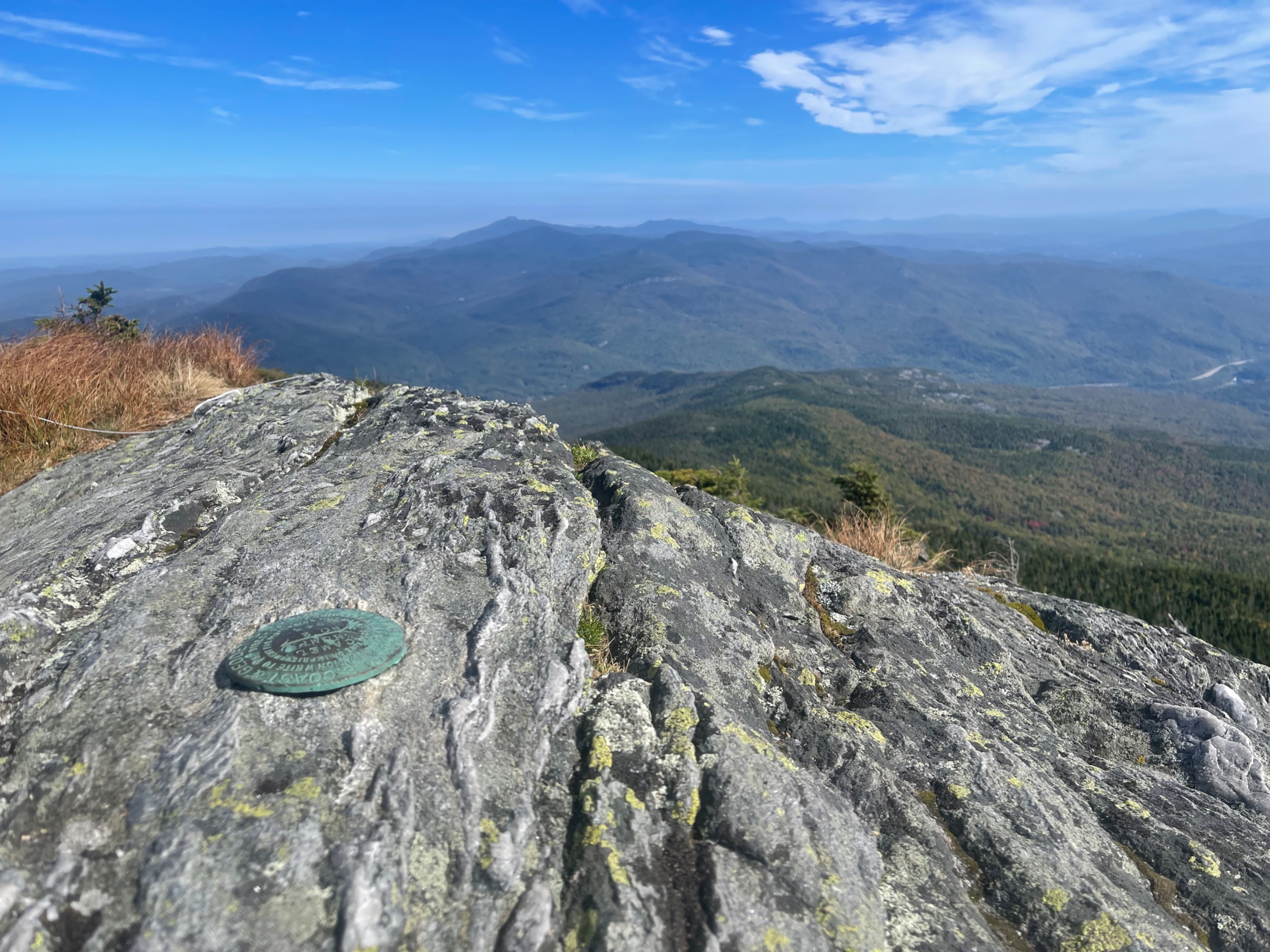 I always look for these US Geological survey markers whenever I summit a mountain. Found it!
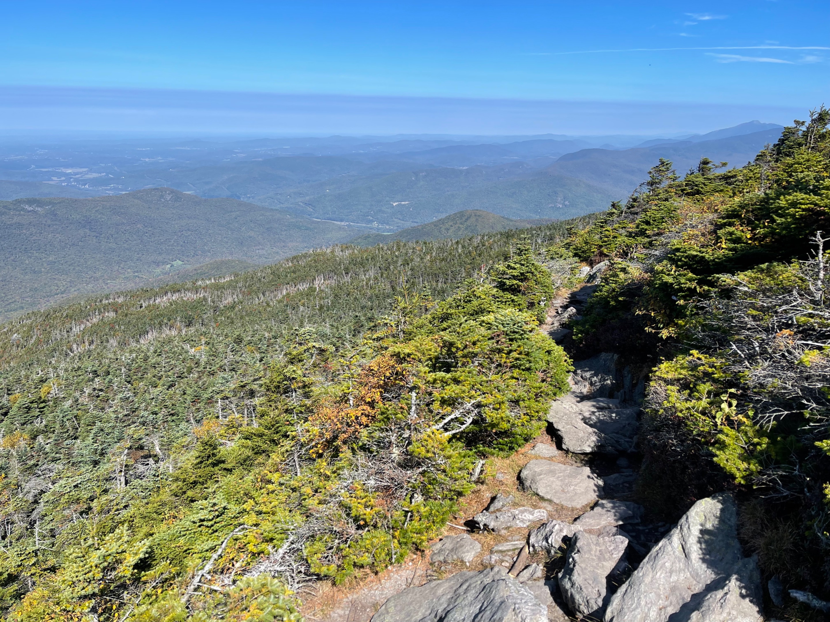
 Looking NW over Vermont. You can see the rocky trail heading off from here.
 Found another one!
 Another amazing view from the trail.
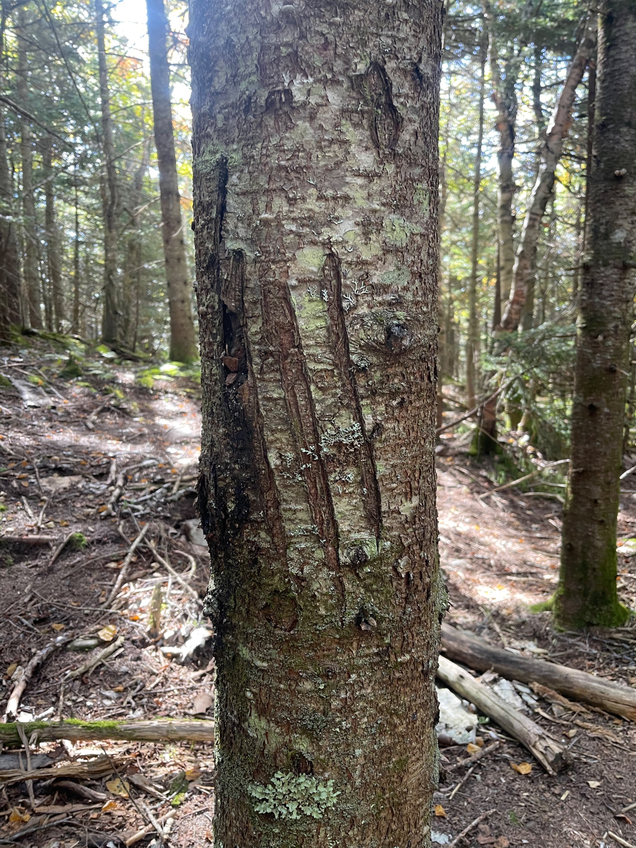 Looks like a bear has been using this tree as a scratching post.
 Looks like a chose a pretty good day for this hike.
 I can see all the way to Lake Champlain from up here!
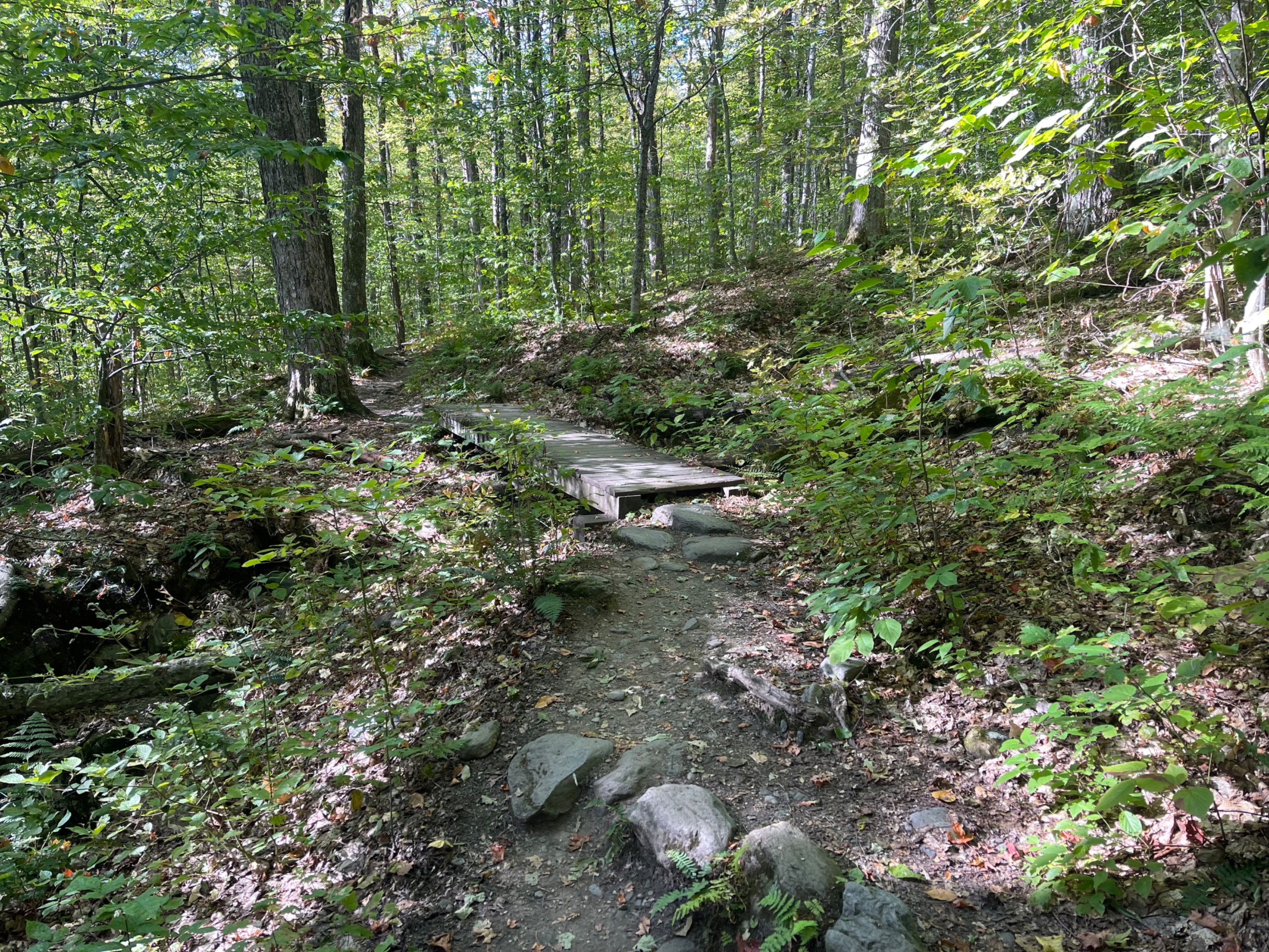
 The trail itself is very well maintained. There were a couple of these sturdy bridges over some of the wetter terrain.
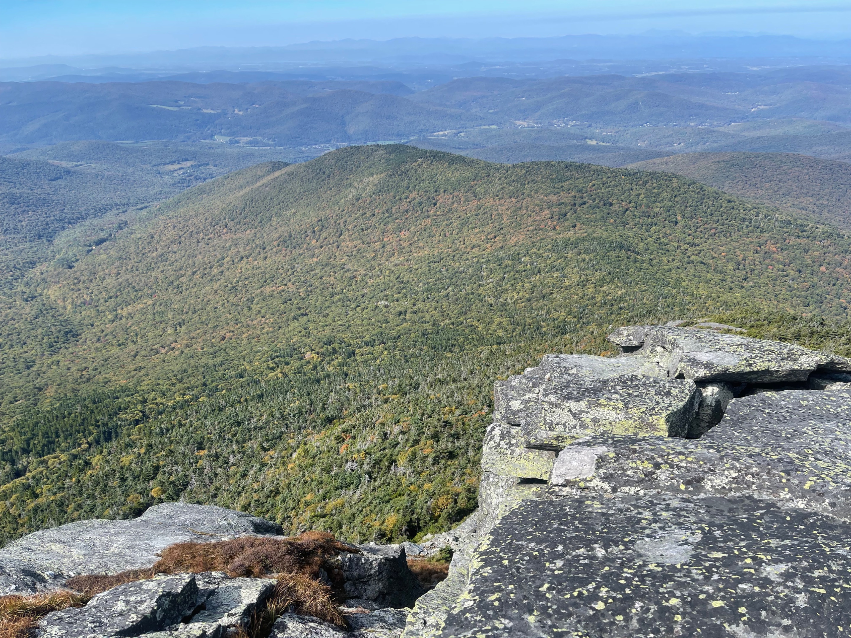 There was a pretty steep dropoff over the cliff on this side of Camel's Hump.
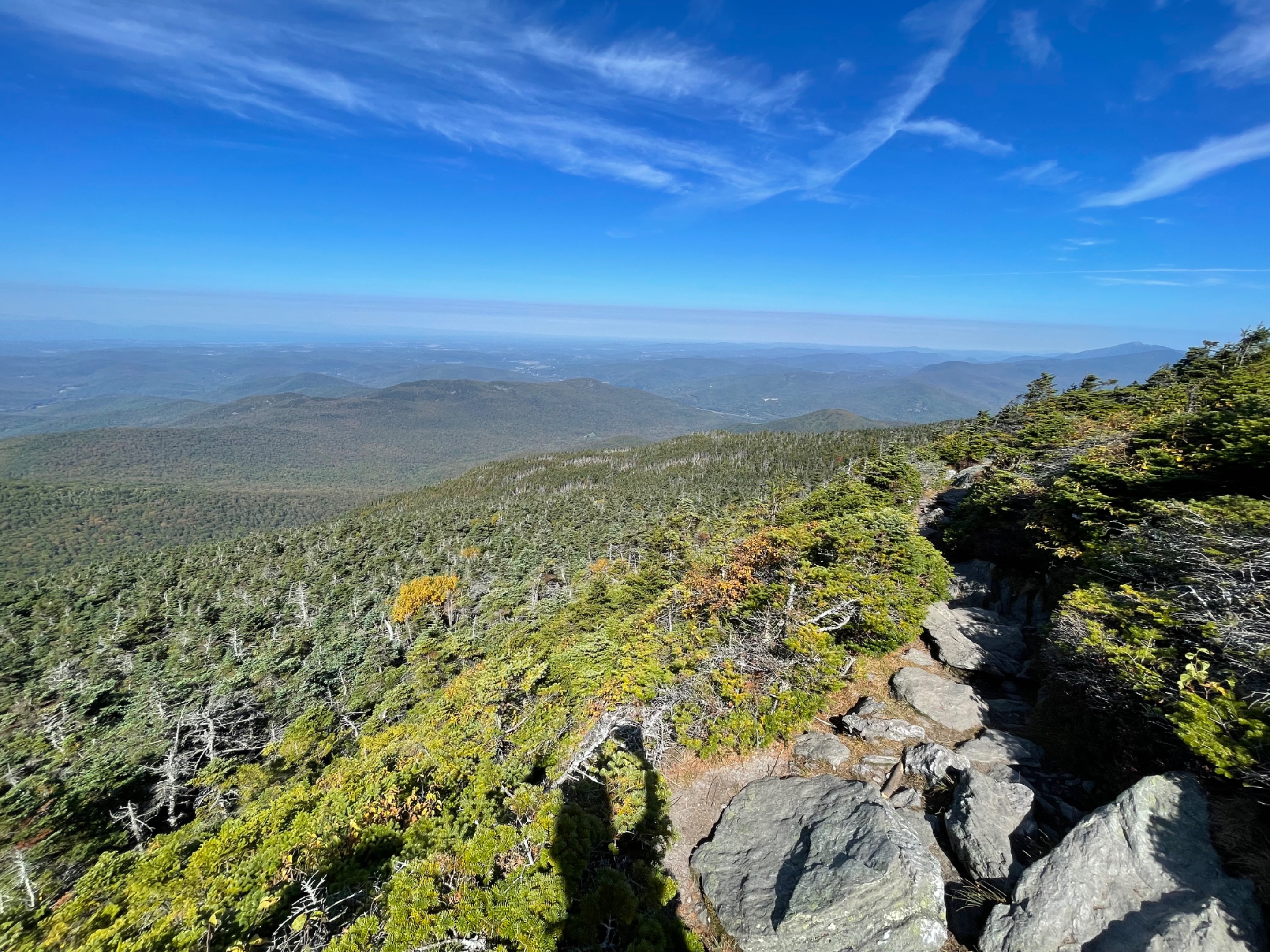
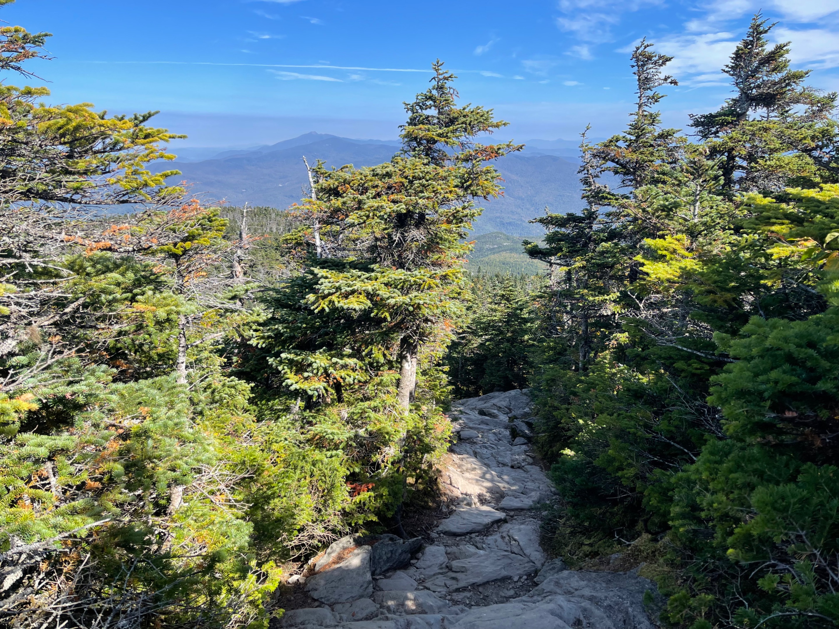 Towards the top of the mountain the trail became very rocky and the trees became purely conifers.
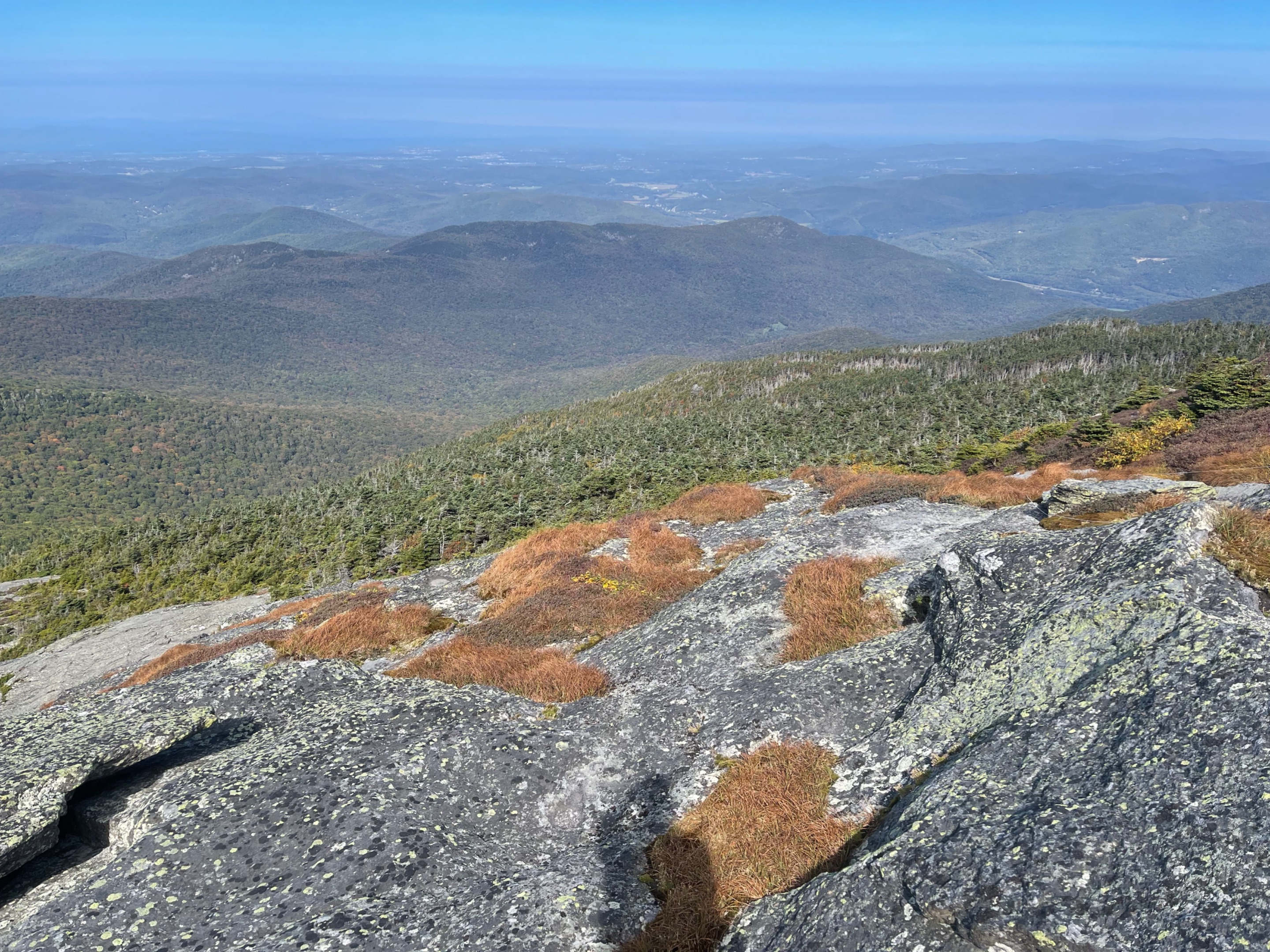
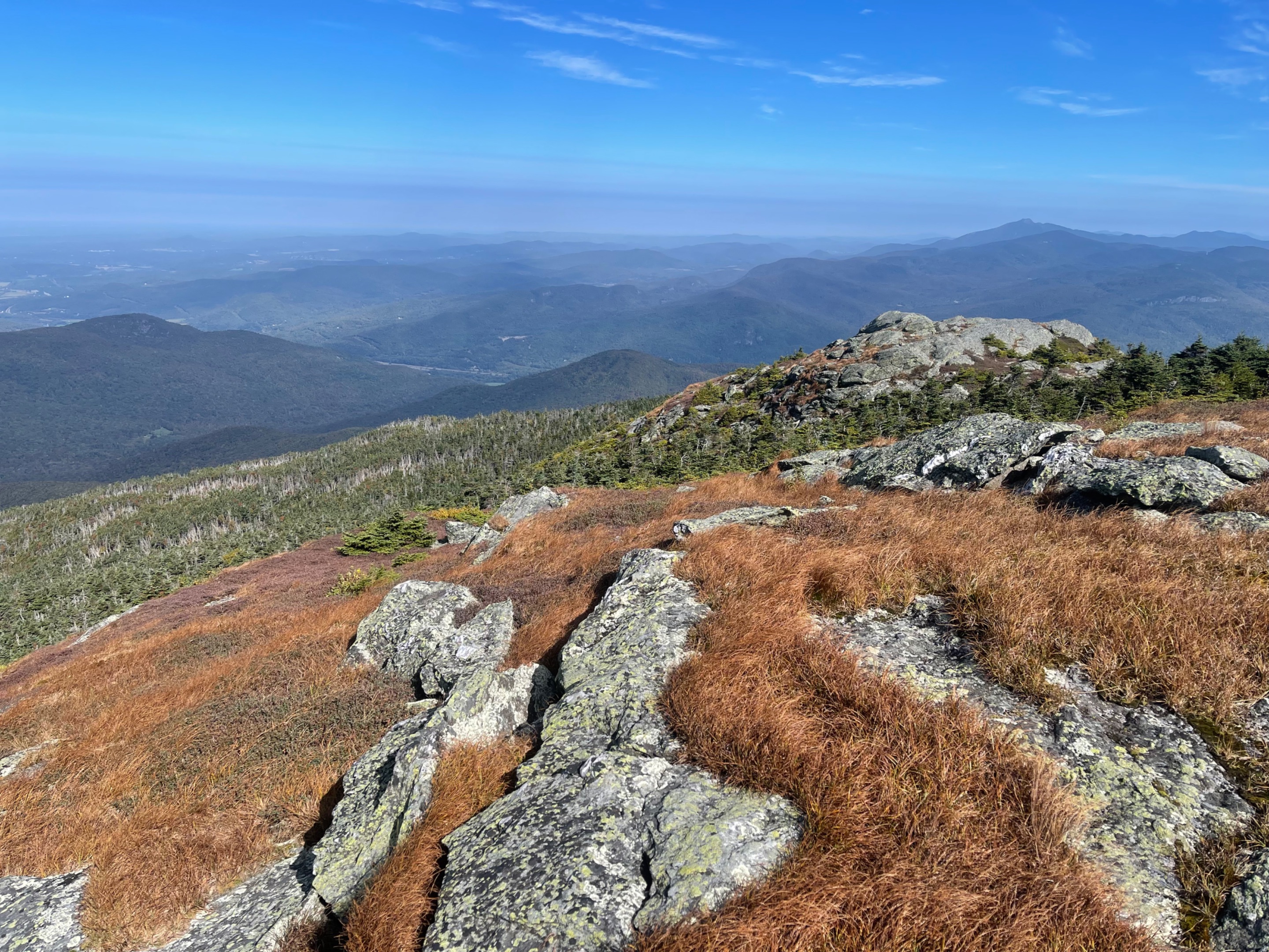 There are a few alpine species of plants that are quite rare, and only grow at this altitude here in Vermont. There are lots of signs telling people to only walk on the rocks, to protect the fragile alpine ecosystem.
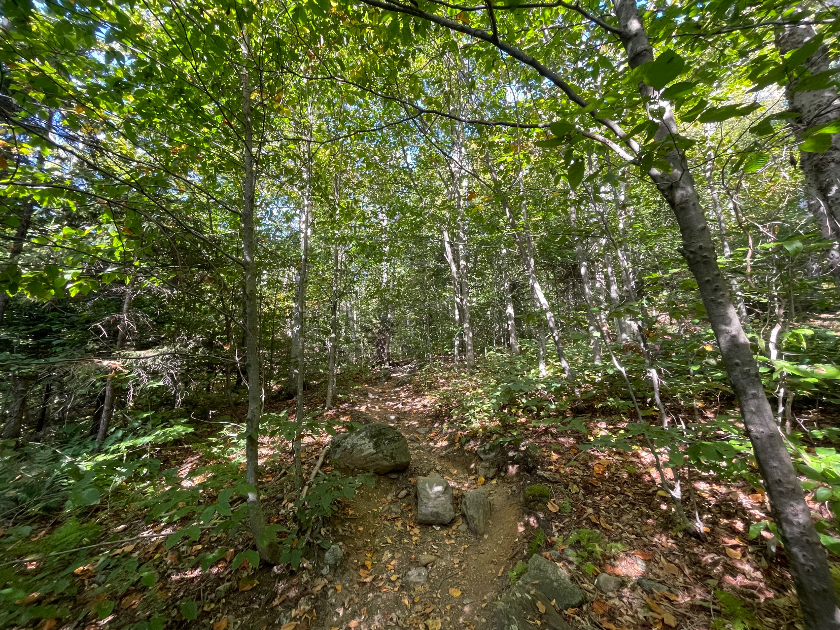
 Heading up the Monroe Trail.
 Well, you gotta start somewhere. This was at the very beginning of the hike.
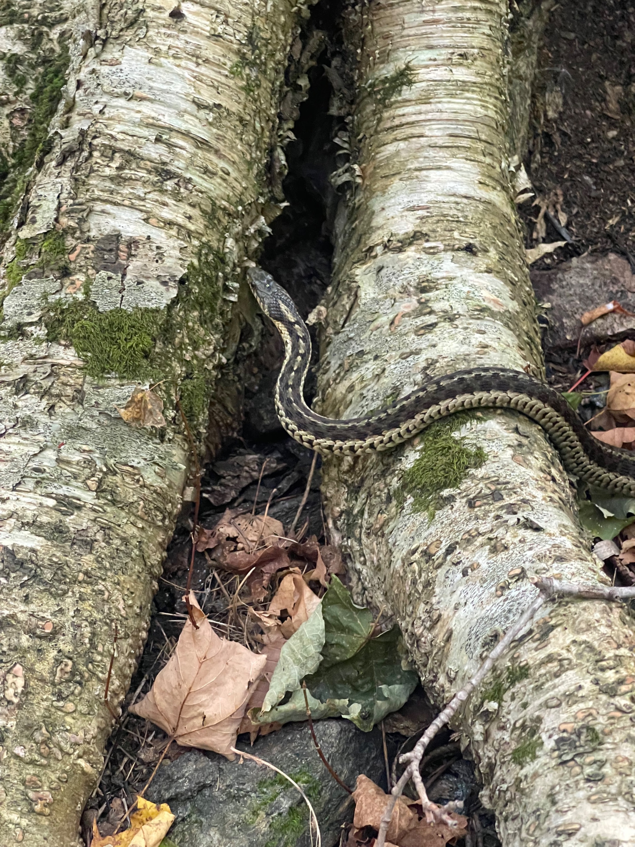 You never know what you will come across in the wilds of Vermont. This was a pretty good sized garter snake.
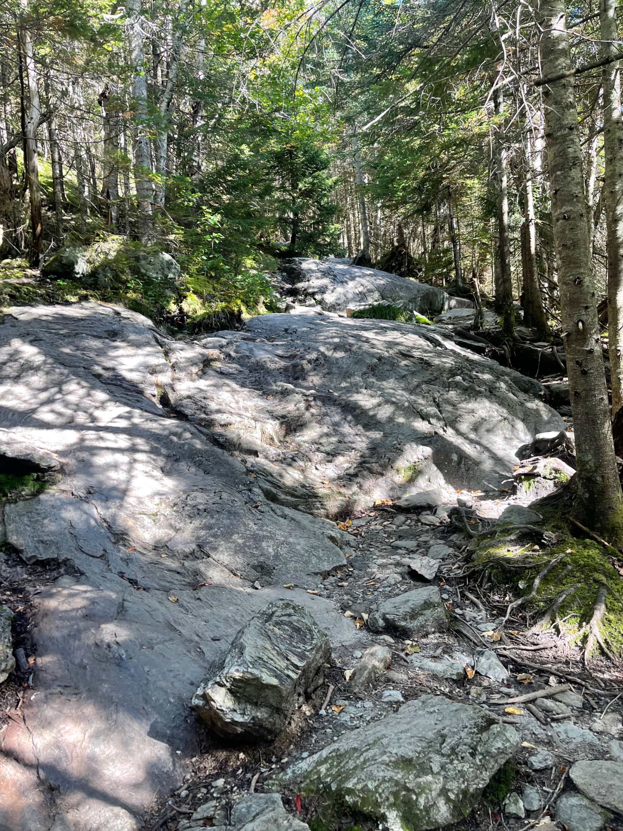 Some parts of the Monroe Trail were more like rock climbing than trail hiking.
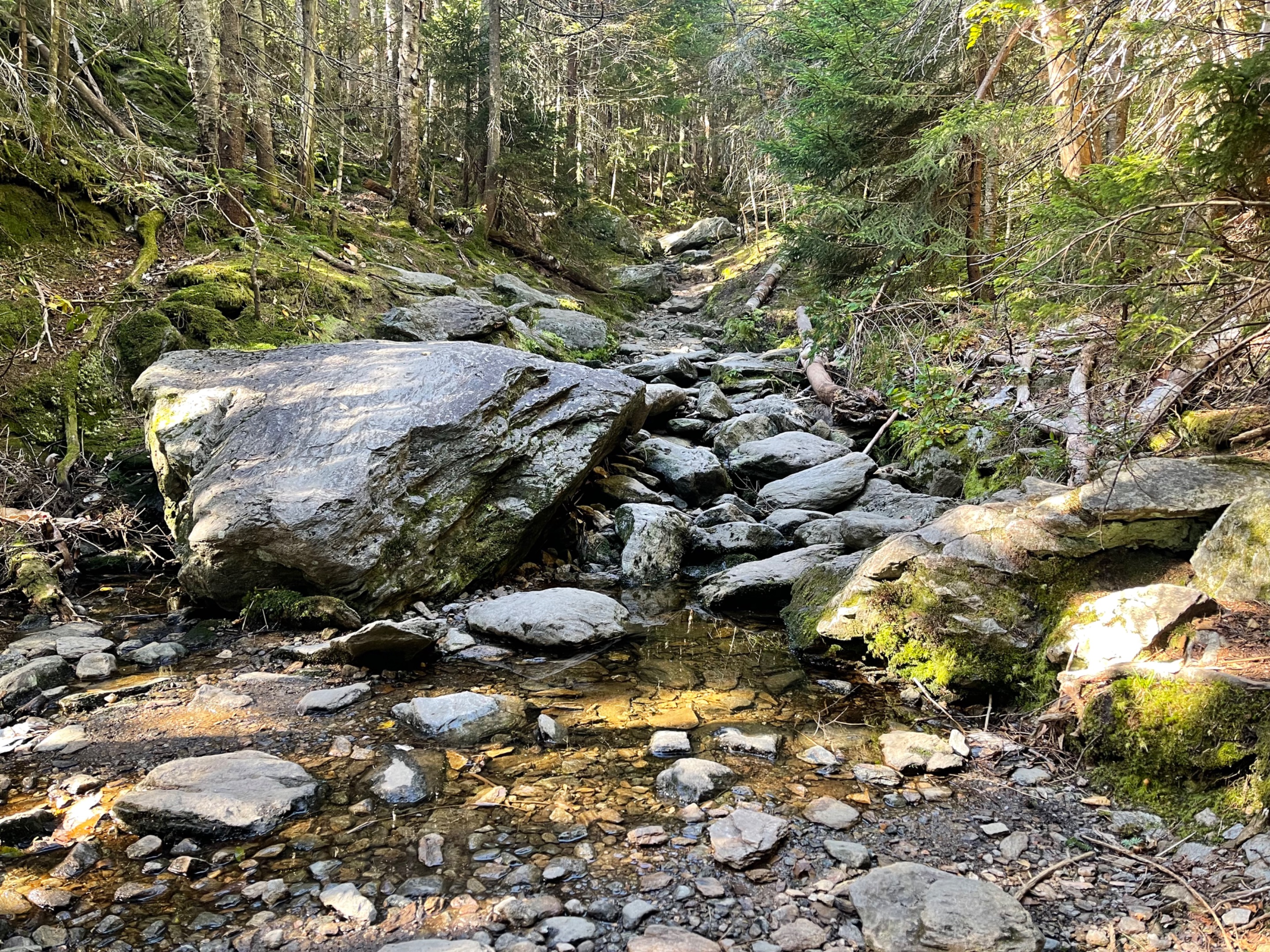
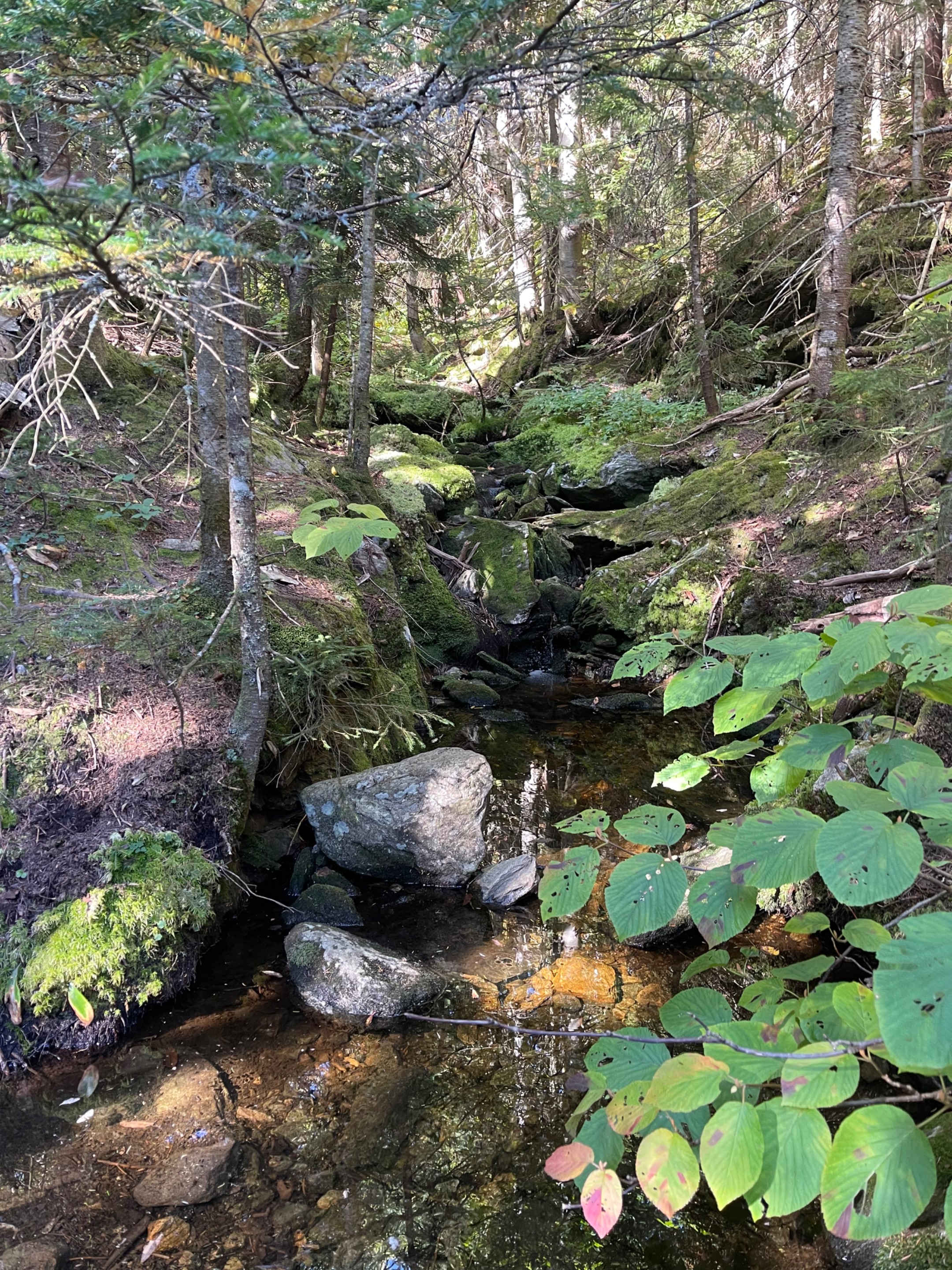 I really like this picturesque stream that came across the trail. All the different shades of green around it made it look like a moss garden.
 The Monroe Trail on a picture perfect day.
 Beautiful views from the summit.
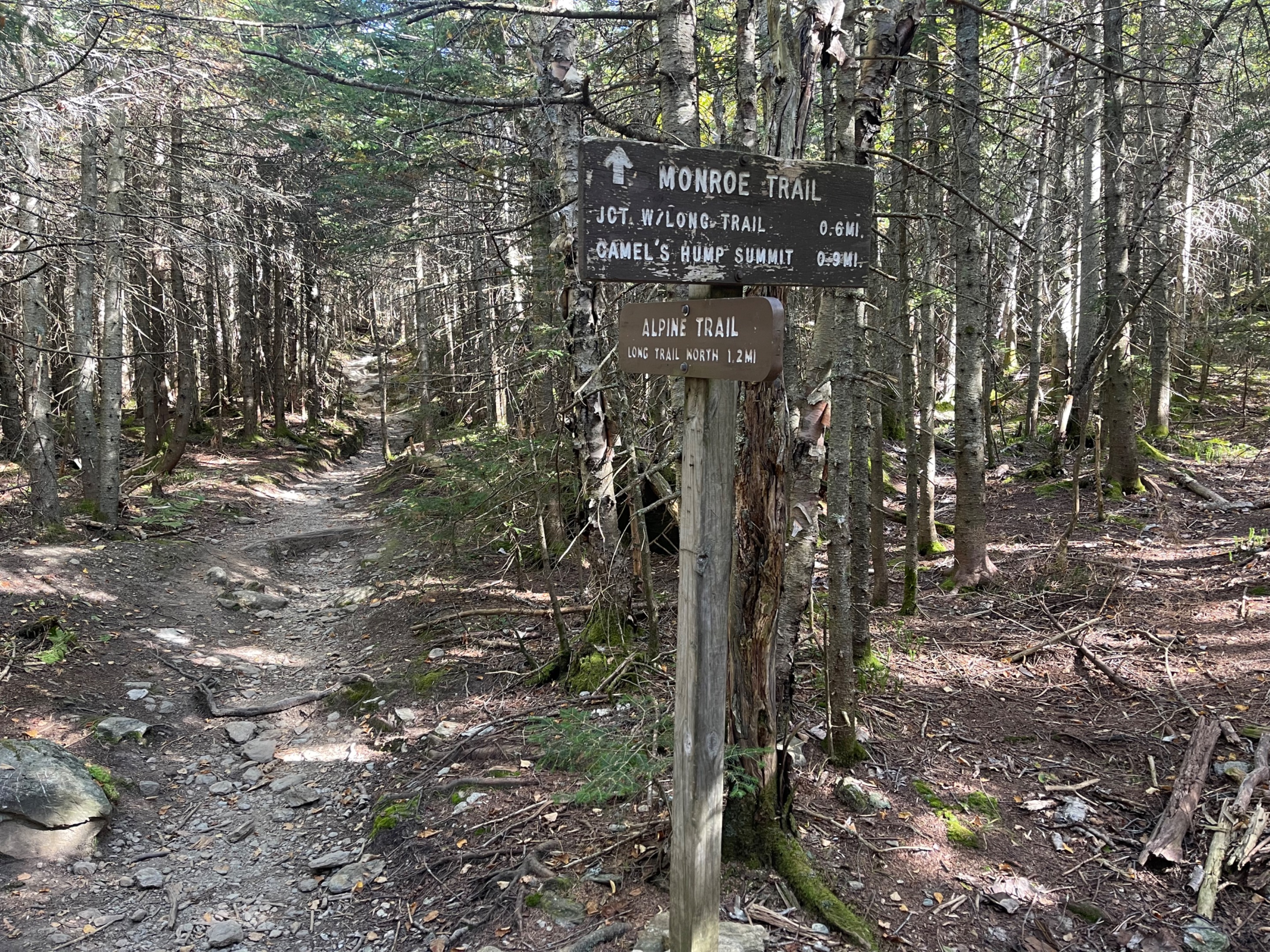 I'm getting close now! 0.6 miles to go.
 The trail was relatively dry, thanks to the drought we are in. But you can tell that the clouds still provide some moisture near the summit.
 Early on in the trail.
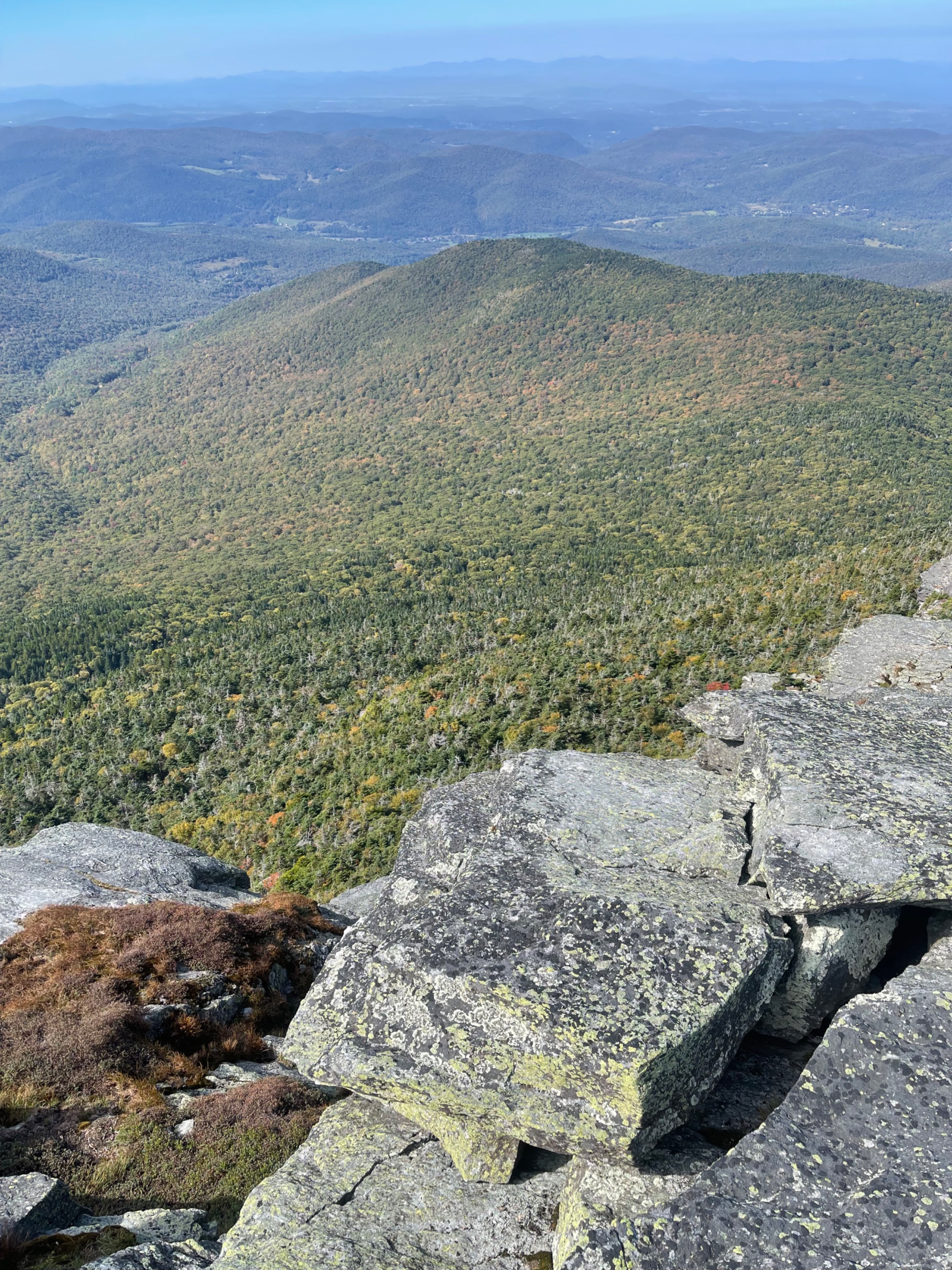
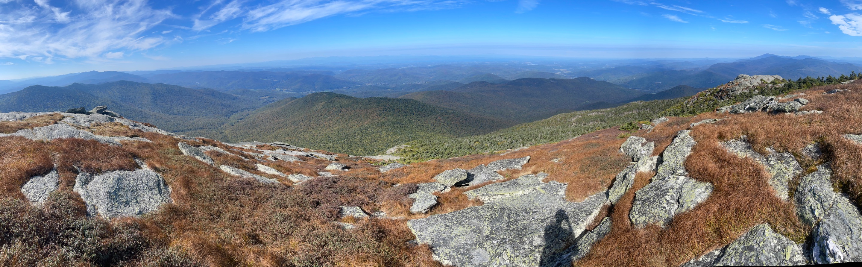 What a view. The Green Mountains sprawled out in front of me, all the way to Lake Champlain.
As always, keep traveling and keep posting! -Dai Mar