America the Beautiful Trip April 2025. English text is in cursive, below each paragraph in Polish.
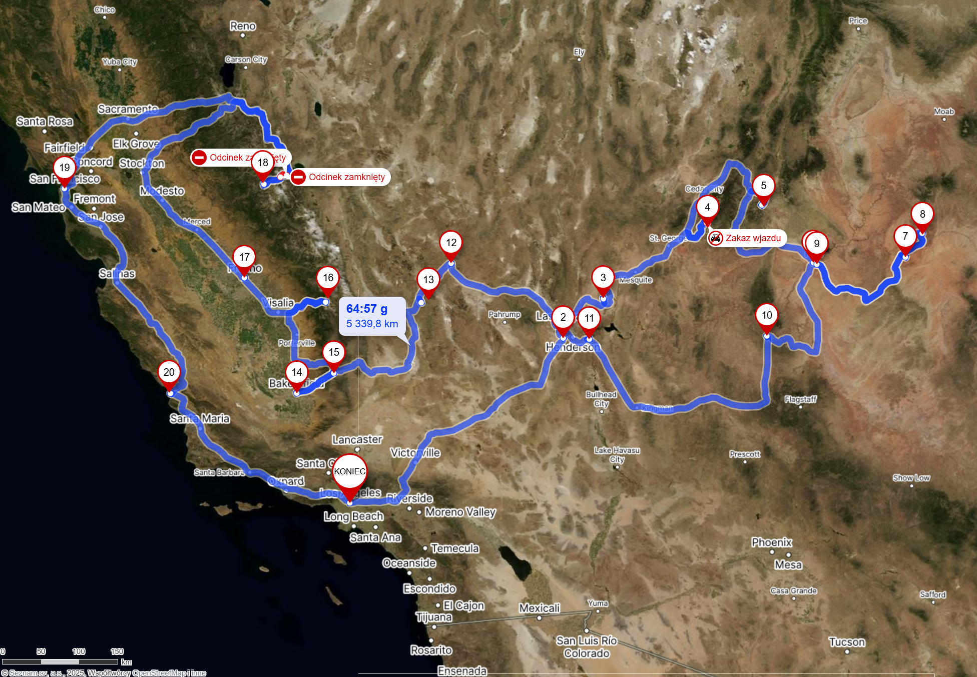
Po latach corocznych podróży do USA na firmowe konferencje, wreszcie zmądrzałem i postanowiłem połączyć wylot służbowy ze zwiedzaniem. Wspólnie z dwójką dobrych znajomych, zobaczyliśmy najpiękniejsze miejsca południowo-zachodnich Stanów Zjednoczonych - Nevada, Utah, Arizona i Kalifornia, czyli 'America the Beautiful Trip'. Ok. 5tys km samochodem i 320km w nogach. Ten post będzie mi służył jako wstęp i ramę dla kolejnych, szczegółowych wpisów. Poniżej dzielę się planem, dziennymi przebiegami autem i pieszo, kosztami oraz załączam po 2 zdjęcia z każdego dnia na zachętę.
After years of travelling to the US for company conventions, I decided the obvious - to stay longer for sightseeing. I am person who thrives in nature and my choice was simple - National/State Parks of southwestern US - Nevada, Utah, Arizona and California. Therefore the title - 'America the Beautiful Trip'. 5tys km driven and 320km walked. This post will serve as a framework for my future, more detailed articles. I am providing here my itinerary and 2 photos per day, as an appetizer.
Itinerary / Kilometrówka
Punktem początkowym i startowym było Los Angeles (najkorzystniejsze bilety lotnicze z Polski). Ja od razu musiałem lecieć do Las Vegas na konferencję. W tym czasie moi towarzysze mieli 3,5 dnia na zwiedzanie Los Angeles, podróż do Las Vegas i wędrówkę po Red Rock National Conservation Area.
Our start and end point was Los Angeles. Since I had to attend a company convention in Las Vegas, my trip started there, 3,5 days after arrival. My companions used that time to see LA, to travel to Las Vegas and hike in Red Rock National Conservation Area.
Dzień / Day 0.5 - 17.04.2025
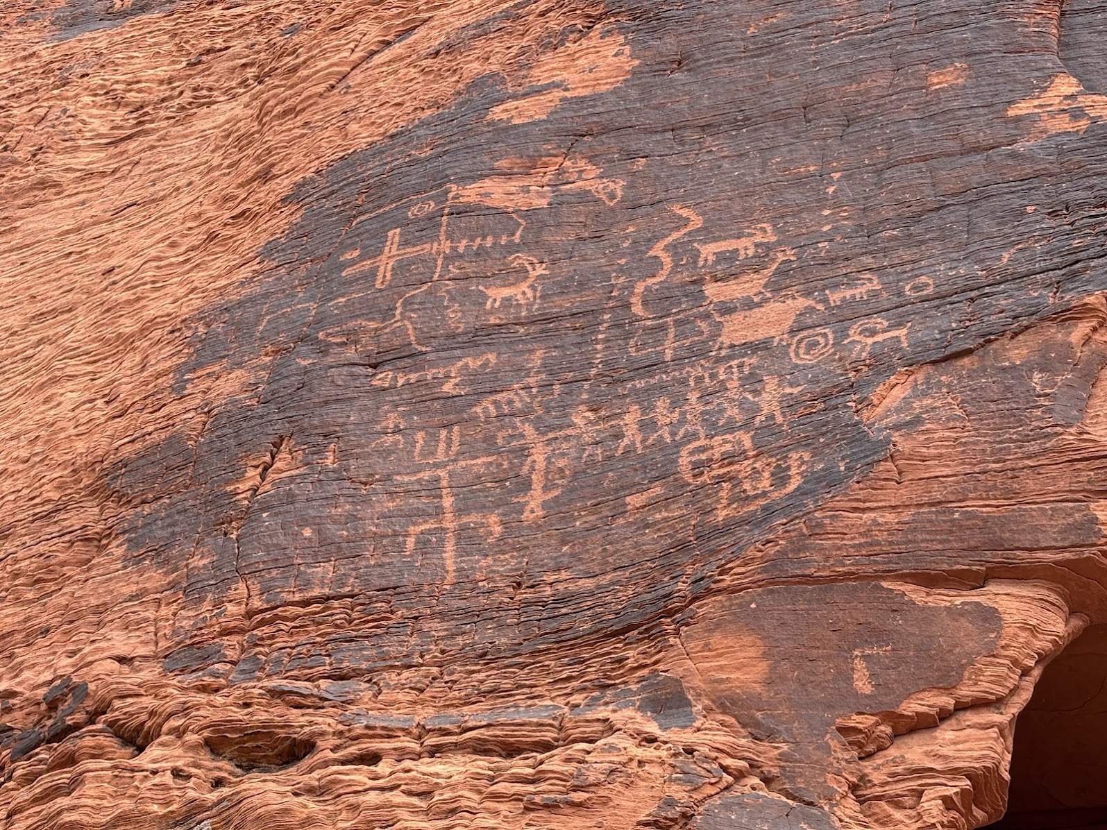
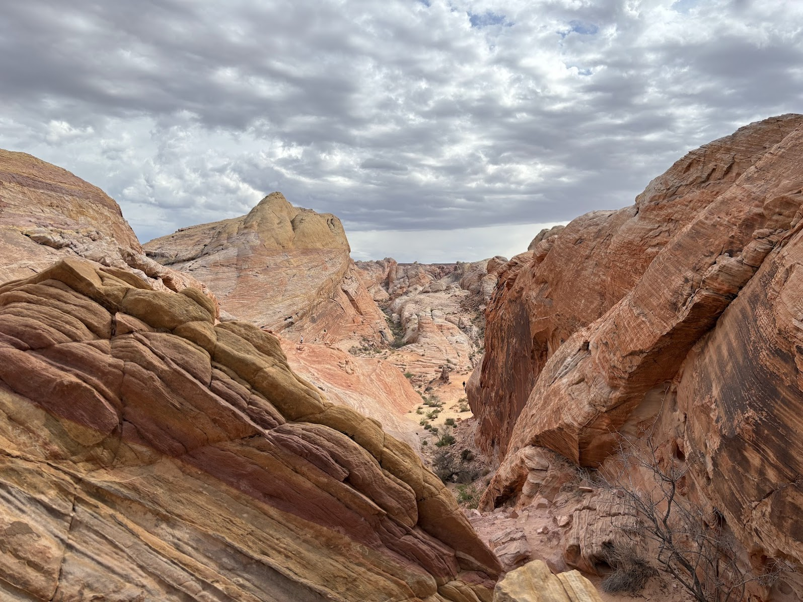
Valley of Fire, Nevada
Moja wyprawa zaczęła się 17 kwietnia w południe. Celem było dotarcie do Springdale (Zion National Park), a po drodze mieliśmy kilka krótkich wędrówek w Valley of Fire State Park.
My trip started at midday of April 17. We used the afternoon to reach Springdale (Zion National Park). ON the way there we had 3 short hikes in Valley of Fire State Park.
| Samochodem / by car | Las Vegas -> Valley of Fire -> Springdale (300km) |
|---|---|
| Pieszo / on foot | Petroglyphs Canyon (1km) + Fire Wave (3,6km) + Elephant Rock (2,2km) |
| Nocleg / Accommodation | Springdale, UT (private) |
| Blog post | TBA |
Dzień / Day 1 - 18.04.2025
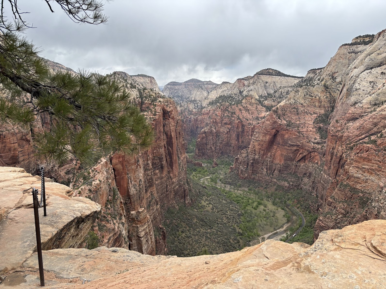
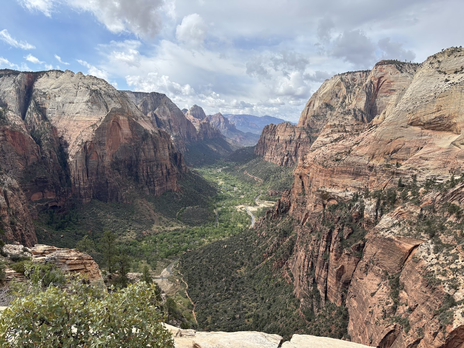
Zion, Utah
Koleżanka z USA zdobyła pozwolenie na kultowe Angels Landing w Parku Narodowym Zion. Program dnia ułożył się więc sam. Po wspinaczce dodaliśmy sobie jeszcze spacer do Emerald Pools.
My American workmate had won the lottery for Angels Landing, so the plan for the day was obvious. After the climb to the iconic viewpoint, we added a stroll to Emerald Pools.
| Samochodem / by car | NA |
|---|---|
| Pieszo / on foot | Angels Landing (7,1km) + Emerald Pools (4,2km) |
| Nocleg / Accommodation | Springdale, UT (private) |
| Blog post | TBA |
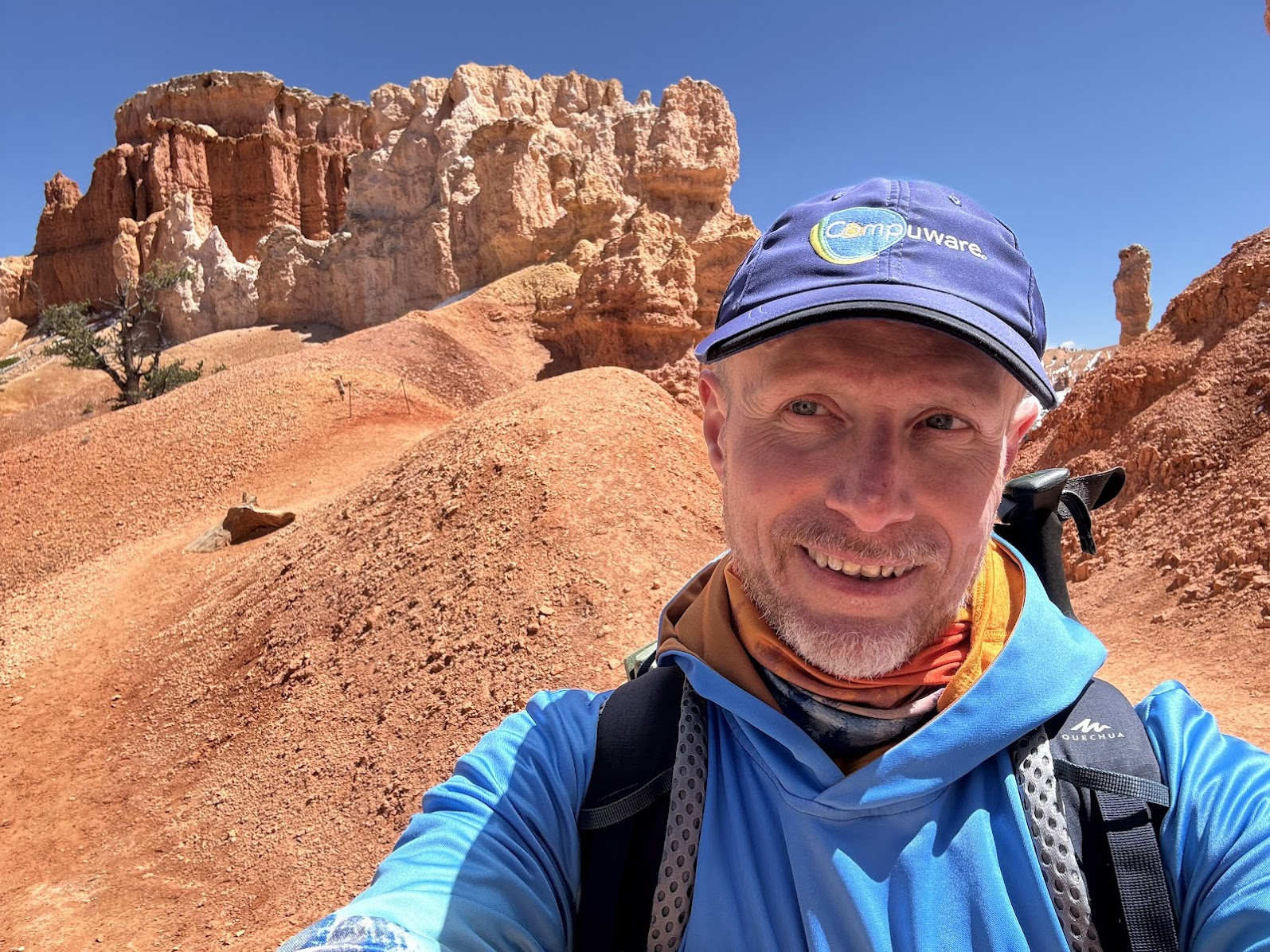
Dzień / Day 2 - 19.04.2025
Bryce Canyon, Utah
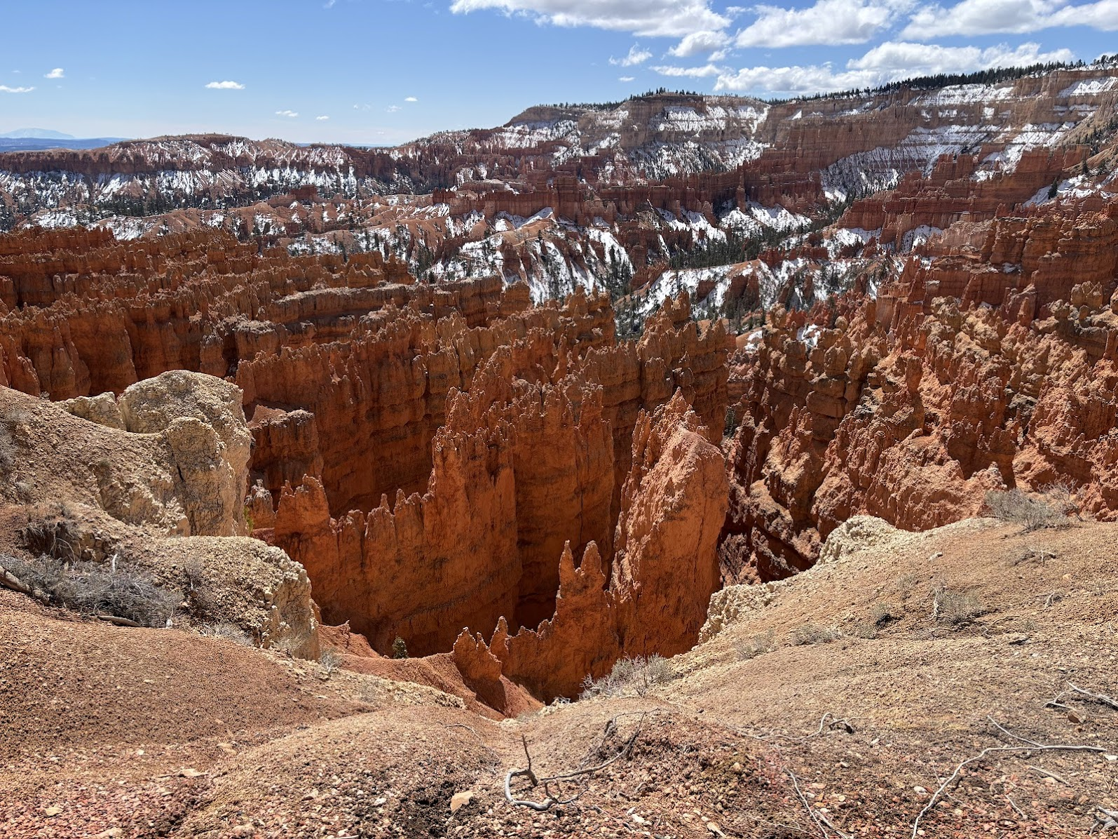
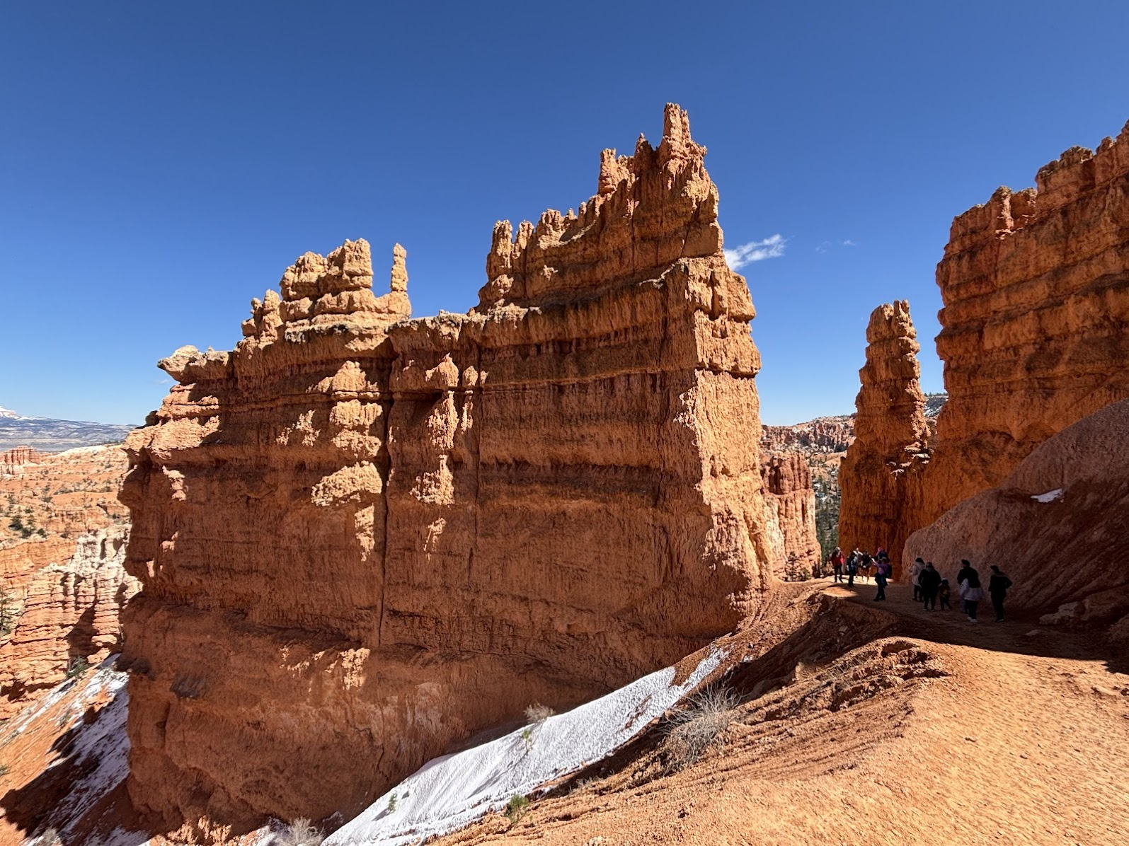
Park Narodowy Bryce Canyon dodaliśmy do planu podróży w ostatniej chwili. A okazał się jednym z hitów wyprawy. Formacje z piaskowca zwane Hoodoo zrobiły na nas ogromne wrażenie.
We have added Bryce Canyon National Park as a last minute item. The hoodoos (sandstone formations) turned out to be one of our top spots during the whole trip.
| Samochodem / by car | Springdale -> Bryce Canyon -> Page (383km) |
|---|---|
| Pieszo / on foot | Navajo and Peekaboo Loops (10km) |
| Nocleg / Accommodation | Travelodge Page, AZ |
| Blog post | TBA |
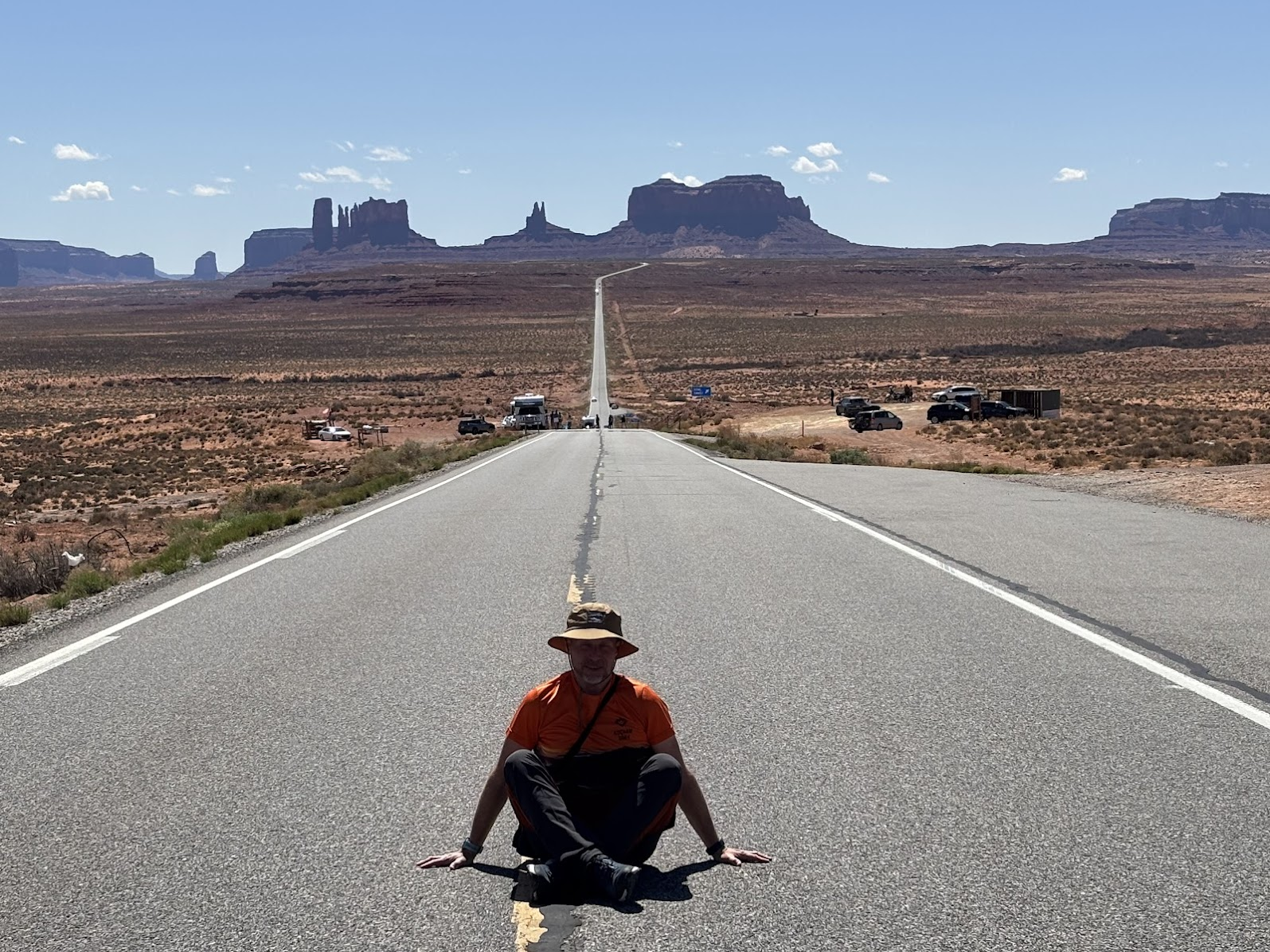
Dzień / Day 3 - 20.04.2025
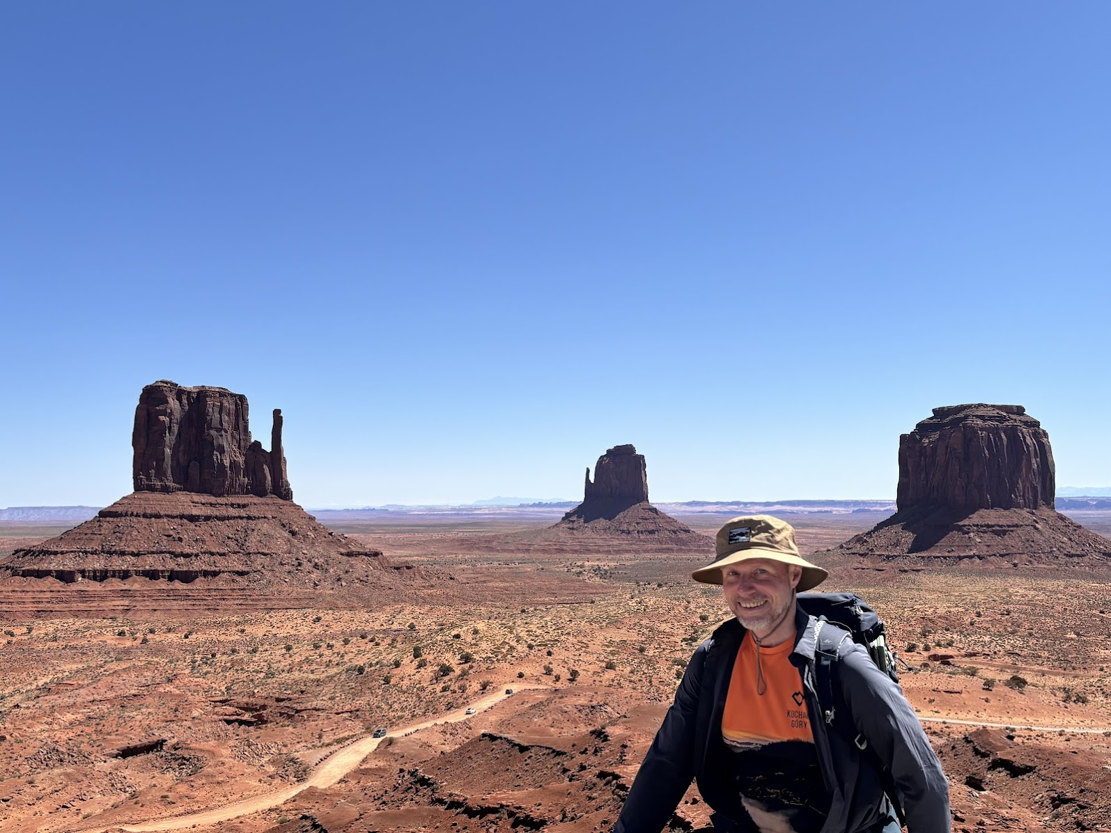
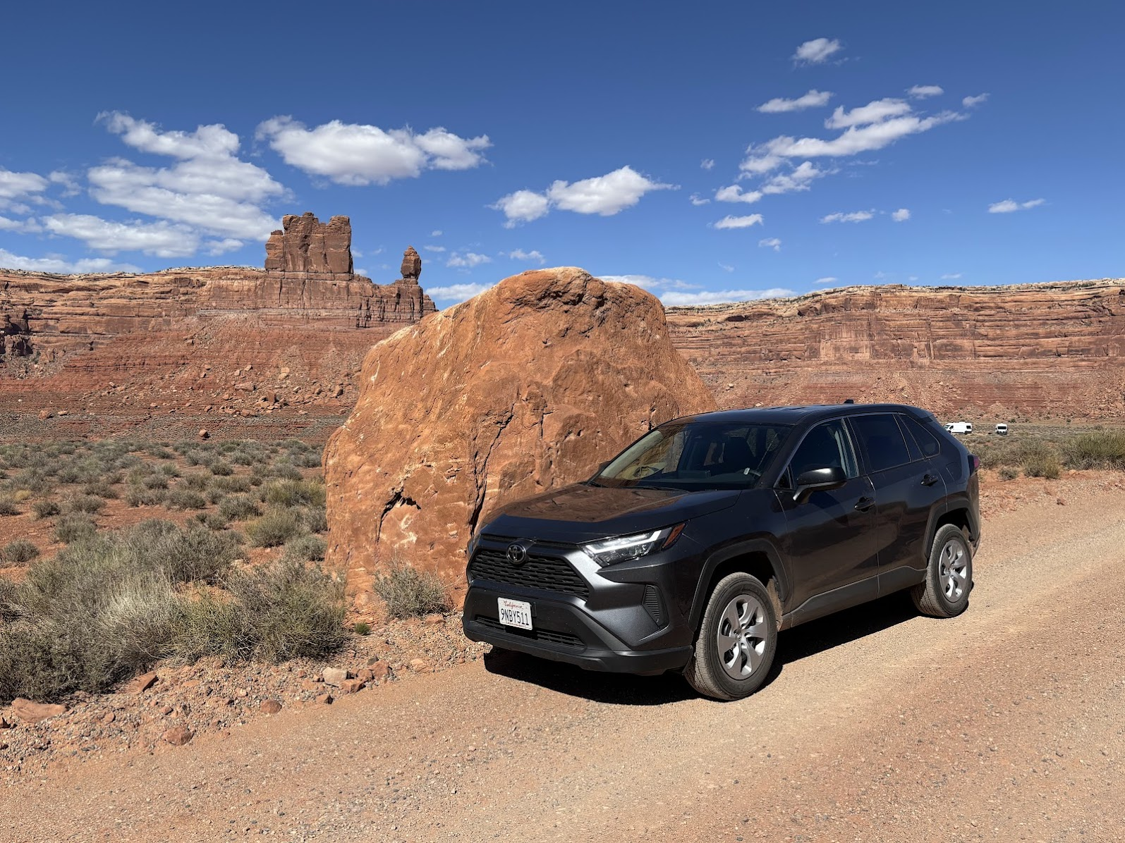
Monument Valley, Arizona
Długi dzień - dojazd do Monument Valley, Forrest Gump Point, off road w Valley of the gods i powrót do Page.
It was a long day - trip to Monument Valley, Forrest Gump Point, off road in Valley of the gods and back to Page.
| Samochodem / by car | Page -> Monument Valley -> Valley of the gods (off road) -> Page (516km) |
|---|---|
| Pieszo / on foot | Monument Valley Wildcat Trail (7,1km) |
| Nocleg / Accommodation | Travelodge Page, AZ |
| Blog post | TBA |
Dzień / Day 4 - 21.04.2025
Glen Canyon, Arizona
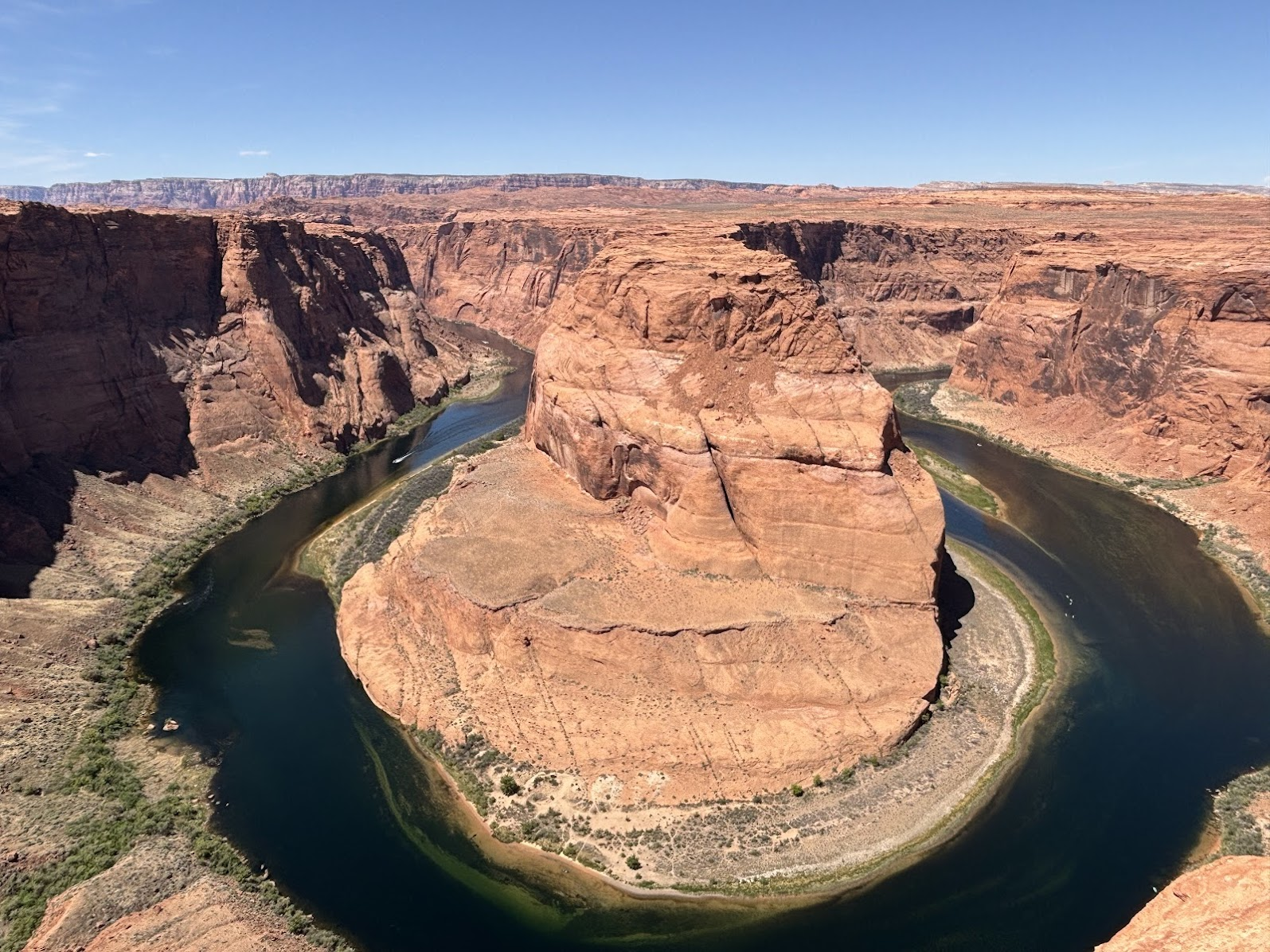
Ten dzień miał być przeznaczony na ikoniczną formację The Wave. Niestety, nie mieliśmy szczęścia w loterii - dziennie wchodzą maksymalnie 64 osoby. Na pocieszenie mieliśmy kilka wędrówek w Glen Canyon - m.in. Horseshoe Bend i Lake Powell.
We had hoped for a permit to The Wave. The lottery wasn't lucky for us (max 64 people are admitted daily), so we spent the day around the Glen Canyon. The highlights were the iconic Horseshoe Bend and Lake Powell.
| Samochodem / by car | okolice / around Page (~56km) |
|---|---|
| Pieszo / on foot | Beehive Trail (ok 2,5km), Horseshoe Bend (ok 2,7km), Lake Powell - Lone Rock Beach (ok. 3km) |
| Nocleg / Accommodation | Travelodge Page, AZ |
| Blog post | TBA |
Dzień / Day 5 - 22.04.2025
Antelope Canyon, Arizona
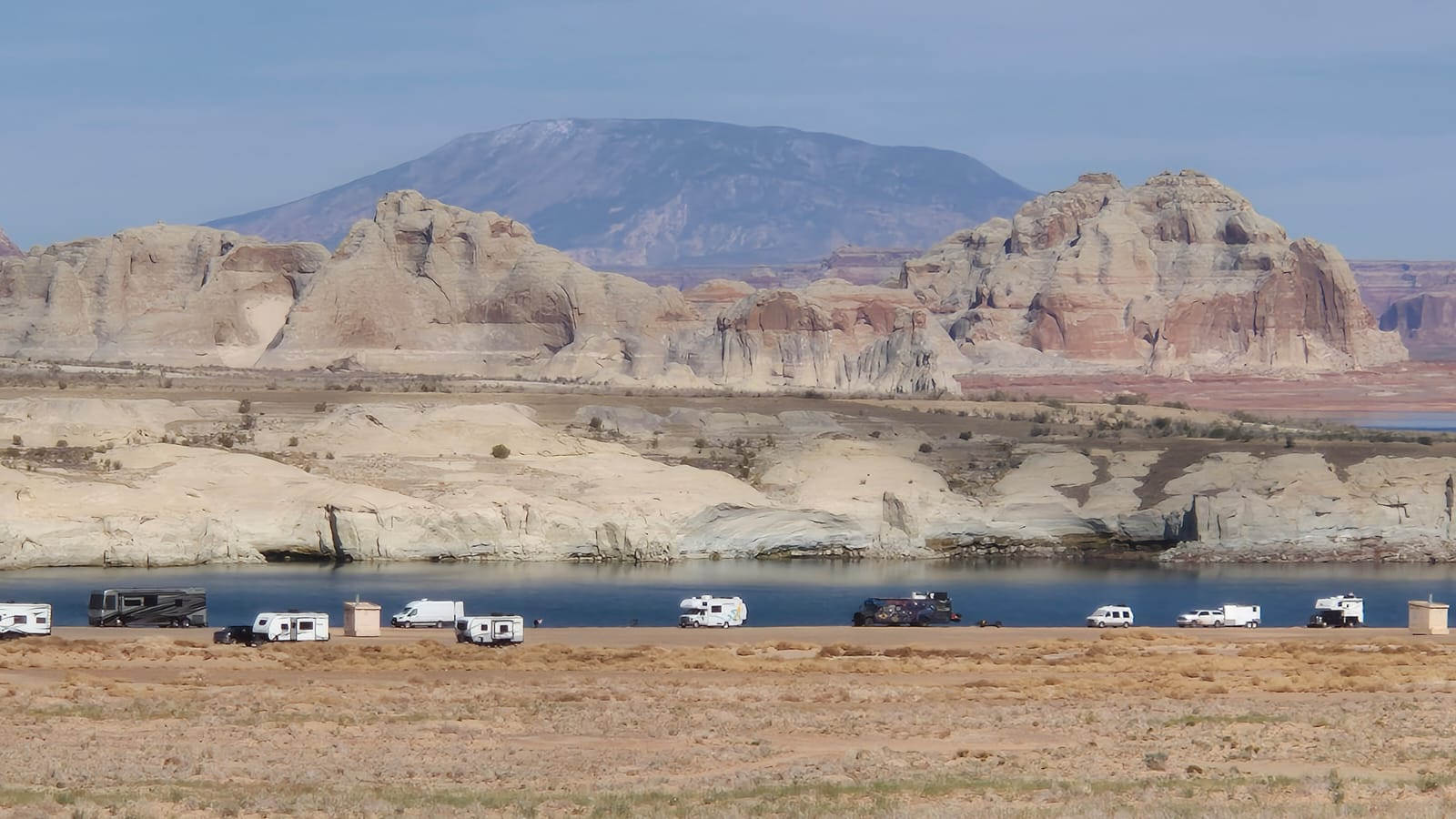
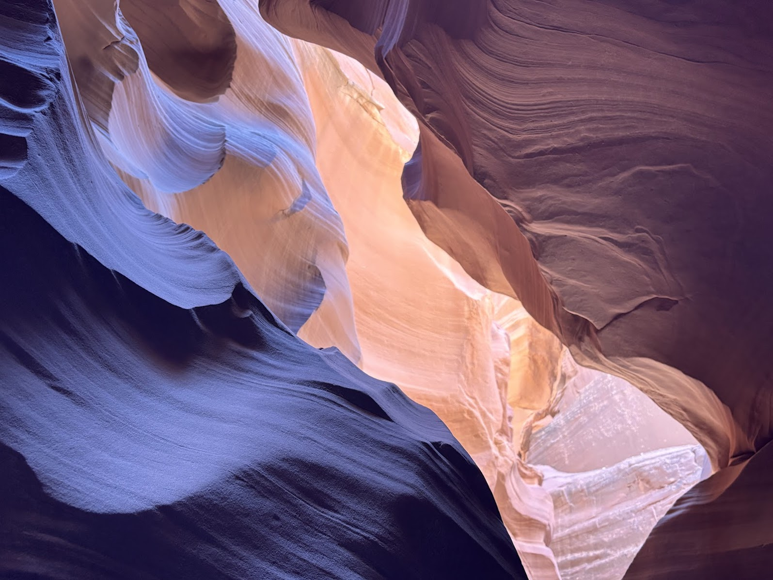
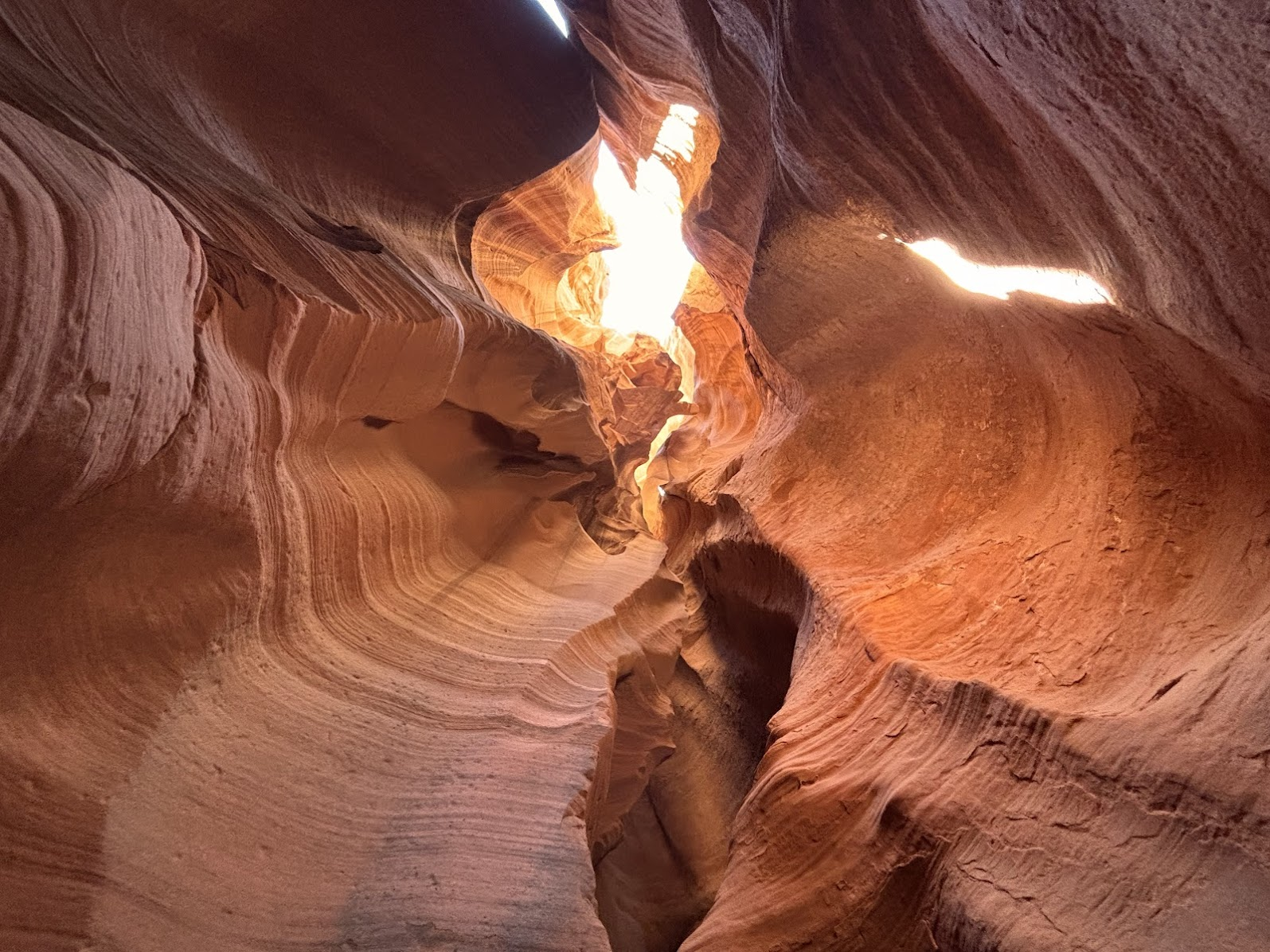
Późne rano spędziliśmy w jednym z piękniejszych miejsc całej naszej wyprawy - Kanionie Antylopy (konkretnie Canyon X - Antelope Canyon). Po południu wycieczka statkiem po jeziorze Powell, z wpłynięciem do Kanionu Antylopy. Potem już tylko długa jazda do Wielkiego Kanionu.
On day 5 we toured one of the most beautiful places of our trip - Antelope Canyon X. Early afternoon was devoted to a boat trip on Lake Powell - we entered the Antelope Canyon from the lake side. The rest of the day was a long drive to Grand Canyon.
| Samochodem / by car | okolice / around Page (~43km) + Page -> Valle (264km) |
|---|---|
| Pieszo / on foot | Canyon X Trail with Taadidiin Tours (~6km) |
| Nocleg / Accommodation | Grand Canyon Inn Valle, AZ |
| Blog post | TBA |
Dzień / Day 6 - 23.04.2025
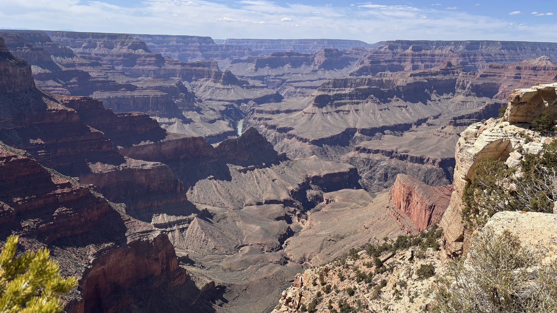
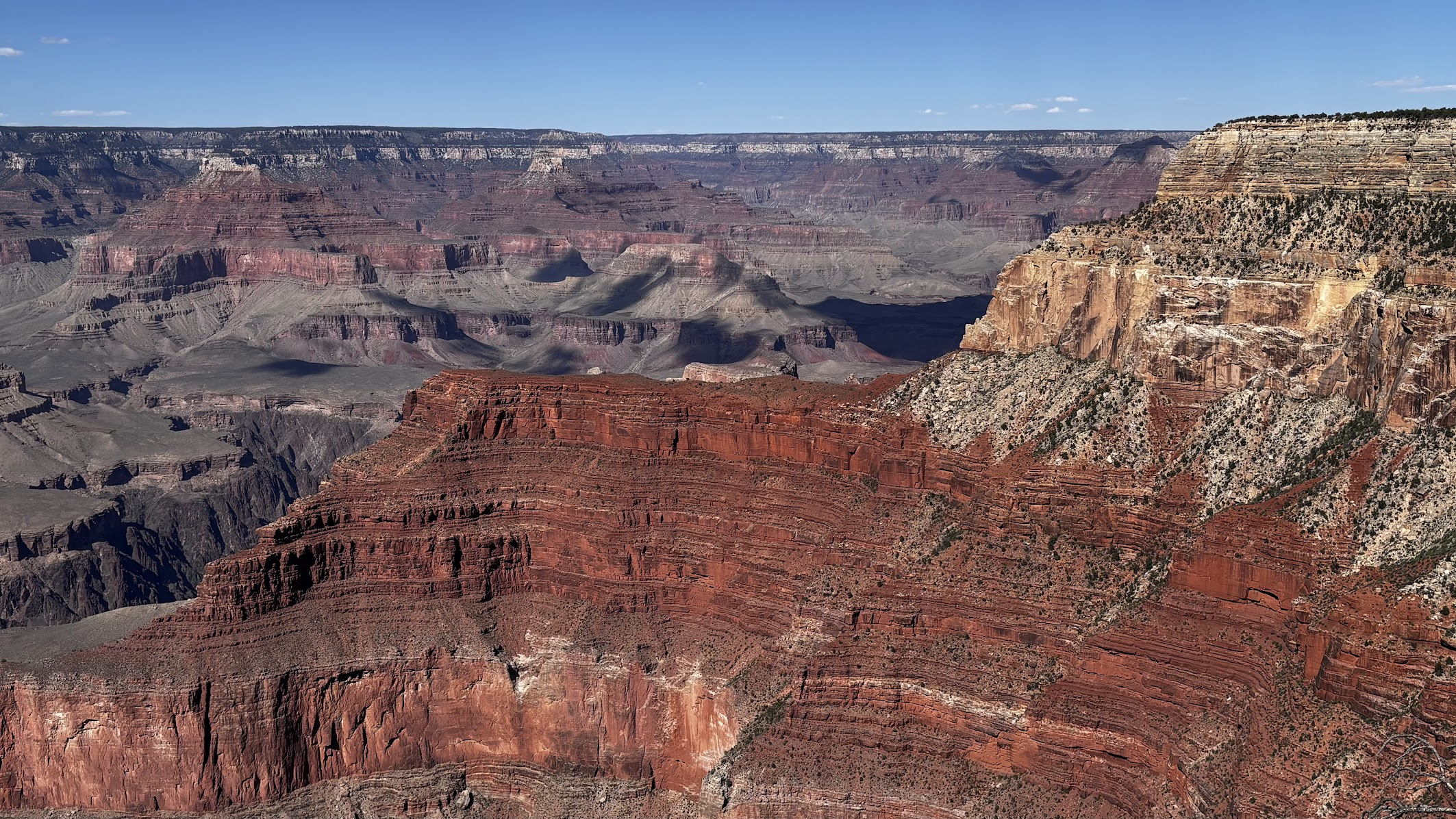
Grand Canyon, Arizona
Pierwszego dnia w Wielkim Kanionie przeszliśmy cały szlak South Rim Trail - czyli 21km wzdłuż południowego skraju kanionu. Kolejnego dnia zejdziemy do jego czeluści.
Our first day at Grand Canyon was the South Rim Trail, from South Kaibab to Hermits Rest. The following day we would descent into the depths of the canyon.
| Samochodem / by car | Valle -> Grand Canyon -> Valle (92km) |
|---|---|
| Pieszo / on foot | South Rim Trail (20,9km) |
| Nocleg / Accommodation | Grand Canyon Inn Valle, AZ |
| Blog post | TBA |
Dzień / Day 7 - 24.04.2025
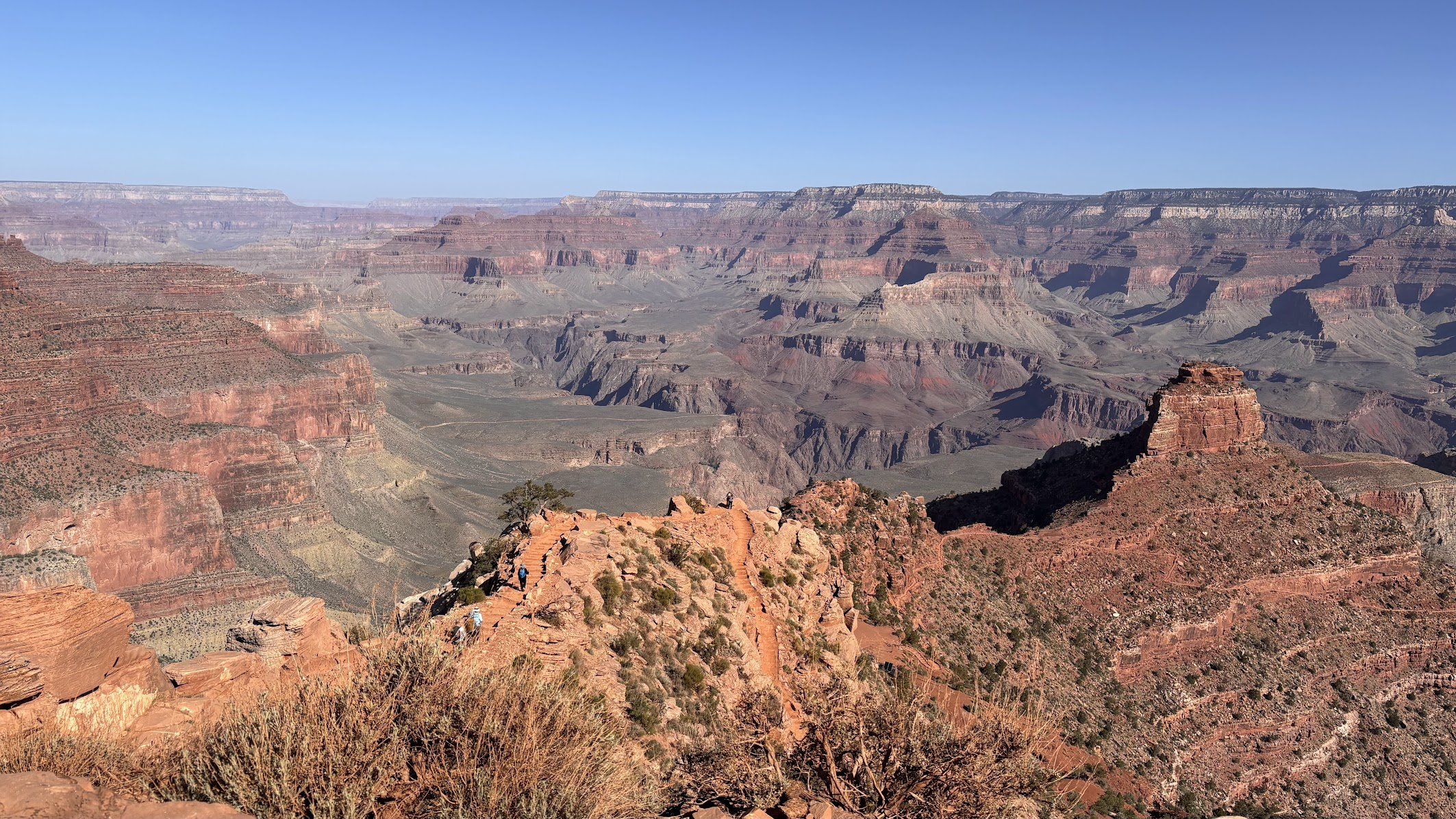
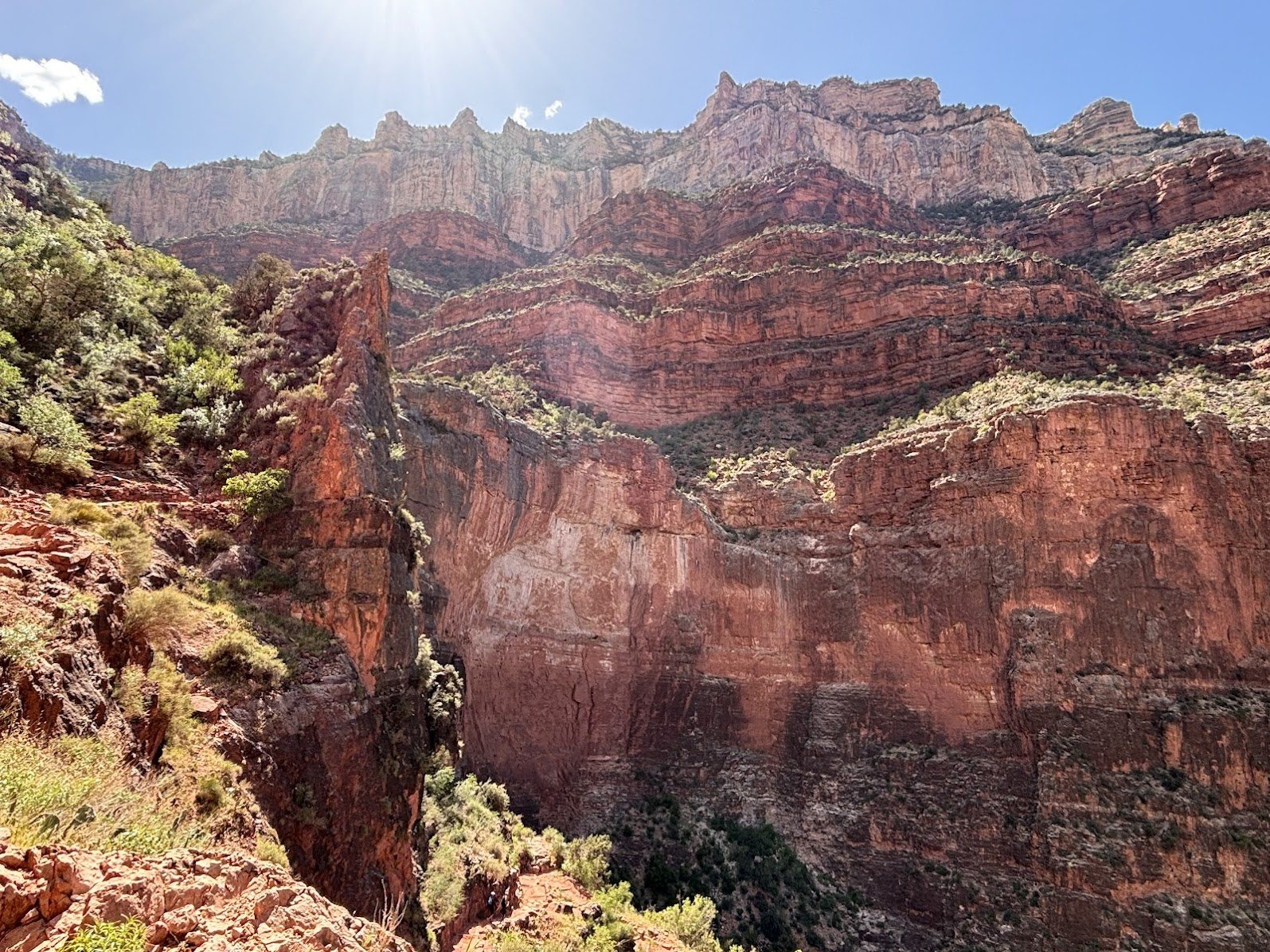
Grand Canyon, Arizona
Według władz Parku Narodowego Grand Canyon, zejście na dno kanionu i powrót tego samego dnia jest niezwykle trudne i niebezpieczne (to 1500m różnicy wysokości). Jeden z nas zszedł i wrócił w 7 godzin szlakiem South Kaibab Trail. Pozostała dwójka wybrała zejście 1000m w dół, trekking na poziomicy 1200m i powrót szlakiem Bright Angel.
According to Grand Canyon park information, descend to the bottom and return on the same day is extremely strenuous. Well, one of us did the trip in 7hrs (South Kaibab Trail). The other two opted for getting down to Tipoff point and a traverse at 1200m elevation (1000m down), with return via Bright Angel Trail.
| Samochodem / by car | Valle -> Grand Canyon -> Valle (92km) |
|---|---|
| Pieszo / on foot | South Rim - Tipoff Point - Indian Gardens - Bright Angel (22,1km) |
| Nocleg / Accommodation | Grand Canyon Inn Valle, AZ |
| Blog post | TBA |
Dzień / Day 8 - 25.04.2025
Hoover Dam, Arizona / Nevada
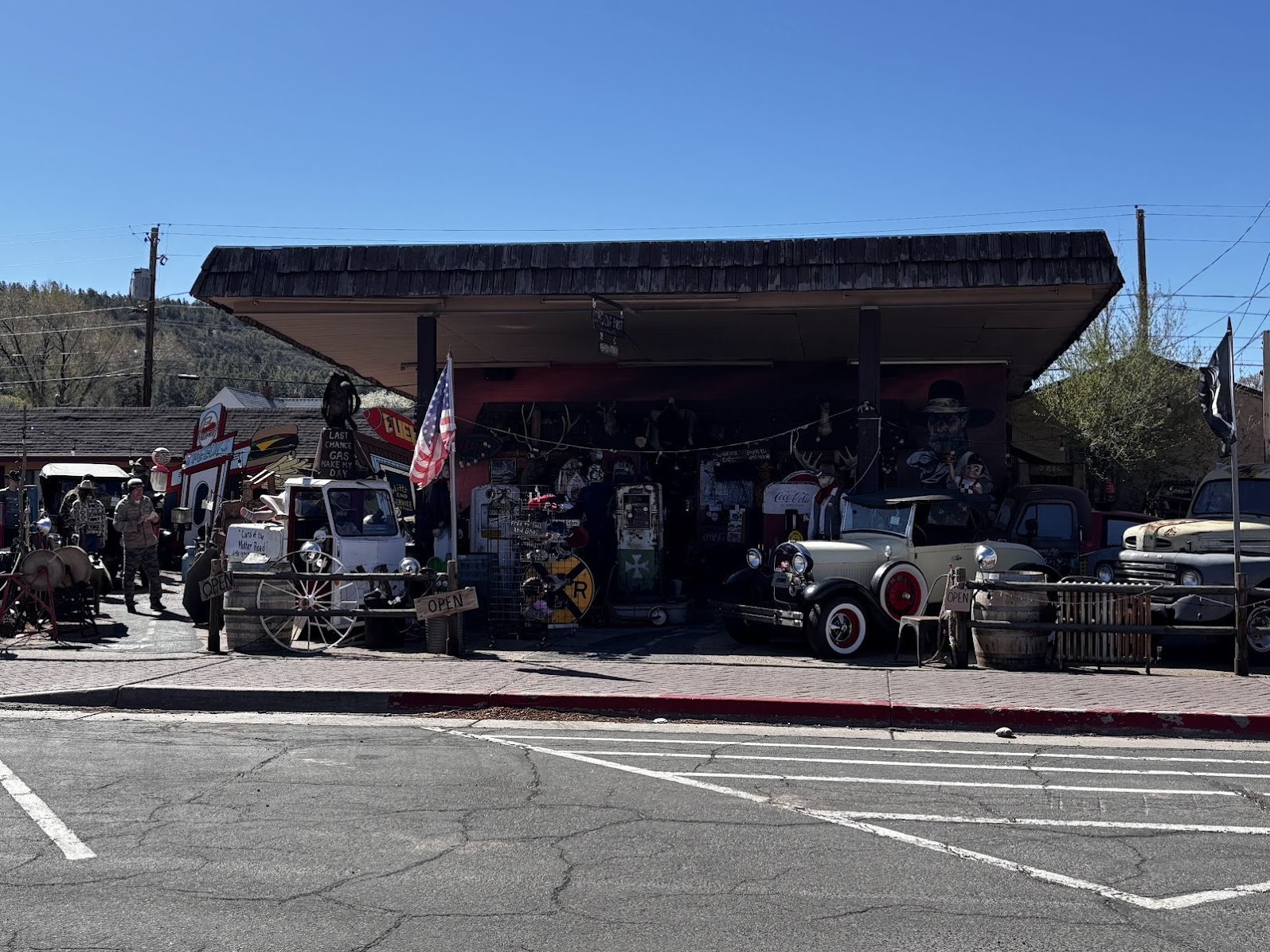
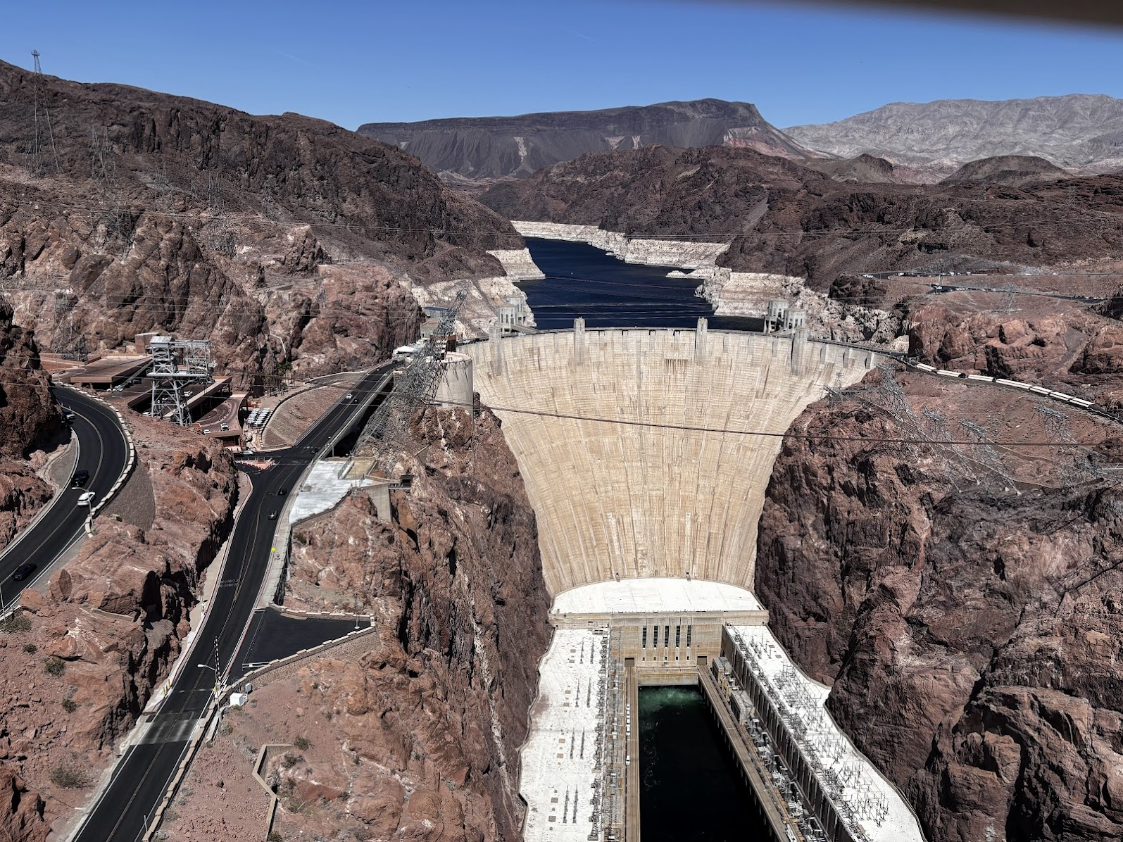
Kolejny dzień to przemieszczenie w kierunku Doliny Śmierci. Po drodze śniadanie w 'skansenowym' miasteczku Williams, przejazd historyczną drogą 66 i zapora Hoovera.
This day was all about transferring towards the Death Valley. We ate breakfast in Williams, a town frozen in time, drove part of the Historic Route 66 and viewed the Hoover Dam.
| Samochodem / by car | Valle -> Historic Route 66 -> Hoover Dam - Beatty (673km) |
|---|---|
| Pieszo / on foot | NA |
| Nocleg / Accommodation | Atomic Inn Beatty, NV |
| Blog post | TBA |
Dzień / Day 9 - 26.04.2025
Death Valley, California
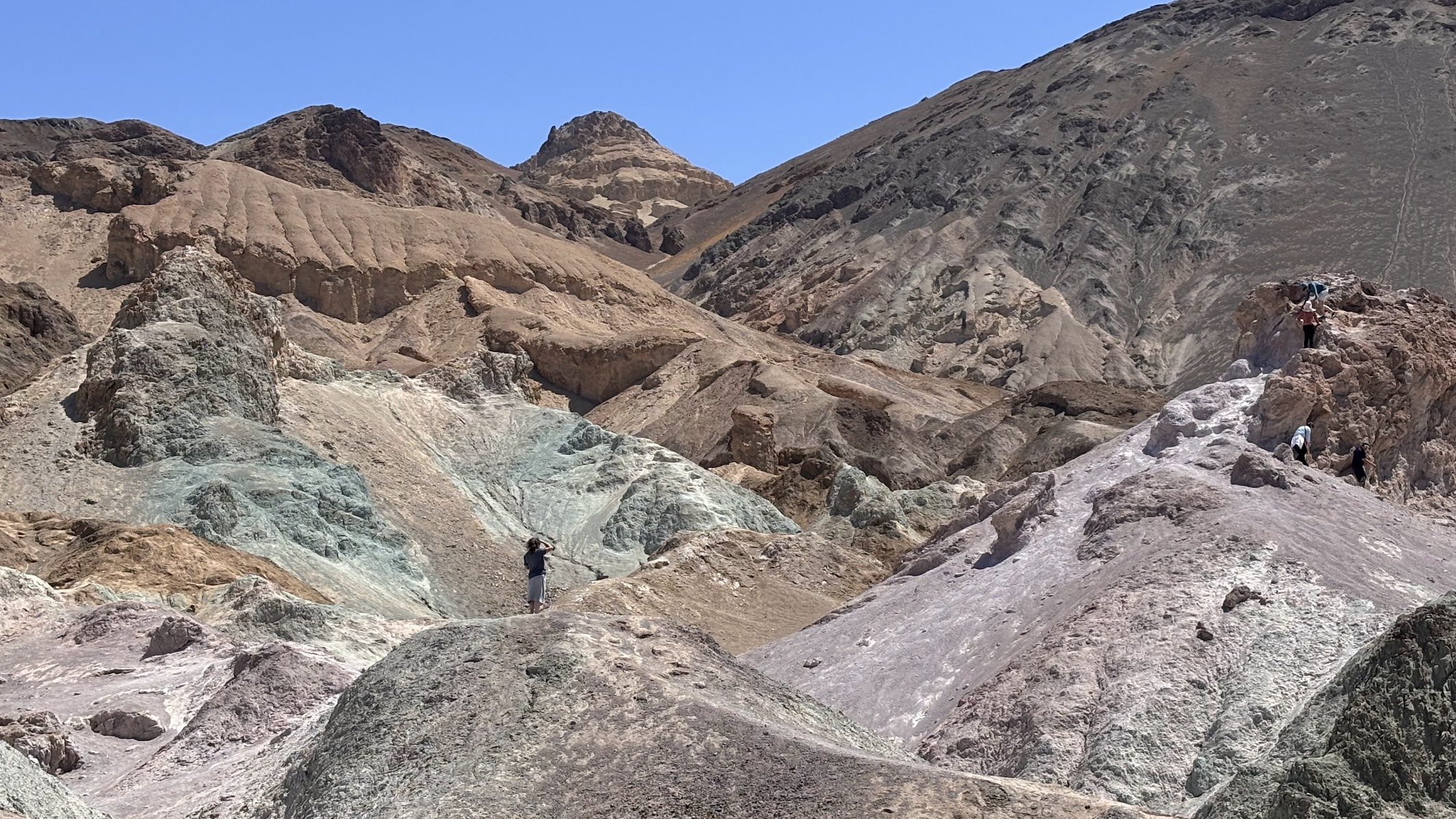
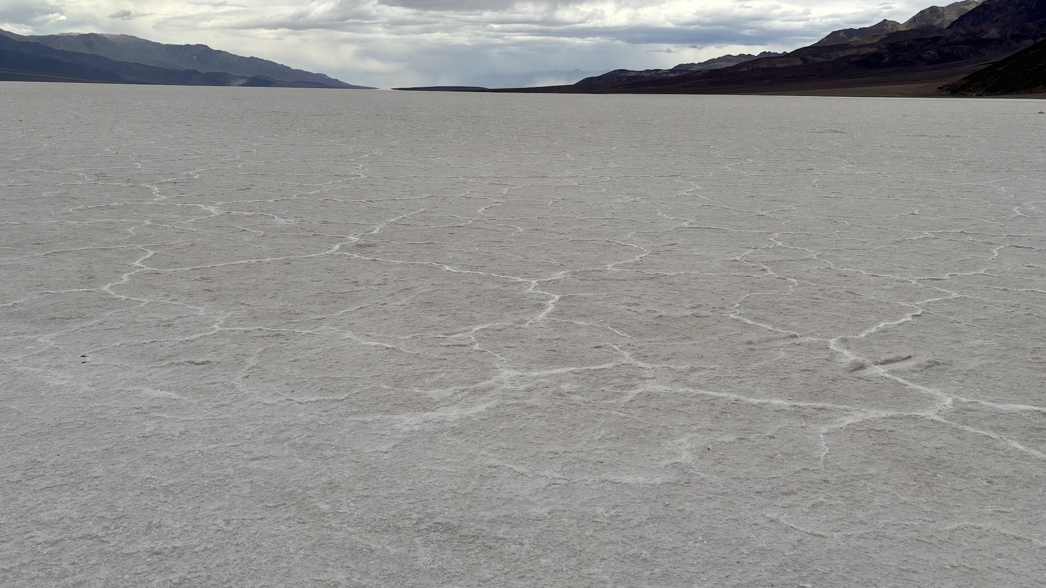
Najlepszy sposób na doświadczenie Doliny Śmierci to seria krótkich wędrówek. Park Narodowy Death Valley to nie tylko najgłębsza na półkuli zachodnie depresja (-86m) z wyschniętym słonym jeziorem i najgorętsze miejsce na Ziemi (+53°), ale także otaczające góry i kaniony, z różnorodnością krajobrazów.
The best way to experience the Death Valley is a series of short hikes. Death Valley National Park offers much more beyond a dry bottom of a salt lake, with its western hemisphere lowest depression (86m below sea level) and hottest place on Earth (+53° C). Surrounding mountains and canyon represent a variety of ladscapes.
| Samochodem / by car | Beatty -> Death Valley Badwater -> Dante's View -> Beatty (283km) |
|---|---|
| Pieszo / on foot | Golden Canyon (4,8km) + Artists Palette (<1km) + Devils Golf Course (<1km) + Natural Bridge (2,4km) + Badwater Basin (<1km) + Dante's View (1,5km) |
| Nocleg / Accommodation | Atomic Inn Beatty, NV |
| Blog post | TBA |
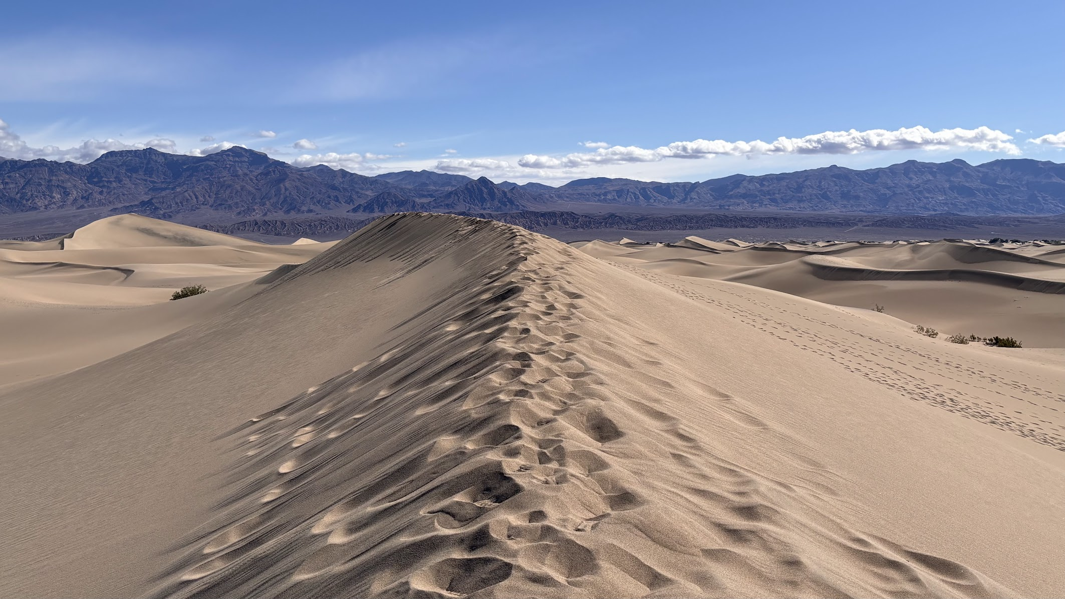
Dzień / Day 10 - 27.04.2025
Death Valley, California
Rankiem drugiego dnia w Parku Narodowym Death Valley odwiedziliśmy wydmy piaskowe i kolejny kanion. Potem długa podróż do serca Kalifornii. Po przekroczeniu pasma Sierra Nevada znaleźliśmy się w strefie klimatycznie zupełnie odmiennej od suchej i gorącej pustyni.
In the morning of the second day in Death Valley National Park we hiked sand dunes and yet another canyon. Then we transferred to the heart of California. When we passed the Sierra Nevada Mts, we found ourselves in a climate totally different from the dry and hot deserts.
| Samochodem / by car | Beatty -> Bakersfield (379km) |
|---|---|
| Pieszo / on foot | Mesquite Dunes (<1km) + Mosaic Canyon (5,8km) |
| Nocleg / Accommodation | Holiday Inn Bakersfield, CA |
| Blog post | TBA |
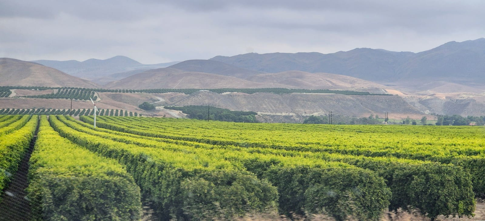
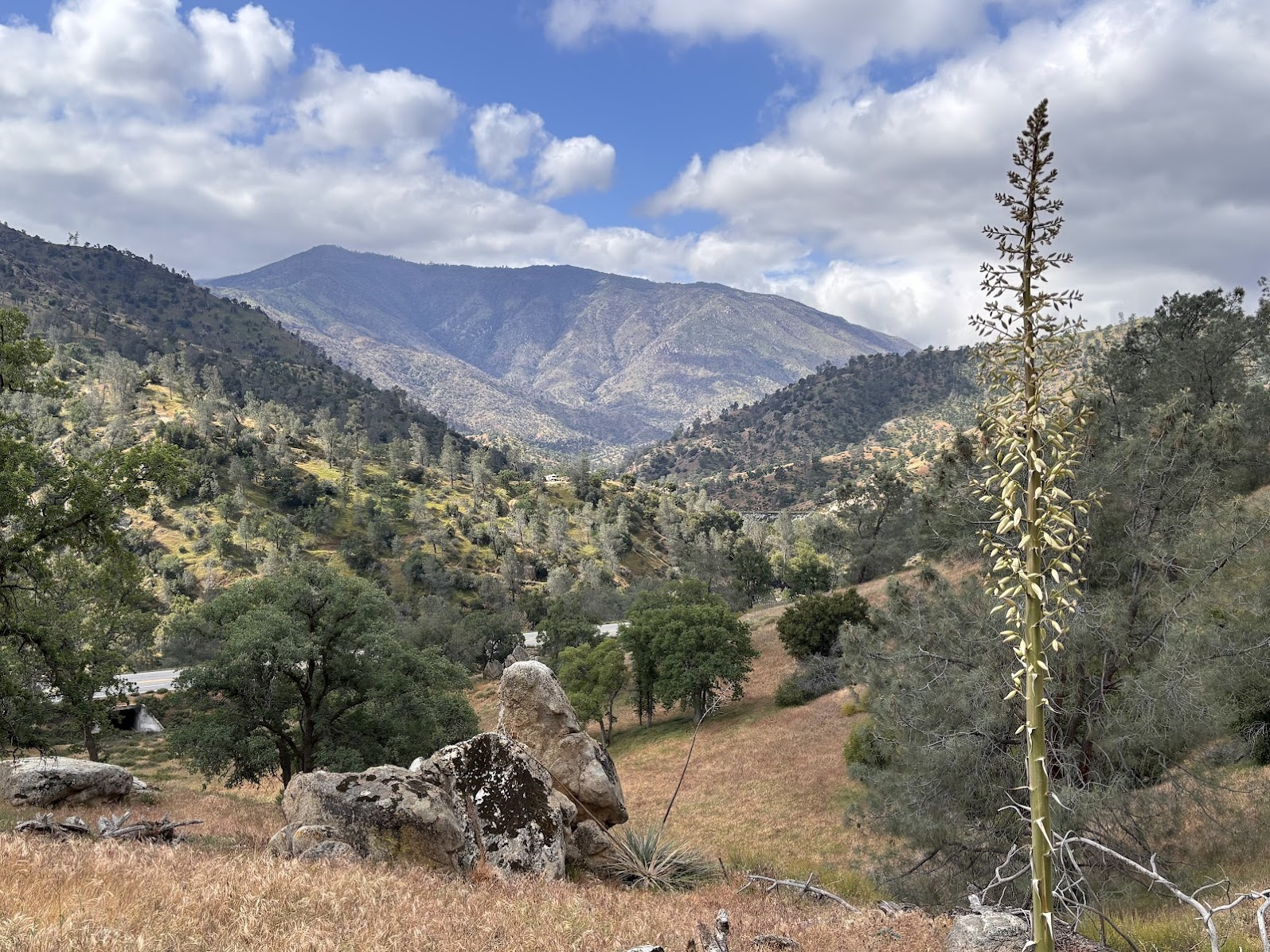
Dzień / Day 11 - 28.04.2025
Lake Isabella, California
Ten dzień nie miał w planie żadnej wielkiej atrakcji. Po prostu pochodziliśmy po zachodnich zboczach gór Sierra Nevada i cieszyliśmy się krajobrazami jakże odmiennymi od poprzednich dni.
This day was not about any great tourist attraction. We spent it hiking the western slopes of Sierra Nevada and enjoyed landscapes so different from previously experienced.