When I first read that the city of Ushuaia is only 6 metres above sea level I was quite surprised. In spite of being a low place, it is possible to find mountains with interesting slopes that test your physical endurance. The highest peak of this city is Mount Olivia at only 1300 metres high, but it is only reserved for professional climbers. Instead, normal people can visit other hills to climb on foot, such as the Cerro Cortez, considered of medium difficulty. It may not be the highest of them all, but it still takes your breath away 😃.
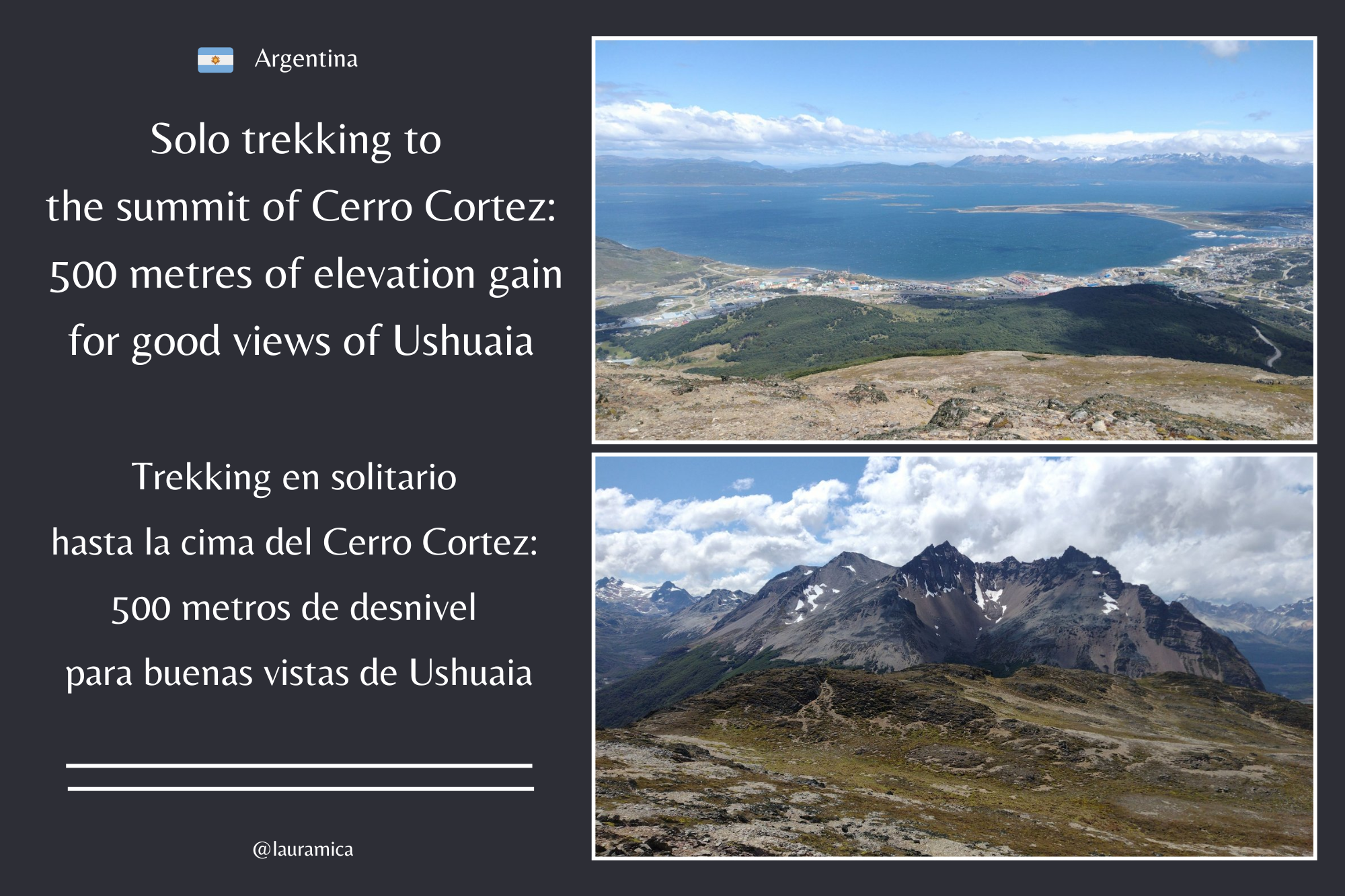 ---
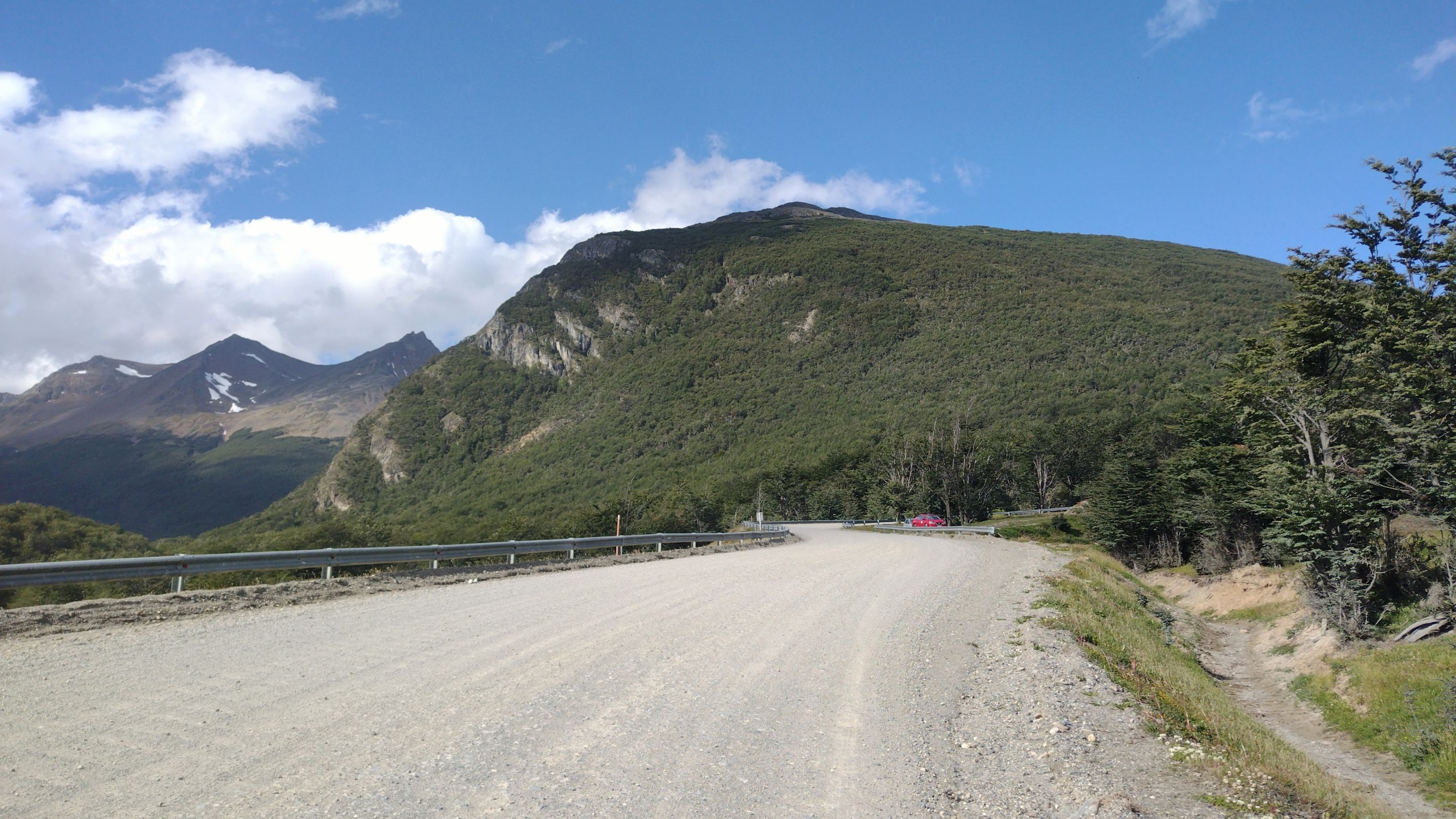
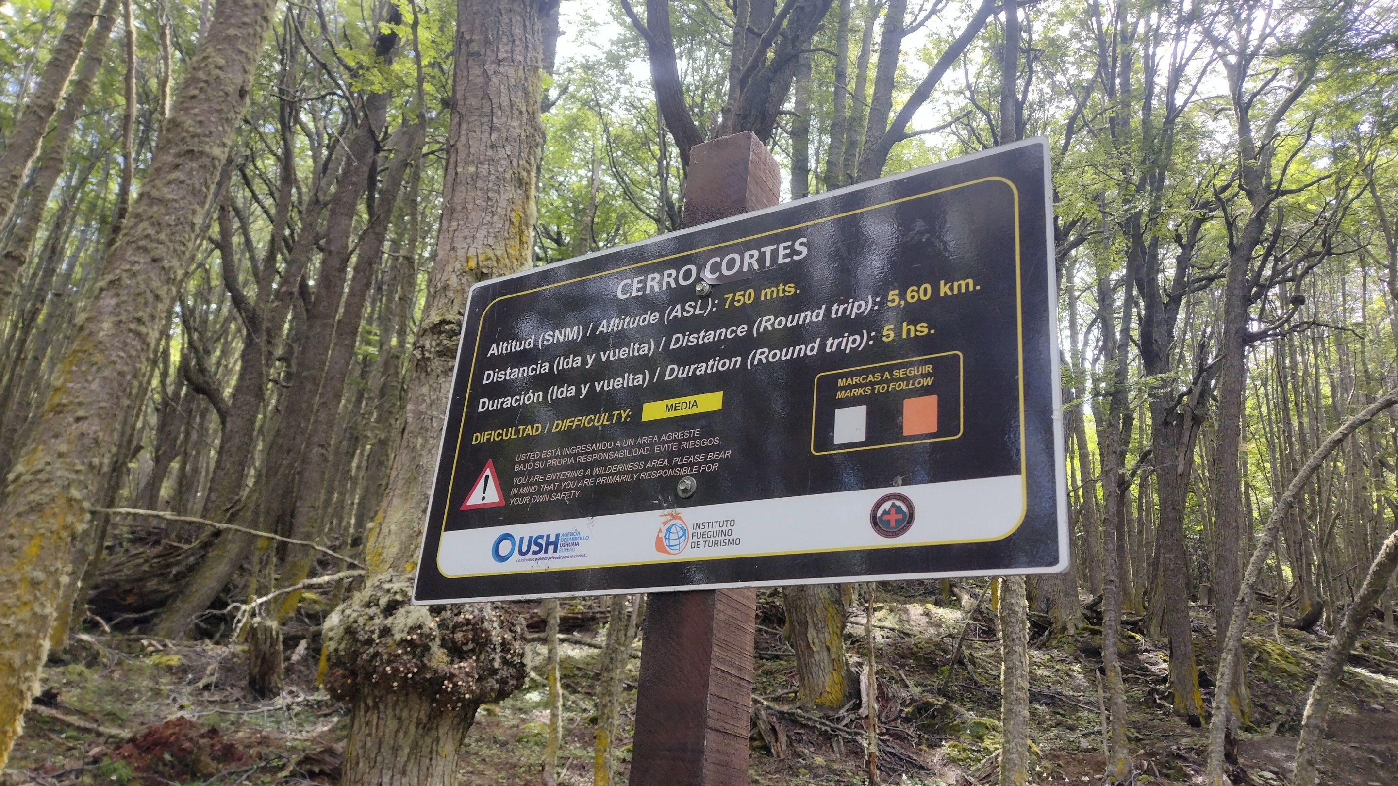
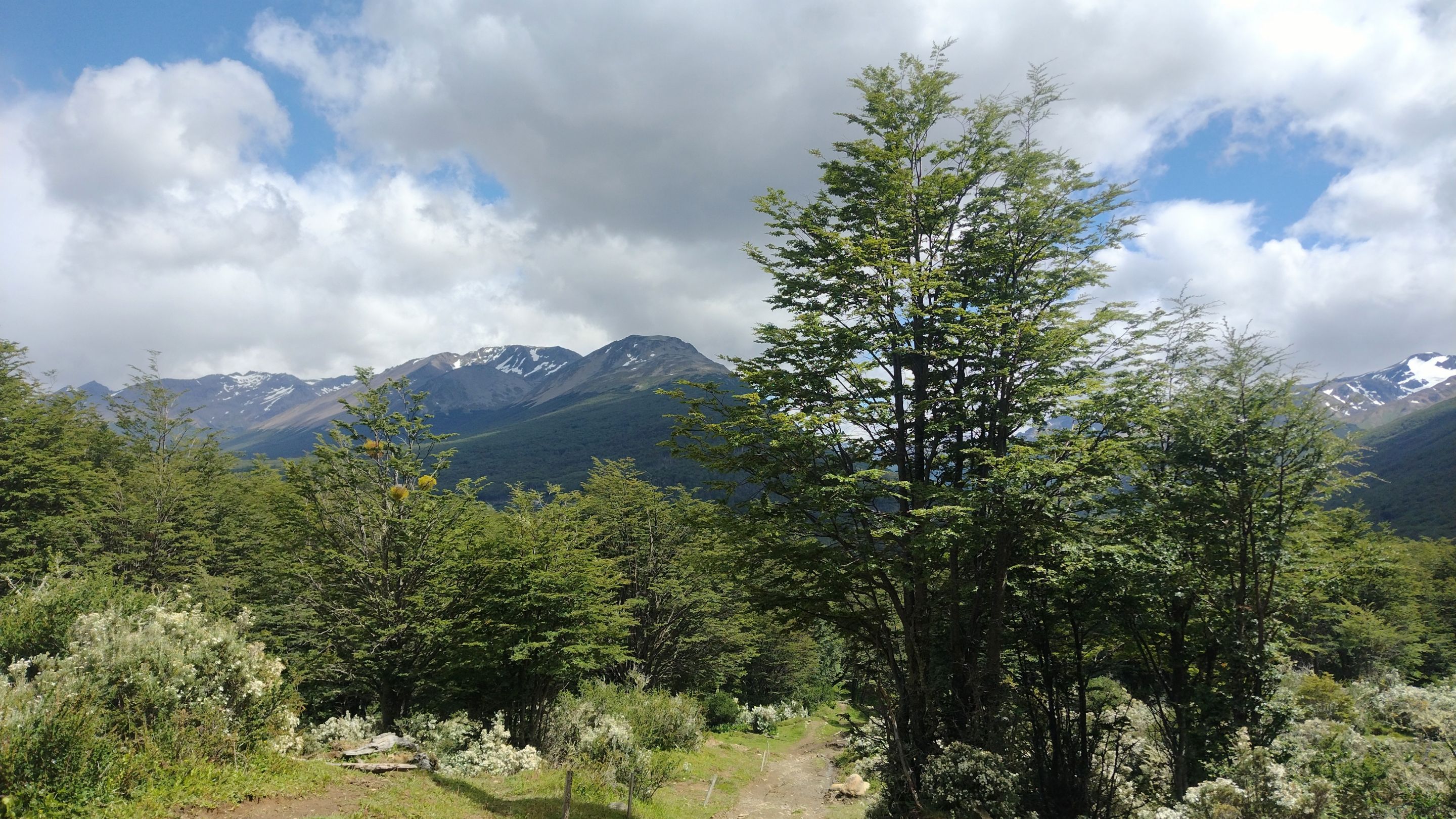
Cerro Cortez is one of the closest mountains to the city centre and, according to what I had read, it would only take me about 5 hours to hike to the top and back. This time was perfect for a morning plan before I had to work at the hostel, so I took an Uber to the trailhead, about 6 km from where I was. The highest point of this mountain is 750 masl, but that drive was mostly uphill, so the final elevation gain I had left to walk was only 500 metres.
---
Cerro Cortez is one of the closest mountains to the city centre and, according to what I had read, it would only take me about 5 hours to hike to the top and back. This time was perfect for a morning plan before I had to work at the hostel, so I took an Uber to the trailhead, about 6 km from where I was. The highest point of this mountain is 750 masl, but that drive was mostly uphill, so the final elevation gain I had left to walk was only 500 metres.
 ---
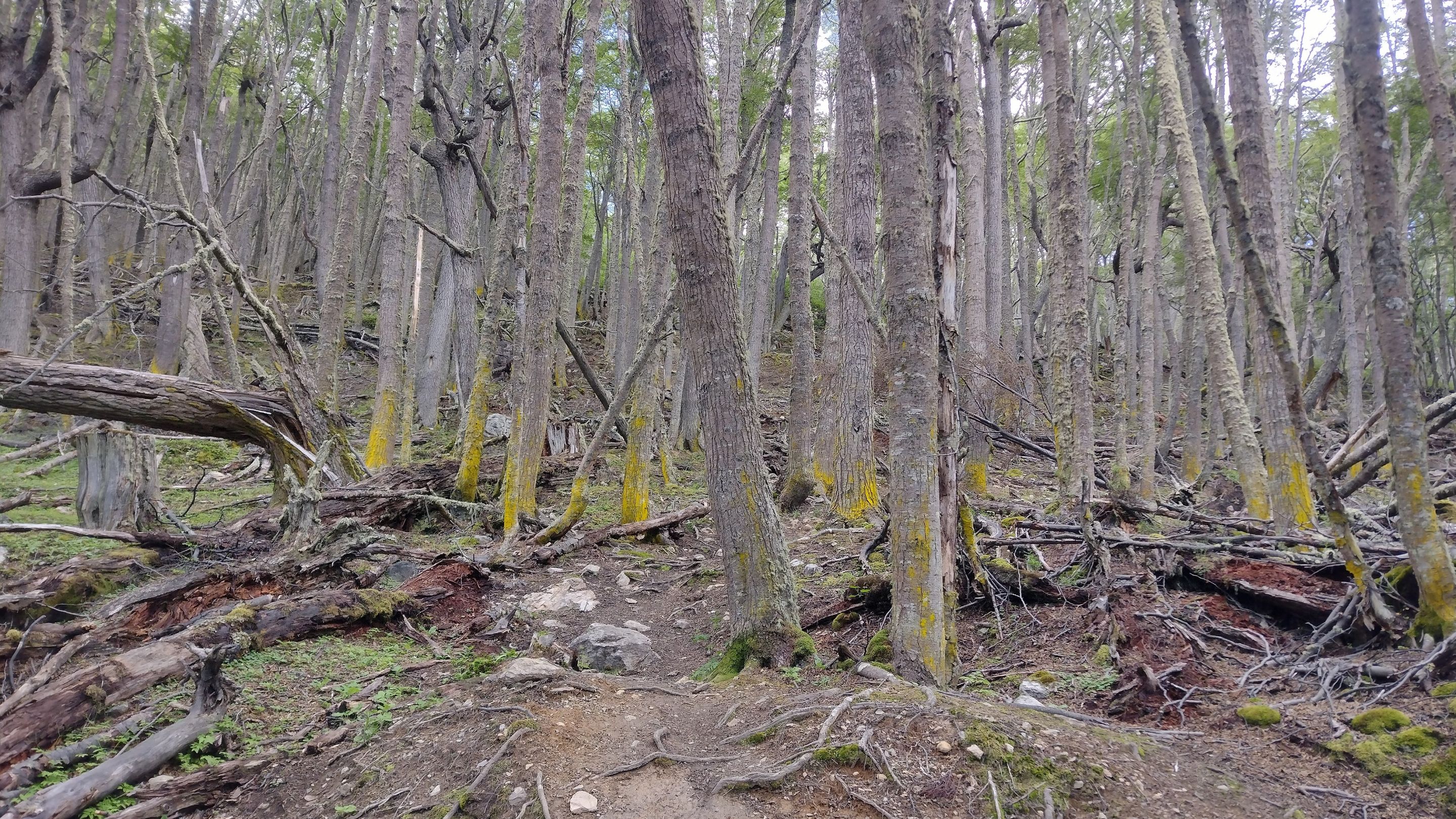
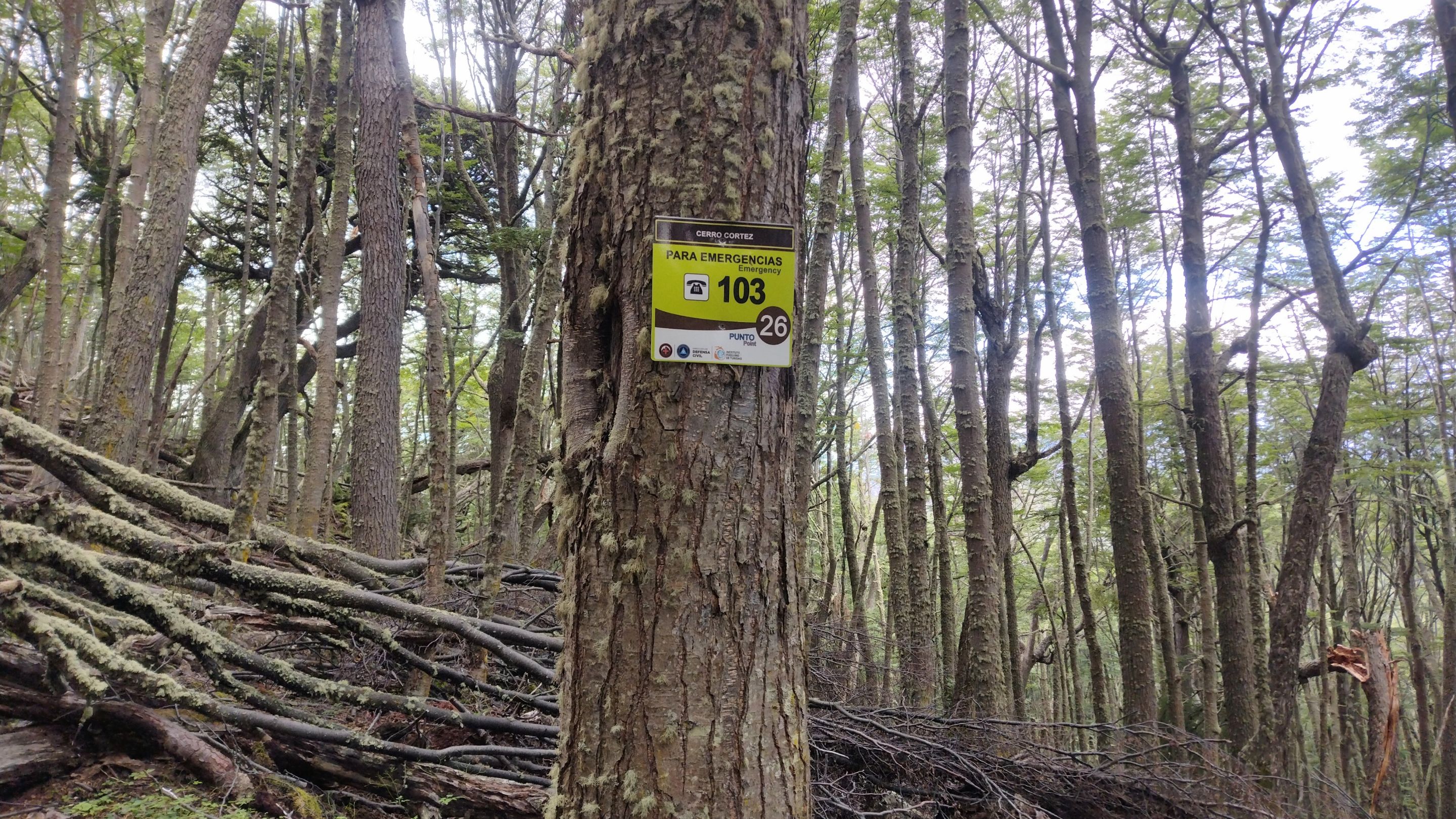
One thing I like about Ushuaia is that most of the trails are well signposted. Of all the trails I've done, I've rarely had to resort to an offline map. That's why it gave me peace of mind to go trekking alone, because I knew that the chances of getting lost were low. Also, this particular mountain is very close to the city, so I never lost my internet signal. And in case of any emergency, you could call the rescue number 103, which luckily in all my long stay, I never had to do.
---
One thing I like about Ushuaia is that most of the trails are well signposted. Of all the trails I've done, I've rarely had to resort to an offline map. That's why it gave me peace of mind to go trekking alone, because I knew that the chances of getting lost were low. Also, this particular mountain is very close to the city, so I never lost my internet signal. And in case of any emergency, you could call the rescue number 103, which luckily in all my long stay, I never had to do.
 ---
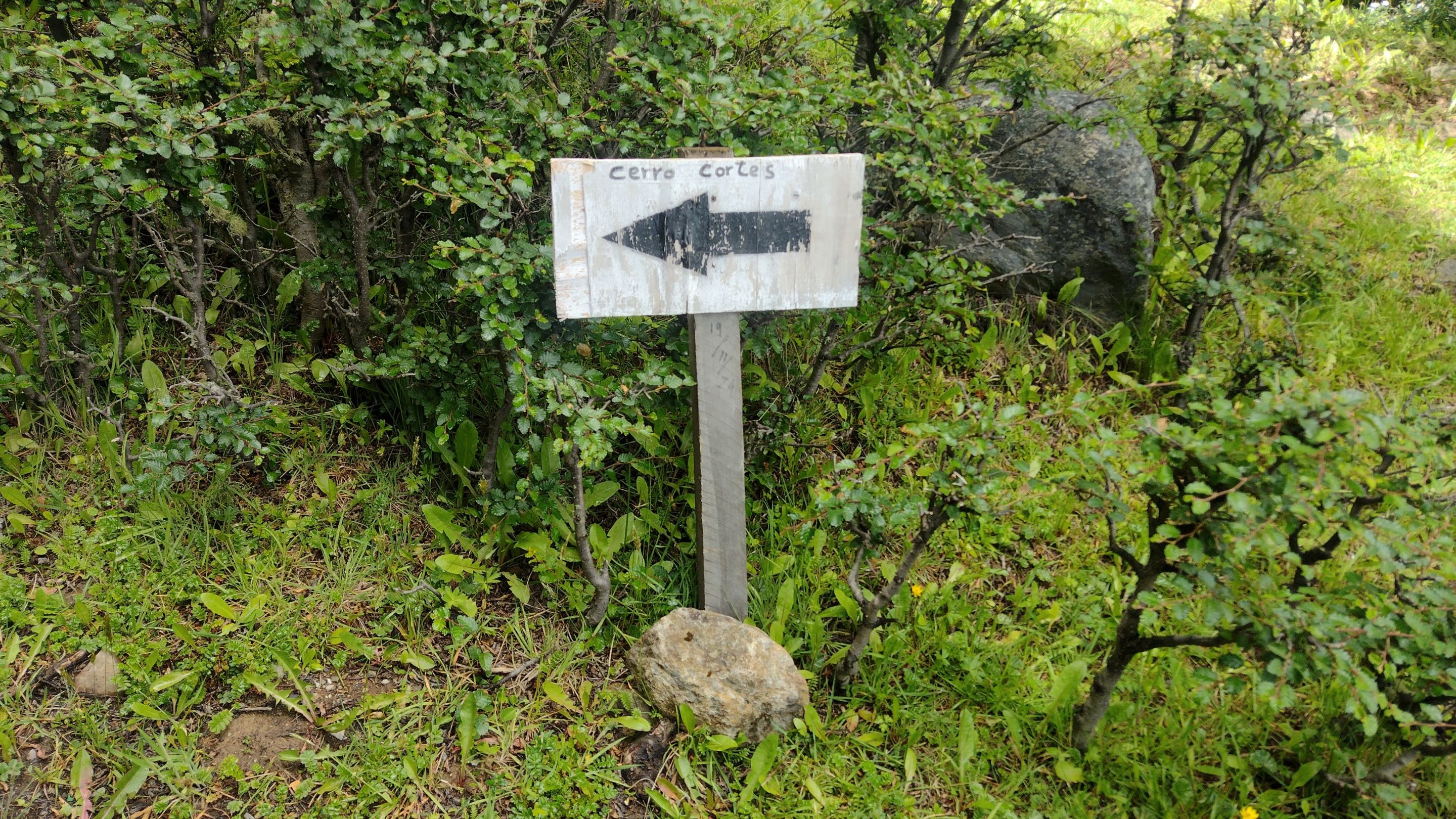
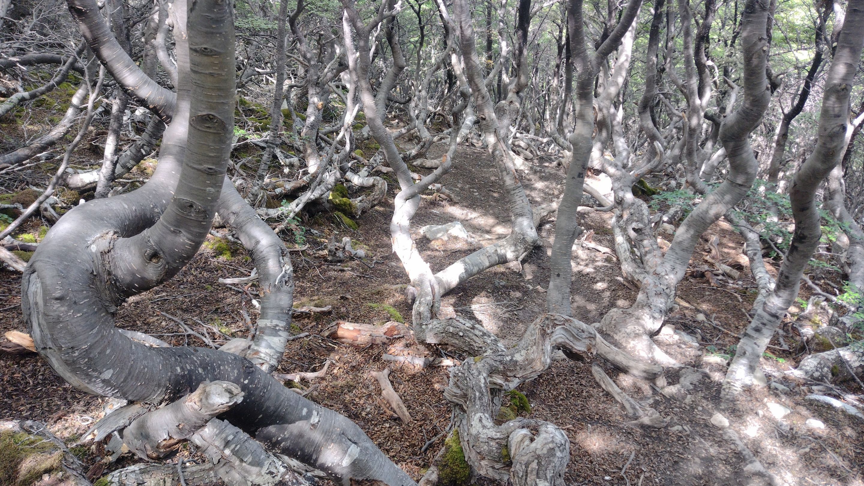
I never knew how to write the name of this mountain properly, as in some places it appears as ‘Cortez’ (surname) and on the trail it says ‘Cortés’ (adjective, polite). I liked it better as a surname, so I wrote it that way. What was certain was that the gradient on this mountain was interesting. Although it was a 3 kilometres one way trail, I think that all the elevation gain was concentrated in 2.5 kilometres. My legs gave it their all, but as always, a big elevation gain means good views faster.
---
I never knew how to write the name of this mountain properly, as in some places it appears as ‘Cortez’ (surname) and on the trail it says ‘Cortés’ (adjective, polite). I liked it better as a surname, so I wrote it that way. What was certain was that the gradient on this mountain was interesting. Although it was a 3 kilometres one way trail, I think that all the elevation gain was concentrated in 2.5 kilometres. My legs gave it their all, but as always, a big elevation gain means good views faster.
 ---
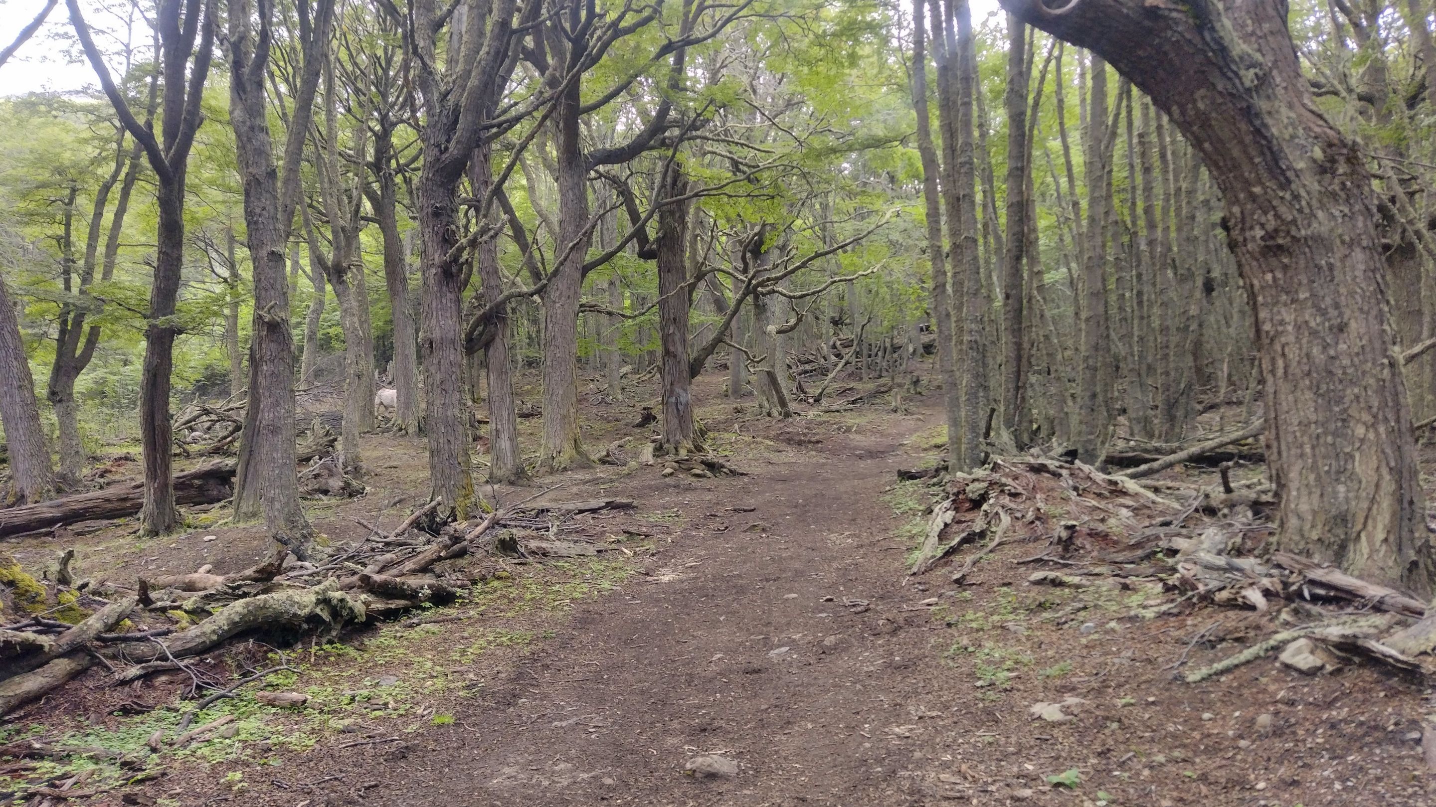
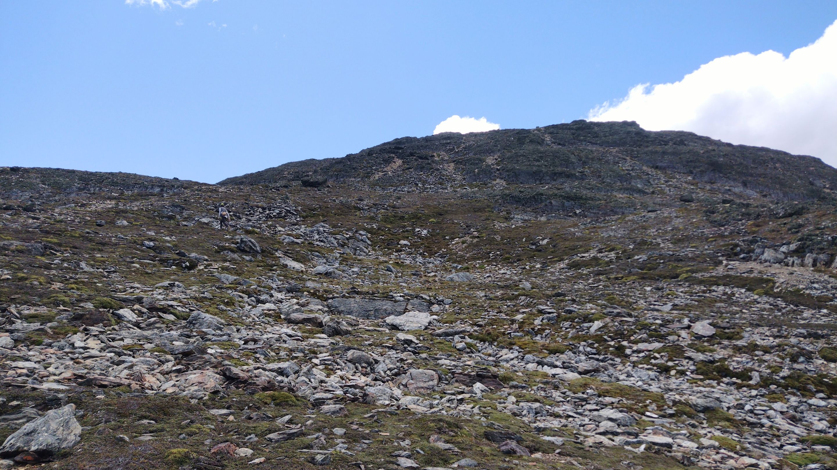
I didn't meet anyone on the way, and that's because this mountain is not one of the most touristy in Ushuaia. I thought that maybe I would meet some locals when I was near the summit, but the only thing that was there was a terrible wind. At times I had to sit down and take shelter because I swear it was pushing me. Keeping a steady pace was difficult and I didn't want any accidents.
---
I didn't meet anyone on the way, and that's because this mountain is not one of the most touristy in Ushuaia. I thought that maybe I would meet some locals when I was near the summit, but the only thing that was there was a terrible wind. At times I had to sit down and take shelter because I swear it was pushing me. Keeping a steady pace was difficult and I didn't want any accidents.
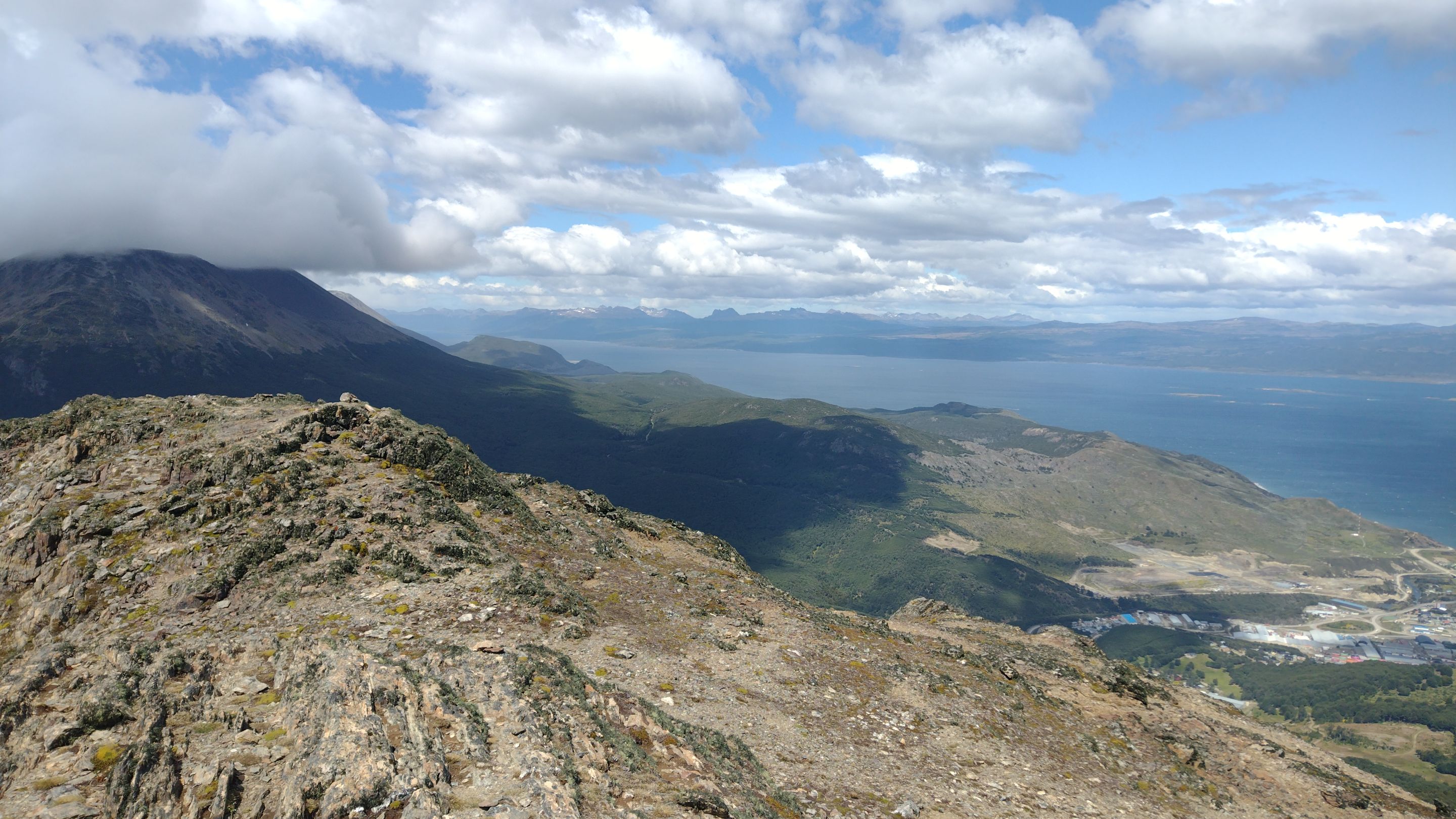 ---
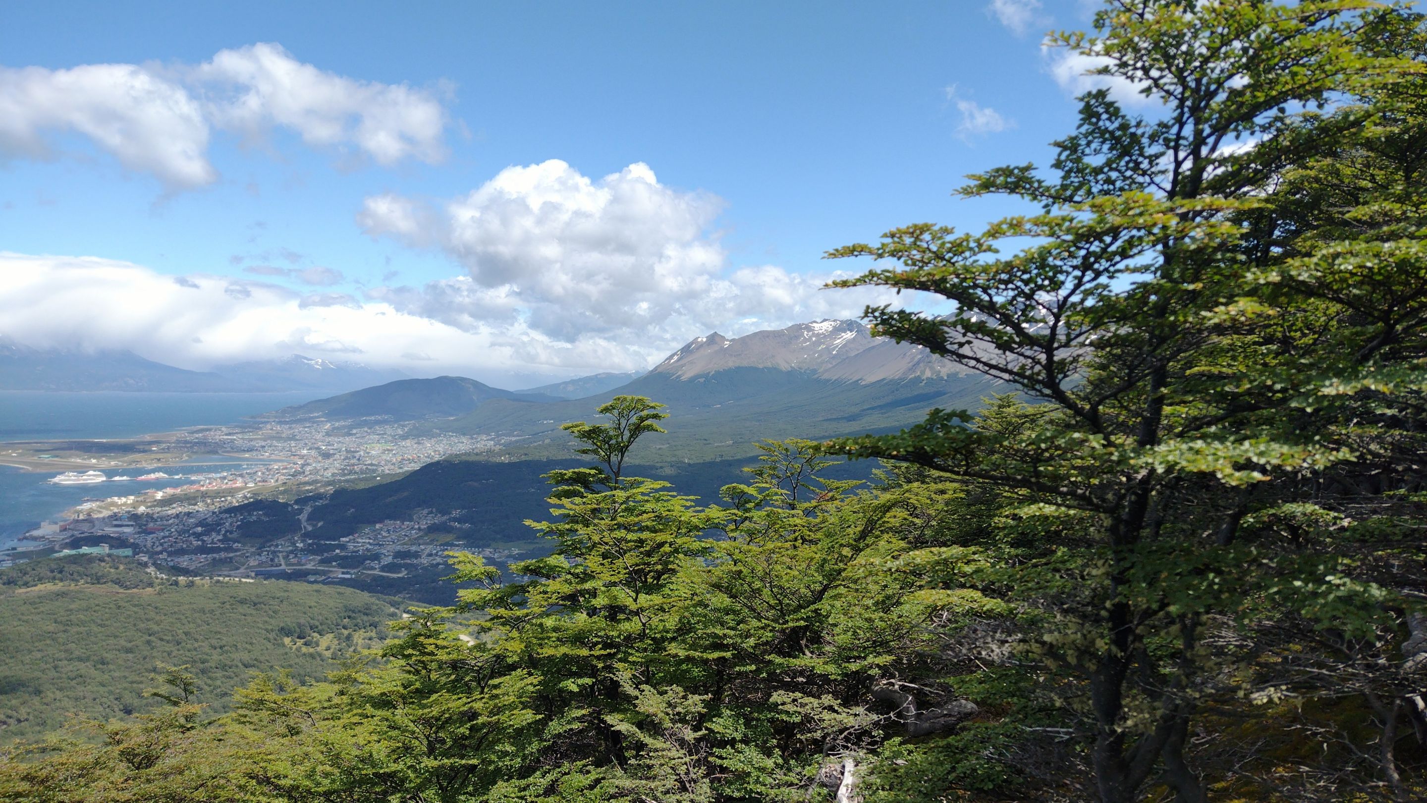
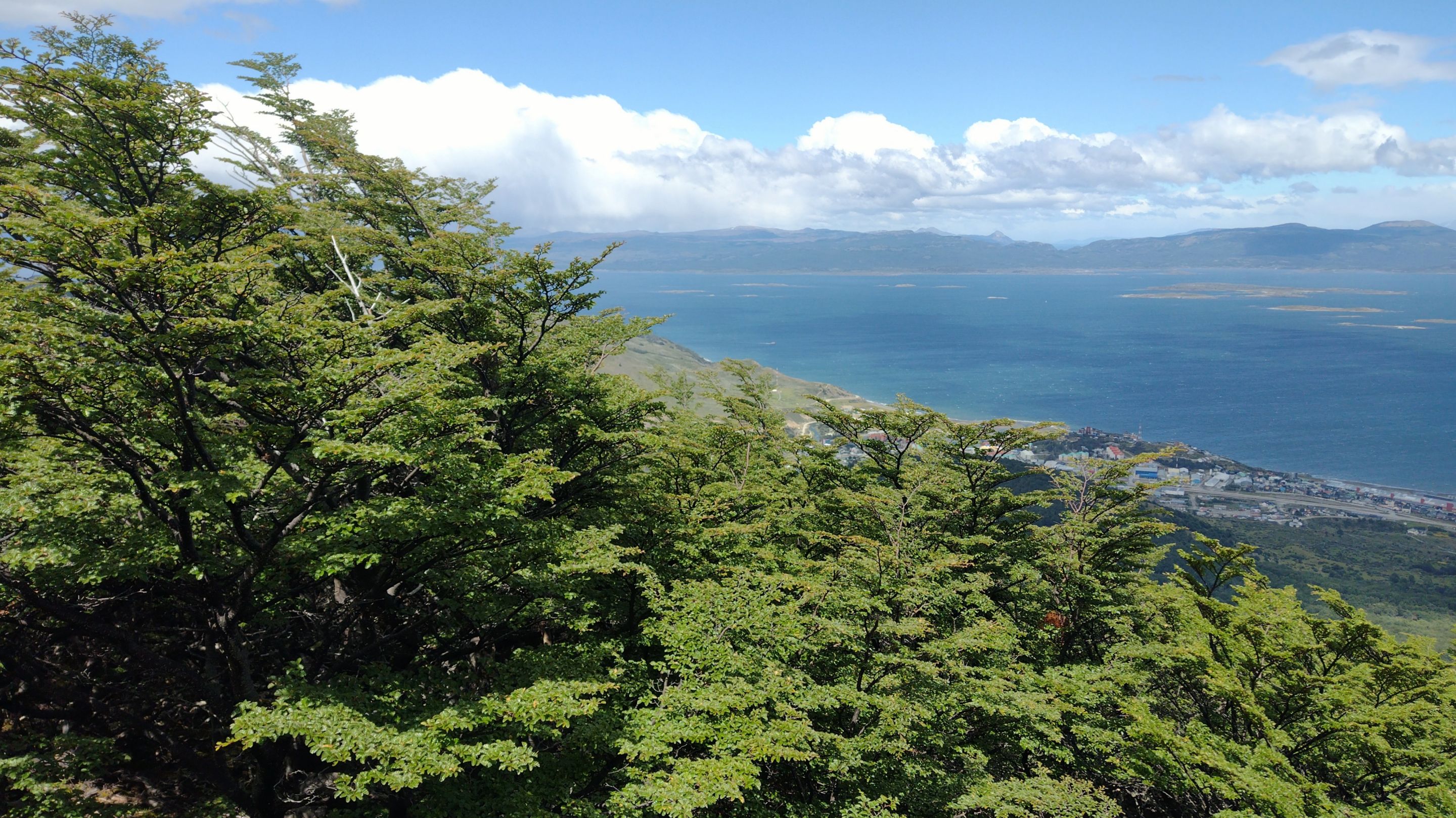
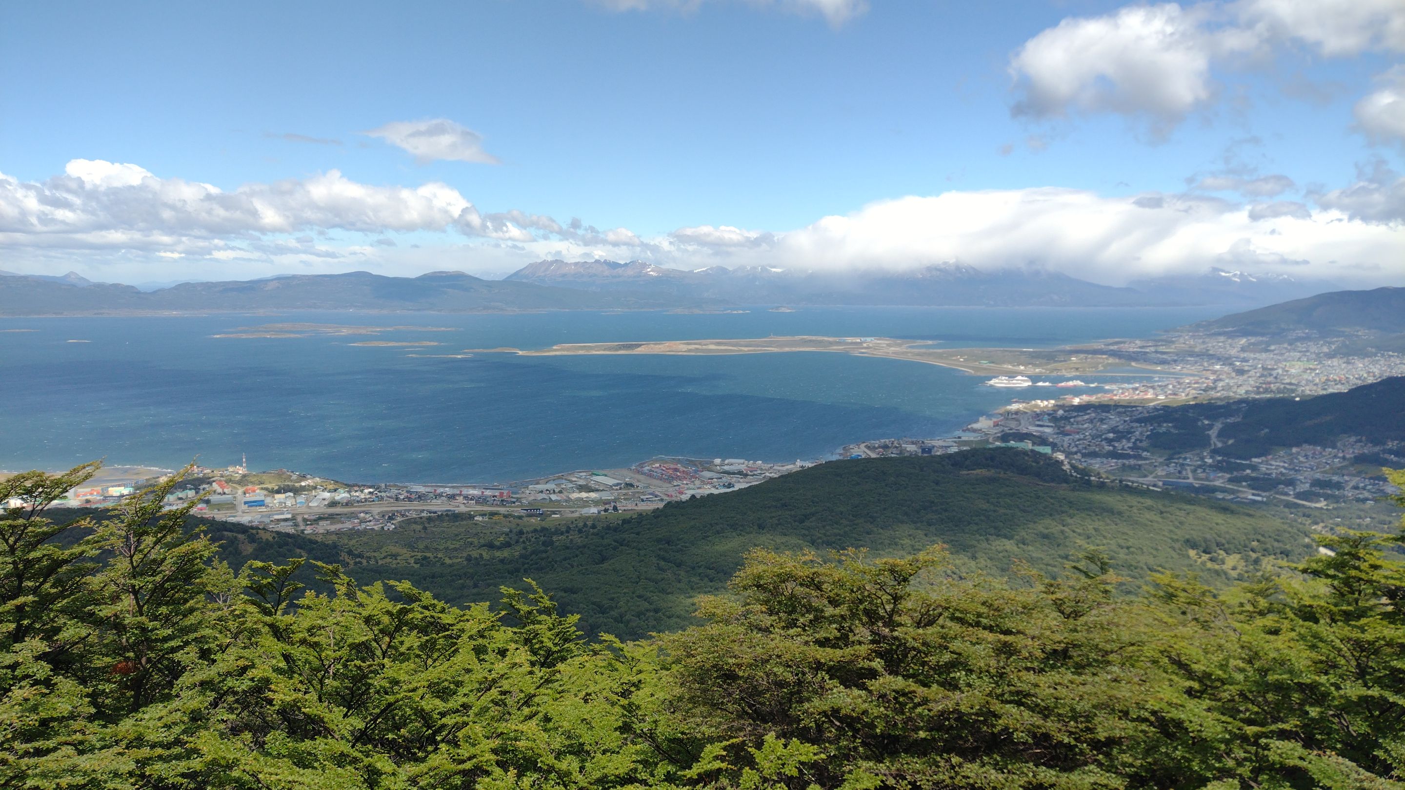
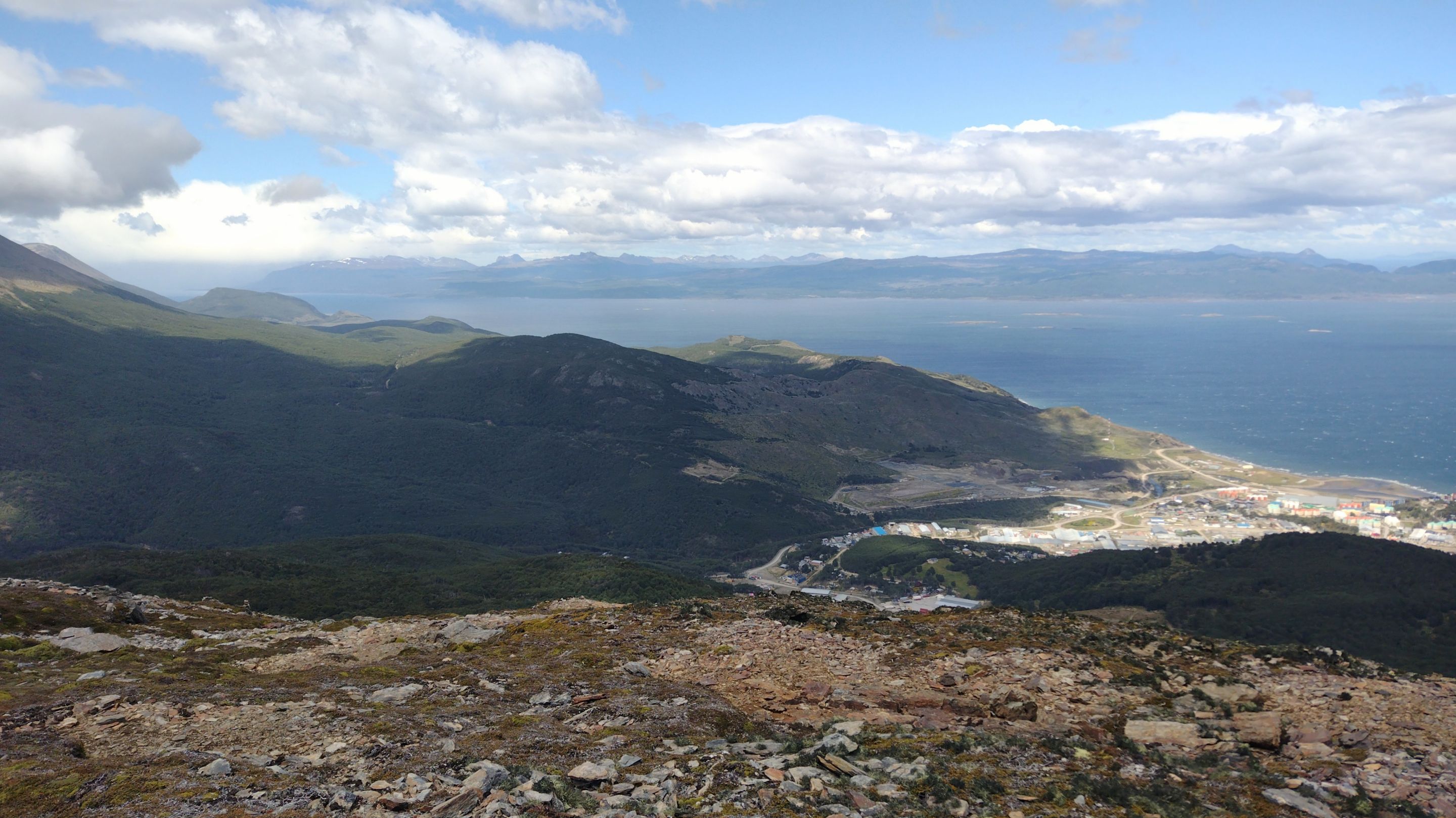
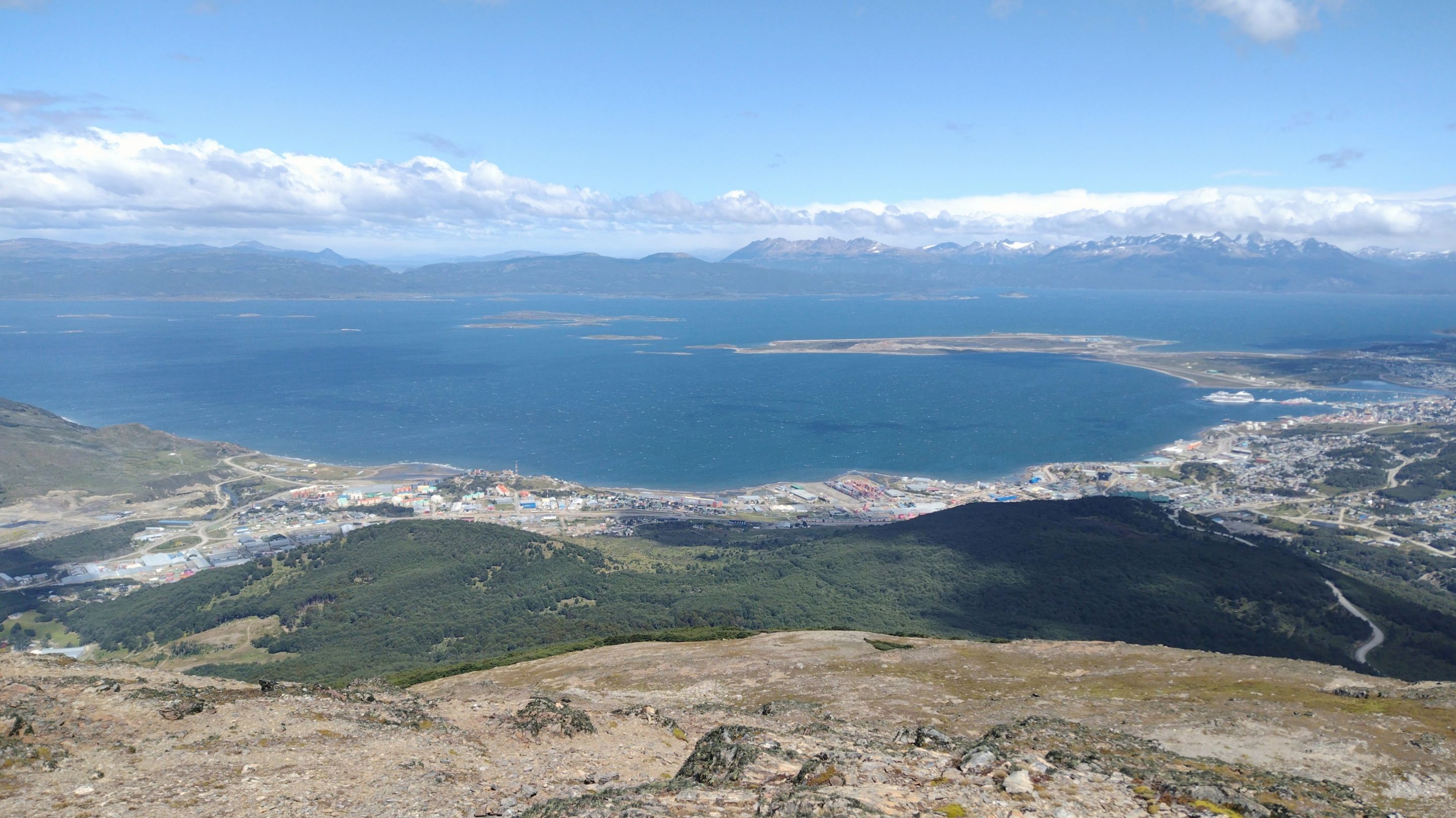
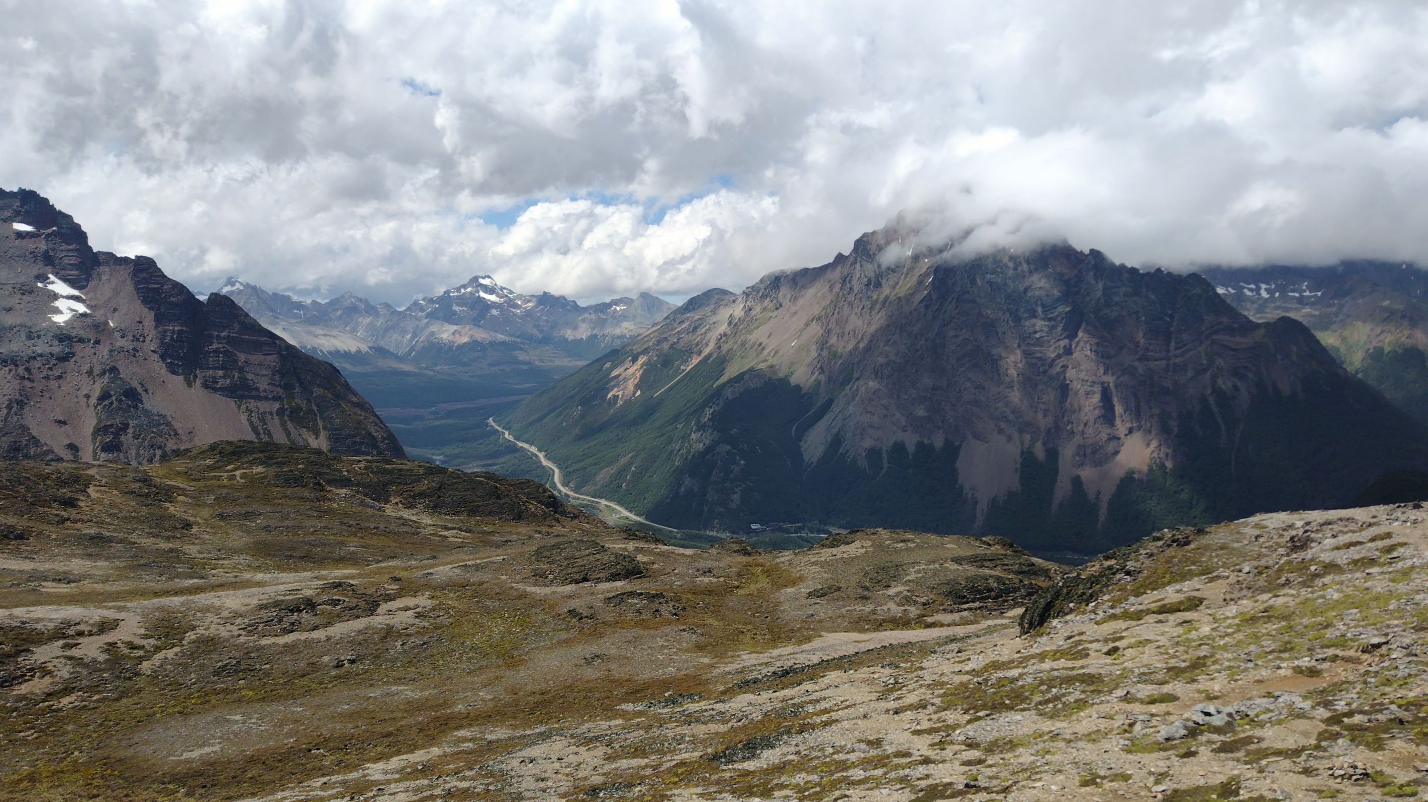
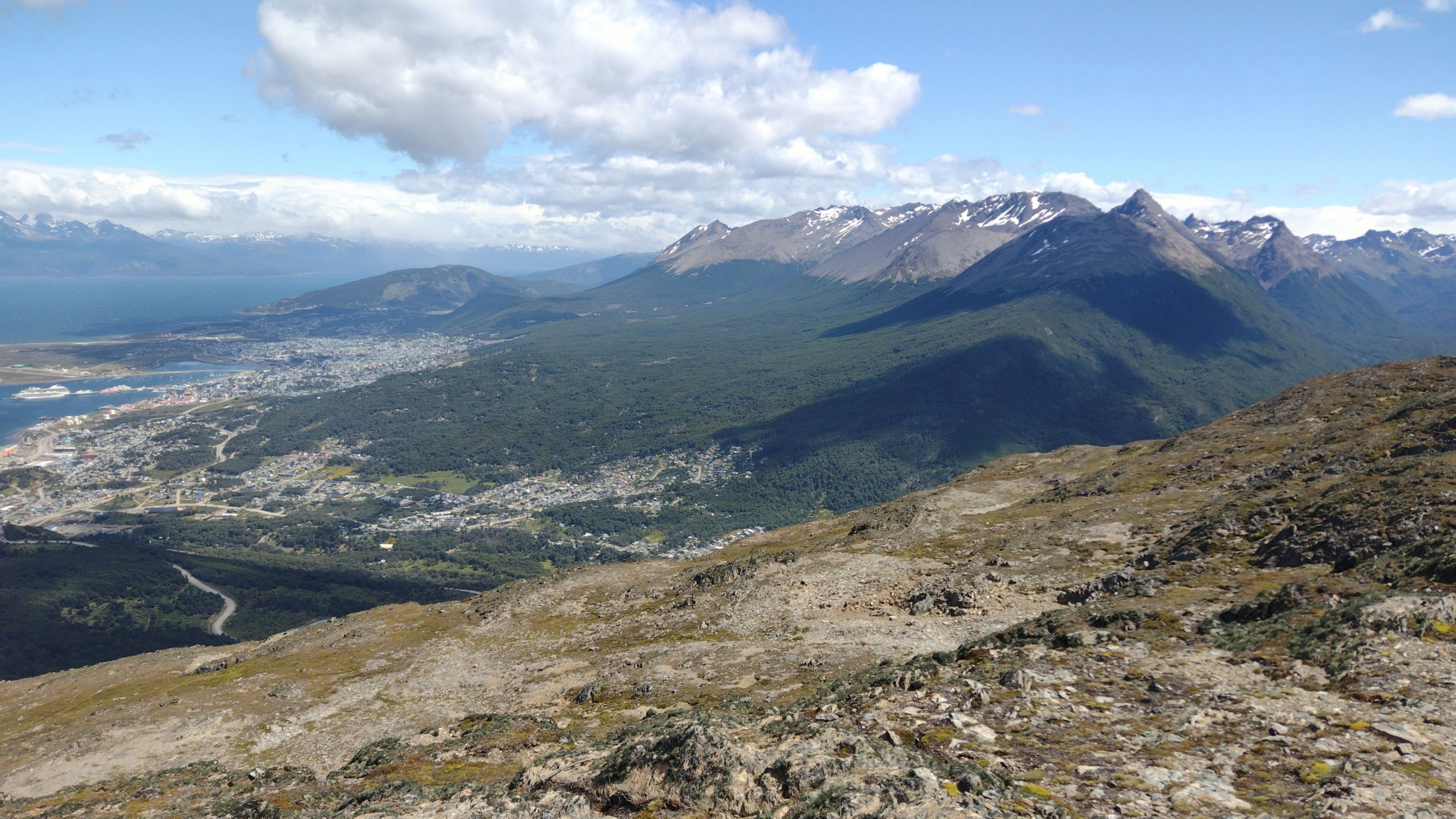
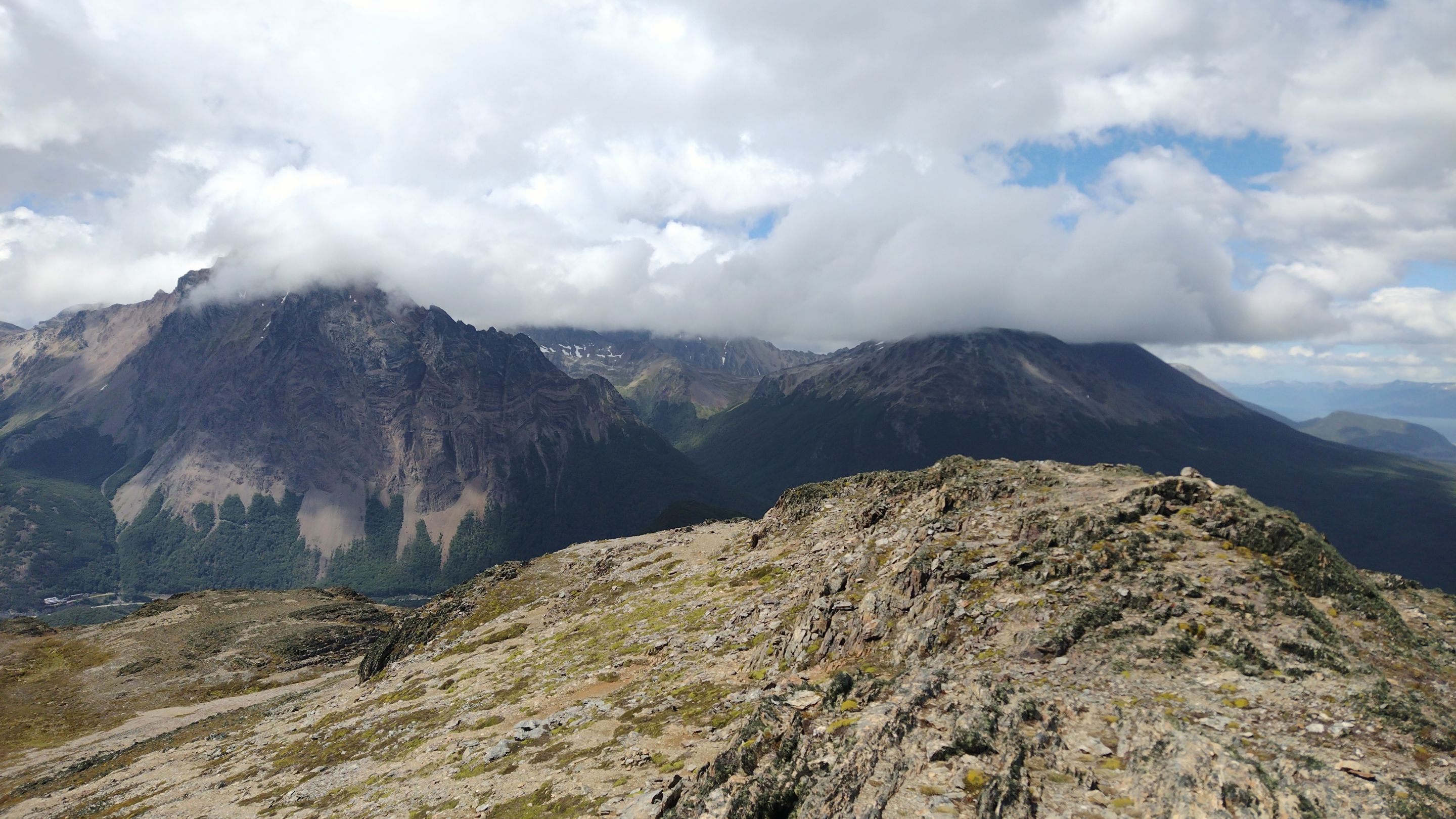
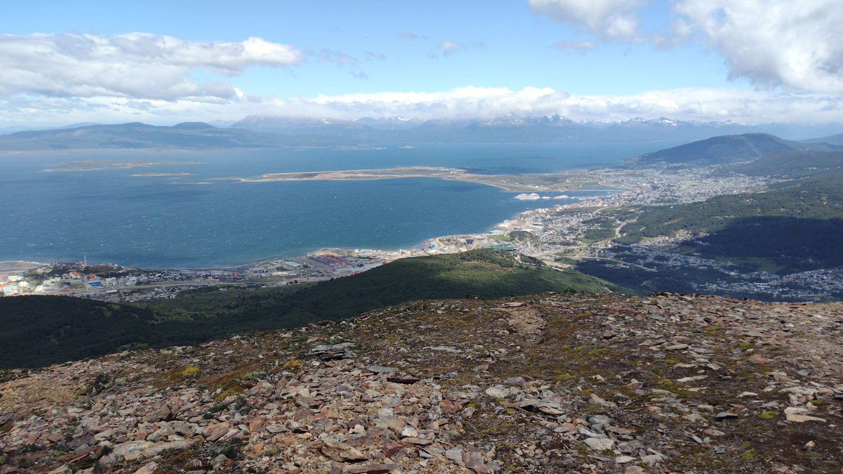
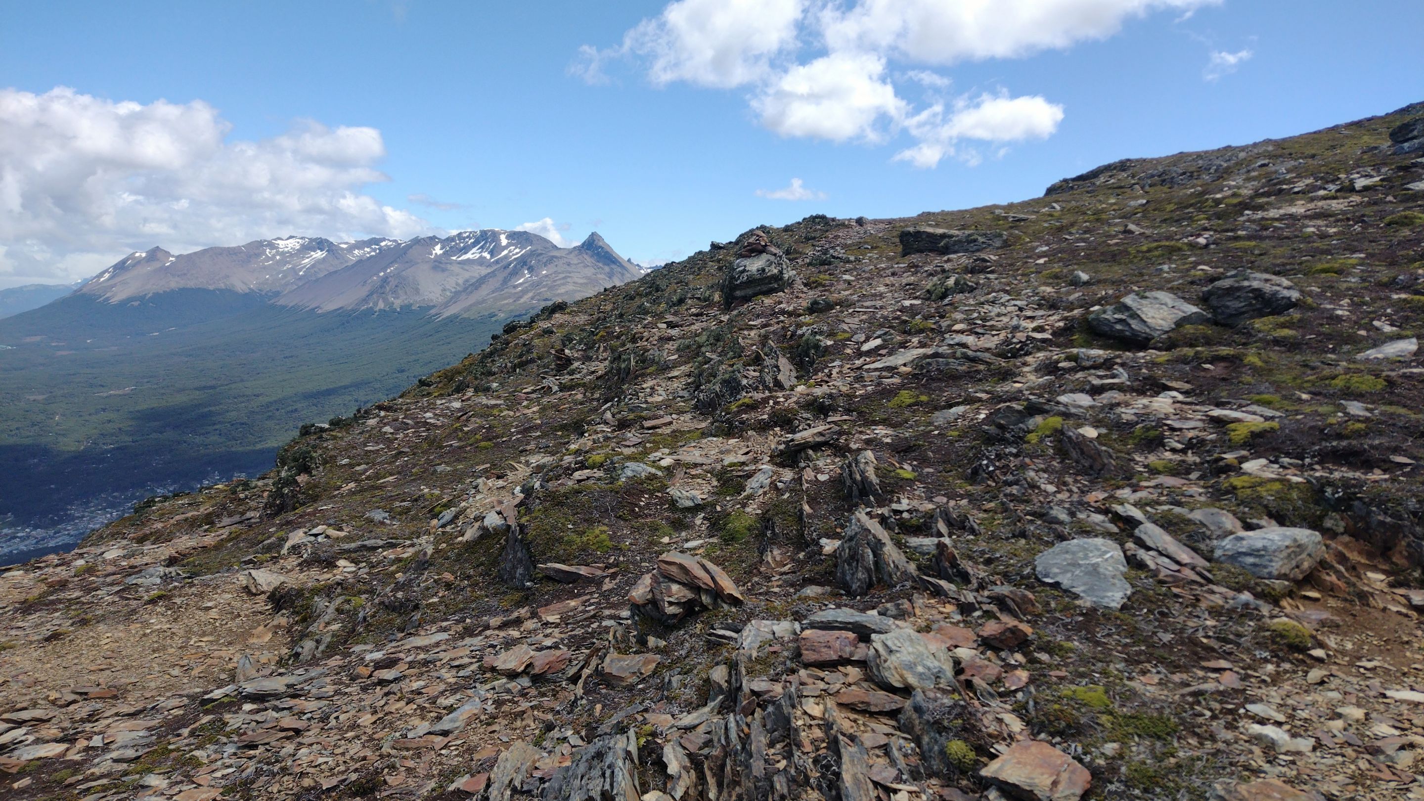
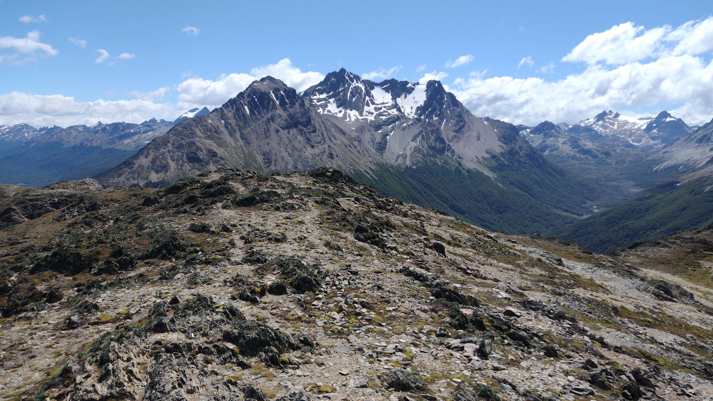
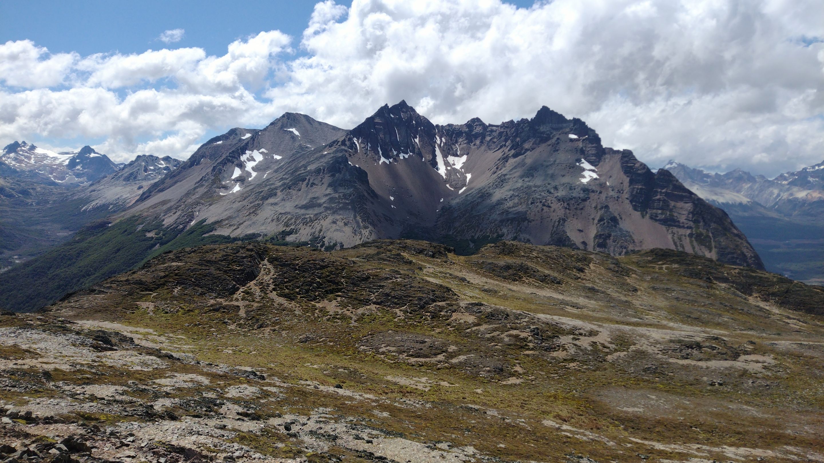
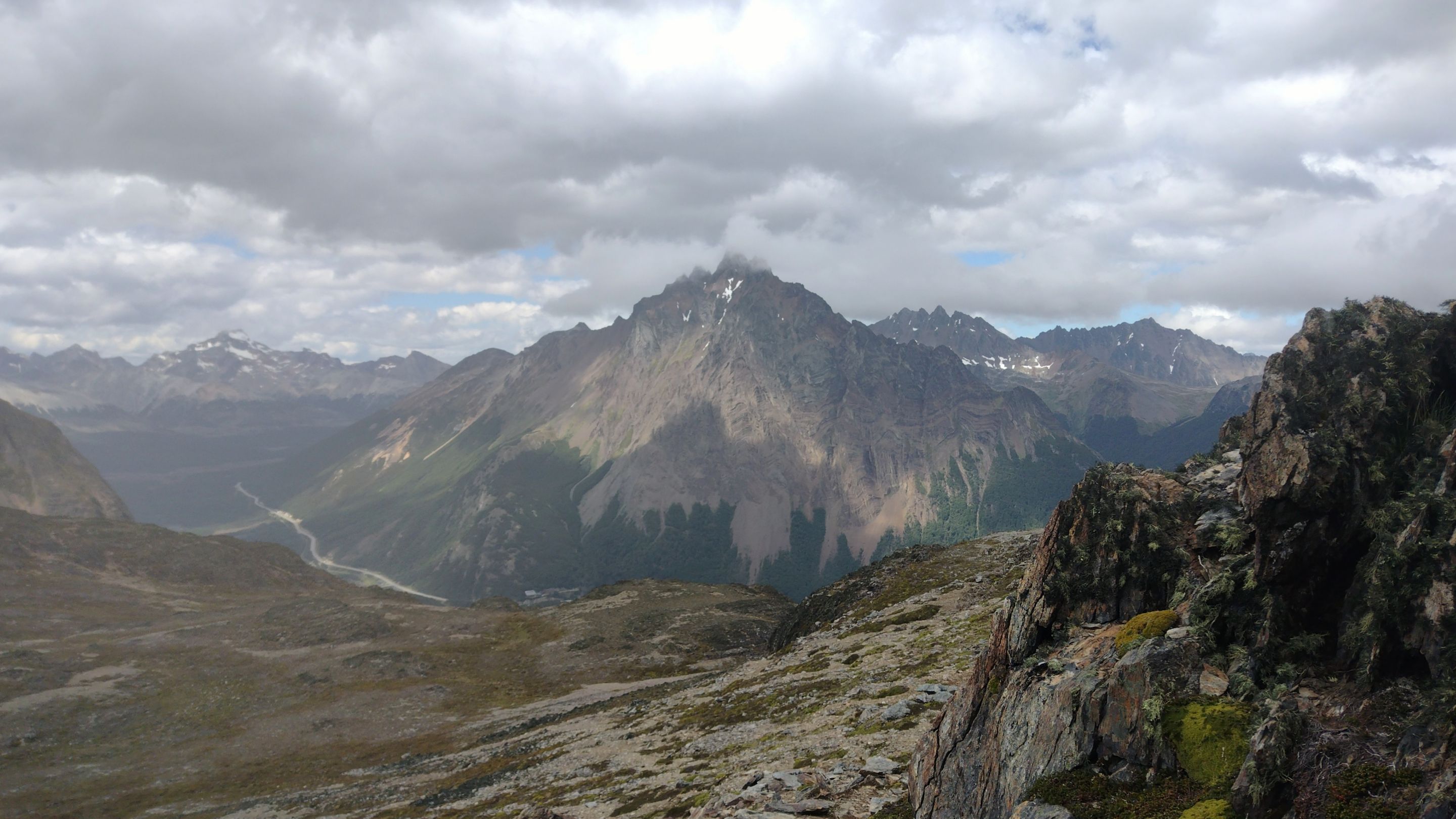
Despite the wind, I reached the summit and everything looked beautiful from there. The weather made the clouds circulate very fast, changing the illumination of the landscape every minute. Even this also made the moment magical. From this summit I could get a good 360° view of the whole city of Ushuaia, the Beagle Channel, Mount Olivia and even the mountain ranges inside the National Park. I like the high peaks, but the ones that are not so high also offer landscapes a bit closer to see them in detail.
---
Despite the wind, I reached the summit and everything looked beautiful from there. The weather made the clouds circulate very fast, changing the illumination of the landscape every minute. Even this also made the moment magical. From this summit I could get a good 360° view of the whole city of Ushuaia, the Beagle Channel, Mount Olivia and even the mountain ranges inside the National Park. I like the high peaks, but the ones that are not so high also offer landscapes a bit closer to see them in detail.
 ---
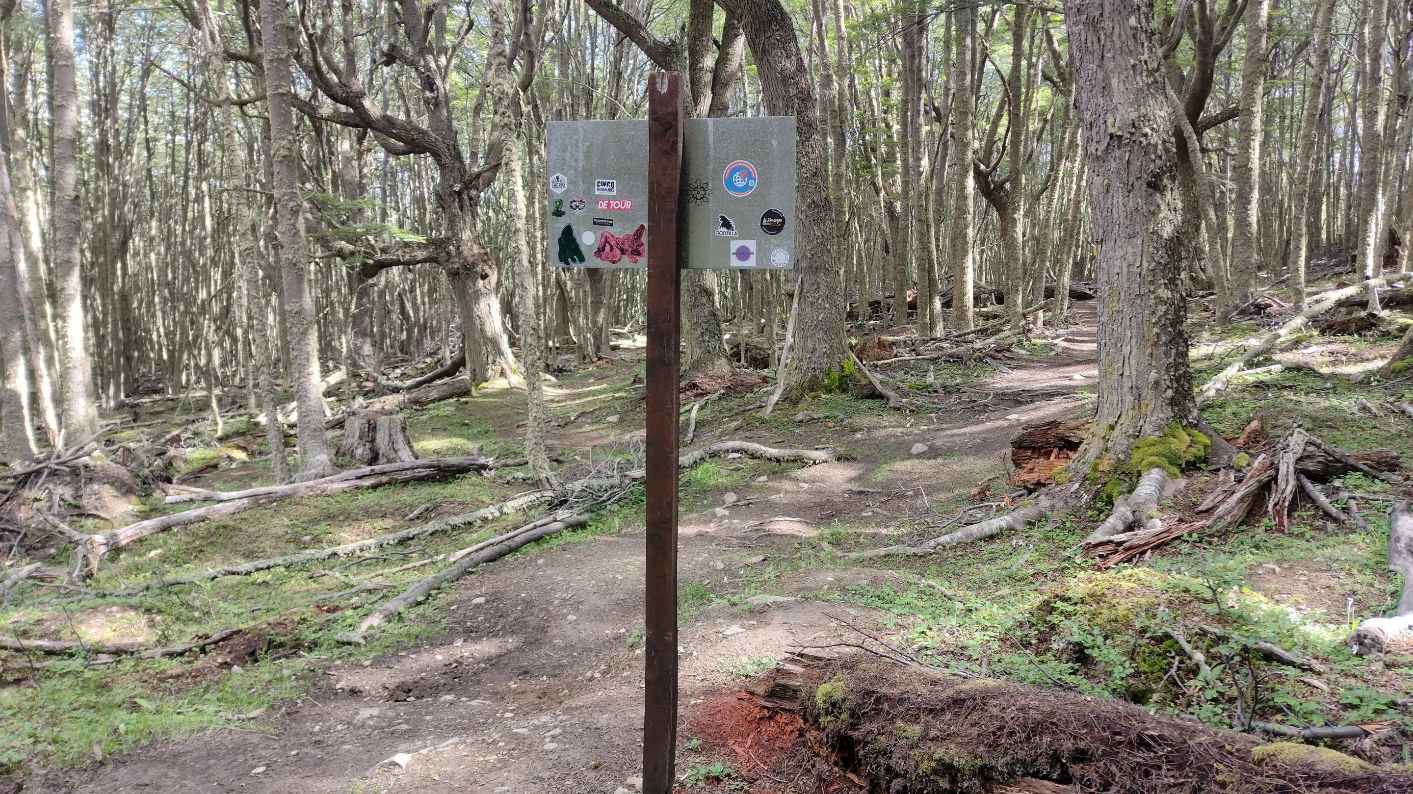
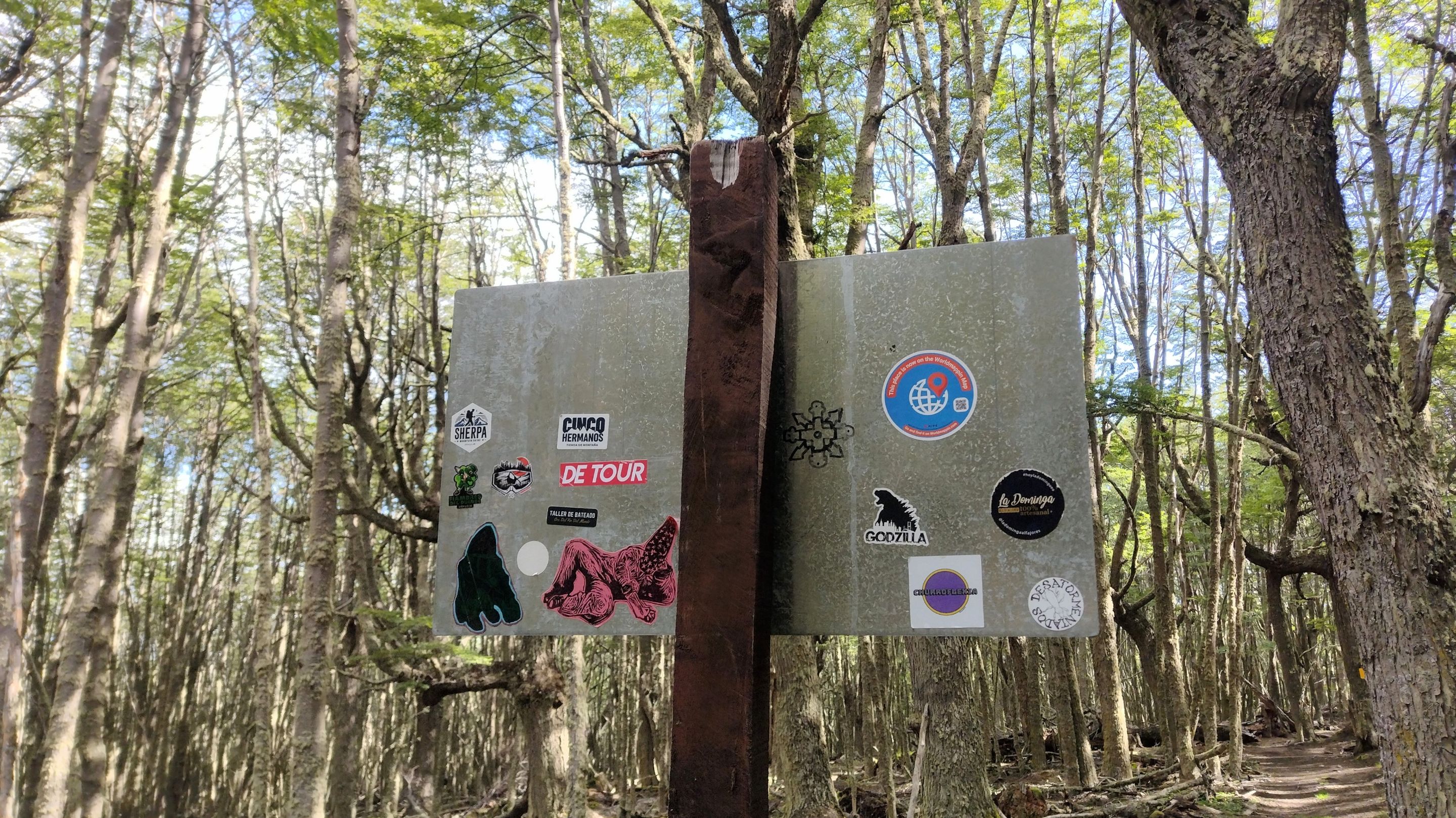
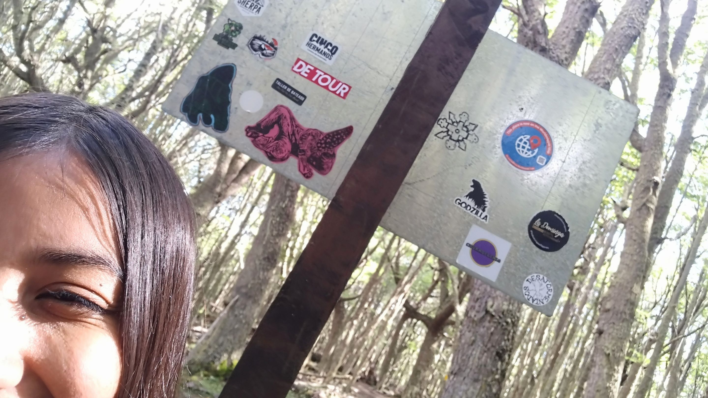
I found a rock shelter where I could take some shelter and have my mountain lunch (a small, non-nutritious sandwich and an apple). I stayed as long as I could, until the humble freezing breezes of the end of the world forced me to come down before my face froze even more. The good thing is that coming down is always a bit quicker than going up, and once back in the forest, there was no trace of the gusts from up there. And on the way up, I found a good location for my new Worldmappin sticker.
---
I found a rock shelter where I could take some shelter and have my mountain lunch (a small, non-nutritious sandwich and an apple). I stayed as long as I could, until the humble freezing breezes of the end of the world forced me to come down before my face froze even more. The good thing is that coming down is always a bit quicker than going up, and once back in the forest, there was no trace of the gusts from up there. And on the way up, I found a good location for my new Worldmappin sticker.
 ---
I usually take a little less time than the signs say, but this time, the whole route took me the exact five hours it was estimated to take. I even imagined it would be a bit more difficult, but all that elevation gain was challenging. Anyway, the views from there were beautiful and being able to see the city of Ushuaia from a new point was very rewarding. All this without detracting from how convenient it was to get off the trail and have a signal to call an Uber back: if I could have driven to the summit, I probably would have done it 😅.
---
I usually take a little less time than the signs say, but this time, the whole route took me the exact five hours it was estimated to take. I even imagined it would be a bit more difficult, but all that elevation gain was challenging. Anyway, the views from there were beautiful and being able to see the city of Ushuaia from a new point was very rewarding. All this without detracting from how convenient it was to get off the trail and have a signal to call an Uber back: if I could have driven to the summit, I probably would have done it 😅.
 ---
With lots of love. / Con mucho amor.
Lau 💕.
---
📸 Cover created with Canva. All the images are my property 💕.
📸 Portada creada en Canva. Todas las imágenes son de mi propiedad 💕.
---
---
With lots of love. / Con mucho amor.
Lau 💕.
---
📸 Cover created with Canva. All the images are my property 💕.
📸 Portada creada en Canva. Todas las imágenes son de mi propiedad 💕.
---
La primera vez que leí que la ciudad de Ushuaia está solo a 6 metros sobre el nivel del mar me sorprendí bastante. A pesar de ser un lugar bajo, es posible encontrar montañas con desniveles interesantes que ponen a prueba tu resistencia física. El pico más alto de esta ciudad es el Monte Olivia con solo 1300 metros de altura, pero solo está reservado para los escaladores profesionales. En su lugar, las personas normales pueden visitar otros cerros a los cuales subir caminando, como el Cerro Cortez, considerado de dificultad media. No será el más alto de todos, pero igualmente te saca la respiración 😃.---
---
Cerro Cortez is one of the closest mountains to the city centre and, according to what I had read, it would only take me about 5 hours to hike to the top and back. This time was perfect for a morning plan before I had to work at the hostel, so I took an Uber to the trailhead, about 6 km from where I was. The highest point of this mountain is 750 masl, but that drive was mostly uphill, so the final elevation gain I had left to walk was only 500 metres.
El Cerro Cortez es una de las montañas que está más cerca del centro de la ciudad y, según lo que había leído, solo me tomaría unas 5 horas ir y volver hasta su cumbre. Este tiempo era perfecto para un plan de mañana antes de tener que trabajar en el hostel, así que me tomé un Uber hasta el inicio del sendero, a unos 6 km de donde estaba. El punto más alto de esta montaña es de 750 msnm, pero ese recorrido en auto fue gran parte en subida, por lo que el desnivel final que me quedaba para caminar era solo de 500 metros.---
---
One thing I like about Ushuaia is that most of the trails are well signposted. Of all the trails I've done, I've rarely had to resort to an offline map. That's why it gave me peace of mind to go trekking alone, because I knew that the chances of getting lost were low. Also, this particular mountain is very close to the city, so I never lost my internet signal. And in case of any emergency, you could call the rescue number 103, which luckily in all my long stay, I never had to do.
Algo que me gusta de Ushuaia es que la mayoría de sus senderos están perfectamente señalizados. De todos los recorridos que hice, pocas veces tuve que recurrir a un mapa sin conexión. Es por eso que me daba tranquilidad salir a hacer trekking sola, porque sabía que las probabilidades de perderme eran bajas. Además, esta montaña en particular está muy cerca de la ciudad, por lo que en ningún momento perdí la señal de internet. Y ante cualquier urgencia, se podía llamar al número de rescate 103, que por suerte en toda mi larga estadía, nunca tuve que hacerlo.---
---
I never knew how to write the name of this mountain properly, as in some places it appears as ‘Cortez’ (surname) and on the trail it says ‘Cortés’ (adjective, polite). I liked it better as a surname, so I wrote it that way. What was certain was that the gradient on this mountain was interesting. Although it was a 3 kilometres one way trail, I think that all the elevation gain was concentrated in 2.5 kilometres. My legs gave it their all, but as always, a big elevation gain means good views faster.
Nunca supe cómo escribir bien el nombre de esta montaña, ya que en algunos lados figura como "Cortez" (apellido) y en el sendero dice "Cortés" (adjetivo, de cortesía). Me gustaba más como apellido, así que lo escribí así. Lo que sí era seguro era que el desnivel en esta montaña era interesante. Si bien era una senda de 3 kilómetros ida, yo creo que todo el desnivel estaba concentrado en 2,5 kilómetros. Mis piernas lo dieron todo, pero como siempre, un gran desnivel positivo implica buenas vistas más rápido.---
---
I didn't meet anyone on the way, and that's because this mountain is not one of the most touristy in Ushuaia. I thought that maybe I would meet some locals when I was near the summit, but the only thing that was there was a terrible wind. At times I had to sit down and take shelter because I swear it was pushing me. Keeping a steady pace was difficult and I didn't want any accidents.
En todo el camino no me crucé a nadie, y es porque esta montaña no es de las más turísticas de Ushuaia. Pensé que quizás encontraría a algún local cuando estuviera cerca de la cumbre, pero lo único que había ahí era un viento terrible. Por momentos me tuve que sentar a resguardarme un poco porque les juro que me empujaba. Mantener el paso firme era difícil y no quería ningún accidente.---
---
Despite the wind, I reached the summit and everything looked beautiful from there. The weather made the clouds circulate very fast, changing the illumination of the landscape every minute. Even this also made the moment magical. From this summit I could get a good 360° view of the whole city of Ushuaia, the Beagle Channel, Mount Olivia and even the mountain ranges inside the National Park. I like the high peaks, but the ones that are not so high also offer landscapes a bit closer to see them in detail.
A pesar del viento, llegué a la cumbre y todo se veía hermoso desde ahí. El clima hacía que las nubes circularan muy rápido, cambiando la iluminación del paisaje a cada minuto. Incluso esto también hacía mágico el momento. Desde esta cima pude obtener una buena vista 360° de toda la ciudad de Ushuaia, el Canal de Beagle, el Monte Olivia e incluso los cordones montañosos dentro del Parque Nacional. Me gustan los picos altos, pero los que no lo son tanto también ofrecen paisajes un poco más cercanos para verlos en detalle.---
---
I found a rock shelter where I could take some shelter and have my mountain lunch (a small, non-nutritious sandwich and an apple). I stayed as long as I could, until the humble freezing breezes of the end of the world forced me to come down before my face froze even more. The good thing is that coming down is always a bit quicker than going up, and once back in the forest, there was no trace of the gusts from up there. And on the way up, I found a good location for my new Worldmappin sticker.
Encontré un refugio de piedras en donde pude resguardarme un poco y tener mi almuerzo de montaña (un pequeño sandwich nada nutritivo y una manzana). Me quedé todo lo que pude, hasta que las humildes brisas congeladas del fin del mundo me obligaron a bajar antes de que se me helara aún más la cara. Lo bueno es que bajar siempre es un poco más rápido que subir, y una vez de nuevo en el bosque, ya no quedaban rastros de las ráfagas de ahí arriba. Y en camino, encontré una buena ubicación para mi nuevo sticker de Worldmappin.---
---
I usually take a little less time than the signs say, but this time, the whole route took me the exact five hours it was estimated to take. I even imagined it would be a bit more difficult, but all that elevation gain was challenging. Anyway, the views from there were beautiful and being able to see the city of Ushuaia from a new point was very rewarding. All this without detracting from how convenient it was to get off the trail and have a signal to call an Uber back: if I could have driven to the summit, I probably would have done it 😅.
Generalmente suelo tardar un poco menos que lo que dicen los carteles, pero esta vez, todo el recorrido me tomó las cinco horas exactas que se estimaban. Incluso me imaginaba que sería un poco más difícil, pero todo ese desnivel fue desafiante. Como sea, las vistas desde ahí eran hermosas y poder ver la ciudad de Ushuaia desde un nuevo punto fue muy gratificante. Todo esto sin restarle mérito a lo cómodo que fue salir del sendero y tener señal para pedir un Uber de vuelta: si hubiese podido ir en auto hasta la cumbre, probablemente lo hubiese hecho 😅.---
❤️ Hope you liked this post! Thanks for reading. ❤️
❤️¡Espero que les haya gustado este post! Gracias por leer. ❤️
--- ---
---
With lots of love. / Con mucho amor.
Lau 💕.
---
📸 Cover created with Canva. All the images are my property 💕.
📸 Portada creada en Canva. Todas las imágenes son de mi propiedad 💕.
---