On day three of our trip to the Azores we did a hike in Sete Cidades. So grab your hiking shoes and come join me as I take you with me on our adventure.
Okay I know that that was cheesy but sometimes you have to change things up a little and try something new in your intro. Okay, moving on.
Sete Cidades is one of the most popular hikes on the Sao Miguel island and it comes up on pretty much every travel blog on the internet relating to the Azores. After seeing it mentioned in so many blogs, it really seemed like a "must do" activity to me and it was something that I was looking forward to most during our trip. We watched the weather when we woke up, and though it was cloudy in the morning we decided to test our luck anyway and just go for it that day.
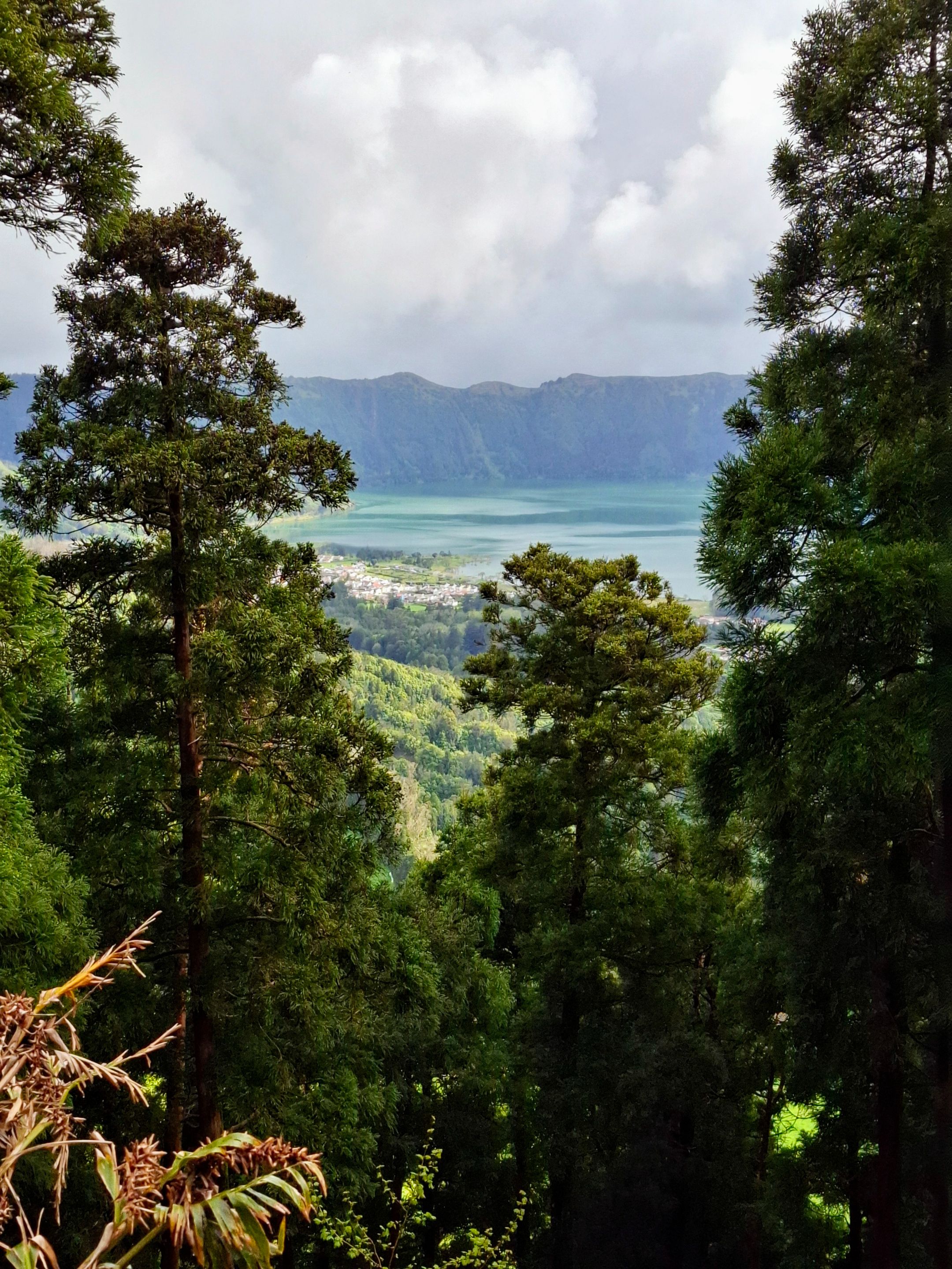
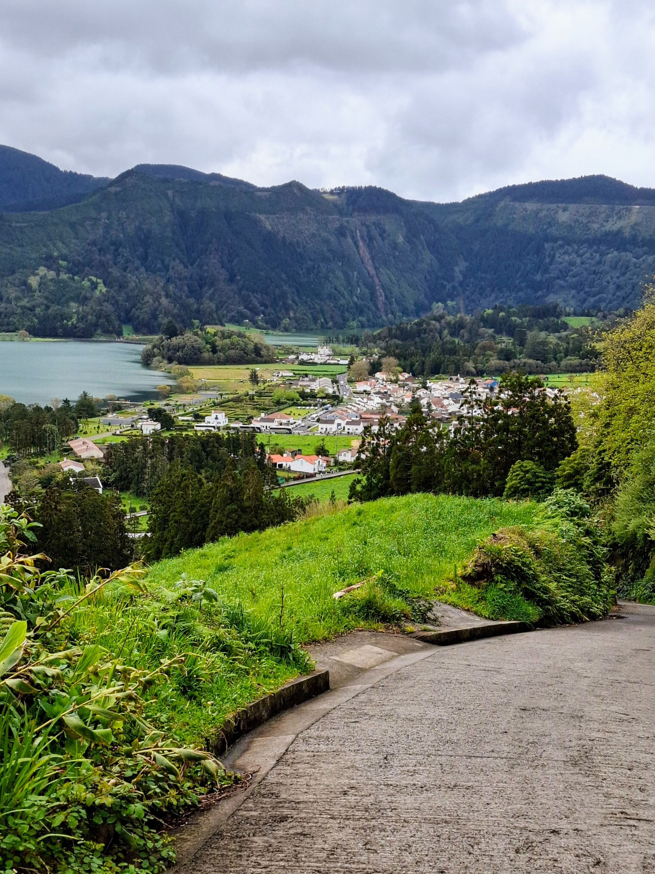
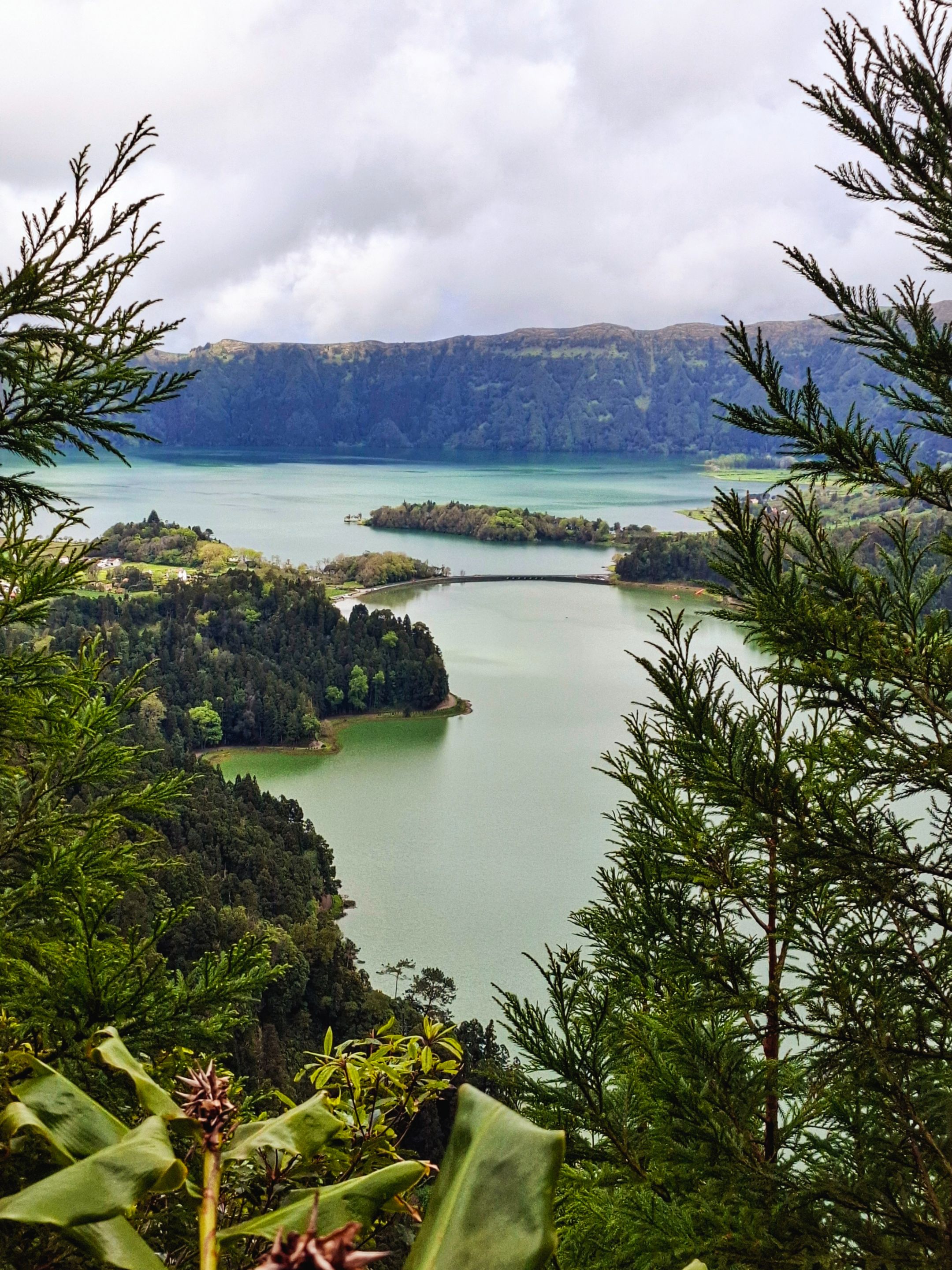
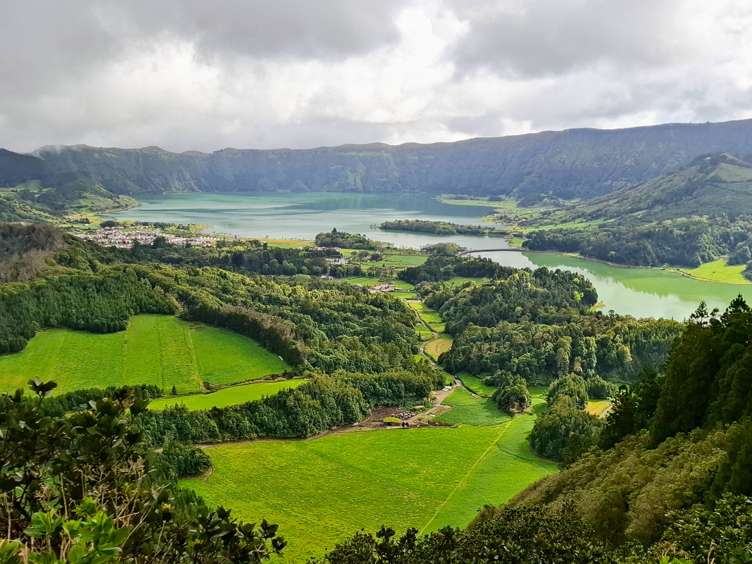
The town of Sete Cidades is located inside a giant volcanic crater and is situated adjacent to a lake at the base of the deep pit. The lake has a bridge spanning it which makes it look like two separate lakes but the two sides are connected so its actually just one body of water.
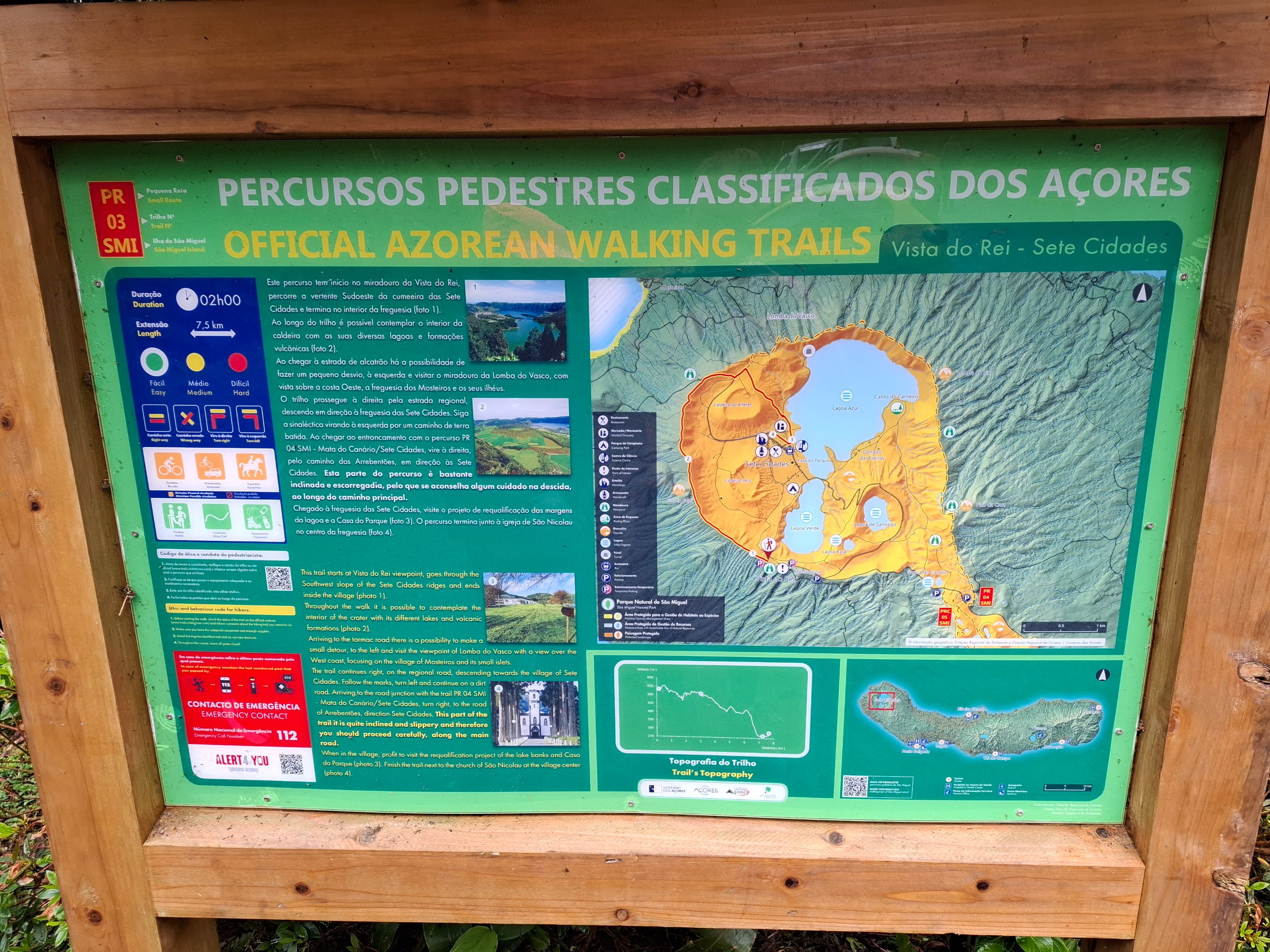
The hike to get to the town follows a circular path that goes partially around the outside ring of the crater and then down the steep banks toward its base. There is also the option of continuing around the entire perimeter of the crater if you want an extra long hike and are happy to just view the town and lake from up above.
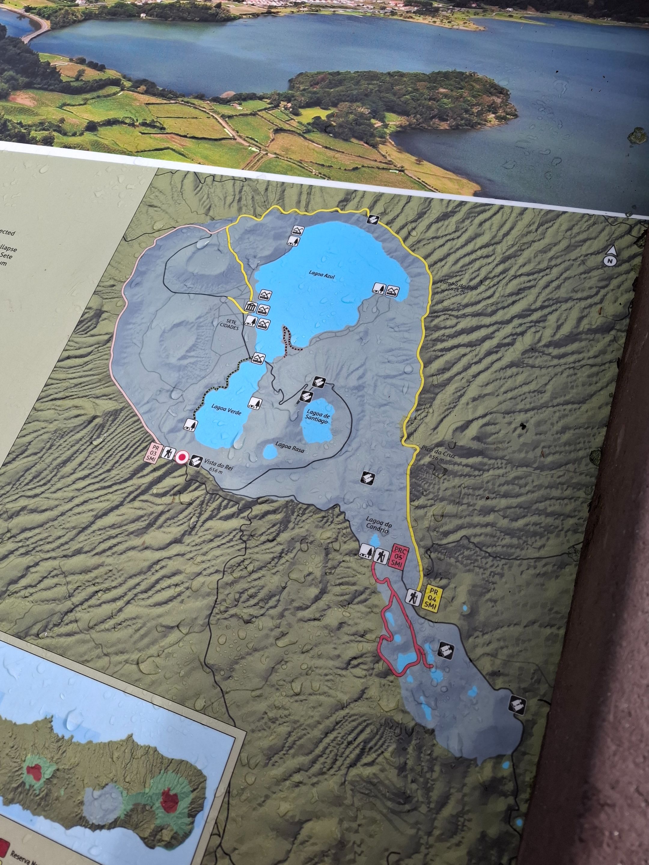
The path that we took went around part of the outer perimeter then down into the crater. It crossed through the town itself and then brought us back up the steep slope to the outer ring back to where we started.
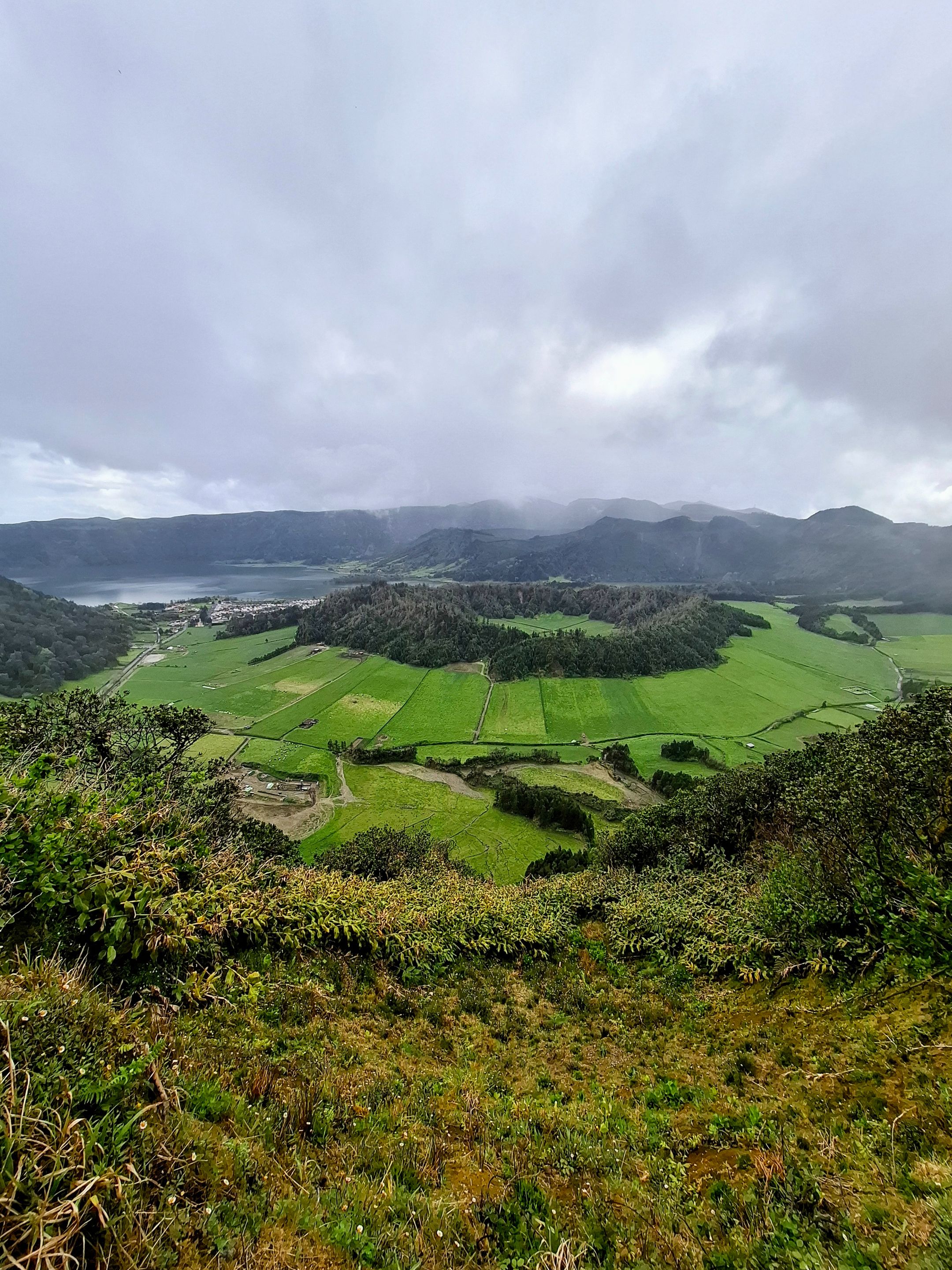
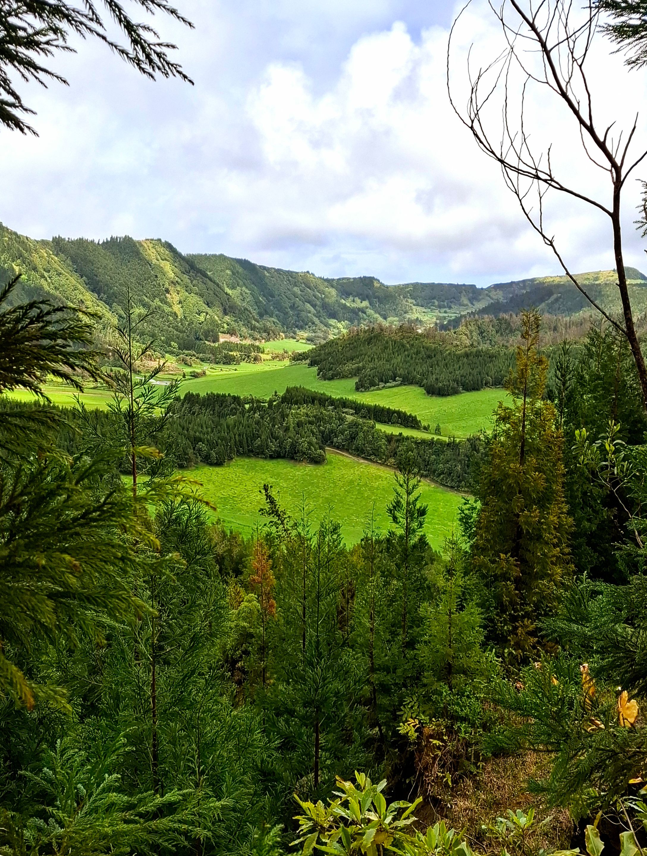
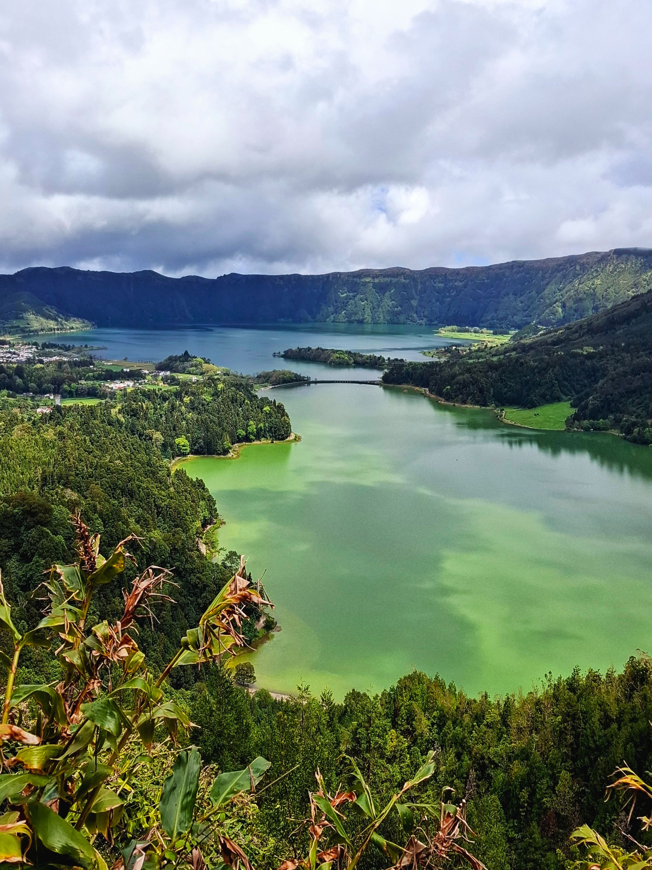
The hike begins at a viewpoint located at the top called "Miradouro da Vista do Rei."
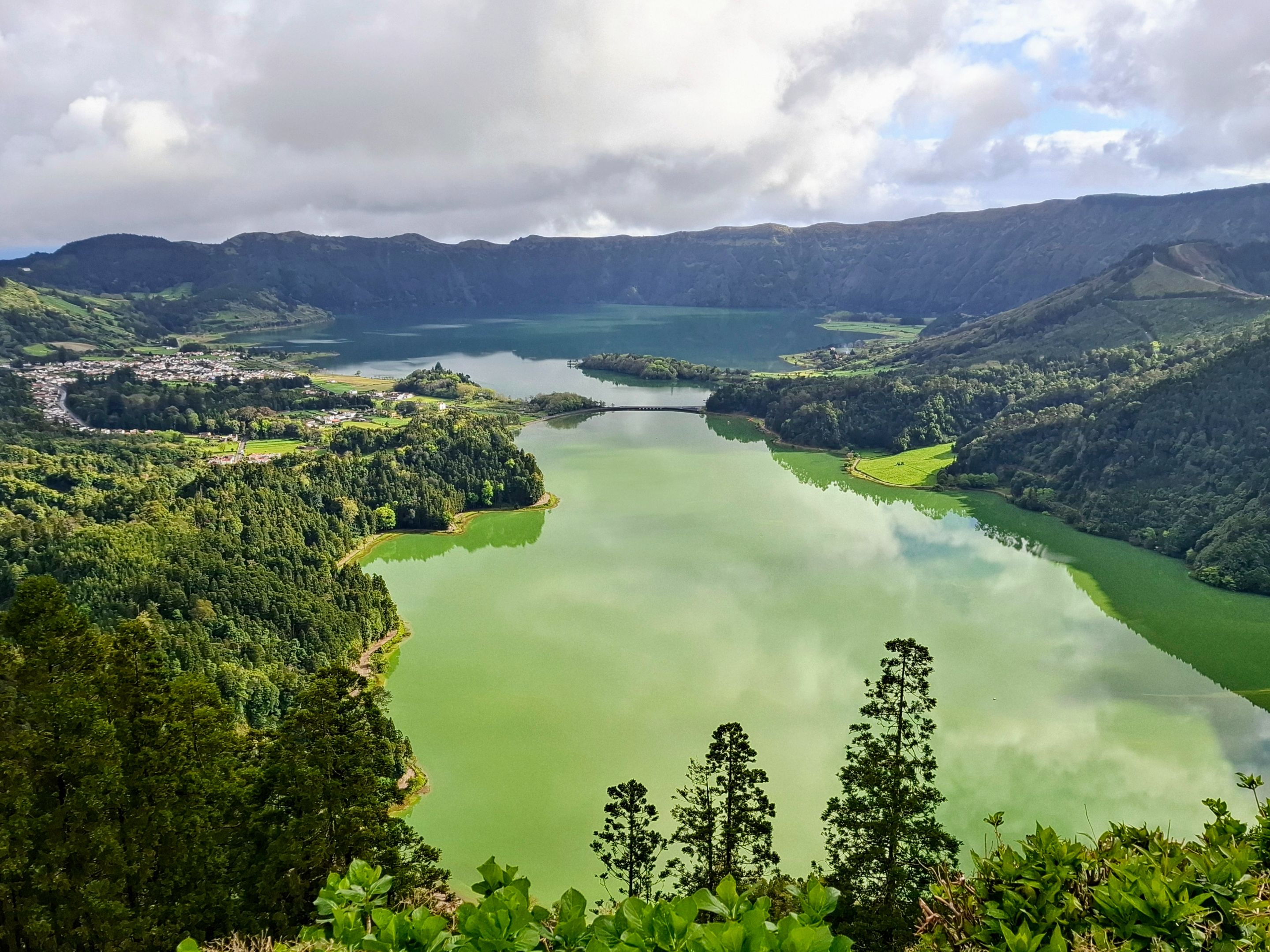
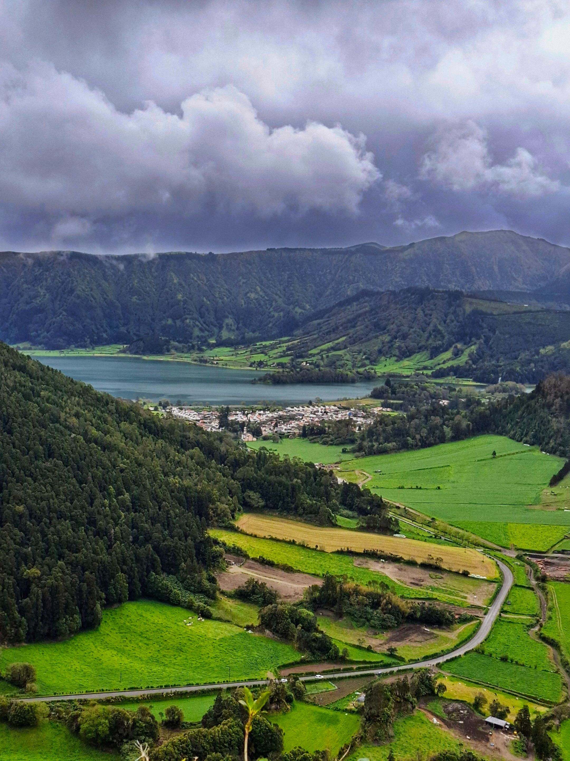
Here there is a large platform that overlooks the lake and the town. The photo above and below are of the view from that platform.
If you don't want to do the hike you can still drive to that location just to see the view, which is worth it in itself. There is parking there but it's limited in space and has a maximum allowable time of only 20-30 minutes. It's lots of time if you are just there to see the view but not enough for the hike which took us around 3 hours or so.
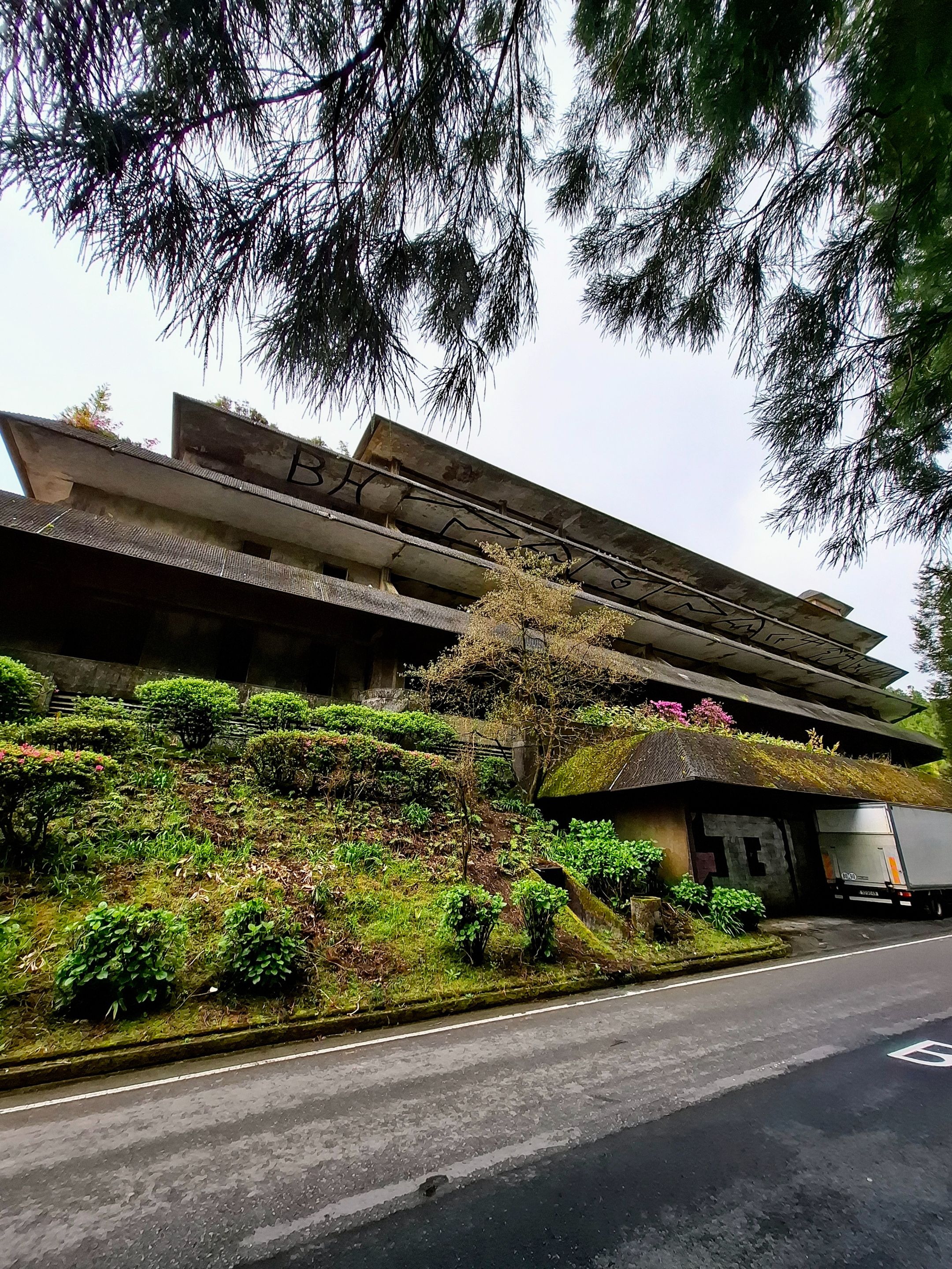
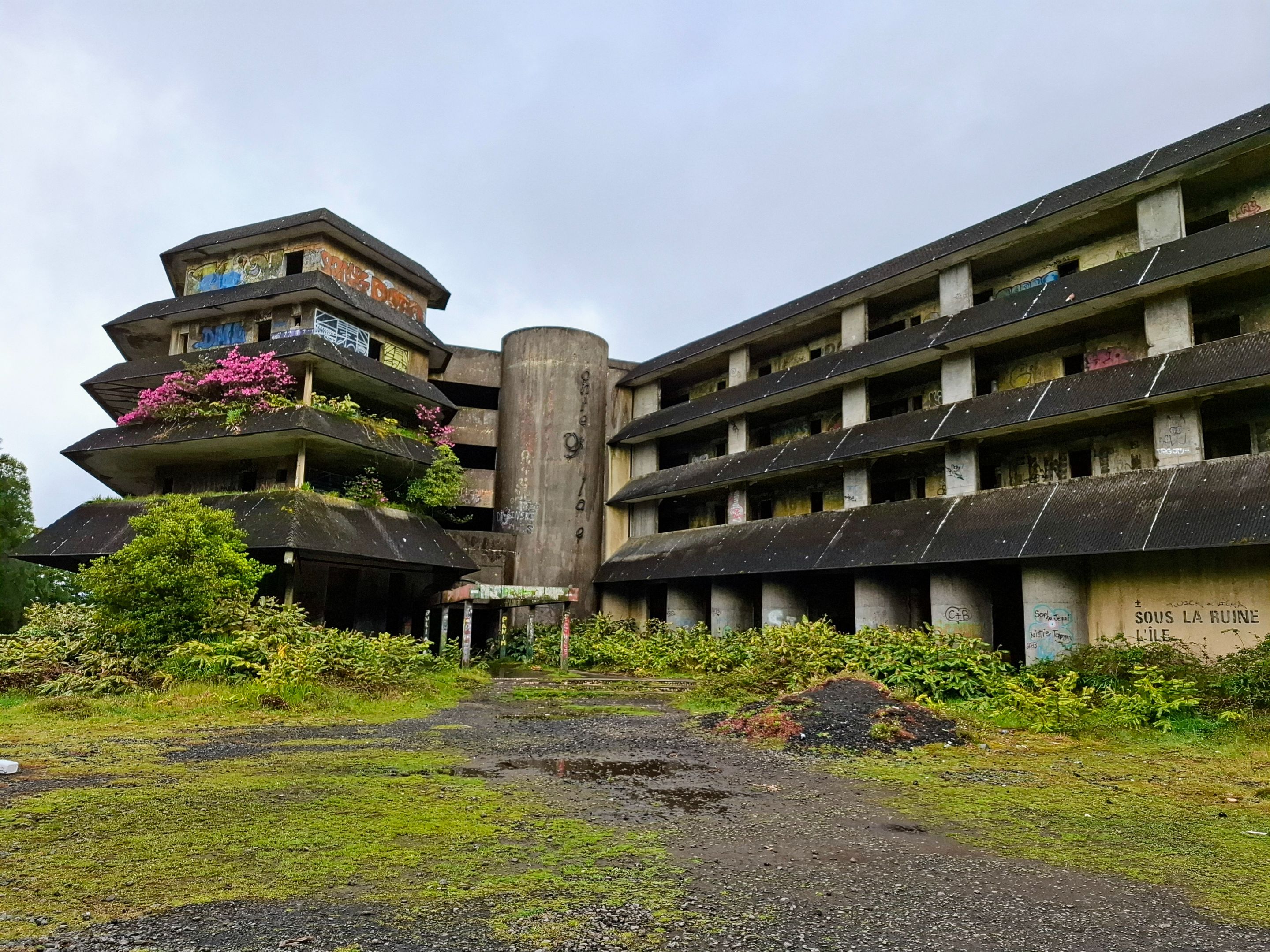
At the viewpoint is another landmark called "Monte Palace" which is an abandoned hotel.
We drove passed them both to park our car on a pull over at the side of the road a few minutes away.
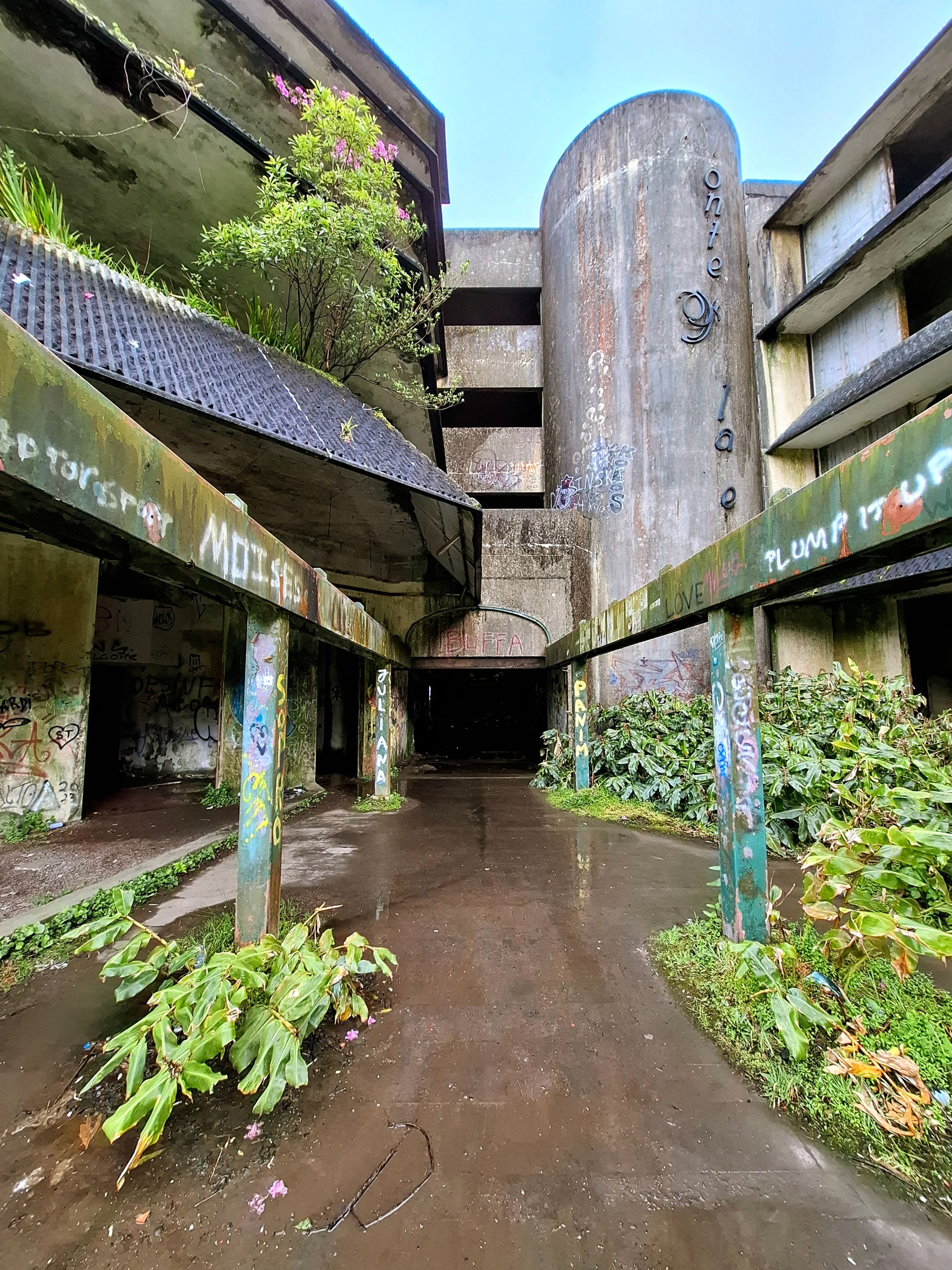
The hotel is forbidden to enter, for safety reasons, but all that is stopping people from entering is a sign out front. The gates were wide open to enter.
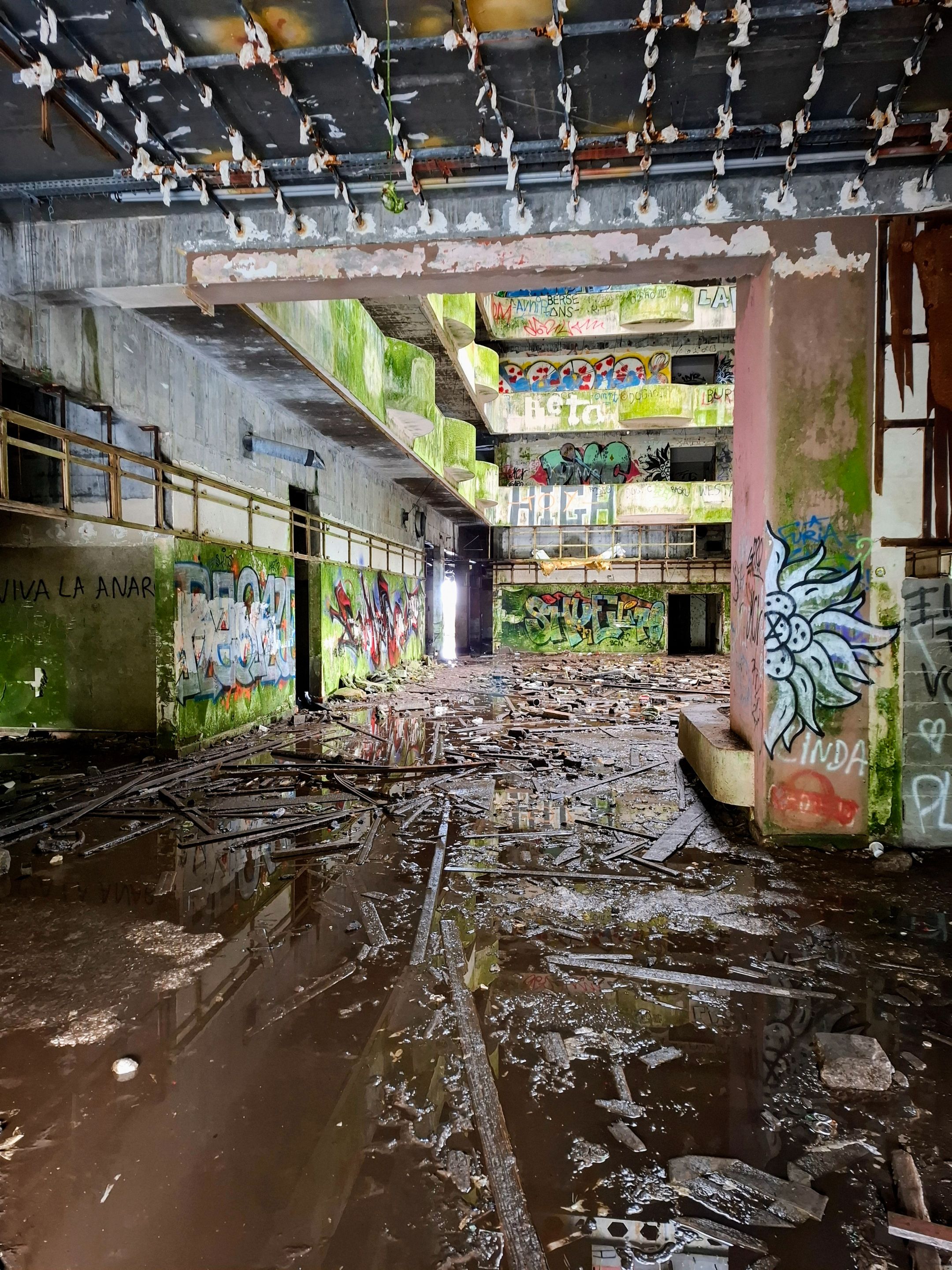
I went in to take a look around because im a rebel. It actually did seem pretty dangerous in there though, with debris all over the ground. I wouldn't exactly recommend going in, this is definitely a "do at your own risk" type of situation.
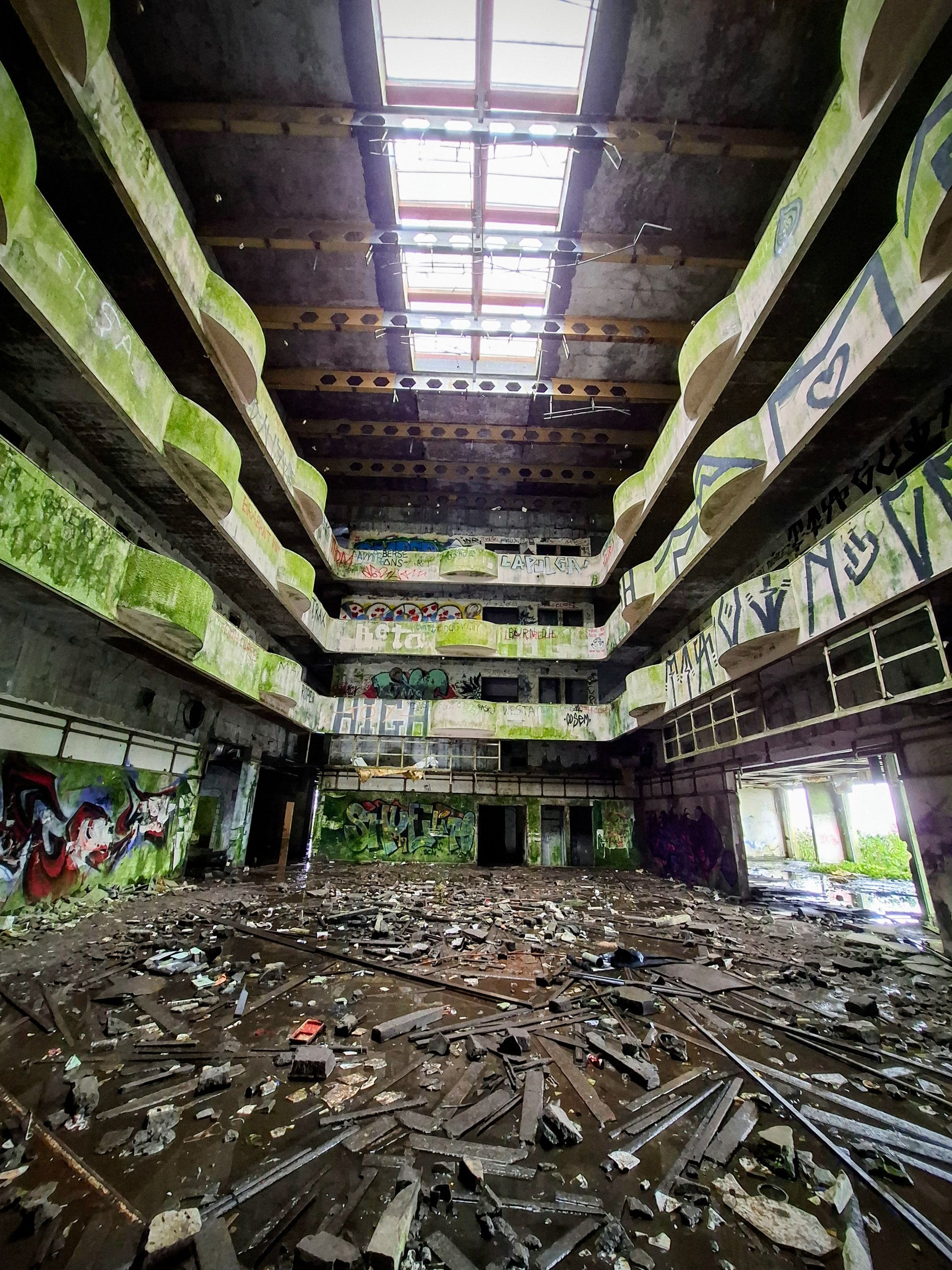
I was a little worried that a chunk of ceiling might fall from above and land on my head. I didn't stick around in there very long. A rebel but still conscientious.
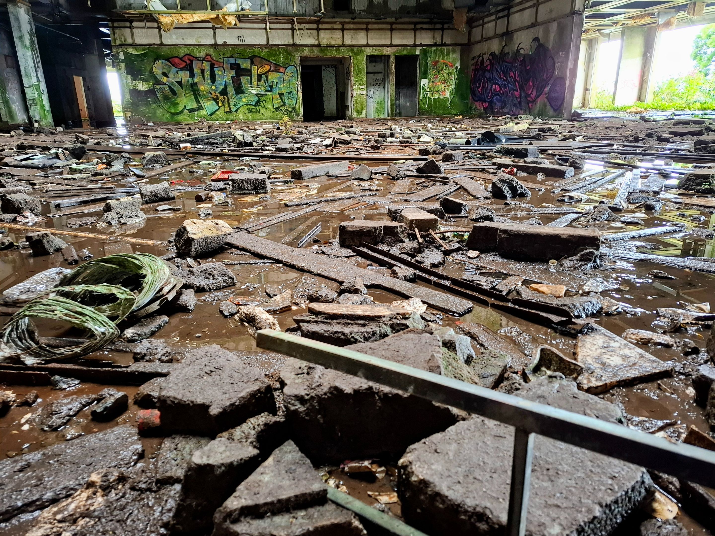
Later on I actually saw people standing on the roof outside overlooking the view. There must have been a staircase in there somewhere that brought them to the top. I didn't see that myself.
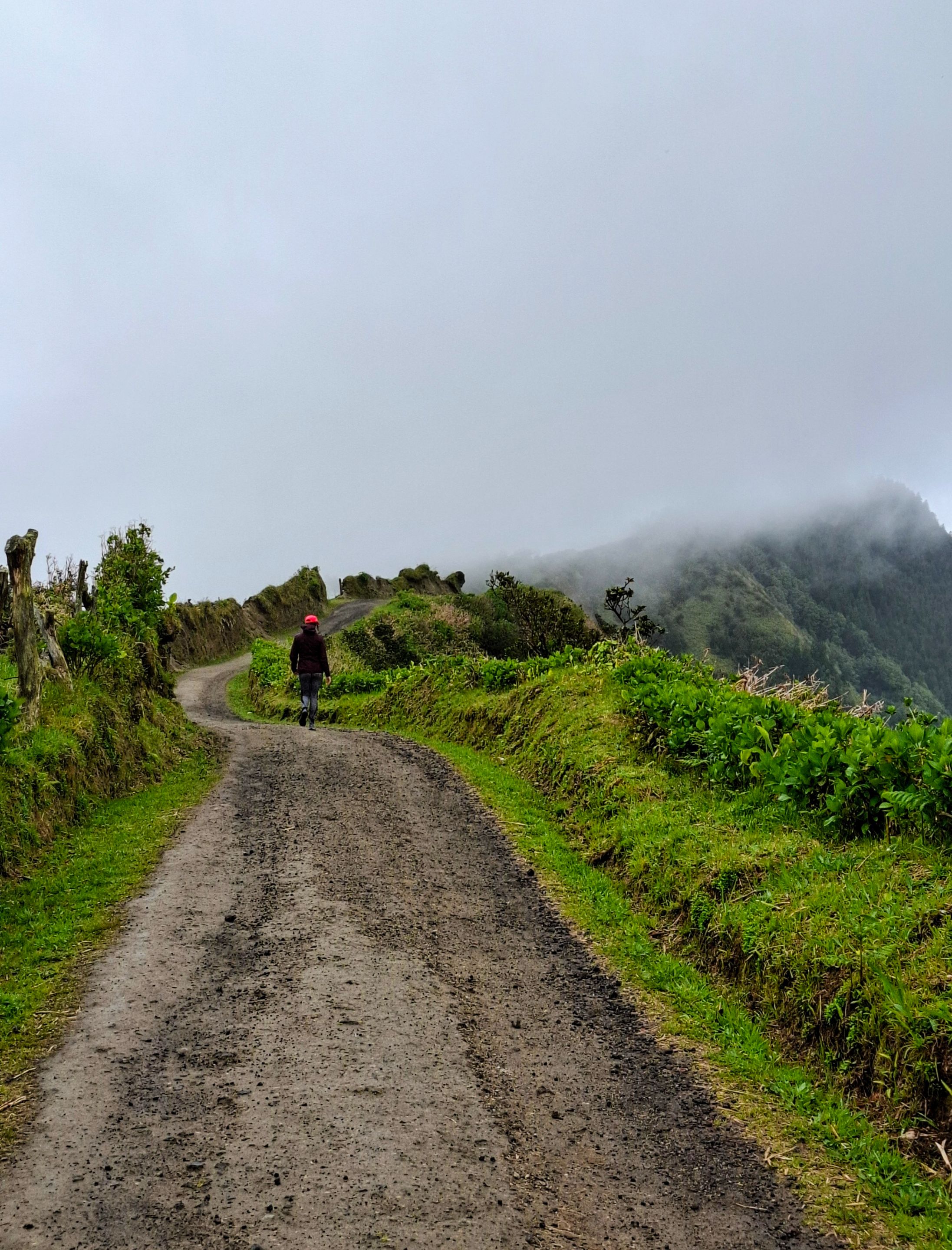
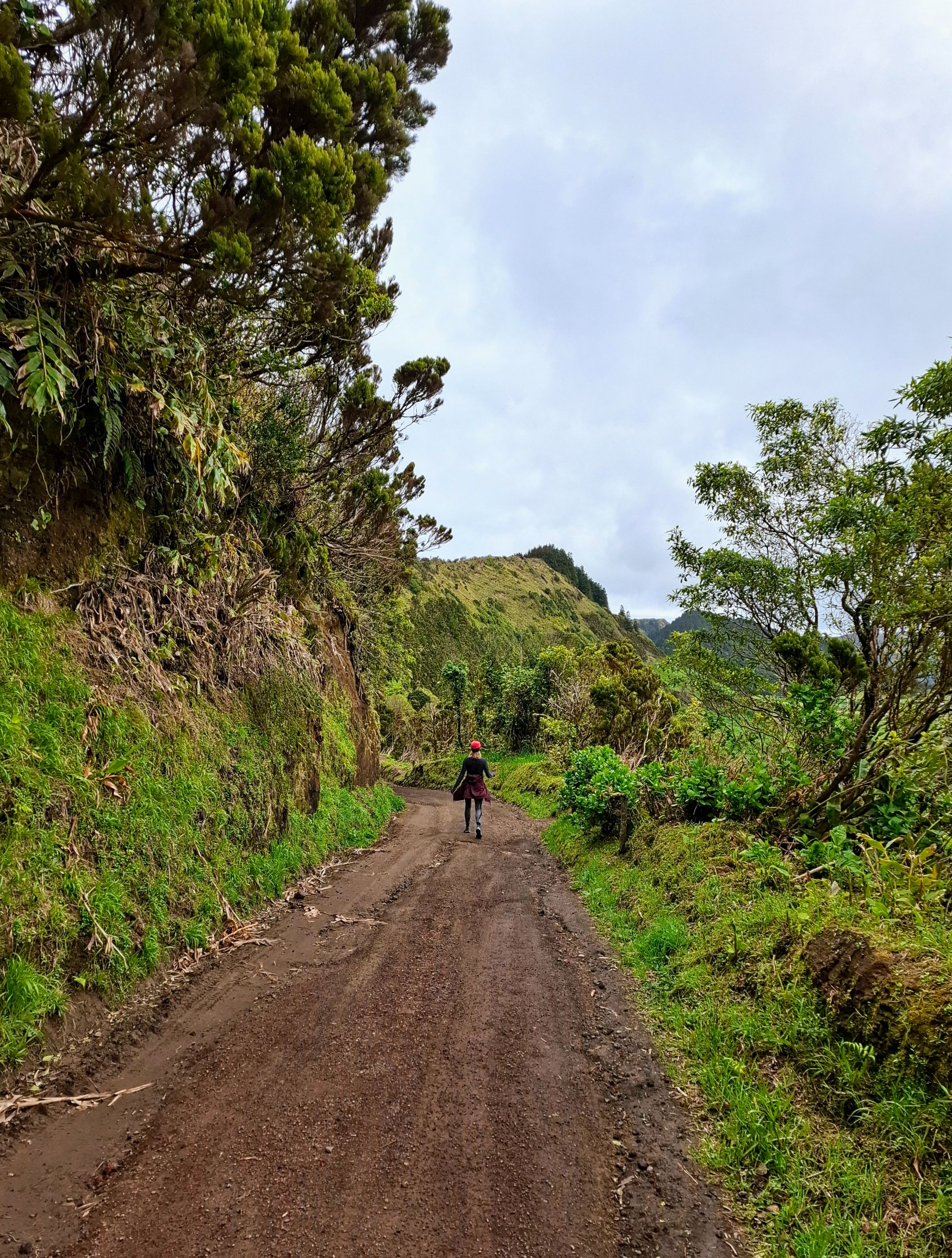
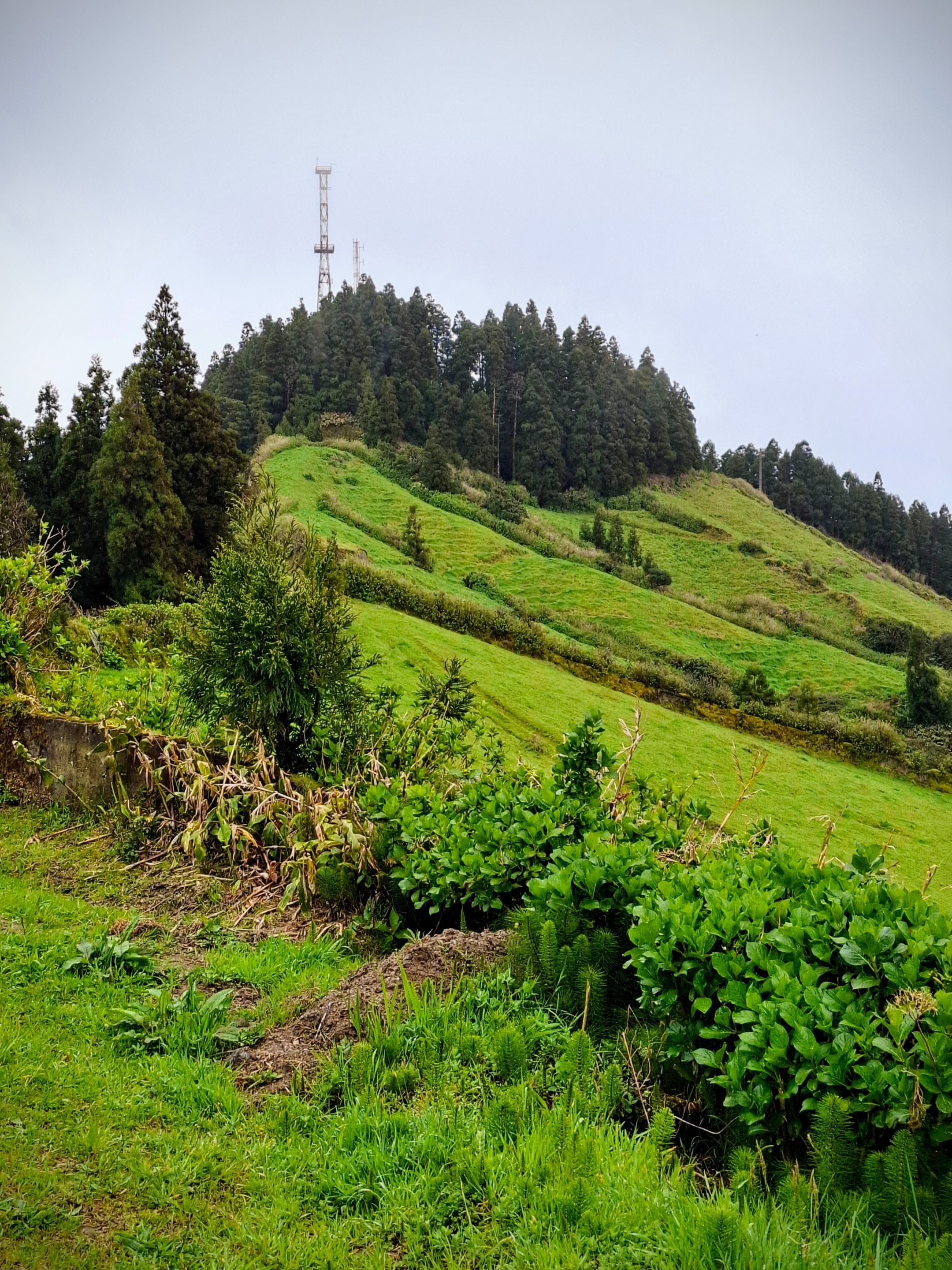
The begining of the hike along the top of the crater followed a dirt path that was wide enough to accommodate many people at once and was smooth enough for mountain bikes.
I say that because we were passed on our hike by a group of cyclists with a tour guide. Something to look into if you're into that sort of thing.
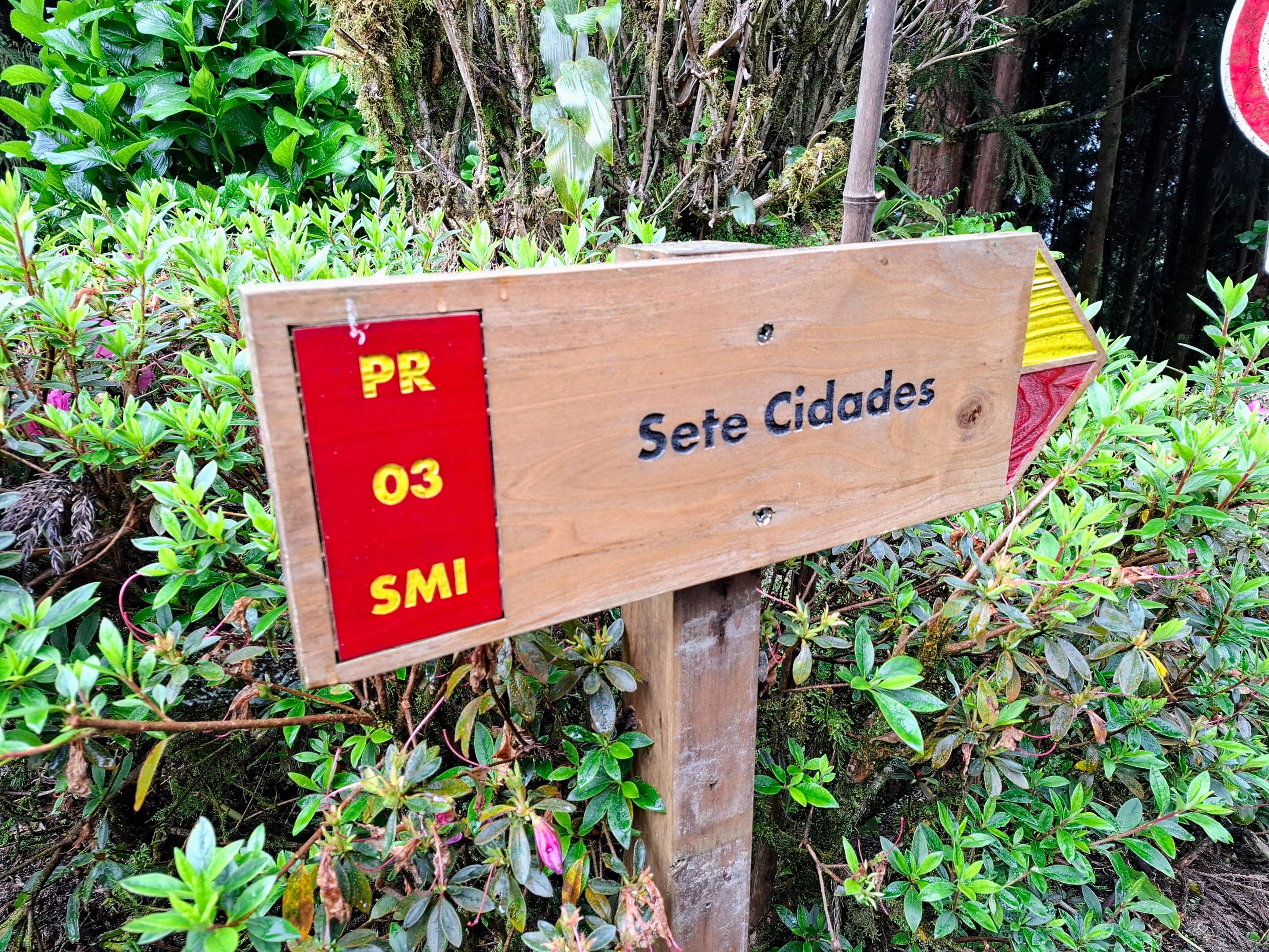
The trail was well marked and easy to follow all the way to the town.
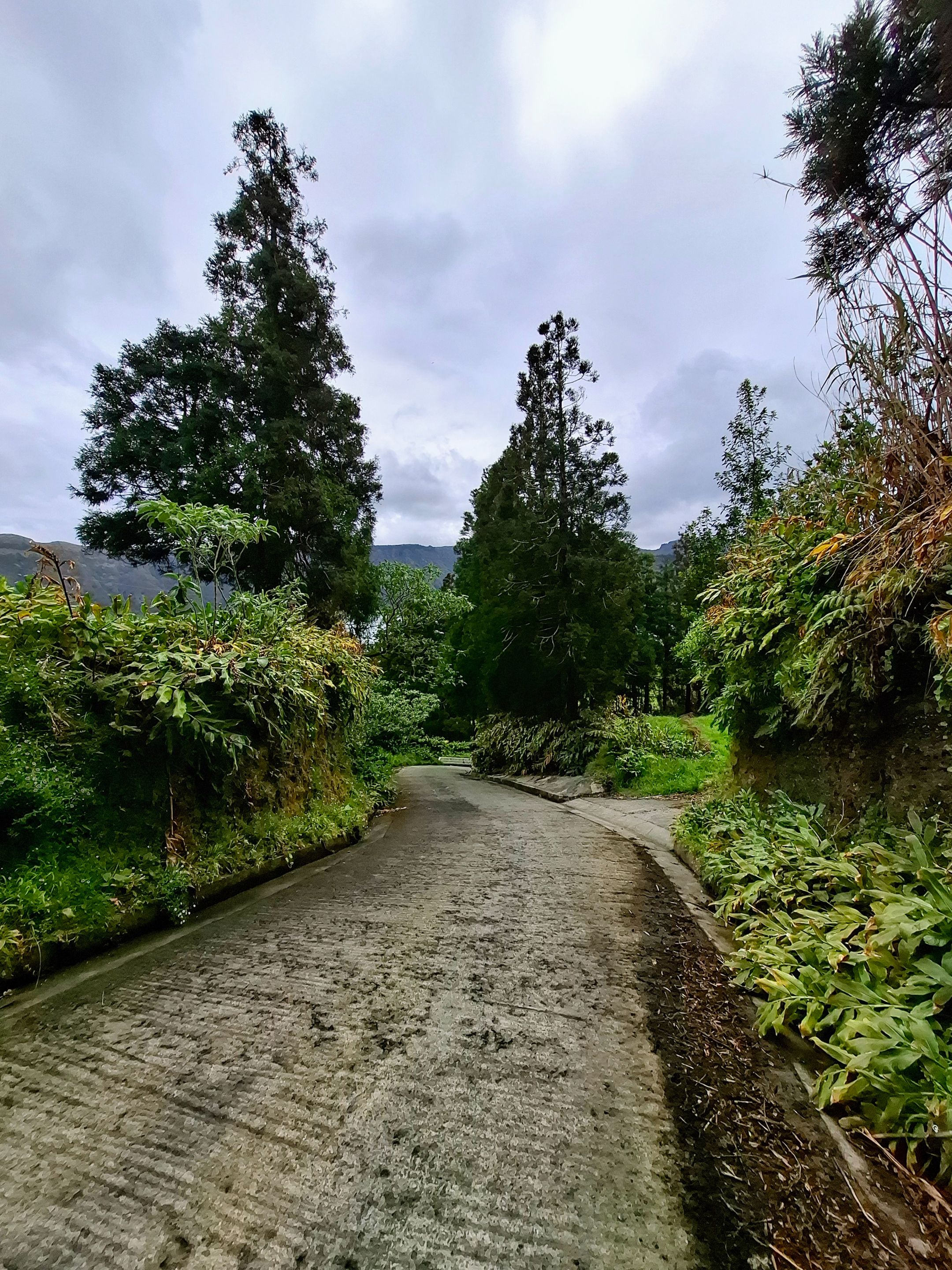
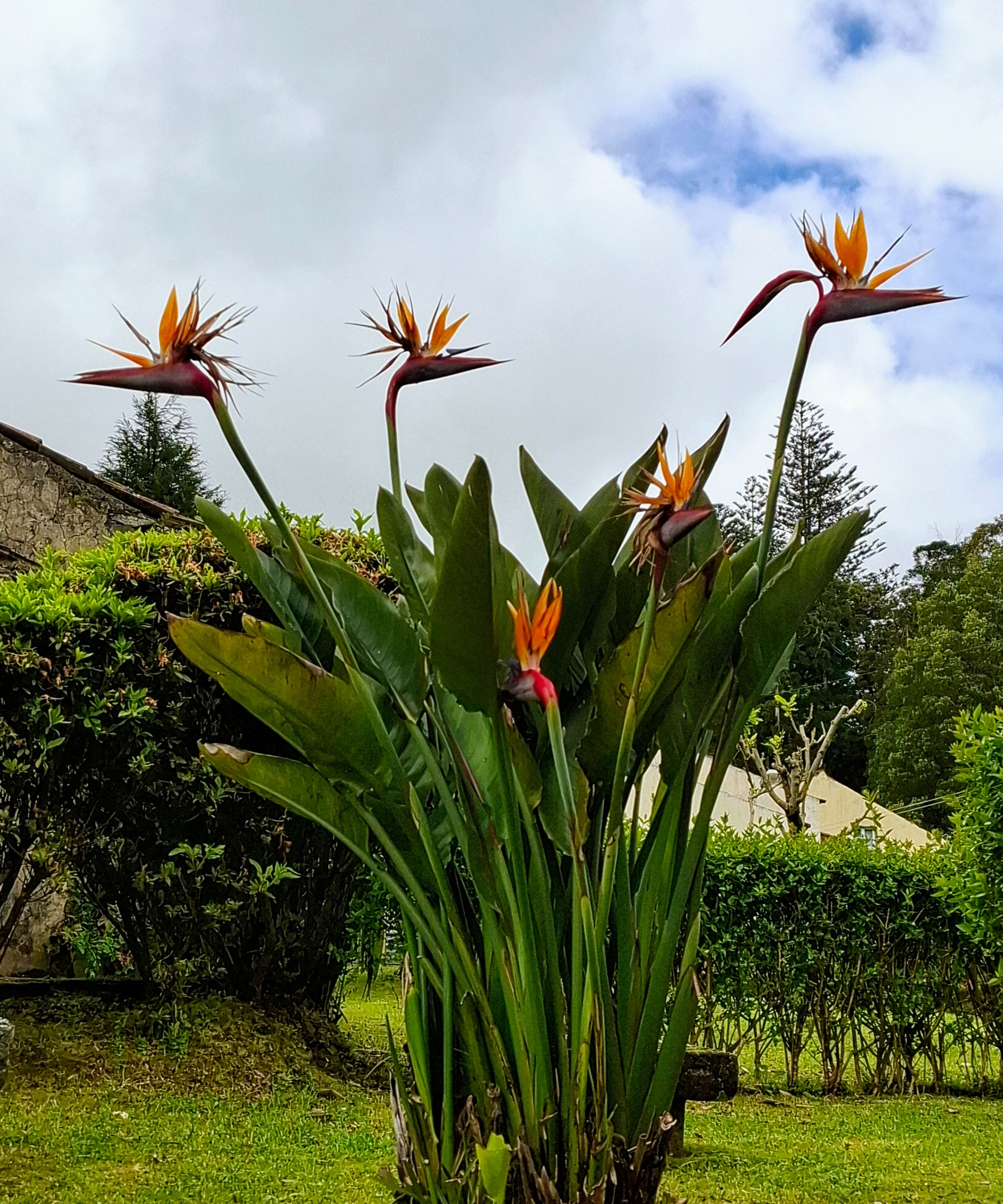
Here are some random pictures I took from the trail.
There were views of the inside of the crater all along the way.
There were several vantage points as well.
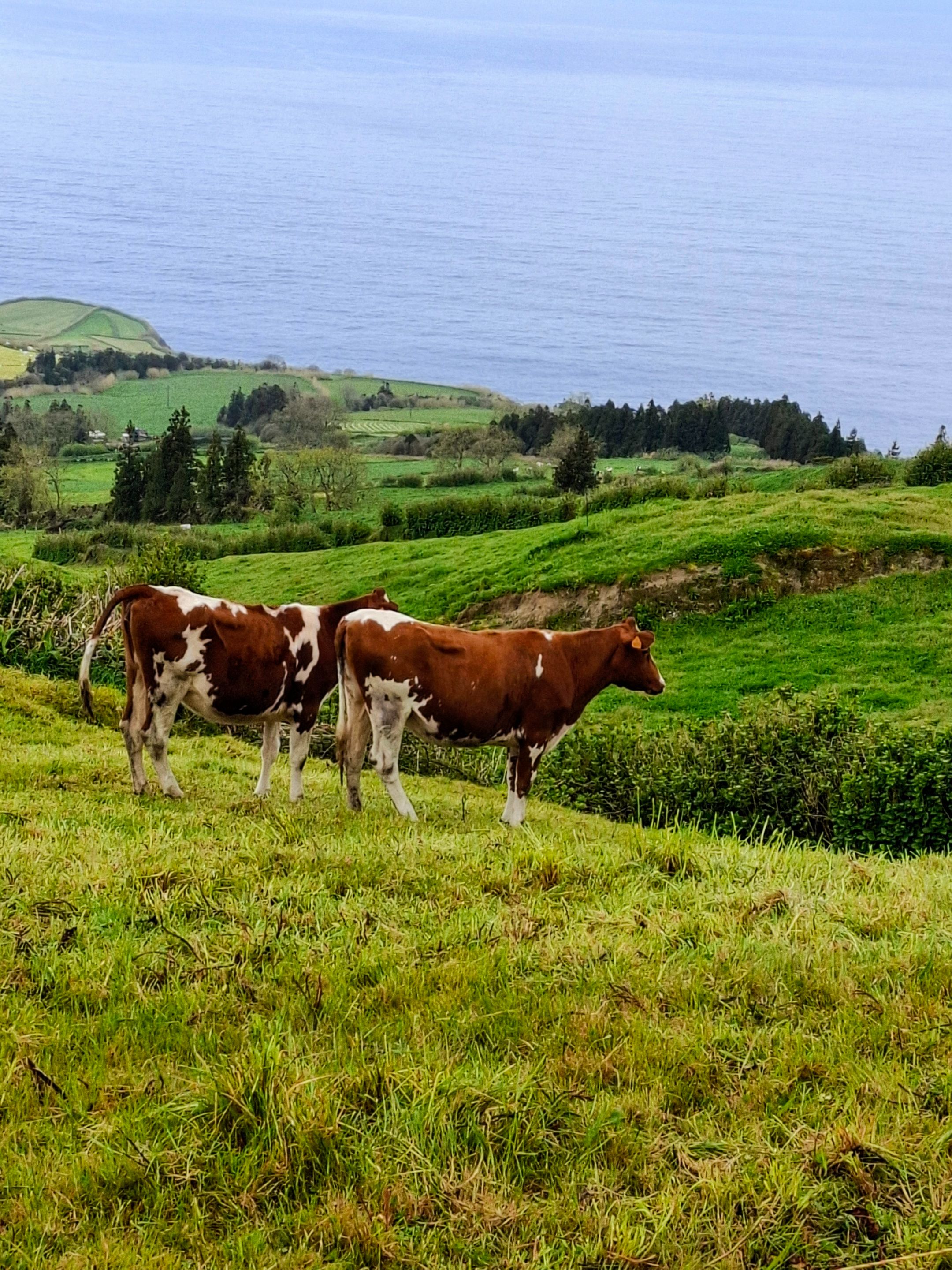
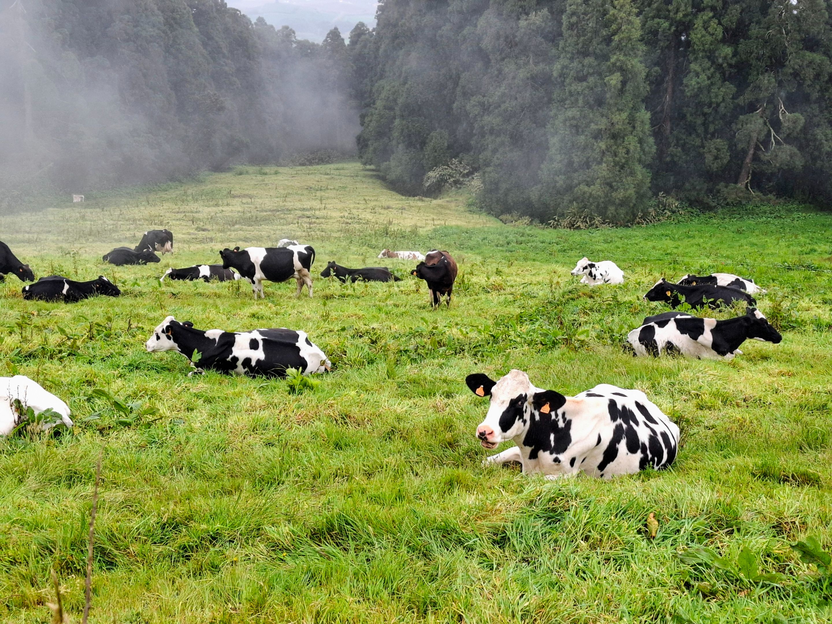
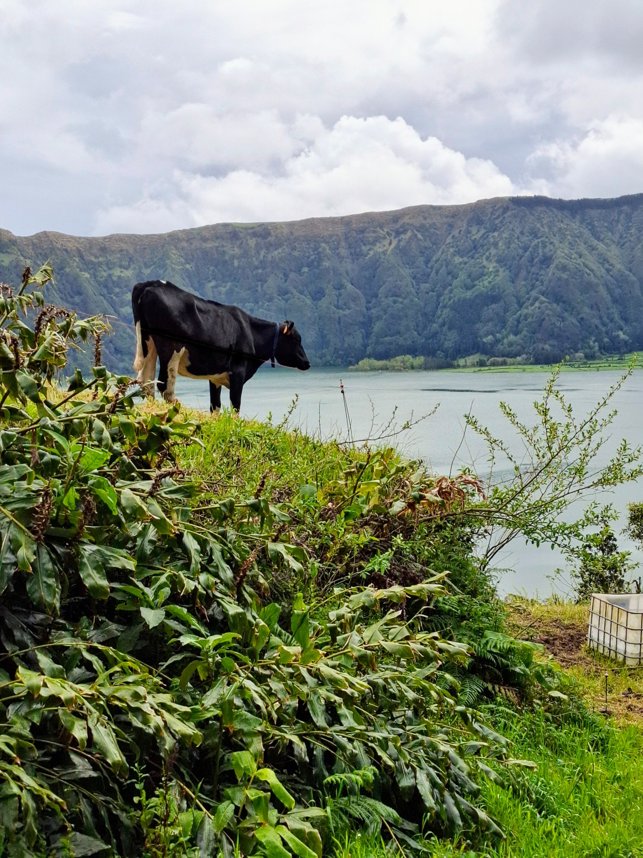
There were also views of the ocean on the other side and fields with cows grazing in them. We love seeing cows on trips, especially mountain cows.
It was cloudy when we arrived but clear enough to see the view.
Shortly into our walk it started to rain pretty hard though. Luckily it passed after only 20 minutes, just long enough to soak us.
From there on we had a mix of cloudy skies with brief moments of sunshine peeking through.
There were other hikers on the trail but it wasn't busy at all. Mostly we had the path to ourselves that day.
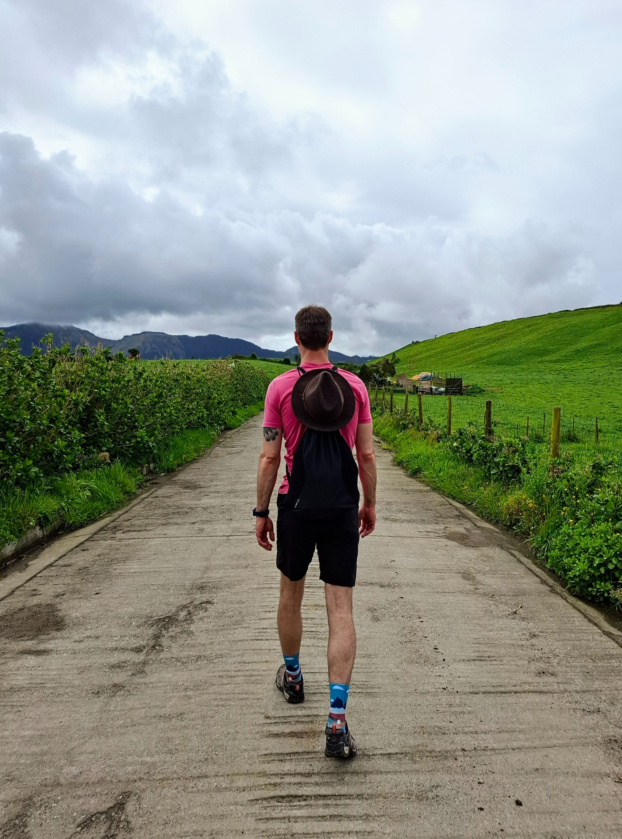
When we got to the official road heading into the town it was surprisingly steep.
You can't tell from the photos but the road was a 20° incline, as measured by my wifes phone.
It was tiring on our shins and knees, but nothing that the cows couldn't handle.
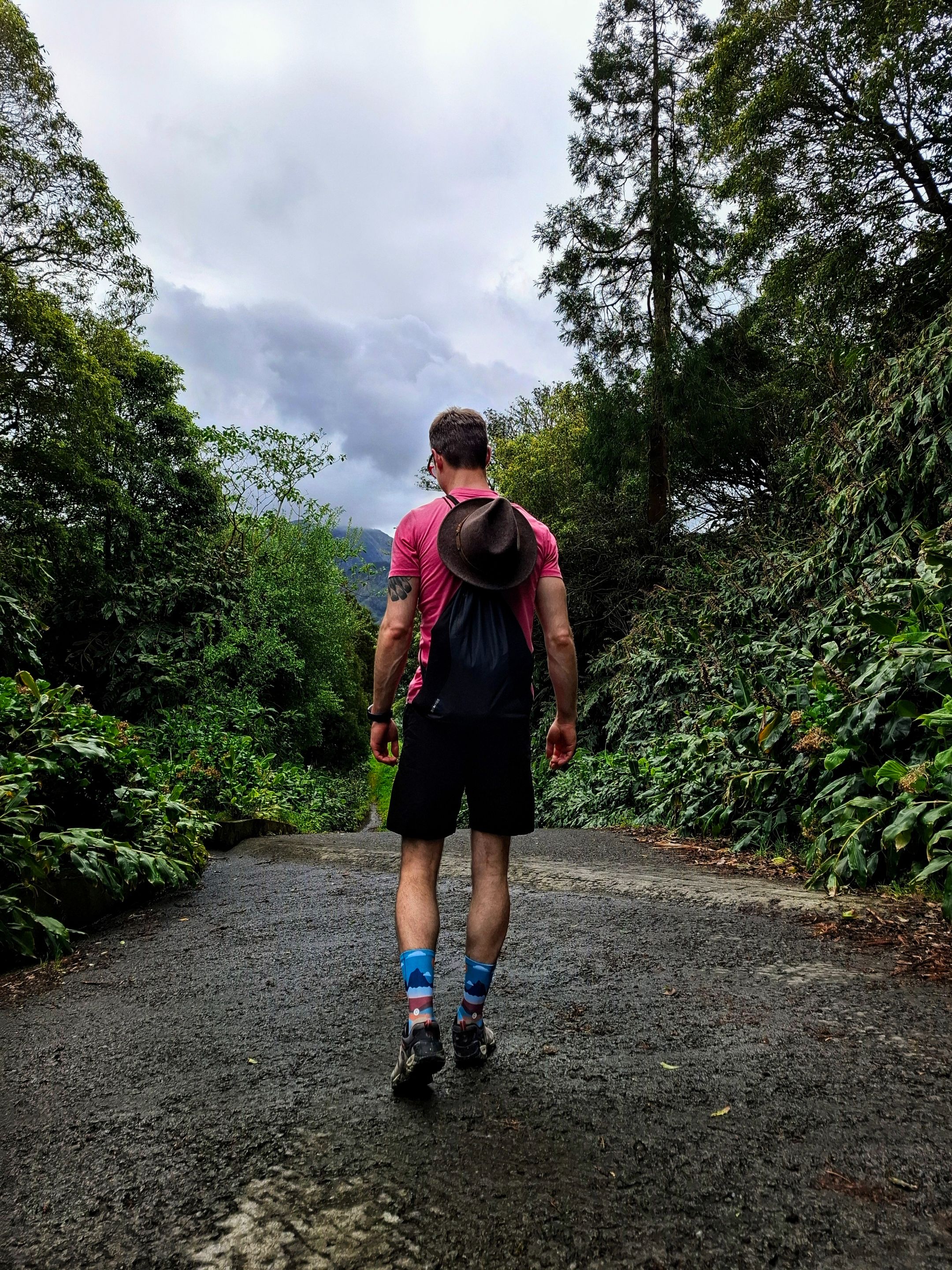
My wife snapped this photo of me here which is one of my favorites of me on the entire trip.
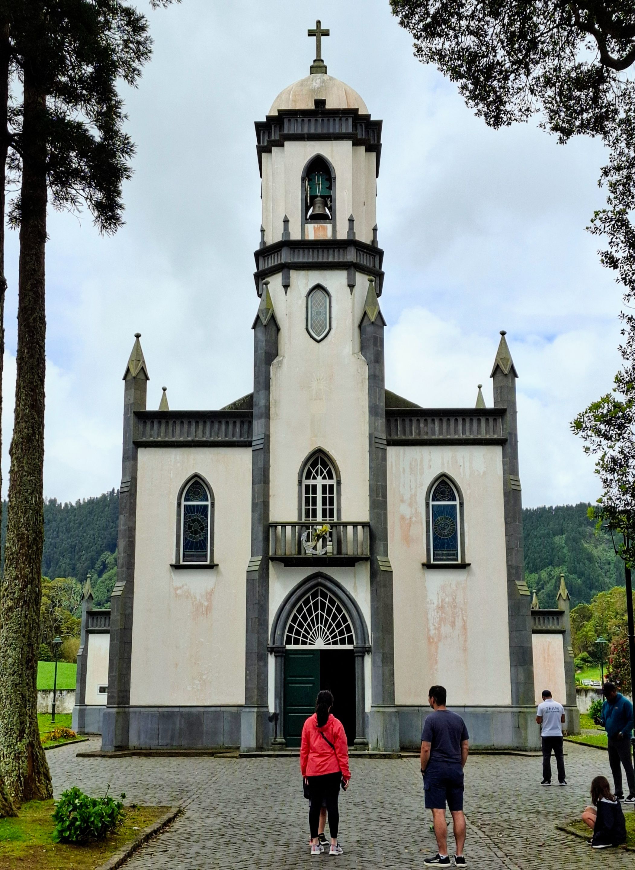
When we got into Sete Cidades it was actually pretty busy with tourists. We saw some tour busses parked there which must have brought everyone down.
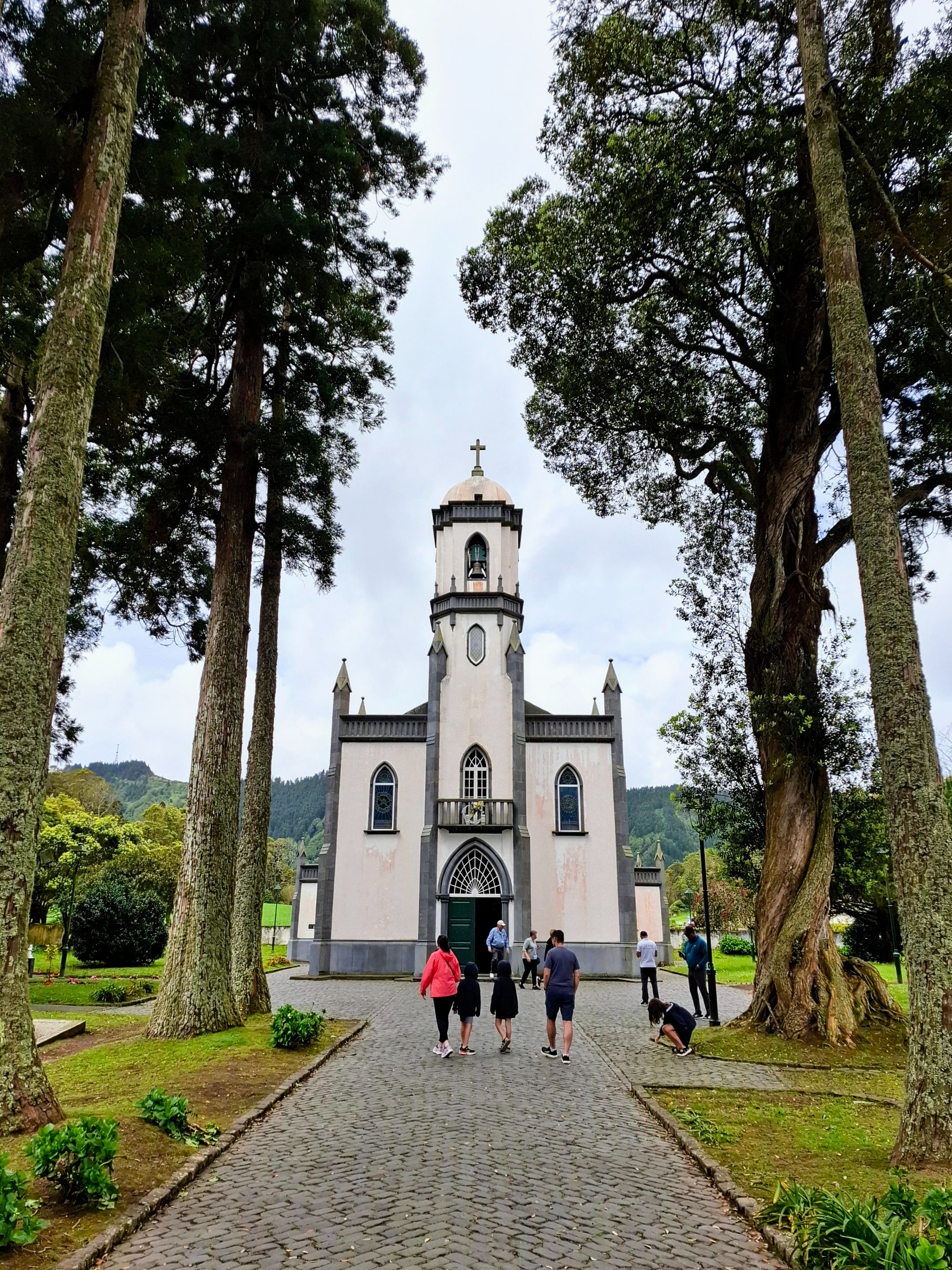
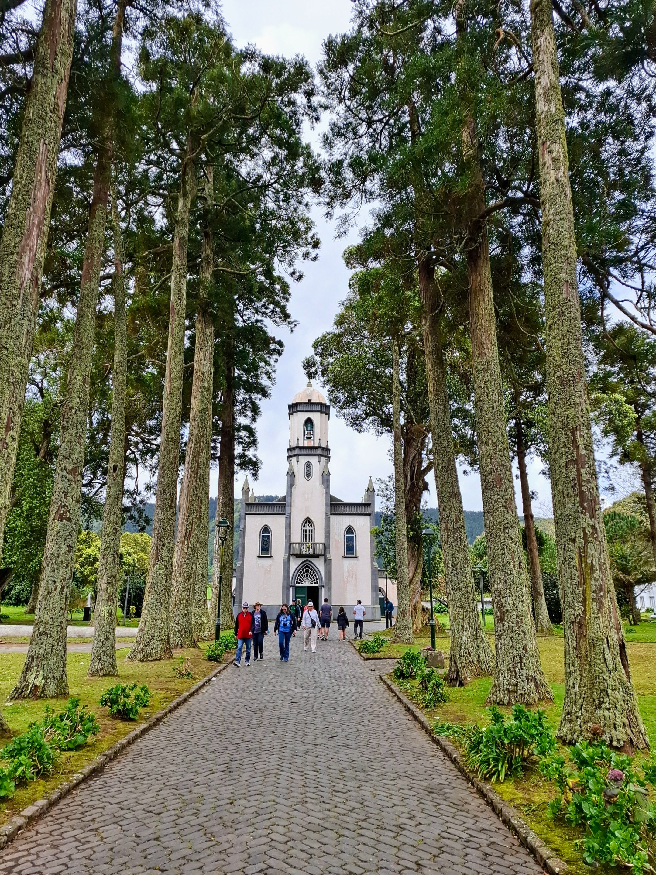
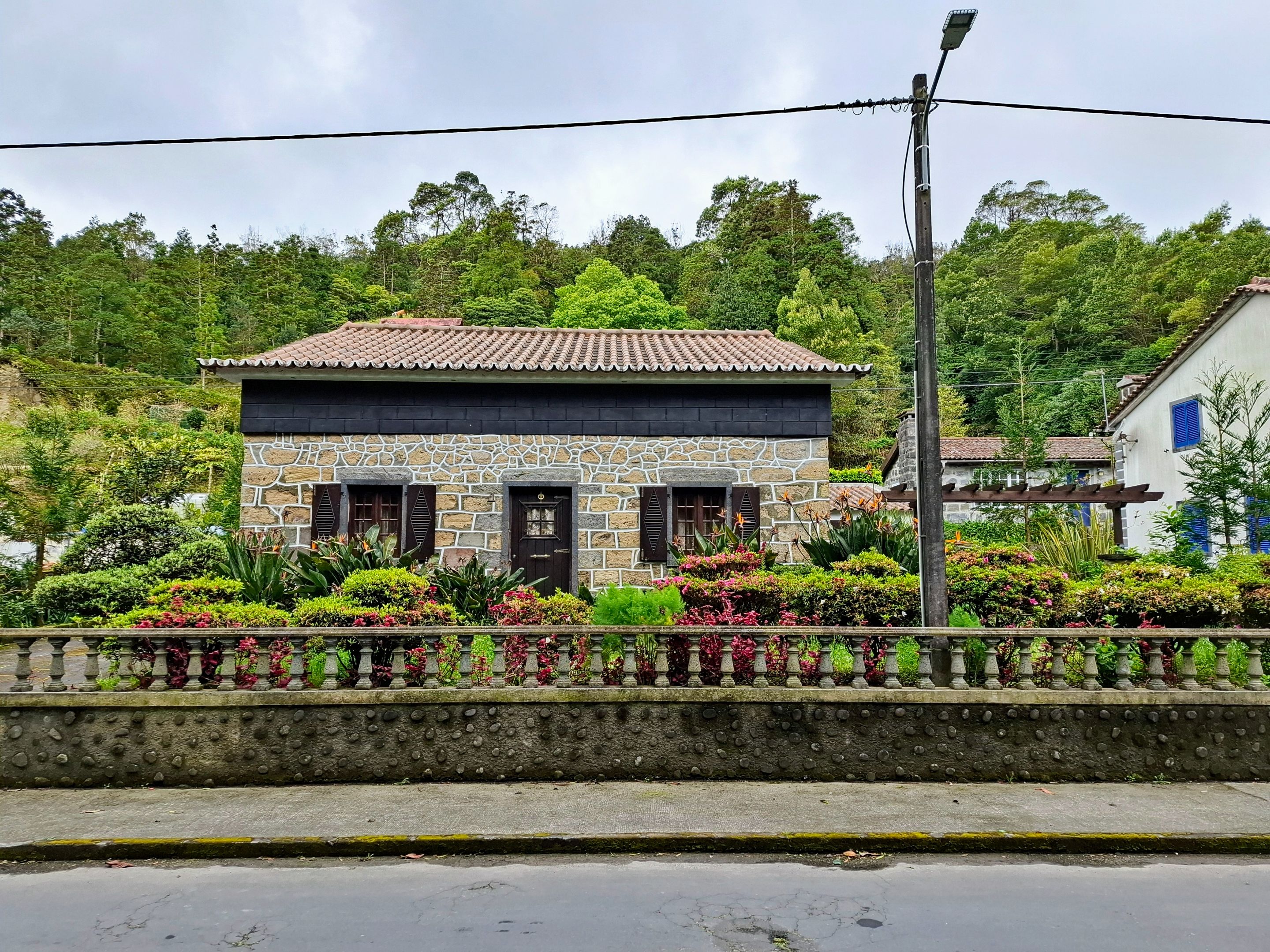
The town was very small though, with nothing to really see other than its small church.
There is the lake of course and you are able to walk around that, and maybe do some kayaking and other water sports. Other than that there was not a whole lot else to see and explore from what we could tell.
We saw one restaurant that was closed until later in the afternoon so we got a coffee and a pastry snack at the small grocery store before continuing on out of town and up the crater wall back to where we started.
The path back was much different than the beginning. It was less wide, more rugged and had a more steep incline. It also went through the forest.
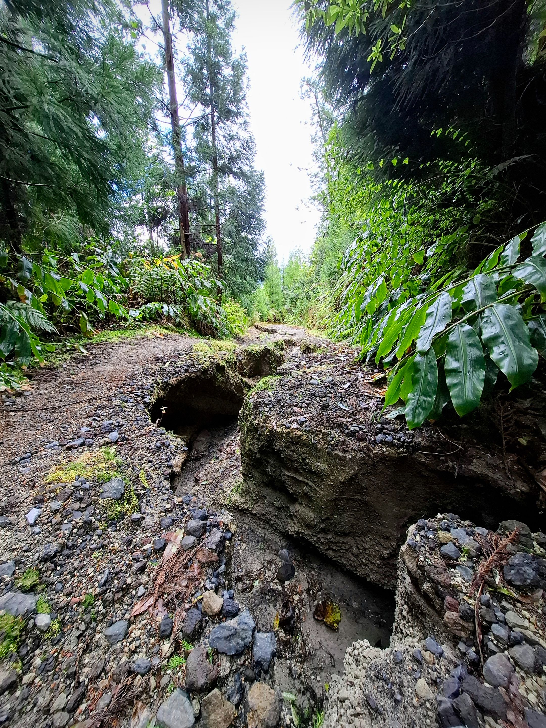
There were parts where rain water had flooded the trail and eroded deep channels into it as it made its way back down to the lakes below.
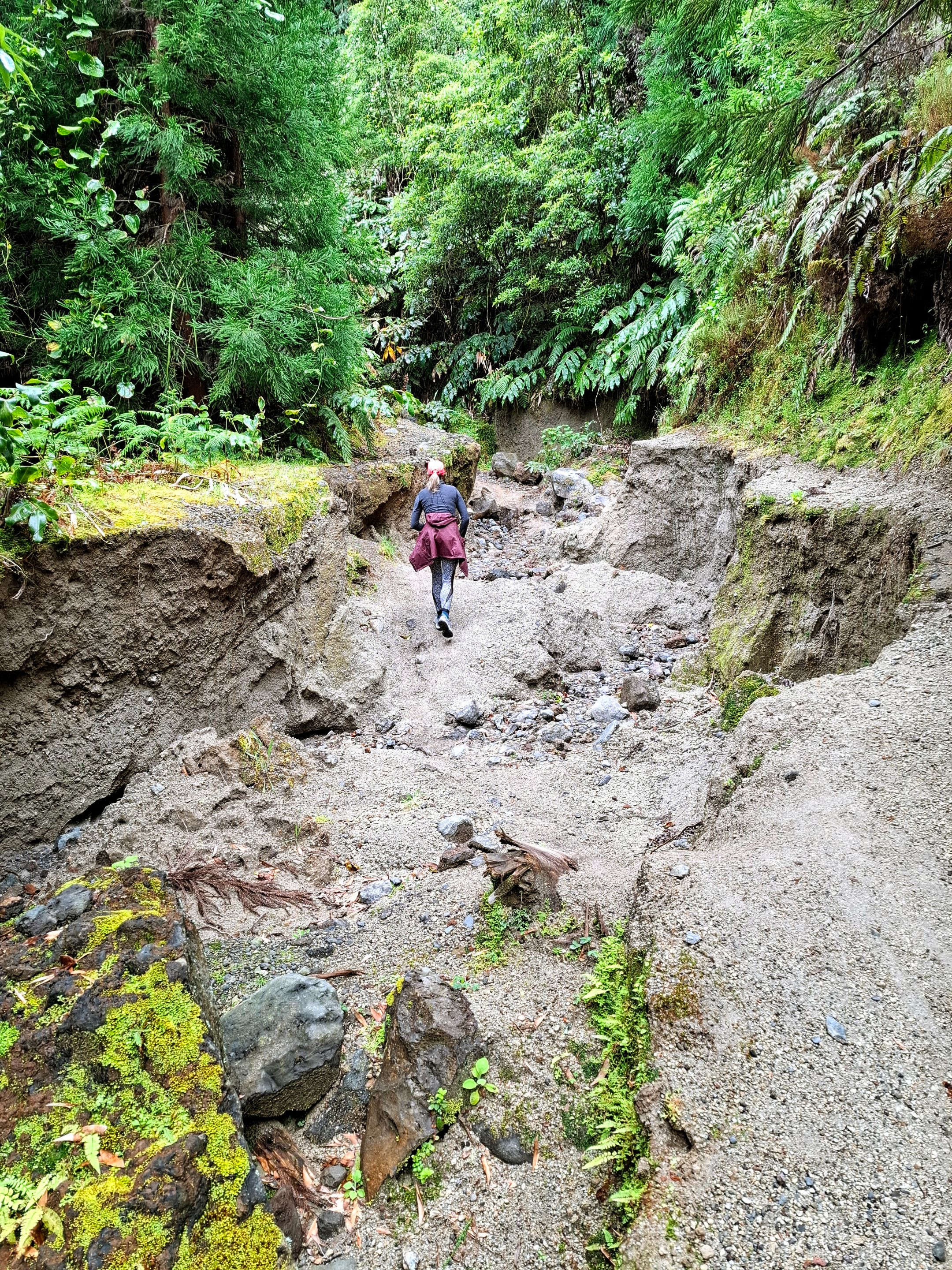
One area had even eroded the ground so deeply that trees had been uprooted and toppled over which destroyed the main trailway.
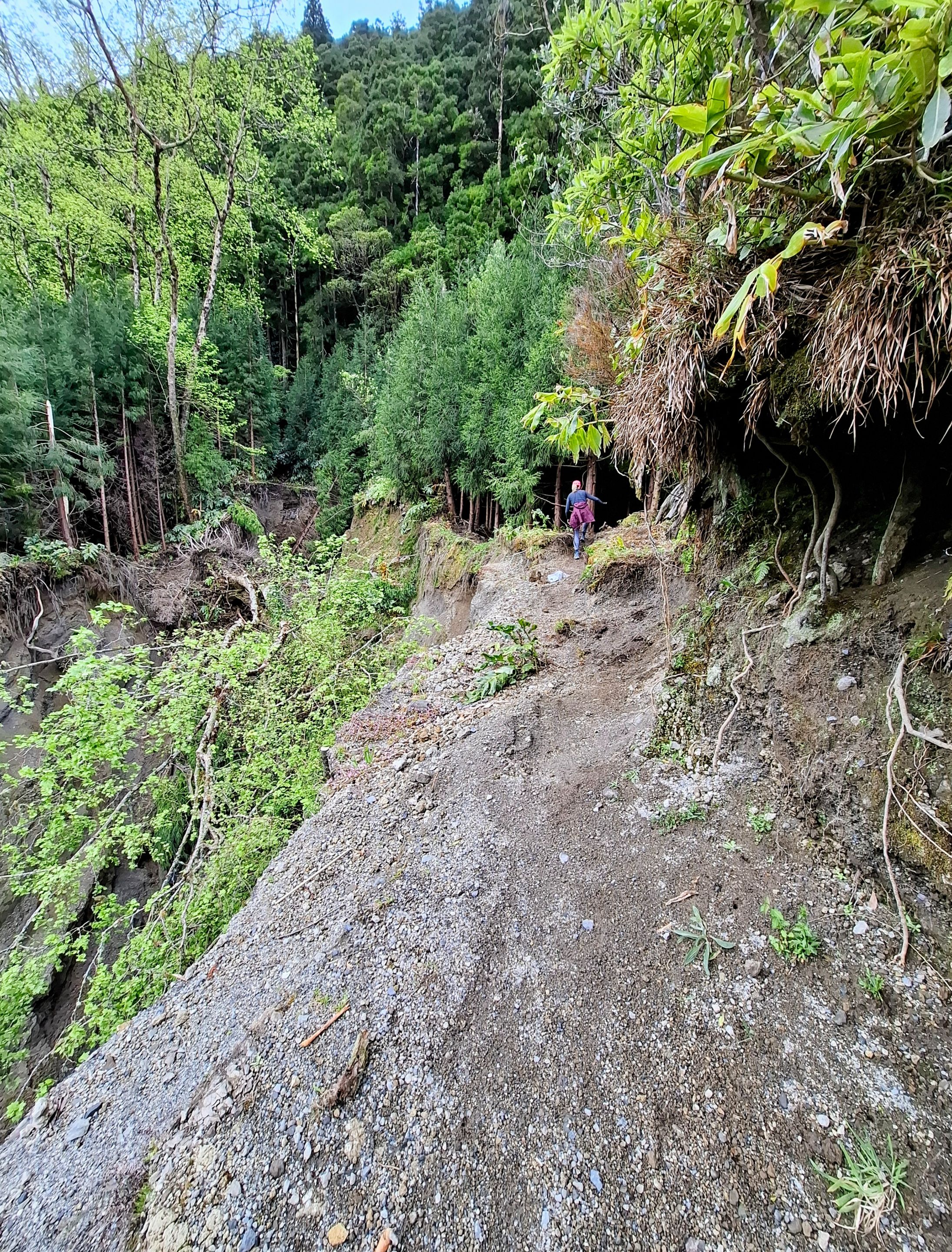
At no point did the hike feel dangerous for us though. The path just veered around that spot.
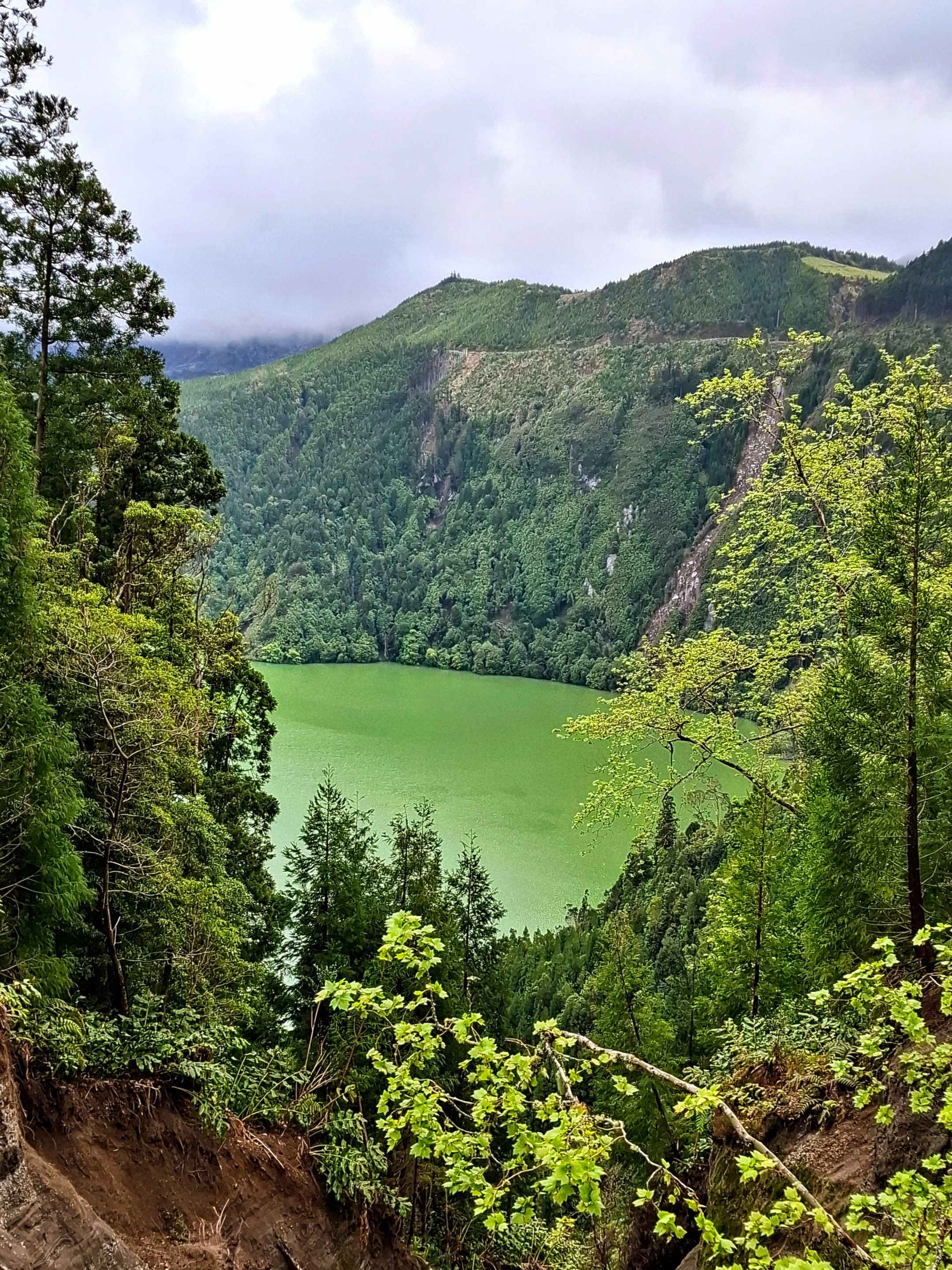
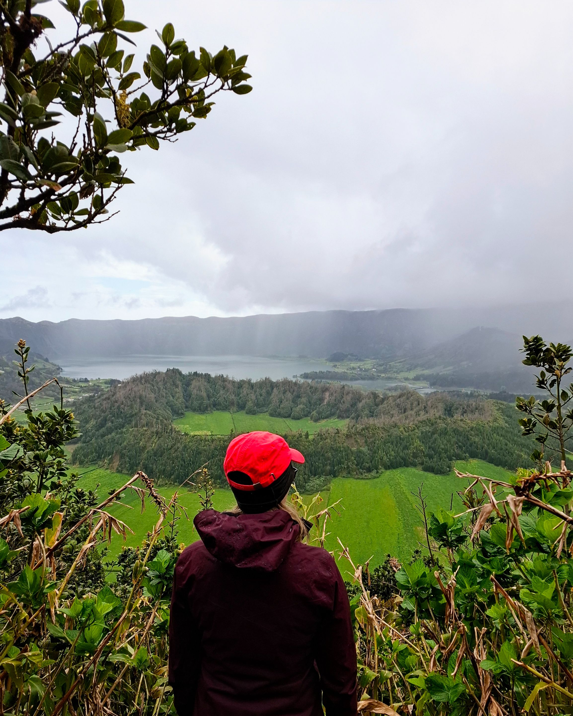
When we got near the top the trees opened up again and we got better and better views of the lake again.
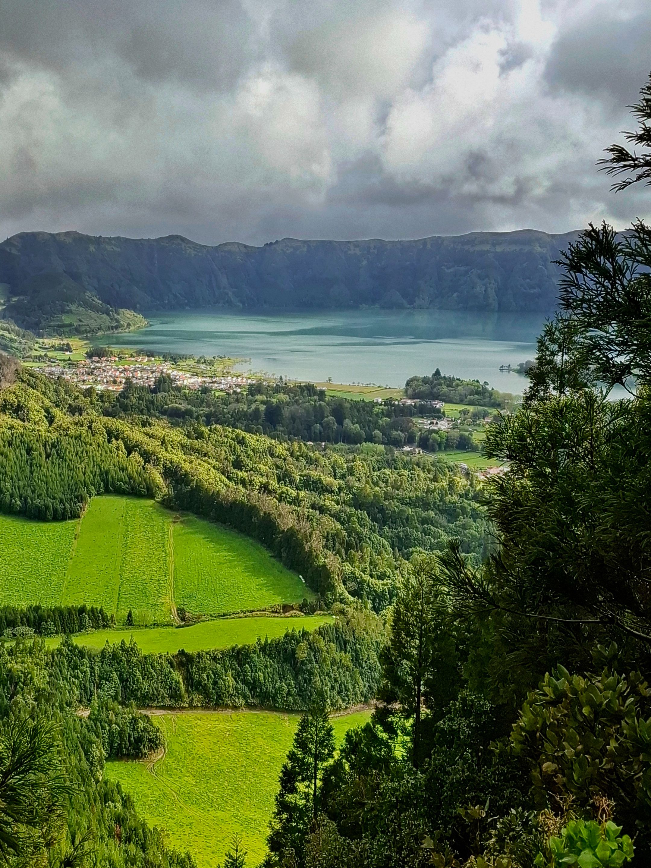
Something very interesting and a unique characteristic of the lake is that it had two tones. One side of it looks blue and the other side of it looks distinctly green.
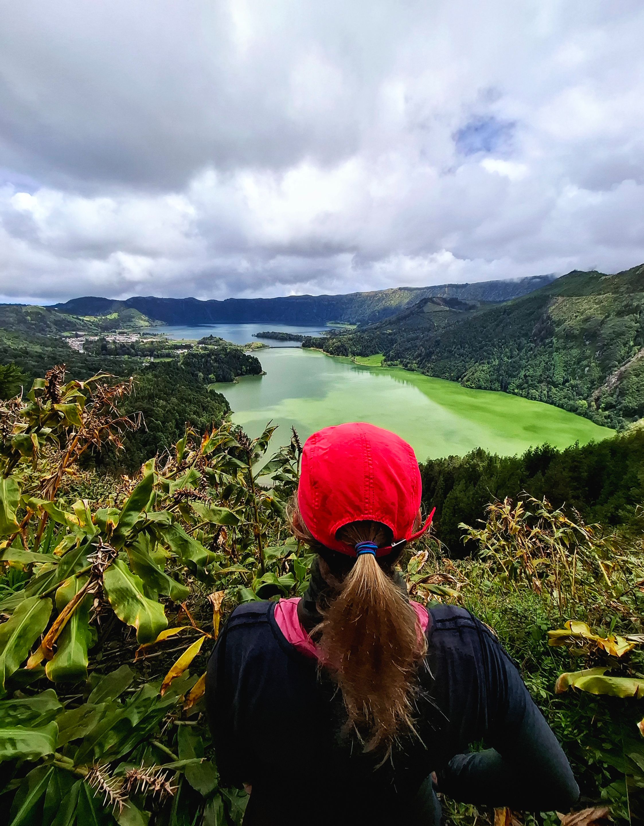
This feature became more and more apparent as we got higher up and was especially noticeable when the sun came out and hit the water directly.
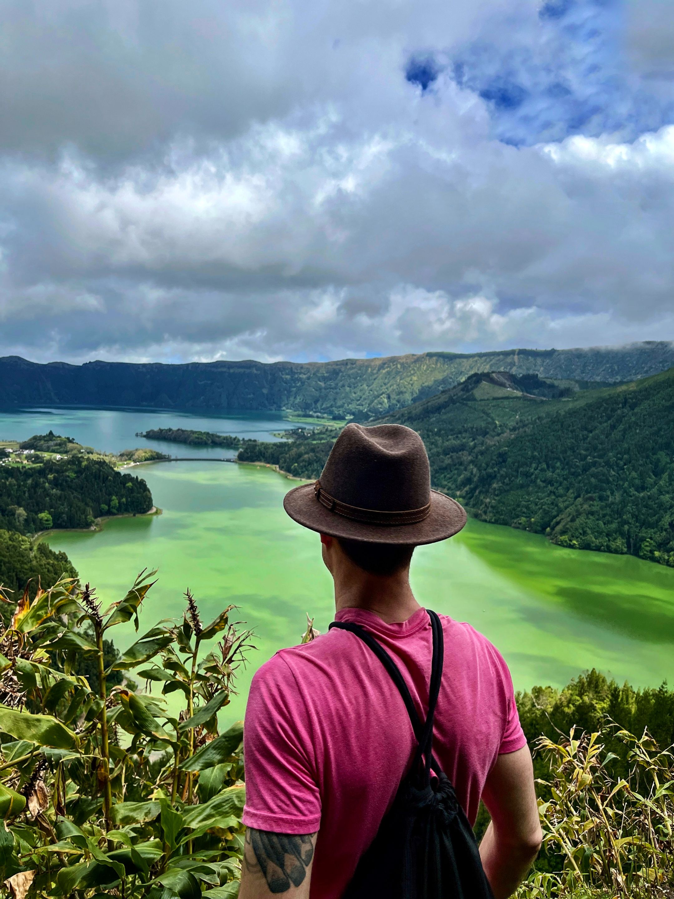
Apparently the two tone nature of the lake is a natural phenomenon caused simply by the varying depths of the two side and the algae and minerals gathered in each end. The green side is the shallower end. I also noticed a lot of cow farms on that side as well when we walked over to the trail so a part of me wonders if their waste is also making its way into the water and maybe that's why there is so much algae at that end? Cow manure contains a lot of phosphorus and nitrogen, the main ingredients of fertilizer, so I wonder if that has an impact on the vegetation in the lakes? We had that issue in Canada and the US with Lake Erie. So much phosphorus was entering the water that the vegetation took it over completely. That's a whole other story though.
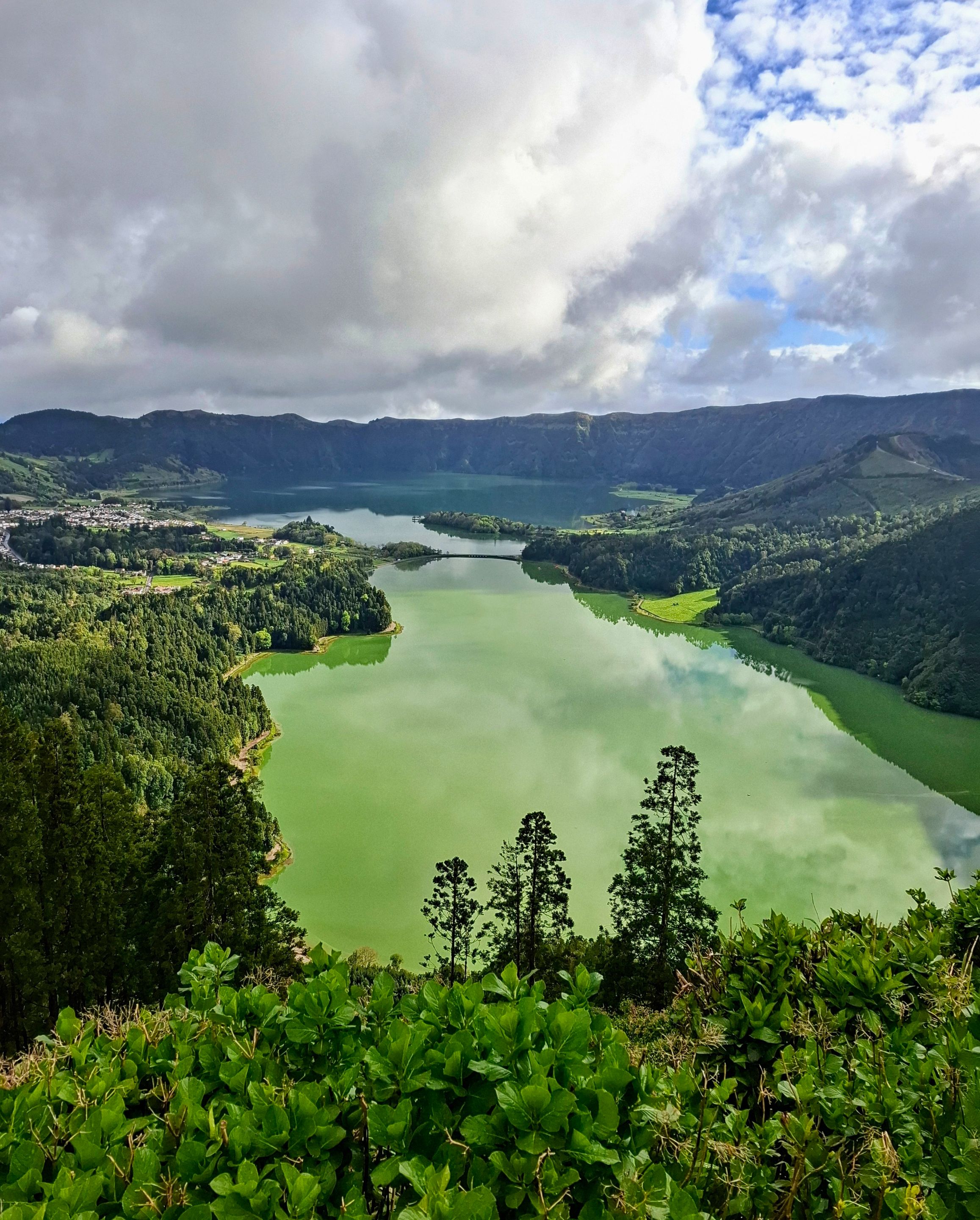
This last image was taken from a hidden gem of a location. It gave the closest and best view of the lake and there were no people there at all. The best part was that it was located at the very end of our hike only about a 5 (maybe 10) minute walk from the main viewpoint. Here is how to get there starting from the trail entrance. Just past the parking lot, only a few meters down, there is a smaller path that veers steeply to the right from the main pathway. Turn there and walk down thus new trail for only like 3-5 minutes. The path widens into a clearing with no trees or shrubs. That's it. You can't see the spot from the viewpoint so I don't think that many people know about it but it's so close to the main viewpoint that you can hear people above you. It's way less busy and the view is better though so it's worth the small 5-10 minute walk to get there, in my opinion.
Well, that's it for our hike at Sete Cidades. What did you think, was it worth the hike? Have you been there yourself or do you plan to visit? Let me know in the comments.