Farthest Away from the Farthest!
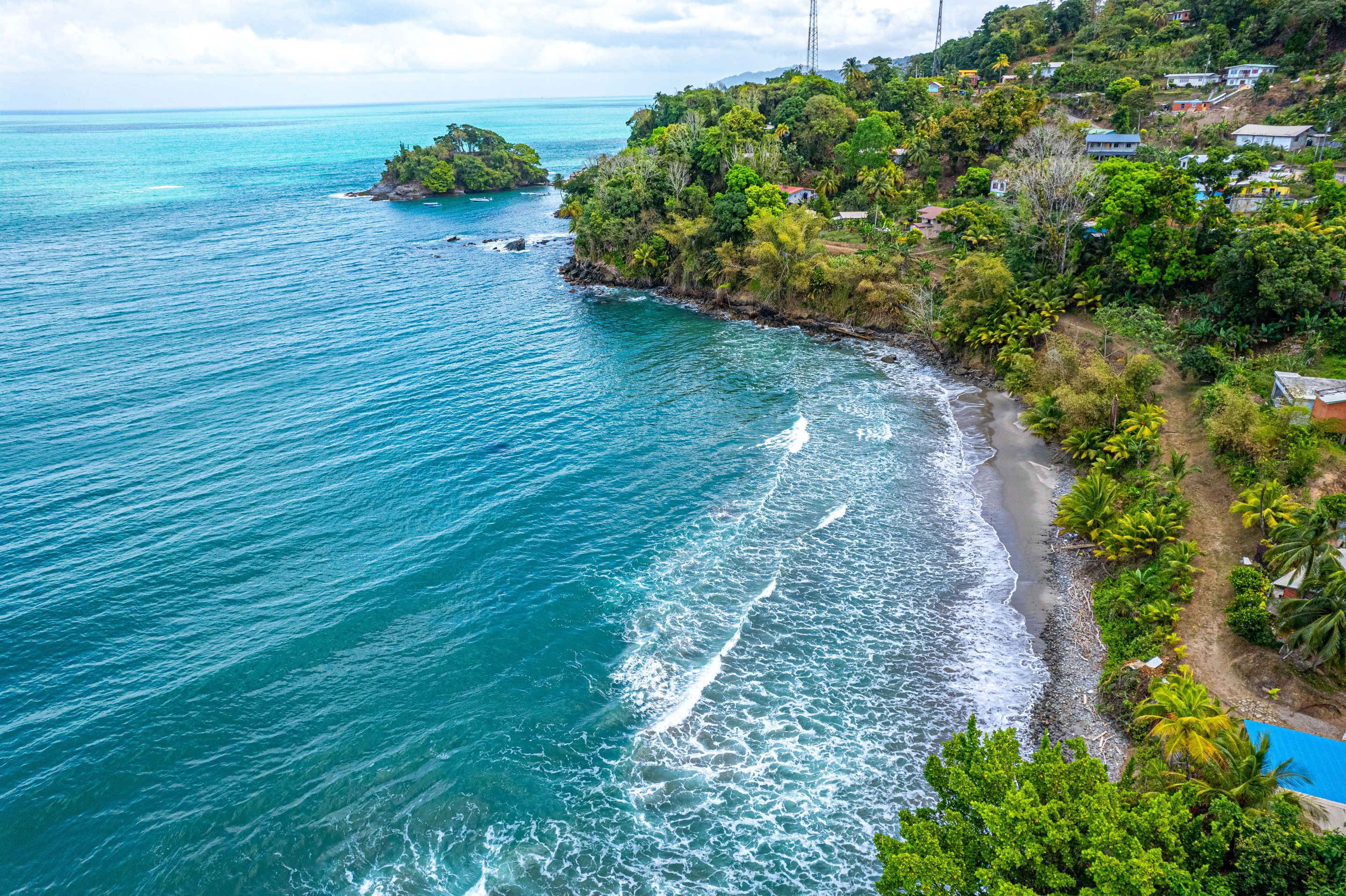
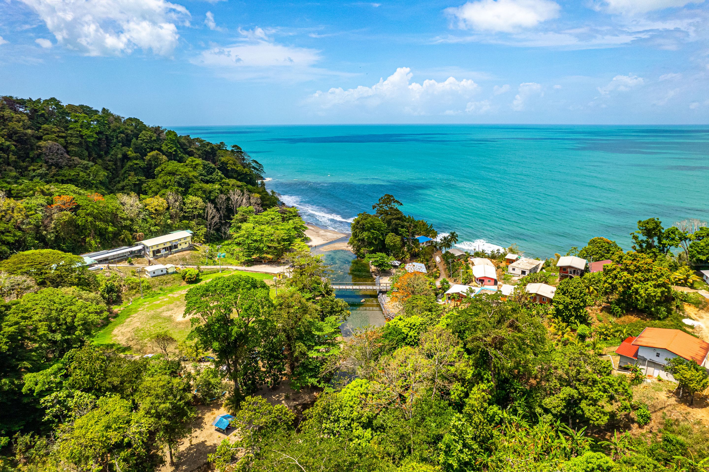 (Aerial View of Matelot Bay and the river mouth)
Matelot Bay on the northern coast of Trinidad takes objectively one of the longest drives to get to a recreational and tourist attraction, if not THE longest. To give some perspective, Toco beach is considered far away, almost a 3 hour drive. Matelot Bay and its river is another hour's drive away once you get to Toco! The large matelot river is a nice spot where people have family picnics Trinidad style and enjoy the beach as well, giving the best of both worlds! We explore the beach and the river and it was quite exciting as it was my first time visiting as well.
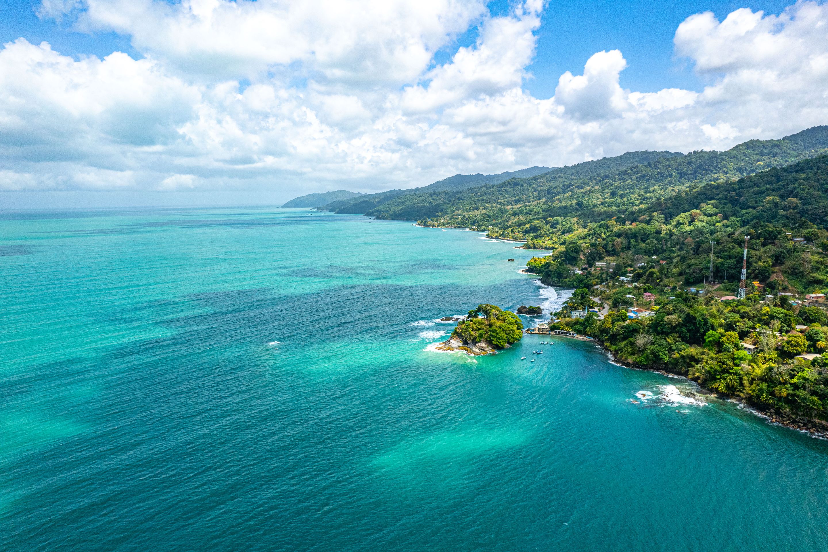
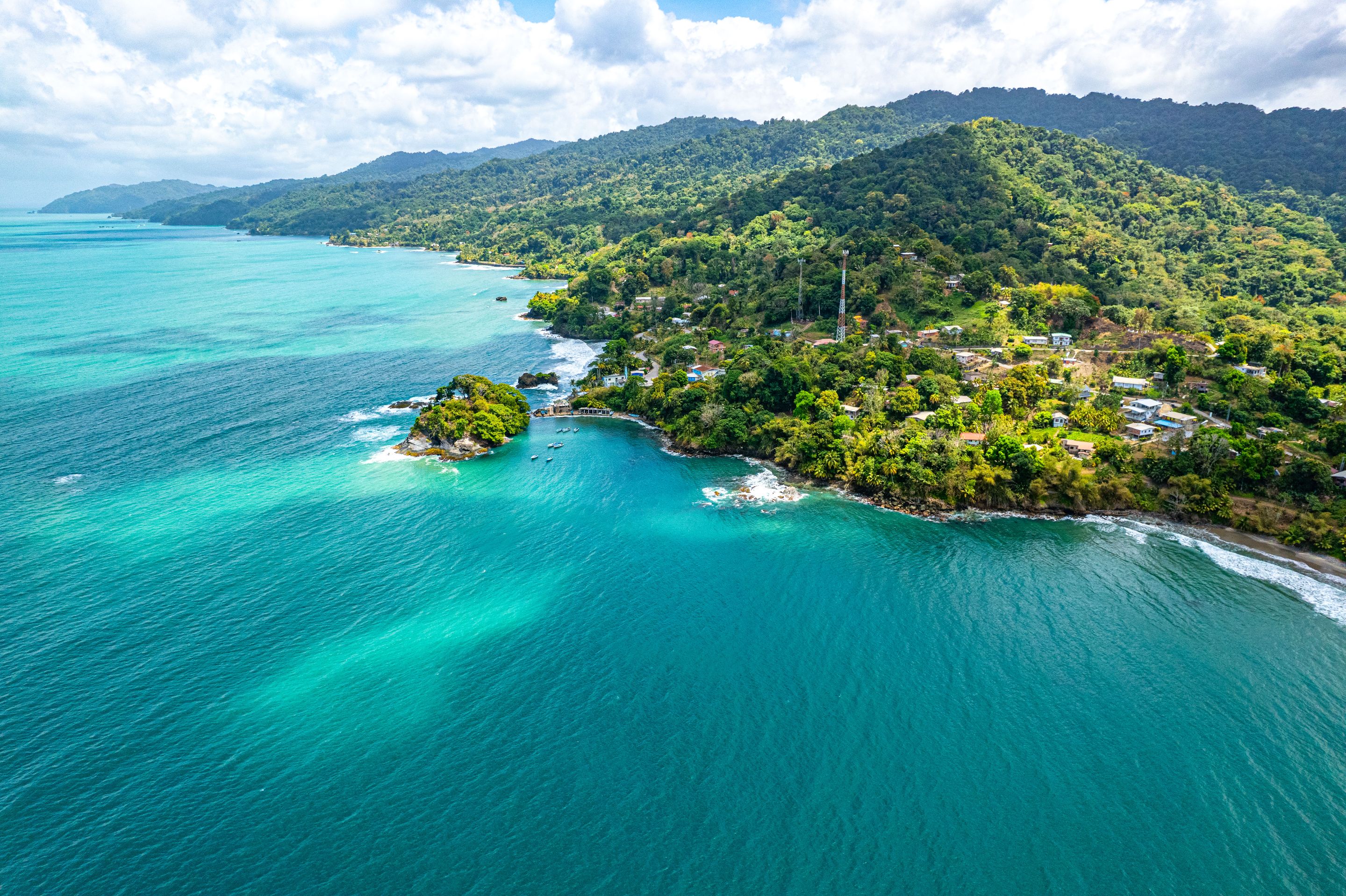
The drive to Matelot takes you along the east coast of Trinidad first before swinging left onto the northern coastline via Paria Road. This means that for the aforementioned hour's drive from Toco where you depart from the eastern coast, till you get to Matelot, you are greeted by breathtaking and mesmerizing views of of turquoise blue ocean, rocky beaches and wonderful vegetation with quaint sleepy settlements along the way.
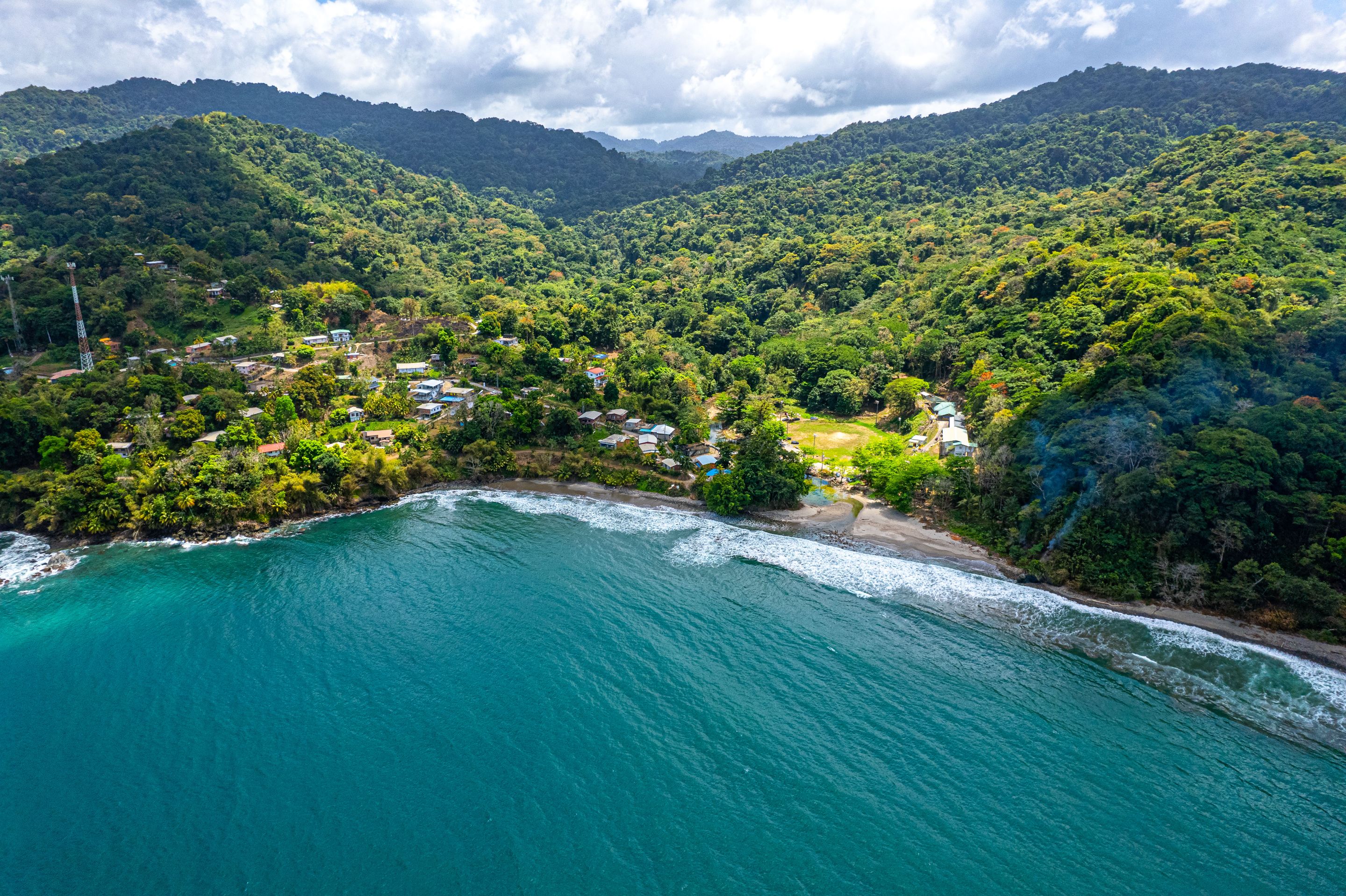
This was my first time seeing these views in the country I was born in and I did not know we had such unique views like this here! By the time we got to the town of Matelot, I felt like the drive alone would have left me satisfied! The town itself was very quiet, relaxing but not at all lacking in infrastructure and did not at all feel like a remote and underdeveloped village.
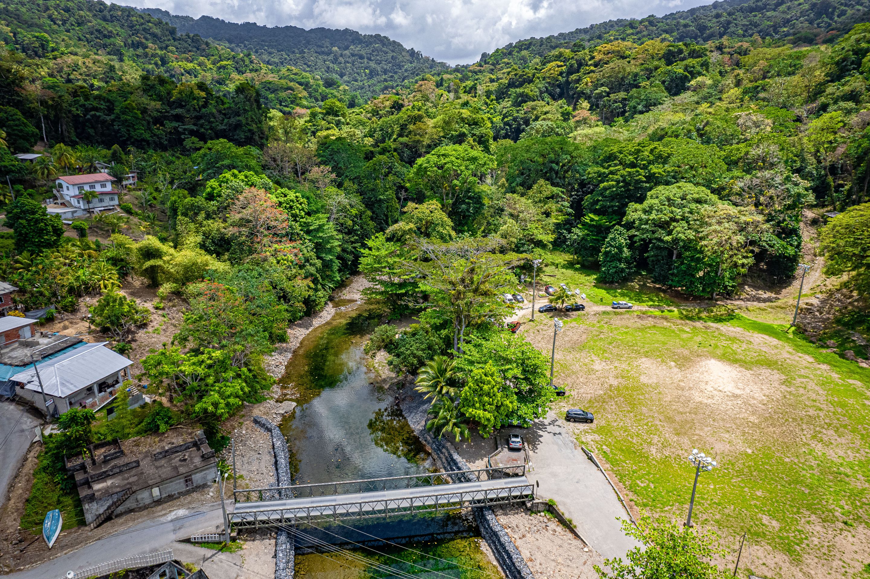
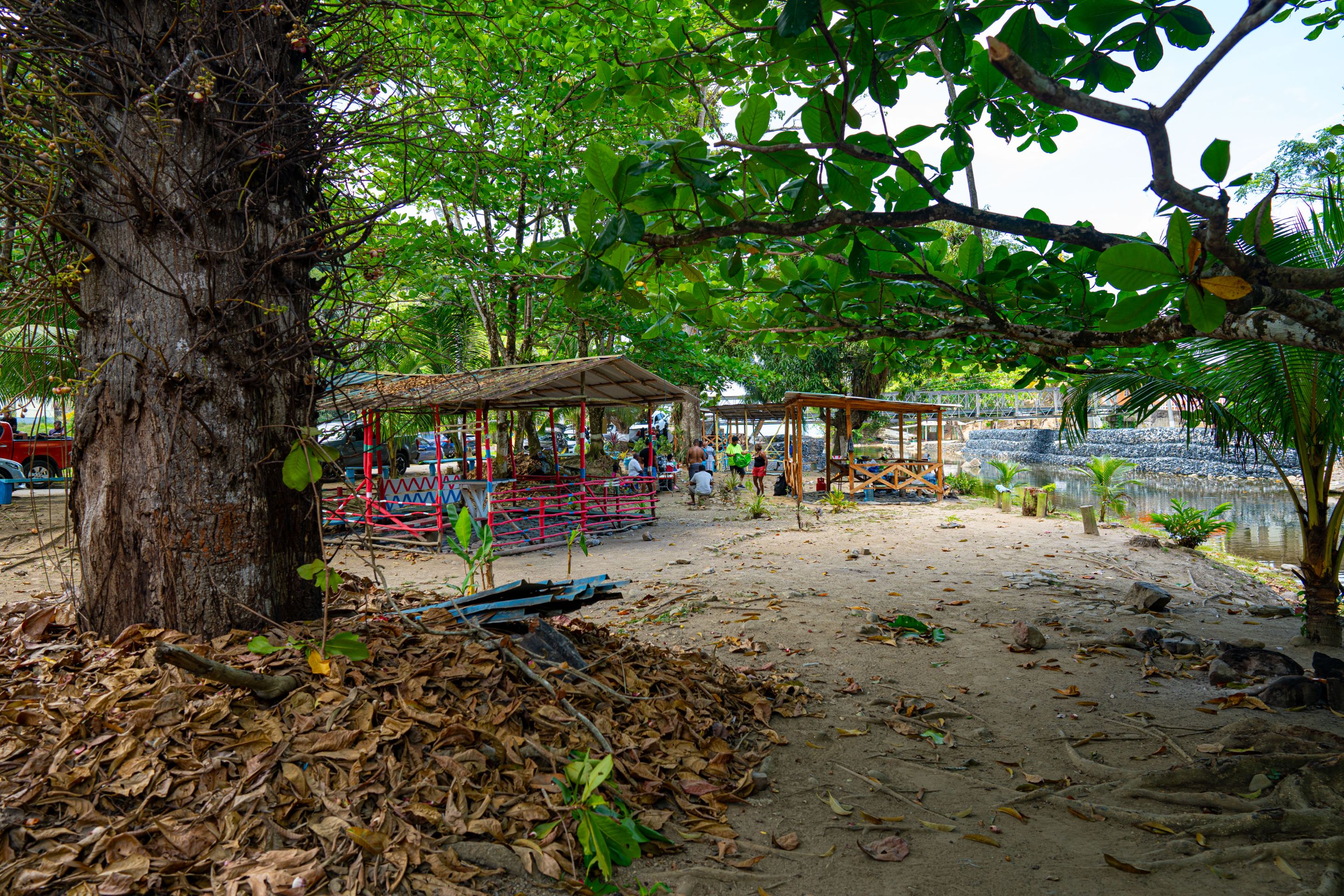
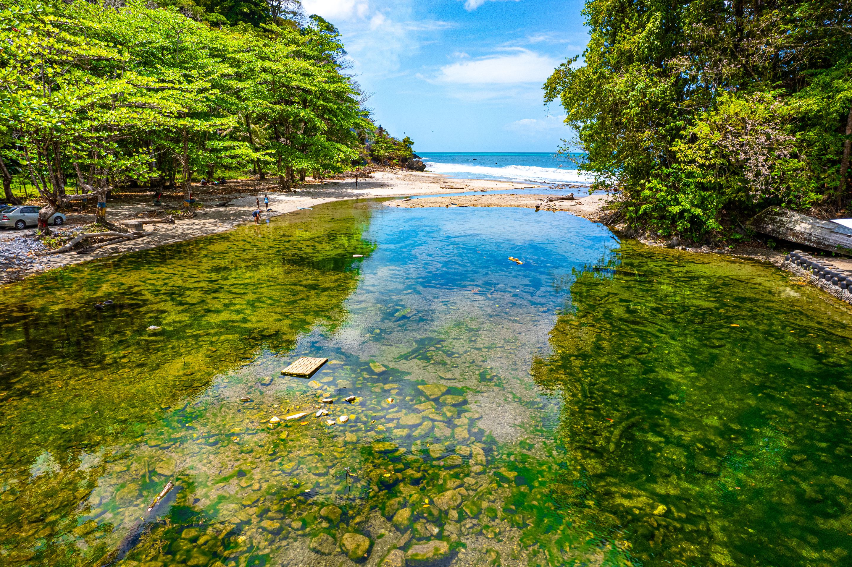
Driving to the actual end of the road itself takes you to the river and beach. A bridge takes you over the said river to the access road that takes you either upriver (going left) or to the beach down river (going right). There was a large field for playing cricket or football along with floodlights. As you can see from the photos above, cars were parked along the river under the trees that line its banks where there were picnic areas to lounge and enjoy nature as you will see.
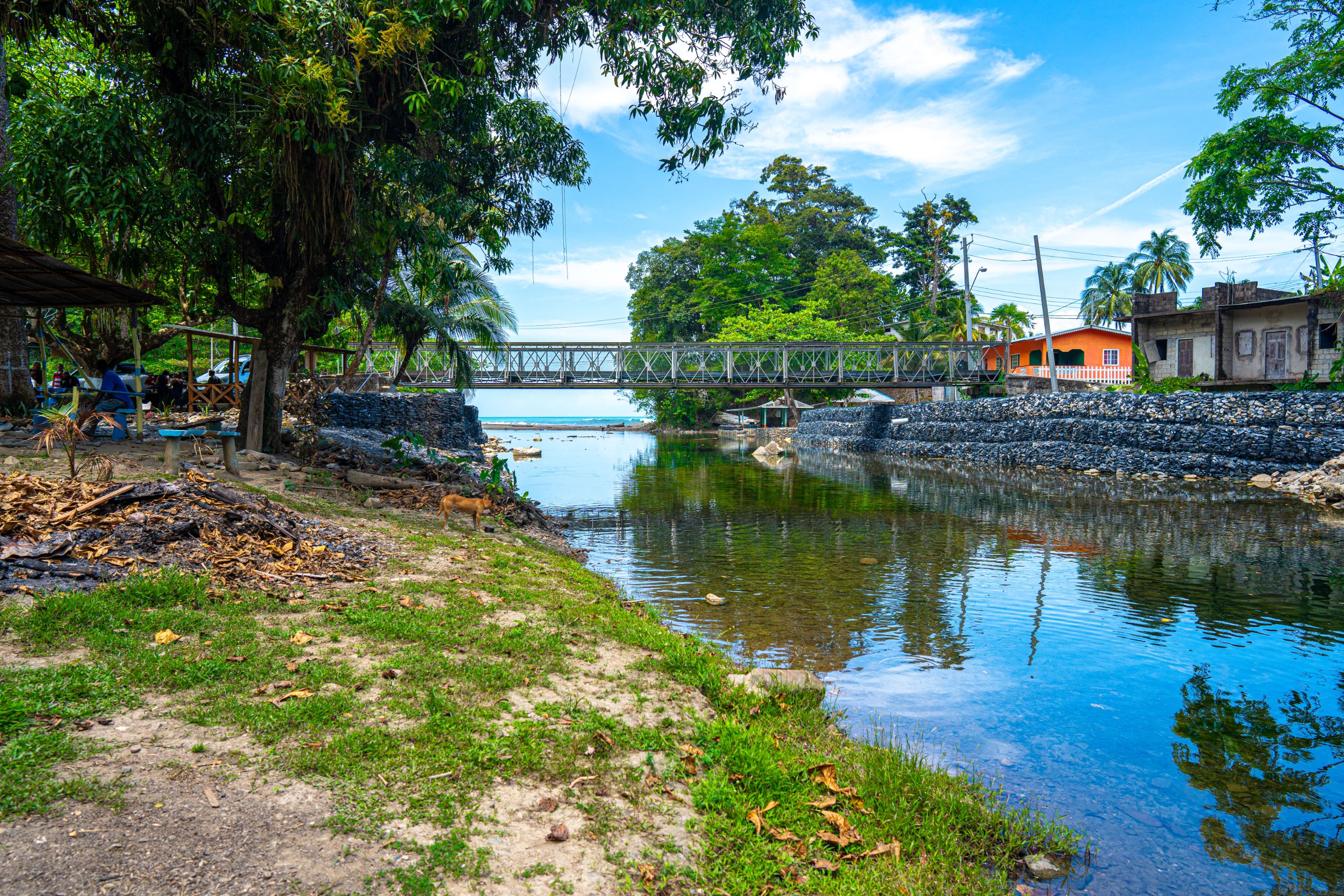 (A view of the bridge from under the trees upriver facing the ocean in the background)
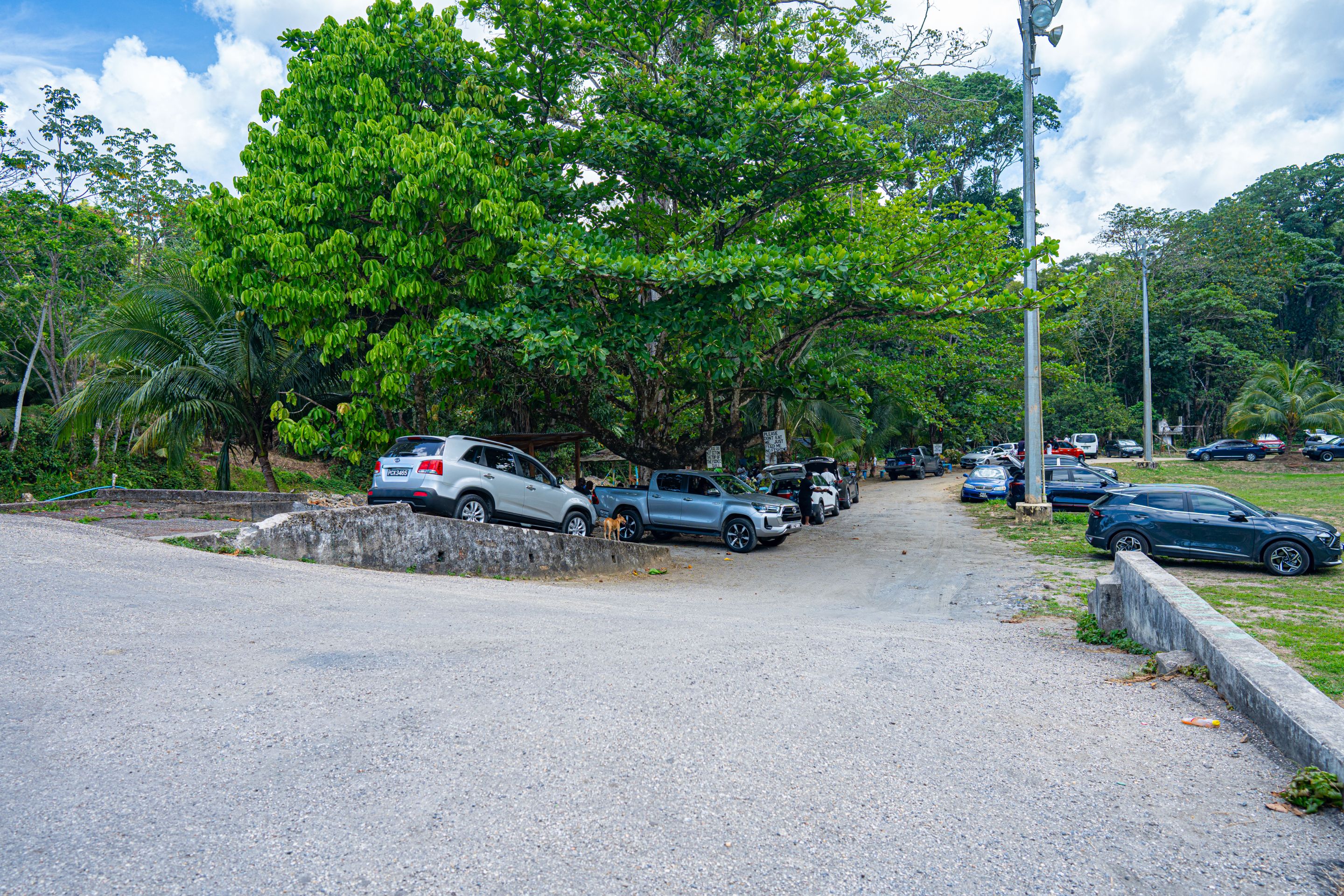 (A view of the cars parked along the recreational and picnic area just after the bridge)
We decided to explore the picnic area along the river banks first as this was the area with the most people and commotion. There were so many cars and a bit of lightly played music here and there.
As we walked along, there were people on benches under the trees and gazebos/ sheds along the banks of the river making merry with their families. In Trinidad, as I've mentioned before, recreational activities like this and many others are referred to a "lime" or the act of "liming". We know not the origin of this term but it is a ubiquitous term and this was a quintessential "river lime"!
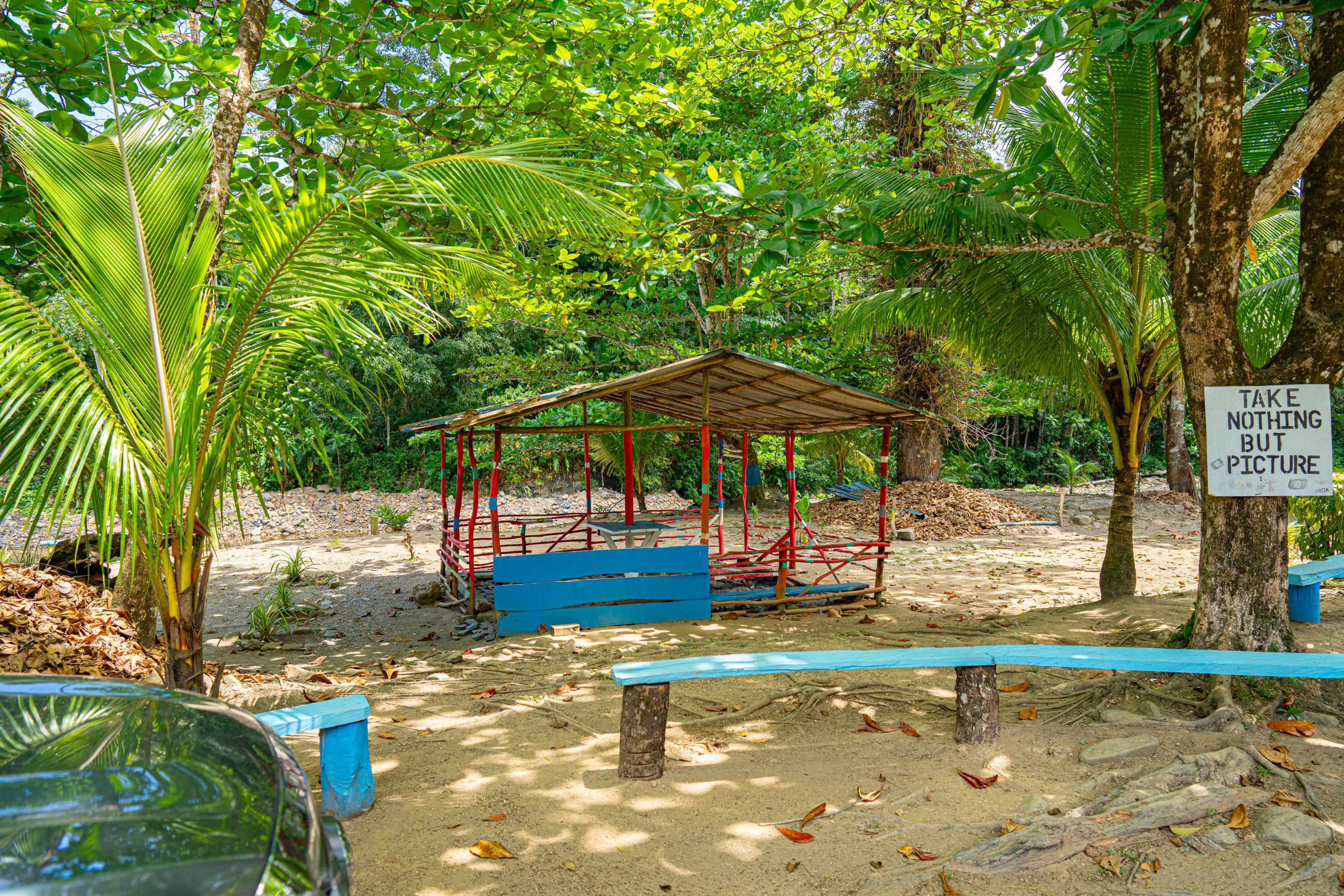
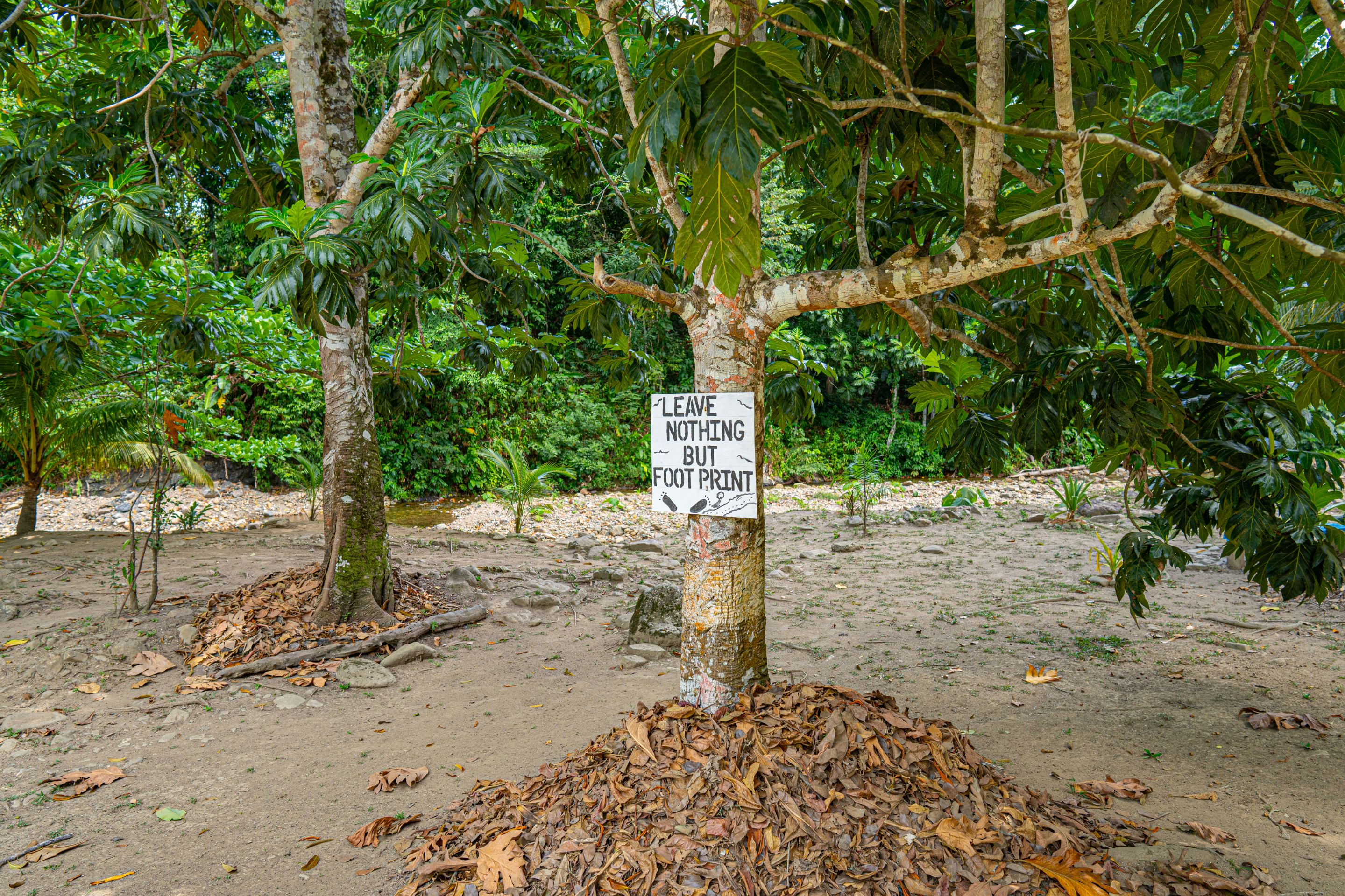
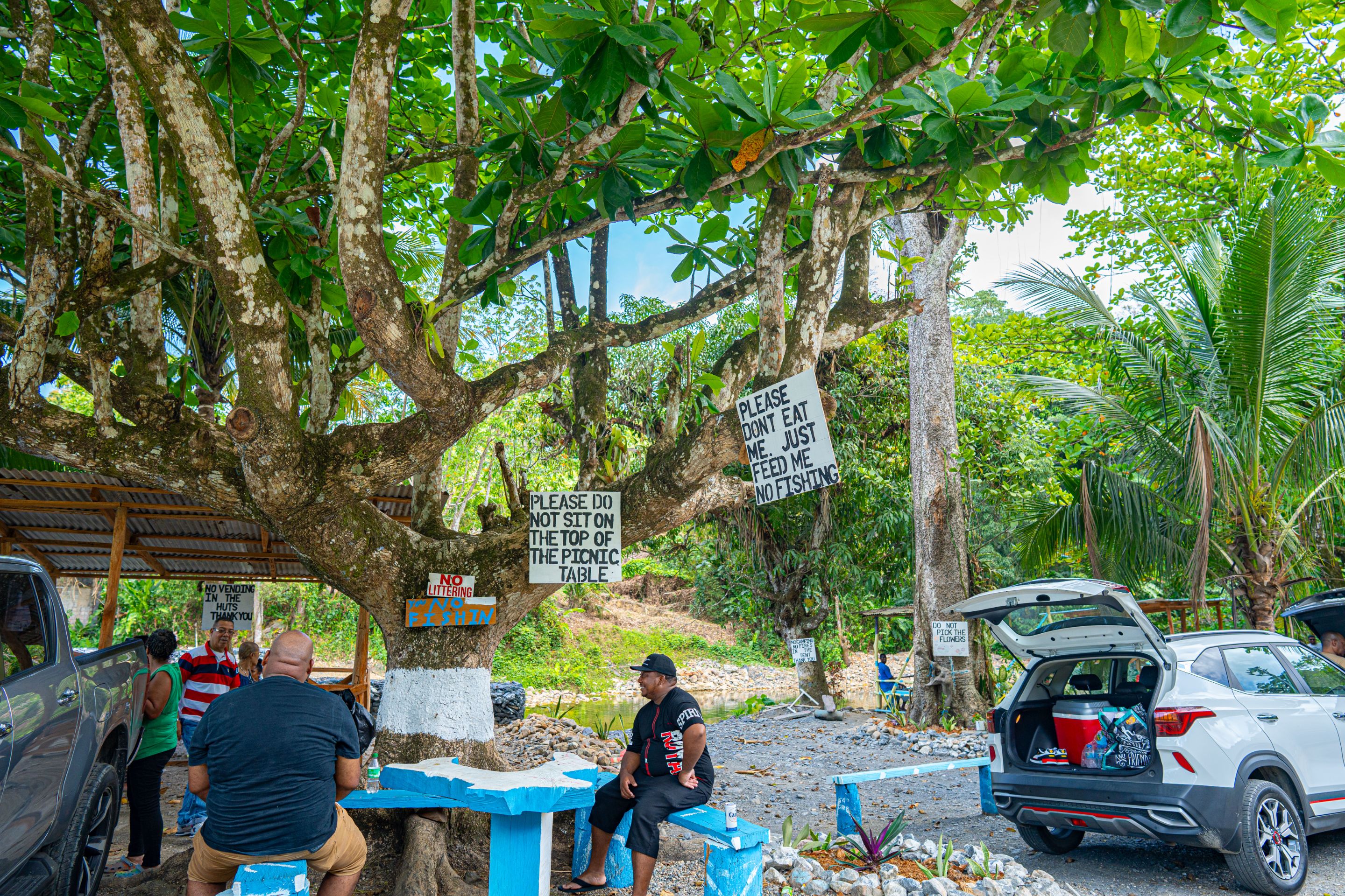
I found the signs that were put up extremely hilarious including the grammatical errors. The place was well kept and neatly taken care of. There was no litter to be seen and you can tell that the recreational area is frequented but treated with consideration.
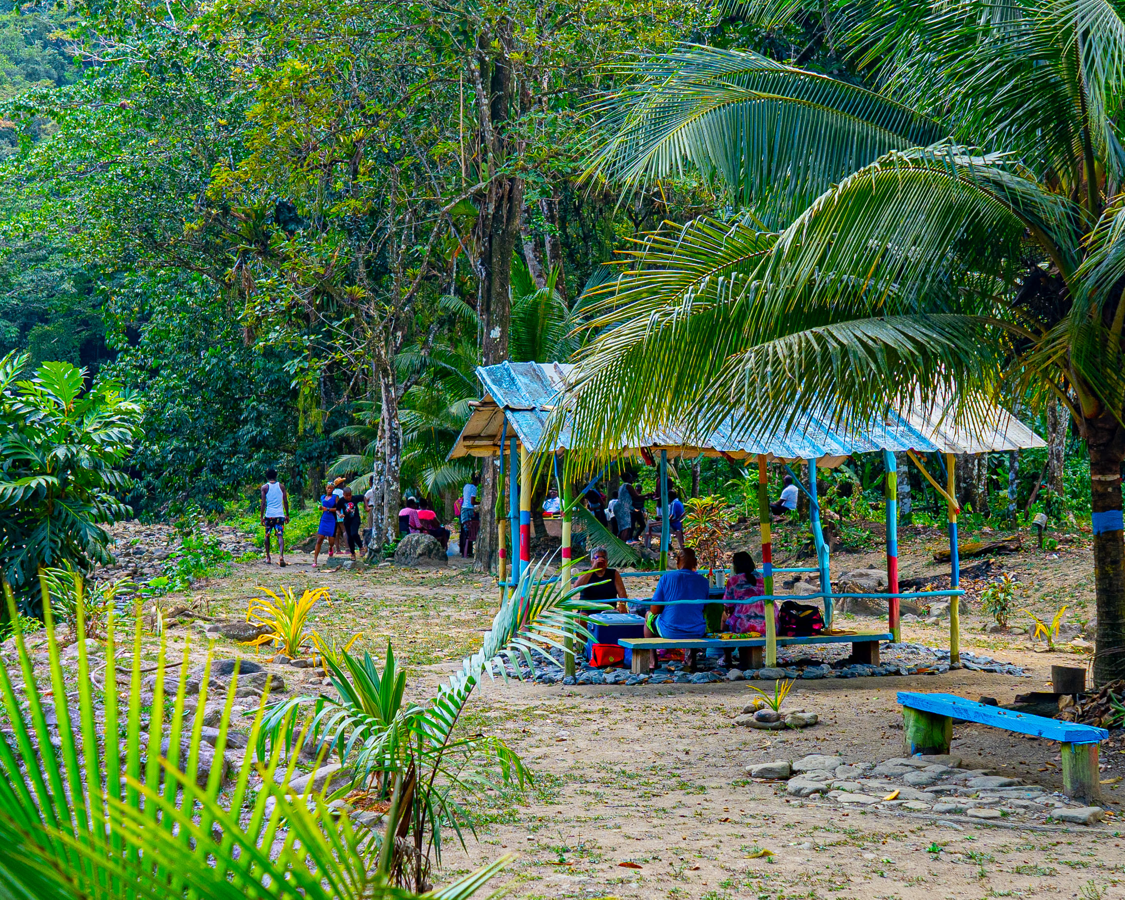
The shots above show how people enjoy the nature at the banks of the river while cooking, eating and drinking. They usually bring their ring stoves with a propane tank or light a fire and cook that way as well. It's quite the thing too see and is very relaxing especially when you're with family and friends.
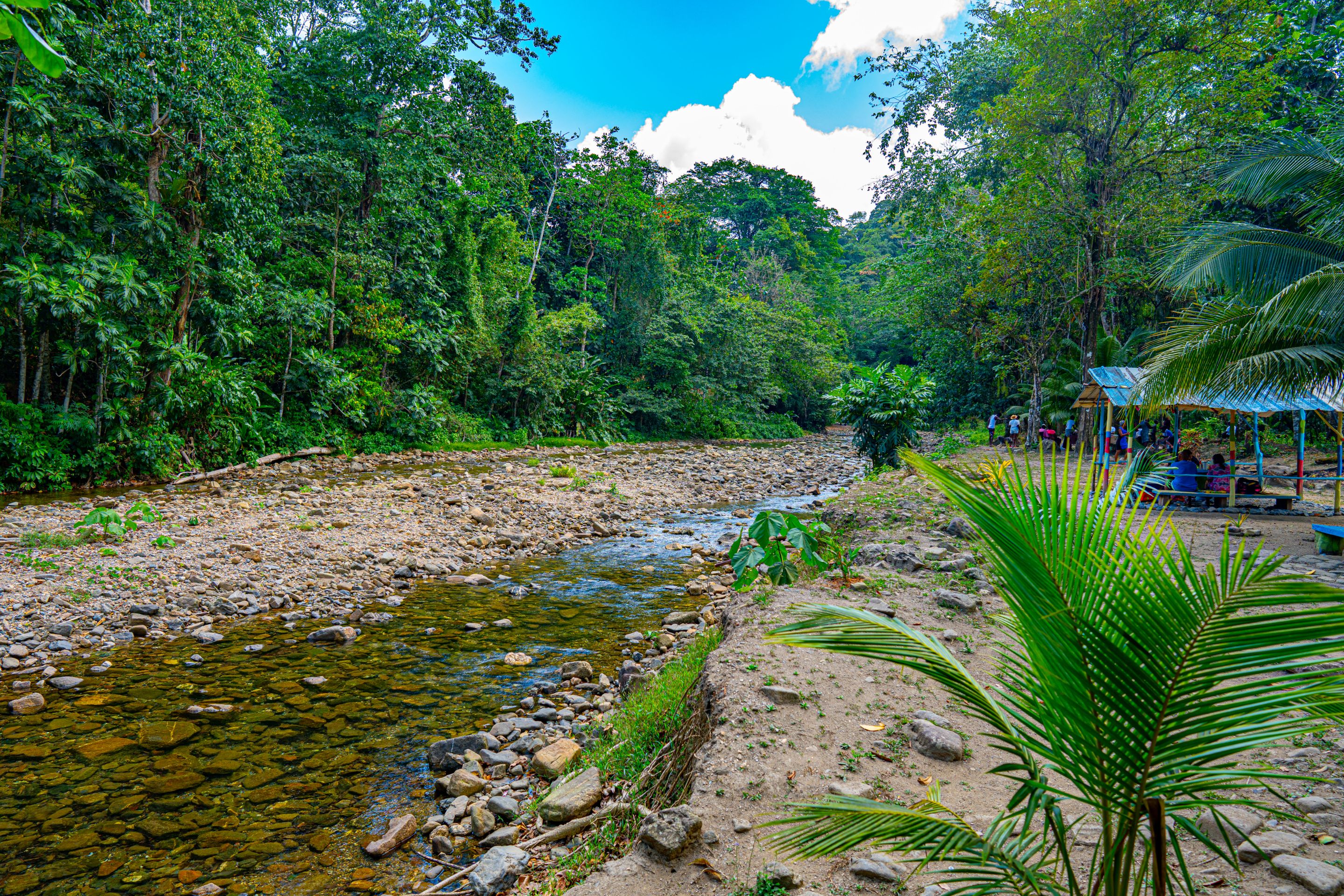
This is what the river looks like with the gazebos and limers on the right on its banks. Waters volume was significantly less today as Trinidad was in its dry season resulting in less water down stream. Nevertheless the stream was clear and clean as it flowed down to ocean. Across the banks were thick forest adding to the immersion in nature.
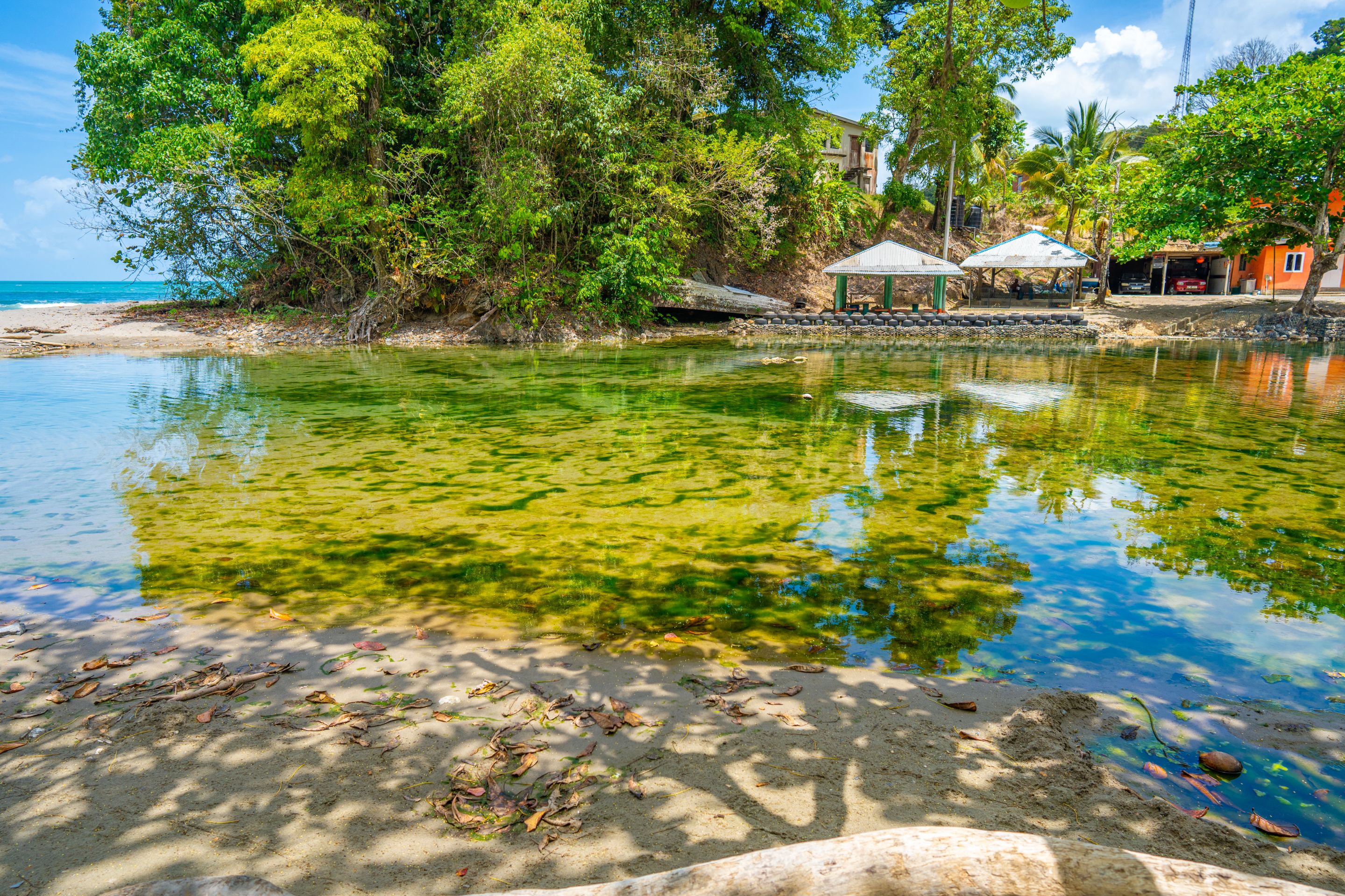
This is what the gazebos downriver looked like with their thatched roofs towards the bridge. It was about this time that we decided to walk along the bank towards the ocean itself with its blue waters.
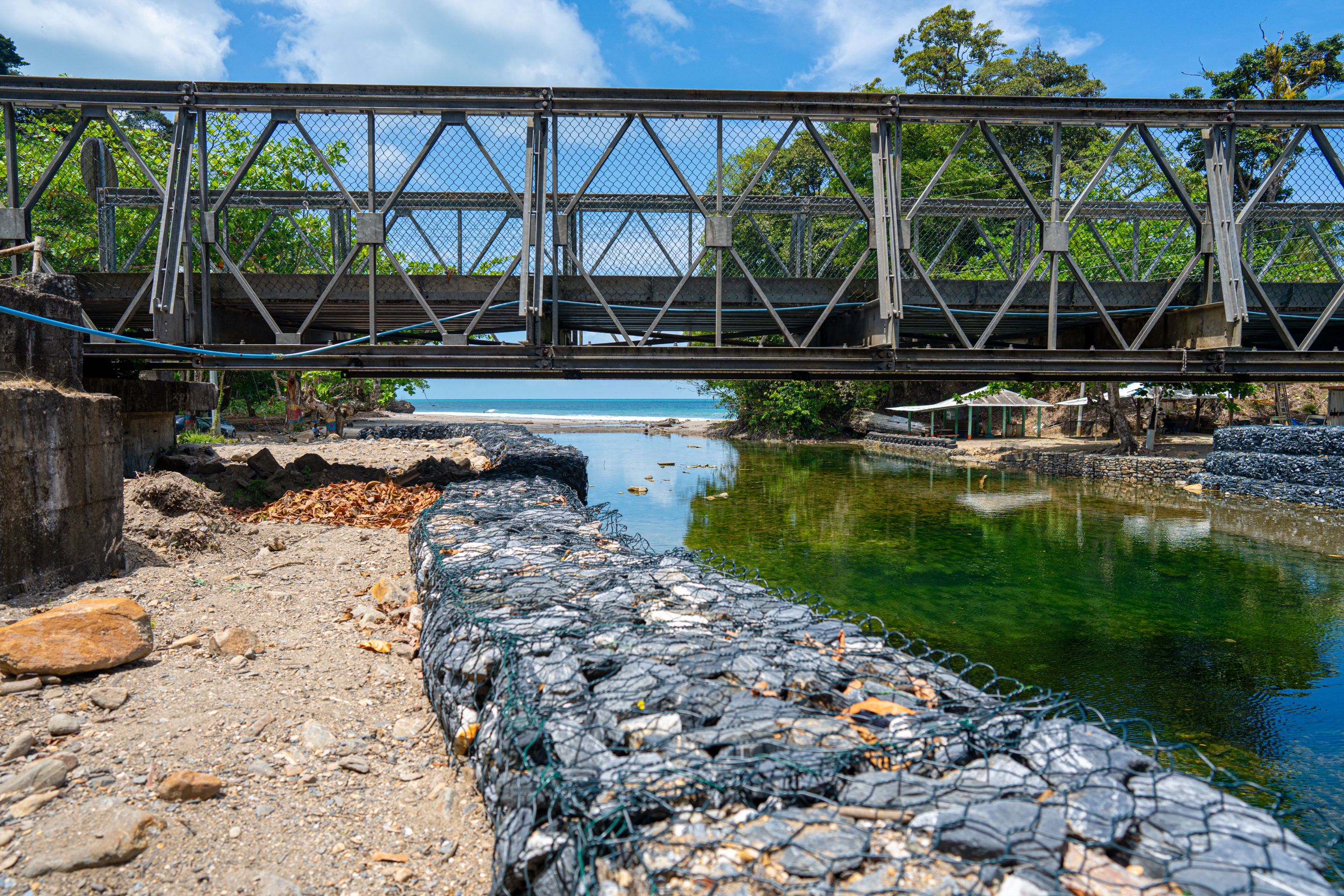
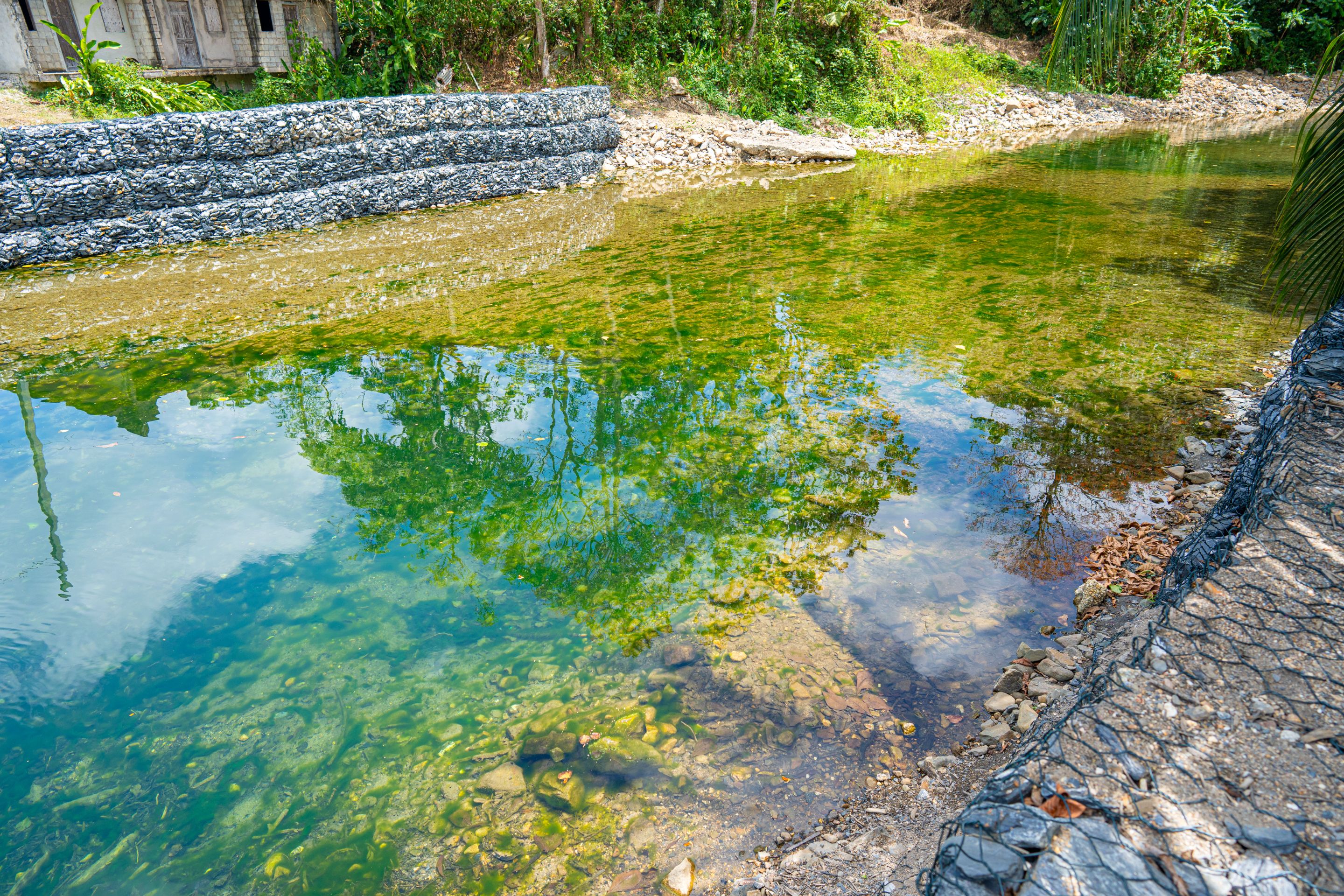
The way was blocked by the bridge itself so we had to walk around it. The river under the bridge was much higher in volume with a lot more moss and so on at the bottom. It seemed to be a emerald green color and even its depths had increased in this area as well.
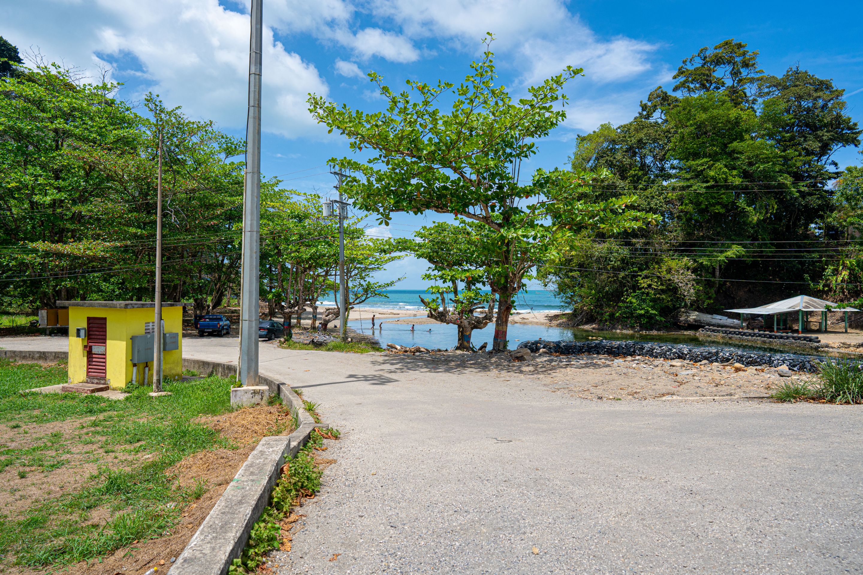
Finally we got to the area before the mouth of the river where the river flowed into the ocean. The waters were clear but there was so much moss on the rocks that you could see at the bottom.
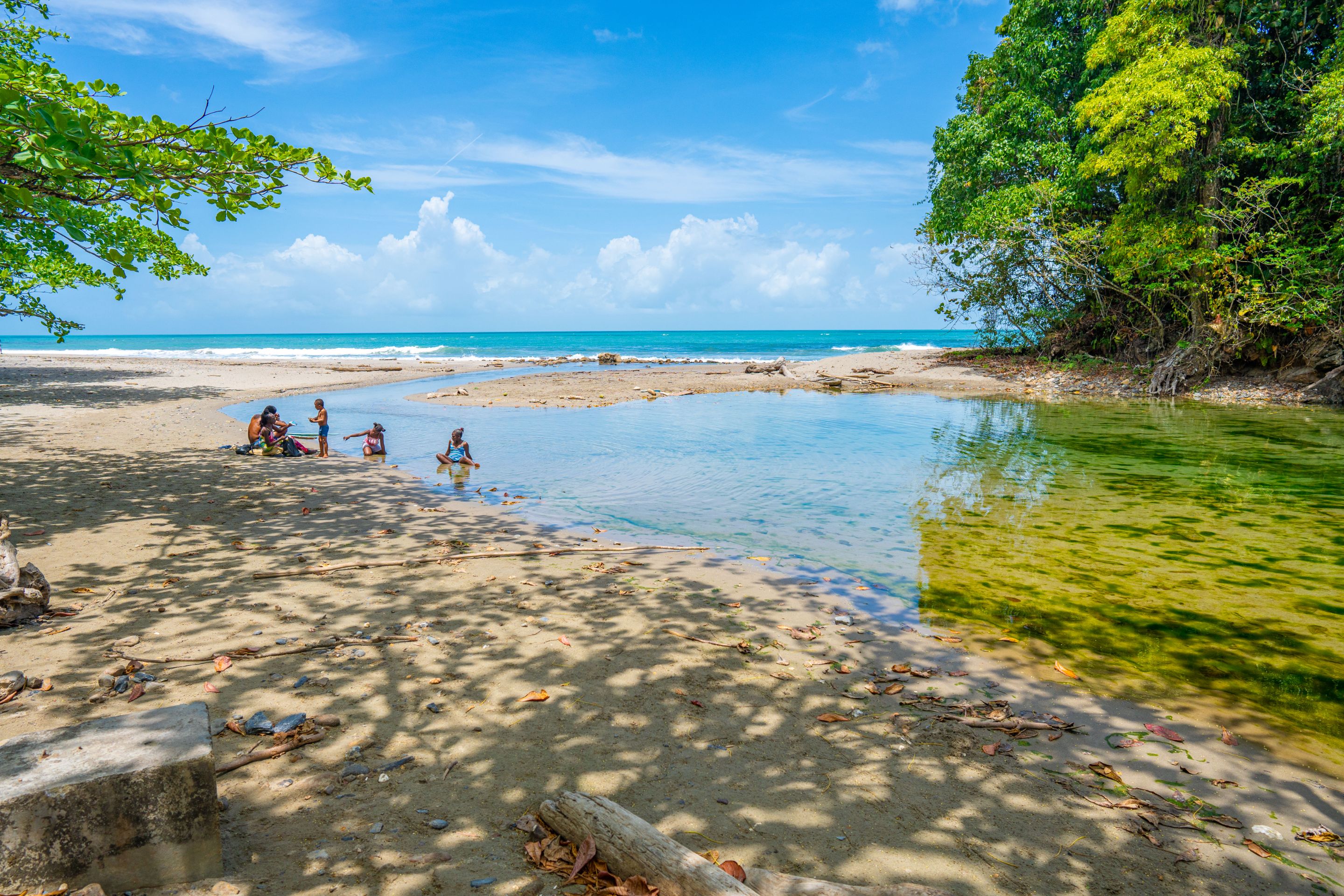
There were a few children playing and bathing here as it was much safer compared to the crashing waves. It was quite relaxing here as well but even more so as you could hear the waves as they crashed on the sands but see and feel the tranquility of the river.
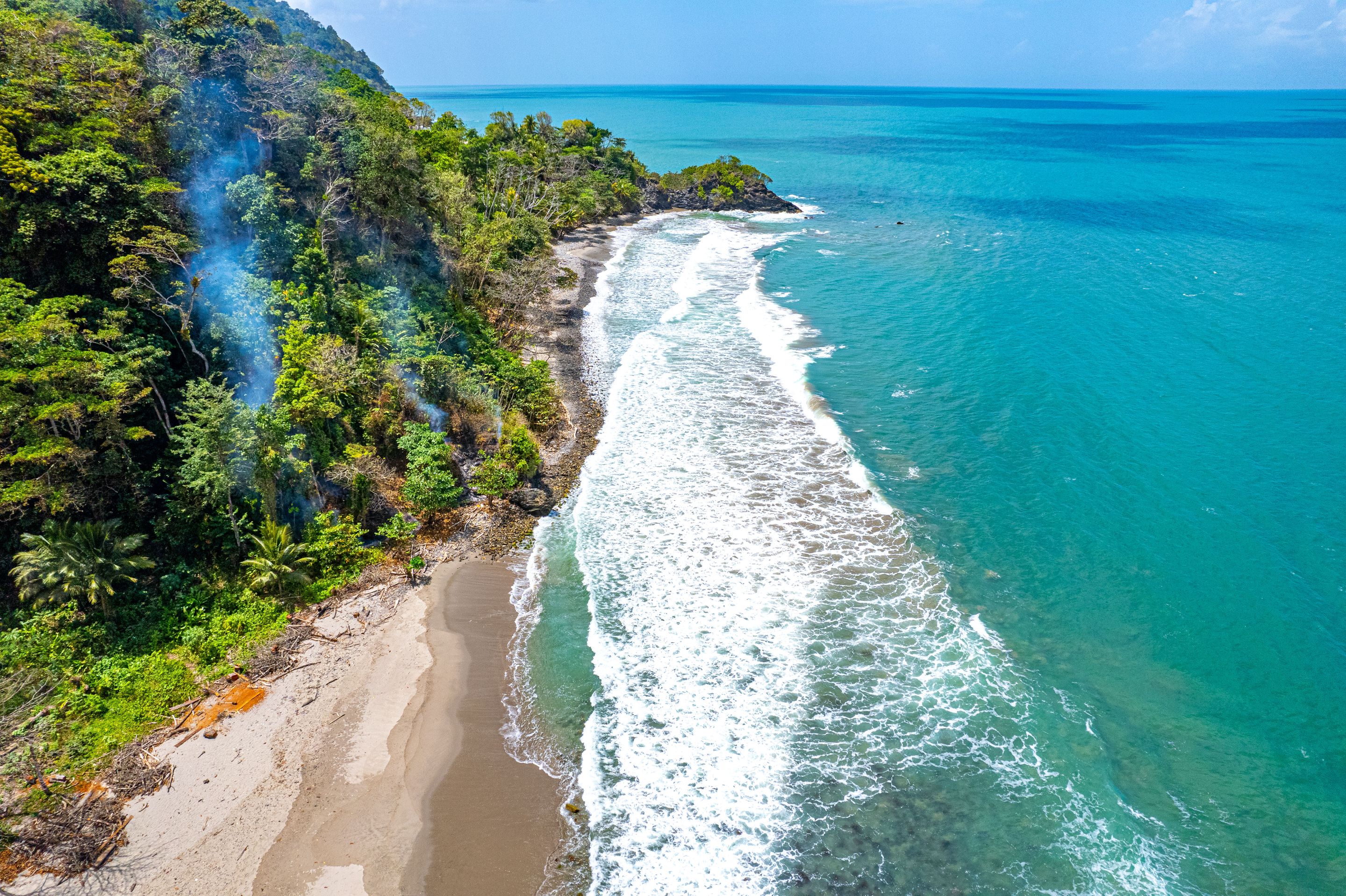
I decided to send up the drone to see what I could see and the views of the turquoise blue ocean were breathtaking to say the least, especially the way the coastline looked as it stretched for miles!
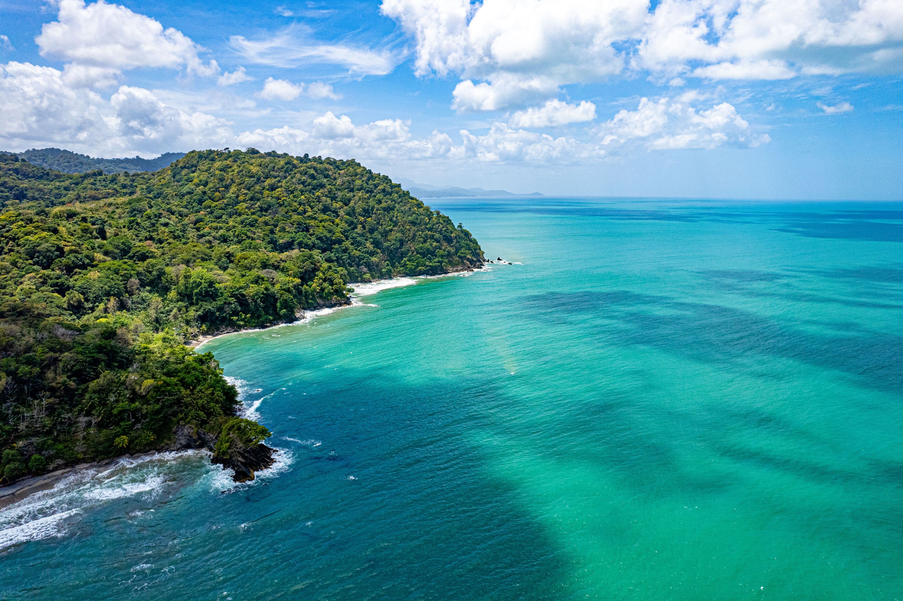
I had never seen waters like this in Tinidad in terms of color and clarity. Usually, they are always muddy brown and sometimes a little color but still smudged a little. I guess it was becuase of how arrid this dry season in Trinidad was, the rivers and coastlines were especially clean and colorful!
Matelot, its river and beach was an awesome location. The Journey was enthralling, the river and the vibes on its banks were immaculate and the beach with its tranquil vibes and breathtaking colors were on another level. This was my first time on this part of the Island of Trinidad and it definitely will not be the last! Thanks for coming along, Cheers!