The most beautiful thing about the ruins of Yaxchilán (pronounced ʝaʃtʃiˈlan) is their location: far away from roads and settlements, in the middle of the rainforest, surrounded by jungle giants. The only sounds to be heard are those of nature – insects, birds, occasionally in the distance the cries of howler monkeys. This is how travellers may have felt during their adventurous discoveries in the 19th century, when the world had not yet been surveyed down to every place.
Probably the first European who saw Yaxchilán was Colonel Juan Galindo, military governor of the department of Petén in Guatemala. Around 1833, he travelled down the Rio Usumacinta to investigate the ancient Maya constructions. During his travels, he explored Palenque and Copán, and must have also passed Yaxchilán.
Das schönste an den Ruinen von Yaxchilán (sprich ʝaʃtʃiˈlan) ist ihre Lage: weit weg von Straßen und Siedlungen, mitten im Regenwald, umgeben von Urwaldriesen. Zu hören sind nur die Geräusche der Natur – Insekten, Vögel, gelegentlich in der Ferne das Geschrei von Brüllaffen. So mögen sich die Reisenden im 19. Jahrhundert bei ihren abenteuerlichen Entdeckungen gefühlt haben, als die Welt noch nicht bis in den letzten Winkel vermessen war.
Yaxchilán hat als wohl erster Europäer Oberst Juan Galindo gesehen, Militär-Gouverneur des Departements Petén in Guatemala. Um 1833 fuhr er den Rio Usumacinta hinab, um die alten Bauten der Maya zu untersuchen. Bei seinen Reisen erforschte er Palenque und Copán, dabei muss er auch an Yaxchilán vorbeigekommen sein.
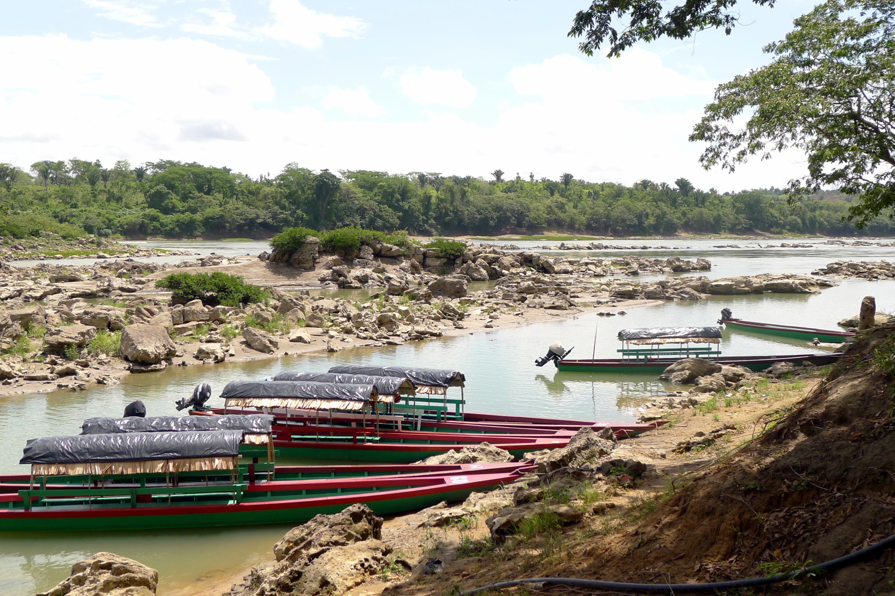 The only way to get to Yaxchilán is on the Usumacinta River. Boats wait for tourists in Frontera de Corozal.
Nach Yaxchilán gelangt man nur auf dem Fluss Usumacinta. In Frontera de Corozal warten Boote auf Touristen.
The only way to get to Yaxchilán is on the Usumacinta River. Boats wait for tourists in Frontera de Corozal.
Nach Yaxchilán gelangt man nur auf dem Fluss Usumacinta. In Frontera de Corozal warten Boote auf Touristen.
The ruins of Yaxchilán can only be reached by boat. Since the beginning of the 1990s, there has been a road to Frontera de Corozal on the Usumacinta. From there, the trip on the river takes about an hour. Before that, the ruins could only be reached by a small plane or after a river journey of more than 150 kilometres that lasted for days.
Zu den Ruinen von Yaxchilán kommt man nur mit einem Boot. Seit Beginn der 1990er-Jahre gibt es eine Straße nach Frontera de Corozal am Usumacinta. Von dort dauert die Fahrt auf dem Fluss eine knappe Stunde. Davor waren die Ruinen nur mit einem kleinen Flugzeug oder nach einer tagelangen Flussreise von über 150 Kilometern erreichbar.
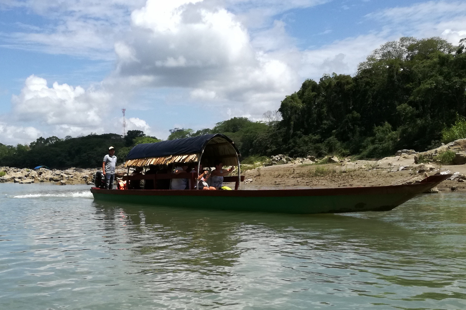 Long wooden boats with powerful outboards take tourists to the Mayan ruins within an hour.
Lange Holzboote mit starken Außenbordern bringen die Touristen in knapp einer Stunde zu den Maya-Ruinen.
Long wooden boats with powerful outboards take tourists to the Mayan ruins within an hour.
Lange Holzboote mit starken Außenbordern bringen die Touristen in knapp einer Stunde zu den Maya-Ruinen.
The Rio Usumacinta has a lot of water and flows into the Gulf of Mexico. The river passes the limestone mountains of the Sierra del Lacandón and forms in this region the border between Guatemala and Mexico over many hundreds of kilometres. On the Guatemalan side, there is a national park: Parque Nacional Sierra del Lacandón. Here there is still virgin forest with rare animals, while the Mexican side is already heavily cleared.
The river was an important artery on which other Maya cities were located: Piedras Negras downstream at a distance of 40 kilometres from Yaxchilán, and Altar de Sacrificios 80 kilometres upstream, both on the right and east of the Usumacinta respectively, i.e. in Guatemala.
Der Rio Usumacinta ist der wasserreichste Fluss Mittelamerikas und mündet in den Golf von Mexiko. Zuvor fließt er durch die Kalkberge der Sierra del Lacandón und bildet über viele Hundert Kilometer die Grenze zwischen Guatemala und Mexiko. Auf der Seite Guatemalas erstreckt sich ein Nationalpark: der Parque Nacional Sierra del Lacandón. Hier gibt es noch Urwald mit seltenen Tieren, während die mexikanische Seite schon stark gerodet ist.
Der Fluss war eine bedeutende Verkehrsader, an der weitere Maya-Städte lagen: Piedras Negras flussabwärts in 40 Kilometern Entfernung von Yaxchilán, 80 Kilometer flussaufwärts Altar de Sacrificios, beide rechts beziehungsweise östlich des Usumacinta, also in Guatemala.
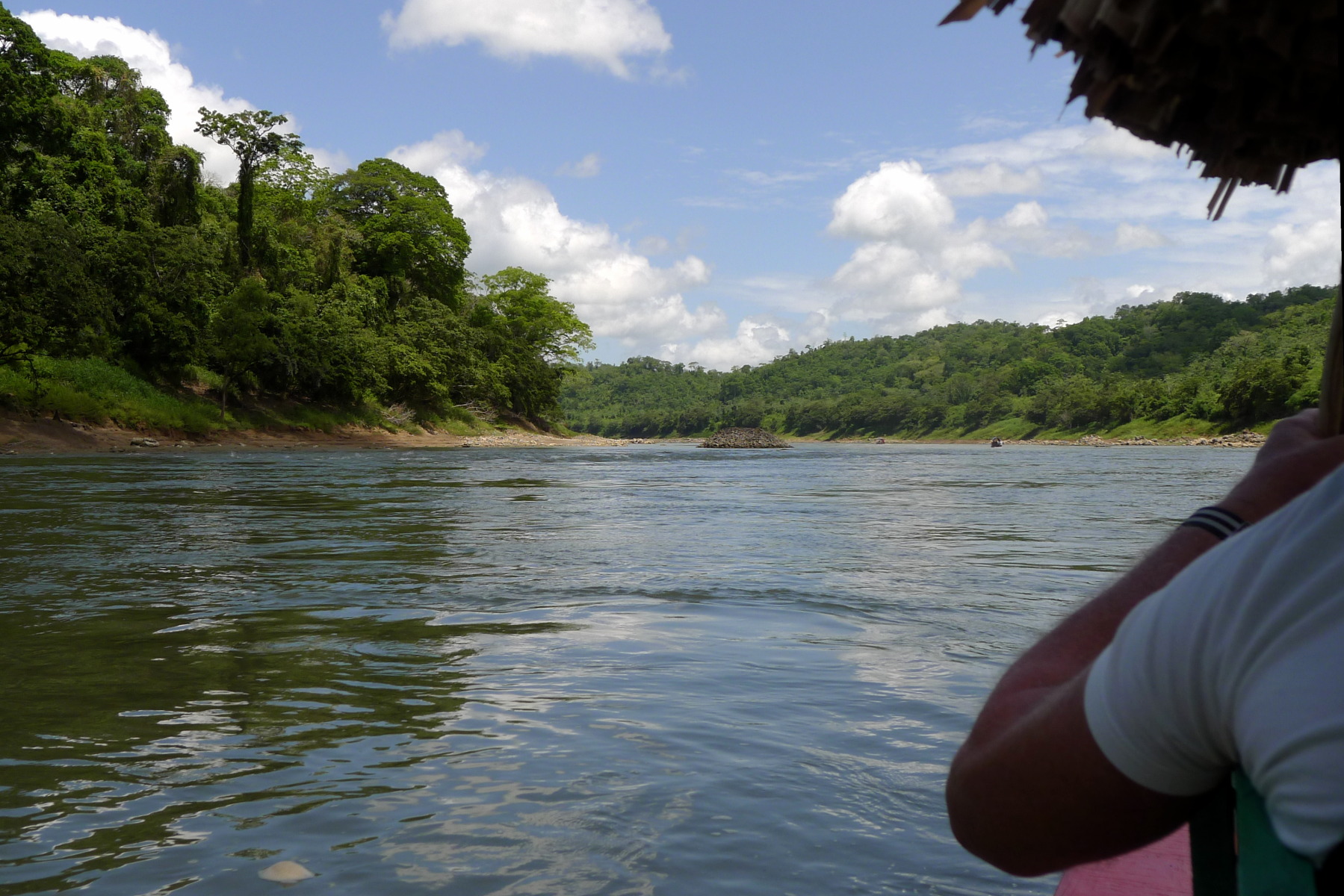 Right next to the river, the rainforest is still largely intact. On the left the Mexican bank, on the right Guatemala. The stone hill in the background already belongs to Yaxchilán.
Unmittelbar am Fluss ist der Regenwald noch weitgehend intakt. Links das mexikanische Ufer, rechts Guatemala. Der Steinhügel im Hintergrund gehört schon zu Yaxchilán.
Right next to the river, the rainforest is still largely intact. On the left the Mexican bank, on the right Guatemala. The stone hill in the background already belongs to Yaxchilán.
Unmittelbar am Fluss ist der Regenwald noch weitgehend intakt. Links das mexikanische Ufer, rechts Guatemala. Der Steinhügel im Hintergrund gehört schon zu Yaxchilán.
Yaxchilán lies at the zenith of a narrow, horseshoe-shaped loop of the Usumacinta and is thus protected from the river on all sides. It is best to look at it on a map: Only in the south of the city remains a land access about 500 metres wide.
Yaxchilán liegt im Scheitelpunkt einer engen, hufeisenförmigen Schleife des Usumacinta und ist so nach allen Seiten vom Fluss geschützt. Am besten schaut man sich das auf einer Karte an: Nur im Süden der Stadt bleibt ein etwa 500 Meter breiter Landzugang.
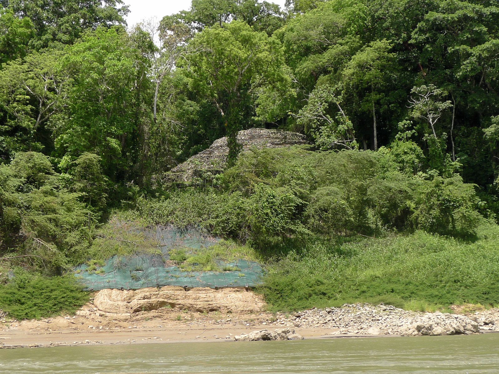 From the boat you can already see the first Mayan ruin on the shore. Yaxchilán ruled the river for centuries.
Vom Boot aus sieht man am Ufer schon die erste Maya-Ruine. Yaxchilán beherrschte Jahrhunderte lang den Fluss.
From the boat you can already see the first Mayan ruin on the shore. Yaxchilán ruled the river for centuries.
Vom Boot aus sieht man am Ufer schon die erste Maya-Ruine. Yaxchilán beherrschte Jahrhunderte lang den Fluss.
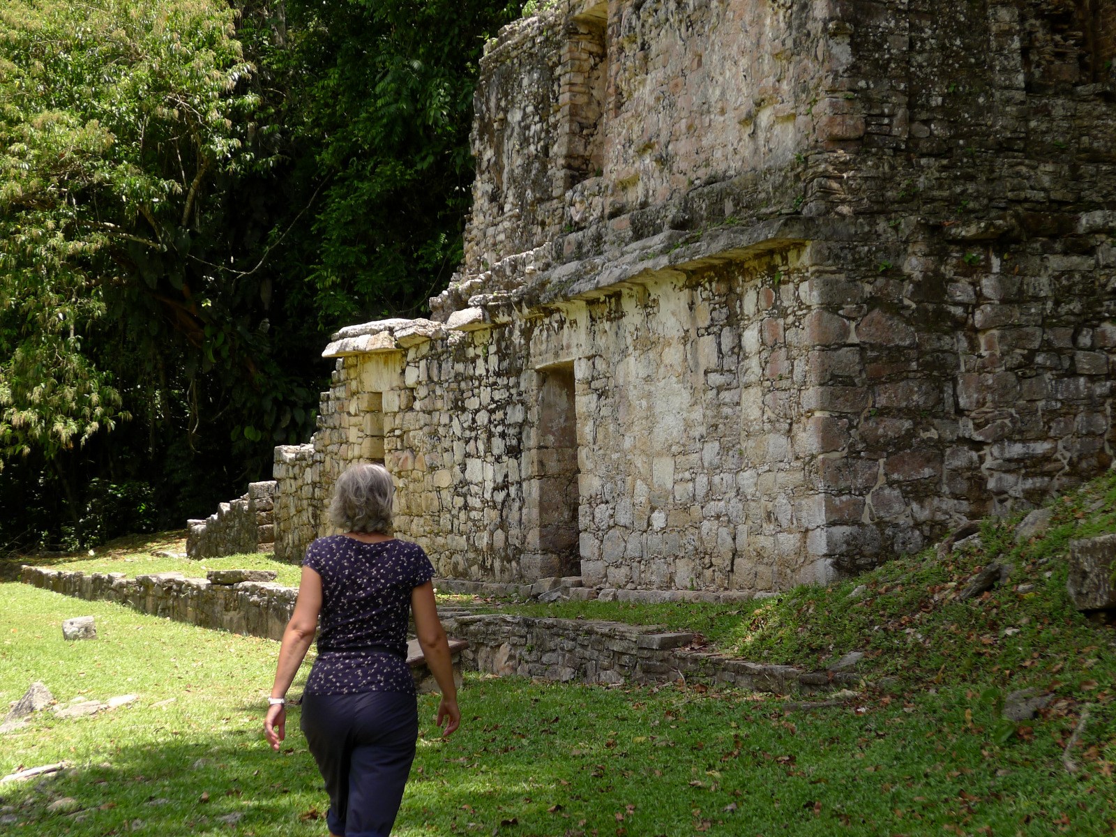
 Today's entrance area at the point where one enters the site from the river bank.
Der heutige Eingangsbereich an der Stelle, wo man vom Flussufer aus die Ruinestätte betritt.
Today's entrance area at the point where one enters the site from the river bank.
Der heutige Eingangsbereich an der Stelle, wo man vom Flussufer aus die Ruinestätte betritt.
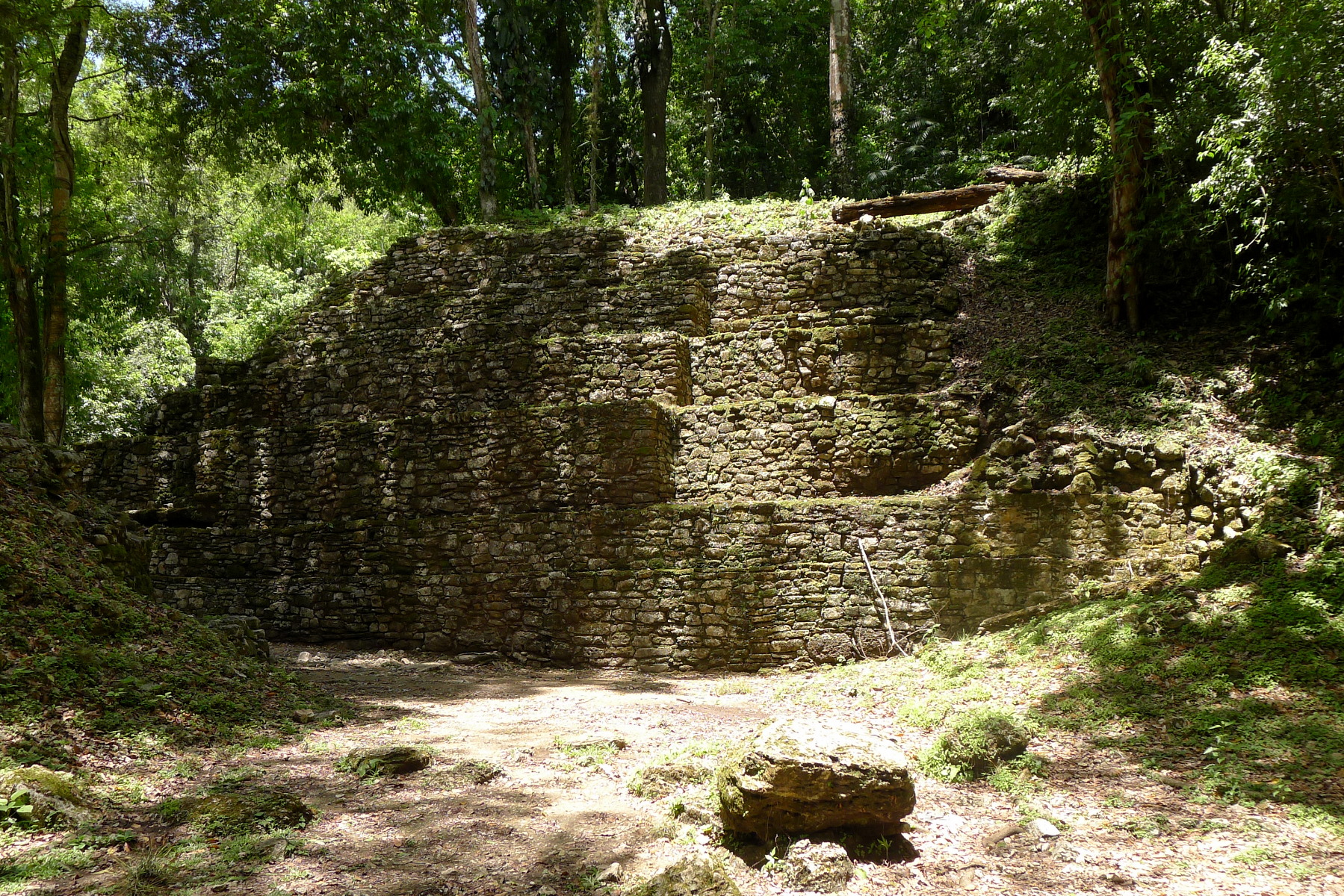
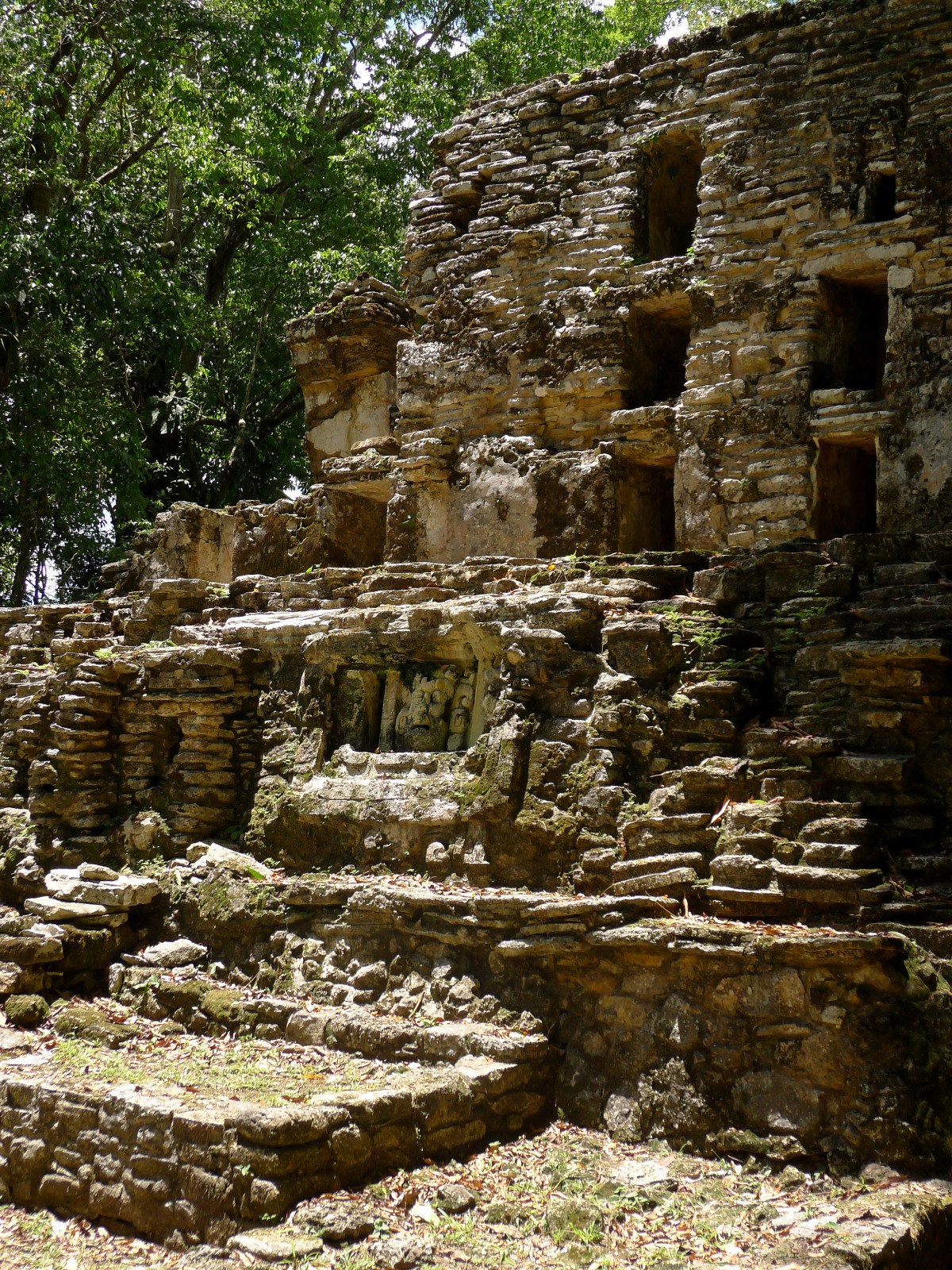
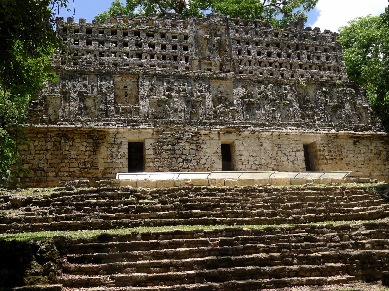
 Building 19 with three floors, also called »Labyrinth«, on the north-western edge of a large square.
Gebäude 19 mit drei Stockwerken, auch »Labyrinth« genannt, am nordwestlichen Rand eines großen Platzes.
Building 19 with three floors, also called »Labyrinth«, on the north-western edge of a large square.
Gebäude 19 mit drei Stockwerken, auch »Labyrinth« genannt, am nordwestlichen Rand eines großen Platzes.
The buildings have numbers that most authors use in their descriptions. I have tried to match my photos to the correct numbers. At the end of the post you will find a simple map with the most important buildings in the centre of the Maya city.
Today's access to the ruins leads through a dark corridor in building 19. This large building is also called the labyrinth and forms the western end of the grounds.
Die Bauten haben Nummern, die von den meisten Autoren bei ihren Beschreibungen verwendet werden. Ich habe versucht, meine Fotos den korrekten Nummern zuzuordnen. Am Schluss des Posts findet Ihr einen einfachen Plan mit den wichtigsten Gebäuden im Zentrum der Maya-Stadt.
Der heutige Zugang zu den Ruinen führt durch einen dunklen Gang in Gebäude 19. Dieser große Bau wird auch das Labyrinth genannt und bildet den westlichen Abschluss des Geländes.
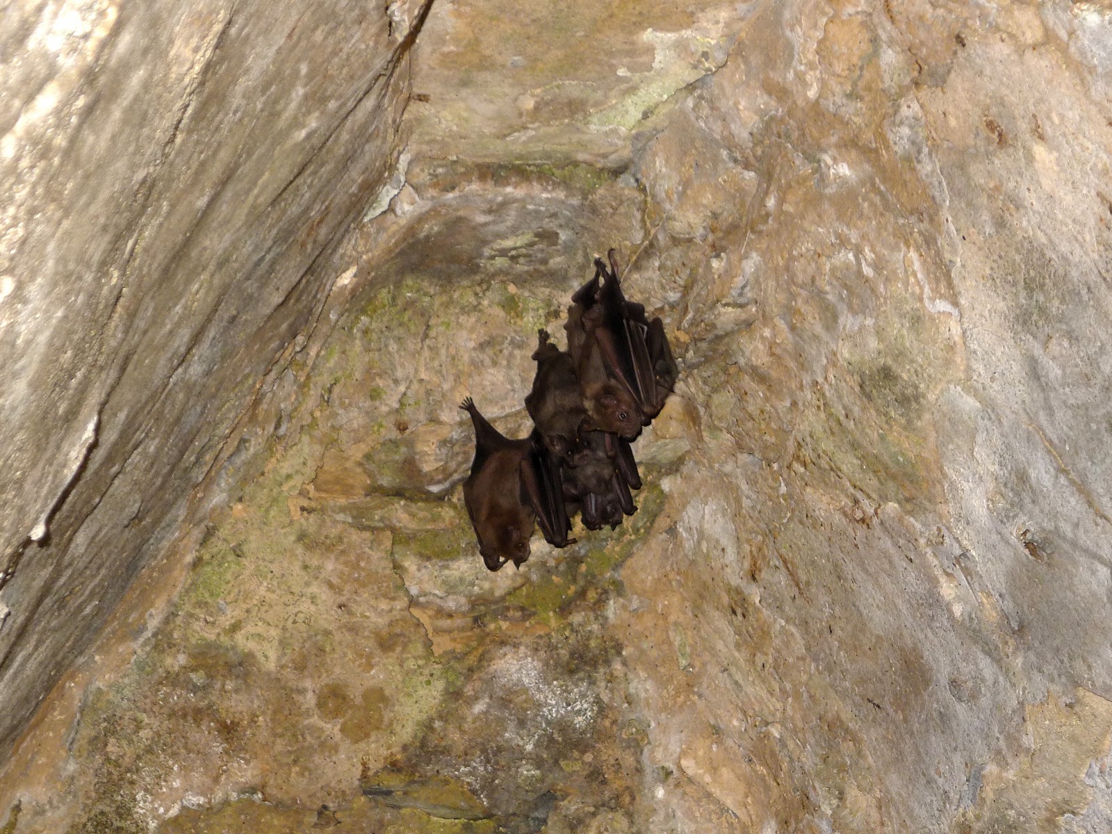 Bats hanging on the ceiling of the labyrinth (building 19).
In den falschen Gewölben des Labyrinths (Gebäude 19) hängen Fledermäuse.
Bats hanging on the ceiling of the labyrinth (building 19).
In den falschen Gewölben des Labyrinths (Gebäude 19) hängen Fledermäuse.
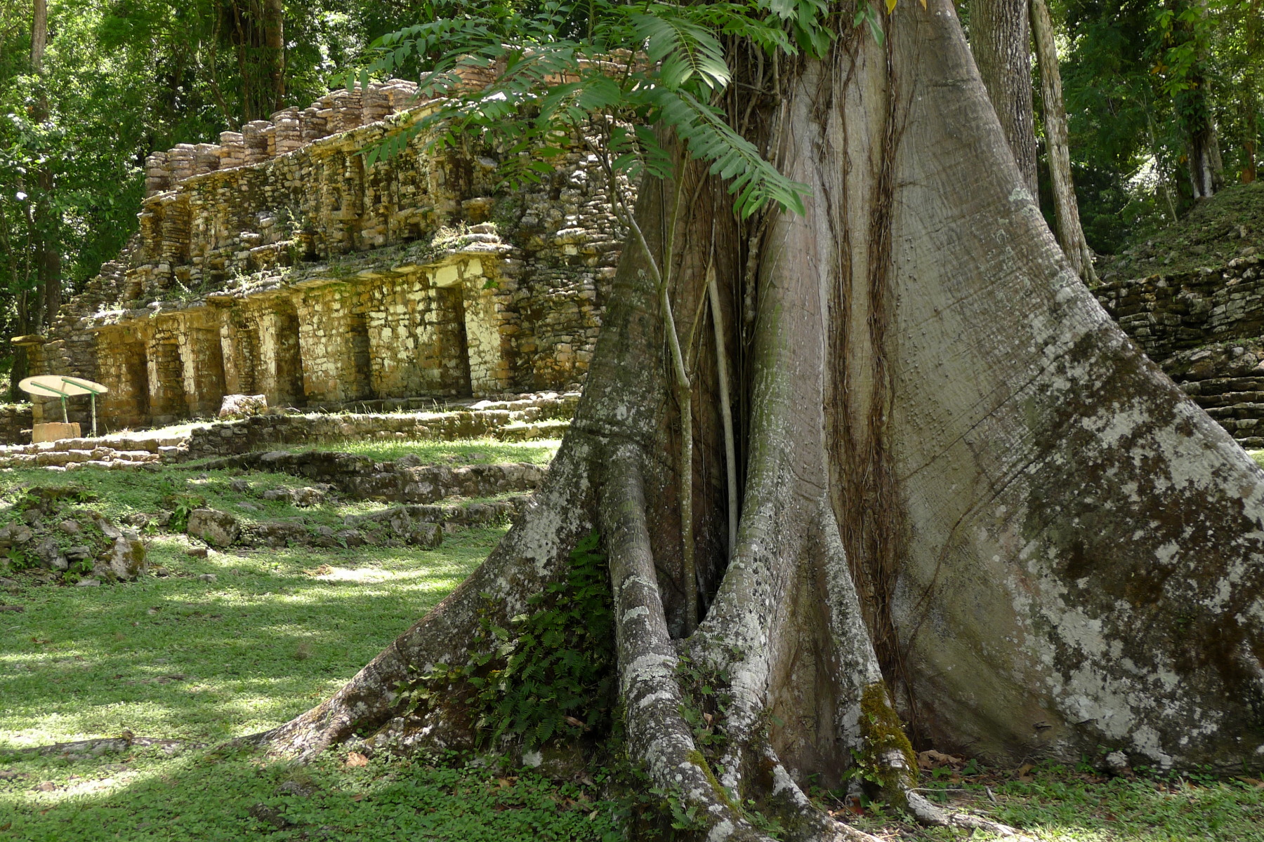 View from the main square back to the labyrinth (building 19).
Blick vom Hauptplatz zurück auf das Labyrinth (Gebäude 19).
View from the main square back to the labyrinth (building 19).
Blick vom Hauptplatz zurück auf das Labyrinth (Gebäude 19).
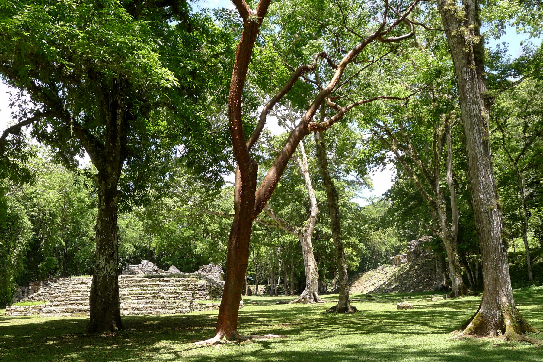
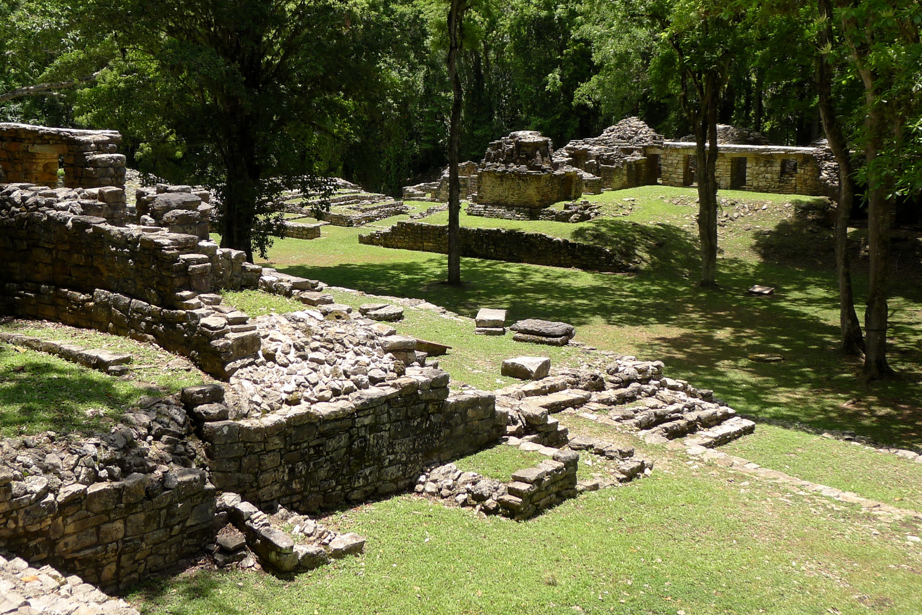
A large main square stretches from northwest to southeast. It is called the »Gran Plaza« or »central acropolis«: Numerous more or less well-preserved buildings are grouped around this main square, including a ball court.
The few tourists get lost in the extensive grounds, and most of the time you are all alone on your wanderings through the ruins. The main square has been cleared to make the ruins visible, but there are still some giant trees between the buildings, in whose branches spider monkeys cavort.
Ein großer Hauptplatz erstreckt sich von Nordwesten nach Südosten. Er wird als »Gran Plaza« oder »zentrale Akropolis« bezeichnet: Um diesen Hauptplatz gruppieren sich zahlreiche mehr oder weniger gut erhaltene Gebäude, darunter auch ein Ballspielplatz.
Die wenigen Touristen verlieren sich in dem ausgedehnten Gelände, meistens ist man ganz allein bei seinen Streifzügen durch die Ruinen. Der Hauptplatz wurde gerodet, um die Bauten sichtbar zu machen, aber es stehen noch einige Baumriesen zwischen den Gebäuden, in deren Geäst sich Klammeraffen tummeln.
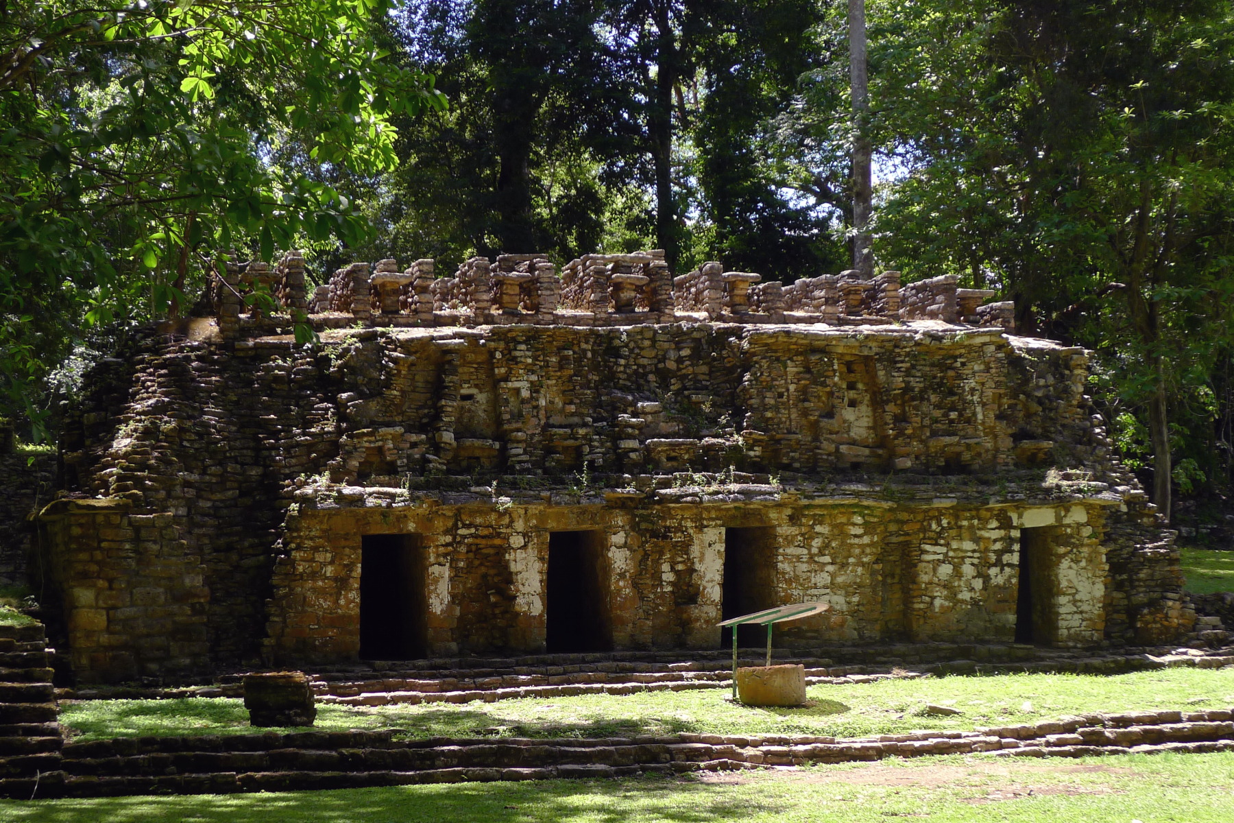
 Building 18, like No. 19, is located on the north-western edge of the large square, the central Acropolis.
Gebäude 18 liegt wie Nr. 19 am nordwestlichen Rand des großen Platzes, der zentralen Akropolis.
Building 18, like No. 19, is located on the north-western edge of the large square, the central Acropolis.
Gebäude 18 liegt wie Nr. 19 am nordwestlichen Rand des großen Platzes, der zentralen Akropolis.
 Ball court in the middle of the central Acropolis.
Ballspielplatz inmitten der zentralen Akropolis.
Ball court in the middle of the central Acropolis.
Ballspielplatz inmitten der zentralen Akropolis.
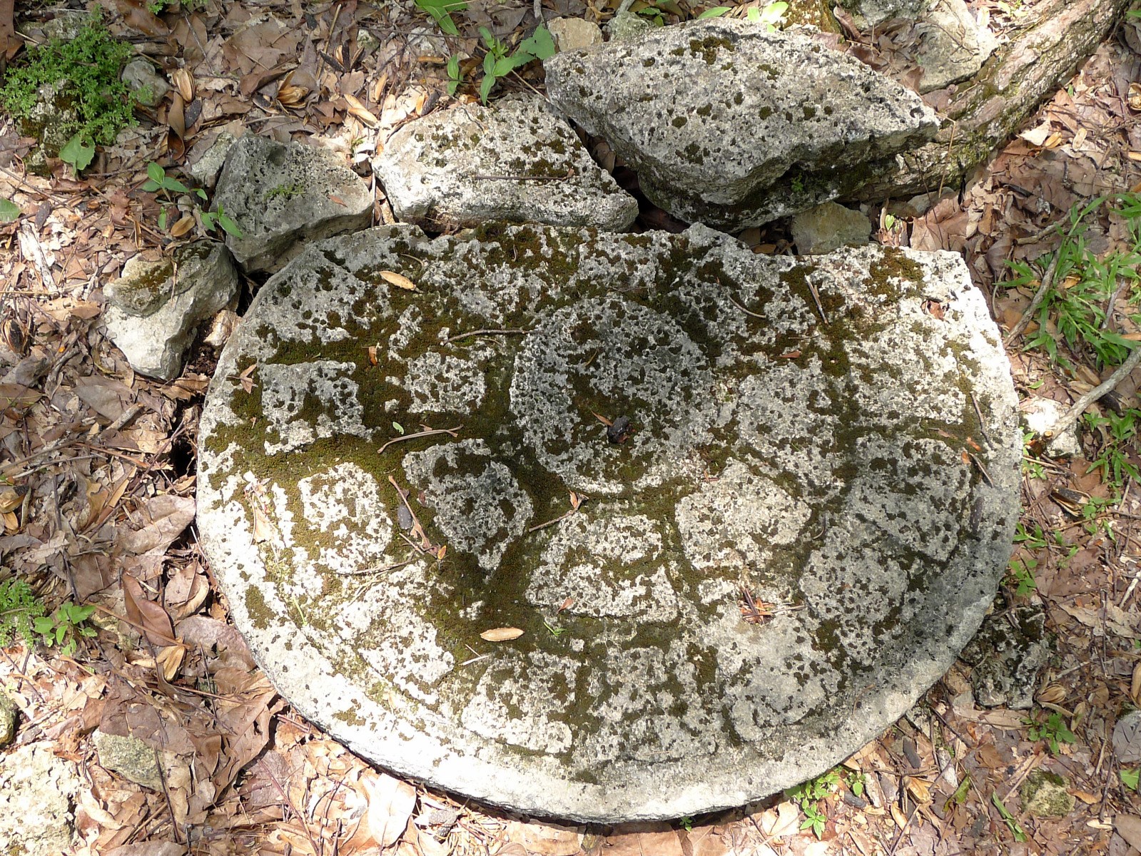 Markers dividing the playing field are still preserved on the ball court.
Auf dem Ballspielplatz sind noch Marken erhalten, die das Spielfeld unterteilten.
Markers dividing the playing field are still preserved on the ball court.
Auf dem Ballspielplatz sind noch Marken erhalten, die das Spielfeld unterteilten.
 Main square with building 22.
Blick auf den Hauptplatz mit Gebäude 22.
Main square with building 22.
Blick auf den Hauptplatz mit Gebäude 22.
The temple buildings of Yaxchilán are not as well preserved as those in Palenque or even Chichén Itzá. But due to their isolated location by the river deep in the rainforest, the ruins emanate an incomparable atmosphere.
Members of the Maya people of the Lancandones, who live according to ancient custom, still come here to worship their gods: in 1999 Reinhard Krüger photographed a bird sacrifice by the Lacandones at a cult stone in Yaxchilán – this would be impossible in Chichén Itzá.
At the south-eastern end of the main square follow two relatively well-preserved buildings, No. 20 with three rooms and, high above the river, the probably Early Classical building No. 6: this was the original entrance to the city in Maya times.
Die Tempelbauten von Yaxchilán sind lange nicht so gut erhalten wie in Palenque oder gar in Chichén Itzá. Aber durch ihre abgeschiedene Lage am Fluss tief im Regenwald strahlen die Ruinen eine unvergleichliche Atmosphäre aus.
Nach alter Sitte lebende Angehörige des Maya-Volks der Lancandonen kommen immer noch hierher, um ihre Götter zu verehren: 1999 fotografierte Reinhard Krüger ein Vogelopfer der Lacandonen an einem Kultstein in Yaxchilán – in Chichén Itzá wäre das undenkbar.
Am südöstlichen Ende des Hauptplatzes folgen zwei relativ gut erhaltene Gebäude, Nr. 20 mit drei Räumen und, hoch über dem Fluss, das vermutlich frühklassische Gebäude Nr. 6: Das war der ursprüngliche Zugang zur Stadt in der Zeit der Maya.
 Building 6 above the river is possibly Early Classical (before 600 AD) – that would make it one of the oldest temples still standing here.
Gebäude 6 über dem Fluss ist möglicherweise frühklassisch (vor 600 n.Chr.) – dann wäre es einer der ältesten Tempel, die hier noch stehen.
Building 6 above the river is possibly Early Classical (before 600 AD) – that would make it one of the oldest temples still standing here.
Gebäude 6 über dem Fluss ist möglicherweise frühklassisch (vor 600 n.Chr.) – dann wäre es einer der ältesten Tempel, die hier noch stehen.
 Building 20, which is in relatively good condition, has three rooms and, like Building 6, stands at the south-eastern end of the main square.
Das relativ gut erhaltene Gebäude 20 hat drei Räume und steht wie Gebäude 6 am südöstlichen Ende des Hauptplatzes.
Building 20, which is in relatively good condition, has three rooms and, like Building 6, stands at the south-eastern end of the main square.
Das relativ gut erhaltene Gebäude 20 hat drei Räume und steht wie Gebäude 6 am südöstlichen Ende des Hauptplatzes.
The Classic Time of the Maya – Die klassische Zeit der Maya
The Classic period of the Maya extends from 250 to 900 AD. This period is further divided into the Early and Late Classical periods, which lasted from 250 to 600 and 600 to 900. The period from around 900 until the arrival of the Spanish in the 16th century is called the Postclassic. Most of the ruins preserved in Chichén Itzá or Izamal, for example, belong to this »Postclassic« period.
Yaxchilán existed pretty much in the classical Maya period. Inscriptions from the city record a total of 19 kings, the first from around 350, the last mention dates from 810. Like so many other Maya cities, Yaxchilán was left in the 9th century. So when the first Europeans came there, the ruins had been lying abandoned in the jungle for over 1000 years.
Die klassische Zeit der Maya reicht von 250 bis 900 nach Christus. Diese Periode unterteilt man noch einmal in die frühe und späte Klassik, die von 250 bis 600 beziehungsweise 600 bis 900 dauerte. Den Abschnitt ab etwa 900 bis zu Ankunft der Spanier im 16. Jahrhundert bezeichnet man als Postklassik. In diese »nachklassische« Zeit gehören zum Beispiel die meisten Ruinen, die in Chichén Itzá oder Izamal erhalten sind.
Yaxchilán existierte ziemlich genau in der klassischen Zeit der Maya. Inschriften aus der Stadt überliefern insgesamt 19 Könige, den ersten ab etwa 350, die letzte Erwähnung stammt aus dem Jahr 810. Wie so viele andere Maya-Städte auch wurde Yaxchilán im 9. Jahrhundert aufgegeben. Als die ersten Europäer dorthin kamen, lagen die Ruinen also seit über 1000 Jahren verlassen im Urwald.
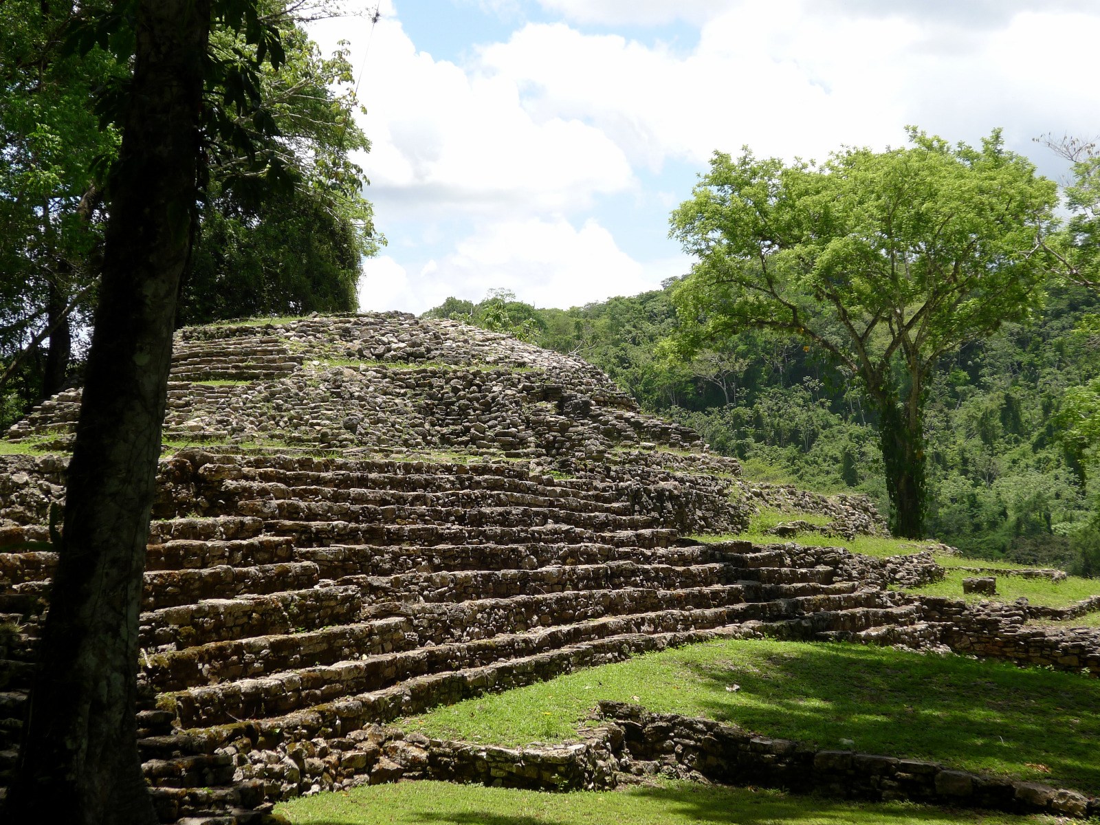
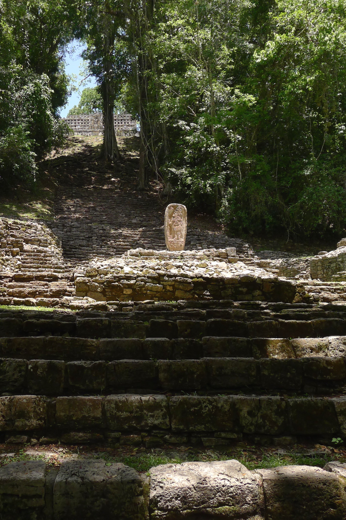 A massive staircase leads to the highest point of the central Acropolis with building 33.
Eine gewaltige Treppe führt zum höchsten Punkt der zentralen Akropolis mit dem Gebäude 33.
A massive staircase leads to the highest point of the central Acropolis with building 33.
Eine gewaltige Treppe führt zum höchsten Punkt der zentralen Akropolis mit dem Gebäude 33.
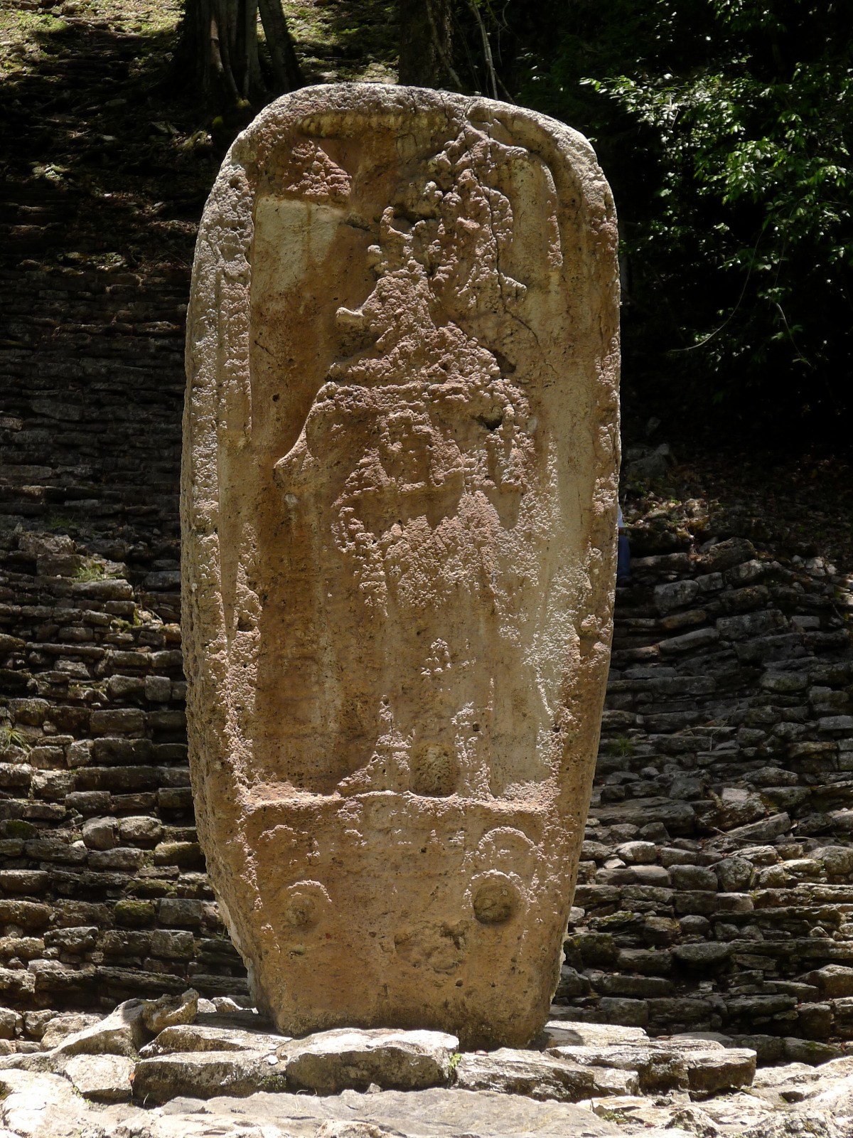 A weathered stele stands on a platform of the stairs to building 33. It is said to date from the year 613, so it is older than the stairs and the building and was erected here later.
Auf einer Plattform der Treppe zu Gebäude 33 steht eine verwitterte Stele. Sie soll aus dem Jahr 613 stammen, ist also älter als Treppe und Gebäude und nachträglich hier aufgestellt worden.
A weathered stele stands on a platform of the stairs to building 33. It is said to date from the year 613, so it is older than the stairs and the building and was erected here later.
Auf einer Plattform der Treppe zu Gebäude 33 steht eine verwitterte Stele. Sie soll aus dem Jahr 613 stammen, ist also älter als Treppe und Gebäude und nachträglich hier aufgestellt worden.
 Building 33 on the highest point was probably inaugurated in 756. The blocks of the top step show reliefs (photo below) and are therefore protected by a plastic roof.
Gebäude 33 auf dem höchsten Punkt wurde vermutlich im Jahr 756 eingeweiht. Die Blöcke der obersten Treppestufe zeigen Reliefs (Foto siehe unten) und werden deshalb durch ein Plastikdach geschützt.
Building 33 on the highest point was probably inaugurated in 756. The blocks of the top step show reliefs (photo below) and are therefore protected by a plastic roof.
Gebäude 33 auf dem höchsten Punkt wurde vermutlich im Jahr 756 eingeweiht. Die Blöcke der obersten Treppestufe zeigen Reliefs (Foto siehe unten) und werden deshalb durch ein Plastikdach geschützt.
At the highest point, Building 33 overlooks the entire central acropolis and the Usumacinta River. At the largest and most beautiful temple of Yaxchilán, the roof comb is still very well preserved. The roof comb is an important component of Maya buildings, a kind of headdress of the temple, analogous to the costume of the kings, who also wore strange formations on their heads.
Building 33 was built in the zenith when Yaxchilań ruled the river and the surrounding towns almost undisputedly. The temple was probably inaugurated in 756 by Bird Jaguar IV. This King reigned from 752 to 768.
Auf dem höchsten Punkt überblickt Gebäude 33 die gesamte zentrale Akropolis und den Fluss Usumacinta. Bei dem größten und schönsten Tempel von Yaxchilán ist der Dachkamm noch sehr gut erhalten. Der Dachkamm ist ein wichtiges Bestandteil der Maya-Bauten, eine Art Kopfschmuck des Tempels, analog zur Tracht der Könige, die ebenfalls seltsame Gebilde auf ihren Häuptern trugen.
Gebäude 33 entstand in der Blütezeit, als Yaxchilań fast unumstritten den Fluss und die umliegenden Städte beherrschte. Der Tempel wurde wohl im Jahr 756 von Bird Jaguar IV eingeweiht. König Bird Jaguar IV regierte von 752 bis 768.
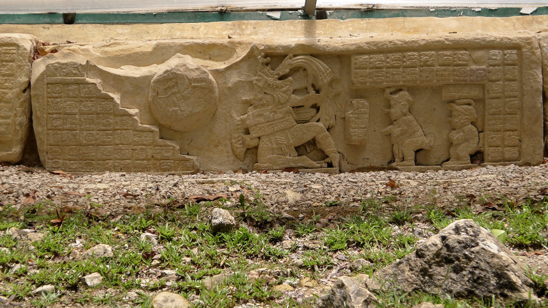 Carved top step in front of building 33: In the centre King Bird Jaguar IV, on the left a ball, on the right two dwarfs watching the king playing ball. Hieroglyphs explain the scene.
Behauene oberste Treppenstufe vor Gebäude 33: In der Mitte König Bird Jaguar IV, links ein Ball, rechts zwei Zwerge, die dem König beim Ballspiel zuschauen. Hieroglyphen erläutern die Szene.
Carved top step in front of building 33: In the centre King Bird Jaguar IV, on the left a ball, on the right two dwarfs watching the king playing ball. Hieroglyphs explain the scene.
Behauene oberste Treppenstufe vor Gebäude 33: In der Mitte König Bird Jaguar IV, links ein Ball, rechts zwei Zwerge, die dem König beim Ballspiel zuschauen. Hieroglyphen erläutern die Szene.
The top step of the staircase to temple building 33 consists of 13 blocks. They show King Bird Jaguar IV playing ball. A prisoner can be seen rolled up in the ball. It is important to know that the Maya sometimes sacrificed their prisoners of war by tying them up like a ball and rolling them down the stairs in front of their temples.
Strangely enough, two dwarfs are watching the king playing ball. I have not found an explanation for this. On the right and left, the ancestors of Bird Jaguar IV are depicted on further blocks (not on the photo): on the left, father Shield Jaguar II, on the right, grandfather Bird Jaguar III, both also playing ball.
_Die oberste Stufe der Treppe zum Tempel Gebäude 33 besteht aus 13 behauenen Blöcken. Sie zeigen König