Hello Beautiful People!
“Climb the mountain not to plant your flag, but to embrace the challenge, enjoy the air and behold the view. Climb it so you can see the world, not so the world can see you.”– David McCullough Jr.
Lately, I have been busy working that I rarely do the things that I love such as hiking and climbing. While looking at my FB account, the memory popped up and there I saw my memorable adventure to Mt. Mauyog.
When I was in High school, I was always amazed looking at the high peak of the mountain that can be seen from our place. I told myself that someday I am going to climb that mountain. Finally, after several years, I got to experience it.
Now, let me share with you my Mt. Mauyog experience with my aunt and cousin.
##
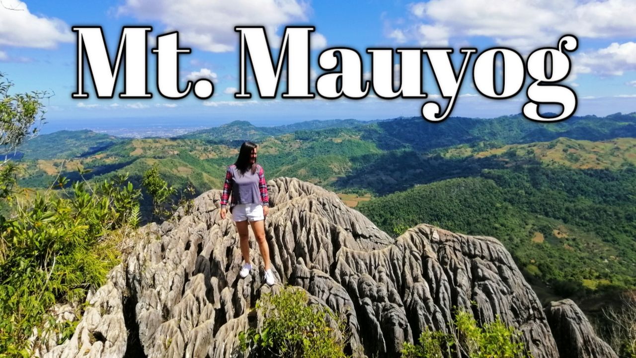
WHERE IS MT. MAUYOG?
Mt. Mauyog is situated in Barangay Sunog, Balamban Cebu. From my place, it will take about 30 minutes to get there. If you are coming from Cebu City, you will ride a v-hire from Ayala Terminal then just tell the driver that you will be hiking to Mt. Mauyog so the driver will know where to drop you off. Then after the v-hire ride, you will ride a habal2x (motorcycle taxi) towards the foot of Mt. Mauyog.
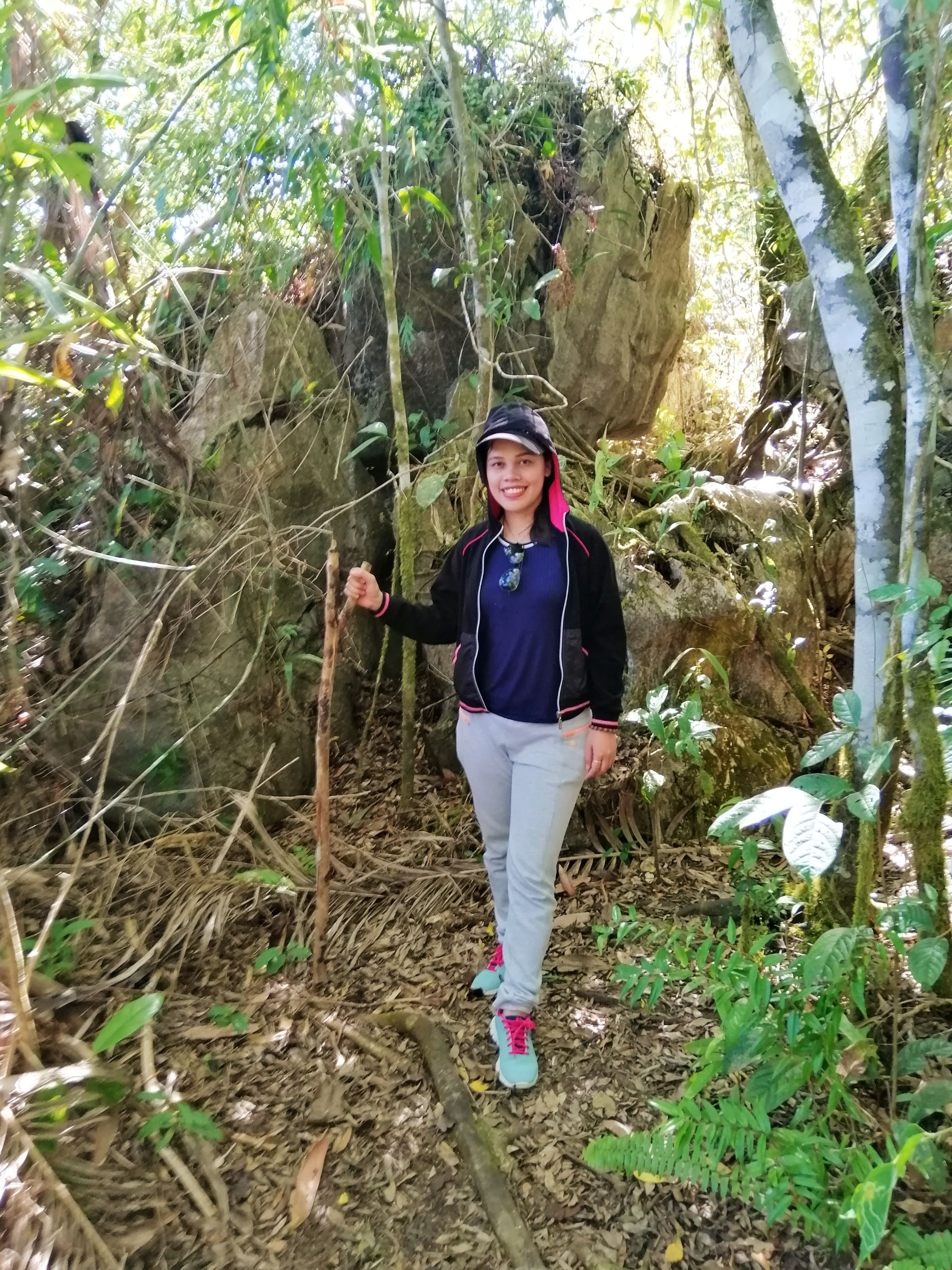
Before hiking up, my aunt, cousin, and I decided to eat first our food since we needed to make ourselves full for the long way up.
After filling our stomachs, we paid the entrance fee of 30 pesos per person. I was overwhelmed when the staff of Mt. Mauyog told us that we needed to have a guide which will cost us 300 pesos. For me it was a bit costly for us so we insisted on not having a guide and told them that we already knew the way up. However, if money is not an issue for you and your group then better have a tour guide to guide and help you carry your belongings.
##
LET'S START THE TREK!
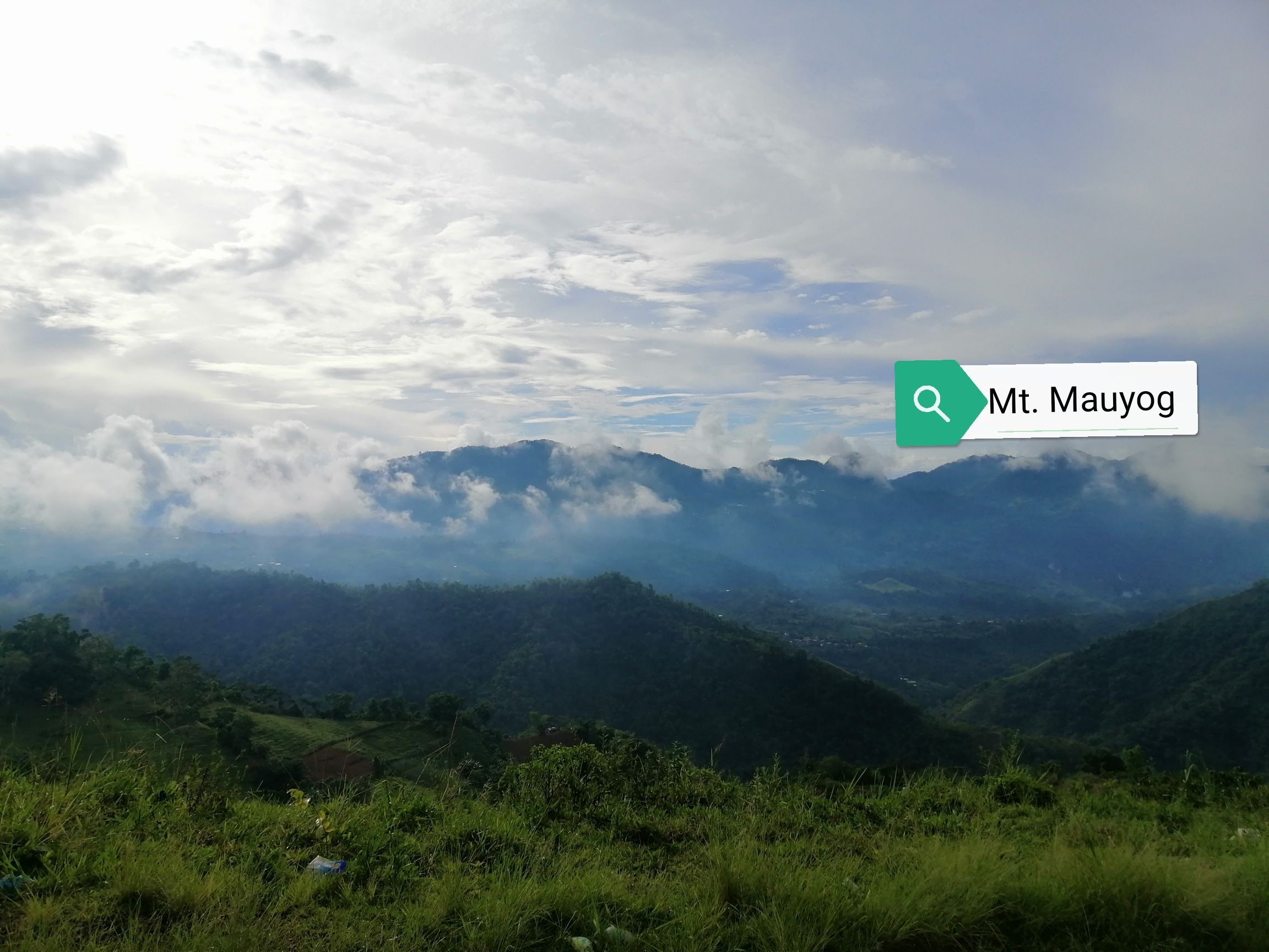
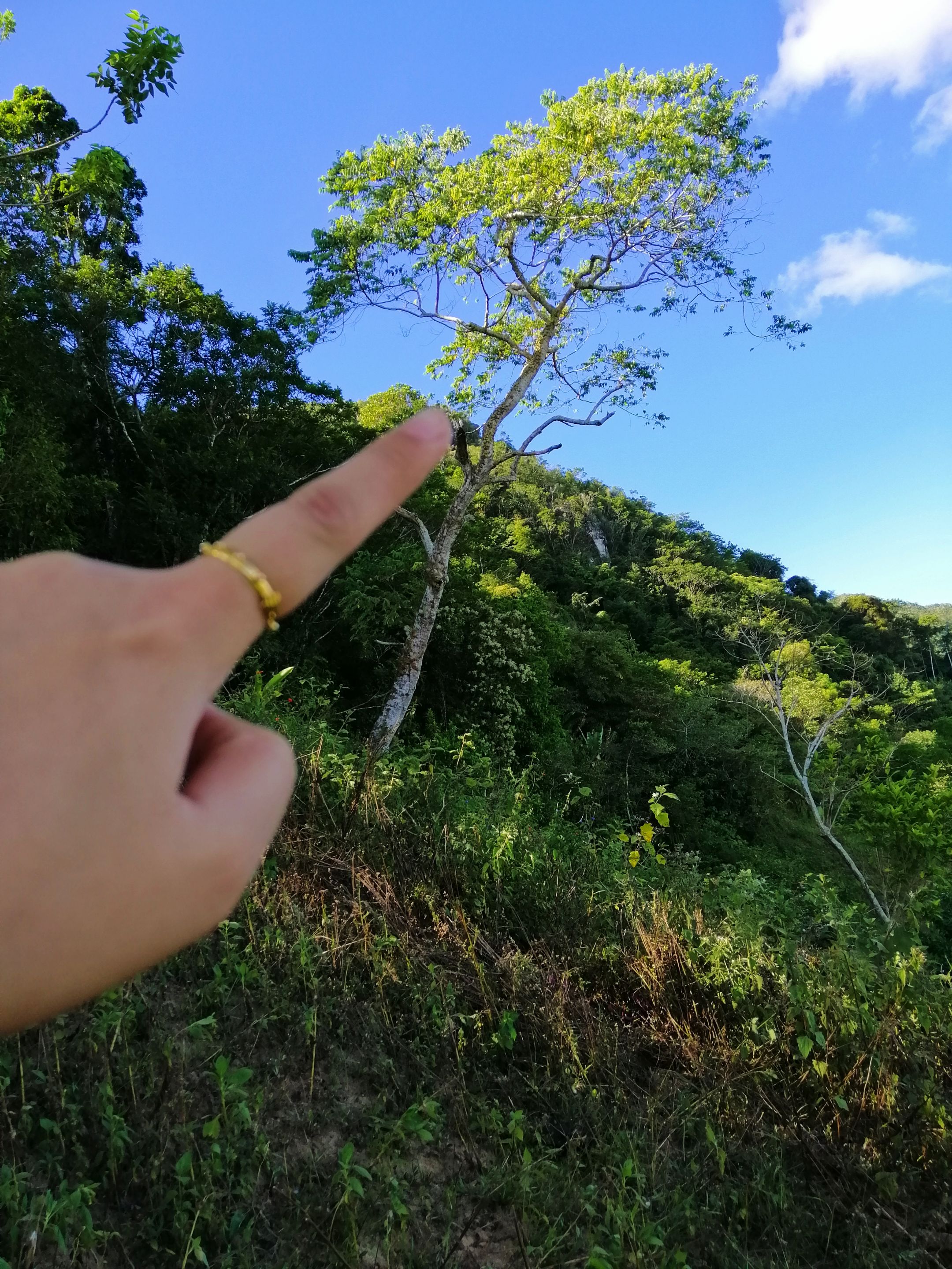
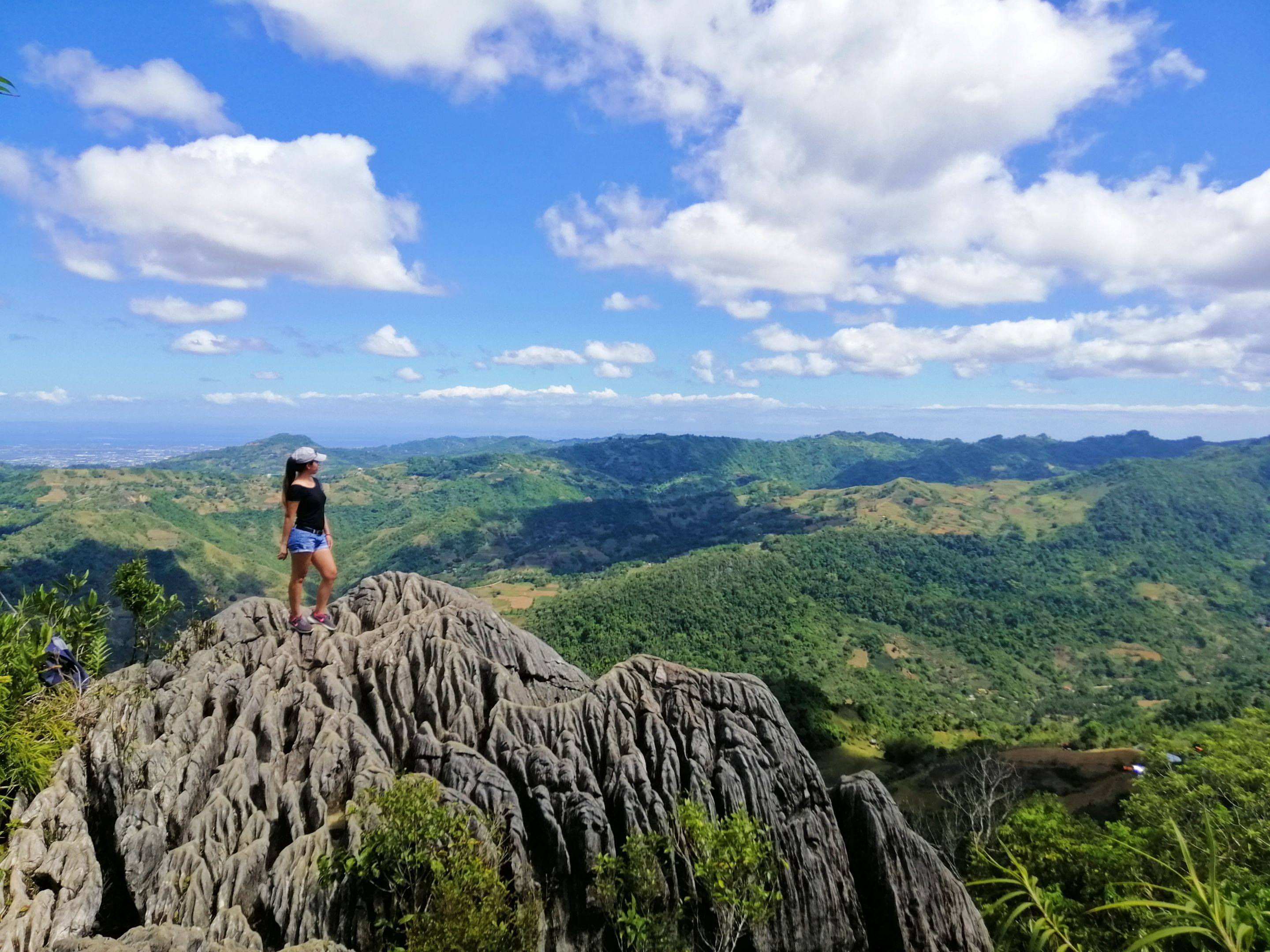
Pointing at the highest peak in Balamban Cebu. From this area, you'll see the rock formation from afar. At first, it looks like the hike up was not so challenging. Later then we found in the middle of our climb that it was very difficult since the way up has steep slopes.
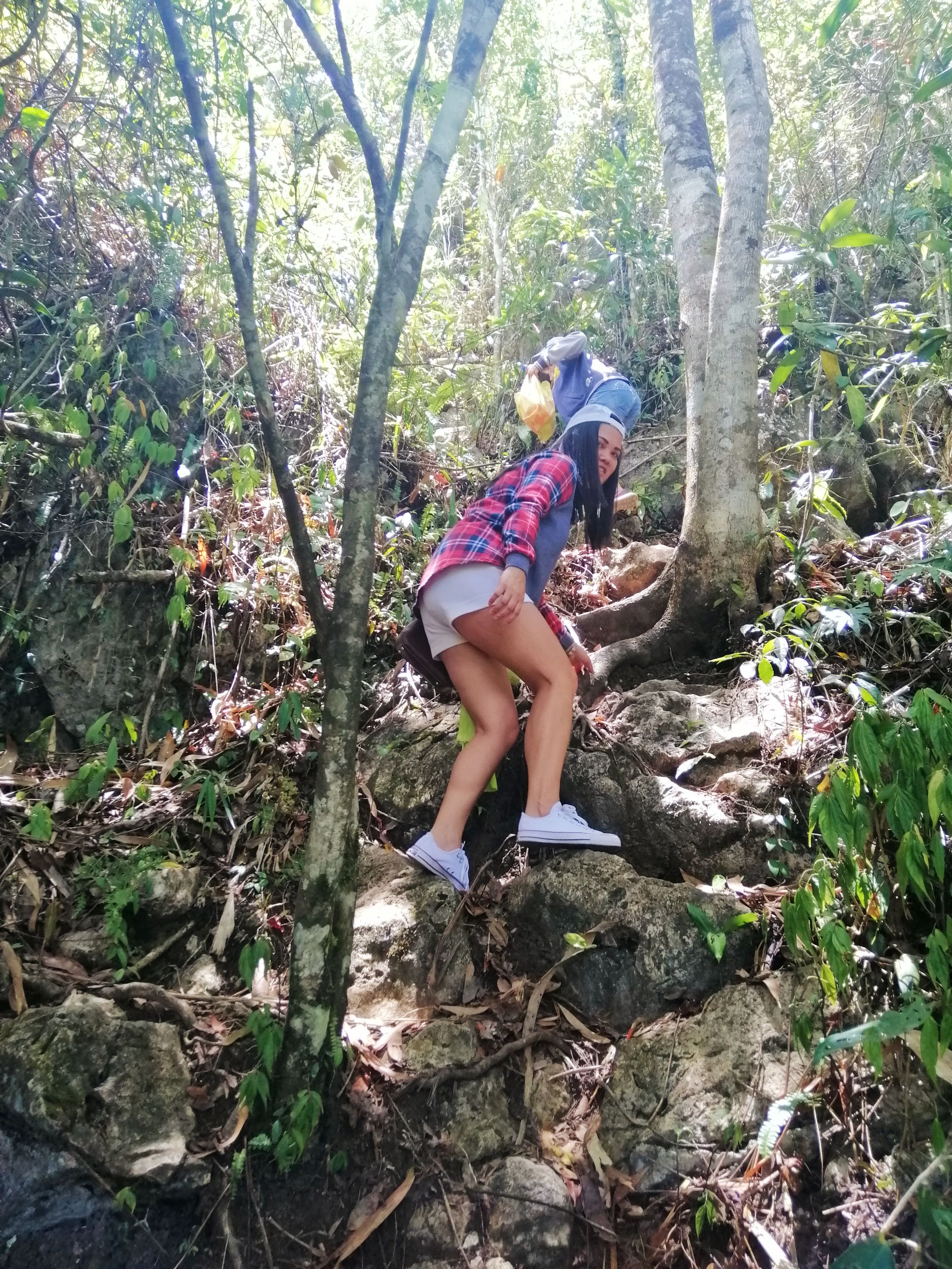
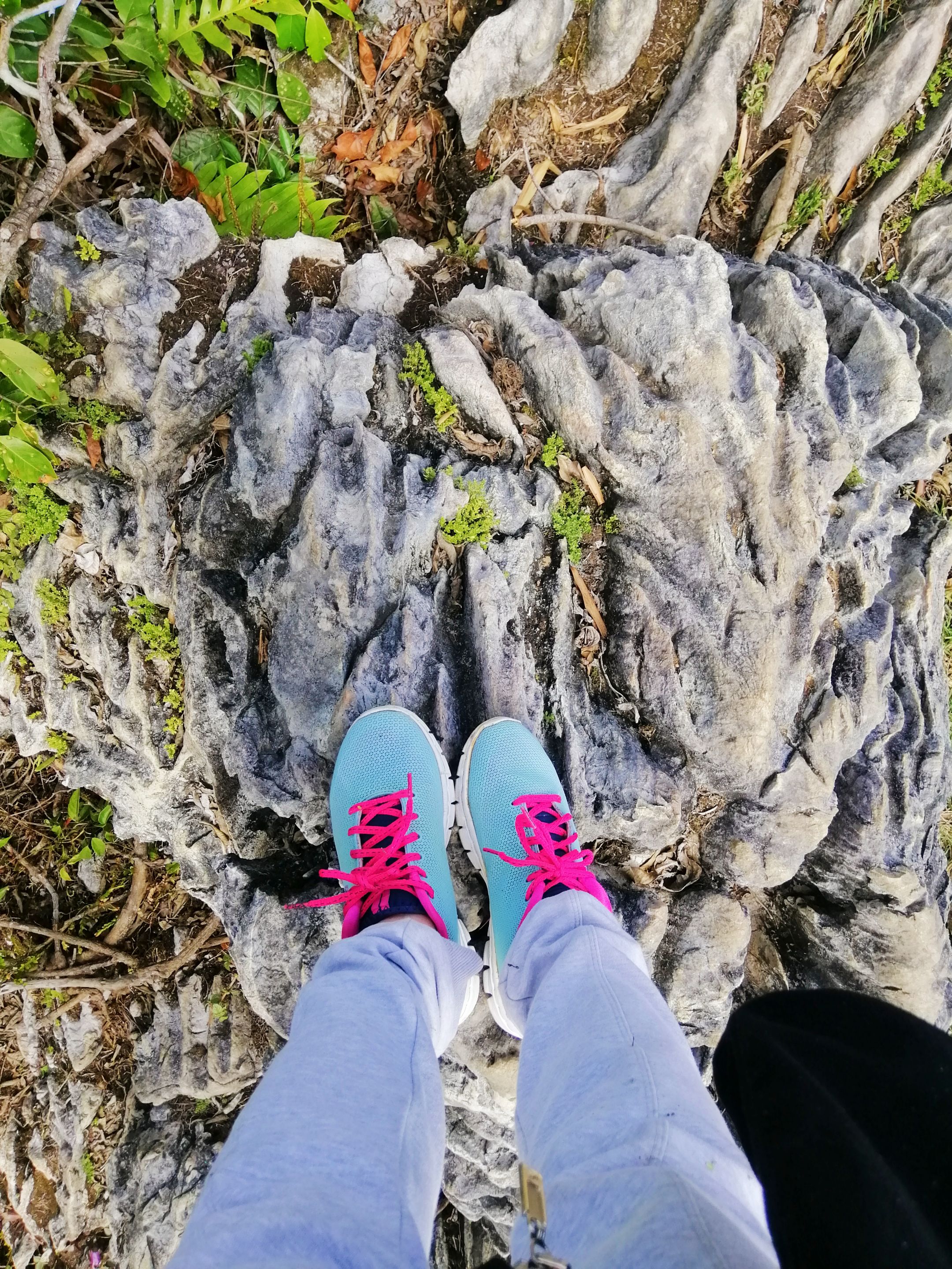
If you are planning to visit this place, do not forget to wear comfortable clothes and shoes and of course bring a bottle of water. We had a hard time climbing since we were not wearing comfortable shoes for hiking. We were not so prepared for this challenging hike.
##
WELCOME TO MT. MAUYOG
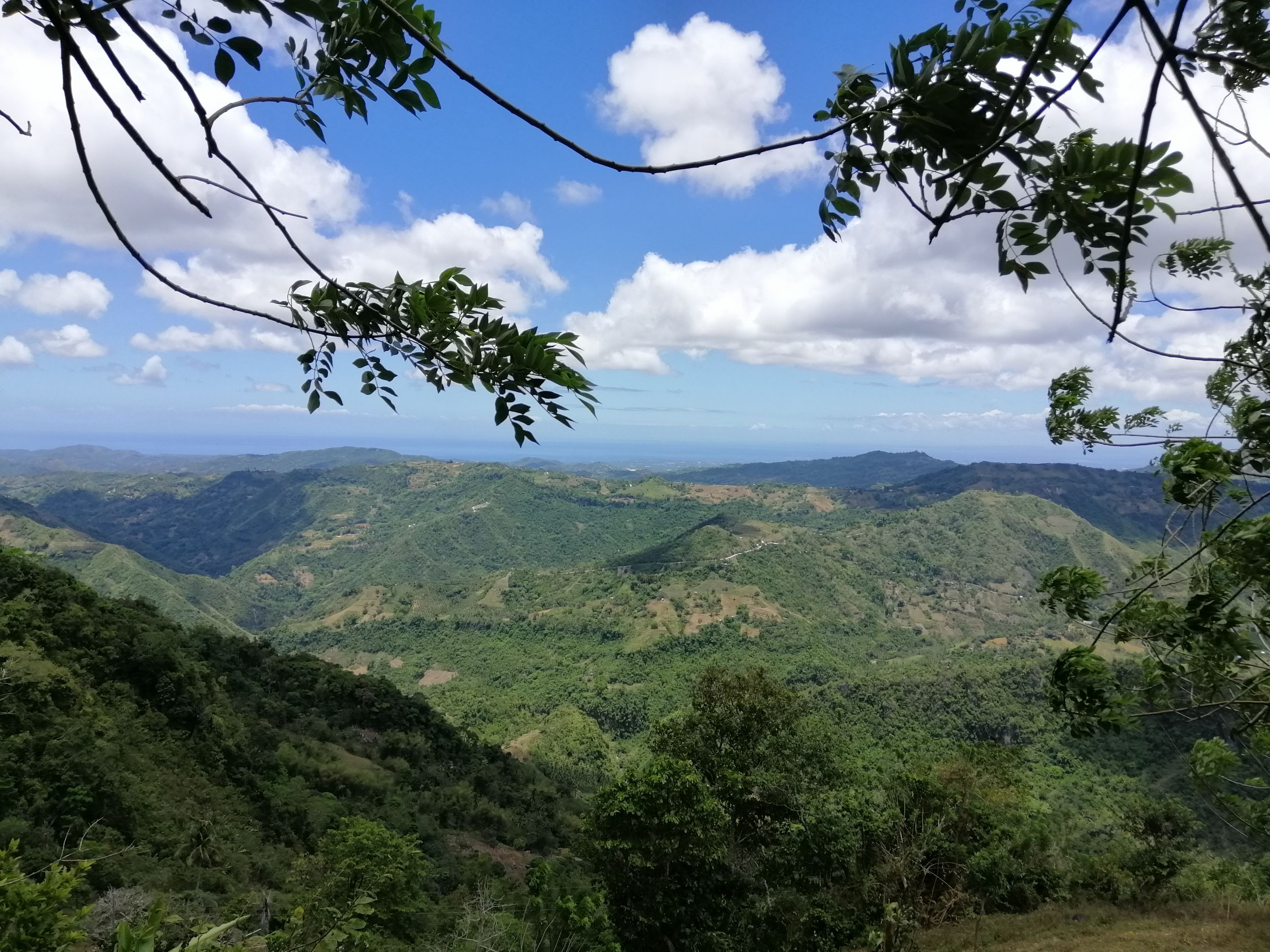
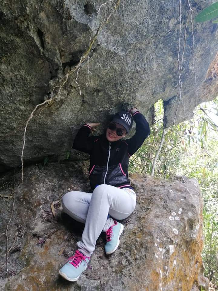
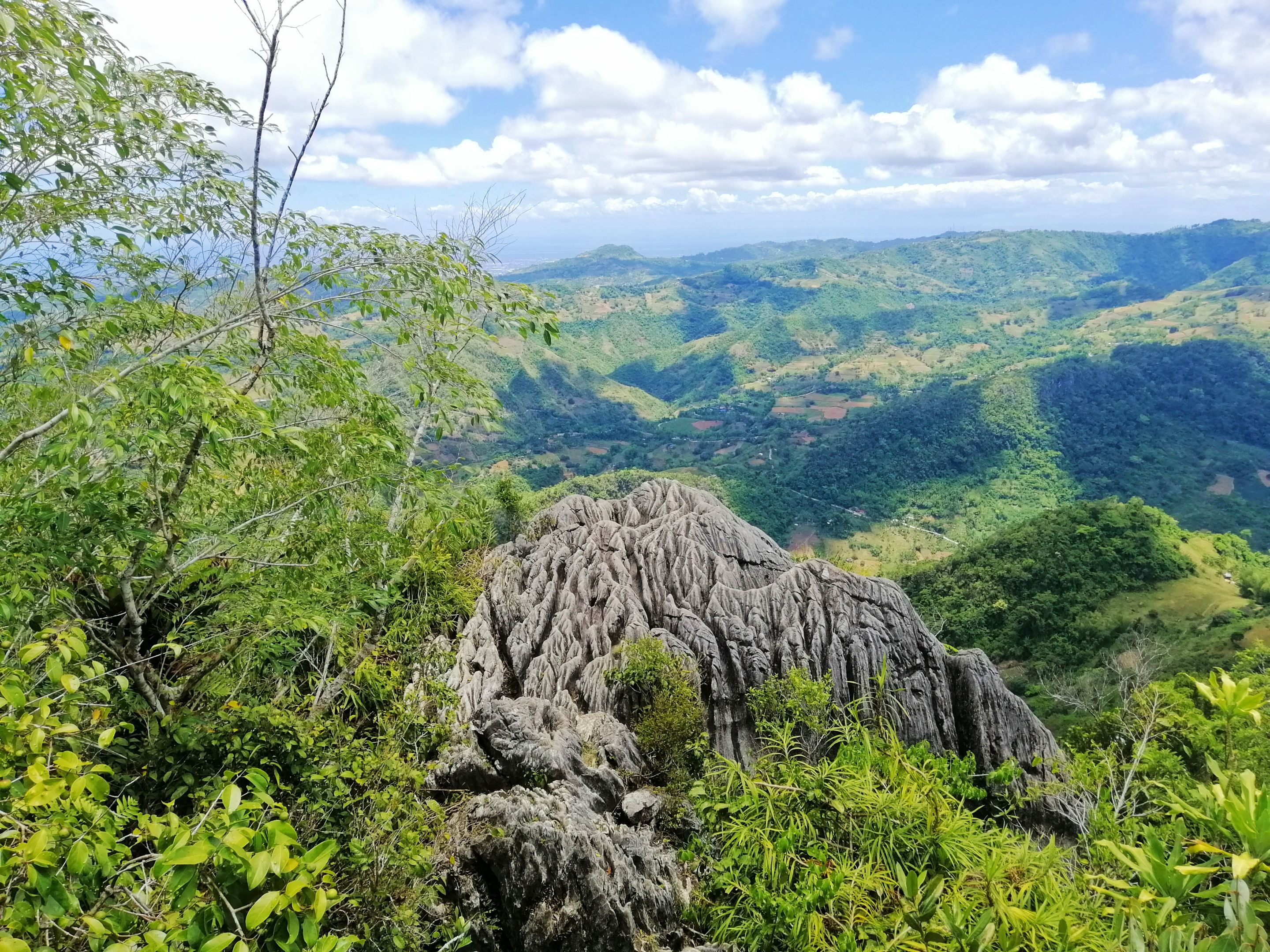
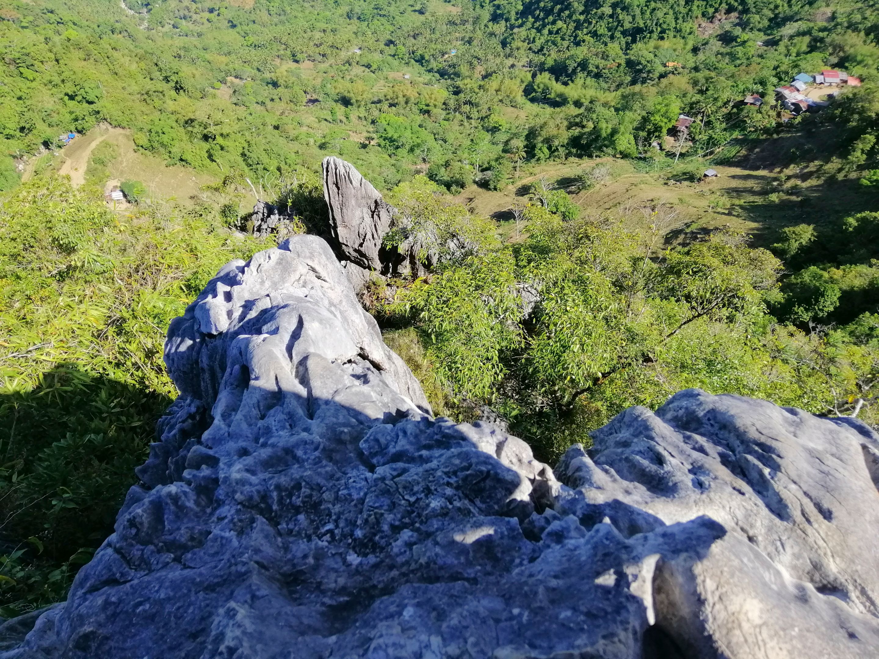
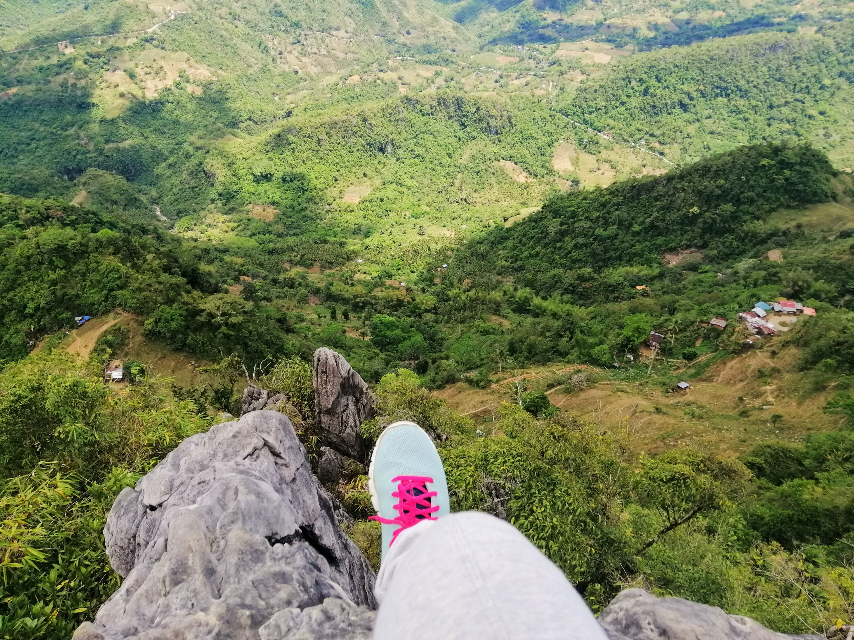
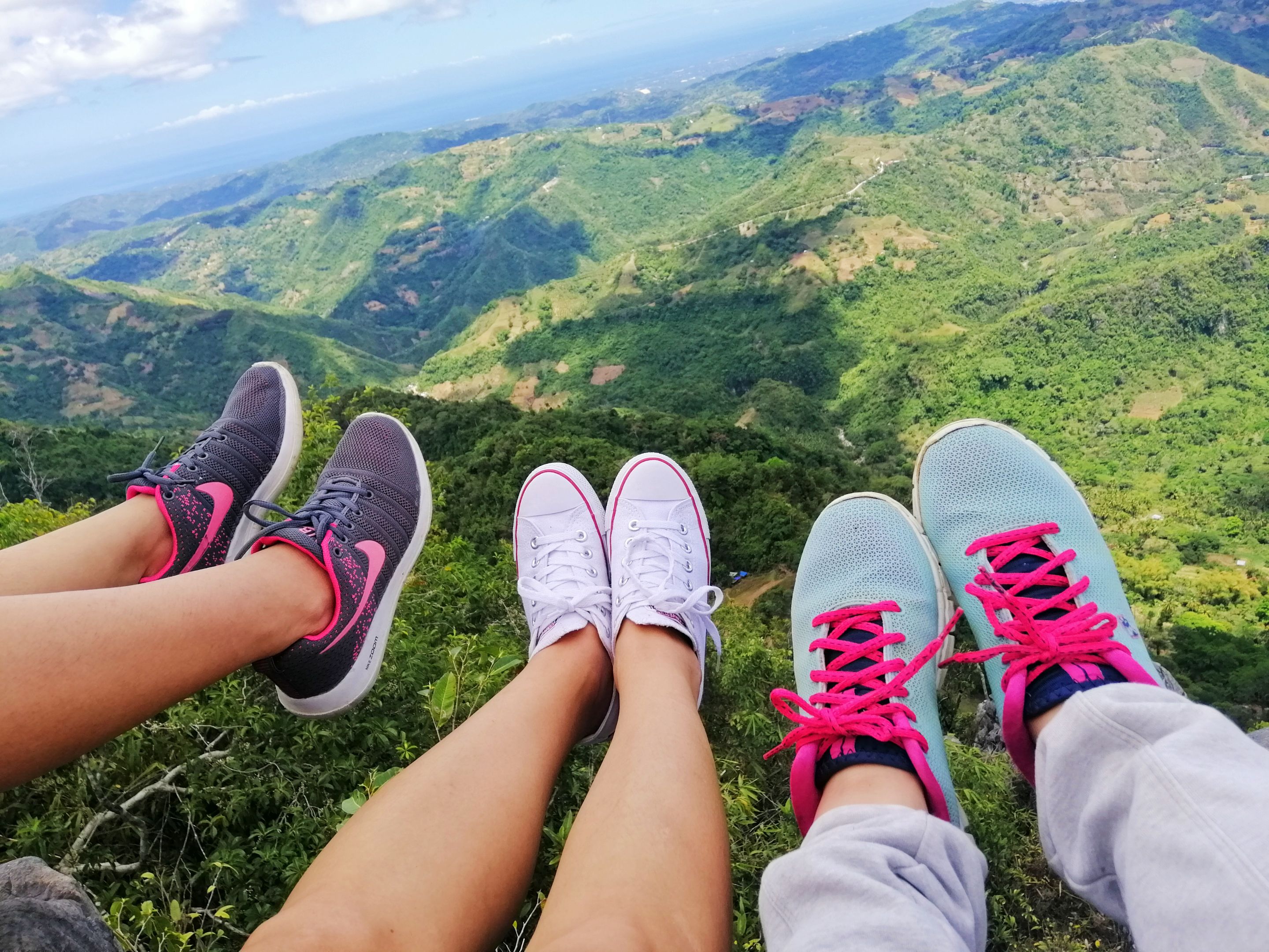
After an hour of hiking in the scorching heat and steep slopes of Mt. Mauyog, finally we arrived. Actually, it took us an hour since we were always resting after the hard parts of the climb. When we reached the summit, we saw the view of the place and it was all worth it. Look at the beautiful rock formation.
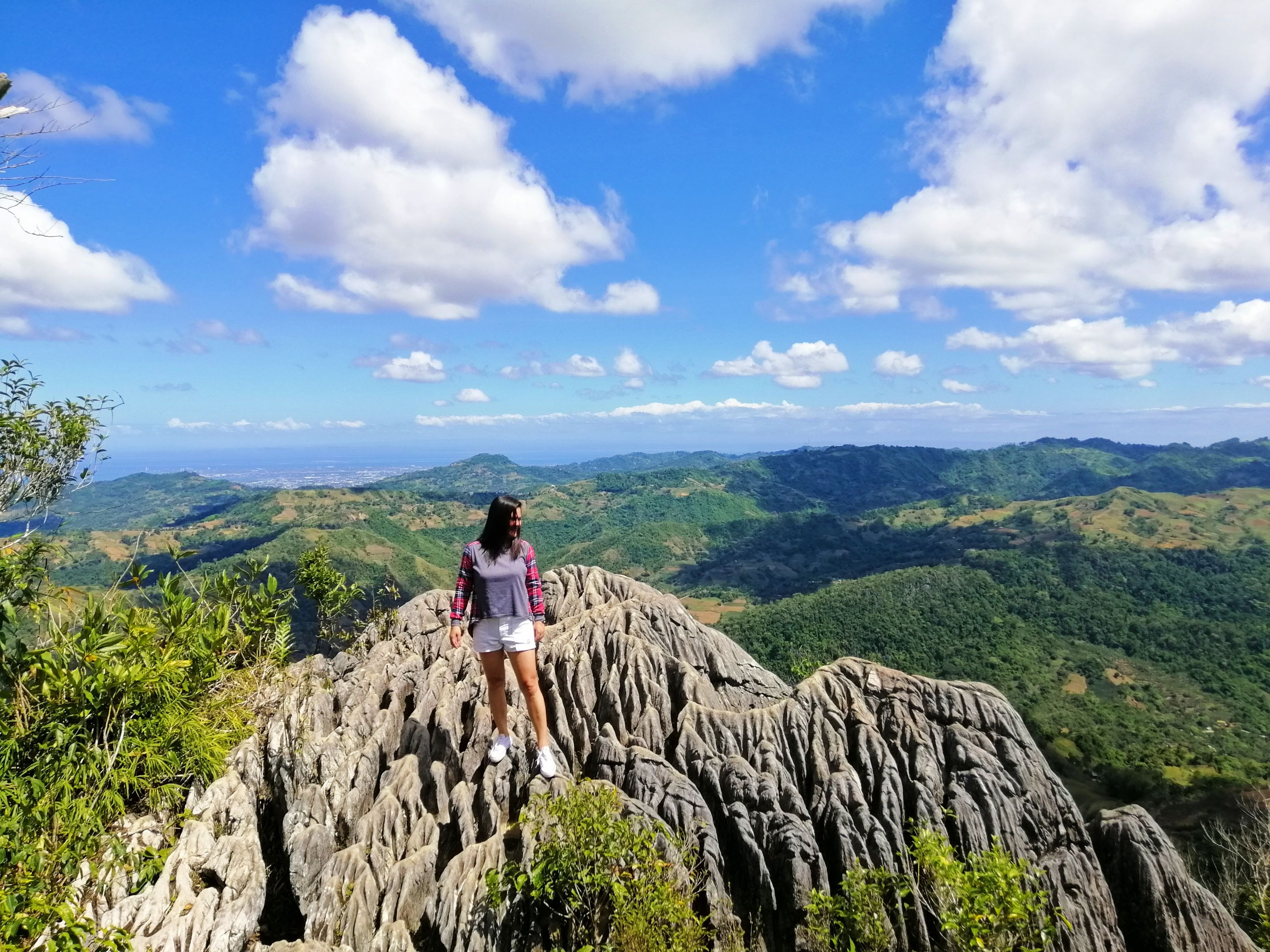
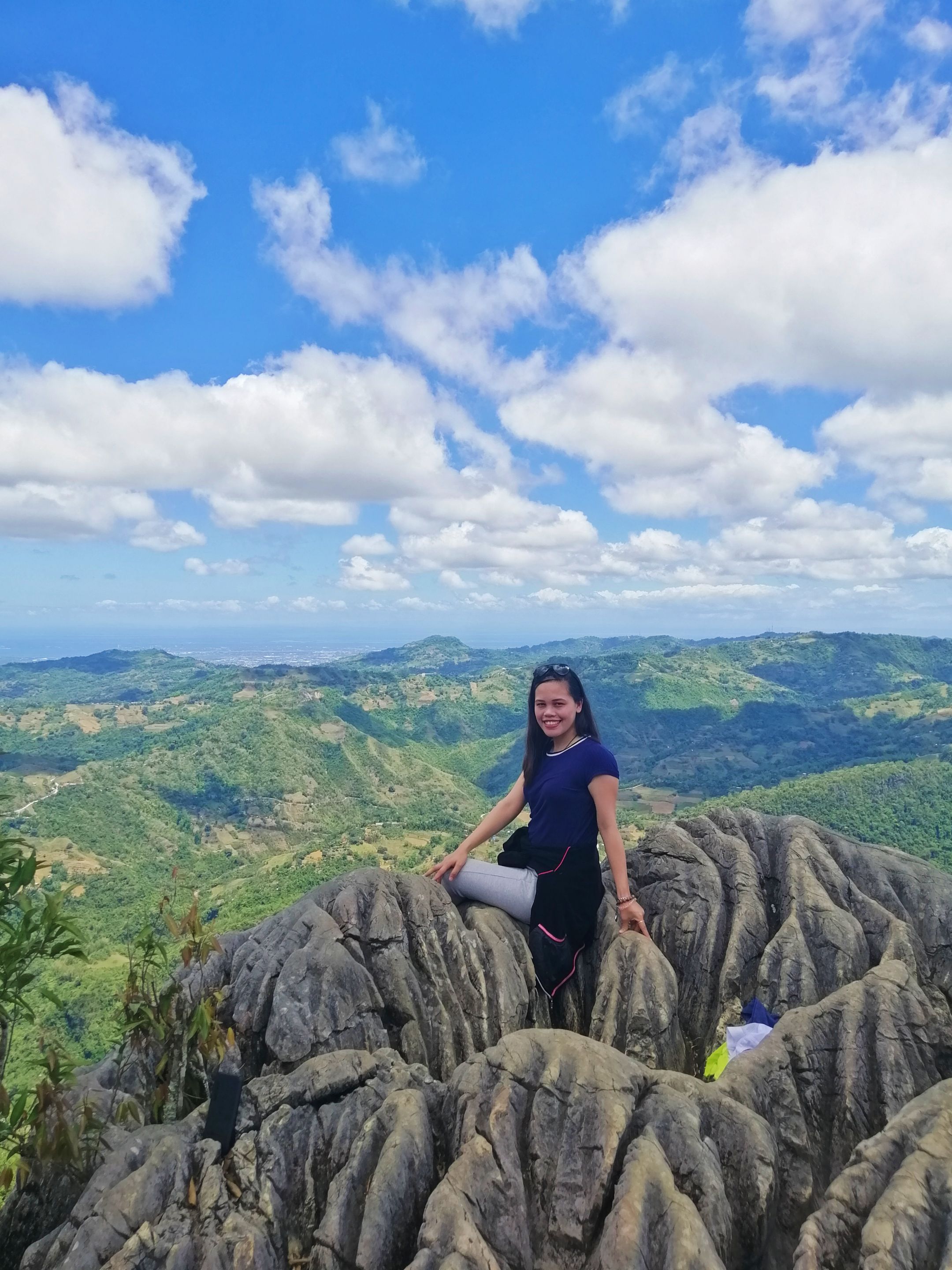
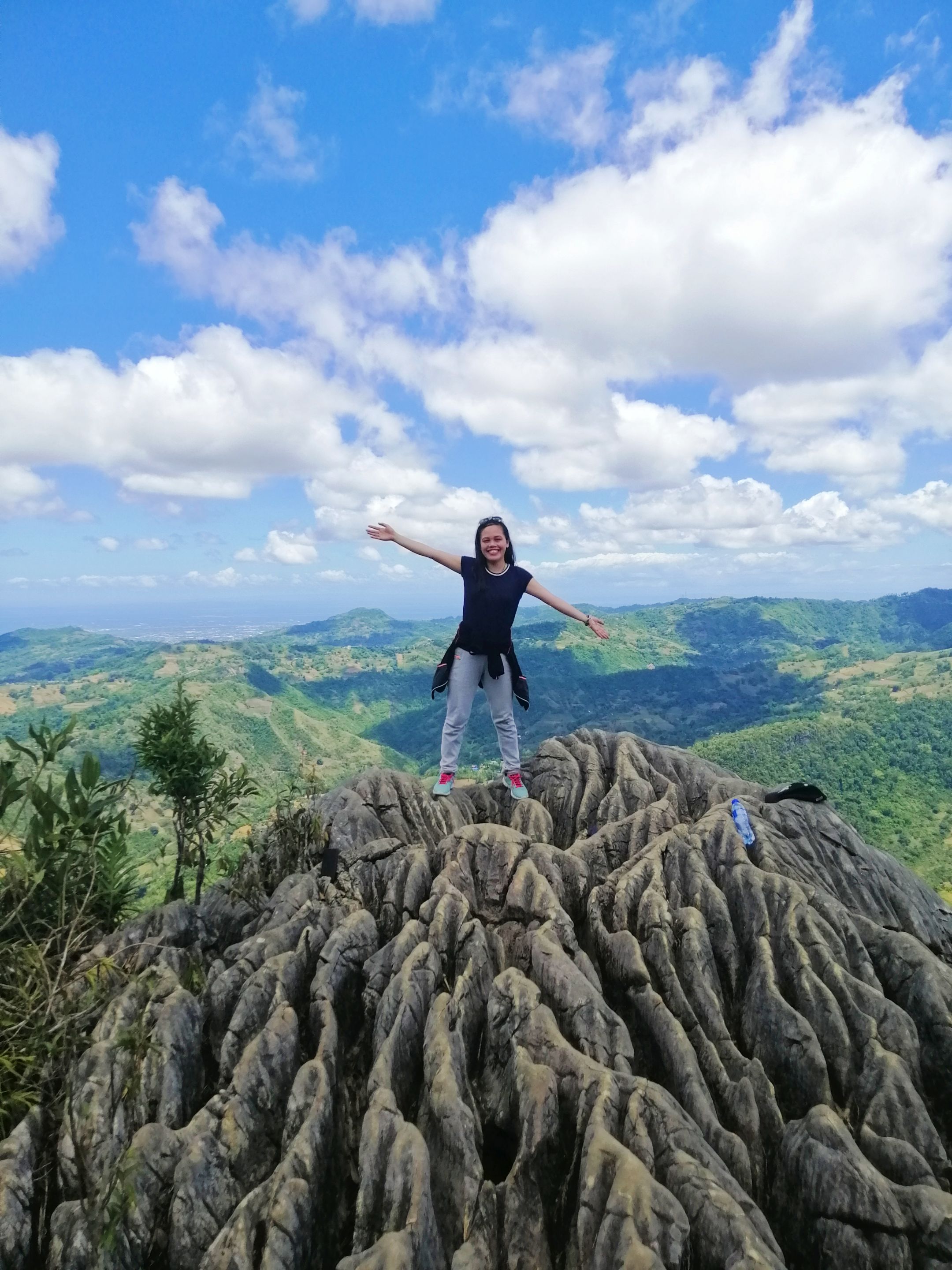
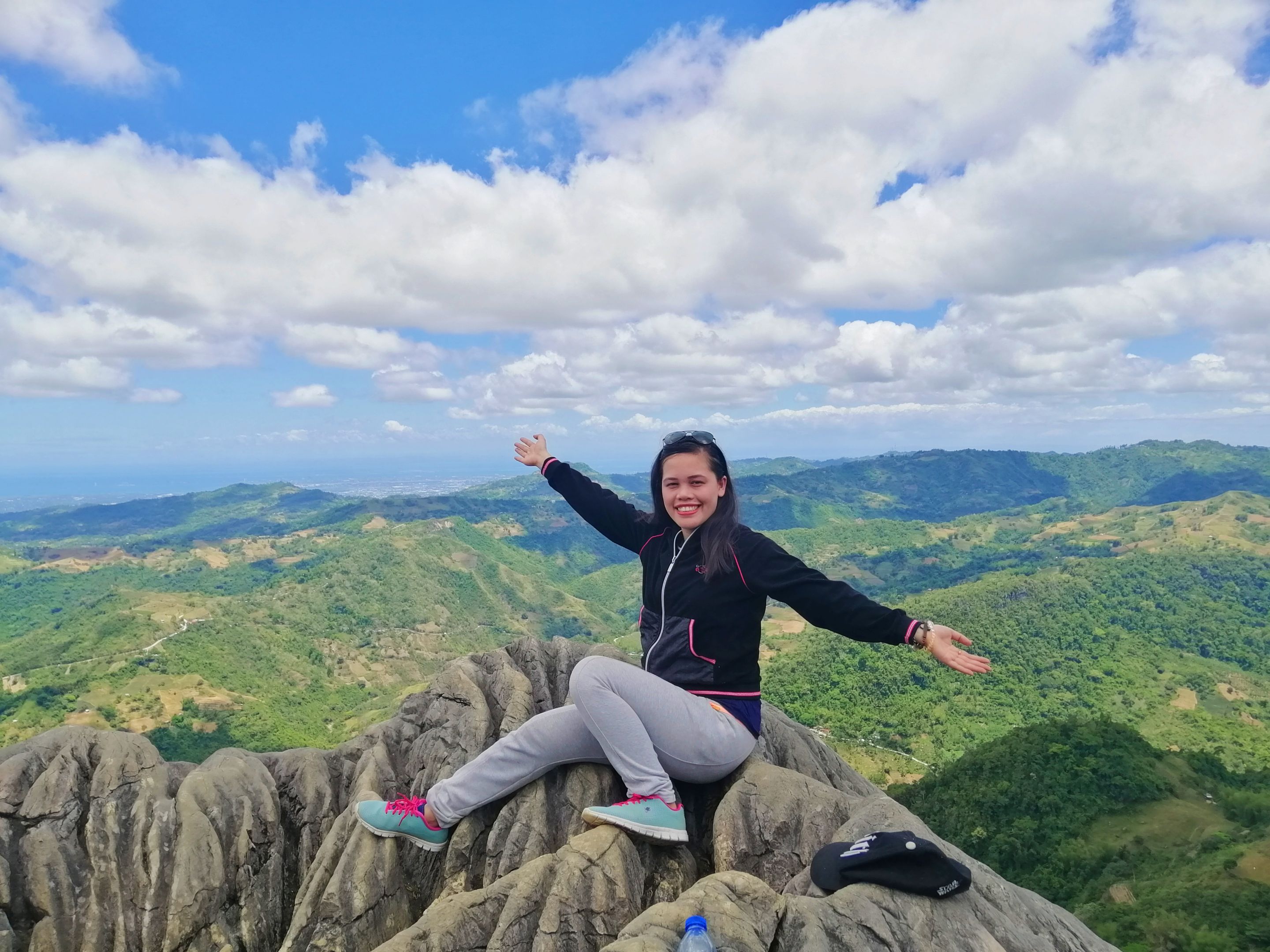
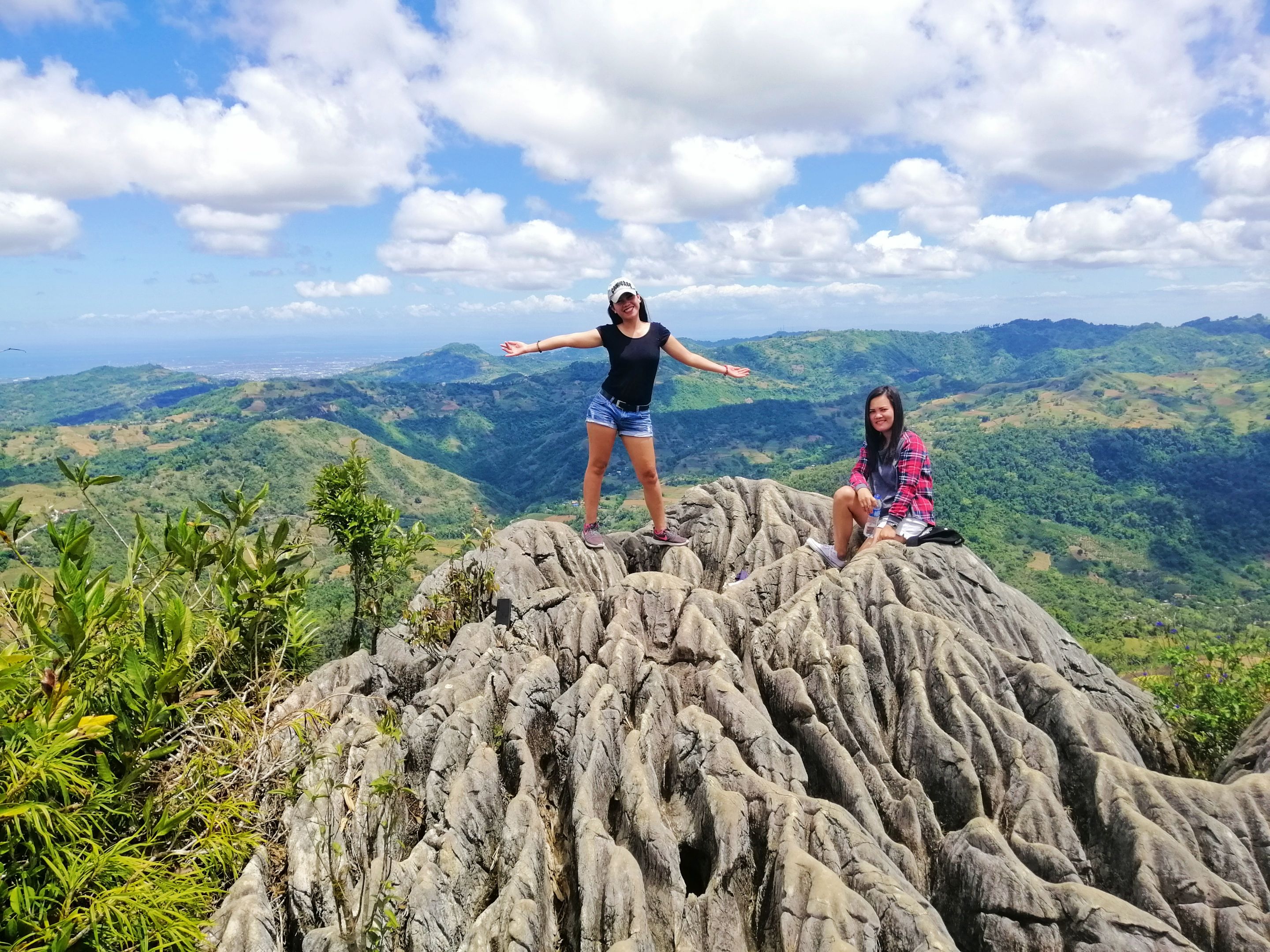
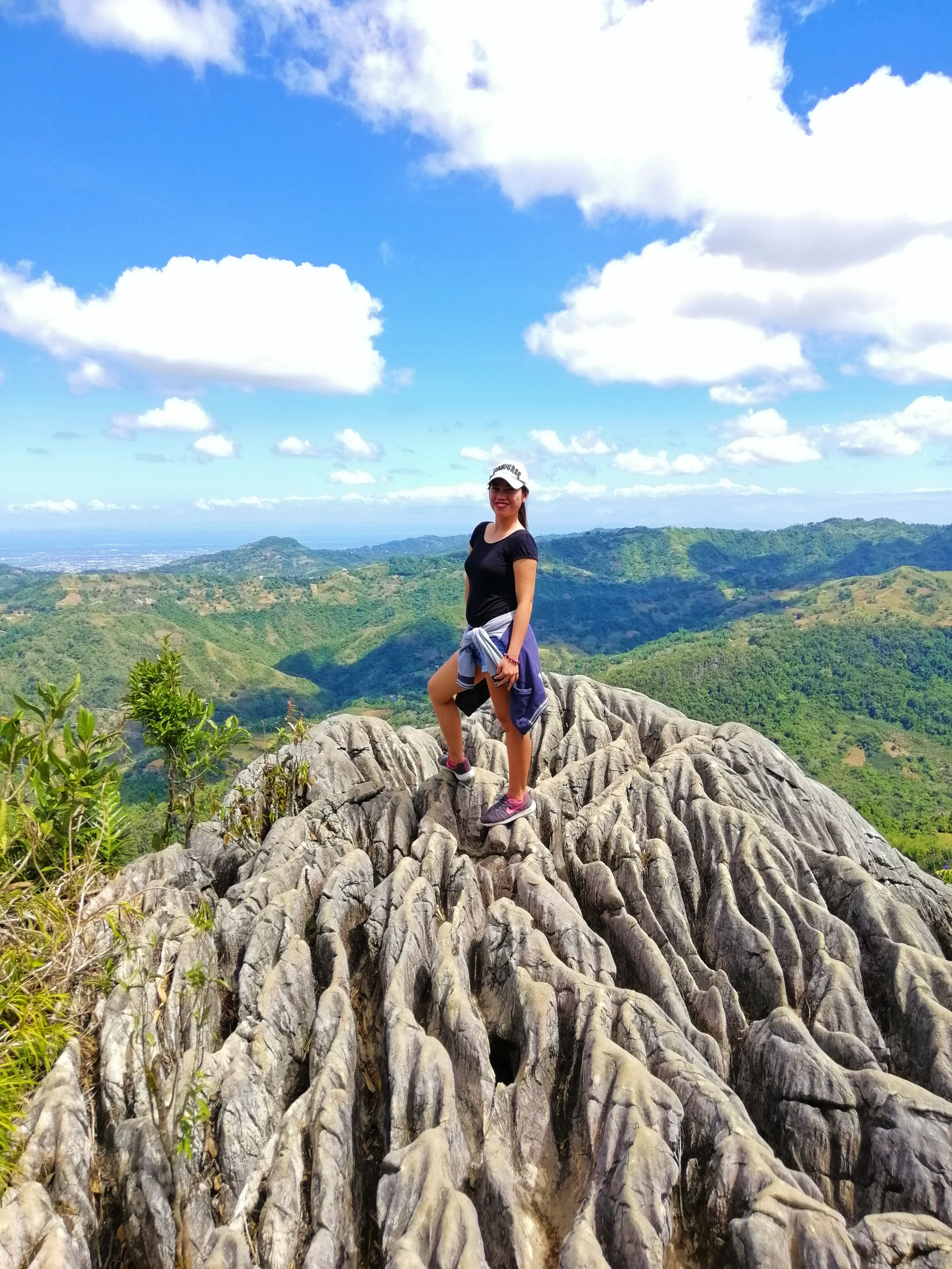
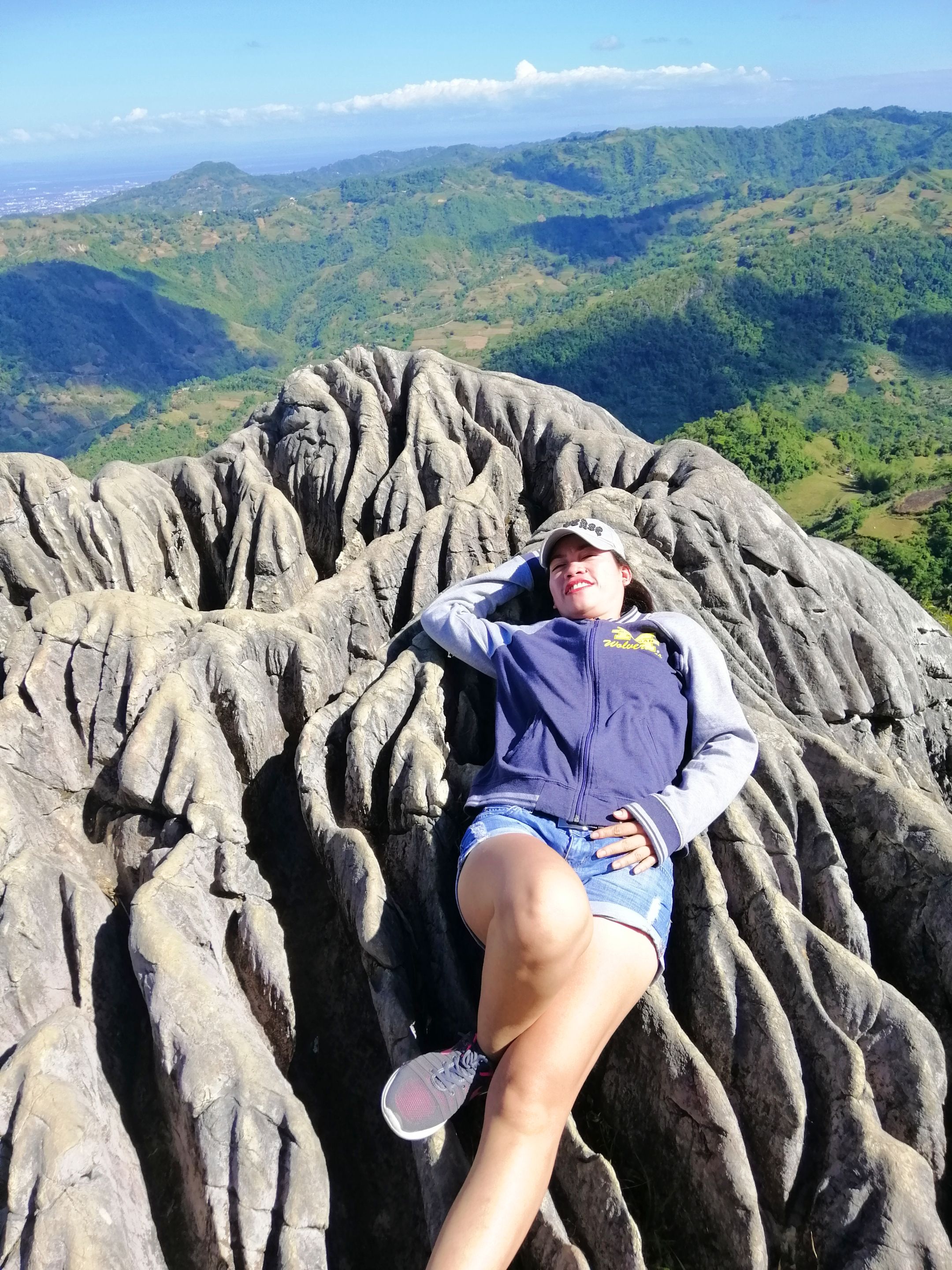
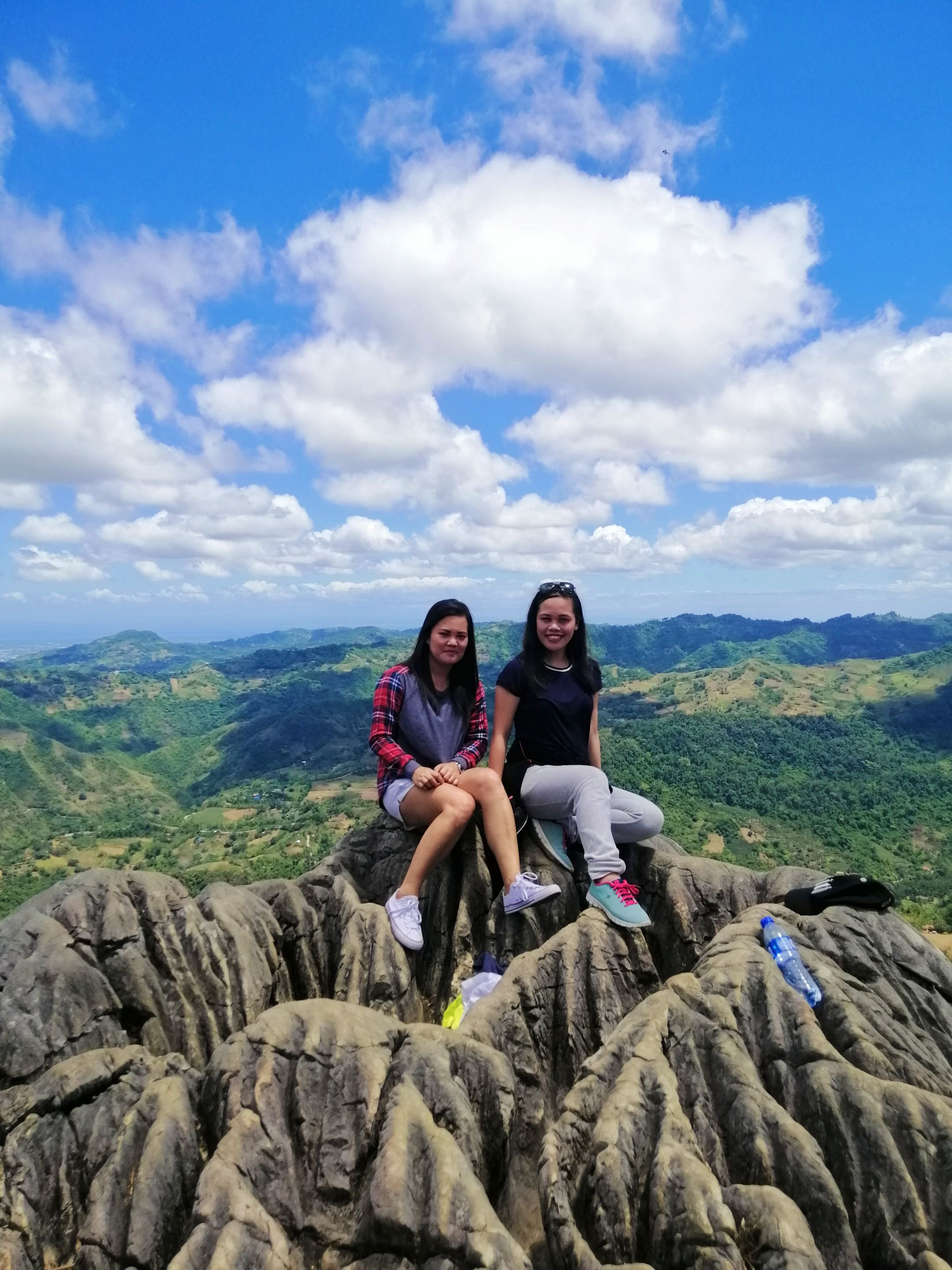
Later on, we went to the best spot of Mt. Mauyog and spent most of our time there appreciating the beauty of nature. We took a lot of photos and took turns in getting pictures. However, we have to be extra careful because when we misstep, we might be in danger.
Subsequently, we proceeded downhill and decided to hike towards Tagbao, Cebu City. From there, we took a habal2x ride since we were a bit tired of hiking for 2 hours.
Thanks to Facebook for reminding me that I should get back to the things that I love doing since I am getting fatter nowadays. I should get back into shape as soon as possible.
##
HOW TO GET THERE
- Take a vhire from Ayala Terminal to Cantipla. From there ride a habal2x (motorcycle taxi) to Barangay Sunog.
##
SIMPLE REMINDERS
- Bring extra money.
- Bring 2 liters of water to keep you hydrated.
- Don't forget to apply sunscreen.
- Wear comfortable clothes ad shoes for hiking.
-----
**THANK YOU FOR READING THIS POST!**
Sabukidblog is a blog of a family who lives in the countryside of Cebu, Philippines. They decided to create a place where they could inspire their readers by sharing their life experiences, food trips, and travel adventures. They will also be sharing their simple life in the rural area.
If you want to read more stories from sabukidblog- an upvote, comment, follow and reblog would mean a lot to them. Join them as they share their stories together. God Bless everyone.
[//]:# (!pinmapple 10.46021 lat 123.82817 long CLIMBING MT. MAUYOG WITH MY AUNT AND COUSIN d3scr)
#mountain
#nature
#pinmapple
#cebu
#philippines
#mountmauyog
Payout: 0.000 HBD
Votes: 660
More interactions (upvote, reblog, reply) coming soon.