Introduction
Hi everyone, friends on Worldmappin! @lauramica presents our Wednesday Travel Digest. I hope you enjoy the places we visited today! ❤️ This time, our featured posts take us to a mountainous area in Mifafí Páramo, Venezuela, along the coast in Benidorm, Spain, and also show us some nature on a hike near Zaragoza, also in Spain. We also visited other parts of the world like Montenegro, Cuba, Argentina, and Malaysia. Thank you all for sharing your posts on the Worldmappin map. Have a wonderful day! 😃❤️
All featured posts are visible on the Editors Choice Map and upvoted by @worldmappin, our curation trail, and potentially @blocktrades. For more travel digests check out #traveldigest.
Our winners today
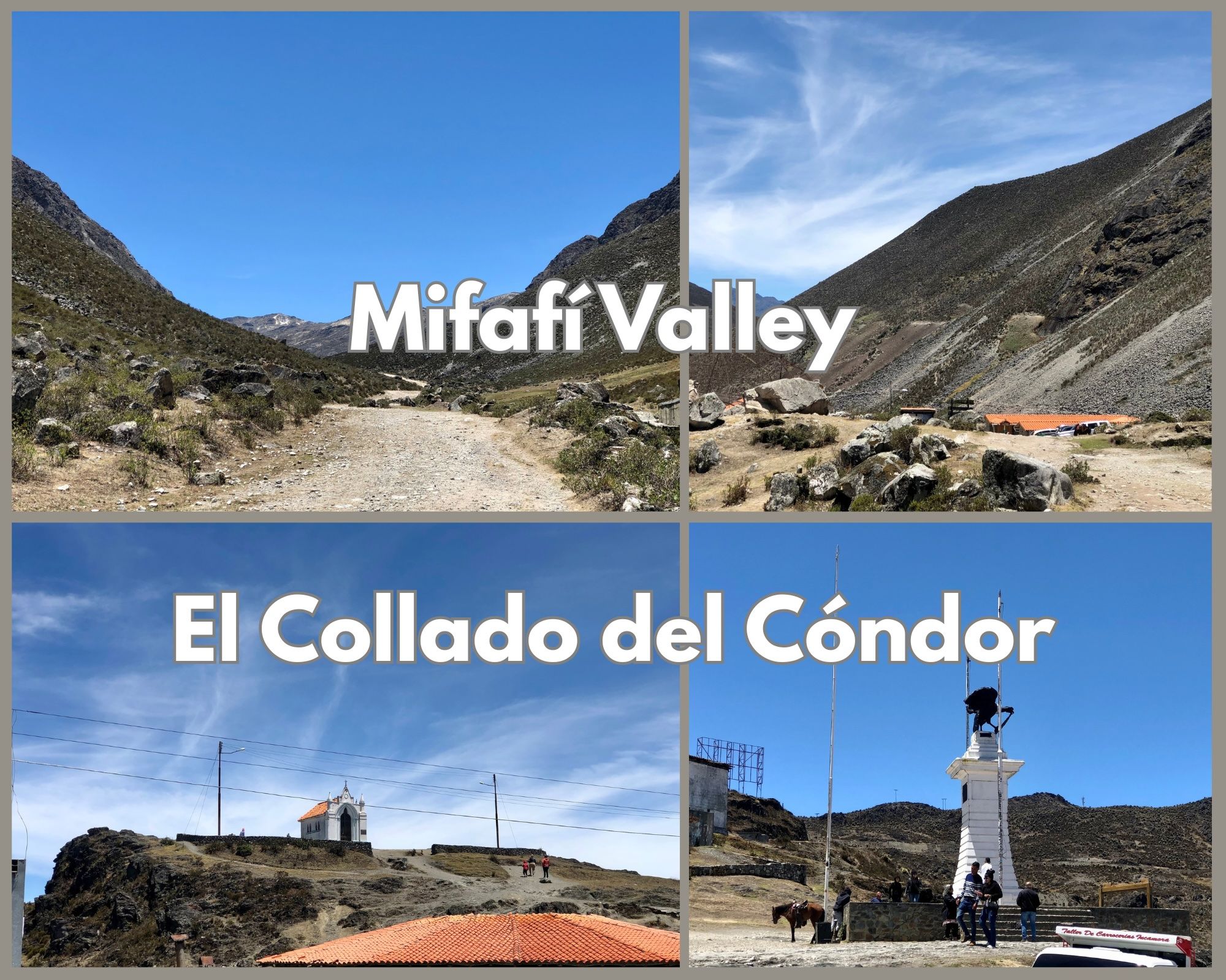
🥇 The Páramo de Mifafí and Collado del Cóndor [Eng-Sp] by @coquicoin
It'been a while since my last post, but let's break my silence with a little trip through the mountains of Venezuela. Today, I invite you to join me on a short journey along one of the sections of the Trans-Andean in the state of Mérida in the Venezuelan Andes to visit El Pico El Aguila. This was one of the trips we took while traveling in Mérida last April. One morning, we took the road with the idea of going to Collado del Cóndor, which is the highest point on the Trans-Andean road. But first we stopped to visit the entrance to the Mifafí Páramo.
This post on Worldmappin - This user on Worldmappin
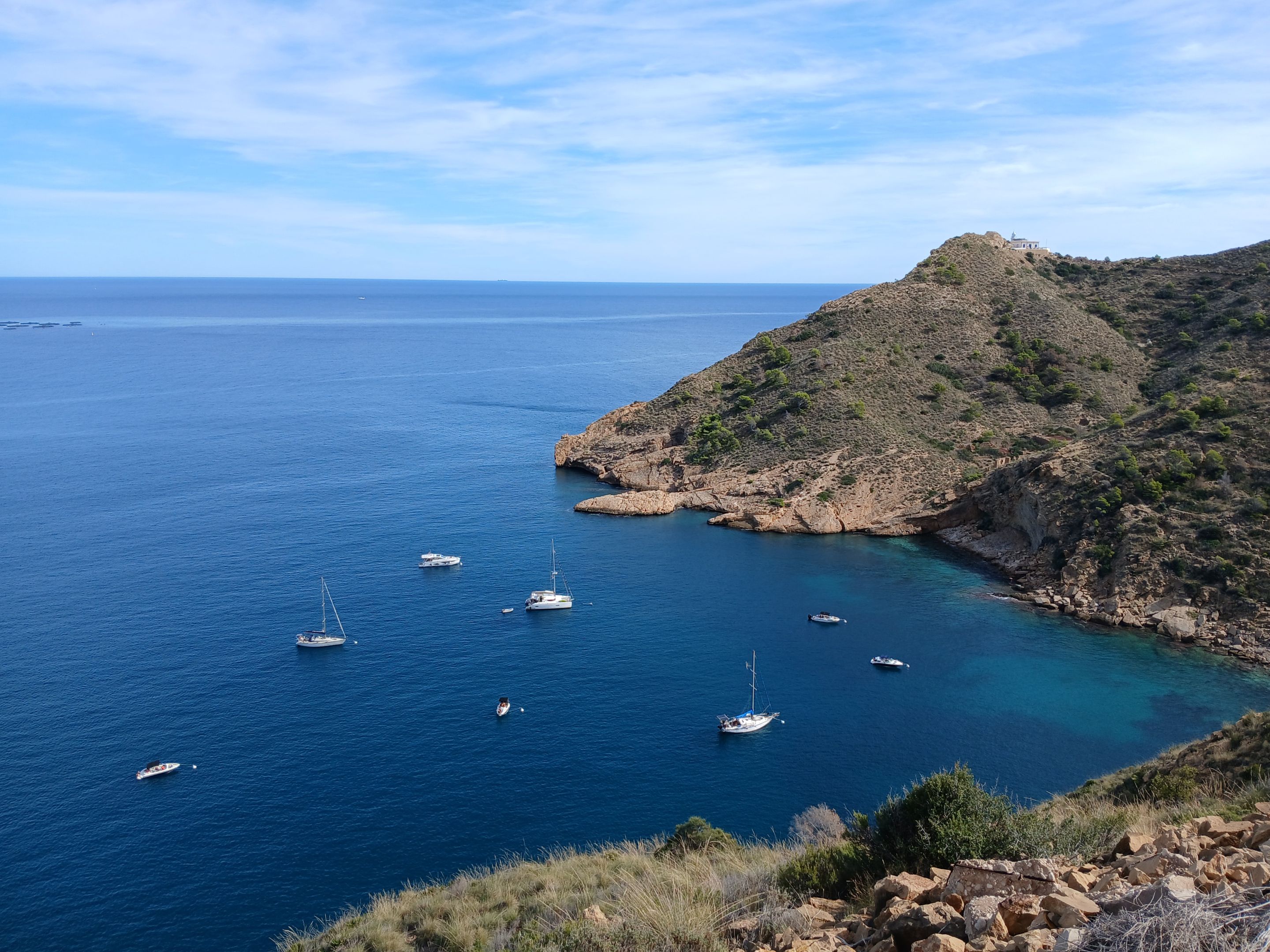
🥈 Halfway to the lighthouse by @mipiano
Although I have walked these paths countless times, especially the one leading to the lighthouse, I always like to see aerial footage as well as pictures from the other side of Serra Gelada. We once visited a part of this park that can only be approached from the sea by catamaran, where we saw these high cliffs and how completely different this mountain is from that other side.
This post on Worldmappin - This user on Worldmappin
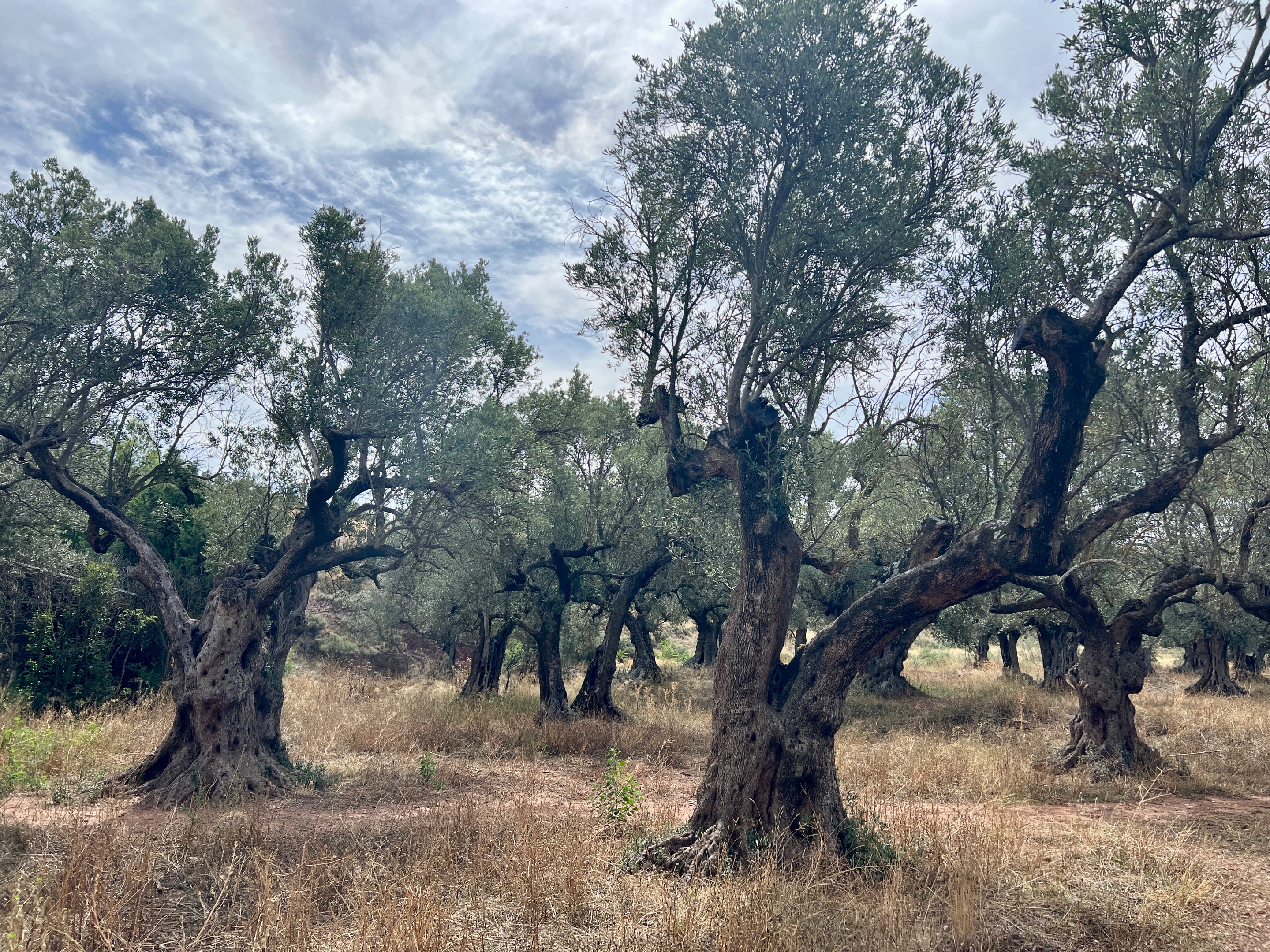
🥉 Paseo entre olivos y carrascas // Walk among olive trees and holm oaks by @palomap3
The Rodanas Sanctuary, in addition to its heritage, cultural and identity value, is the starting point for a variety of hiking trails suitable for all types of people. On the day we visited the sanctuary, we took the opportunity to walk the easy trail that I am sharing here today. Enjoying nature is not incompatible with new technologies. The council of Épila, the municipality where we are, provides all the routes we can take via QR codes that can be scanned. As you can see, we have up to 20 different ones to choose from. The only thing I missed was that, in addition to the name, they indicated the distance to be covered and the level of difficulty of each route.
This post on Worldmappin - This user on Worldmappin
Honorable Mentions
- Fushimi Inari Taisha, Kyoto, Japan by @azircon
- Exploring Havana, Cuba by @davidsantafe
- Cinfães Village - Main Church Garden, Portugal by @onyfest
- Havana, history between cobblestones, Cuba by @lileisabel
- We arrive at the Tatacoa Desert, Neiva, Colombia by @cristianm
- A Journey to Faith Report: El Cobre, Santiago de Cuba, Cuba by @neuropoeta
- Living in a coastal city has its perks, Corrientes, Argentina by @jlufer
- Balwearie Road along Windygate to the Mill Dam, UK by @tengolotodo
- Trip to Batu Caves, Kuala Lumpur with Hivefest10 Attendees, Malaysia by @rivalzzz
- A walk through the small Croatian seaside town of Biograd na Moru, Croatia by @rsphotos
- Exploring the Castle ruins of CHÂTEAU DE LA PRUNE-AU-POT XV in CEAULMONT FRANCE by @littlebee4
- Siu Puong, A Majestic Waterfall Deep In The Jungle, Vietnam by @dodovietnam
- Boats, sea, rocks, park, the horizon, the past and immensity, Málaga, Spain by @avdesing
- The Whispering City of the Middle Ages: Kotor, Montenegro by @bilginhilal
- Exploring the Pyramids of Giza, Egypt by @elevator09
Support WorldMappin and join the Worldmappin community
The more support we get, the more we can give back! Want to help?Delegate to WorldMappin!
Follow our curation trail
Upvote the Traveldigest
Want to know more about what we're up to next?
Join our Discord
Let's have more Pins of the world with Worldmappin!
Vote for our proposal (#348) on Peakd.com
Vote for our proposal (#348) on Ecency
Vote for our Proposal (#348) on Hive.blog
Vote for our Proposal (#348) using HiveSigner
Thank you for your support!