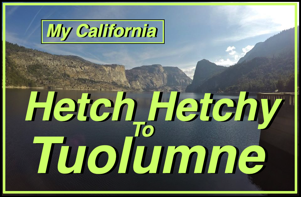
For this weeks [Show Us Your California](https://peakd.com/mycalifornia/@thesocalhive/show-us-your-california-contest-week-1) contest by @thesocalhive I share a backpacking trip with my mom in northern Yosemite from...
Hetch Hetchy to Tuolumne!!

We woke up early at the Crane Flats campground in Yosemite national park. We got our backpacks loaded up and ready to go. We drove out to the Hetch Hetchy reservoir, parked the truck and hiked down to the O'Shaughnessy Dam!
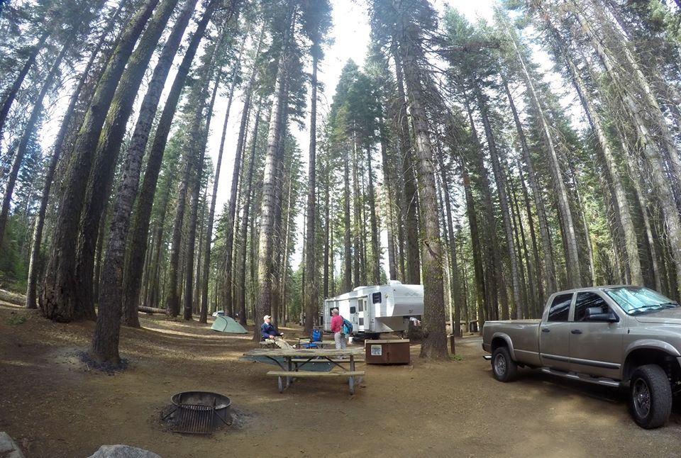 Crane Flats campground
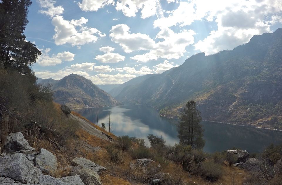
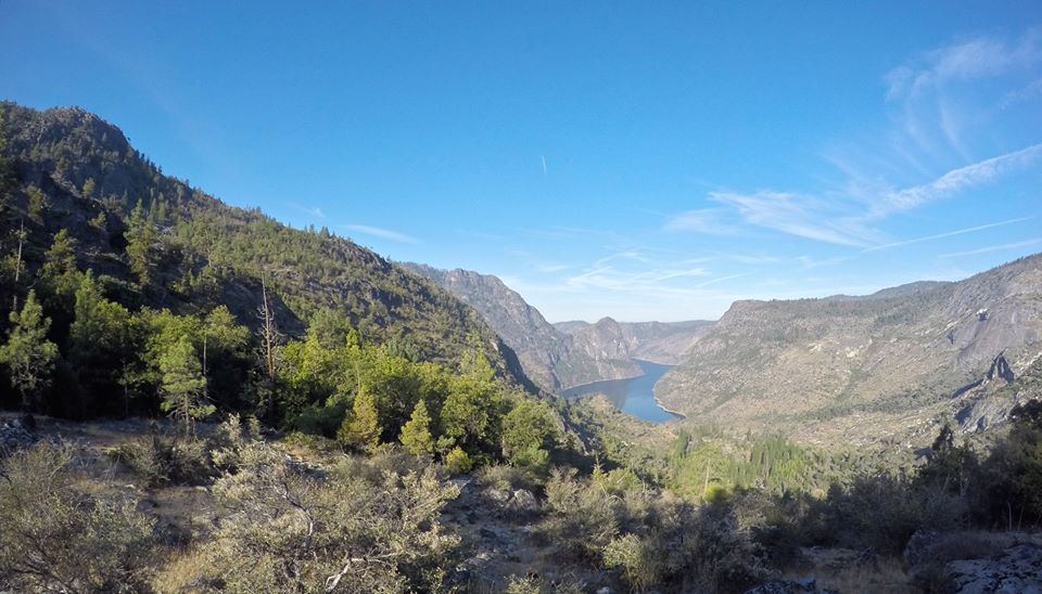
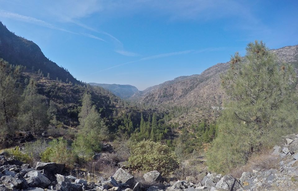 Overlooking Poopenaut valley
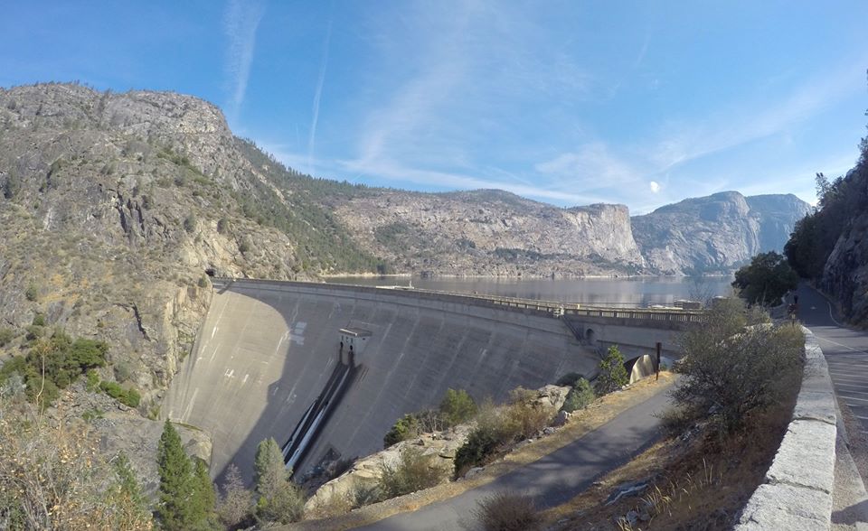 The O'Shaughnessy Dam
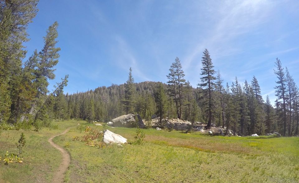
 Hiking around Hetch Hetchy
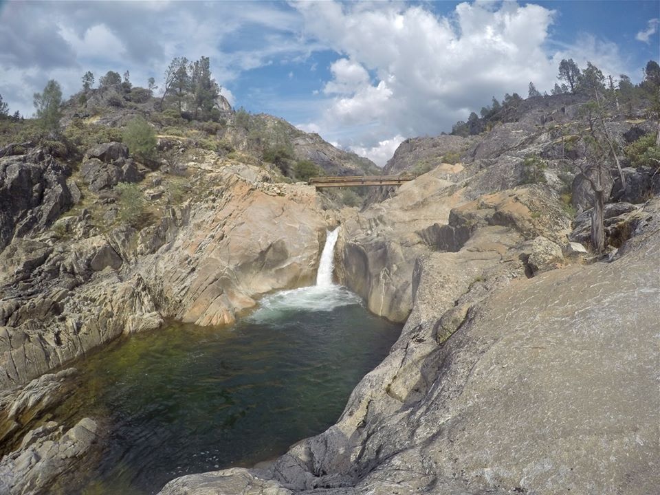
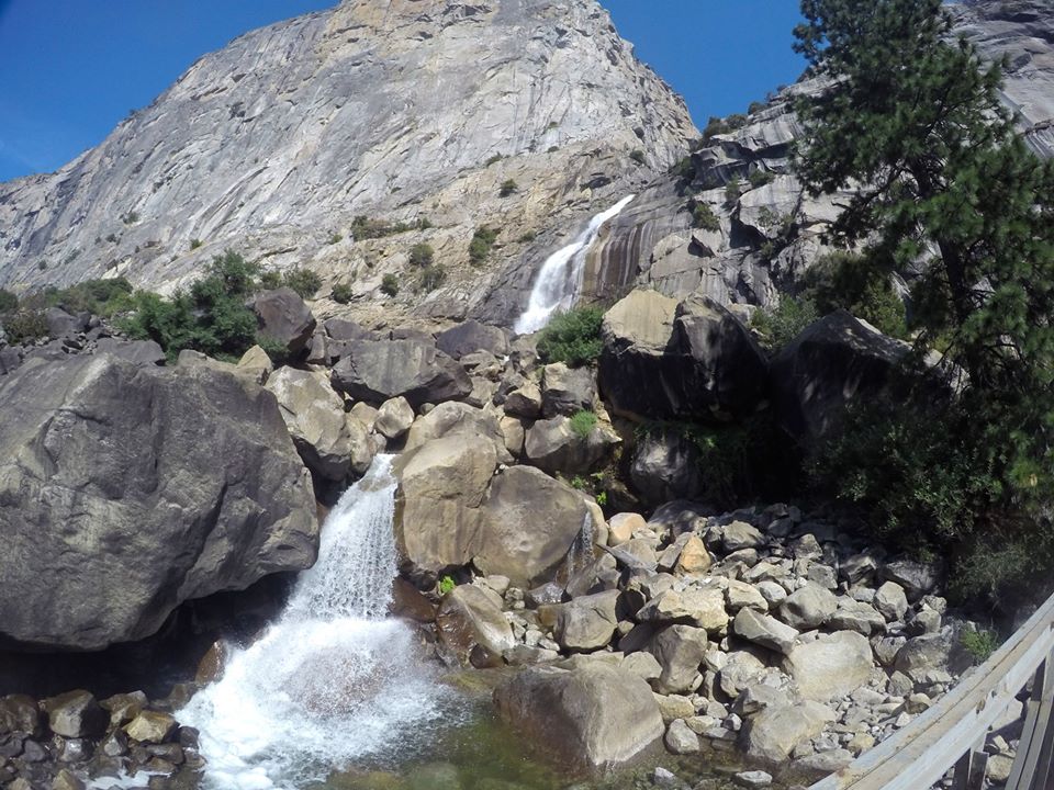 Wapama falls
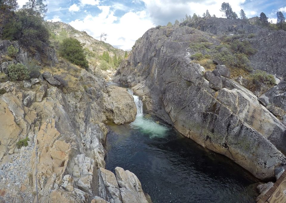
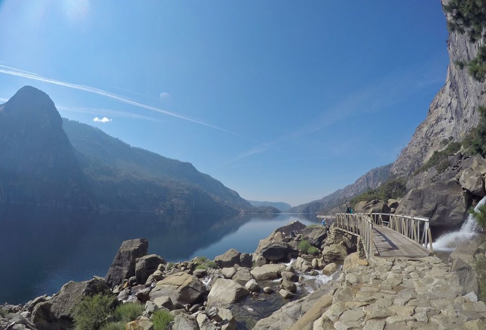 The bridge below Wapama falls
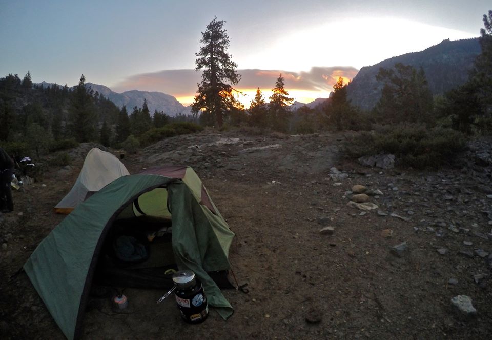
Since we were starting at lower elevations meant it was hot, and the bugs were out in full force. But we pushed through it and made our way up to Rancheria creek. We found a spot to setup camp there. Luckily the bugs weren't as bad at camp. After camp was setup we hiked around the area and checked out all the awesome waterfalls and swimming holes. On the trail just above camp there was a great 25 foot high wooden bridge crossing the creek over a beautiful deep pool. So of course I had to jump off it a few times! Then we made our way back to camp and had some dinner. And we got a gorgeous sunset before heading to bed.
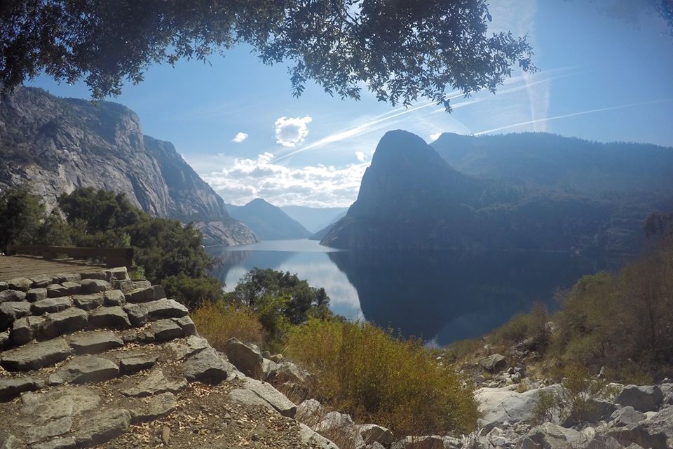
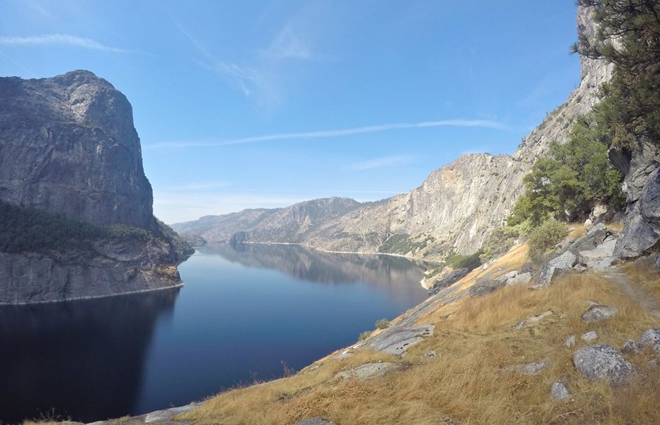 Hetch Hetchy
 Hetch Hetchy
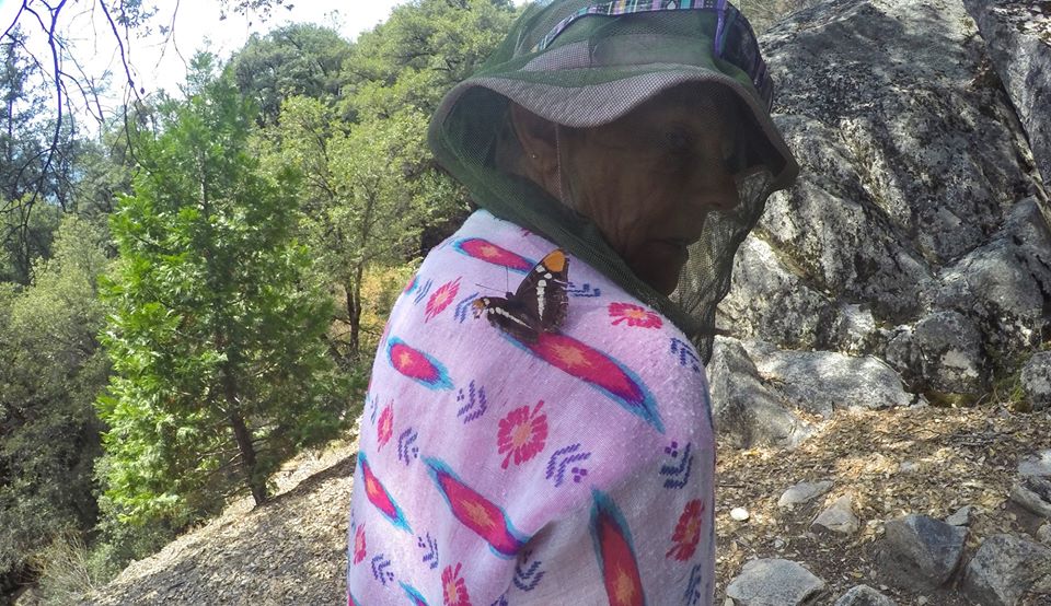 A butterfly landed on my moms shoulder
 Swimming hole in Rancheria creek
 Rancheria creek
 Rancheria creek
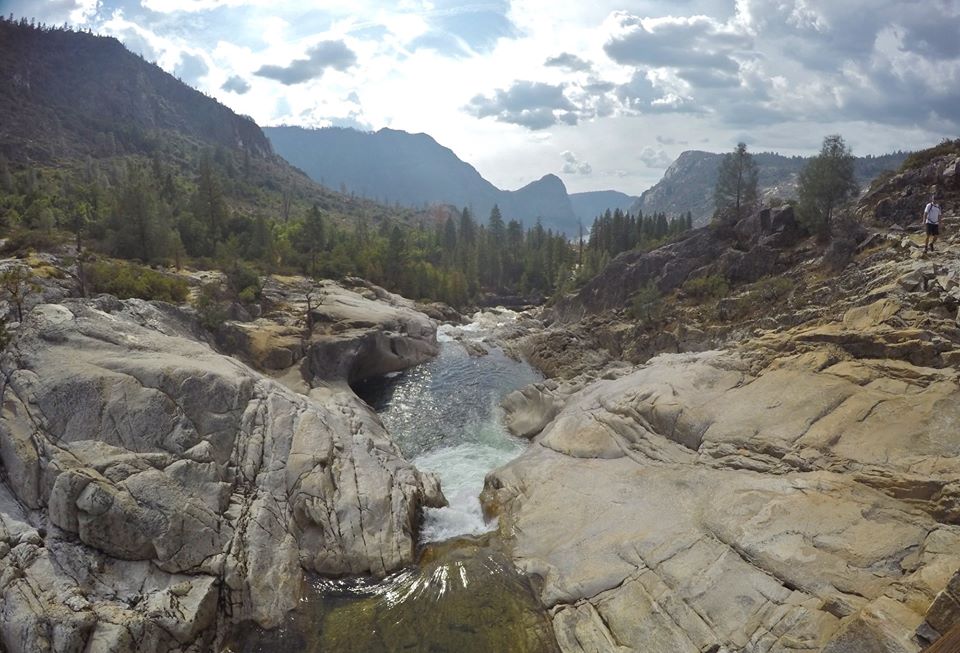
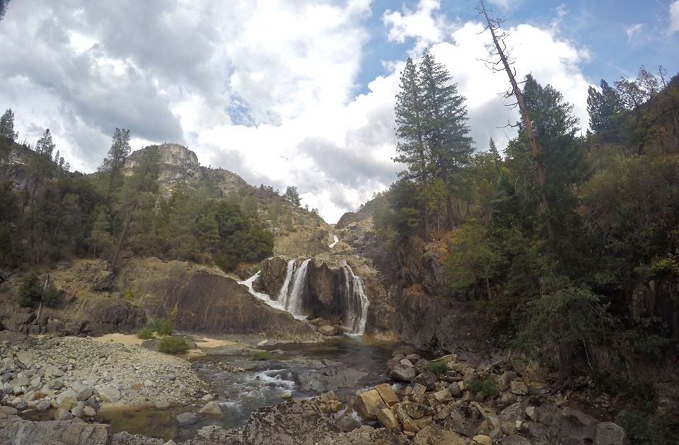 Waterfalls on Rancheria creek
 Views from camp
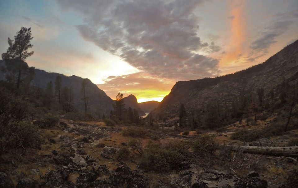 Sunset from camp
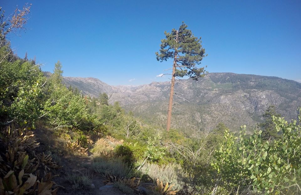
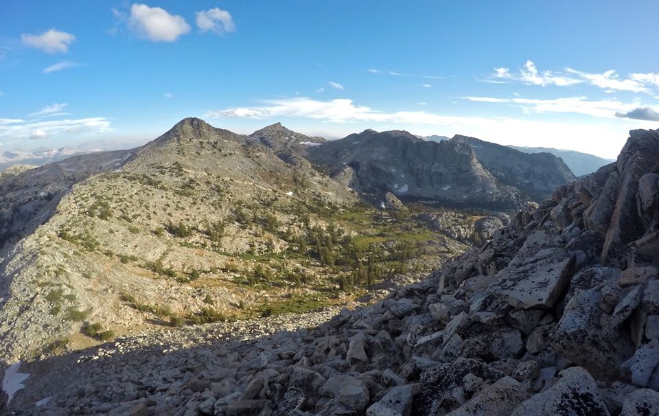
The next day we left Rancheria creek and made some steep switchbacks up the northeast side of LeConte point. Once up the switchbacks I left the trail for a side trip to go climb the point! It took a bit of route finding to find an easy route up, but I managed just fine. From the point there were excellent views overlooking Hetch Hetchy. I lingered there for awhile just taking it all in. The views really just left me in awe. But as we had a long day I had to keep moving and make my way back down to the trail.
 Views from the trail
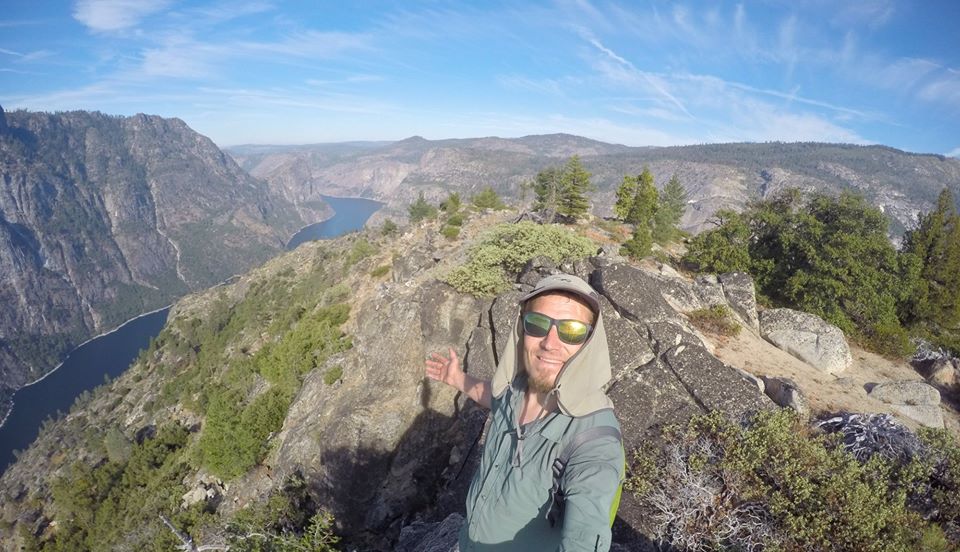 Selfie on top of LeConte point
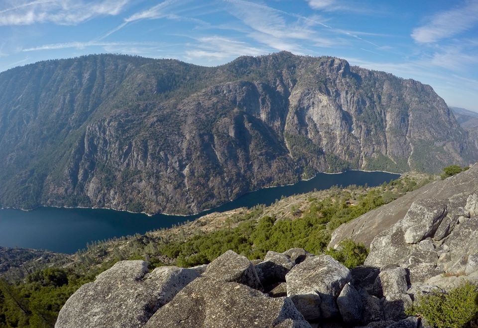 Views of Hetch Hetchy from LeConte point
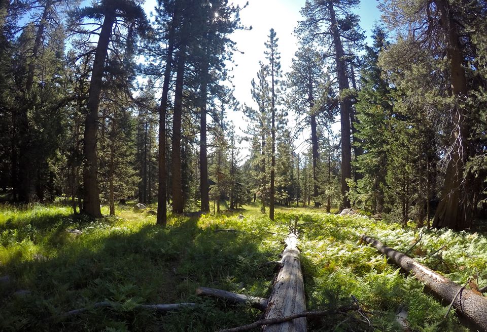
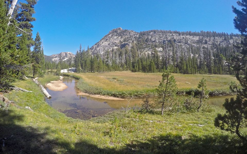
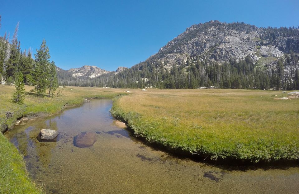
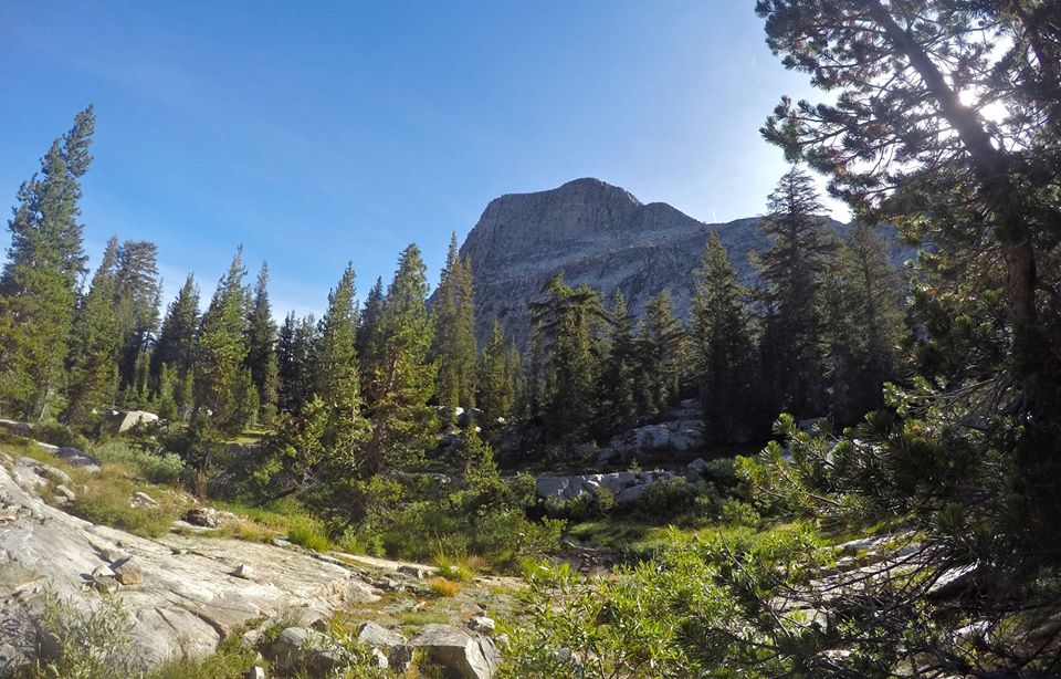
Once back on the trail I began the big long climb over Rancheria mountain. Rancheria mountain was pretty lush with lots of small creeks and meadows. Which is beautiful, but also made for quite a bit of bushwhacking and trying to follow an overgrown trail. At one of the meadows I caught up with mom, who had kept hiking up the trail while I climbed out to LeConte point. We took a short break and then continued climbing over the mountain. Once over the top we started dropping back down. All the way down into Pleasant valley. In the valley we stopped for a short break at a nice little waterfall, but after our break we couldn't find where the trail went!? It took a little searching, but eventually we found it. We were getting pretty tired at this point, but we still made one more steep climb up to Table lake. We made our way up to the lake and found a spot to setup camp for our second night. As the sun set I mustered up my last bit of energy, grabbed my pole and headed out to the lake to have a little fun trout fishing!
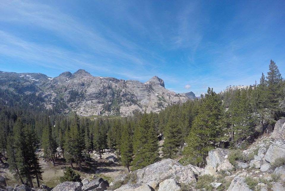
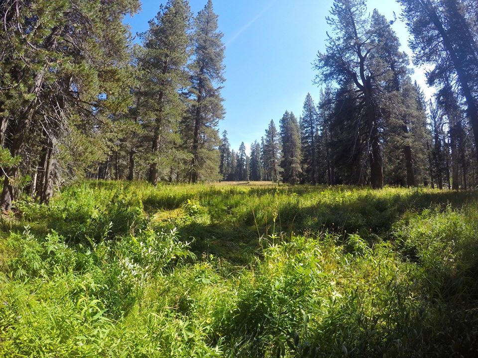 Meadows on Rancheria mountain
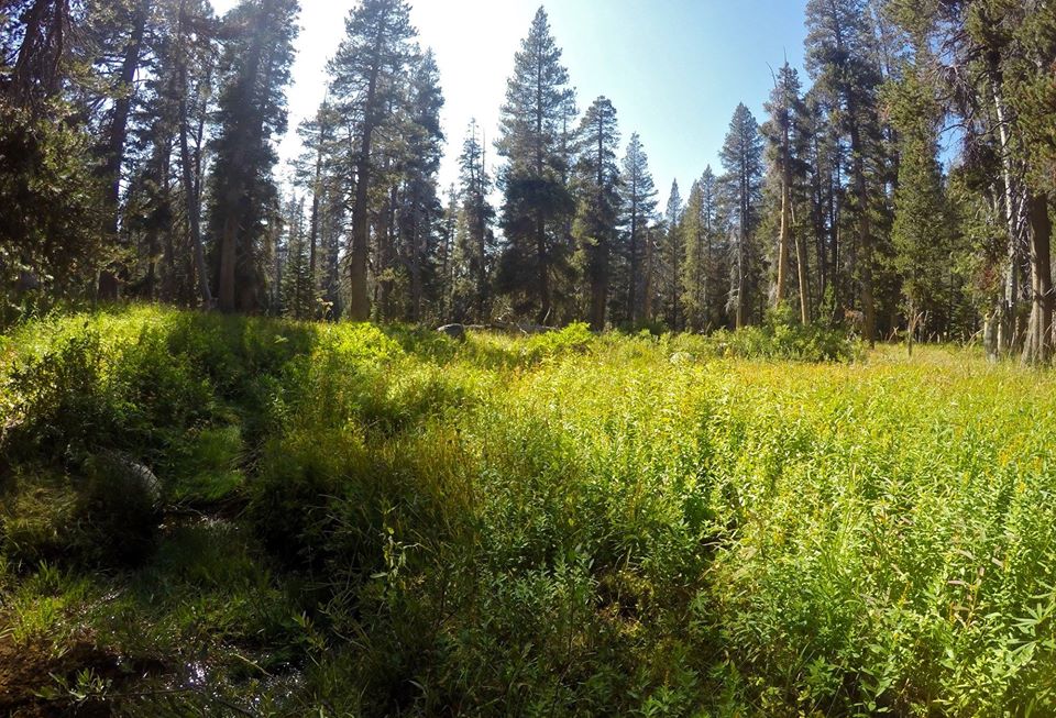 More meadows on Rancheria mountain
 Descending into Pleasant valley
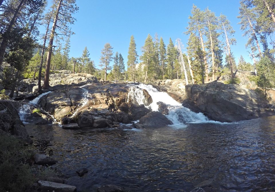 Waterfall in Pleasant valley
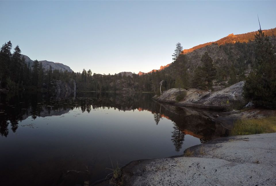 Table lake
 Sunset from camp
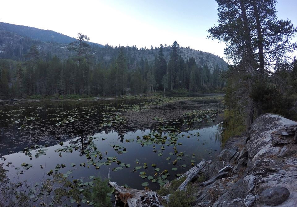
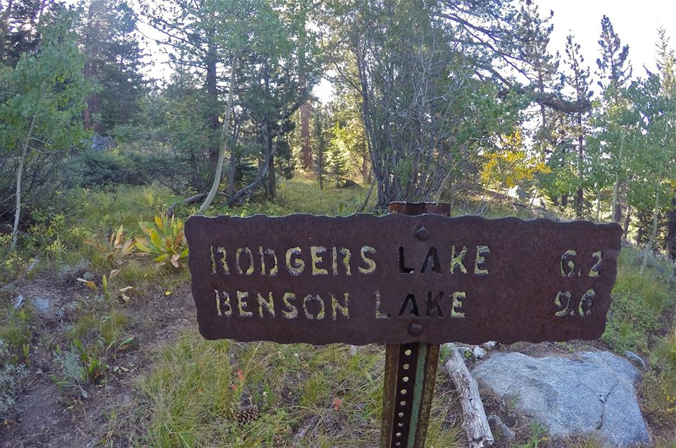
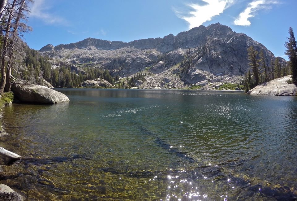
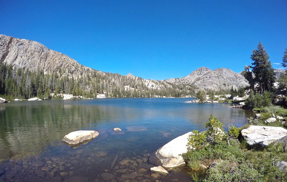
On day 3 we got up and packed up our camp at Table lake. From there we left Pleasant valley and climbed around a ridge into Rodgers canyon and we hiked up Rodgers canyon all the way up to Neille lake and to Rodgers lake. Rodgers lake was really beautiful and we found a great spot to setup our next camp.
 Morning at Table lake
 Meadows above Table lake
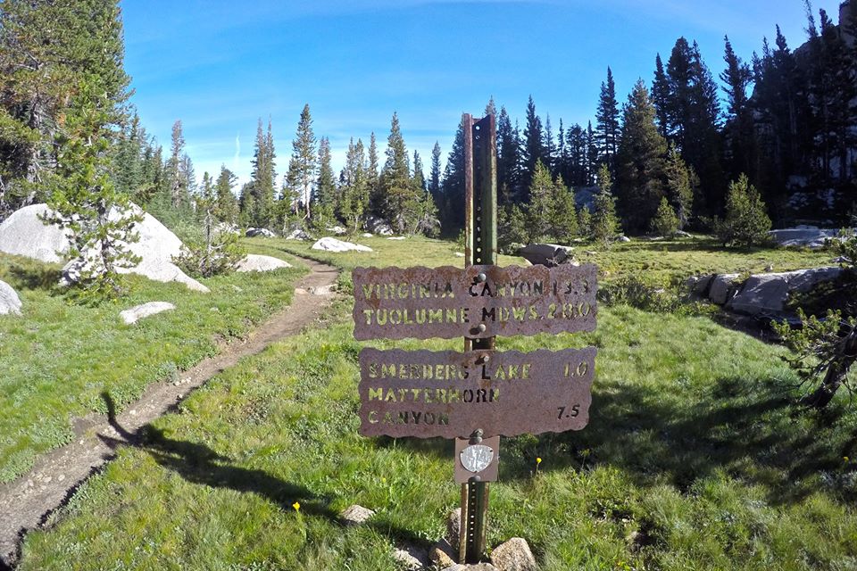
 Trail junction to Rodgers canyon
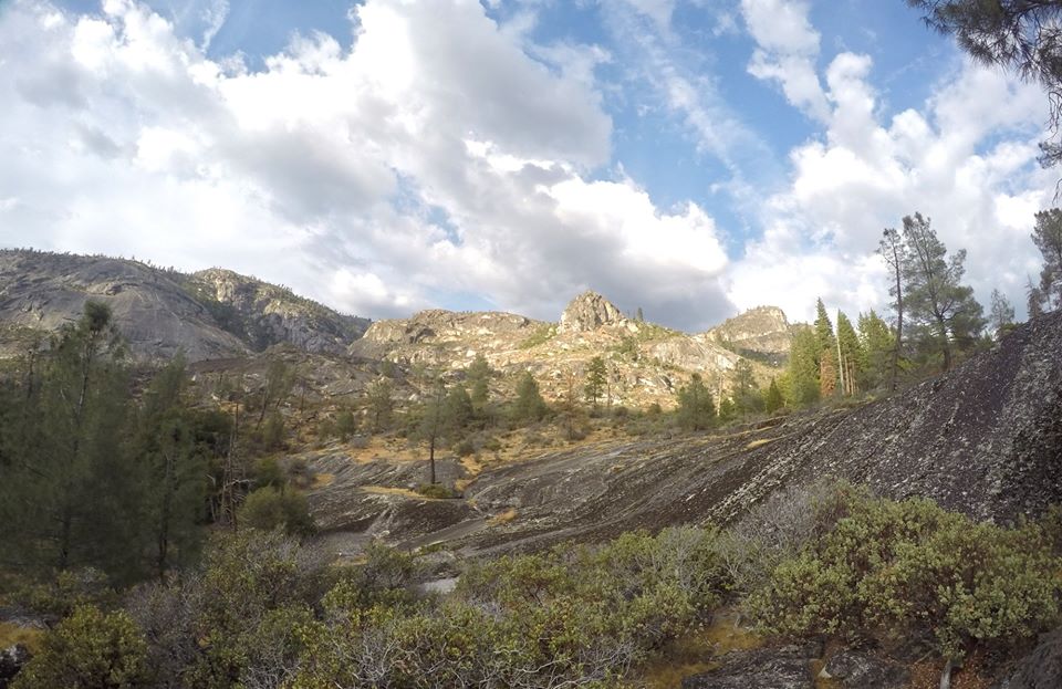
 Rodgers canyon
 Rodgers canyon
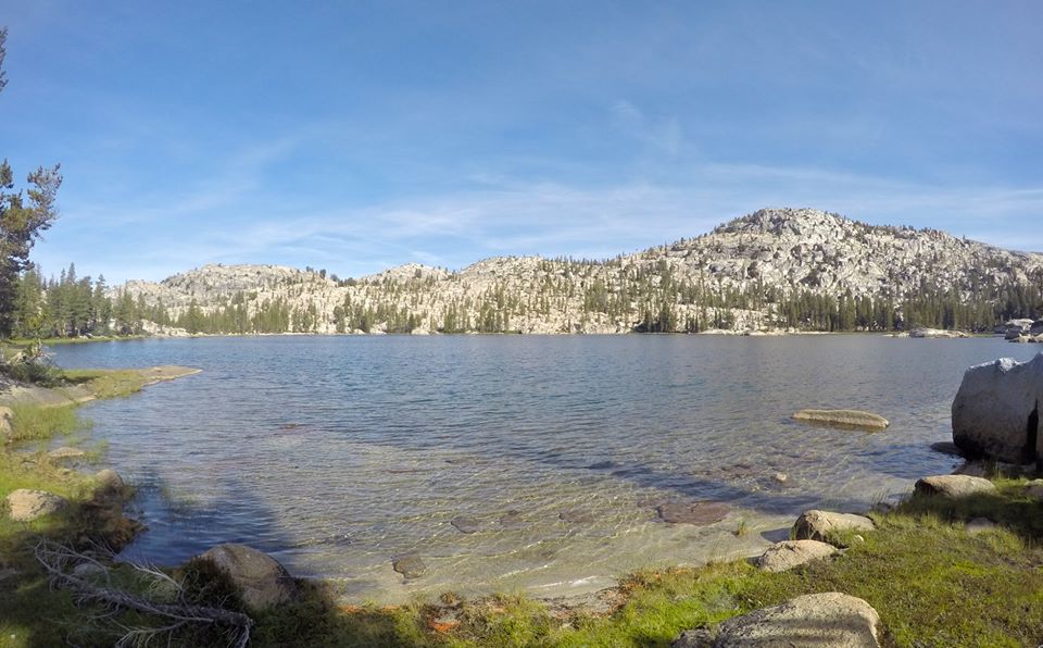
 Nielle lake
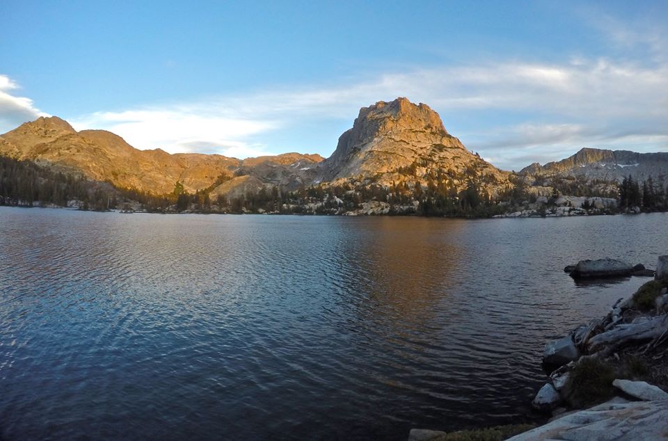
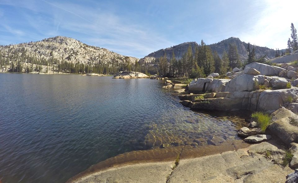
 Rodgers lake
 Me at Rodgers lake
 Our camp at Rodgers lake
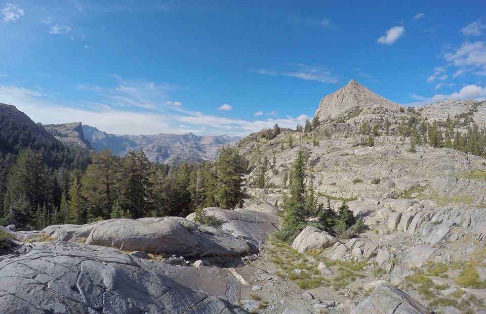
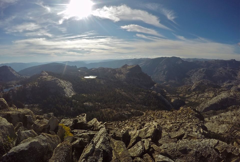
Once camp was setup I headed out to climb Volunteer peak (10,481')! I started hiking around the lake and ran into a couple fisherman who were also camping at the lake. After chatting with them for a minute I left the lake and started my climb up to the summit. The approach was easy class 1 and the climb was an easy class 2 talus scramble. The views were absolutely incredible though!! Spectacular 360 views of northern Yosemite! I had been thinking about trying to climb Pettit peak as well, but it was already late in the day, and Volunteer peak was just so awesome, so I opted for a little extra summit time there before heading back down to our camp at Rodgers lake for the third night of the trip.
 Hiking around Rodgers lake
 A small unnamed lake
 Approaching Volunteer peak
 Views from Volunteer peak
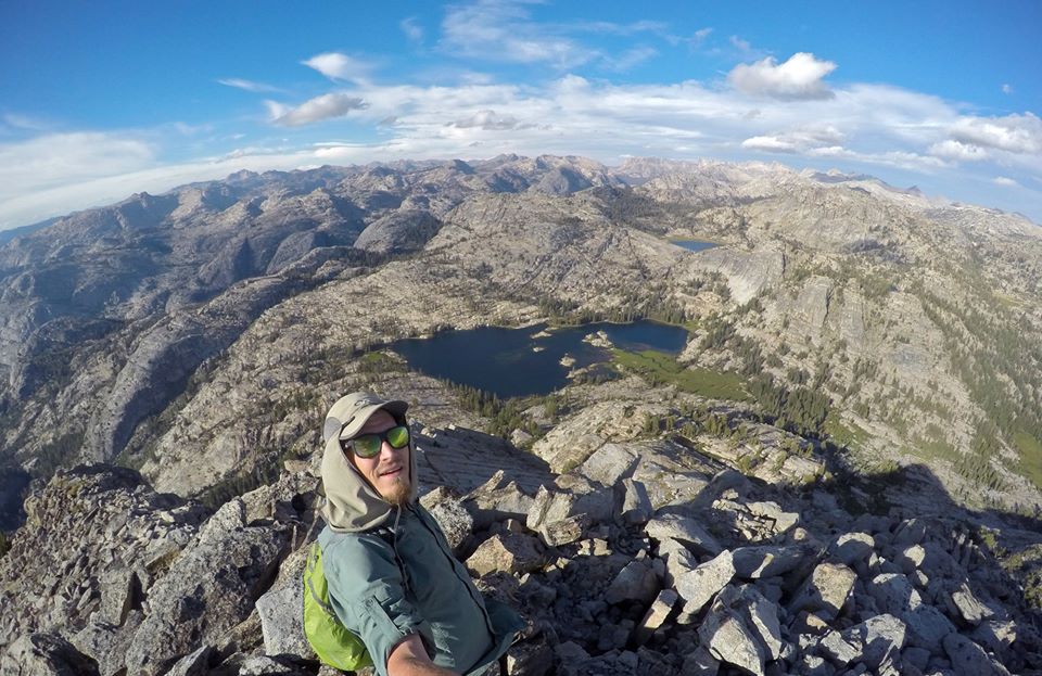 Selfie on the top of Volunteer peak
 Descending from Volunteer peak
 Making my way back to camp
 Evening at Rodgers lake
The next morning mom and I left Rodgers lake and dropped down to the PCT(Pacific Crest Trail) and followed it around Volunteer peak to beautiful Smedburg lake. We stopped for a quick break at the lake and I tried a little trout fishing. We saw several PCT thru hikers as well as a large buck. Which was just the first of many deer sightings for the day. From the lake we followed the PCT up to Benson pass(10,140'). Which turned out to be much more of a climb than I had expected.
 Hiking around Volunteer peak
 Trail junction with the PCT
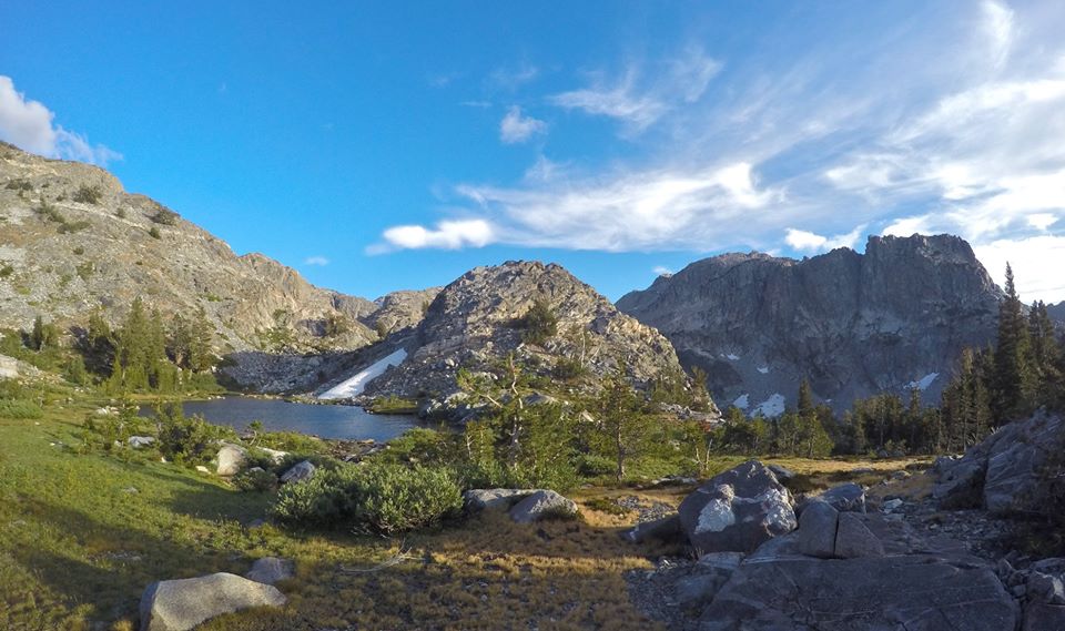
 Smedburg lake
 Smedburg lake
 Views from Benson pass
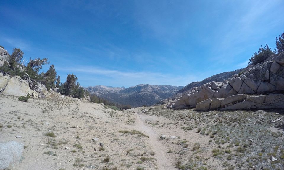 Benson pass
At the pass we met two other backpackers and we talked with them for a bit.. turned out they were fans of my Youtube channel! That was so cool to get to meet them way out there in the backcountry. From the pass we dropped down to Wilson creek (where we saw even more deer) and followed it to it's confluence with Matterhorn canyon! In Matterhorn canyon we left the PCT and continued hiking up the massive canyon for quite a ways. It just got more and more amazing as we went. After hiking more than 15 miles for the day we were getting pretty exhausted so eventually we found a real nice spot in the canyon to setup camp just south of Finger peaks and the Sawtooth ridge!
 Meadows near Wilson creek
48426373_2216523901712069_2751469862155976704_o.jpg (https://files.steempeak.com/file/steempeak/derekrichardson/t2ITtr3k-48426373_2216523901712069_2751469862155976704_o.jpg) Matterhorn canyon
48364643_2216524311712028_1552587908219666432_o.jpg (https://files.steempeak.com/file/steempeak/derekrichardson/sy5uph4X-48364643_2216524311712028_1552587908219666432_o.jpg) Matterhorn canyon
48372084_2216524181712041_2000549084477259776_o.jpg (https://files.steempeak.com/file/steempeak/derekrichardson/wVUNWrJn-48372084_2216524181712041_2000549084477259776_o.jpg) Matterhorn canyon
48379532_2216524151712044_4016402524704604160_o.jpg (https://files.steempeak.com/file/steempeak/derekrichardson/s9FzV4jq-48379532_2216524151712044_4016402524704604160_o.jpg) Matterhorn canyon
48356798_2216524045045388_4779609790772936704_o.jpg (https://files.steempeak.com/file/steempeak/derekrichardson/W6PPyxGv-48356798_2216524045045388_4779609790772936704_o.jpg) Matterhorn canyon
48383131_2216559808375145_342712281114607616_o.jpg (https://files.steempeak.com/file/steempeak/derekrichardson/MjU6xjic-48383131_2216559808375145_342712281114607616_o.jpg) Evening time in Matterhorn canyon
So for Day 5 we had a big day planned including two cross country passes, and unfortunately a storm was rolling in. Mom and I packed up our camp in Matterhorn canyon and hiked up to the head of the canyon. From there we started our climb up our fist pass of the day, Matterhorn pass. We were able to find a good route up the pass and had just a little bit of class 3 climbing near the top. On the east side of the pass there was supposed to be a chute to go down. It took us awhile to find it but we finally did and made our way down it into Spiller canyon. My original plan had been to climb Matterhorn peak from there, but with the heavy winds and an impending storm coming in we decided to skip the peak. We found a spot by Spiller creek where we had some cover from the wind and we took a break and had our lunch there.
50748291_2288002591230866_3707990445121339392_o.jpg (https://files.steempeak.com/file/steempeak/derekrichardson/2Laolfnj-50748291_2288002591230866_3707990445121339392_o.jpg) Upper Matterhorn canyon
51014107_2288003264564132_6530136072897167360_o.jpg (https://files.steempeak.com/file/steempeak/derekrichardson/GtWDLvLP-51014107_2288003264564132_6530136072897167360_o.jpg) At the head of Matterhorn canyon
50771857_2288003121230813_4891509498608353280_o.jpg (https://files.steempeak.com/file/steempeak/derekrichardson/QNXtPWa0-50771857_2288003121230813_4891509498608353280_o.jpg) Watermelon snow on the way up Matterhorn pass
50986820_2288002854564173_6512112749445644288_o.jpg (https://files.steempeak.com/file/steempeak/derekrichardson/jFlrYs1E-50986820_2288002854564173_6512112749445644288_o.jpg) Views from Matterhorn pass
51506015_2288003067897485_5853751119745908736_o.jpg (https://files.steempeak.com/file/steempeak/derekrichardson/Vn10xwR0-51506015_2288003067897485_5853751119745908736_o.jpg) Dropping into Spiller canyon
![51088771_2288003327897459_644